Empire State Building (3)

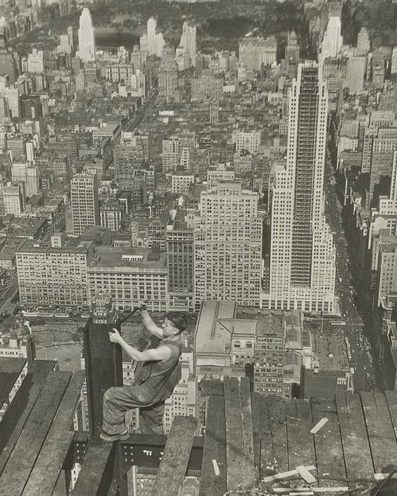
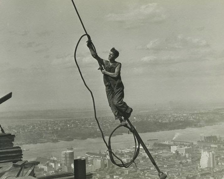
A worker atop the Empire State Building in 1931. Photo courtesy of New York Public Library.

096_1931-2Bnypl

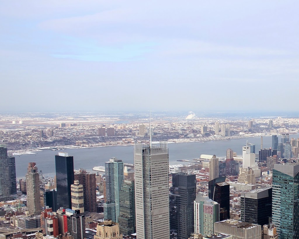
The view in 2011:

096_2011

The caption of the first photo is “Icarus, high up on Empire State.”  However, this worker, thankfully, did not have his wings (cable?) melt.  Both photos show some of the changes in the area looking north of the Empire State Building, toward the Upper West Side, the Hudson River, and New Jersey beyond it.  The only readily-identifiable building from both photos is the large white building in the lower right corner of the 931 photo – it is barely noticeable in the same area of the 2011 photo.

Empire State Building (2)

A worker atop the Empire State Building in 1931. Photo courtesy of New York Public Library.

095_1931-2Bnypl

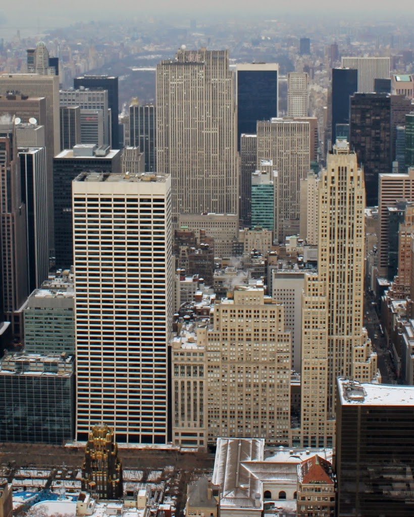
The same view in 2011:

095_2011

These historic photos, which capture the human element of the construction of the Empire State Building, also show how much midtown New York has changed in the past 80 years.  One prominent landmark that didn’t even exist in 1931 was the Rockefeller Center, whose construction was just beginning when the first photo was taken.  It is now easily visible in the upper center of the 2011 photo.

Empire State Building (1)

A worker atop the Empire State Building in 1931. Photo courtesy of New York Public Library.

094_1931-2Bnypl

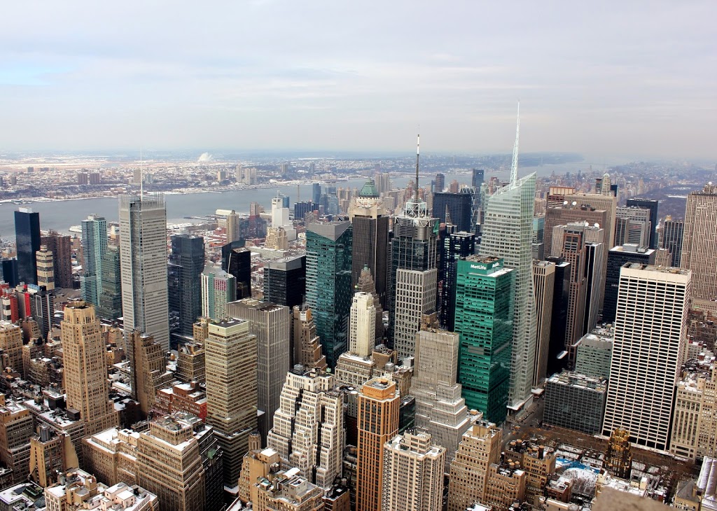
The same view in 2011:

094_2011

The view from atop the Empire State Building, looking north toward the Upper West Side and the Hudson River.  Central Park is seen prominently in the 1931 photo, but it is barely visible 80 years later, as the increasing height of the skyscrapers has all but blocked it from view.

View from Bunker Hill Monument, Boston (5)

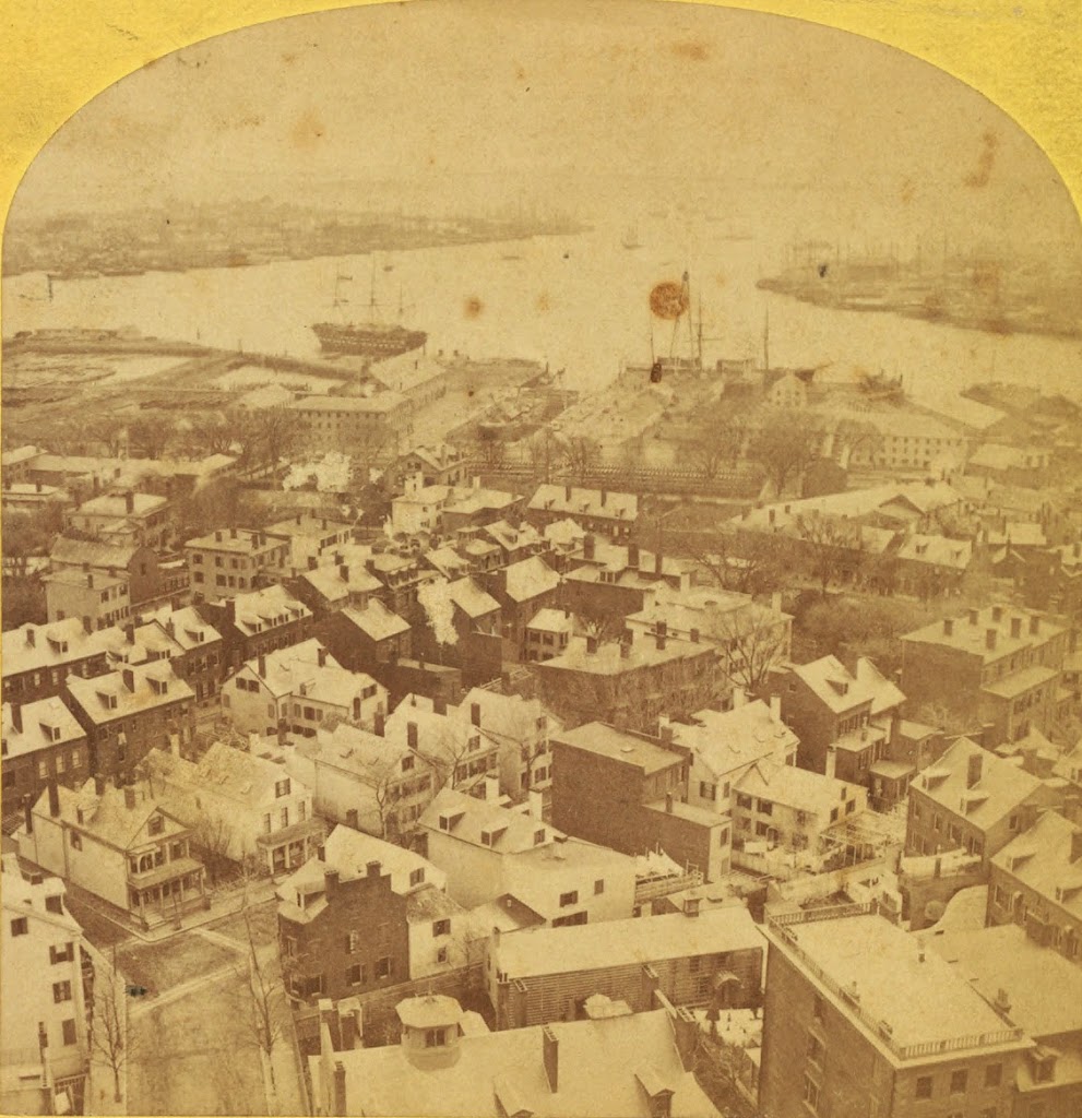
The view from the Bunker Hill Monument, sometime between the 1860s and 1880s. Photo courtesy of New York Public Library.

091_1860s-1880s-2Bnypl

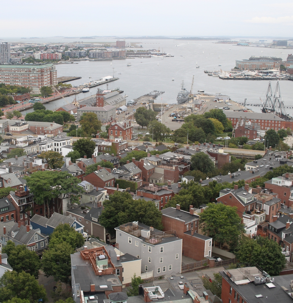
The view in 2024:

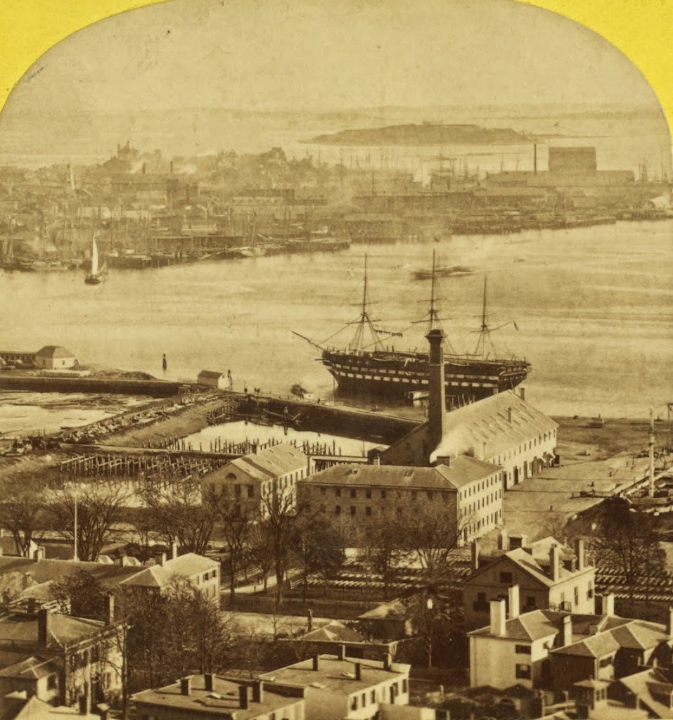
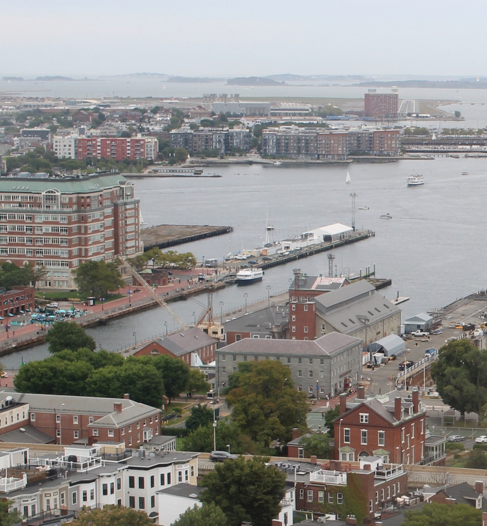
This view is zoomed in on the Boston Navy Yard, and some of the buildings are easily identifiable in both – in fact, all four of the visible shipyard buildings in the 2010 photo are also in the first photo.  Further away, in East Boston, much of the land in the 2024 is new – the harbor was filled in to create Logan International Airport. One of the runways is barely visible in the upper center.

In the navy yard, the ship visible on the far right of the 2010 photo is the World War II-era destroyer USS Cassin Young.  It contrasts sharply to the wooden sailing ship in the first photo, which I believe is the USS Ohio, a ship of the line built in 1820.  By the time this photo was taken, she was being used as a receiving ship.  The Ohio was in Boston from 1850 until 1883, when she was sold and burned for scrap metal.

View from Bunker Hill Monument, Boston (4)

The view from the Bunker Hill Monument, sometime between the 1860s and 1880s. Photo courtesy of New York Public Library.

090_1860s-1880s-2Bnypl

The view in 2024:

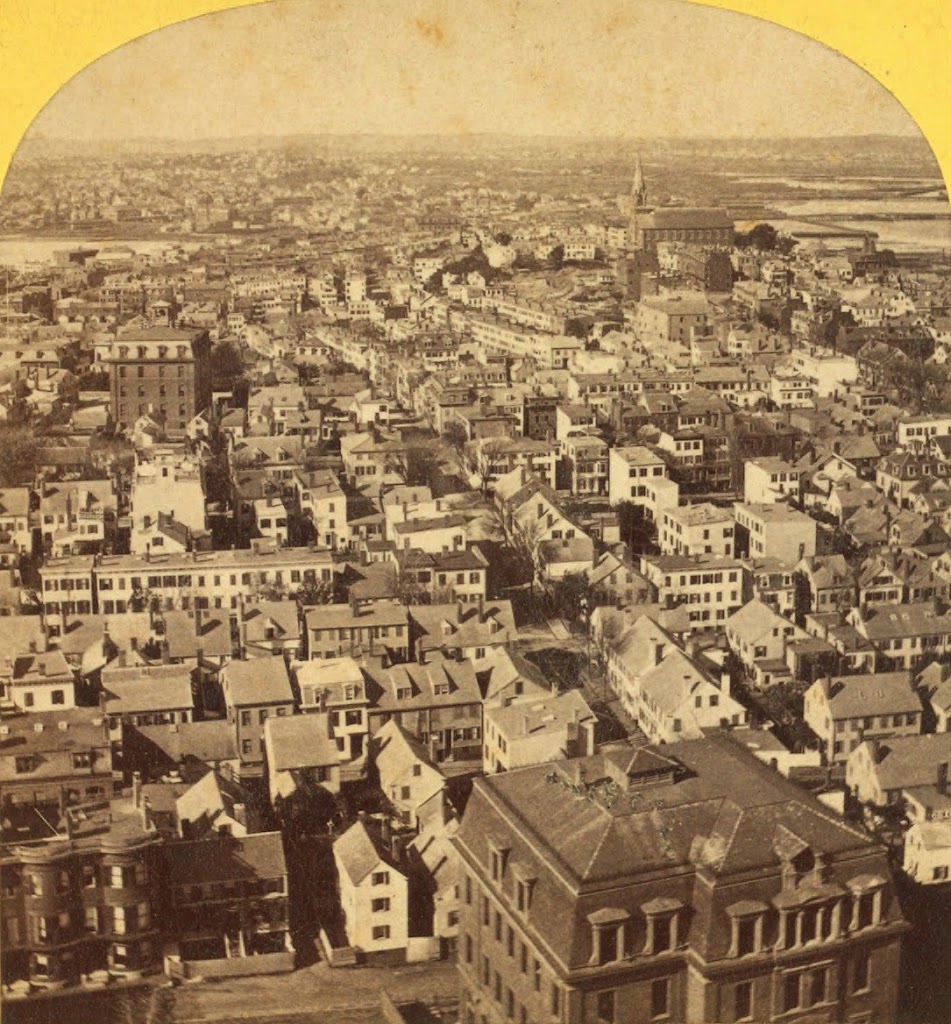
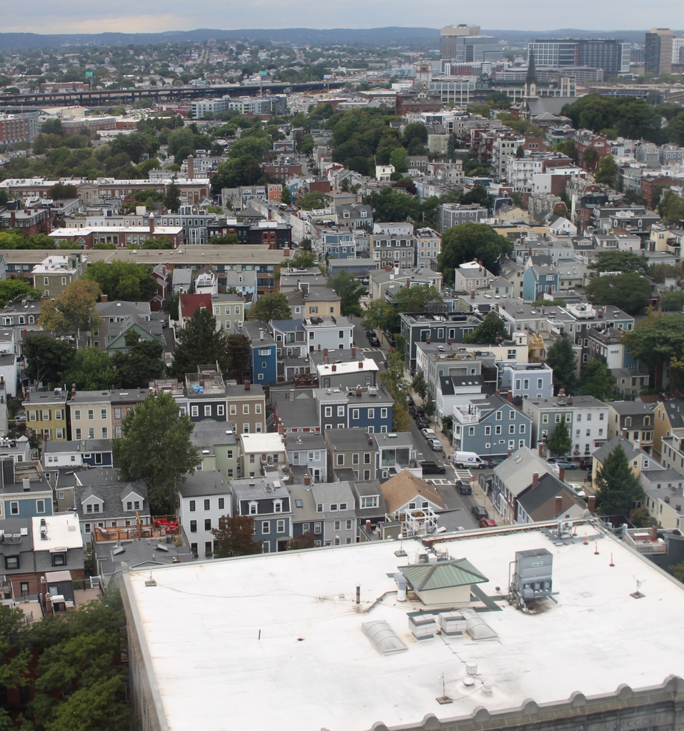
The view looking north from the Bunker Hill Monument.  Many of the buildings in Charlestown remain the same as they were in the original photo, although the large building in the lower right has been replaced by an even larger building in the same location.

View from Bunker Hill Monument, Boston (3)

The view from the Bunker Hill Monument, sometime between the 1860s and 1880s. Photo courtesy of New York Public Library.

089_1860s-1880s-2Bnypl

The same view in 2024:

These two photos show three sections of Boston – Charlestown in the foreground, East Boston in the distance, and the North End of Boston barely visible to the right.  Other than the approach ramp to the Tobin Bridge, not much has changed in Charlestown – many of the houses in the foreground can easily be identified in both photos.  On the waterfront, many of the buildings at the former Boston Navy Yard are still there, and have been incorporated into the Boston National Historical Park. ln the distance, East Boston has been substantially expanded for Logan International Airport, which is barely visible on the far side of East Boston.