Benjamin Franklin Grave, Philadelphia, Pennsylvania

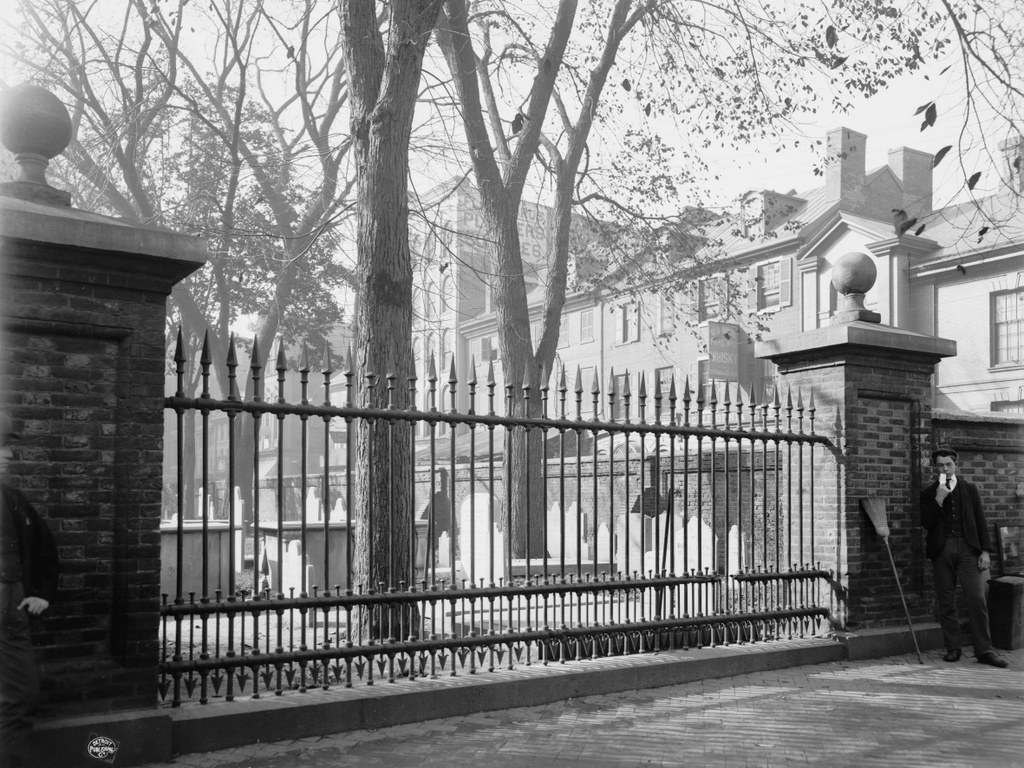
The grave of Benjamin Franklin in Christ Church Burial Ground, seen through the iron fence along Arch Street, around 1900. Image courtesy of the Library of Congress, Detroit Publishing Company Collection.

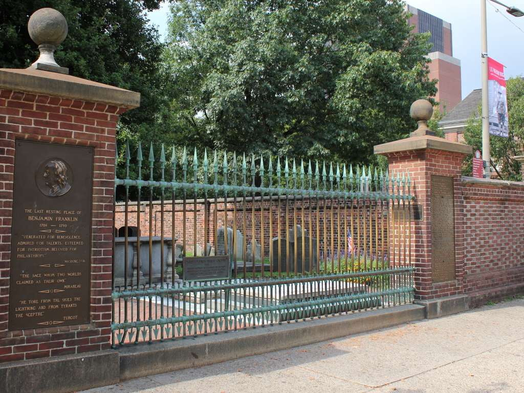
The scene in 2019:

As discussed more detail in the previous post, Christ Church Burying Ground is the final resting place of Benjamin Franklin, who is interred here alongside his wife Deborah under the stone slab on the other side of the fence. Although located just a few feet from the sidewalk, his gravestone was originally hidden from the street by the brick wall that encircles the graveyard. Over time, the gravesite languished in this corner of the graveyard, and was largely forgotten. However, in an effort to boost civic pride in the city’s famous statesman, this section of the wall was replaced by an iron fence in 1858, allowing passers-by to easily view the gravesite.

By the time the first photo was taken at the turn of the 20th century, Franklin’s grave was an important tourist attraction in the city. As shown in the photo, though, the 125-year-old brick wall had fallen into disrepair. It would continue to crumble over the next few decades until it was finally rebuilt in 1927, using many of the original materials in the process. The rest of the graveyard continued to deteriorate, though, and it was closed to the public from 1977 until 2003, when it finally reopened following an extensive conservation project.

Restoration work has continued since then, including repairs to Franklin’s gravestone that were completed in 2017 and largely funded by Jon Bon Jovi. Today, the scene looks very similar to the first photo, aside from the lost buildings in the background along Fifth Street. The graveyard is open to the public for a small fee, and it features both self-guided and group tours that highlight the many famous people buried here, including Franklin and a number of other prominent 18th and early 19th century Americans.

Christ Church Burial Ground, Philadelphia, Pennsylvania

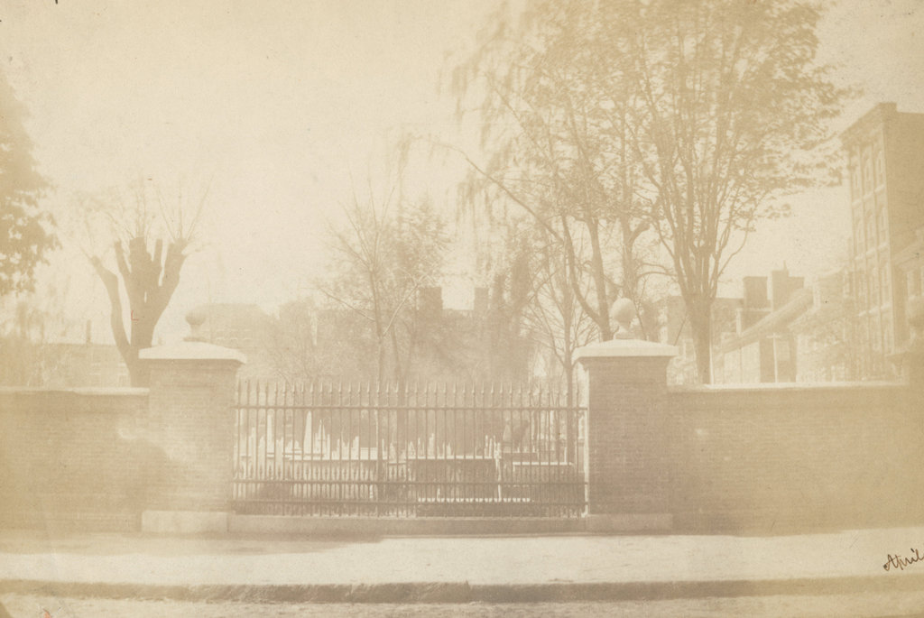
The Christ Church Burial Ground, seen looking south from Arch Street in April 1859. Image courtesy of the Library Company of Philadelphia, Frederick De Bourg Richards Photograph Collection.

The scene in 2019:

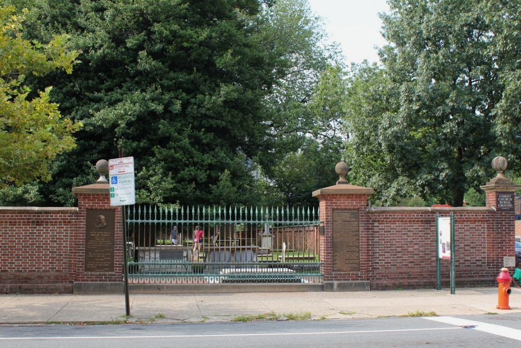
As discussed in an earlier post, Christ Church was established in 1695, and its parishioners originally worshipped in a small wooden church on Second Street, just north of Market Street. The church had a small burial ground next to it, but this soon became too small, so in 1719 the church purchased this property two blocks away at the corner of Arch and Fifth Streets. It would become the church’s primary burial ground, along with being the final resting place for many of the city’s most prominent colonial-era leaders, including five signers of the Declaration of Independence. The most famous of these is Benjamin Franklin, whose gravestone is the low slab on the other side of the iron fence.

A brick wall was constructed along the perimeter of the burial ground in 1772. When Franklin died 20 years later, he was interred here, right alongside the fence and next to his wife Deborah. His grave was only a few feet from the sidewalk, yet it eventually fell into obscurity because the fence obscured its view from the street. This became an issue in the mid-19th century, in part because of a rivalry between Philadelphia and Franklin’s birthplace of Boston. By this point Boston had honored their native son with a massive pyramidal monument above Franklin’s parents’ gravesite, and had dedicated a statue in front of City Hall. In the meantime, though, Franklin’s gravesite here in Philadelphia languished in a rarely-visited corner of the graveyard until 1858, when proponents persuaded Christ Church to allow this section of the brick wall to be replaced with an iron fence, in order to make the grave visible from the street. The first photo was taken a year later, showing the grave just beyond the lower right side of the iron fence.

Today, more than 160 years after the first photo was taken, all of the buildings in the background are long gone, but the burial ground is still here. The wall looks the same as it did in the first photo, but it was actually reconstructed in 1927, using many of the bricks from the original wall. The gap in the brick wall was retained here, and it is now flanked by plaques describing Franklin and his life. Notwithstanding the rebuilt fence, though, the graveyard fell into disrepair by the late 20th century, and it was closed for many years before finally reopening in 2003 following an extensive restoration project. It is now open to the public for a small fee, and offers both self-guided and group tours.

Mount Pleasant, Philadelphia, Pennsylvania

The Mount Pleasant mansion in Fairmount Park, around 1900. Image courtesy of the Library of Congress, Detroit Publishing Company Collection.

The house in 2019:
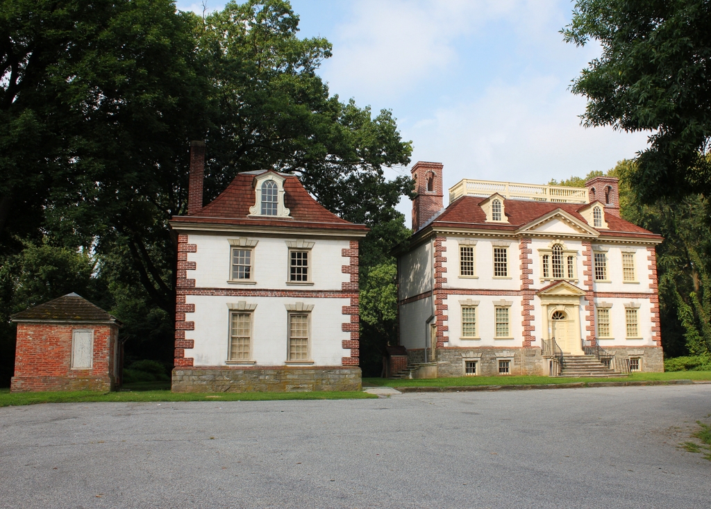
Fairmount Park is located along the banks of the Schuylkill River, several miles to the northwest of downtown Philadelphia. During the colonial era, this area of the city was still sparsely-settled, and the bluffs overlooking the river were desirable locations for the country estates of some of Philadelphia’s affluent families. These mansions were generally used as summer homes, allowing these families to escape the heat and diseases of the densely-populated city center. Most of the homes were built in the 18th or early 19th centuries, and 16 are still standing today as part of Fairmount Park, the largest park in Philadelphia. Of these, perhaps the finest mansion is Mount Pleasant, which was built here in the early 1760s on the east bank of the Schuylkill River.

Mount Pleasant was designed by Thomas Nevell, and it is an excellent example of colonial Georgian-style architecture. As was typical for Georgian houses of the period, its design is symmetrical, and it makes use of decorative elements such as quoins on the corners, a pedimented doorway, a Palladian window, and a hip roof with dormers. The main house is flanked by two smaller buildings with matching exteriors. The one on the north side—which is just out of view on the right side of this scene—was the office, and the one on the south side, in the foreground of these photos, was the summer kitchen.

The original owner of this house was John MacPherson, a sea captain who became wealthy as a privateer during the French and Indian War. In command of the 20-gun ship Britannia, MacPherson captured several dozen French vessels throughout the war, in the process hurting the French war effort while simultaneously enriching himself. His exploits cost him his right arm, which he lost to a French cannonball in the midst of a battle, but upon returning to Philadelphia he used his new wealth to build his country estate here in Philadelphia. He originally named it Clunie, after his family’s ancestral home in Scotland, but subsequently changed it to Mount Pleasant. The size of the property also changed during MacPherson’s ownership; he started with about 31 acres, but the estate eventually grew to 120 acres.

MacPherson was a patriot during the American Revolution, and he even made an ultimately unsuccessful bid to become commander of the newly-established Continental Navy. His two sons, William and John, served in the Continental Army during the war. William resigned his commission as a British lieutenant in order to join the Continental Army, and he eventually became a brevet major and served on the staff of the Marquis de Lafayette. His brother John was also a staff officer during the war, serving as aide-de-camp to General Richard Montgomery, but both he and Montgomery were killed in the Battle of Quebec on December 31, 1775.

In the meantime, the elder John MacPherson interacted with high-ranking members of the Continental Congress, which met in Philadelphia’s Independence Hall throughout the war. On at least one occasion, on September 25, 1775, Massachusetts delegate John Adams visited him here at Mount Pleasant for dinner. The future president subsequently wrote about it in his diary, commenting on the house, his family, and MacPherson’s naval ambitions:

Rode out of town, and dined with Mr. McPherson. He has the most elegant seat in Pennsylvania, a clever Scotch wife, and two pretty daughters. His seat is on the banks of the Schuylkill. He has been nine times wounded in battle; an old sea commander; made a fortune by privateering; an arm twice shot off, shot through the leg, &c. He renews his proposals of taking or burning ships.

Despite living in “the most elegant seat in Pennsylvania,” MacPherson eventually decided to move out of the house and offer it for sale. He had no immediate buyers, but in the meantime he leased the house to Juan de Miralles, Spain’s unofficial envoy to the United States. Although Spain was officially neutral at this point in the war, Miralles established connections with many American leaders in Philadelphia, including by hosting lavish balls here at Mount Pleasant.

Then, in 1779 General Benedict Arnold purchased Mount Pleasant from John MacPherson. At the time, Arnold was still an ostensibly loyal officer in the Continental Army. He had been a hero at the Battle of Saratoga, but in the process he suffered a leg injury. During his recovery he was unable to fight on the front lines, so Washington appointed him military governor of Philadelphia in 1778. However, Arnold’s volatile personality made him ill-suited for a position that required tact and subtlety in dealing with local leaders, and he also faced accusations that he was using his position to enrich himself. It was also during his time in Philadelphia that Arnold met and fell in love with 18-year-old Peggy Shippen, whose wealthy family had Loyalist sympathies. Despite being twice her age and from a very different social background, Arnold began courting her later in 1778, and they were married on April 8, 1779.

At the time, Arnold’s financial situation was somewhat strained, and he was under suspicion for misusing his authority for personal gain. However, he purchased Mount Pleasant as a wedding gift for Peggy, giving the impression that he was wealthier than he really was. In reality, he was hampered by debt, which would only worsen after he and Peggy moved in here and began living a lavish lifestyle. This, combined with Arnold’s belief that patriot leaders were not grateful for his actions and sacrifices that he made on the battlefield, ultimately helped lead him to famously betray the Continental Army in 1780. Peggy likely played a role in this decision as well, as she had Loyalist connections and may have helped initiate contact between Arnold and his British handler, Major John André.

As it turned out, the Arnolds’ stay here at Mount Pleasant was short. His treason was discovered after André was captured on September 23, 1780, and Arnold himself only narrowly escaped capture. Mount Pleasant was subsequently confiscated, and it changed hands several times before being purchased by Peggy’s father, Edward Shippen, in 1784. Despite his Loyalist connections during the war, and the infamy of his son-in-law, Shippen remained a respected member of Philadelphia society, eventually becoming chief justice of the Supreme Court of Pennsylvania. He owned Mount Pleasant until 1792, when he sold it to Jonathan Williams.

Originally from Boston, Williams spent much of the Revolutionary period in France, first as a secretary to his great uncle, Benjamin Franklin, and then as a commercial agent of the United States. He later became an Army officer upon returning to the United States, and he held the position of Chief of Engineers for the Army Corps of Engineers from 1802 to 1803, and 1805 to 1812. During this time, he also became the first superintendent of West Point, serving from 1801 to 1803, and 1805 to 1812. In 1814 Williams was elected to the House of Representatives, but he died just two months into his term in 1815, without ever having attended a session of Congress.

After his death, his son Henry J. Williams inherited Mount Pleasant, and the house remained in the Williams family until 1853. By this point, the banks of the Schuylkill River were no longer as desirable a location for country estates as they had been a century earlier, in part because the city’s growth was encroaching on the area. Starting in the mid-19th century, the city of Philadelphia began purchasing estates along the river, in order to better protect the public water supply. These acquisitions became Fairmount Park, and in 1868 the city purchased Mount Pleasant and added it to the parkland.

The first photo was taken at the turn of the 20th century, and it shows the exterior in a somewhat deteriorated condition, with plenty of peeling paint on both the main house and the kitchen building. However, in 1927 Mount Pleasant was restored by the Philadelphia Museum of Art, which has administered the house ever since. It underwent another major restoration in the early 2000s, and today its exterior looks far better than it did when the first photo was taken 120 years ago. Adams’s description of it as being “the most elegant seat in Pennsylvania” is as true now as it was in 1775, and in 1974 it was designated as a National Historic Landmark because of its historic and architectural significance.

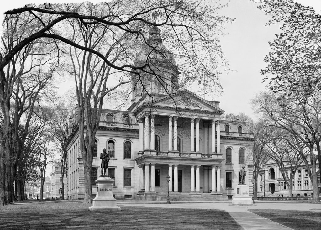
Presidents’ Row, Princeton, New Jersey

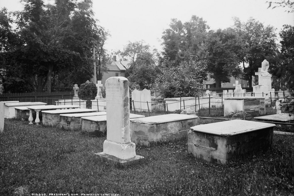
Presidents’ Row at Princeton Cemetery in Princeton, around 1903. Image courtesy of the Library of Congress, Detroit Publishing Company Collection.

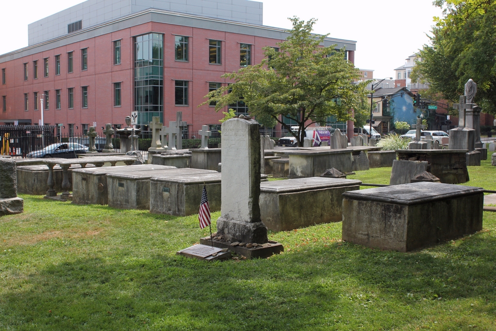
The scene in 2019:

This section of Princeton Cemetery is located in the southwest corner of the cemetery, near the corner of Wiggins and Witherspoon Streets. It is sometimes referred to as Presidents’ Row, as it is the final resting place of many of Princeton’s early presidents. Among these, probably the most famous were Jonathan Edwards, the theologian and pastor who was one of the leaders of the Great Awakening, and John Witherspoon, who was the only clergyman to sign the Declaration of Independence. In addition, U. S. Vice President Aaron Burr—who was both the son and grandson of Princeton presidents—is buried here, and his headstone stands in the center of this scene.

The graves of the former Princeton presidents are arranged roughly in order of when they served, beginning on the far right with Aaron Burr Sr. He was the second president of the college, following the brief tenure of John Dickinson in 1747, and he served until his death in 1757. He was then succeeded by his father-in-law, Jonathan Edwards, who had previously served as pastor of the church in Northampton, Massachusetts and then a missionary to Native Americans in Stockbridge, Massachusetts. Edwards was also an influential author, and he was highly sought by the school’s trustees to replace Burr. Despite reservations about his abilities, Edwards accepted the position, and was installed as president on February 16, 1758.

However, Edwards’s time as president proved to be brief. He arrived in Princeton in the midst of a smallpox outbreak, and one of his first acts as president was to receive an inoculation, in order to encourage students to do the same. Ideally, the inoculation would give Edwards only a mild case of smallpox, which would then give him lifetime immunity. Instead, though, his condition only worsened, and he died on March 22, 1758, barely a month after becoming president. He was buried here in the cemetery, just to the left of Burr’s gravestone. Edwards’s daughter Esther, the widow of Aaron Burr Sr., had cared for him during his illness, and she subsequently contracted smallpox too, dying on April 7 at the age of 26. Her death left her two children orphaned, including the two-year-old future vice president. Edwards’s wife Sarah then briefly took custody of them, but she died later in 1758 from dysentery at the age of 48.

Neither of Edwards’s next two successors as president, Samuel Davies (served 1759-1761) and Samuel Finley (1761-1766), were president for a particularly long time, and both died relatively young. They are also buried here, with Davies on the left side of Edwards and Finley on the other side of Davies. It took the school several years to replace Finley, but in 1768 Scottish minister John Witherspoon accepted the position and immigrated to the American colonies. He went on to serve as pastor for more than 25 years, and during this time he was also involved in politics. He was a New Jersey delegate to the Continental Congress throughout most of the American Revolution, and in this role he signed both the Declaration of Independence and the American Revolution. Witherspoon remained president of the college until his death in 1794, and he was buried here in the cemetery on the left side of Finley; his gravestone is the fifth from the right side of the row.

The next president after Witherspoon was Samuel Stanhope Smith, who served from 1795 until his resignation in 1812. He is buried beneath the table monument with the pillars, directly to the left of Witherspoon. Beyond Smith’s gravestone is Walter Minto, a mathematics professor who died in 1796. He is one of the few non-presidents who is buried in this plot. Then, beyond Minto’s grave on the far left side of the scene is Ashbel Green, who served as president from 1812 to 1822, and died in 1848. There are several more gravestones beyond Green, including college presidents James Carnahan and John Maclean, but these are in the distance beyond the frame of these photos.

Aside from the college presidents, the other noteworthy burial here is Aaron Burr, whose tall narrow headstone is very different from the flat tables of the presidents. As his headstone indicates, he served as a colonel in the Continental Army during the American Revolution, and he was subsequently vice president from 1801 to 1805, during Thomas Jefferson’s first term. However, he is best remembered for having killed Alexander Hamilton, and his reputation was also marred by his involvement in a bizarre plot to establish an independent country in what is now the southwestern United States. He lived in poverty for much of his later life, before marrying a wealthy widow when he was 77. However, they separated for months later, and she subsequently divorced him. Appropriately enough, her lawyer in the case was Alexander Hamilton Jr. Burr died in a Staten Island boarding house in 1836 at the age of 80, and he was interred here next to his parents and grandparents.

The first photo was taken around 1903, more than a century after many of the burials in this scene. Some of the stones appear to have fared poorly over the years, particularly those of Jonathan Edwards and Aaron Burr Sr., both of which are heavily chipped. However, the gravestones appear to have been restored since then, because they are more intact in the present-day scene than they were in 1903. Overall, this section of the cemetery has seen few changes since the first photo was taken, and the only major different in the current photo is the Princeton Public Library, which now stands in the distance on the other side of Wiggins Street.

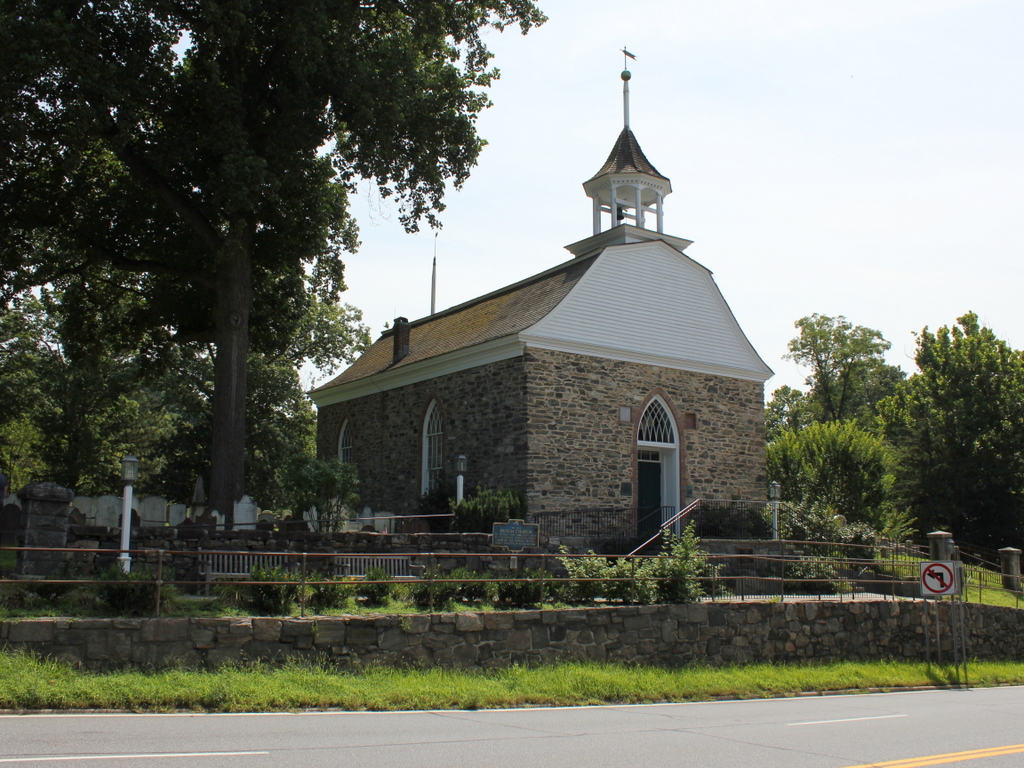
Old Dutch Church, Sleepy Hollow, New York

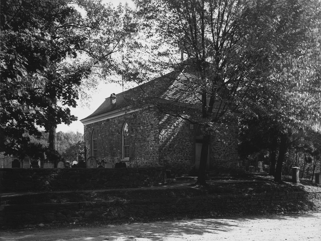
The Old Dutch Church of Sleepy Hollow, around 1903. Image courtesy of the Library of Congress, Detroit Publishing Company Collection.

The church in 2019:

This church was made famous by Washington Irving’s 1820 short story “The Legend of Sleepy Hollow,” but the building predates the story by more than a century, and it stands as the second-oldest existing church building in the state of New York. It was built in the late 1690s by Frederick Philipse I, a wealthy Dutch settler who owned a large tract of land along the Hudson River in Westchester County.

Philipse immigrated to New York in the 1650s, about a decade before England gained control of the colony from the Dutch. However, the Dutch landowners here were allowed to retain their property, and by the 1670s he had acquired a significant amount of land, including the modern-day municipalities of Yonkers, Greenburgh, and Mount Pleasant. At the time, there was a small community here in North Tarrytown, including a graveyard here on the left side of this scene. However, the people lacked a permanent church building, so in the late 1690s Philipse had this stone, Dutch Colonial-style church constructed at the southern end of the graveyard for his tenant farmers. By some accounts, Philipse designed the church himself, and he also may have personally assisted with the construction work, including carving the pulpit.

The church is located on the west side of the Albany Post Road, modern-day US Route 9, on a hillside about a hundred yards north of where the road crosses the Pocantico River. During the American Revolution, this area around Sleepy Hollow was a sort of neutral zone, located between British-occupied New York City and the areas to the north, which were controlled by the Continental Army.

One of the most important wartime incidents here occurred in 1780, when Major John André was captured by American forces less than a mile south of the church. He had been returning south after a secret meeting with Benedict Arnold, and upon searching him the Americans discovered documents that incriminated Arnold in a plot to surrender West Point to the British. Arnold was able to evade capture after the plot was exposed, but West Point remained secure and André was subsequently executed as a spy, since he had been behind enemy lines in civilian clothing.

Another significant local event in the war was the Battle of White Plains, which was fought a few miles to the southeast of here in 1776. During the battle, a Hessian soldier was decapitated by an American cannonball, and this is said to have been the inspiration for the Headless Horseman of “The Legend of Sleepy Hollow.” In the story, the narrator describes how, according to legend, the ghostly apparition had lost his head in “some nameless battle” during the war. He was buried here in the graveyard next to this church in Sleepy Hollow, but he would leave every night and travel to the battlefield in search of his head, although he always needed to return to the graveyard by dawn.

By the time Washington Irving published his story in 1820, this church was already over 120 years old. In the story, he emphasized the eerie, isolated location of the church, particularly in this passage:

The sequestered situation of this church seems always to have made it a favorite haunt of troubled spirits. It stands on a knoll, surrounded by locust-trees and lofty elms, from among which its decent, whitewashed walls shine modestly forth, like Christian purity beaming through the shades of retirement. A gentle slope descends from it to a silver sheet of water, bordered by high trees, between which, peeps may be caught at the blue hills of the Hudson. To look upon its grass-grown yard, where the sunbeams seem to sleep so quietly, one would think that there at least the dead might rest in peace. On one side of the church extends a wide woody dell, along which raves a large brook among broken rocks and trunks of fallen trees.

The first photo shows the church as it appeared nearly a century later, around 1903. By this point, both the church and its surroundings had undergone changes. The church was damaged by a fire after a lightning strike in 1837, and the repairs included alterations to the building. It was partially restored to its original appearance in the late 19th century, but by then it was no longer in regular use. The congregation had moved to a new building in Tarrytown during the mid-19th century, and the old one here in Sleepy Hollow was subsequently used only for special events.

Also during this period, the land around the church became a new cemetery. Originally named the Tarrytown Cemetery, it was later renamed Sleepy Hollow Cemetery at the request of Washington Irving, who was interred here after his death in 1859. Unlike the much older graveyard next to the church, this new cemetery reflected the mid-19th century trend of rural cemeteries. These were typically well-landscaped, with plenty of trees and winding footpaths that followed the contours of the ground, making cemeteries feel more like a park. Aside from Irving, many other prominent people have been buried here in Sleepy Hollow, including industrialist Andrew Carnegie after his death in 1919.

Today, more than a century after the first photo was taken, the 320-year-old church is still standing here alongside US Route 9. Remarkably little has changed in the scene during this time, and the building is still owned by the Reformed Church of the Tarrytowns, which continues to hold events and services here on occasion. Because of its historical significance, along with its literary associations with “The Legend of Sleepy Hollow,” the church was designated as a National Historic Landmark in 1961.

Washington Irving Grave, Sleepy Hollow, New York

The gravesite of Washington Irving in Sleepy Hollow Cemetery, around 1910. Image courtesy of the Library of Congress, Detroit Publishing Company Collection.

The scene in 2019:

Washington Irving was the first widely-successful American fiction writer, best known for his short stories such as “Rip Van Winkle” and “The Legend of Sleepy Hollow.” His lifetime coincided with the early years of the country; he was born in New York City in 1783, just months before the Treaty of Paris, and he died in 1859, less than a year and a half before the start of the Civil War. Throughout this time, he published many works, including short story collections, biographies, and histories. He served in the War of 1812, as recognized by the flag next to his headstone, and many years later he served as the US minister to Spain during the John Tyler administration, from 1842 to 1846.

Although he grew up in New York City, and spent a number of years in Europe, Irving spent much of his later life in the vicinity of Sleepy Hollow. In 1835 he purchased Sunnyside, his estate in nearby Tarrytown. With the exception of his time in Spain, it was his home for the rest of his life, and after his death he was buried here in Sleepy Hollow Cemetery. The cemetery is located directly adjacent to the Old Dutch Church of Sleepy Hollow and its churchyard, both of which Irving featured in his “Legend of Sleepy Hollow.”

Washington Irving never married, and he had no children, but he is interred here in the cemetery with a number of other family members. When the first photo was taken in the early 20th century, these included his parents William Irving and Sarah Sanders immediately to the left of his gravestone, and his brother Ebenezer Irving and Ebenezer’s wife Elizabeth Kip to the right.

In the second row of the first photo, starting on the left, is Lewis Irving, the grandson of Washington Irving’s older brother William. Further to the right in the second row are Mary and Julia Irving, who were daughters of Ebenezer and Elizabeth Irving. On the far right is William R. Grinnell, the husband of Mary and Julia’s sister Charlotte. The two rounded headstones in the back row are Julia Granger and her husband Sanders Irving, and to the right are Amanda Tenant and her husband Edgar Irving. Both Sanders and Edgar were sons of Ebenezer and Elizabeth. There is also a flag in the back row, which might be a temporary marker for Washington Irving, the son of Edgar and Amanda, who died in 1910. The first photo was taken around this time, so it may have been taken after he died but before a permanent stone was installed.

Today, more than a century after the first photo was taken, much of this scene has remained the same; even the pine tree in the background appears to be the same one in both photos. However, the headstones are significantly more weathered than they had been in the early 20th century, and there have been several more interments here in the Irving family plot. Immediately behind and to the right of Washington Irving’s headstone is Catherine Irving, the last surviving child of Ebenezer and Elizabeth, who died in 1911 at the age of 95.

In the back row is the headstone of the younger Washington Irving, in the place of the flag from the first photo. Further to the left in the back row is his sister, Mary Irving Huntington. She died in 1932 at the age of 82, and hers is the most recent headstone in this scene. She was ten years old when her famous great uncle died in 1859, so she may have been the last living member of the family who would have had memories of Washington Irving.