Samuel Chapin Statue, Springfield

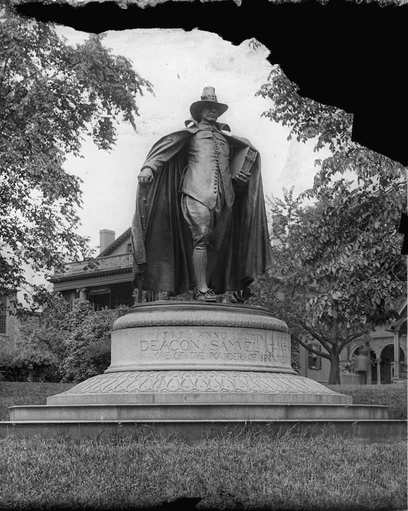
The Samuel Chapin Statue at the Quadrangle, around 1905. Image courtesy of the Library of Congress, Detroit Publishing Company Collection.

055_1905c-2Bloc

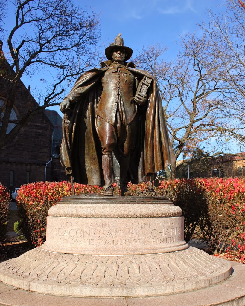
The same statue in 2012:

055_2012

Samuel Chapin, one of my ancestors, was an early settler in Springfield, one of several such founders memorialized in a statue in the city.  He served as the first deacon of the church, was on the first board of selectmen, and also served as a town magistrate.  In 1881, one of his descendants, businessman and Congressman Chester W. Chapin, commissioned noted sculptor Augustus St. Gaudens to create this statue.  It was finished in 1887, and was first situated at Stearns Park, but was moved to Merrick Park at the Quadrangle in 1899, shortly before the above photo was taken.  The statue, named The Puritan, became one of St. Gaudens’s most popular work, and it hasn’t changed much in the past 100 years, although some of the buildings around it have.  The house directly behind it in the 1905 photo (I believe it’s the parsonage for Christ Church Cathedral) is long gone, as is the old library, which isn’t visible in the photo, but which was located just to the photographer’s right.  Note, however, the arches in the distance on the far right of the 1905 photo – those are from the art museum, which still exists – the arches aren’t visible from the angle of the 2012 photo, but the building itself is barely visible above the hedges.

Robert E. Lee Monument, New Orleans

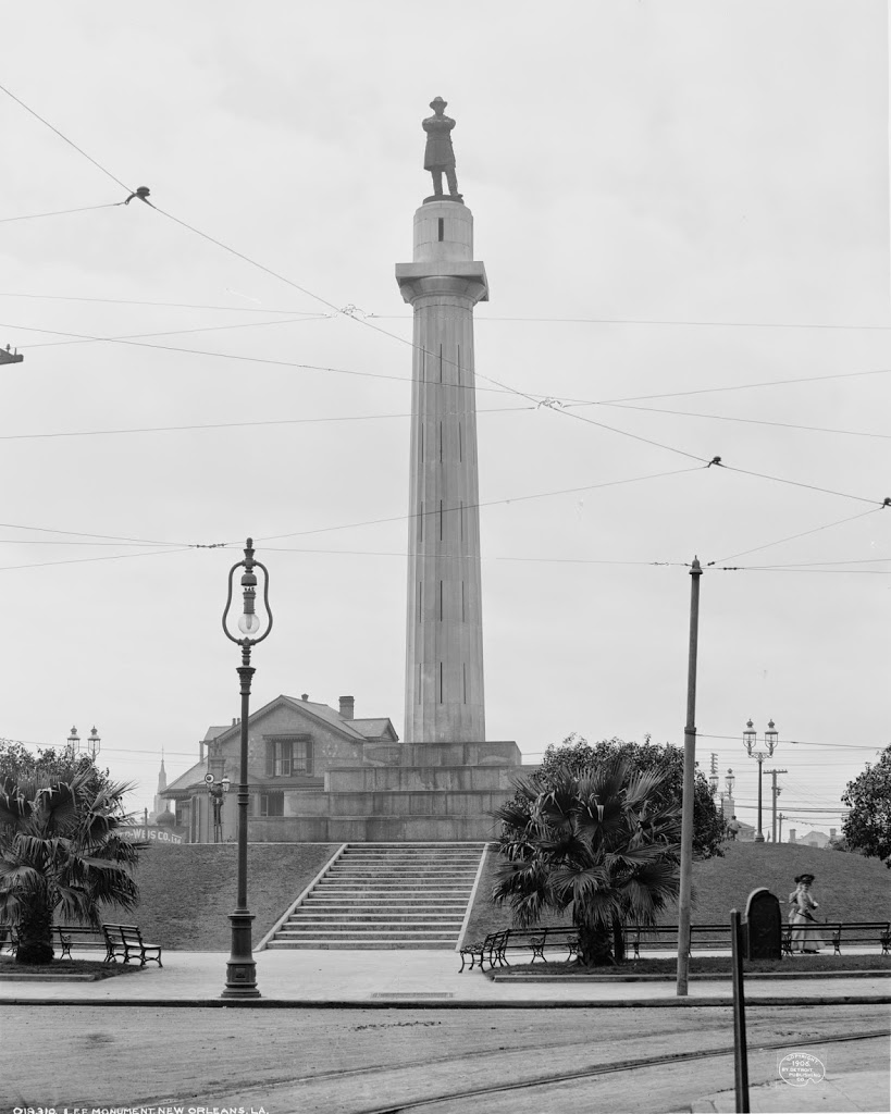
Robert E. Lee Monument, New Orleans, about 1906. Image courtesy of the Library of Congress, Detroit Publishing Company Collection.

Louisiana

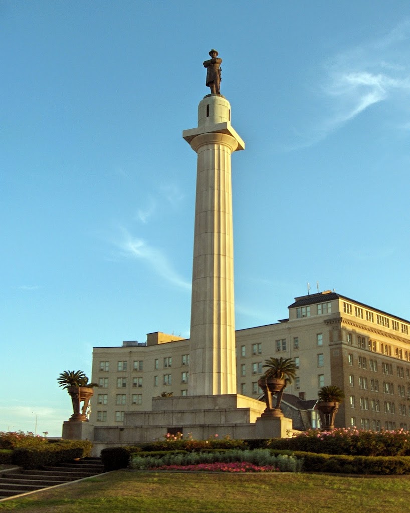
The same monument in 2009:

051_2009

In a bit of a departure from my usual northeast locations, I came across the c.1906 photo of the same statue that I photographed in 2009 while in New Orleans.  The subject, given that it’s the south, is Robert E. Lee, and the statue has been there since 1884.

North End, Boston

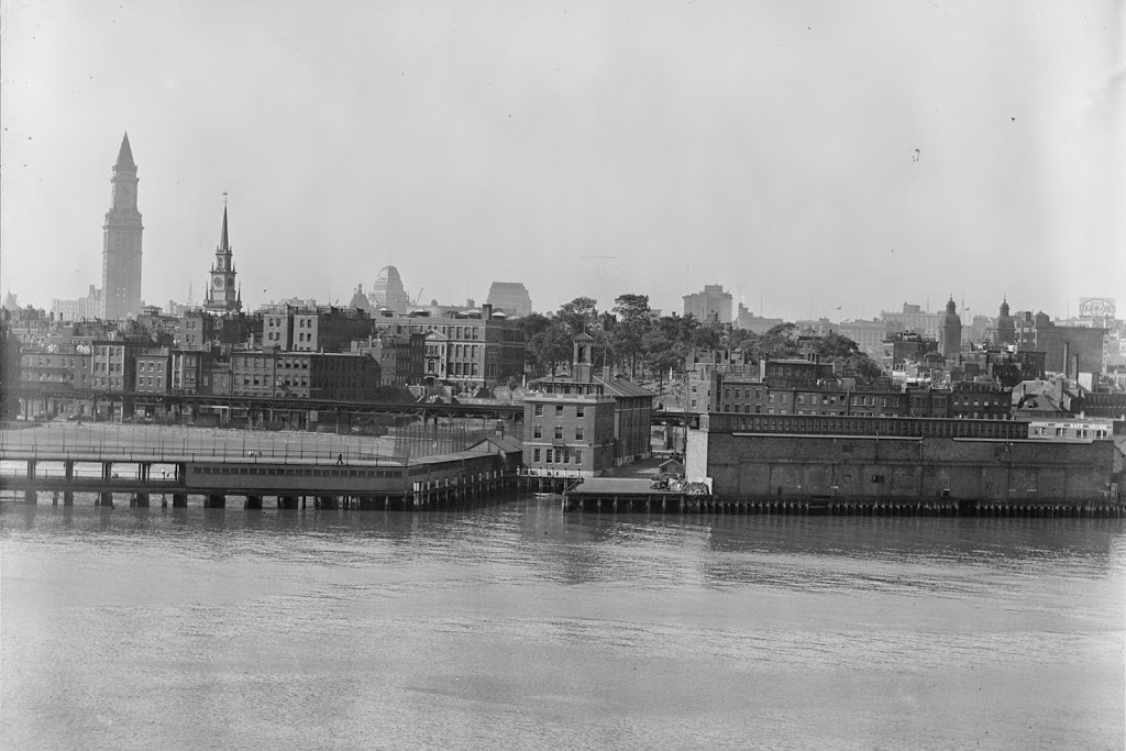
The view of the North End in Boston, from Boston Harbor, around 1930. Image courtesy of Boston Public Library, Leslie Jones Collection.

050_1930-2Bbpl

The scene in 2021:

These two photos show the North End of Boston from across the harbor at Charlestown Navy Yard. Many of the buildings in the North End are still there today, but the Boston skyline behind it has been completely changed – the once prominent Custom House Tower now blends in with the rest of the skyscrapers in downtown, although Old North Church in the foreground still stands out among the low-rises in the North End.

View from Summit House, Mount Tom, Holyoke, Mass.

The view of Easthampton from the Summit House atop Mount Tom, between 1905 and 1915.  Image courtesy of the Library of Congress, Detroit Publishing Company Collection.

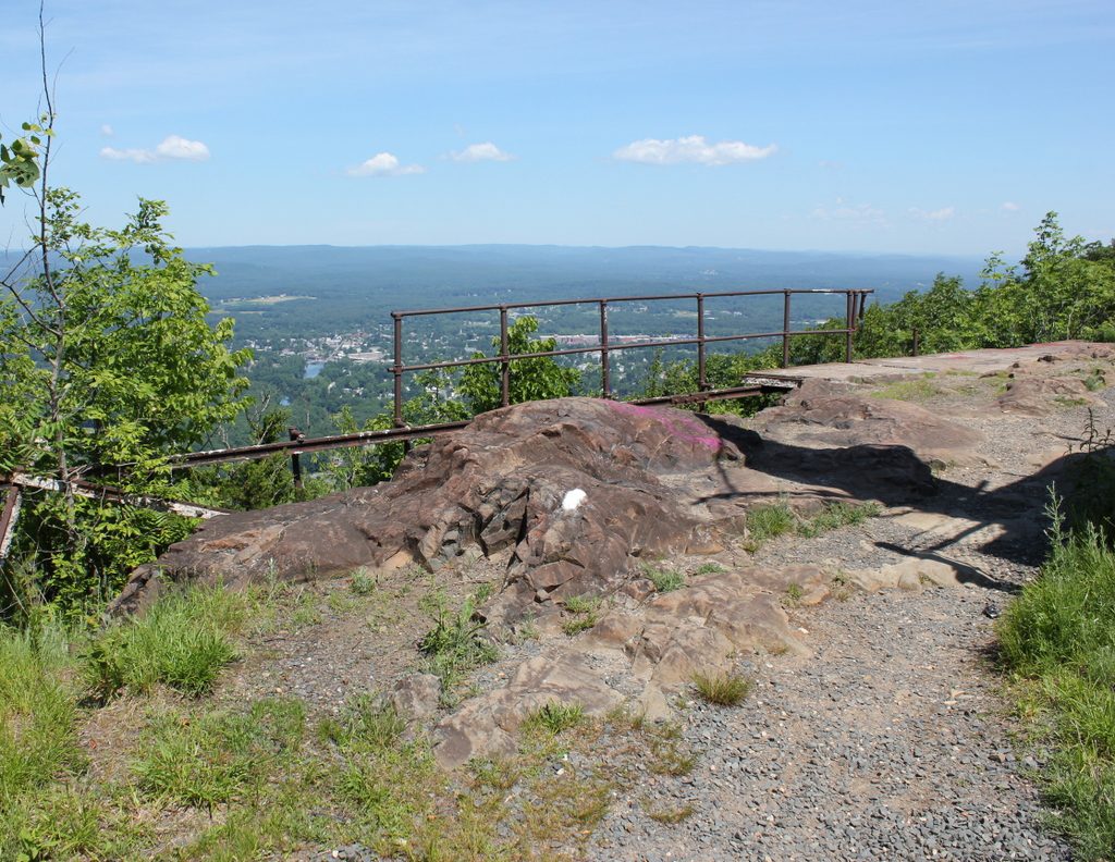
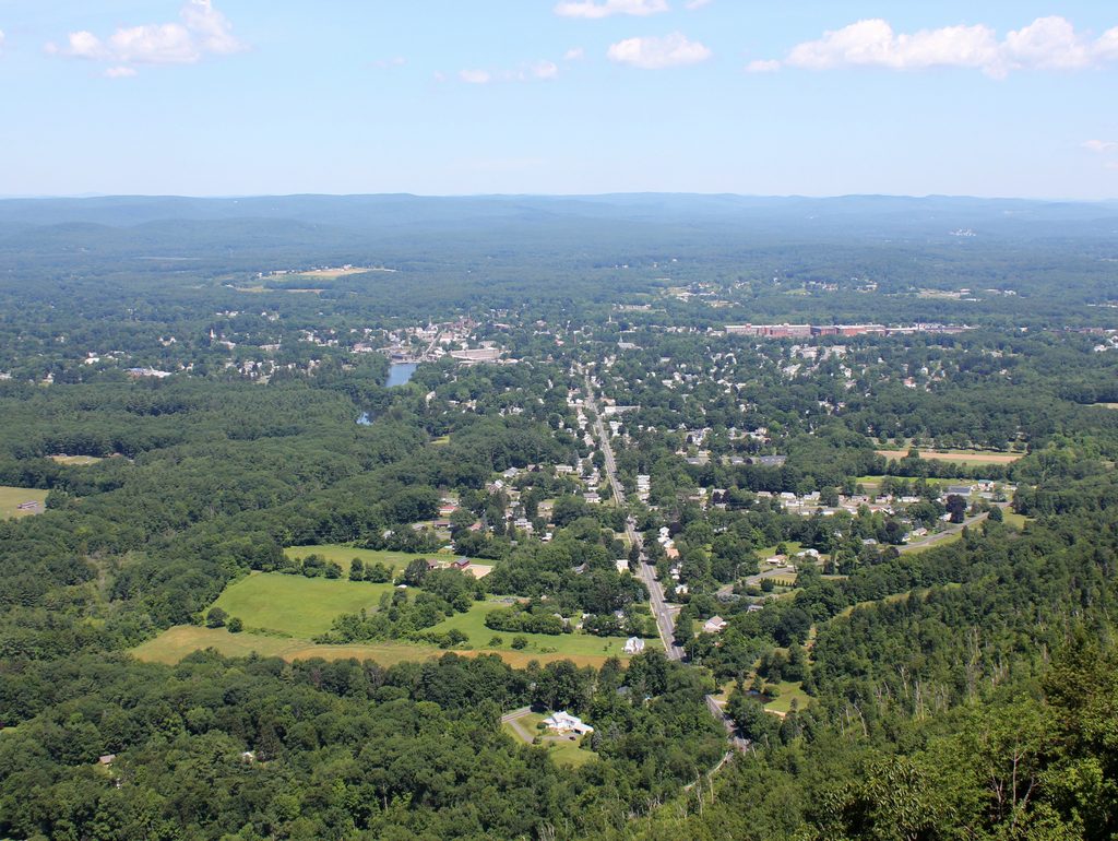
The scene in 2019:

The Summit House no longer exists, so I wasn’t able to perfectly re-create the early 20th century photo, but the 2019 photo shows the remains of the promenade that is in the foreground of the older photo.  President William McKinley once walked along it, but now all that remains is the concrete that once supported the wooden boardwalk and the rusty metal railings that tourists once admired the view from alongside.  The Summit House from the older photo was built in 1901, replacing the 1897 structure that had burned just three years later.  The 1901 building also burned, in 1929, and the third one was closed in 1938.  The site of the summit houses is now off-limits; it is the site of numerous radio and TV antennas for the Springfield area.

Easthampton from Mount Tom, Holyoke, Mass

The view of Easthampton from Mount Tom, between 1900 and 1910.  Image courtesy of the Library of Congress, Detroit Publishing Company Collection.

The scene in 2019:

Not much has changed in Easthampton in 100 years, at least nothing that it particularly noticeable from the summit of Mount Tom. President William McKinley would’ve seen a very similar view during his visit in 1899, but another famous visitor to the mountain, Jonathan Edwards, would’ve seen a very different view in the 1730s.

Long Sands Beach, York, Maine

The view of Long Sands Beach in York, Maine, between 1900 and 1910. Image courtesy of the Library of Congress, Detroit Publishing Company Collection.

Beaches

In 2011:

039_2011

The landscape hasn’t changed much – not many of the present-day buildings are readily identifiable in the early 20th century photo, but in either case the style of buildings hasn’t changed much in the past 100 years.  A few buildings that definitely do still exist are the cottages on the bluff on the far right hand side of the old photo.  Although this area is outside the frame of the 2011 photo, other photos of the area show that those buildings are still there.