Charles River Esplanade, Boston

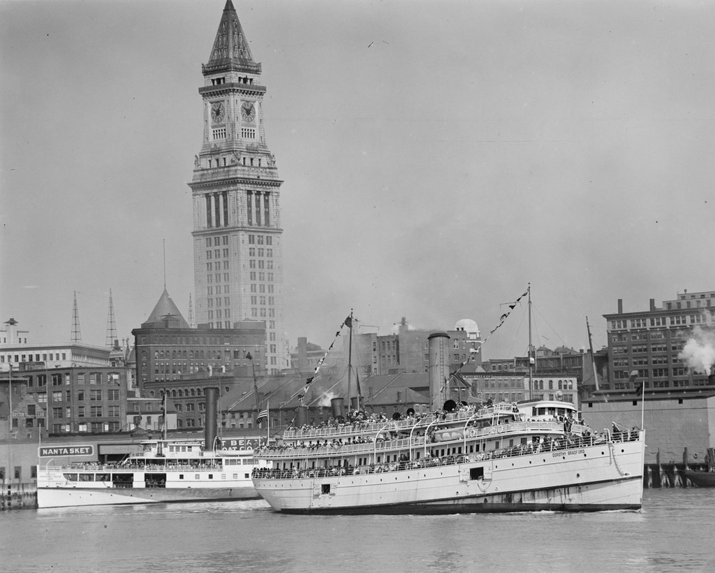
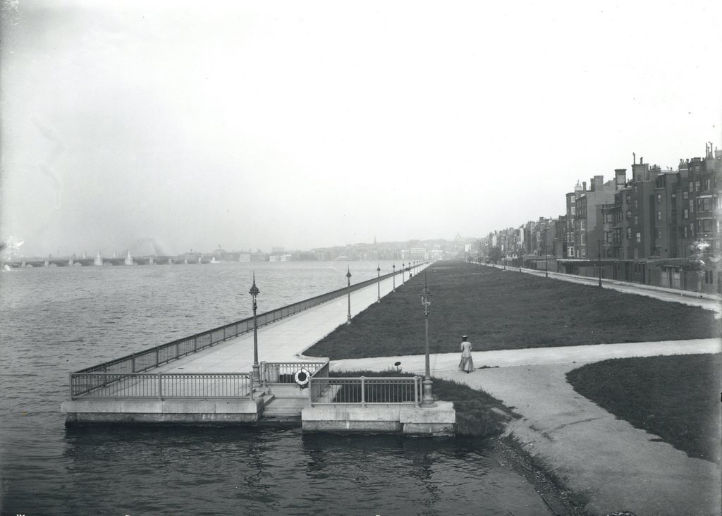
Looking east along the Charles River Esplanade from the Harvard Bridge on Massachusetts Avenue, on October 5, 1910. Image courtesy of the City of Boston Archives.
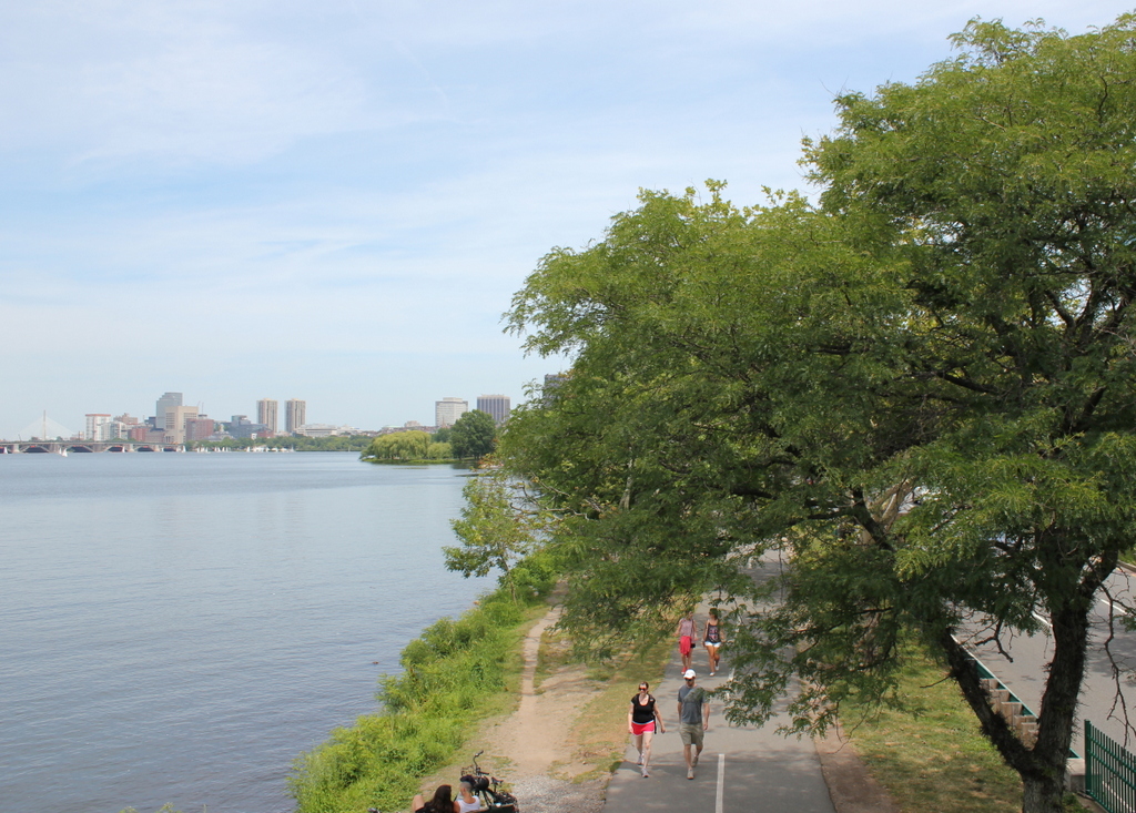
704_1910-10-05 coba

The view in 2015:

704_2015
These photos were taken just a short distance along the bridge from the ones in the previous post, and the first photo here shows the Charles River Esplanade as it appeared soon after its completion.  This parkland was built on reclaimed land just north of Back Street, which was once located right along the Charles River, as seen in the 1907 photo of the previous post.  The Esplanade underwent a major change in the early 1950s, though, when Storrow Drive was built through here.  This parkway allows relatively easy access to downtown Boston from points west, but in the process it largely cut off the Esplanade from the rest of the Back Bay.

Today, the park is still there, and although it is noticeably smaller from its appearance the first photo, it was expanded in other areas to compensate for the land taken to build Storrow Drive.  Part of the expanded parkland can be seen in the distance, just to the left of the center.  The only significant landmark that is clearly visible in both photos is the Longfellow Bridge, which can be seen in the distance to the left.  It was completed in 1906, and still carries vehicles and Red Line subway cars over the Charles River between Boston and Cambridge.

Waterfront, Portsmouth, NH

The view along the Portsmouth waterfront, taken from along Ceres Street looking toward the buildings on Bow Street, around 1900-1906. Image courtesy of the Library of Congress, Detroit Publishing Company Collection.

620_1900-1906 loc

The view in 2015:

620_2015
The angle here isn’t exactly the same,  but the two photos show some of the same buildings while demonstrating some of the change that has occurred along Bow Street.  The four buildings on the far right of the first photo are the same ones seen in the center of the 2015 view, and the two in the center of the first one still exist, but they are out of view from here, obscured by taller, modern buildings to the right of them.  The spire of St. John’s Church, which features prominently in the first photo, is also still there, although from this angle just the very top of the weathervane can be seen above the buildings.

Although many of the buildings are still there, though, the greatest change has been in their use; the waterfront of early 20th century Portsmouth was heavily industrial.  To the right were the offices for Eldredge Brewery, a prominent local brewery that opened in 1858 and operated for nearly a century, with a hiatus during the Prohibition era that came less than 20 years after the photo was taken.  In the center of the first photo, the white building served its purpose as both the home of Preston’s Laboratory and also as a large advertisement for its products.  It offered to customers such necessities as “Cologne Water,” “Tooth Powder,” and “Stedman’s Tu-Tha-Lin,” along with other “Simple remedies at all summer resorts.”  Although primarily industrial, it looks like there were people living here, too – notice the laundry hanging behind some of the buildings.

Today, the waterfront has been redeveloped as an upscale commercial district, with stores and restaurants replacing breweries and drug companies.  Martingale Wharf, the building once occupied by Preston’s Laboratory, is now a restaurant, one of several along this section of Bow Street that offer diners a view of the Piscataqua River.  On the left, in the background of both photos, is the Portsmouth Naval Shipyard.  although technically located in Kittery, Maine, the shipyard has played a major role in Portsmouth’s economy since it was established in 1800.  It is still in use today, specializing in submarine repair and modernization.

Looking North From The Empire State Building

The view looking north toward Central Park from the Empire State Building on September 11, 1933. Photo courtesy of the Library of Congress, Gottscho-Schleisner Collection.

460_1933-09-11 loc.tif

The view in 2011:

460_2011

When the Empire State Building was completed in 1931, it stood far above any of its Midtown neighbors.  However, in the past 80 years the other buildings between the Empire State Building and Central Park have begun creeping upward.  The Empire State Building was still the tallest when the 2011 photo was taken, but the skyscrapers are noticeably taller.  The Rockefeller Center, which blocks out part of the view of Central Park in the 1933 photo, stands out in the first photo, but now the 70-story building seems to blend in with its surroundings.  Today, the Empire State Building is no longer the tallest in the city, or even in Midtown – it has since been displaced by 432 Park Avenue, with two even taller residential skyscrapers on West 57th Street in the works.

Looking South From the Empire State Building

The view looking south from the Empire State Building around 1931.  Photo courtesy of the Library of Congress.

459_1931c loc

The view in 2011:

459_2011

For all of the changes that have taken place in New York City over the past 80 years, these two photos really don’t look all that different.  The buildings in lower Manhattan have certainly become taller, but even many of the skyscrapers from the 1931 photo are still there.  In the center foreground, many of the buildings along Fifth Avenue are still there, including the Flatiron Building, which was old even when the first photo was taken.  The Statue of Liberty is still there on the right in the distance, although the far left side has one major change: the Verrazano-Narrows Bridge connecting Brooklyn and Staten Island.  Both views give an idea of the massive scale of the Empire State Building; the first was taken around the time the building was completed, and it towered over everything else in Midtown – even the 21-story Flatiron Building looks diminutive when viewed from here.  When the second photo was taken in 2011, the Empire State Building was still the tallest in the city, although it had been surpassed by both World Trade Center towers from 1972 to 2001, and in 2013 it would again be surpassed by the new World Trade Center building, which is visible under construction in this 2011 view.

Springfield & Connecticut River from Forest Park

The view looking toward Springfield from atop Laurel Hill in Forest Park, around 1905. Image courtesy of the Library of Congress, Detroit Publishing Company Collection.

224_1905c-loc.tif

The same view in 2014:

224_2014

While driving along Interstate 91 through the Longmeadow curve, there is a semicircular retaining wall built into the side of the hill, with a flagpole on top.  I had never paid much attention to it, but when I came across the first photo above, I wondered if that is where it was taken from.  As it turns out, this overlook is part of what is called Laurel Hill, and is the section of Forest Park where the Barney Mausoleum is built.  From the Mausoleum, it is just a short path to this overlook, which once offered views of the city of Springfield and the Connecticut River.  Today, neither the city nor the river is visible from this spot, and the small dirt road barely visible in the 1905 photo is now Interstate 91.

From a traffic perspective, this is a major bottleneck in the Springfield area.  Route 5 and I-91, which are combined in this short section, serve as the primary north-south transportation corridor in western New England, and link Springfield to Hartford and points south.  However, because of the tight fit in trying to squeeze an interstate highway between the hills on the right and the railroad tracks on the left, I-91 is reduced to just two lanes, and that, combined with the many on/off ramps and curves, makes this a common site of traffic jams and accidents.  It all looks so much more peaceful 100 years ago.

SS Dorothy Bradford, Boston, Mass

The steamer Dorothy Bradford leaving Boston, with the Custom House Tower in the background, in the late 1920s. Photo courtesy of Boston Public Library, Leslie Jones Collection.

139_1920s bpl

The scene in 2013:

139_2013

The SS Dorothy Bradford was built in 1889 for the Cape Cod Steamship Company, and brought passengers to and from Provincetown on Cape Cod.  The company shut down in 1937, and the Dorothy Bradford was sold for scrap.

The Boston Public Library estimates the date of this photo as 1930, but it had to have been earlier than that, because the steamer behind the Dorothy Bradford, the SS Mary Chilton, burned in a fire along with almost the entire rest of its company’s fleet in a fire in November 1929.