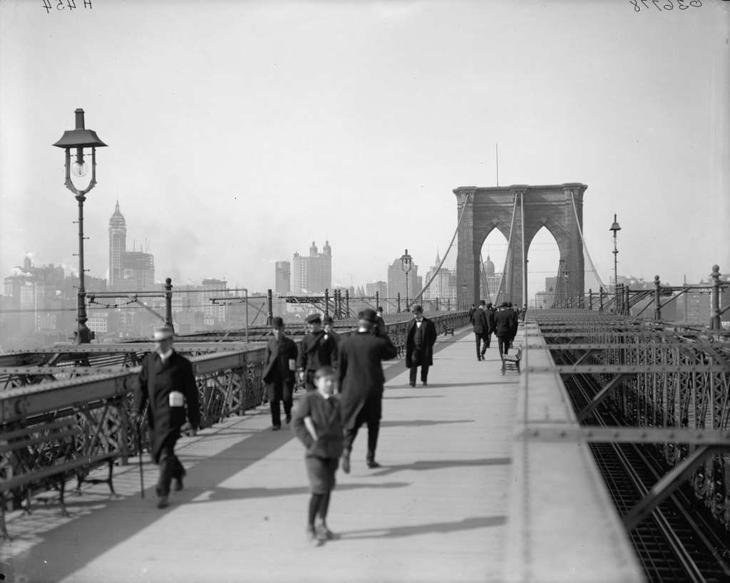
Brooklyn Bridge Promenade

The view along the Brooklyn Bridge Promenade, looking toward Manhattan, between 1908 and 1920. Image courtesy of the Library of Congress, Detroit Publishing Company Collection.

125_1908-1920 loc

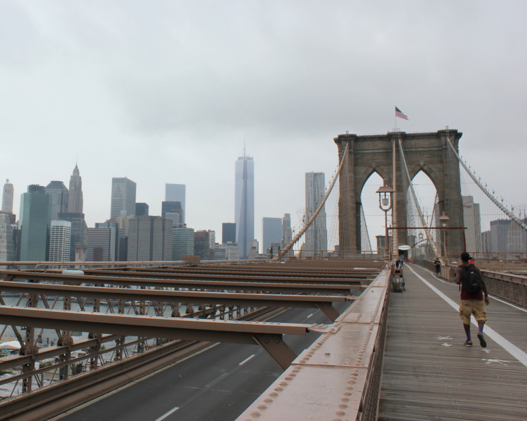
The same view in 2013:

125_2013

The angle here isn’t exact, since they were taken from different sides of the walkway, but both photos show the same view of the Brooklyn Bridge and of the Manhattan skyline.  The first photo is interesting, because although the subject of the photo is the bridge, the background shows three different buildings that were, at one point, the tallest in the world:

1. New York World Building: The tallest from 1890 to 1894, demolished in 1955 to expand the approaches for the Brooklyn Bridge.  The dome of the building is barely visible under the left-hand arch of the bridge tower.

2. Park Row Building:  Held the record from 1899 to 1901, and the building still exists, although it’s not visible in the 2013 photo.  It can be seen in the first photo, near the center, with the two towers on top.

3. Singer Building: Held the record from 1908 to 1909, and was demolished in 1968.  It is readily visible on the far left of the first photo, and its location today is marked by One Liberty Plaza, the large black rectangle at the base of the new World Trade Center building.

Lower Manhattan (3)

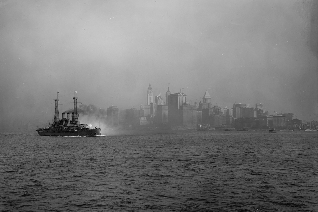
A view of Lower Manhattan from New York Harbor, taken between 1910 and 1917. Image courtesy of the Library of Congress, Detroit Publishing Company Collection.

124_1910-1917 loc

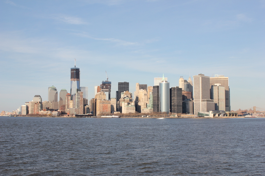
A similar angle in 2012:

124_2012

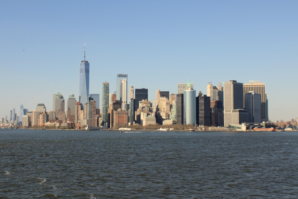
The scene in 2023:

Taken from about the same spot as the first photo of the previous post, the circa 1910s photo here may have been taken on the same day, although the battleship to the left is different from the two in the other post.  This battleship is either a Connecticut or Vermont class ship, built in the first decade of the 1900s and decommissioned shortly after the end of World War I.

Just like in the other post, the 2012 photo here is taken a little to the east of the first one. The only readily-identifiable landmark from both photos is the Whitehall Building. However, the Singer Building and its replacement, One Liberty Plaza, help to estimate the angle of each photo. In the first photo, the Singer Building is immediately behind and to the left of the Whitehall Building, while in the 2012 photo, One Liberty Plaza is to the right of the Whitehall Building.

April 2023 Update: I have added an updated photo of the scene, showing it after the completion of One World Trade Center and several other high-rise buildings here in Lower Manhattan.

Lower Manhattan (2)

The view of Manhattan from New York Harbor, around 1913-1920. Image courtesy of the Library of Congress, Detroit Publishing Company Collection.

123_1913-1920 loc

A similar view in 2012:

123_2012

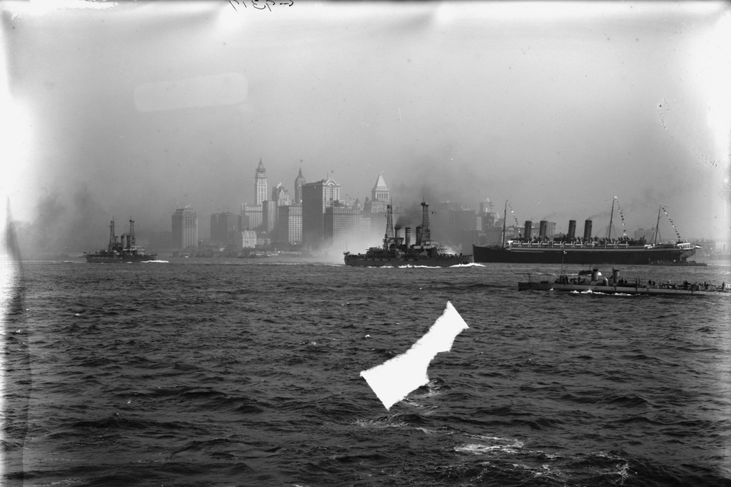
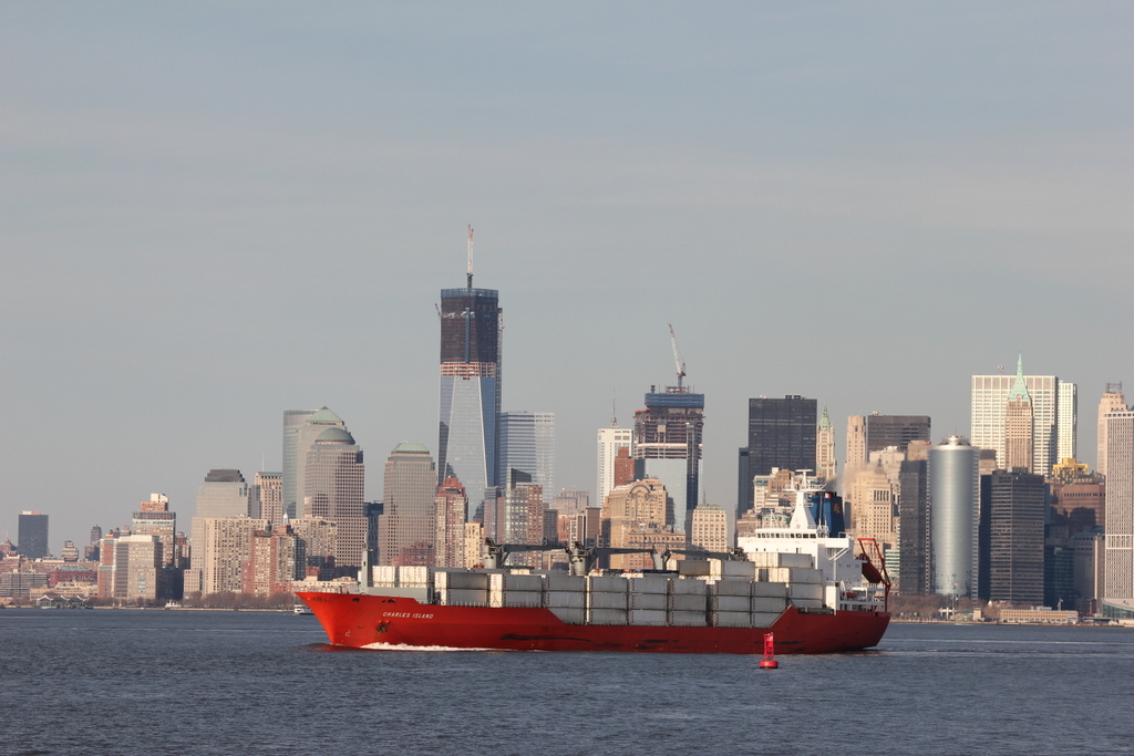
There’s a lot going on in the first photo.  New York City has always been a busy port, but it was especially so in the early 20th century.  The top photo shows three major ships – the two battleships, and the passenger liner to the right.  In addition, there are several US Navy torpedo boats visible.

The two battleships are two of the five Virginia-class battleships, which were built by the US Navy between 1905 and 1906.  By the time this photo had been taken, they had already been rendered obsolete by new advances in battleship design, but they remained in commission until 1920, and were scrapped or sunk as target ships by 1923.  As for the ocean liner, it is German, as evidenced by the flag on the stern, but I don’t know its exact identity.  The 2012 photo, on the other hand, shows the type of shipping that is most common today.  New York is no longer a destination for trans-Atlantic ocean liner traffic, nor is it a major military base, but today it is a major port for container ships, such as the Charles Island that is seen in the photo.

New York’s skyline has obviously changed in the past 100 years, although a few landmarks are still visible.  the angle isn’t exact between the two photos – the 2012 one was taken slightly to the east of the first one, but they show the same general view.  Both photos show the Whitehall Building, which is fairly prominent in the first photo, just above the stern of the lead battleship.  Today, its distinctive shape is still visible, just above the middle section of the container ship.  Another major building in the first photo is the Singer Building, seen just behind and to the left of the Whitehall Building.  It was demolished in 1967 to make way for the far less architecturally significant One Liberty Plaza, which is the large, black, rectangular building just above she ship’s bridge.  Also in the 2012 photo is the new World Trade Center.  At the time that the photo was taken, the two tallest buildings were still under construction.

Boston Skyline

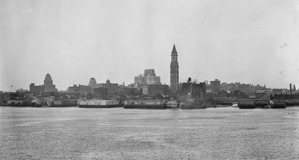
The view of Boston from the harbor, in the early 1930s. Image courtesy of Boston Public Library, Leslie Jones Collection.

069_1930c-2Bbpl

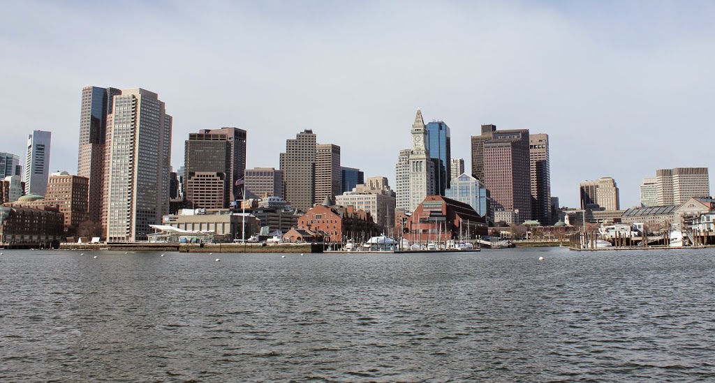
The view in 2013:

069_2013

Boston’s skyline has changed a lot in the past 80 years, but there are still some recognizable buildings in both photos.  The Custom House Tower, the lonely skyscraper in the first photo, is still among the tallest buildings in downtown Boston, but it no longer stands out like it did from when it was built in 1915 until the 1970’s.  Part of the reason why Boston’s skyline got off to a slow start was because, for many years, the city had a 125 foot limit on any buildings; the Custom House was able to skirt these requirements because it was a federally-owned structure.  One of the other prominent building in the 1930’s photo is the John W. McCormack U.S. Post Office and Courthouse, another federally-owned building that is still standing, but barely visible in the 2013 photo.  The building was built between 1930 and 1933, which establishes the earliest that the photo could have been taken.

Springfield Skyline (3)

The view of Springfield from West Springfield, between 1900 and 1910. Image courtesy of the Library of Congress, Detroit Publishing Company Collection.

058_1900-1910-2Bloc

The view in 2014:

058_2014

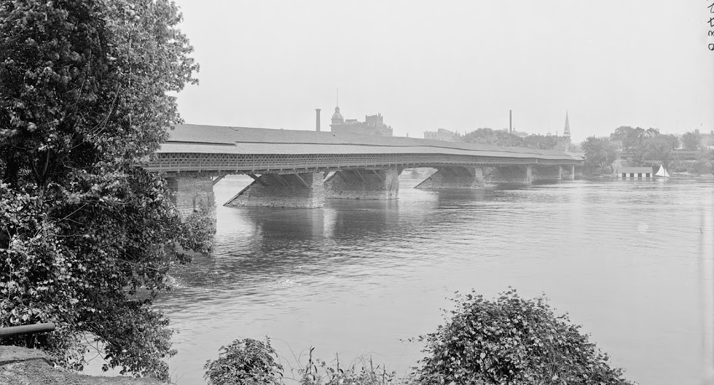
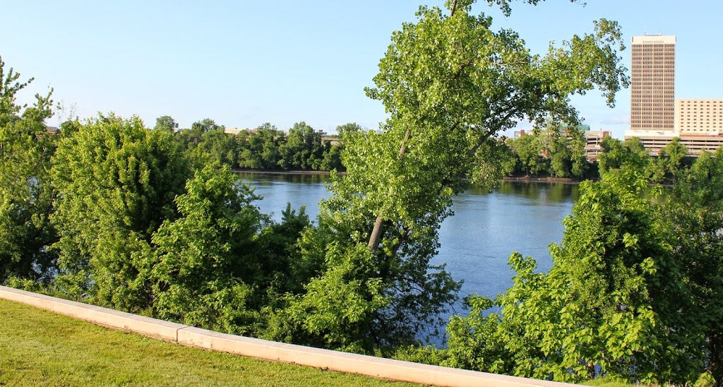
The most obvious difference here is the lack of a covered bridge – this bridge was replaced by the current Memorial Bridge (just to the right of the scene in the 2013 photo) in 1922. The first bridge across the river in Springfield was an uncovered, six span bridge that was built in 1805. It collapsed in 1814, and was replaced by the covered bridge, which was completed in 1820. The designer was Isaac Damon, the same architect who designed Springfield’s Old First Church.  This bridge far outlasted its predecessor, and even the present Memorial Bridge hasn’t reached the 102 years that the covered bridge made it to.

The bridge was finally demolished – or, to be more accurate, dismantled piece by piece to reuse the wood – in 1922, upon completion of Memorial Bridge. Although there are no visible traces of the bridge itself, it’s still easy to pinpoint its location; there is a Bridge Street in Springfield, and another one directly across the river in West Springfield. Neither street currently leads to a bridge, but they were once the approaches to the old covered bridge.

Springfield Skyline (2)

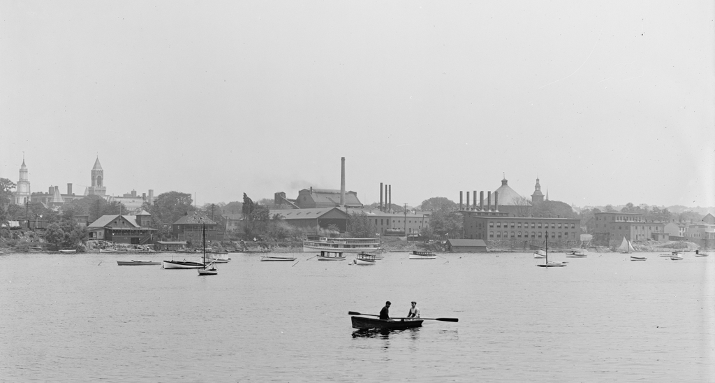
The South End of Springfield, seen from West Springfield between 1900 and 1910. Image courtesy of the Library of Congress, Detroit Publishing Company Collection.

The same view in 2014:

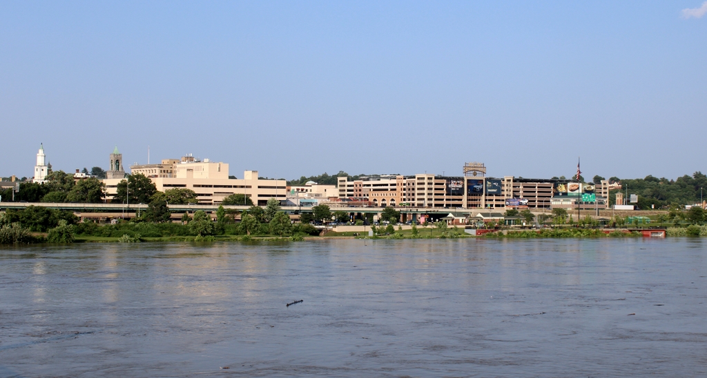
The scene in 2023:

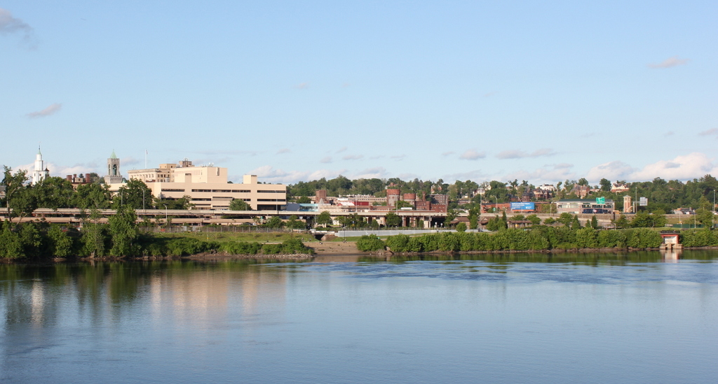
Like the photos taken from the same spot but angled a little upstream, not much remains visible from the original photo.  Old First Church, the Hampden County Courthouse, and the Court Square Building are still there, but not much else is readily identifiable in both photographs.  The steeple that is visible toward the right-hand side of the first photo is St. Joseph’s Church, which was built in 1873 and demolished in 2008.  The building that has since taken its place is visible in the second photo – it is a gray-green rectangular building visible just above and to the left of the large brick structure that is on the waterfront on the right-hand side of the photo.

Several buildings that are visible in the 2013 photo did exist when the earlier one was taken, but they aren’t visible in it. Among those is the old castle-like National Guard Armory, which was built in 1895 and damaged in the 2011 tornado. At the time it was being used as the South End Community Center, but today it stands vacant, although part of MGM’s proposed casino includes preserving the distinctive facade of the building.

Along the waterfront, much has changed in the past 100 years.  Back in the early 20th century, the waterfront was dominated by boating clubs and factories.  According to a 1910 map, there were three boathouses along this stretch of riverfront, several of which can be seen in this photo. They were the Springfield Yacht Club, the Springfield Canoe Club, and the Springfield Boat Club. Presumably many of their members are among those who are sailing or rowing on the Connecticut River.  Sadly, this is not the case today – the construction of I-91 effectively blocked off downtown Springfield from the waterfront, and today a little-used bike path along the riverfront is the only significant recreational activity available on this part of the river.

2023 Update: The third photo shows the scene nearly a decade after the second photo. The most significant change here is the MGM Springfield Casino, which stands on the right side of the scene. This photo also shows much higher water levels than the other two photos, due to floodwaters caused by heavy rains upstream in Vermont in July 2023.