Crawford Notch, Hart’s Location, New Hampshire

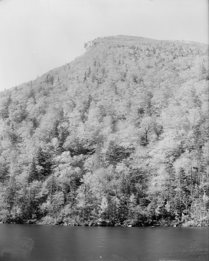
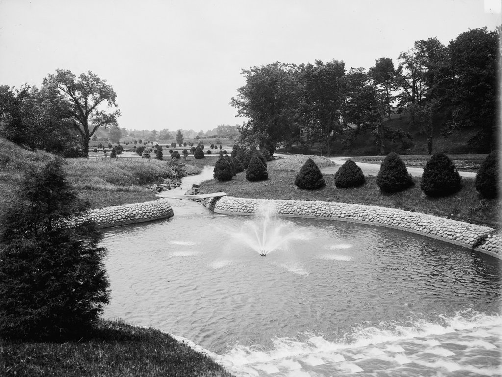
The view looking northwest through Crawford Notch in the White Mountains of New Hampshire, around 1860-1875. Image courtesy of the New York Public Library.

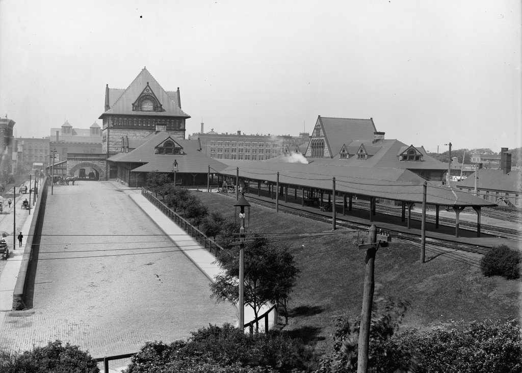
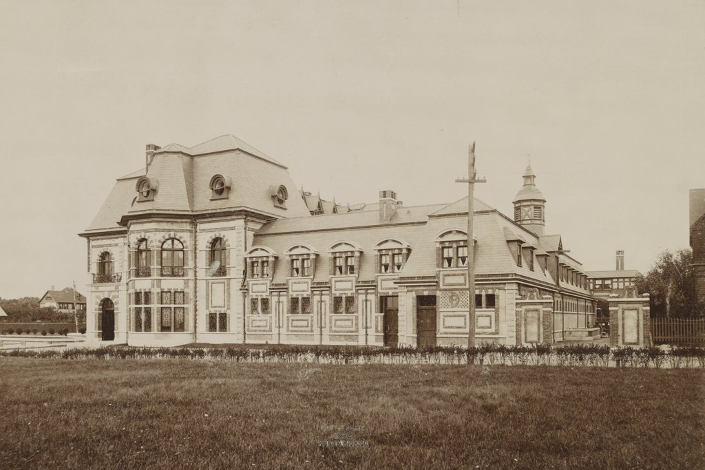
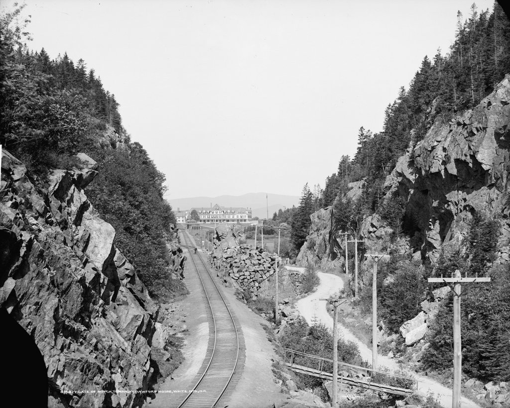
The same view around 1907. Image courtesy of the Library of Congress, Detroit Publishing Company Collection.
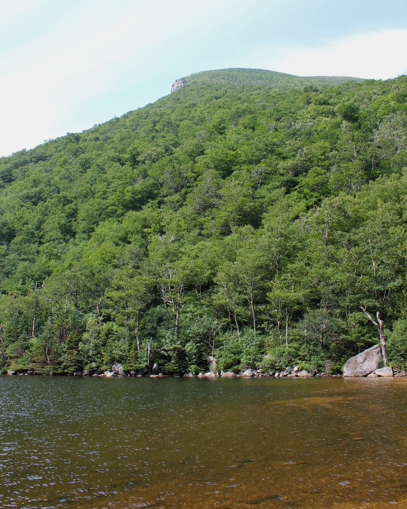
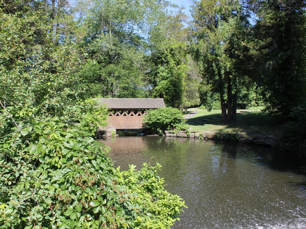
The scene in 2018:

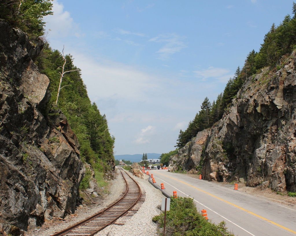
Crawford Notch is an important mountain pass within the White Mountains of New Hampshire. Until the completion of the Kancamagus Highway in the 1960s, it was the only east-west route through the mountain range, and over the years it has served as a major link between northern Vermont and the coastal region of southern Maine. The notch consists of a narrow valley that is several miles in length, but the actual mountain pass is here at the northern end of this valley, at a gap in the mountains that was originally barely 20 feet wide. This spot came to be known as the gate of the notch, because of the high rocks that stand on either side of the pass.

The highest point of Crawford Notch is just to the north beyond the gates, in the distance of this scene. At 1,900 feet in elevation, it forms the divide between the Ammonoosuc River, which flows west to the Connecticut River and then to Long Island Sound, and the Saco River, which flows east through Crawford Notch and then to Maine, where it empties into the Atlantic Ocean just south of Portland. To the northeast of here is the Presidential Range, which begins here at the Notch and reaches its highest point, Mount Washington, about 6.5 miles from here. In the opposite direction, to the southwest of the notch, is the Peimgewasset Wilderness, the largest wilderness area in the state.

The first recorded discovery of Crawford Notch occurred in 1771, when Timothy Nash and Benjamin Sawyer came across it while hunting. As the story goes, Nash had become lost while tracking a moose. He climbed a tree in order to get his bearings, and in the process he sighted the gates here at the northern end of the notch. The notch had long been known to Native Americans, but Nash and Sawyer were evidently the first Europeans to find it, and within a few years there was a rough road through here.

The notch was ultimately named in honor of the Crawford family, who became the first permanent settlers of the area. Around 1790, Abel Crawford built a house a little further to the north of here, where he remained for several years before selling it to his father-in-law, Eleazer Rosebrook. Crawford then moved to the southern end of the notch, around the site of the present-day town of Hart’s Location.

Both he and Rosebrook operated inns for travelers, and Crawford helped to pioneer tourism to the White Mountains region. After Rosebrook’s death in 1817, Abel’s son Ethan Allen Crawford inherited the property here at the notch. Two years later, the Crawfords constructed an 8.5-mile trail from the notch to the summit of Mount Washington, and provided guided trips for visitors. Now known as the Crawford Path, it is considered to be the oldest continuously-used hiking trail in the country, and it has been incorporated into the Appalachian Trail.

One early visitor to this region was Timothy Dwight IV, a prominent author and theologian who served as president of Yale from 1795 to 1817. He came to the Notch on at least two separate occasions, and provided a description of it in his book Travels in New England and New York. In this particular visit, he approached the notch from the north, facing the opposite direction of these photos, and he wrote:

The entrance of the chasm is formed by two rocks, standing perpendicularly at the distance of twenty-two feet from each other: one about twenty feet in height, the other about twelve. Half of the space is occupied by the brook, mentioned as the head stream of the Saco; the other half by the road. The stream is lost, and invisible, beneath a mass of fragments, partly blown out of the road, and partly thrown down by some great convulsion.

When we entered the Notch we were struck with the wild and solemn appearance of every thing before us. The scale, on which all objects in view were formed, was the scale of grandeur only. The rocks, rude and ragged in a manner rarely paralleled, were fashioned and piled on each other by a hand, operating only in the boldest and most irregular manner. As we advanced, these appearances increased rapidly. Huge masses of granite, of every abrupt form, and hoary with a moss which seemed a product of ages, recalling to the mind the “Saxum vetustum” of Virgil, speedily rose to a mountainous height. Before us, the view widened fast to the south-east. Behind us, it closed almost instantaneously; and presented nothing to the eye but an impassable barrier of mountains.

The first photo was taken more than a half century after Dwight wrote this account, but the notch still had much of the same rugged appearance that he would have seen. The road had been improved somewhat over the years, starting in 1806, when the Tenth New Hampshire Turnpike opened through the notch. By the late 1820s, the road was suitable for stagecoaches, but when the first photo was taken around the 1860s or 1870s, this section of the road still looked like a narrow dirt path through the wilderness.

Aside from the road, the only sign of civilization in the first photo is the Crawford House, which is barely visible in the distant center. The original Crawford House was built here in the early 1850s, but it burned in 1859. The hotel was quickly rebuilt on the same site, reopening later in 1859. This new building can be seen in both the first and second photos, and it stood here until it too was destroyed by a fire in 1977. The site of the hotel is now the Highland Center, a lodge and education center operated by the Appalachian Mountain Club.

Perhaps the most dramatic change in this scene occurred shortly after the first photo was taken, when a railroad was constructed through here. The first railroad across the continent had been completed in 1869, and by this point there was even a cog railway to the summit of nearby Mount Washington. However, it would take several more years for railroad engineers to conquer Crawford Notch. The project required several long trestles and deep rock cuts, along with the widening of the gap here at the gates of the notch. The grade of the railroad was also a challenge, with northbound trains having to ascend 1,623 feet in just 30 miles, but the Portland & Ogdensburg Railroad was ultimately completed through the notch in 1875.

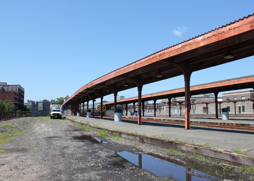
In addition to improving transportation through northern New England, the railroad also provided passenger service to the heart of the White Mountains, making it easier for tourists to visit the region. Several of the grand hotels along the route even had their own stations, including the Crawford House, whose station is barely visible in the distance on the right side of the tracks in the second photo. This particular station building had been constructed in 1891, several years after the Maine Central Railroad acquired the Portland & Ogdensburg, and it is still standing today as the only surviving structure from the second photo.

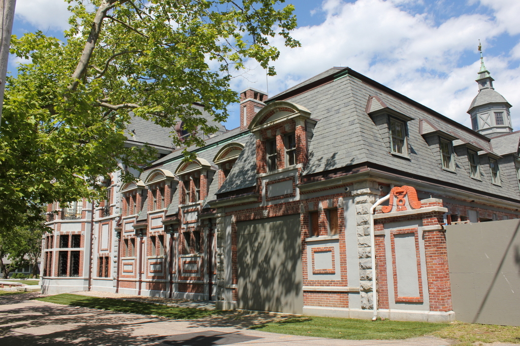
In more than a century since the second photo was taken, the road through the notch has been widened and straightened. It has come a long way since the dirt path of the first photo, and it is now designated as U.S. Route 302, which runs from Portland, Maine to Montpelier, Vermont. Today, it remains as important a route through the White Mountains as it had been when the first road was constructed through here in the 18th century. In that sense, the road has actually outlived the railroad, which was abandoned by Maine Central’s successors, Guilford Transportation, in 1983. However, this section of railroad was ultimately acquired by the Conway Scenic Railroad, which operates excursion trains for tourists. The railroad also owns the station here in the distance, and it serves as the northern terminus for most of its trains.

Today, the White Mountains are still a popular tourist destination, and Crawford Notch is still a major focal point within the region. Most of the notch is within the town of Hart’s Location (population 41 as of 2010), but the northern border of the town is here at the gates of the notch, so the buildings in the distance are actually within the town of Carroll. The land on the Carroll side of the border is still privately owned, but the Hart’s Location side is part of the 5,775-acre Crawford Notch State Park. This park is, in turn, mostly surrounded by the much larger White Mountains National Forest, which covers more than 750,000 acres in New Hampshire and Maine.

Old Man of the Mountain, Franconia, New Hampshire

The Old Man of the Mountain, seen from Profile Lake at the base of Cannon Mountain, around 1890-1901. Image courtesy of the Library of Congress, Detroit Publishing Company Collection.

The scene in 2018:

The Old Man of the Mountain was previously featured on this blog many years ago, in a post that showed a closeup of the rock formation, before and after its collapse. Unlike that view, however, this scene here shows not just the rock formation, but also its surroundings, including the east side of Cannon Mountain and Profile Lake at its base. This is, more or less, the view that most visitors would see of the Old Man from the ground, without the aid of binoculars or telephoto lenses.

The iconic granite profile was formed at some point after the last ice age, as a result of erosion at the top of the cliff. It stood 1,200 feet above the surface of Profile Lake, and it was on the side of Cannon Mountain, which rises a total of 4,080 feet above sea level. Cannon Mountain forms the western side of Franconia Notch, an important mountain pass through the White Mountains, and by the early 19th century the Old Man of the Mountain had become a notable landmark for travelers passing through here.

The first recorded mention of the rock formation came in 1805, when a pair of surveyors observed it from near this location. As the story goes, they arrived here at dusk and camped along the shore of the lake. When they awoke in the morning, one of the surveyors looked up from the lake to discover the sun shining on the east-facing cliff, illuminating the stone profile.

Over the next few decades, the Old Man of the Mountain drew the attention of writers and other prominent people. New Hampshire native Daniel Webster famously declared, regarding the rock formation, that “God Almighty had hung a sign out to show that here He makes men.” Although originally from Massachusetts, poet John Greenleaf Whittier wrote extensively about the White Mountains, and he made reference to the Old Man of the Mountain in his 1850 poem, “The Hill-Top,” which includes the following lines:

Beyond them, like a sun-rimmed cloud,
     The great Notch mountains shone,
Watched over by the solemn-browed
     And awful face of stone!

Also in 1850, Nathaniel Hawthorne published a short story, “The Great Stone Face.” It was one of several stories that Hawthorne set in the White Mountains, and it included the following description of the formation:

The Great Stone Face, then, was a work of Nature in her mood of majestic playfulness, formed on the perpendicular side of a mountain by some immense rocks, which had been thrown together in such a position as, when viewed at a proper distance, precisely to resemble the features of the human countenance. It seemed as if an enormous giant, or a Titan, had sculptured his own likeness on the precipice. There was the broad arch of the forehead, a hundred feet in height; the nose, with its long bridge; and the vast lips, which, if they could have spoken, would have rolled their thunder accents from one end of the valley to the other.

In time, the Old Man of the Mountain became probably the most recognizable symbol of New Hampshire. Its rugged features paired well with the state’s “Live free or die” motto, and over the years it has appeared on everything from license plates to state highway signs to the 2000 New Hampshire state quarter. It has also appeared in countless paintings, postcards, photographs, and other illustrations over the years. The first photo was one of these, having been taken around the late 19th century by the Detroit Publishing Company, which produced postcards of landmarks across the country.

For more than a century after the first photo was taken, this scene remained essentially unchanged. However, as early as the 1870s, geologists has begun expressing concerns that the same forces of erosion that created the Old Man of the Mountain might soon destroy it. The many cycles of freezing and thawing had caused large cracks to form within the rocks, leading the state to secure it with chains in the 1920s. Then, in 1958, the formation was further reinforced with cement and steel rods. However, these measures ultimately proved to be only temporary solutions, because it finally collapsed on May 3, 2003, nearly 200 years after it was discovered here by the surveyors.

Today, with the exception of the loss of the rock formation, the rest of this scene still looks the same as it did when the first photo was taken. In fact, it is largely the same as it would have appeared in 1805, when the surveying team first spotted the Old Man of the Mountain from near this location. This area is now part of the Franconia Notch State Park, and it is surrounded by the much larger White Mountain National Forest, which preserves most of the land here in New England’s highest mountain range.

Union Station, Springfield, Mass (2)

The old Union Station in Springfield, seen from near the corner of Lyman and Chestnut Streets around 1900-1910. Image courtesy of the Library of Congress, Detroit Publishing Company Collection.

The scene in 2018:

The first photo shows Union Station as it appeared about 10 to 20 years after its completion, as seen looking west from near Chestnut Street. The photo in a previous post shows the south side of the station from Lyman Street, but this view provides a more elevated look at the station, showing both the north and south sides, along with the platforms in between. Further in the distance, beyond the station on Main Street, are two of the city’s leading hotels: the Massasoit House on the far left at the end of Lyman Street, and Cooley’s Hotel, which can be seen in the center of the photo.

This area has been the site of Springfield’s primary railroad station since 1839, when the Western Railroad arrived, linking Springfield with Worcester and Boston. The original station, which was located on the west side of Main Street, burned in 1851, and the following year it was replaced by a brick and iron, shed-like station on the same spot. This station served for most of the second half of the 19th century, but it began to cause problems as the city grew in population and as rail traffic increased. Because the station was located at street level, trains had to cross directly over Main Street, leading to significant delays for traffic on the street. The station itself was also becoming insufficient for the number of trains that passed through here, and by the late 1860s there were already calls for a new station and elevated tracks through downtown Springfield.

In 1869, the state legislature authorized such a project, but it would take another 20 years before it was actually finished, thanks to an impasse between the city government and the Boston & Albany Railroad, which was the successor to the old Western Railroad. This dispute centered around which side was responsible for paying to raise the tracks and lower the grade of Main Street, and it ultimately did not get resolved until 1888, when the railroad agreed to spend around $200,000 to raise the tracks, while the city would spend about $84,000 to lower Main Street by four feet.

This compromise enabled the station project to move forward, and the old station was demolished in the spring of 1889. The new one was completed in July, and it was located on the east side of Main Street, which provided more room for the station. It featured a Romanesque Revival-style design, and the original plans had been the work of noted architect Henry H. Richardson, who designed many of the stations along the Boston & Albany Railroad. He died in 1886, though, and his successor firm of Shepley, Rutan & Coolidge subsequently modified the plans for the Springfield station.

One of these changes proved to be a serious design flaw. Richardson had intended for a single station building, located on the south side, with a large train shed over the tracks. However, the Connecticut River Railroad, which would share the union station with the Boston & Albany and the New York, New Haven & Hartford Railroads, objected to this plan, wanting a separate building on the north side. As a result, the finished station consisted of two buildings, each with its own ticket offices and waiting rooms, and four tracks in between them. The smaller northern building, on the right side of this scene, served northbound and westbound travelers, while the larger building on the south side was for those heading southbound and eastbound.

Within less than 20 years, this design was already causing problems as Springfield continued to grow. Having two different station buildings was an inefficient use of space, since it meant redundant facilities such as the waiting rooms. This was also a source of confusion for passengers, who would sometimes find themselves at the wrong ticket office or platform. In addition, the two buildings prevented the railroads from adding new tracks, since the space in between was already filled with four tracks and three platforms.

Aside from practical considerations, the architecture of the building was also obsolete by the early 20th century. Romanesque Revival had been widely popular during the last two decades of the 19th century, particularly for public buildings, and railroad stations were seen as important architectural showcases. They were usually the first thing that a traveler saw in a particular city, so any self-respecting city need a monumental station, in order to give a good first impression to visitors. This may have been the case for Union Station in the 1890s, but Romanesque Revival had fallen out of favor by the next decade, and the new generation of iconic railroad stations – such as Grand Central and Penn Station – began to feature classically-inspired Beaux-Arts designs.

As early as 1906, it was evident that the station was inadequate. That year, the Springfield Republican published an article on the city’s numerous railroad-related problems, observing that “[t]he most important problem as far as the safety and convenience of the public is concerned is the rebuilding of the union station.” In 1921, the newspaper was even more explicit, remarking on how “there seems to be, in fact, a nearly unanimous demand that the structure be cast to the scrapheap,” and four years later it declared that the station was “long execrated for its combination of discomfort, dinginess and danger.”

The station’s demise was hastened by a November 1922 fire that caused about $25,000 in damage to the north building. The fire was considered to be suspicious, but its origins were unclear, with the railroad superintendent simply telling the Republican, “your guess is as good as mine.” The city’s fire chief declared that he found no evidence of arson, although he did not actually inspect the cellar beneath the waiting room, where the fire had apparently started. There were no injuries, and most of the valuables, including mail, packages, and cash, were safely removed by railroad employees and by an off-duty police officer.

Within less than a month of the fire, the railroad had approved the plans for a new station. This replacement would be in approximately the same location, but the entire station would be located on the north side of the tracks. It would be connected to Lyman Street on the south side by way of a tunnel beneath the tracks, and this tunnel would also provide access to the platforms, avoiding the dangers of passengers crossing directly over the busy tracks. Perhaps most significantly, the number of tracks would be increased from four to 11, reducing congestion and delays on the railroad.

Demolition on the old station began in 1925, just 36 years after it was built, and the new Union Station opened the following year. It would remain in use for the next few decades, but passenger rail began to experience a significant decline throughout the country during the post-World War II era. With passenger trains becoming unprofitable for railroads to operate, Amtrak ultimately took control of the country’s passenger rail services in 1971. Two years later, most of Union Station was closed except for the Lyman Street entrance, and a small Amtrak station was built on the south side of the tracks.

Union Station sat empty for many years, and only one of the old station platforms was used for passenger service. However, the building underwent a major restoration in the 2010s, reopening in 2017. It now features a ticket office, waiting area, and retail space in the concourse, along with office space on the upper levels, including the offices of the Peter Pan Bus Lines. Union Station is also the terminus for most of the city’s PVTA bus lines, with 18 bus berths just to the west of the station. In addition to this, the rail traffic here at the station has also increased. Along with a number of daily Amtrak trains, Union Station is also served by the Hartford Line, which opened in 2018 with commuter trains running from Springfield south to New Haven.

The 2018 photo shows this scene about a year after the station reopened. An Amtrak train is visible in the distant center of the photo, consisting of two passenger cars pulled by a P42DC diesel engine. This is the typical setup for most of the Springfield to New Haven Amtrak trains, and the rear car is a converted Metroliner cab car, which allows the train to be operated in either direction without turning the locomotive. Just to the right of the train is Platform C, which was the last part of the station’s renovation project. It was still unfinished when the first photo was taken, but this project – which upgraded the platform to modern accessibility requirements – was finished in January 2020, marking the end of Union Station’s restoration.

Forest Park Fountain, Springfield, Mass

A fountain in Forest Park, around 1905. Image courtesy of the Library of Congress, Detroit Publishing Company Collection.

The scene in 2018:

Forest Park was established in 1884, when Orrick H. Greenleaf donated around 65 acres of land on the south side of Sumner Avenue. Other benefactors soon gave adjoining parcels to the city, but the single largest gift came in 1890, when ice skate manufacturer Everett H. Barney gave nearly 175 acres of what is now the western end of Forest Park. This gift included his home, Pecousic Villa, and its well-landscaped grounds, which featured aquatic gardens, ponds, and the meandering Pecousic Brook. Barney’s only stipulation was that he and his wife would be allowed to live in the house for the rest of their lives, with the city taking possession of it after their deaths.

The first photo shows a view of this section of the park, facing west from the top of a dam on the Pecousic Brook. At the foot of the dam is a small pool lined with stones, with a fountain in the center. Beyond the pool, the brook flows under a simple plank bridge, before rounding a curve to skirt past the aquatic gardens, which are visible in the upper left center of the photo. To the right is a steep hill leading up to a broad plateau, and there is a similar one just out of view on the left, forming a narrow valley for the brook to flow through.

Today, nearly 115 years since the first photo was taken, Forest Park has seen some major changes, but it remains the largest park in the city, and one of its most popular recreation areas. Further upstream of here, there are several more dams and ponds that have been constructed since the early 20th century, but the course of the brook remains largely the same in this scene. The dam is still here, as is the pool, although the perimeter now consists of large rocks, as opposed to the small, round stones of the first photo. However, perhaps the most noticeable change to this scene is the covered pedestrian bridge in the center of the 2018 photo, on the same spot where the plank bridge had once crossed the brook.

Belcourt, Newport, Rhode Island (2)

Belcourt, seen from the west side along Ledge Road in Newport, around 1895. Image courtesy of the Library of Congress.

The scene in 2018:

As discussed in more detail in the previous post, Belcourt was completed in 1894 as the summer home of Oliver Hazard Perry Belmont, a banker from the prominent Belmont family of New York. It was the third-largest mansion ever built in Newport, and like many of the others it was designed by noted architect Richard Morris Hunt. However, its design was unusual in that Belmont – a young, divorced man with a penchant for horses – dedicated the entire first floor to storage space for carriages and luxurious stables for his horses.

The first photo was taken within about a year after Belmont moved into the house, but it would soon undergo significant changes to the interior, after his 1896 marriage to the recently-divorced Alva Vanderbilt. She was much more interested in using the house for entertaining people than for stabling horses, so after moving in she converted much of the ground floor into a banquet hall, among other alterations to the house.

Oliver Belmont died in 1908, and in 1916 Alva sold the house to his brother, Perry Belmont. He owned Belcourt for the next 24 years, before selling it for just $1,000 in 1940. The house would go through several more owners in the mid-20th century, before being purchased by the Tinney family in 1956. By this point, the house had suffered from serious neglect, but the Tinneys worked to restore it, and opened part of the house for public tours. It would remain in their family until 2012, when it was sold to Carolyn Rafaelian, the founder of the Alex and Ani jewelry company.

Today, it is not possible to photograph Belcourt from the exact same spot as the 1895 photo, as the previously-vacant land in the foreground is now occupied by houses. However, the 2018 photo shows a very similar angle of the west side of the house, seen from Ledge Road. The photo also shows some of the major restoration work that Rafaelian has done, including the replacement of the deteriorated roof. As a result, the exterior looks as good as it did when the house was completed some 125 years ago, and the only noticeable difference between these two photos is the garage door in the foreground, which was added sometime in the 20th century.

Lafayette Statue, Washington, DC

The Major General Marquis Gilbert de Lafayette statue in Lafayette Square, opposite the White House in Washington, D.C., around 1900-1906. Image courtesy of the Library of Congress, Detroit Publishing Company Collection.

The statue in 2018:

Lafayette Square has been parkland since Washington, D.C. was laid out in the 1790s, but it did not receive its current name until 1824, when it was dedicated in honor of the Marquis de Lafayette. It is located directly to the north of the White House, on the other side of Pennsylvania Avenue, and during the 19th century the other streets around the square became one of Washington’s most desirable residential areas.

The first statue in the square was, ironically, not of Lafayette. Instead, it was an equestrian statue of Andrew Jackson, which was dedicated in 1853 in the center of the park. This statue of Lafayette, located in the southeast corner of the square, was not added until 1891. Officially titled Major General Marquis Gilbert de Lafayette, the 36-foot statue was the work of French sculptor Alexandre Falguière. Lafayette stands atop the pedestal, but the monument also includes figures of four other French military leaders of the American Revolution: Comte d’Estaing and Comte de Grasse on the right, and Comte de Rochambeau and the Chevalier Duportail on the left side. In the center, looking up at Lafayette, is a female figure representing America.

The first photo was taken within about 10 to 15 years after the Lafayette statue was dedicated. Around this time, it was joined by three more statues, with one on each of the other three corners of the square. Like the Lafayette statue, these all honored prominent foreign leaders of the American Revolution, starting with Rochambeau in 1902 and followed by statues of Thaddeus Kosciuszko and Friedrich Wilhelm von Steuben in 1910.

In more than a century since the first photo was taken, the area surrounding Lafayette Square has undergone significant changes. Many early 19th century townhouses are still standing, but they are no longer used as private residences, and they are now joined by more recent government buildings. However, the square itself is not much different from its early 20th century appearance, and all five statues still stand here, including the Lafayette one that is shown here. These statues are now part of the Lafayette Square Historic District, which was designated as a National Historic Landmark in 1970.