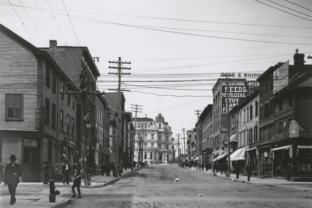
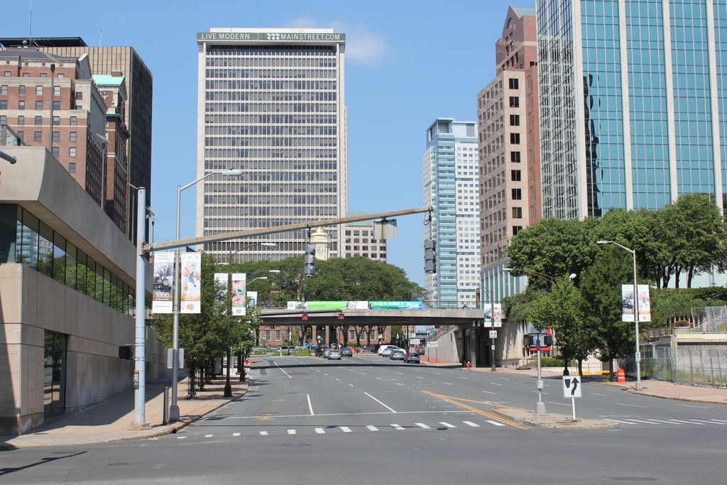
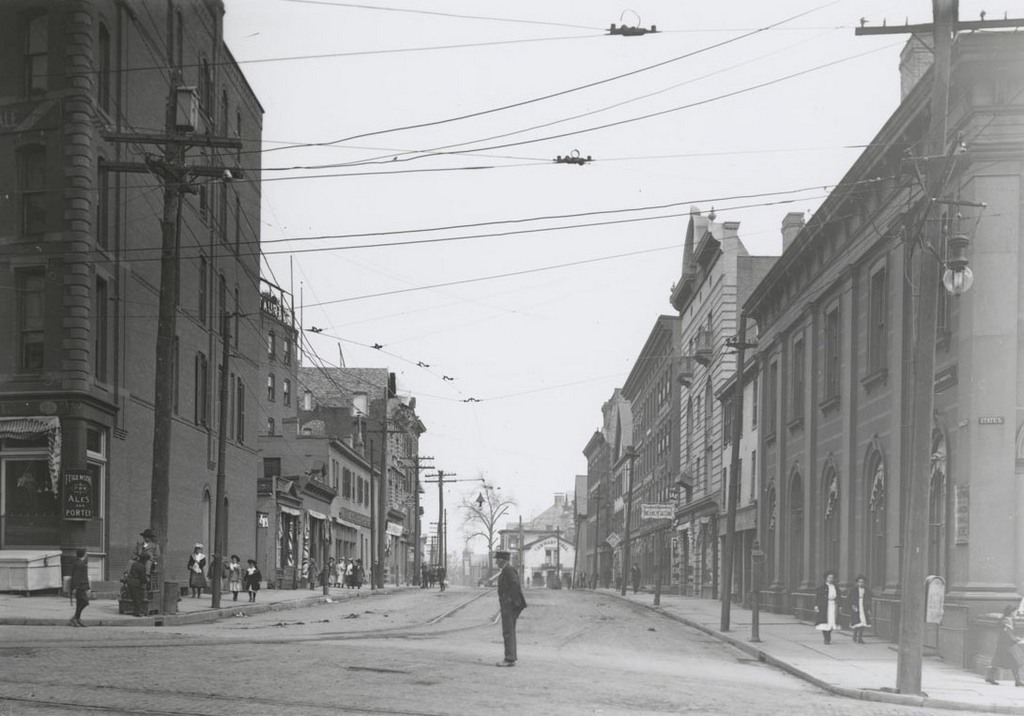
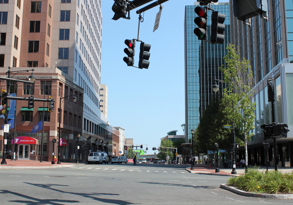
Main Street from Central Row, Hartford, Connecticut

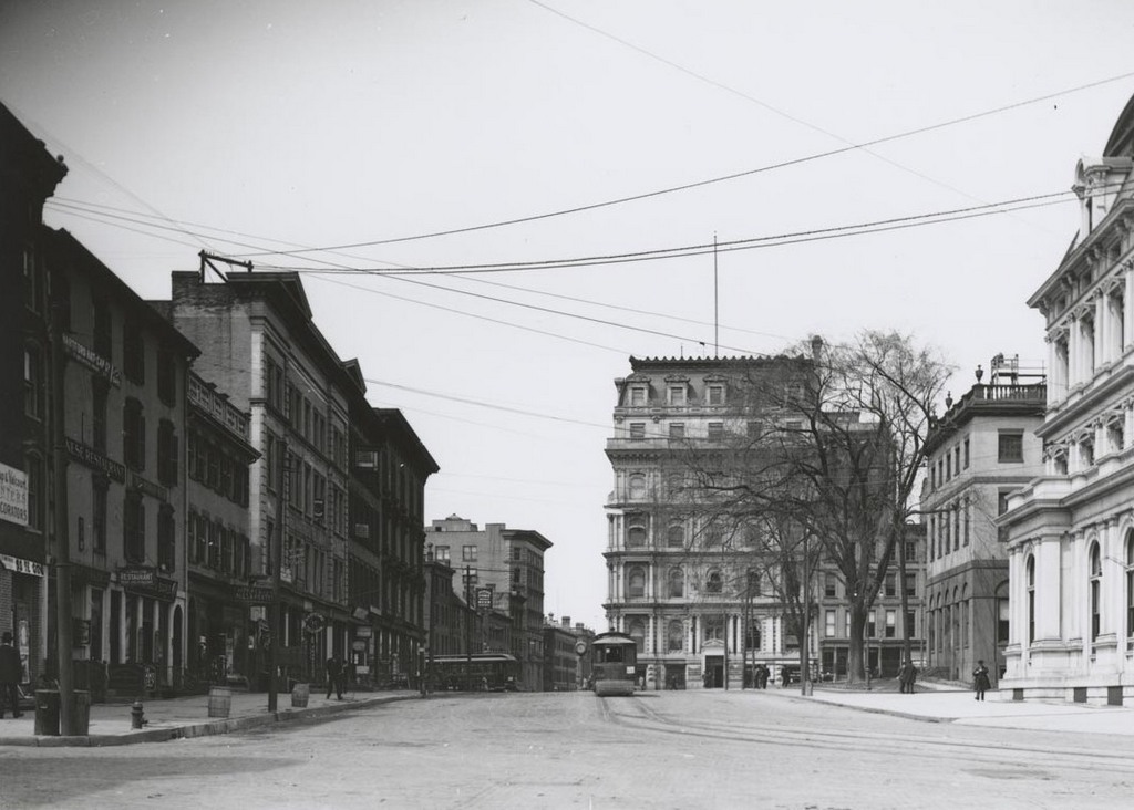
Looking north on Main Street from in front of the Old State House, on November 25, 1903. Image courtesy of the Connecticut State Library.

977_1903-11-25 csl

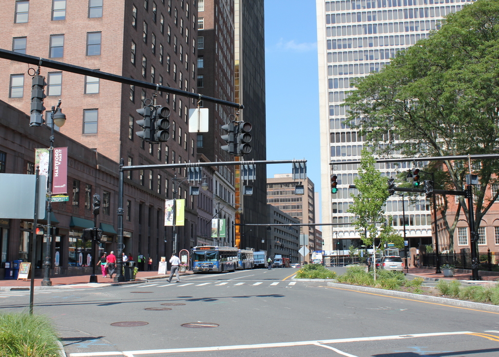
Main Street in 2016:

977_2016
Aside from a few buildings several blocks away in the distance, none of the buildings from the first photo are still standing. The Old State House, which is just out of view to the right, is still there, but otherwise this section of Main Street has undergone a complete transformation since the early 20th century. The buildings on the left side of the first photo were known as Bankers’ Row, and included some of the city’s most prominent financial institutions. Just out of view to the left, at the corner of Main and Pearl Streets, was the Connecticut Mutual Life Insurance building. Next to it, starting on the left of the 1903 photo, was the 1850 State Bank building, the 1874 Phoenix National Bank building, and the 1870s Corning Building, home to the Connecticut Trust & Safe Deposit Company. On the other side of Asylum Street, near the center of the photo, is the Catlin Building, which was built in 1898 and, a few years after the first photo was taken, was purchased by the Hartford National Bank.

All of these buildings were gone by 1930, starting with the Phoenix National Bank, which was extensively rebuilt in 1906. The stone phoenix on top of the building dated back to 1827, when it was put atom the company’s first building, and it remained on top of the reconstructed building until its demolition in the early 1920s. The State Bank building was demolished around 1907 and replaced with a new building, which is also no longer standing, and the Catlin Building, just 13 years old, was replaced in 1911 with a new building that stood until 1990. The last survivor in the foreground of the first photo was the Corning Building, which was replaced in the late 1920s with the current building at the corner of Main and Asylum Streets.

The Linden, Hartford, Connecticut

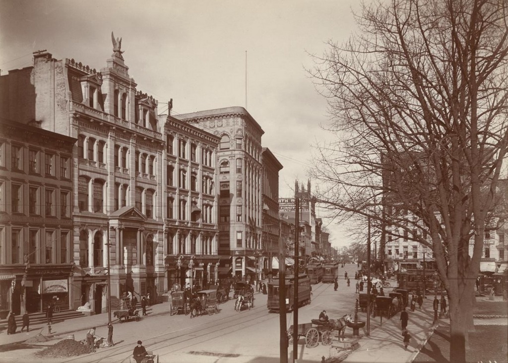
Looking south on Main Street from the corner of Sheldon Street, around 1903-1906. Image courtesy of the Connecticut State Library.

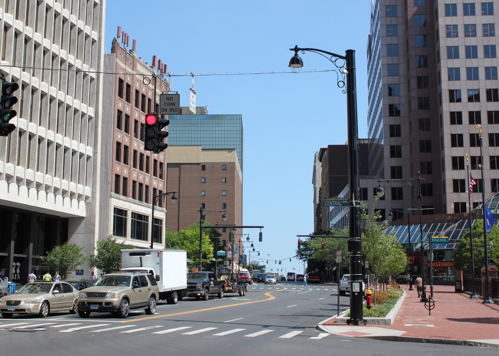
The scene in 2016:

976_2016
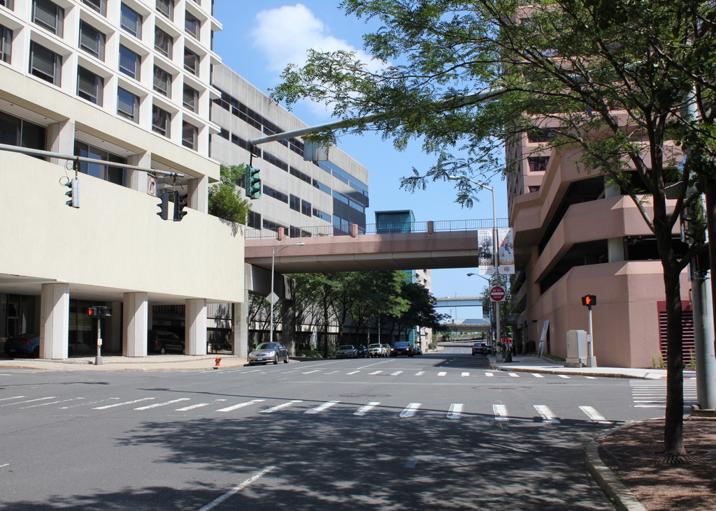
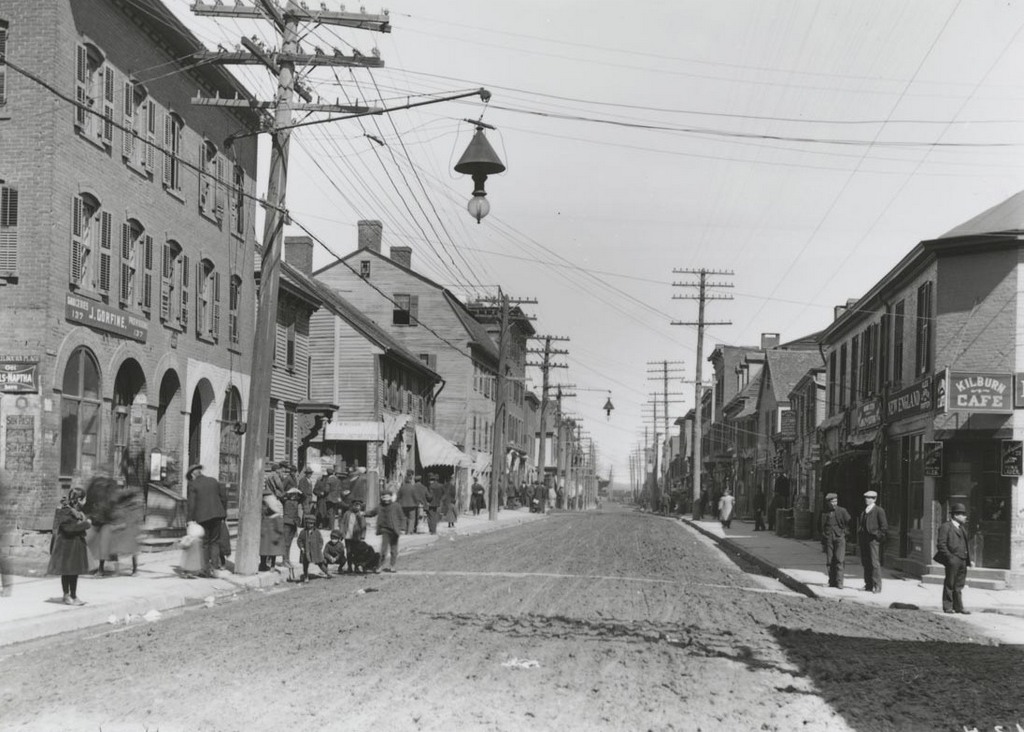
This view shows some of the same buildings as an earlier post, just from a different angle a block away. The building in the foreground here is The Linden, a Romanesque-style apartment building that was completed in 1891. Most of the other buildings in the distance beyond it are still standing, including the Hotel Capitol, built in 1875 a block away, and the South Congregational Church, completed in 1827. The only building not still standing from the first photo is the South Baptist Church on the far right. It was built in 1854 and demolished to build the present Central Baptist Church. Today, most of the buildings in this scene are part of the Buckingham Square Historic District on the National Register of Historic Places.

Main Street and Capitol Avenue, Hartford, Connecticut

Looking north on Main Street from near the corner of Capitol Avenue, around 1903-1906. Image courtesy of the Connecticut State Library.

974_1903-1906 csl

The scene in 2016:

974_2016
Very little has changed along this section of Main Street, which is part of the Buckingham Square Historic District. It consists of a number of historic buildings from the late 1800s, including several in this view. On the left is the Hotel Capitol, which was built in 1875, and on the other side of Capitol Avenue, in the center of the photos, are two slightly newer buildings. The yellow brick one to the left was built in 1895 by hotel owners Gilbert and Louis Heublein, and the one on the right is the Linden, which was built in 1891 as an upscale apartment building. The only building from the first photo that is no longer standing is the South Baptist Church in the distance on the right. Built in 1854 at the corner of Main and Elm, it was demolished in the 1920s after the congregation merged with another Baptist church. They formed the Central Baptist Church, which opened the present-day building on the same location in 1926.

Main Street, Laconia, NH (2)

Looking north on Main Street from the bridge across the Winnipesaukee River in Laconia, probably in 1907. Image courtesy of the Library of Congress, Detroit Publishing Company Collection.

972_1900-1910 loc

Main Street in 2016:

972_2016
This scene is a perfect example of urban renewal gone horribly wrong. What had once been a vibrant downtown with a variety of 19th century architecture was completely leveled in the 1960s, and it was replaced with nondescript one-story commercial buildings to the left and a parking garage on the right. Even the streets themselves were dramatically changed, with bizarre traffic patterns and an extremely narrow, one-way street here that looks more like a back alley than a Main Street.

The first photo is far more interesting than the present-day scene, and it was probably taken around the same time as the one in this earlier post, which shows the same view from about 150 yards further up Main Street. Some of the downtown businesses in this view include several drugstores, hardware stores, tobacco shops, and confectioneries, along with a photographer, tailor, paint store, sporting goods store, baker, harness maker, and a horse shoer. There are several advertisements posted on the building on the left side of the photo. One of them is a poster for the Cole Bros. Circus on Tuesday, July 23, which helps to establish the 1907 date since that day was a Tuesday in 1907. Below it is a larger advertisement for Folsom Opera House, which reads: “A Genuine Treat. The most perfect Moving Pictures ever examined. All the latest and best films including the funny chase pictures and animated pantomimic dramas. Wonderful Realism.”

Most of the buildings from the first photo were still standing by the 1950s, as seen in a photo on this Weirs Beach website. However, nothing in the block between Beacon and Pleasant Streets is still standing today, and most of the buildings further in the distance are also gone, although some were demolished before the 1960s redevelopment. The Eagle Hotel at the corner of Main and Pleasant Streets was demolished in the 1930s, and the Unitarian Church across the street from it, whose steeple is visible near the center of the photo, was destroyed by a fire in 1938. At least one brick building, barely visible on the left side near the center of the photo, is still standing. Nearly 250 yards away from the camera, this is the only identifiable building left from the 1907 scene along this section of Main Street.

Cornhill from Washington Street, Boston

Looking up Cornhill from Washington Street, on April 14, 1897. Image courtesy of the City of Boston Archives.

964_1897-04-14 coba

The scene in 2016:

964_2016
This narrow cobblestone street in downtown Boston connected Adams Square with nearby Scollay Square, and it was once a major literary center of the city, with many bookstores and publishers. When the first photo was taken, the early 19th century buildings here had a variety of businesses, with signs advertising for carpets, furniture, wallpaper, signs, trunks, and rubber goods. The first photo also shows a trolley coming down the street from Scollay Square, but this would soon change with the opening of the Tremont Street Subway in less than five months. Part of it was built under Cornhill, and it was the nation’s first subway, allowing trolleys to avoid the congested streets between Boston Common and North Station.

Nearly all of the buildings in the first photo were demolished in the early 1960s to build the Government Center complex. City Hall is just out of view on the right side of the 2016 photo, and the only building left standing in this scene is the Sears’ Crescent, partially visible in the distance on the left side of the street in both photos. Built in 1816 and renovated around 1860, this building still follows the original curve of Cornhill, serving as a reminder of what the neighborhood looked like before one of Boston’s most controversial urban renewal projects.

Harvard Square, Cambridge, Mass

Looking west toward Harvard Square on Massachusetts Avenue in Cambridge, around 1906. Image courtesy of the Library of Congress, Detroit Publishing Company Collection.

962_1906c loc

Harvard Square in 2016:

962_2016
The first photo was taken only a few years before the Red Line opened. At the time, people traveling from Cambridge to Boston had to use the streetcars, as shown here. In the distance on the left side of the photo, passengers are boarding a trolley whose destination is “Subway Park Street,” and the trolley to the right of it is presumably heading outbound from Park Street, on the way to its destination at Mount Auburn. This route was replaced in 1912 by the much faster Red Line subway, which originally ran from Park Street to here at Harvard Square, and a station entrance was built in the middle of the square. The station also included a streetcar tunnel that allowed passengers to easily transfer between the subway and the trolleys; this tunnel was later modified for buses and is still in use as the Harvard Bus Tunnel.

As for the buildings at Harvard Square, very little is left from the turn of the century. None of the buildings in the first photo have survived, with most being demolished in the early 20th century to build the current Colonial Revival buildings. Most of the businesses themselves are long gone, except for the Harvard Cooperative Society. Originally located in the Greek Revival-style building in the center of the photo, this bookstore was founded in 1882 as a cooperative for Harvard students. Now commonly known as The Coop, the bookstore is still in operation in a different building on the same spot, and serves students at both Harvard and MIT. Otherwise, the only landmark remaining from the first photo is the gate on the far right side, which connects the square to Harvard Yard.