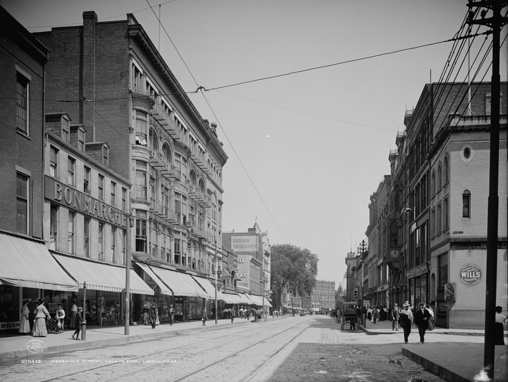
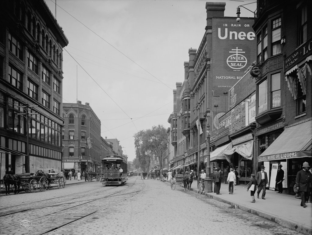
The view looking west on Merrimack Street from Kearney Square, around 1908. Image courtesy of the Library of Congress, Detroit Publishing Company Collection.
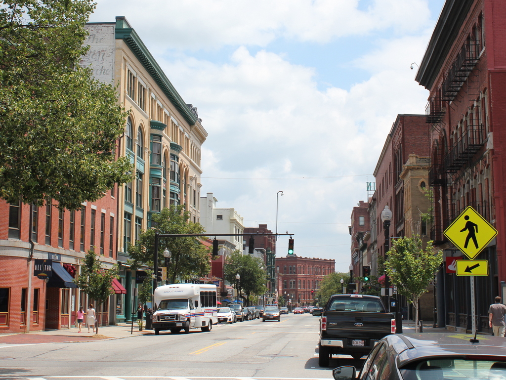
Merrimack Street in 2015:
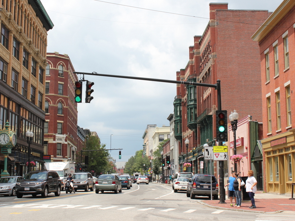
These views show the same section of Merrimack Street as the ones in this post, just from the opposite direction. This area has long been the commercial center of the city, and it saw significant development in the late 19th and early 20th centuries. Since then, however, there haven’t been many major changes, so this stretch of Merrimack Street is lined on both sides with a number of historic buildings, including three prominent ones that appear in both of these photos: the Colonial Building (1906) on the far left, the Wyman’s Exchange (c.1880) just beyond it, and the massive Hildreth Building (1882) on the opposite side of the street.
The Colonial Building is one of the newest buildings in this scene, and in the 1908 photo it looks like the finishing touches aren’t complete yet, because the storefront windows are still covered in paper. It was built on the site of Barristers’ Hall, a church-turned-lawyer’s office that had been built in 1843 and burned down in 1905. The owner, Joseph L. Chalifoux, was a clothing merchant who rebuilt the site and leased the new building to Nelson’s, a five and ten cent store that was probably in the process of opening when the first photo was taken. Since then, the building was expanded in 1929, and has continued to house retail space and commercial offices, enjoying a prominent location on the corner of Merrimack and Central Streets.
On the other side of Central Street is Wyman’s Exchange, which replaced an earlier building of the same name that was built in the 1830s. Over the years, a number of businesses have used the storefronts along the Central and Merrimack Street sides, with the upper floor being used for professional offices such as lawyers, doctors, and dentists. The one major change that has occurred since the first photo was taken was the addition of a fifth and sixth floor atop the original building. The upper floors match the rest of the building, and it was probably done soon aftert he first photo was taken. Today, aside from being taller by 50 percent, the building retains much of its historic appearance.
The Hildreth Building was built in several stages between 1882 and 1884, beginning with the part closest to the camera. One of the building’s first tenants was S & H Knox and Company, a five-and-dime store that was still operating out of the building on the left-hand side when the 1908 photo was taken. Within a few years, the owner of the company would merge with his cousins’ stores to form F.W. Woolworth. The storefront on the other side was the home of King’s, a clothing company that asks prospective customers “Why not give us a try?” in a sign over one of the windows. In 1908, the east side of the building featured a large advertisement for Uneeda Biscuit, made by the National Biscuit Company. The biscuits are no longer made today, but the company has since shortened their name to Nabisco, and they still use a variation of the logo seen on the sign.