Harpers Ferry, West Virginia

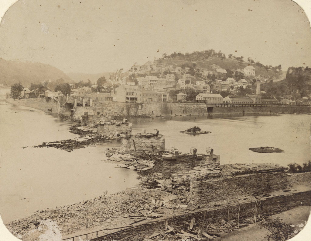
Looking across the Potomac River towards Harpers Ferry from the Maryland side of the river, around June 14, 1861. Image courtesy of the Library of Congress, Civil War Collection.

728_1861 loc

The same view in 2015:

728_2015 loc
The town of Harpers Ferry had only about 1,300 residents at the start of the Civil War, and its land area was just a half a square mile, but it became among the most contested places of the war.  It was literally located on the border of the Union and the Confederacy, changing hands eight times during the war and ending up in a different state by the time it was over.

As its name implies, this area was first settled as a ferry crossing.  Originally part of Virginia, it is located at the confluence of the Potomac and Shenandoah Rivers, and beginning in 1733 colonist Peter Stevens operated a ferry across the Potomac here, enabling settlers from Maryland and Pennsylvania to access the Shenandoah Valley of Virginia.  The town isn’t named Stevens Ferry, though, because around 1748 he sold his land and ferry to Robert Harper, who operated it until his death in 1782.

Because of its transportation connections and relatively defensible position, Harpers Ferry was one of two locations, along with Springfield, Massachusetts, selected by George Washington for federal armories.  Further transportation developments came in the 1830s: the Chesapeake & Ohio Canal (seen in the lower foreground of both photos) was completed as far as Harpers Ferry in 1833, several stagecoach lines were opened in 1834, and the Baltimore & Ohio Railroad reached the Maryland (foreground) side of the river later in 1834.  The first railroad bridge was completed in 1837, allowing a direct connection from the armory to the rapidly growing national rail network.

By 1850, this small town had grown to over 1,700 people thanks to the armory (visible along the waterfront to the right in the first photo), but before the end of the decade it would become the center of one of the major precursors to the Civil War.  In October 1859, abolitionist John Brown led a raiding party of 22 men in an attempt to capture the arsenal and start a slave rebellion.  The raid ultimately failed, and most of the raiders were either killed or were captured and executed, including John Brown, whose December 2 execution was seen as a martyrdom by many northern abolitionists.

The Civil War began just a year and a half after the raid, and Virginia’s state legislators voted to secede on April 17, 1861.  One of the state’s first objectives was to take the Harpers Ferry arsenal, which at the time was guarded by just 65 men.  Led by Lieutenant Roger Jones, they destroyed the arsenal and its 15,000 guns before evacuating the town ahead of the Confederates.  The Confederates didn’t occupy the town for long, though.  They left on June 14, and burned the Baltimore & Ohio bridge as they left.  The remains of the bridge can be seen in the foreground of the first photo, which according to the caption was “photographed immediately after its evacuation by the rebels.”

When the first photo was taken, the town was still relatively intact, but as the war progressed it became somewhat of a no man’s land.  Despite the loss of the armory, it was still a vital transportation corridor for armies on both sides, so between 1861 and 1863 it changed hands several more times.  West Virginia became a state on June 20, 1863, with Harpers Ferry citizens voting 196 to 1 to leave Virginia and join the union.  The town was briefly occupied by the Confederates in early July, but they soon evacuated for the last time and Union solders returned on July 13, finally bringing stability to Harpers Ferry for the rest of the war.

In terms of population, Harpers Ferry never fully recovered from the Civil War.  The armory never reopened, and the population has steadily fallen to less than 300 as of the 2015 census.  However, it has become a major tourist destination, with the Harpers Ferry National Historic Park now comprising much of the historic town.  Although the Chesapeake & Ohio Canal has not operated in nearly a century, there are still several railroad lines that pass through here.

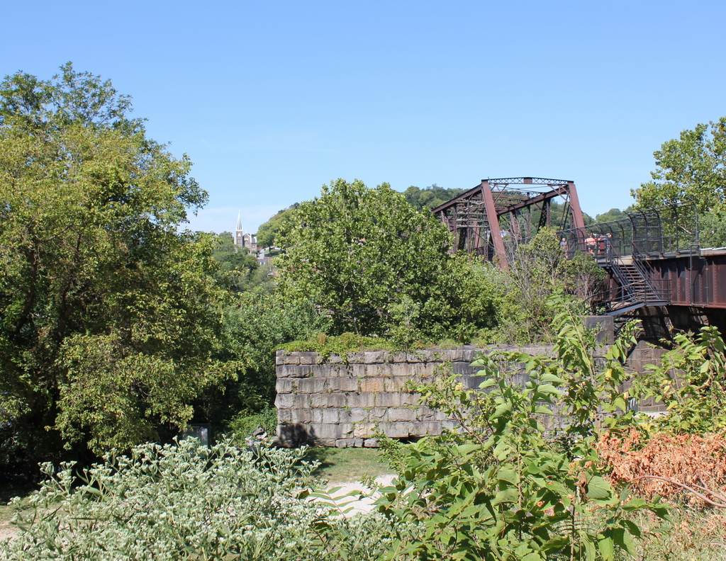
One of the bridges, seen to the right in the 2015 photo, also carries the Appalachian Trail over the Potomac River on a pedestrian walkway on the left side of the bridge.  The bridge pier in the foreground is from an earlier railroad bridge that had been built on the spot of the one that was destroyed in 1861.  This bridge, in turn, was washed away in a 1936 flood, and it was never rebuilt.  Today, the modern railroad bridge, as well as trees along the river, help to hide the view of Harpers Ferry, with only a few buildings visible in the 2015 scene.

(Much of the information for this post came from “To Preserve the Evidences of a Noble Past”: An Administrative History of Harpers Ferry National Historical Park (2004).  For further reading, it and other resources are available online here at the National Park Service website.)

Put’s Bridge, Springfield Mass

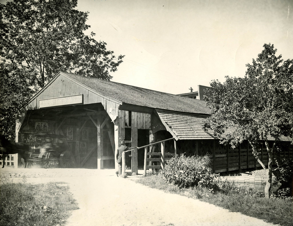
The old covered bridge across the Chicopee River from Springfield to Ludlow, taken from the Springfield side in 1897. Photo courtesy of the Hubbard Memorial Library.

473_1897 hubbardmemlib

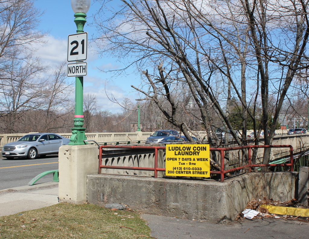
The present-day bridge in 2015:

473_2015

Alternately called Putts Bridge, this spot at Wallamanumps Falls on the Chicopee River has long been the site of a bridge connecting Springfield and Ludlow.  The early accounts are somewhat vague, but the first bridge was built in either the late 1780s or early 1790s.  Either way, a bridge was definitely here by 1794; prior to that, Ludlow’s 500 or so residents would have to get to and from Springfield by fording the river, a task that I can’t image was particularly pleasant or safe.  The bridge was constructed by Eli Putnam, hence the name Put’s bridge.  However, bridges here didn’t seem to have much of a lifespan; in the next 30 years, three additional bridges would have to be constructed on this site.

The 1822 bridge must have been different, because it lasted until this 1897 photograph.  By this point, though, the 75 year old bridge was starting to show its age, and the next year it was replaced with a new iron bridge.  However, the replacement didn’t even last half as long as its predecessor before it was replaced by the current bridge in 1930.  Today, this concrete and steel bridge carries Route 21 across the river, and it still serves as the primary connection from Ludlow to Springfield.  The one difference in the location of these two photos is that the covered bridge was at a substantially lower elevation, so the 1897 photo would’ve actually been taken partway down the hill toward the river.  I could’ve recreated the scene from here, but I chose this location since it represents what the surface of bridge today looks like, rather than just the underside of it.

Brooklyn Bridge Construction

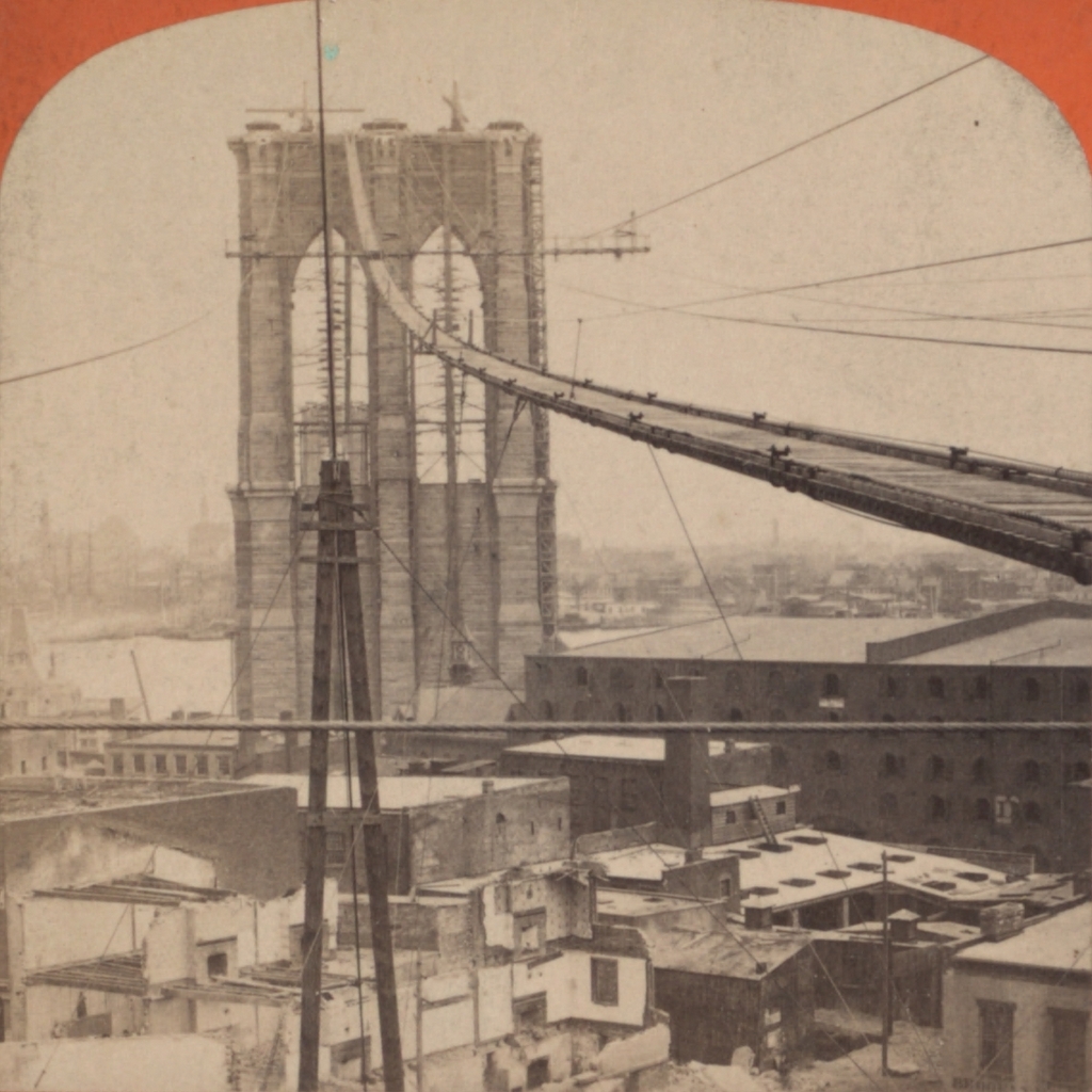
The Brooklyn Bridge, before the construction of the walkway, probably taken around 1880. Photo courtesy of the New York Public Library.

449_1880c nypl

The scene in 2013:

449_2013

The Brooklyn Bridge opened in 1883, but before the roadway could be built, the towers were connected by a narrow walkway.  Although intended for the workers, it was also open to the public, and was a popular destination, to the point where bridge management had to start issuing passes in order to cross.  Of course, this was in the days before OSHA regulations and other safety measures, but it actually wasn’t as dangerous as it looks.  Some publicity-seeking daredevils even jumped off of it and into the East River, with varying success rates.  Upon completion of the bridge, the present-day walkway opened, which can be seen around the turn of the last century in this post.  Thankfully, modern-day bridge pedestrians need not balance themselves on a narrow catwalk, nor ascend and descend the two 272-foot tall bridge towers in order to cross the river.

Tucker Toll Bridge, Bellows Falls, Vermont (2)

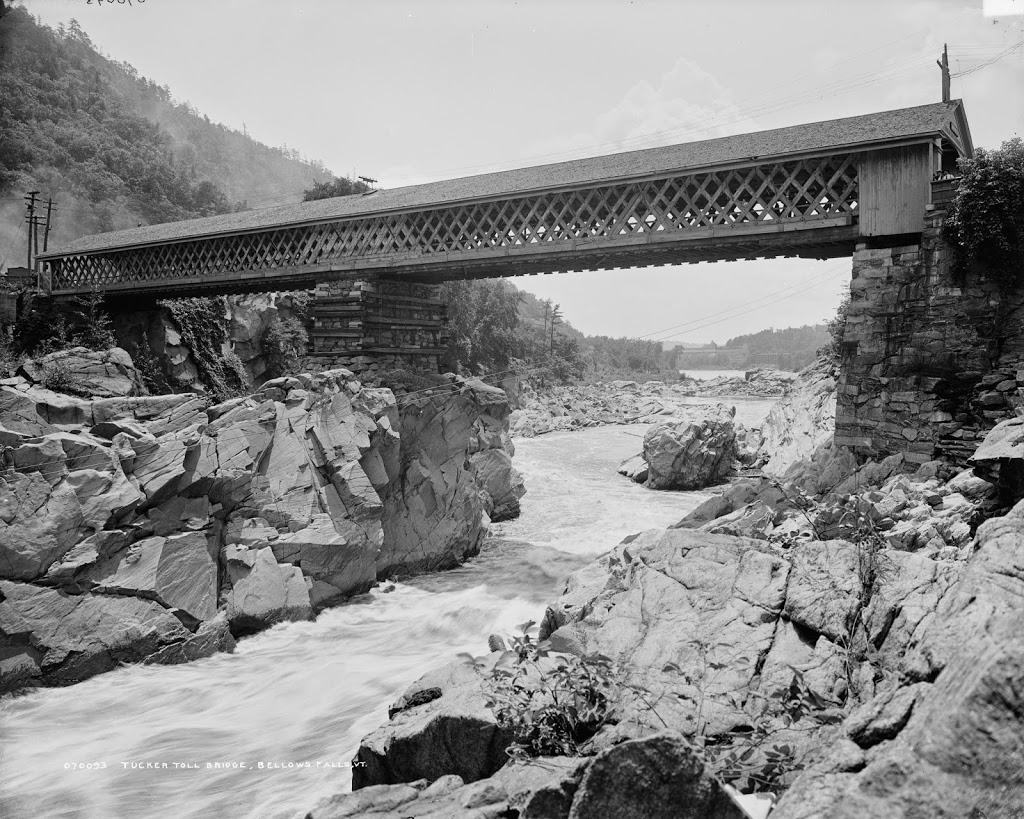
Another view of the Tucker Toll Bridge, from the downstream side, probably around 1900 Image courtesy of the Rockingham Free Public Library.

The bridge in 2018:

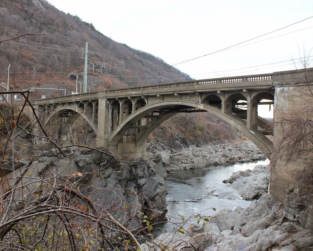
This is another view of the bridge across the Connecticut River at Bellows Falls, seen from the Vermont side facing upstream.  As explained in this post, this was the site of the first bridge across the Connecticut River when a primitive bridge was built across here in 1785.  The bridge in the 1907 photo was the second on the site, and opened in 1840.  This bridge, known as the Tucker Toll Bridge, was replaced by the current concrete arch bridge, the Vilas Bridge, in 1930.  However, the bridge has been closed since 2009, and as of 2018 it is unknown what will happen to it.

This angle gives a good view of the gorge at Bellows Falls, where the Connecticut River drops 52 feet through a narrow gorge.  It was originally known as the Great Falls, and an early stagecoach line that ran through here advertised that passengers would be able to “view one of the most stupendous works of Nature.”  Today, much of the river’s water is diverted into a power canal just above the falls, so it isn’t as dramatic as it would have been to an 18th century traveler, but it is still an impressive view looking down from the top of the gorge.

Tucker Toll Bridge, Bellows Falls, Vermont (1)

The Tucker Toll Bridge over the Connecticut River at Bellows Falls, Vermont, around 1900-1910. Image courtesy of the Library of Congress, Detroit Publishing Company Collection.

Vermont

The scene in 2014:

418_2014

As mentioned in this post, Bellows Falls became a major transportation and industrial center in the region during the 19th century because of its location on the Connecticut River.  As seen in these photos, the river drops 52 feet in elevation through a narrow gorge, making it an ideal site for hydroelectrically-powered industries, but also a strategic location to build a bridge.  Further south, the river was much wider and bridge-building viewed as almost impossible; one man reportedly commented on the idea in Springfield, Mass. around 1800, saying, “Gentlemen, you might as well undertake to bridge the Atlantic Ocean.”

However, here in Bellows Falls the width of the river and the rocky outcroppings meant a shorter bridge and no need to build piers in the river.  As a result, the first bridge across any part of the Connecticut River opened on this spot in 1785, connecting New Hampshire and Vermont and facilitating trade from New Hampshire to Montreal and other northern destinations.  At the time, Vermont was actually an independent nation, which I suppose technically made the first bridge an international border crossing.

The construction of the bridge was authorized by the state of New Hampshire, who also set the tolls for travelers; in 1804, the tolls ranged from three cents for a person on foot, to 30 cents for a four wheel carriage with four horses.  Upon completion, the Massachusetts Spy gave a glowing review of the bridge, writing:

“We hear from Walpole, state of New Hampshire, that Colonel Enoch Hale hath erected a bridge across the Connecticut River on the Great Falls, at his own expense.  This bridge is thought to exceed any ever built in America in strength, elegance, and public utility, as it is the direct way from Boston through New Hampshire and Vermont to Canada, and will exceedingly accommodate the public travel to almost any part of the state of Vermont.”

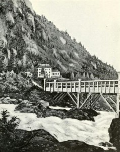
The 1907 book History of the Town of Rockingham Vermont provides this depiction of the bridge, viewed from about the same spot as the two photographs:

Picture1

This first bridge was uncovered, which meant the wood deck and structure was exposed to the elements, so by 1840 it was in need of replacement.  The new bridge, which is the same one in the first photo here, was built directly over the old one, about 15 feet above it, which allowed the old bridge to continue to be used even as its replacement was being built.  The 1840 bridge became known as the Tucker Toll Bridge, named after the family who owned it for many years.  It remained in the hands of private owners until 1904, when the towns of Rockingham and Walpole purchased it and made it free for travel.  This bridge was, in turn, replaced by the current concrete arch bridge in 1930.  However, it has deteriorated over the years, and was closed in 2009 because of safety concerns.  At this point, it remains to be seen what will happen to the bridge.

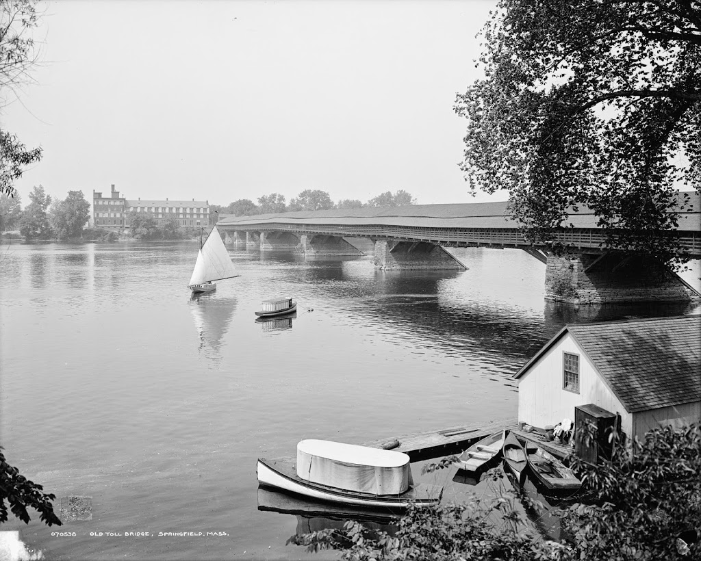
Old Toll Bridge, Springfield Mass

Springfield’s old covered bridge, around 1908. Image courtesy of the Library of Congress, Detroit Publishing Company Collection.

226_1908c-loc.tif

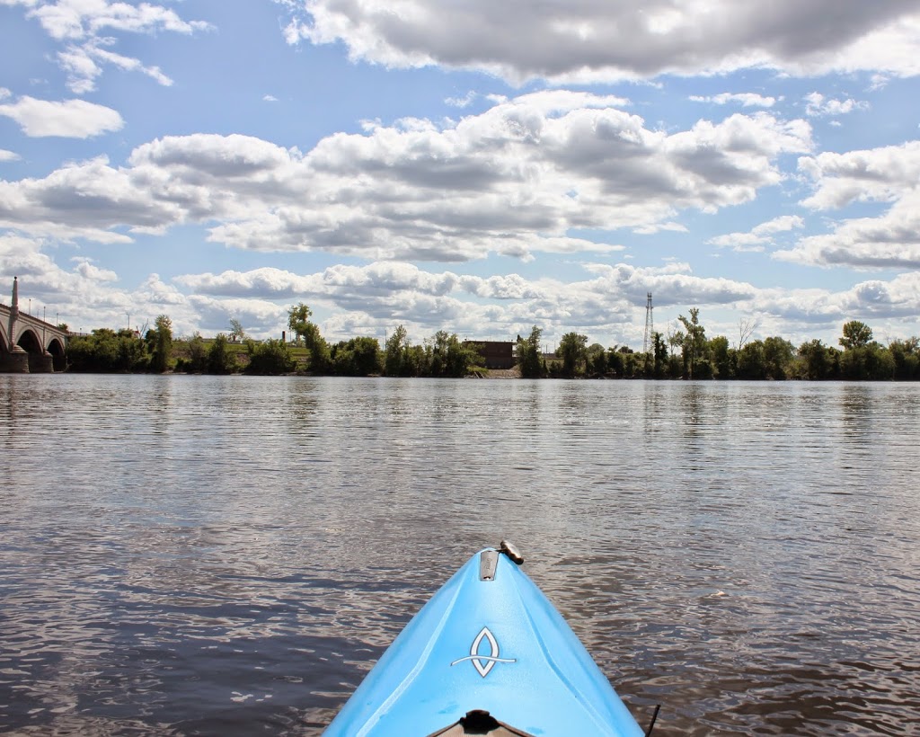
The same view in 2014:

226_2014

This is the first then & now recreation that I’ve done from a watercraft.  The first photo was taken from the riverbank, but because of its relatively inaccessible location today, I decided the water would be a better option.  Plus, the first photo shows some river recreation in the foreground, so I figured it would be appropriate to include a modern-day equivalent.

The building in the foreground of the first photo is the floating bathhouse for one of Springfield’s boat clubs, with a variety of small boats in the water next to it.  Today, Springfield’s waterfront is far more deserted, although there are still several boat clubs on the river nearby.

The bridge in the photo is Springfield’s Old Toll Bridge, which is featured in this post, seen from the other side of the river.  Note that in the old photo in that post, the same boathouse is visible in the distance.  The old covered bridge was replaced by the Memorial Bridge in 1922.  The Memorial Bridge was built a couple blocks downstream, and it is barely visible on the far left of the 2014 photo.