Boston Navy Yard Dry Dock

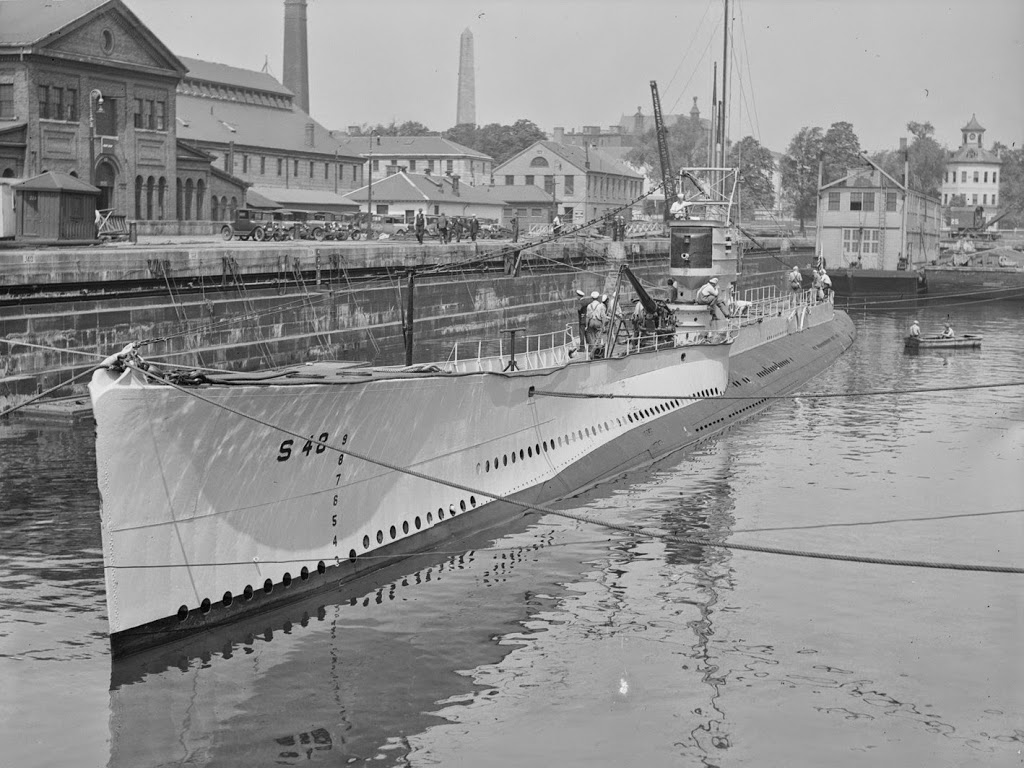
The USS S-48, entering Dry Dock 2 at Boston Navy Yard in 1929. Photo courtesy of Boston Public Library, Leslie Jones Collection.

068_1929-2Bbpl

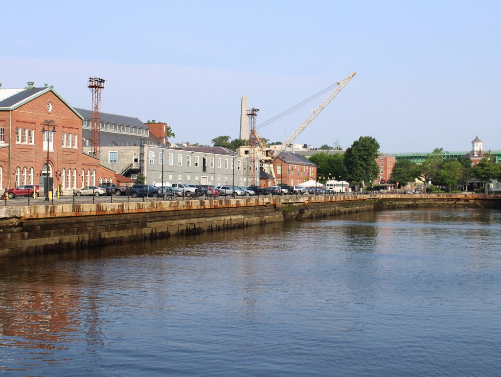
The same view in 2021:

Although no longer an active military base, this part of Boston Navy Yard looks much the same as it did in the 1920s, thanks to its preservation as part of the National Park Service’s Boston National Historic Park.  The yard was opened in 1801, and was very active during World War II, when it built a number of destroyers and other smaller warships.  It closed in 1974, and was then turned over to the NPS.


The submarine in the first photo is the USS S-48, which was launched in 1921, in the days before the Navy gave real names to its submarines.  Even though it was only a few years old when the photo was taken, the S-48 had already experienced several mishaps; during builder’s trials, a manhole cover was left unsecured, which is generally a bad thing on a submarine.  A few years later, it grounded off the coast of New Hampshire and was out of service until a few months before this picture was taken.  The S-48 would serve in World War II, but by then the obsolete submarine was used primarily for training purposes, and was scrapped shortly after the war ended.

Springfield Skyline (3)

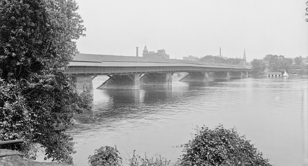
The view of Springfield from West Springfield, between 1900 and 1910. Image courtesy of the Library of Congress, Detroit Publishing Company Collection.

058_1900-1910-2Bloc

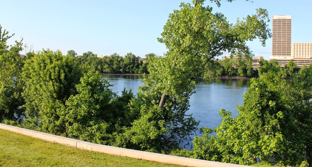
The view in 2014:

058_2014

The most obvious difference here is the lack of a covered bridge – this bridge was replaced by the current Memorial Bridge (just to the right of the scene in the 2013 photo) in 1922. The first bridge across the river in Springfield was an uncovered, six span bridge that was built in 1805. It collapsed in 1814, and was replaced by the covered bridge, which was completed in 1820. The designer was Isaac Damon, the same architect who designed Springfield’s Old First Church.  This bridge far outlasted its predecessor, and even the present Memorial Bridge hasn’t reached the 102 years that the covered bridge made it to.

The bridge was finally demolished – or, to be more accurate, dismantled piece by piece to reuse the wood – in 1922, upon completion of Memorial Bridge. Although there are no visible traces of the bridge itself, it’s still easy to pinpoint its location; there is a Bridge Street in Springfield, and another one directly across the river in West Springfield. Neither street currently leads to a bridge, but they were once the approaches to the old covered bridge.

Long Wharf, Boston

Long Wharf in Boston, around 1910. Image courtesy of Boston Public Library.

044_1910c-2Bbpl

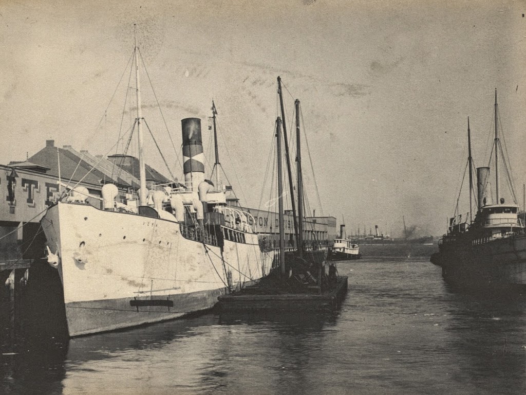
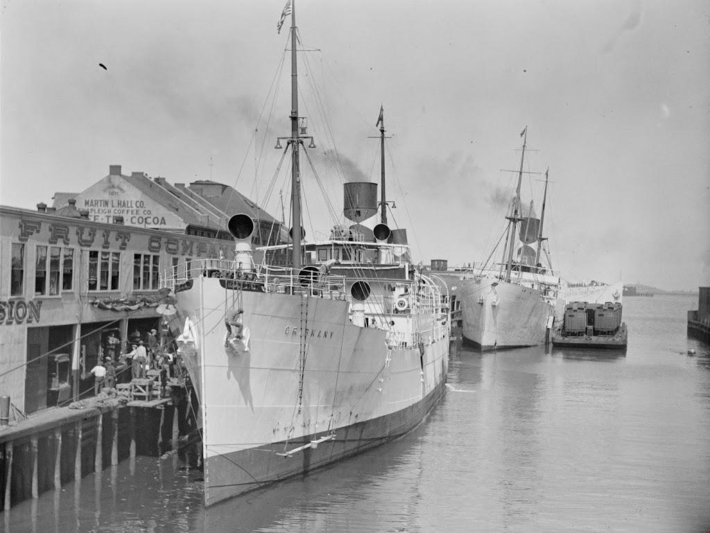
Long Wharf around 1930. Image courtesy of Boston Public Library, Leslie Jones Collection.

044_1930c-2Bbpl

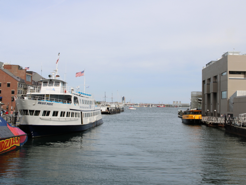
The same view in 2024:

Boston’s Long Wharf was originally much longer than it is now, although the wharf didn’t get shorter – the city grew outwards. At the beginning of the 18th century, a longer wharf was needed to extend further into the harbor, in order to accommodate deeper oceangoing ships. Originally, it started where Faneuil Hall is today, but as time went on, the city expanded by filling in Boston Harbor, sometimes with dirt and rocks, and sometimes with sunken ships and construction debris. Either way, the city ended up filling in much of the space between Long Wharf and other wharves, and the city built up around it. In the 1930’s, the wharf was much the same as it is today, but at the time this part was used by the United Fruit Company, hence the cargo ships. Today, the cargo ships are gone, replaced by ferries to other parts of Boston and surrounding communities. Some of the older buildings remain, including the granite 1848 Custom House Block, which is visible on the far left of both photos.  The cargo ships in the two photos, however, do not exist anymore. I don’t know what happened to the Vera, the steamer in the first photo, but a ship of the same name was sunk by a German U-boat in World War I. The same fate definitely did happen to the ship in the 1930 photo, the Oriskany, though; it was sunk by a U-boat in 1945 off the coast of England.


Railroad Arch, Springfield, Massachusetts

Looking north toward the Boston & Albany Railroad arch over Main Street in Springfield, between 1900 and 1910. Image courtesy of the Library of Congress, Detroit Publishing Company Collection.

028_1900-1910-2Bloc

The railroad arch in 2024:

For many years, there was no bridge over Main Street, forcing the busy rail line to cross the busy road at grade. Finally, in 1890, the stone arch was built, and survives to this day, even when none of the other buildings from the first decade of the 20th century have.  See the 1882 photo in this post for a view of Main Street before the arch was built.

Brooklyn Bridge, New York

The Brooklyn Bridge from the south, as it appeared around 1904. The towers of the Williamsburg Bridge are barely visible in the distance. Image courtesy of the Library of Congress, Detroit Publishing Company Collection.

The same view in 2024:

The Brooklyn Bridge hasn’t changed much in the past 120 years, but its surroundings have.  In addition to the Manhattan Bridge behind it, the skyline of the Lower East Side has also substantially changed, with high-rises covering much of the shoreline in this area.