Highland Light, Truro, Mass

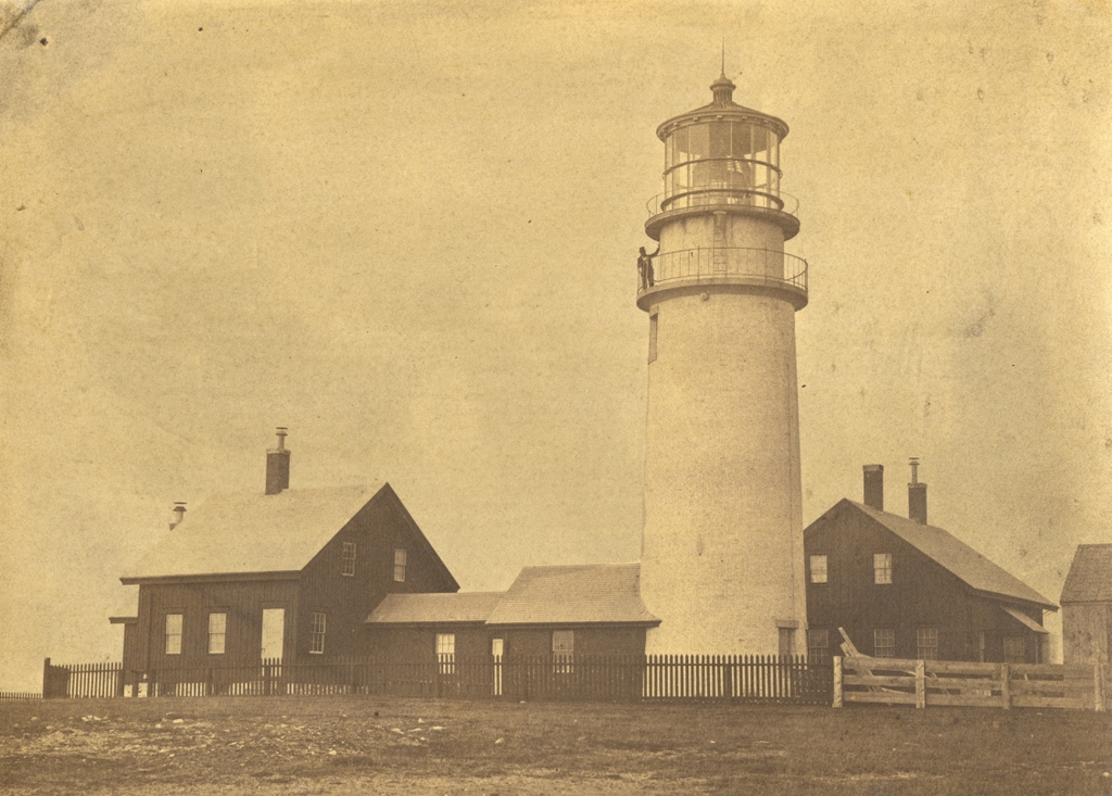
Highland Light, also known as Cape Cod Light, in Truro, Mass, on February 14, 1859. Image courtesy of the National Archives.

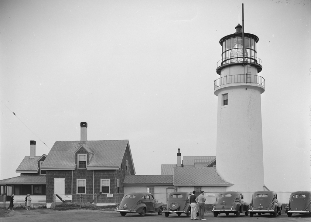
The lighthouse around 1935-1942. Image courtesy of the Library of Congress, FSA/OWI Collection.

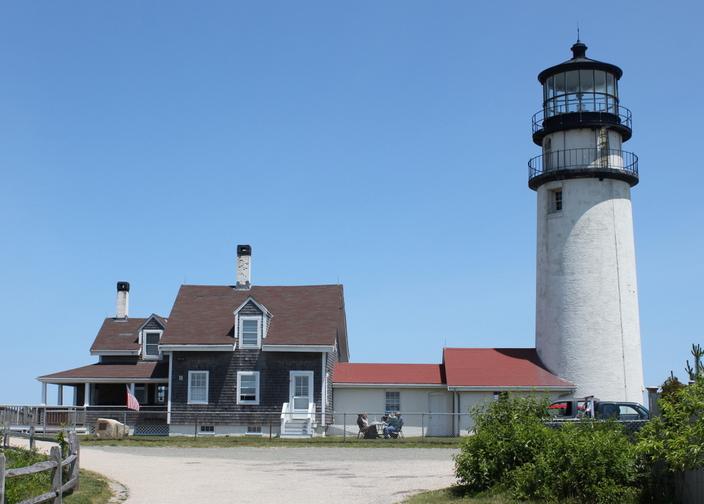
The scene in 2014:

Formed by glaciers at the end of the last ice age, Cape Cod is a long, sandy peninsula on the eastern edge of Massachusetts. It extends outward into the Atlantic Ocean with a hook-like shape that bears resemblance to a flexed arm, and beyond its coastline lies a variety of ever-shifting shoals and sandbars. In the four centuries since European colonization of the area, these attributes have made Cape Cod a significant hazard to navigation, and its shores have been the site of numerous shipwrecks over the years.

The first recorded shipwreck on Cape Cod occurred even before permanent European settlement in the area, when an unknown French ship ran aground sometime around 1617. Many more would follow over the years, including the notorious pirate Samuel “Black Sam” Bellamy, who died 1717 after his ship was wrecked near what is now Marconi Beach in Wellfleet. However, it would be many decades before the first lighthouse was built on Cape Cod to warn mariners away from the treacherous shoreline.

Finally, in 1796, at the behest of a group of Boston merchants, Congress appropriated $8,000 for the construction of the first lighthouse on Cape Cod. The site that was chosen for the lighthouse was here in North Truro, atop the 125-foot cliffs that gave the Highlands area its name. The government purchased ten acres of land, plus a right-of-way, from local resident Isaac Small for $110, and they subsequently hired him as the first keeper of the light, with a salary of $150.

The lighthouse was completed in 1797. It was octagonal in shape and built of wood, and it stood 45 feet tall. It featured a whale oil lantern, and it was evidently the first lighthouse in the country to use an eclipser, which gave it a flashing appearance to distinguish it from Boston Light. Aside from the tower, the light station also included the keeper’s house, a barn, and an oil shed.

The eclipser proved to be unreliable, and the tower itself also had its own problems, with an 1811 report describing it as having been “wretchedly constructed.” Part of the problem was that the tower was too high, so around 1812 it was lowered, and a new lantern was installed atop it. Following these modifications, this lighthouse would remain in service until 1831, when it was replaced by a new 35-foot brick tower.

Like its predecessor, though, the second lighthouse here proved to be similarly deficient in its construction. It was built by Winslow Lewis, a contractor who built many lighthouses along the east coast. However, his works were generally better known for their low costs than for the quality of their construction, and the upper portion of the new lighthouse had to be rebuilt less than a decade later. This part of the project was done by Lewis’s nephew, I. W. P. Lewis, who was by all accounts a far more competent engineer than his uncle.

Despite these improvements, the second tower ultimately proved to be short-lived. It is perhaps most famous as the lighthouse that author Henry David Thoreau visited several times during his visits to Cape Cod in the 1840s and 1850s. He included a chapter on the lighthouse in his book Cape Cod, including an account of how he put his surveying skills to use here and calculated that the cliff was 123 feet above sea level. He also estimated the rate of erosion here, and rather presciently predicted that “erelong, the light-house must be moved.”

Highland Light would ultimately have to be moved, although it would take 140 years before this was necessary, and it was a different lighthouse than the one that Thoreau saw. His last visit to Highland Light occurred in June 1857, and he noted in his journal that “A new lighthouse was built some twenty-five years ago. They are now building another on the same spot.” This lighthouse that he saw under construction was completed later in 1857, and it is the one that is shown here in these three photos.

The new lighthouse was a far more substantial than its two predecessors, standing 66 feet high, with brick walls more than three feet thick at the base. It was equipped with a new French-made Fresnel lens, replacing the 15 Argand lamps and silver-plated reflectors that had illuminated the previous lighthouse. The Fresnel lens cost $30,000, which was twice the cost of constructing the lighthouse itself, and it required a larger crew to maintain. As a result, the one lighthouse keeper here was joined by two assistant keepers. They lived here in two new houses that were connected to the tower by covered walkways. The head keeper lived in the house to the north of the lighthouse, on the left side of this scene, and the assistant keepers lived in the other house, which is visible just beyond the tower in the first two photos.

The first photo was taken less than two years after the new lighthouse was completed. It shows a man, presumably one of the keepers, standing on the lower balcony of the tower. He was probably one of the three keepers listed here in the 1860 census. The head keeper at the time was 55-year-old John Kenney, who lived here with his wife Jane. The first assistant, Hugh Hopkins, was 59, and he lived here with his wife Sarah along with their granddaughter Eliza Knowles and Sarah’s mother Abigail Smith. The second assistant, Thomas Kenney, was the youngest of the three at 50, and his family here included his wife Sarah and their daughters Mary and Elizabeth.

Despite the presence of the lighthouse, shipwrecks continued to occur here along the northeastern shoreline of Cape Cod. During the 19th century there were at least 60 recorded shipwrecks in Truro, many of which were lost with most if not all of their crews. In some cases, multiple ships would be wrecked during a single storm. A snowstorm on December 26, 1872 claimed two sailing vessels, the Peruvian and the Francis, with very different outcomes for the crews. The Peruvian sank with all hands, while the entire crew of the Francis was rescued by volunteers in a whaleboat, although the captain died of an illness several days later. Another deadly storm occurred on January 3, 1878, when 12 sailors died in three different shipwrecks.

The deadliest single shipwreck here in Truro was the Jason, a British sailing ship that was on its way to Boston from Calcutta. The Jason grounded a little north of Ballston Beach, a few miles to the south of Highland Light, during a storm on December 5, 1893. Out of a crew of 25, there was just a single survivor from the wreck. A few years later, these same shores saw the aftermath of one of the deadliest time disasters in New England history, after the passenger steamer Portland was lost off the coast of Cape Ann on November 27, 1898. There were no survivors, and some of the bodies and wreckage washed up here in Truro, despite being about 25 miles from where the ship foundered.

Lighthouse keepers here at Highland Light, as was the case elsewhere, had a variety of responsibilities, including maintaining the lighthouse and other buildings here at the facility. However, their most important duty was to ensure that the light was lit promptly at sunset, remained lit throughout the night, and was extinguished at sunrise. Each of the three keepers worked a shift during the night, with one keeper on duty until 8:00 pm, another from 8:00 to midnight, and then the third from midnight to 4:00 am. Then, at 4:00 the keeper who lit the lamp would return until sunrise.

By the late 19th century, Highland Light was illuminated by a Funck float lamp, which consisted of five concentric wicks of varying diameters. The lighthouse initially burned whale oil, but it later used animal lard and then eventually kerosene. The lamp produced about 500 candlepower of light, which was then greatly amplified by the prisms of the Fresnel lens. The original 1857 lens increased the intensity of the light roughly twentyfold, creating a fixed beam of about 10,000 candlepower. However, by the turn of the 20th century this was insufficient for the needs of maritime traffic, so in 1901 the old lens was replaced by a new first order Fresnel lens. The old lamp was retained, but the new lens further amplified its intensity to about 192,000 candlepower, or nearly 400 times the intensity of the lamp itself. The new lens also rotated, creating a flashing effect that made it much more noticeable at sea than the old fixed lens. A temporary light tower was in use here while the lenses were changed, and the new lens went into use on October 10, 1901.

The second photo was taken around 1940, as shown by the license plates on the cars in the foreground. The massive Fresnel lens is clearly visible in the lantern room, but in 1932 the old oil lamp had been replaced by a thousand-watt electric bulb. This gave the light an intensity of four million candlepower and a range of up to 45 miles, making it one of the most powerful lighthouses in the country. By this point, many American lighthouses had been automated, but Highland Light was still manned by resident keepers. However, this was far from the isolated outpost that Thoreau had visited nearly a century earlier. Automobiles had made the outer parts of the Cape far more accessible than before, and the photo shows a number of tourists here, including two cars from New York and one from Ohio. One sign on the fence indicates that the lighthouse visiting hours are from 10:00 am to noon, and then from 2:00 to 4:00 pm. Another sign advises that the grounds are closed to visitors from sunset until 9:00 am.

The head keeper at the time of the second photo was William A. Joseph. He had served here at Highland Light since the early 1920s, and he held the position of assistant keeper until 1935, when he was promoted to head keeper. By 1940 he was 52 years old, and he lived here with his wife Nellie. That year’s census lists his salary as $1,500, while the two assistant keepers earled $1,320 and $1,260. He remained here until his retirement in 1947, and he appears to have been the last civilian keeper at the lighthouse before the Coast Guard took over the operation of the light station.

Overall, despite being taken more than 80 years apart, the first two photos do not show major changes to the lighthouse or adjacent keepers’ houses. The alterations to the houses were mostly superficial, including the addition of a porch and a dormer window on the head keeper’s house, along with shingles that replaced the earlier vertical boards on the exterior of the houses. The lighthouse itself barely changed in the period between the two photos, aside from the upgraded lens and the addition of some sort of a pipe next to the lantern room.

By contrast, the second and third photos were taken less than 75 years apart, yet they show far more substantial change here at Highland Light. The old Fresnel lens only lasted a few more years after the second photo before being removed in the late 1940s and replaced by an aerobeacon. Then, in 1961 the assistant keepers’ house was demolished, and a new ranch-style duplex was built just to the southeast of the lighthouse. The lighthouse would remain actively staffed by Coast Guard keepers for several more decades after this, but it was ultimately automated in 1986 and a new aerobeacon was subsequently installed.

As lighthouses around the country were automated during the mid to late 20th century, this often led to the deterioration of the keeper’s houses and other associated buildings, which were typically rendered obsolete. However, here at Highland Light it was not just the keeper’s house that was endangered in the late 20th century. By the early 1990s, Thoreau’s prediction that the lighthouse would need to be moved was fast becoming a reality. The 1857 lighthouse was built on the same spot as its predecessors, which had been more than 500 feet from the cliff when the first one was completed in 1797. By the 1990s, though, the ocean’s steady erosion of the sandy cliffs had reduced this distance to just over a hundred feet.

The only real option for saving the lighthouse was to move it, but moving a 66-foot-tall, 450-ton masonry structure is no easy task, especially one that is nearly 140 years old. The lighthouse was first stabilized with a series of vertical two-by-fours that were strapped to the tower with steel wire. Then, 20 steel beams were inserted through the foundation, with two support beams laid perpendicular underneath these beams. These support beams were then slowly pushed along seven parallel roller beams. There were two sets of these roller beams, and the sets were alternated as the lighthouse moved along the beams. It took 18 days to move the lighthouse 450 feet west and 12 feet south of its original location, and the move was completed on July 29, 1996. The keeper’s house was not moved at the same time, but it was later moved and reattached to the lighthouse.

As a result of the move, the 2014 photo was taken a few hundred feet west of where the first two photos were taken, although it faces the same direction and shows the same view of the lighthouse as the other photos. The lighthouse remains an active aid to navigation, standing as both the oldest and tallest on Cape Cod. In the years since this photo was taken, the lighthouse has undergone a major restoration, including repairing the masonry, replacing or repairing corroded metal, installing a new ventilation system, and repainting the exterior. The lighthouse and keeper’s house have been closed to the public during this time, but they are expected to reopen for the upcoming 2022 season.

Chestnut Street near Ninth Street, Philadelphia, Pennsylvania

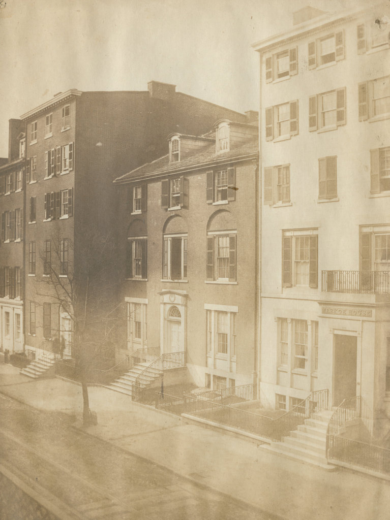
The view along the north side of Chestnut Street, taken looking west from near the corner of Ninth Street, around 1859. Image courtesy of the Library Company of Philadelphia, Frederick De Bourg Richards Photograph Collection.

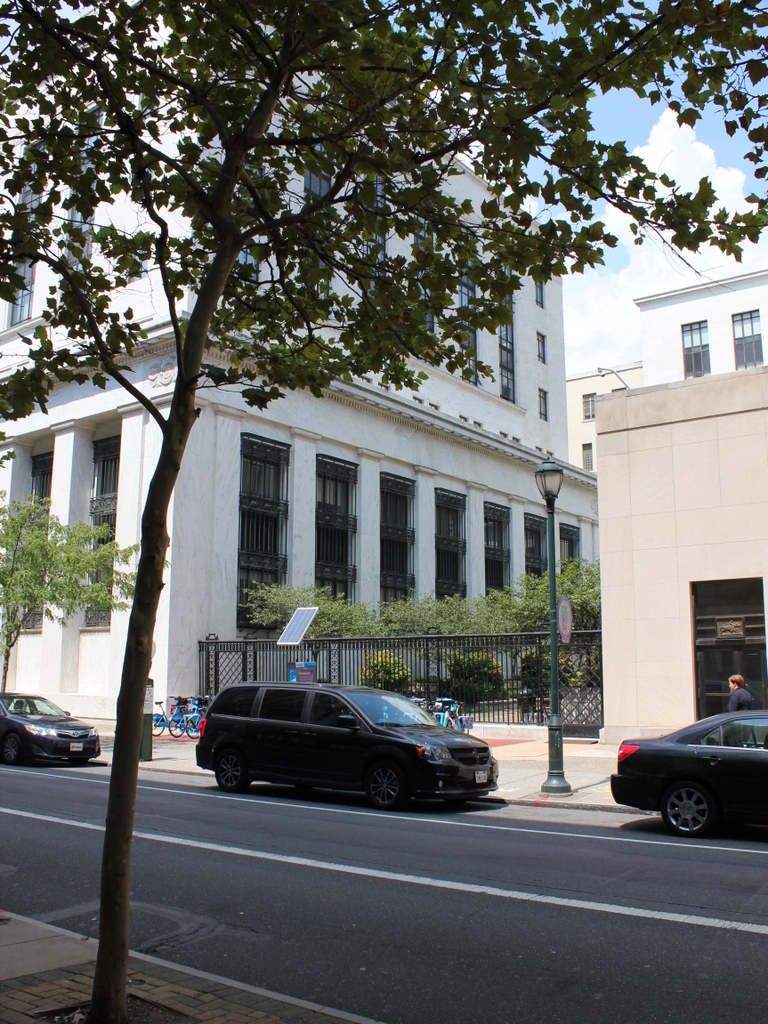
The scene in 2019:

The first photo shows a row of houses that were built around the late 18th or early 19th centuries for some of Philadelphia’s wealthiest residents. The houses were located on the north side of Chestnut Street, about halfway between 9th and 10th Streets, and they range from 919 Chestnut Street on the far right, to 925 Chestnut on the far left. At the time of their construction, this section of the city was predominantly residential, but this had begun to change by the time the first photo was taken a half century later. Some of these houses, particularly the one on the far right, had already been converted to commercial use, and over the next few decades more would see similar conversions, or would be demolished to make way for new, larger buildings.

As shown in the first photo, the house on the right was the Markoe House, a boarding house that had, at one point, been the residence of John Markoe. It had been built around 1810,and was designed by Benjamin Henry Latrobe, a prominent architect whose other works included the United States Capitol. The Markoe family lived here until around 1840, when they evidently fell on hard times and sold the property.

The house was converted into a boarding house, which was named for its original owners. In its early years the Markoe House had several prominent guests, as noted in contemporary newspapers. Senator Alexander Porter of Louisiana stayed here during a visit to Philadelphia in 1843, and in 1844 and 1845 Mirabeau Lamar, the former president of Texas, stayed here on at least two separate occasions. At the time, Texas was still an independent nation, and on the second visit, he was accompanied by Edwin Ward Moore, the commander-in-chief of the Texas Navy. The Markoe House would remain a boarding house here for more than 20 years after the first photo was taken, and it even underwent a significant renovation in 1869. However, it was ultimately demolished in 1881 to build a new office building for the Philadelphia Record.

Aside from the Markoe House, many of the other houses along this section of Chestnut Street were undergoing changes by the time the first photo was taken. In 1860, about a year after the photo was taken, the building immediately to the left of the Markoe House, at 921 Chestnut, was converted into offices for the Penn Mutual Insurance Company. This left, according to an 1860 newspaper article, only two or three buildings on Chestnut Street east of Tenth Street that were exclusively residential.

One of these exceptions was the house at 925 Chestnut Street, which is partially visible on the far left side of the photo. This was the home of General George Cadwalader, who served in the U.S. Army during the Mexican-American War. Shortly after the first photo was taken, Cadwalader returned to the Army upon the outbreak of the Civil War, and served in the Union army throughout the duration of the war. He lived here until at least the early 1870s, making him perhaps one of the last owners of a single-family residence on this part of Chestnut Street. During the 1870 census he lived here with his wife Frances and four servants, and he was very wealthy, with an estate valued at $600,000 at the time, or about $12.5 million today.

Today, more than 160 years after the first photo was taken, there are no surviving buildings from that photo here in this scene. All of them were likely demolished in the late 19th or early 20th centuries, and they were definitely gone by the 1930s, when this block of Chestnut Street became the site of two Depression-era federal buildings. On the left is the former Federal Reserve Bank Building, which was completed in 1935, and on the right is the Nix Federal Building, completed six years later. Both of these buildings are still standing here, as shown in the 2019 photo, although the former Federal Reserve Bank Building is now occupied by Thomas Jefferson University Hospital.

Christ Church Burial Ground, Philadelphia, Pennsylvania

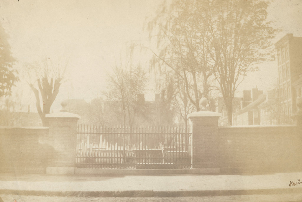
The Christ Church Burial Ground, seen looking south from Arch Street in April 1859. Image courtesy of the Library Company of Philadelphia, Frederick De Bourg Richards Photograph Collection.

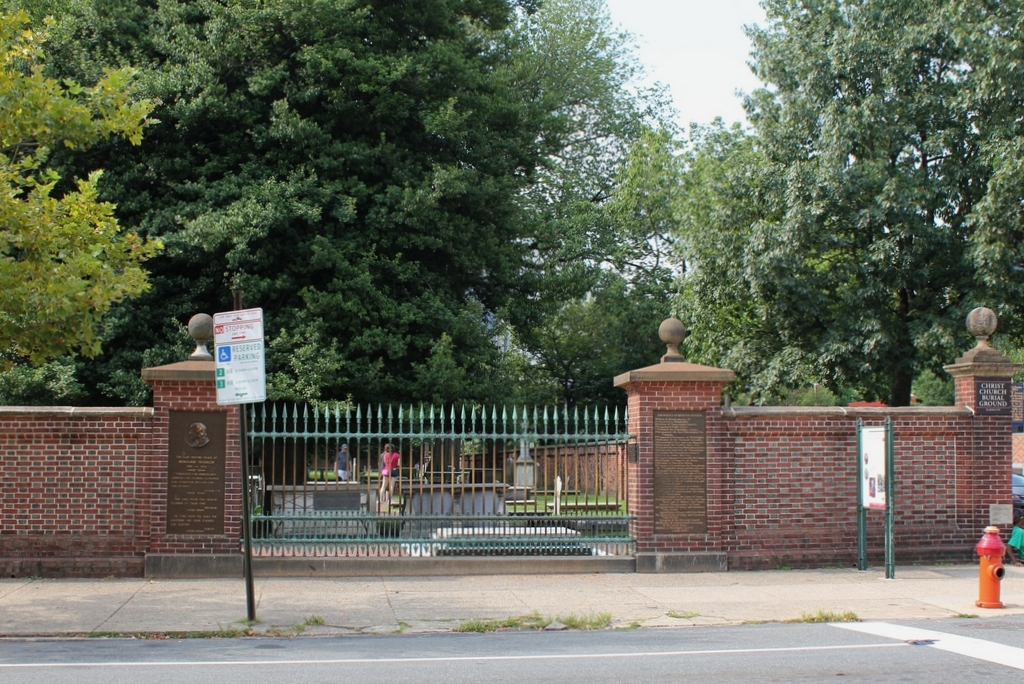
The scene in 2019:

As discussed in an earlier post, Christ Church was established in 1695, and its parishioners originally worshipped in a small wooden church on Second Street, just north of Market Street. The church had a small burial ground next to it, but this soon became too small, so in 1719 the church purchased this property two blocks away at the corner of Arch and Fifth Streets. It would become the church’s primary burial ground, along with being the final resting place for many of the city’s most prominent colonial-era leaders, including five signers of the Declaration of Independence. The most famous of these is Benjamin Franklin, whose gravestone is the low slab on the other side of the iron fence.

A brick wall was constructed along the perimeter of the burial ground in 1772. When Franklin died 20 years later, he was interred here, right alongside the fence and next to his wife Deborah. His grave was only a few feet from the sidewalk, yet it eventually fell into obscurity because the fence obscured its view from the street. This became an issue in the mid-19th century, in part because of a rivalry between Philadelphia and Franklin’s birthplace of Boston. By this point Boston had honored their native son with a massive pyramidal monument above Franklin’s parents’ gravesite, and had dedicated a statue in front of City Hall. In the meantime, though, Franklin’s gravesite here in Philadelphia languished in a rarely-visited corner of the graveyard until 1858, when proponents persuaded Christ Church to allow this section of the brick wall to be replaced with an iron fence, in order to make the grave visible from the street. The first photo was taken a year later, showing the grave just beyond the lower right side of the iron fence.

Today, more than 160 years after the first photo was taken, all of the buildings in the background are long gone, but the burial ground is still here. The wall looks the same as it did in the first photo, but it was actually reconstructed in 1927, using many of the bricks from the original wall. The gap in the brick wall was retained here, and it is now flanked by plaques describing Franklin and his life. Notwithstanding the rebuilt fence, though, the graveyard fell into disrepair by the late 20th century, and it was closed for many years before finally reopening in 2003 following an extensive restoration project. It is now open to the public for a small fee, and offers both self-guided and group tours.

Corner of Fifth and Arch Streets, Philadelphia, Pennsylvania

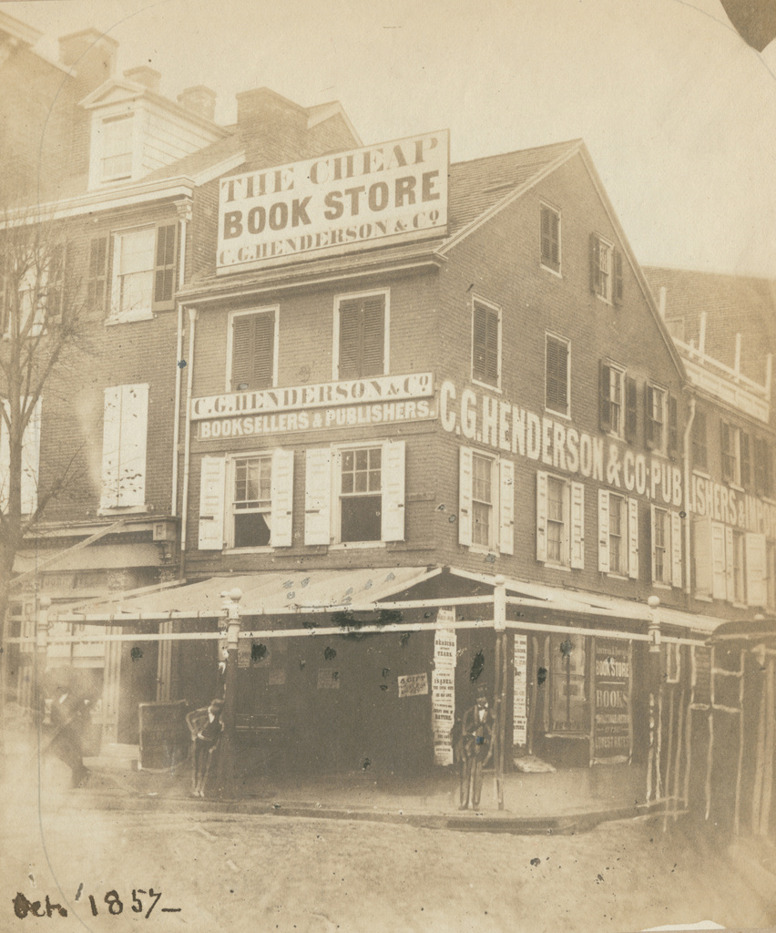
The northwest corner of Fifth and Arch Streets in Philadelphia, in October 1857. Image courtesy of the Library Company of Philadelphia, Frederick De Bourg Richards Photograph Collection.

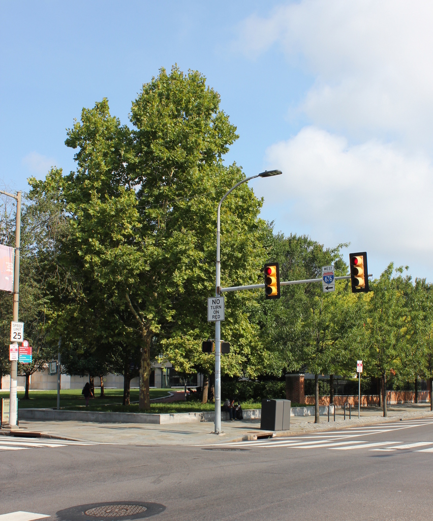
The scene in 2019:

The first photo was taken by photographer Frederick De Bourg Richards, as part of an effort to document Philadelphia’s historic 18th and early 19th century buildings. Unlike many of Richards’s other subjects, such as the Free Quaker Meeting House across the street from here, this three-story commercial building does not appear to have been a major historic landmark. In the original caption of the photo, the building is described simply as “a primitive house,” with no further information as to its history or date of construction. However, it was likely built sometime in the 1700s, and it may have once served as a single-family home before being converted into commercial use.

By the time the first photo was taken, the building was occupied by the publishing and bookselling firm of C. G. Henderson & Co. The company had been established in 1851, and was originally located in a building at the corner of Seventh and Chestnut Streets. However, that building burned later in the year, and by 1852 C. G. Henderson was located here at the corner of Fifth and Arch. As shown in the first photo, the building featured a number of exterior advertisements, including a particularly large sign on the roof, proclaiming it to be “The Cheap Book Store.”

The bookstore seems to have closed within a year or two after the first photo was taken, but the fate of the building itself is somewhat less clear. It may have been demolished at some point in the late 19th century, but it was definitely gone by the mid-20th century, when this entire block, along with several others, was leveled to create the Independence Mall. Today, there are no surviving remnants from the first photo in this scene. Instead, the foreground here is open parkland, and further in the distance is the National Constitution, which occupies much of this block.

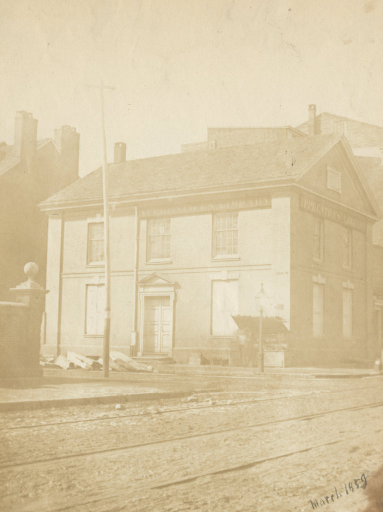
Free Quaker Meetinghouse, Philadelphia, Pennsylvania

The Free Quaker Meetinghouse at the corner of Fifth and Arch Streets in Philadelphia, in March 1859. Image courtesy of the Library Company of Philadelphia, Frederick De Bourg Richards Photograph Collection.

The scene in 2019:

Philadelphia was the national capital throughout most of the American Revolution, with the city serving as the meeting place of the Continental Congress. However, it also had a large population of Quakers, whose religious beliefs included a strong emphasis on pacifism. This caused significant tension between the colonial leaders here who favored independence, and the Quakers who opposed fighting the war. Far from simply refusing to serve in the military, many Quakers refused to pay taxes that would fund the military, and some even refused to use the currency issued by the Continental Congress, believing that the currency was also being used to pay for the war.

Even within the Quaker community, though, there was significant dissent regarding the war for independence. Here in Philadelphia, some were ultimately expelled for supporting the Revolution, and in 1781 they formed the Religious Society of Free Quakers. The group collected money to purchase a lot and build a meeting house, and among the contributors were George Washington and Benjamin Franklin. The design and construction of the building was largely done by Samuel Wetherill and Timothy Matlack, who were among the leaders of the Free Quakers. Matlack had been a delegate to the Continental Congress during the Revolution, but he is probably best remembered for his penmanship; he hand-wrote the official engrossed copy of the Declaration of Independence in 1776.

The meeting house was completed in 1783, and the occasion was commemorated by a marble tablet under the gable on the Arch Street side of the building, which reads “By general subscription for the Free Quakers, erected in the Year of our Lord, 1783, of the Empire 8.” The last part of the inscription refers to the fact that it was the eight year of the American “empire,” with 1776 as its starting point. At the time, the term empire was a bit of an overstatement for a loosely-affiliated group of 13 states on the east coast, but it ultimately foreshadowed the country’s future expansion across the continent.

Aside from Matlack, several other notable Philadelphians were involved with the Free Quakers, including Betsy Ross, the heroine of the famous but likely apocryphal story about the first American flag. Another likely attendee was Dolley Payne, whose father appears to have joined the Free Quakers after being expelled from the Pine Street Meeting. However, Dolley herself was later expelled from the faith when, in 1794, she married a non-Quaker: future president James Madison.

The Free Quakers steadily dwindled in number during the early 19th century, as the original members either died or moved elsewhere. During this time, though, the building was used for a number of other purposes aside from religious gatherings. From 1788 to 1791, part of the building was the home of John Poor’s Academy for Young Ladies, and from 1791 to 1799 it was occupied by the Grand Lodge of Pennsylvania. Then, from 1800 to 1836 it housed the Philadelphia Select Academy.

In the meantime, the Free Quakers continued to use the meeting house until the late 1830, and after this it was used purely for secular purposes. The next long-term occupant was the Apprentices’ Library Company, which moved into the building in 1841. The library made some changes to the building, including two additions in the 1850s and 1860s, and the organization remained here until 1897. The first photo was taken during this time, in 1859, and the photo shows signs for the Apprentices’ Library on both sides of the building.

Today, more than 160 years after the first photo was taken, and nearly 240 years after the building opened, the Free Quaker Meeting House still stands here as an important landmark at the corner of Arch and Fifth Streets. All of the other historic buildings nearby were demolished in the mid-20th century in order to create the Independence Mall, but the meeting house survived, likely because of its connection to Revolutionary-era Philadelphia. However, the building was relocated in 1961, in order to accommodate the widening of Fifth Street. It was moved 33 feet west and 8 feet south to its current location, and this project also included removing the 19th century additions and subsequently restoring the building to its 1780s appearance.

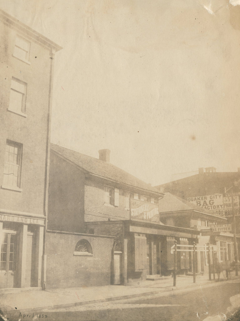
Friends’ Academy, Philadelphia, Pennsylvania

The former Friends’ Academy building on the east side of Fourth Street, just south of Chestnut Street in Philadelphia, in April 1859. Image courtesy of the Library Company of Philadelphia, Frederick De Bourg Richards Photograph Collection.

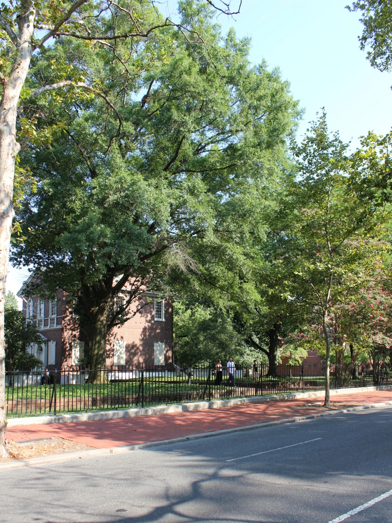
The scene in 2019:

Philadelphia is famous for its association with Quakers, having been founded by Quaker leader William Penn. The Quakers had a number of meeting houses throughout the city, during the colonial period along with several schools, including the Friends’ Academy here on Fourth Street. Both of the buildings in the first photo were built by the Quakers in the mid-18th century, although it seems unclear as to whether both were schools, or if one was a school and one was a meeting house.

The origins of the Friends’ Academy traces back to 1689, when it was established at the behest of William Penn. It moved to this location in 1744, and remained here for nearly a century, until 1841. During this time it was one of the city’s leading schools, and it also had several prominent schoolmasters, including abolitionist Anthony Benezet and historian Robert Proud.

The school relocated to Eleventh Street in the fall of 1841, and eventually became the William Penn Charter School, which still exists as a Quaker-affiliated independent school. In the meantime, though, its former home here on Fourth Street became a mathematical school during the 1840s, run first by William J. Lewis and then by Clinton Gillingham. This school appears to have closed around 1849, and at some point both buildings here were converted into commercial use, with one-story storefront additions extending to the sidewalk, as shown in the first photo.

Up until shortly before that photo was taken, these buildings were occupied by a stationery and printing business on the left, and a gas fitter further in the distance on the right. However, by the time the photo was taken in April 1859, the buildings were boarded up in preparation for demolition, which occurred soon after. They were replaced by more modern commercial buildings that have, in turn, been demolished as well, and today the site is part of the Independence National Historical Park.

Today, there are no surviving features from the first photo, although Carpenters’ Hall stands on the left side of the present-day photo. Built in the early 1770s and made famous as the meeting place of the First Continental Congress, this building was standing when the first photo was taken, but it was not visible from this section of Fourth Street until the rest of the block was demolished around the mid-20th century.