Chauncy Street, Boston (1)

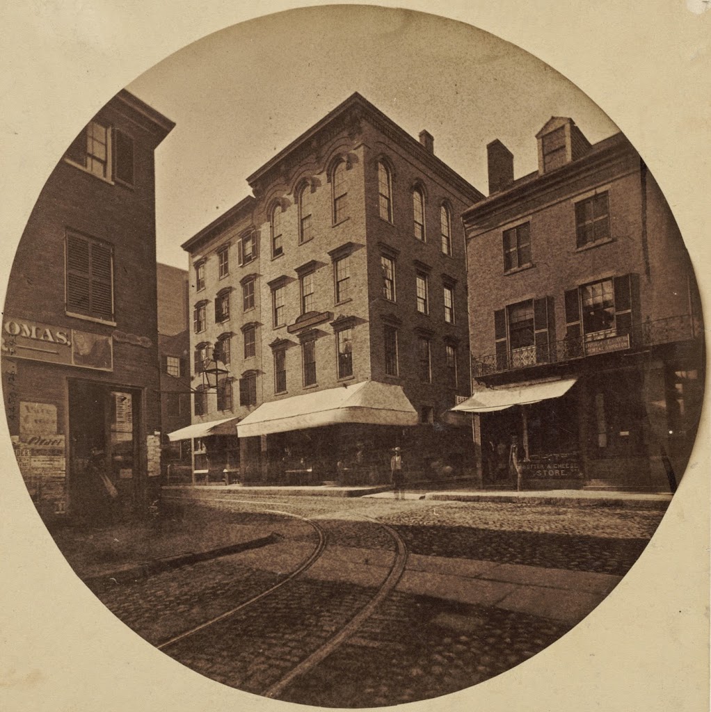
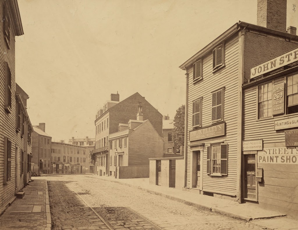
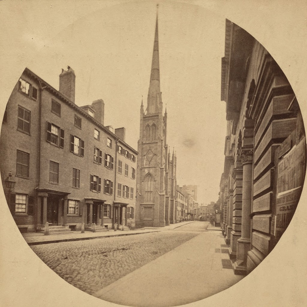
Looking southwest on Chauncy Street in Boston, toward modern-day Avenue de Lafayette from Bedford Street, taken around 1860. Photo courtesy of Boston Public Library.

299_1860-2Bbpl

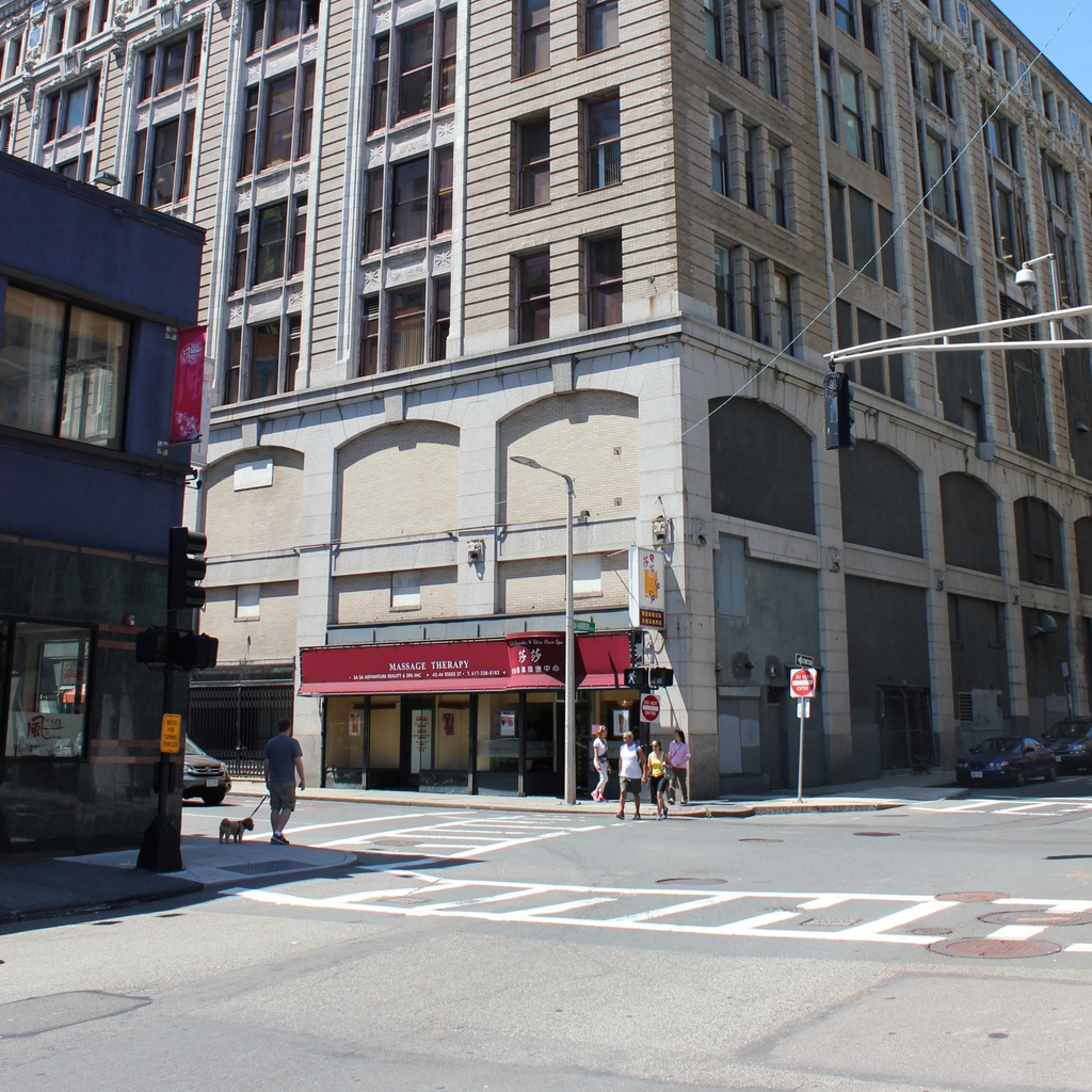
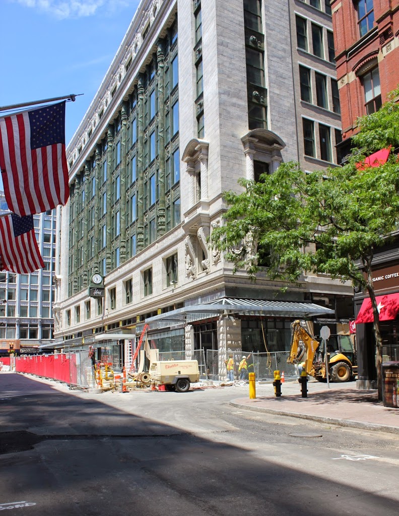
Chauncy Street in 2014:

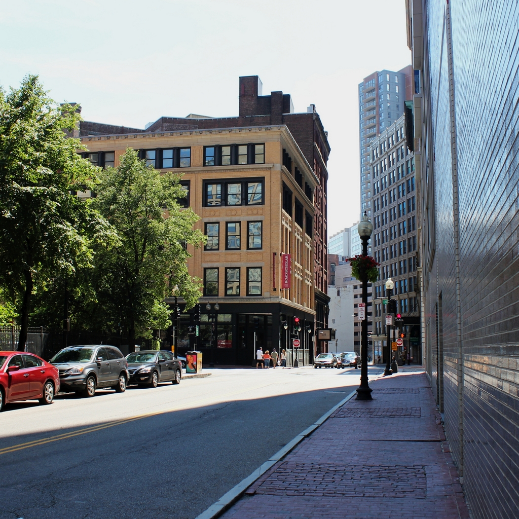
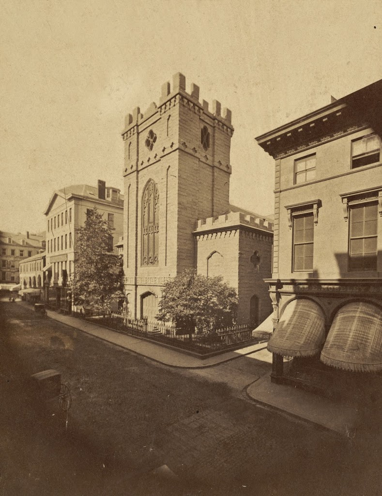
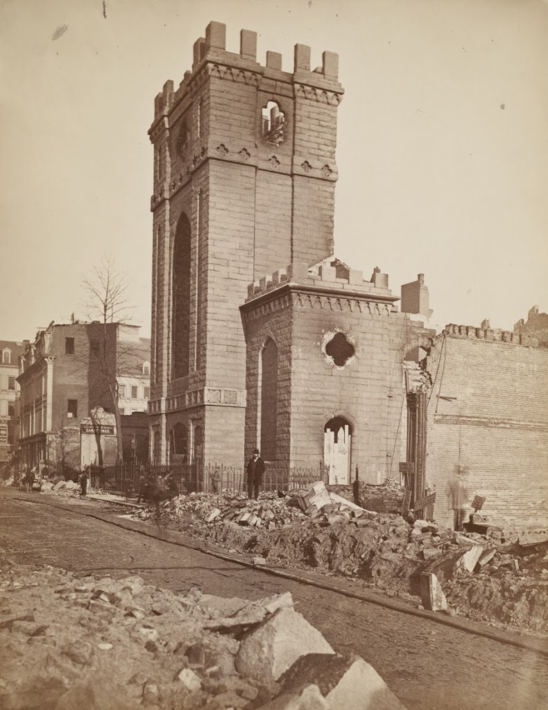
Another work of noted photographer Josiah Johnson Hawes, the first photo shows a very different Chauncy Street than the present-day view. The church at the corner is the Rowe Street Baptist Church, which was built in 1847. The church, along with all of the other buildings in the photo, was destroyed in the Great Fire of 1872, which is one of the reasons why none of the building in the 1860 scene survive to this day.

Harrison & Essex Streets, Boston

The corner of Harrison Avenue and Essex Street in Boston, in 1860. Photo courtesy of Boston Public Library.

298_1860-2Bbpl

The scene in 2014:

Located in present-day Chinatown, this scene has completely changed in the past 150 years, with none of the 1860 buildings surviving today. Even the streets have changed somewhat, with Harrison Avenue (the street in the lower left foreground) being extended across Essex Street, through where the house on the right-hand side of the 1860 photo once stood.  That house was home of Wendell Phillips, a noted 19th century abolitionist, lawyer, and candidate for governor of Massachusetts.

Incidentally, the first photo was taken by Josiah Johnson Hawes, who worked with Albert Sands Southworth in the famous Southworth & Hawes photographic company.  Together, they were among the early pioneers of quality photography, and some of Hawes’s photographs, including the one above, give a rare glimpse of Boston on the eve of the Civil War.

Great Boston Fire (7)

A view of Trinity Church on Summer Street in Boston, taken in 1860. Photo courtesy of Boston Public Library.

295_1860-2Bbpl

A photo from a similar angle, taken in the aftermath of the Great Boston Fire of 1872. Photo courtesy of Boston Public Library.

295_1872-2Bbpl

The scene in 2014:

295_2014

Taken from almost the same location as the photos in this post, and from the opposite direction of the ones here, these photos illustrate not only the damage after the Great Boston Fire, but also what the scene looked like before the fire.  As mentioned previously, the church was built in 1829, where Boston’s Downtown Crossing shopping district is located today.  The area was heavily damaged in the fire, and the church’s congregation relocated to the present-day Trinity Church at Copley Square later in the 1870s.  Today, nothing remains from the first two photos, and even the historic former Filene’s building in the center of the photo is a shell of its former self – literally.  The interior of the building was completely demolished, leaving only the facade as seen in the photo.  As evidenced by the construction work in the photo, the renovation work is ongoing as of July 2014.

Tremont Street, Boston (2)

Tremont Street in Boston, looking north toward Eliot Street (present-day Stuart Street) and Boston Common in the distance, in 1869. Photo courtesy of Boston Public Library.

288_1869-2Bbpl

The scene in 2014:

288_2014

The first photo was taken from nearly the same location as the one in this post, just facing the opposite direction. All of the buildings in the first photo are gone, and most of them were probably demolished very soon after the first photo was taken, when Tremont Street was widened. Today, the narrow, cobblestone street is a distant memory, and Tremont Street is a major road that, in the 2014 photo, passes through Boston’s Theater District.

Tremont Street, Boston (1)

Tremont Street, facing south from between modern-day Stuart and Oak Streets, around 1869. Photo courtesy of Boston Public Library.

287_1869-2Bbpl

Tremont Street in 2014:

287_2014

Today, Tremont Street is a major road in Boston, three lanes wide along with room for parking and sidewalks on both sides. It’s very different from how it appeared in the 1860s, before the road was widened and the buildings on the right were demolished. The narrow streets of the old photo were typical of pre-automobile Boston, and many similar streets survive to this day, helping to contribute to Boston’s reputation as a terrible place to drive.

Tremont Street from Eliot Street, Boston

The view looking up Tremont Street from Eliot Street (modern-day Stuart Street) in 1869. Photo courtesy of Boston Public Library.

286_1869-2Bbpl

The scene in 2014:

286_2014

The first photo was taken before Tremont Street was widened in 1869. All of the buildings on the left-hand side were (presumably) demolished, except for the Hotel Pelham, which was moved 14 feet to the left and survived until 1916. Although the buildings on the right were unaffected by the widening, none of them appear to have survived to the present day. Today, the location is in the middle of the Theater District, with several of the theaters visible on either side of Tremont Street in the 2014 photo.