Corner of Main & Bridge Streets, Springfield, Mass

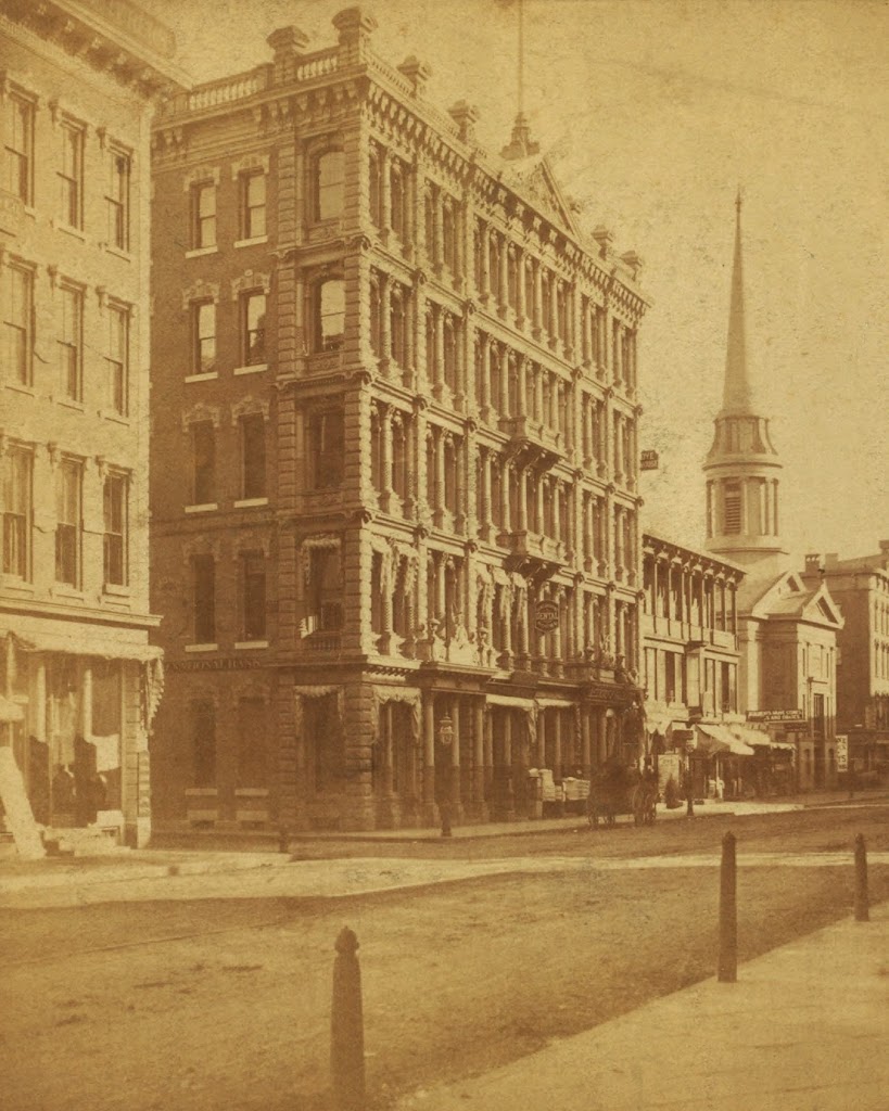
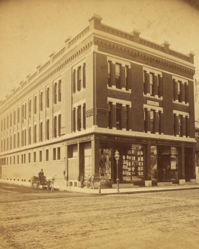
The northwest corner of Main and Bridge Streets in Springfield, sometime in the early 1880s. Photo courtesy of New York Public Library.

406_1865-1885c-2Bnypl

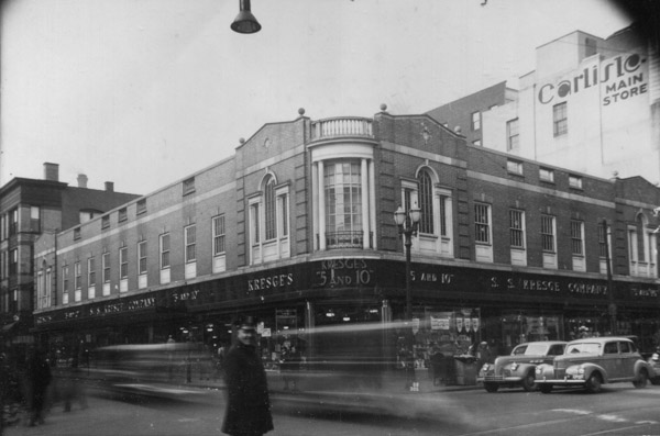
Main and Bridge in 1938-1939.  Image courtesy of the Springfield Preservation Trust.

406_1938-1939c spt

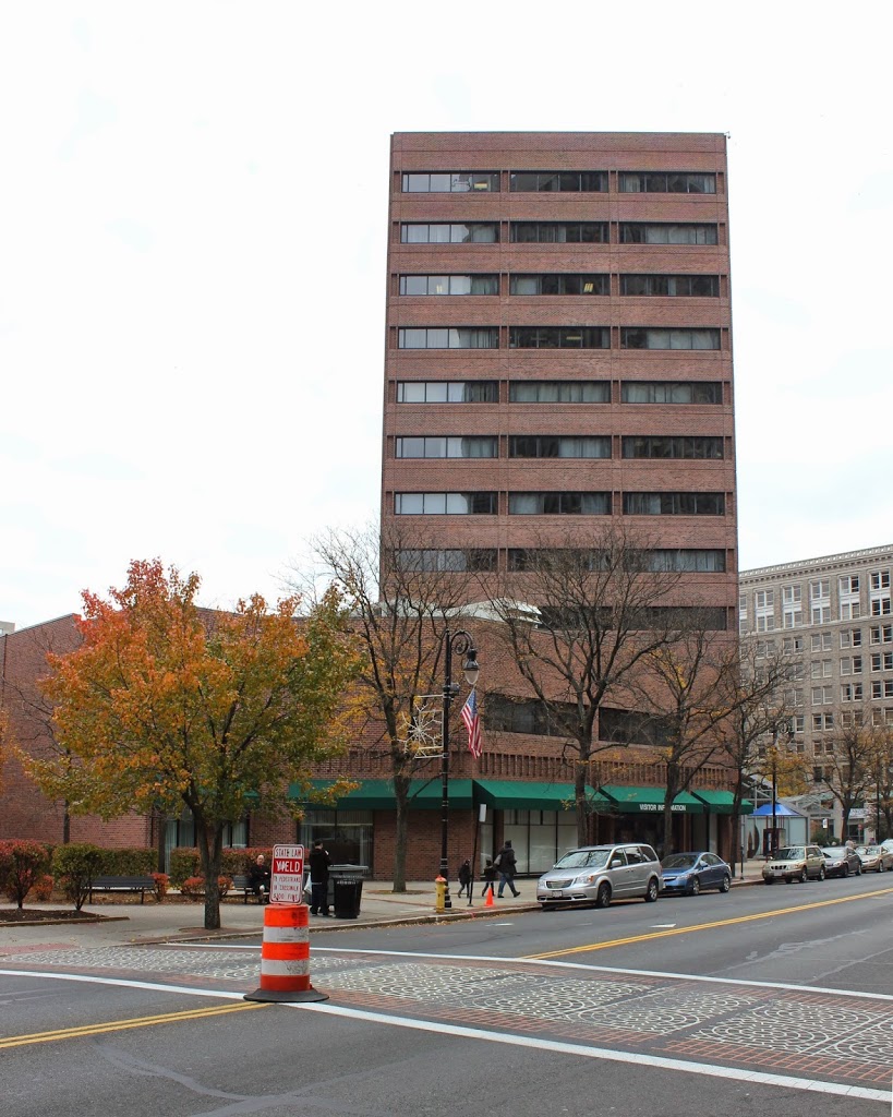
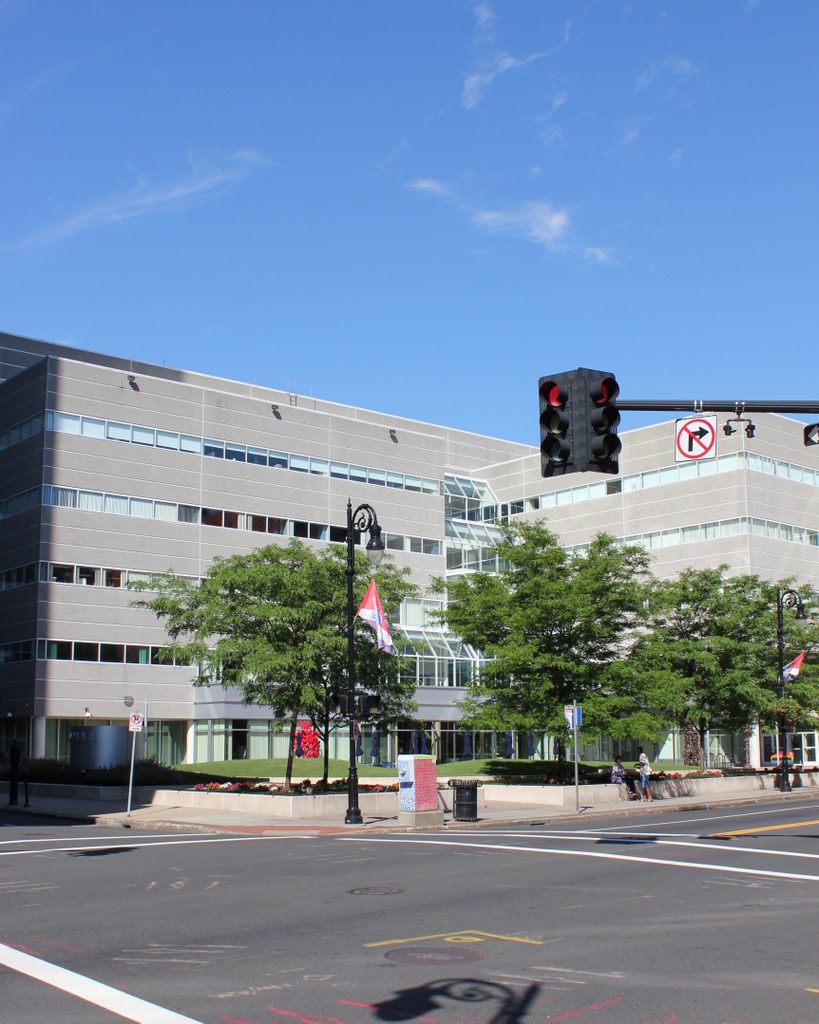
The same location in 2017:

The building in the first photo was the home of W.D. Kinsman’s store, which was described in the 1884 King’s Handbook of Springfield as a “fancy dry-goods and novelties establishment.”  According to the book, Warren D. Kinsman opened the business in 1866 and moved to the location at the corner of Main and Bridge Streets in 1880.  However, the engraving in King’s Handbook shows a building that is five bays wide on the Main Street facade, as opposed to the three which are seen in this photo.  This would seem to suggest a date of around 1880 for the first photo; the building must have been expanded to the right sometime soon after.  The Kinsman building was demolished by the 1930s, and Kresge’s 5 and 10 cent store was built on the site, as seen in the second photo.  Today, Kresge’s is also gone; it was replaced by the former Federal Building, which was renovated in 2009 and is now an office building.

Parsons Tavern, Springfield, Mass

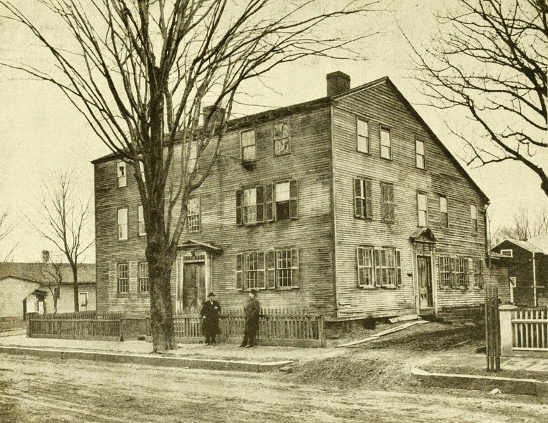
Parsons Tavern on Court Street in Springfield, sometime in the late 1800s. Photo from Our County and Its People: A History of Hampden County, Massachusetts (1902).

Taverns

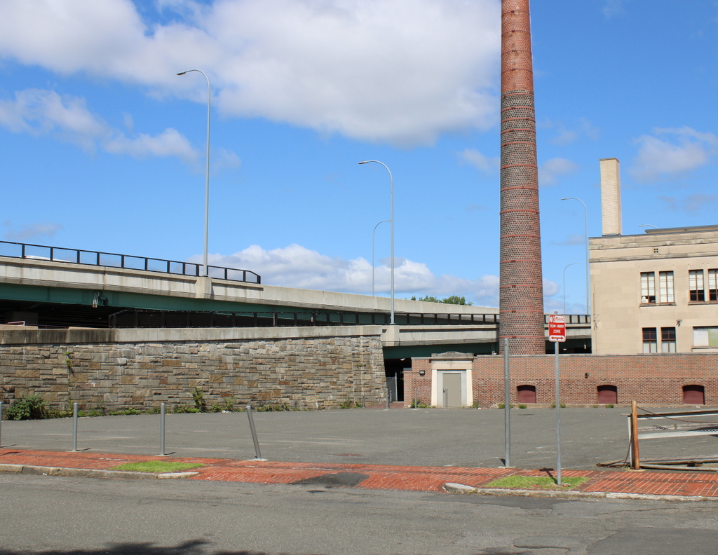
The scene in 2023:

When Springfield was settled by European colonists in 1636, it was at a strategic location along several different transportation routes.  As the years went by, the modes of transportation changed, but Springfield remained an important crossroads.  By the late 1700s, there were three major routes from New York to Boston, the northernmost of which went through Boston.  Although a less direct route than the other two, the Springfield route reportedly offered the best taverns, and in Springfield the best was Parsons Tavern.

The tavern was originally built on what is today the southeastern corner of Court Square, and was operated by Zenas Parsons.  During its time in operation, it hosted at least two presidents, the first of whom was George Washington in October, 1789.  Washington was on his way to Boston, and made a stop in Springfield to inspect the Armory.  He stayed overnight at Parsons Tavern, and wrote in his diary that “A Colo. Worthington, Colo. Williams (Adjutant General of the State of Massachusetts), Genl. Shepherd, Mr. Lyman and many other Gentleman sat an hour or two with me in the evening at Parson’s Tavern where I lodged and which is a good House.”  Years later, in 1817, President James Monroe also visited the tavern, not long before it was moved in order to make way for Court Square.

The tavern was relocated to Court Street around 1820, and it was eventually divided into a four-family apartment building. The top photo shows it in that location, probably sometime in the late 19th century. It stood here until 1897, when it was demolished. Today, the site of the building is a parking lot adjacent to the G.A.R. Hall, across East Columbus Avenue from Symphony Hall.

Paul Revere House, Boston

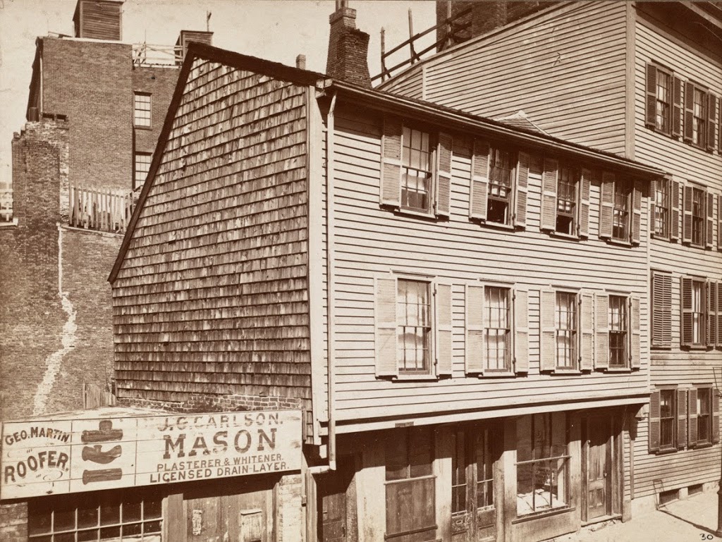
The Paul Revere House in Boston, sometime in the 1800s. Photo courtesy of Boston Public Library.

332_1800s-2Bbpl

The house in 2014:

332_2014

The first photo was taken sometime before the 1898 photo in this post, from a slightly different angle. It is the oldest building in downtown Boston, having been built around 1680. However, it changed in appearance over the centuries, and it wasn’t until the early 1900s that the house was restored to its original appearance. Today, the house is open for tours, and is a major landmark along the Freedom Trail.

Seaver House, Boston

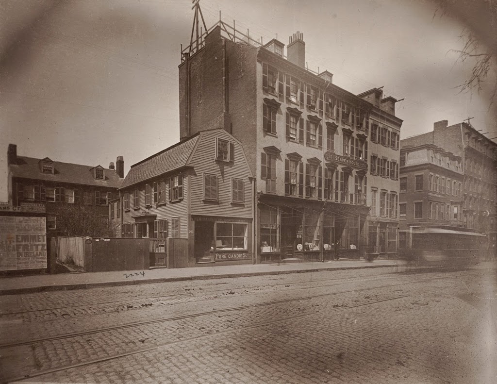
The Seaver House on the west side of Tremont Street across from Hollis Street, around 1882. Photo courtesy of Boston Public Library.

329_1800sc-2Bbpl

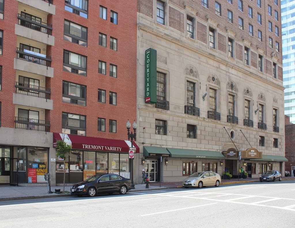
The scene in 2014:

329_2014

This view was taken from almost the same spot as the one in this post, which shows the scene before Tremont Street was widened.  Most of the buildings on Tremont Street in the 1882 photo above were built following the widening of the street, but none of them survive today. However, that doesn’t mean this neighborhood of Boston has completely changed.  It is part of Boston’s Theater District, a distinction that it held as far back as the 1800s.  In fact, the first photo is able to be dated to around 1882 based on the Fritz in Ireland playbill, which is posted on the wall on the far left-hand side of the first photo.  The wood-frame house in the left-center of the photo is the General Crane House, and was home to John Crane, a Boston Tea Party participant and Revolutionary War veteran.  By the time of the 1882 photo, it was home to the William Davis & Co. candy store.  Notice also the rails running through the cobblestone streets, and the blurred image of a horse-drawn trolley.  The trolleys would eventually be electrified and buried beneath Tremont Street in the late 1890s; today, the tunnel is still there, but it is no longer in service.

Sheaffe House, Boston

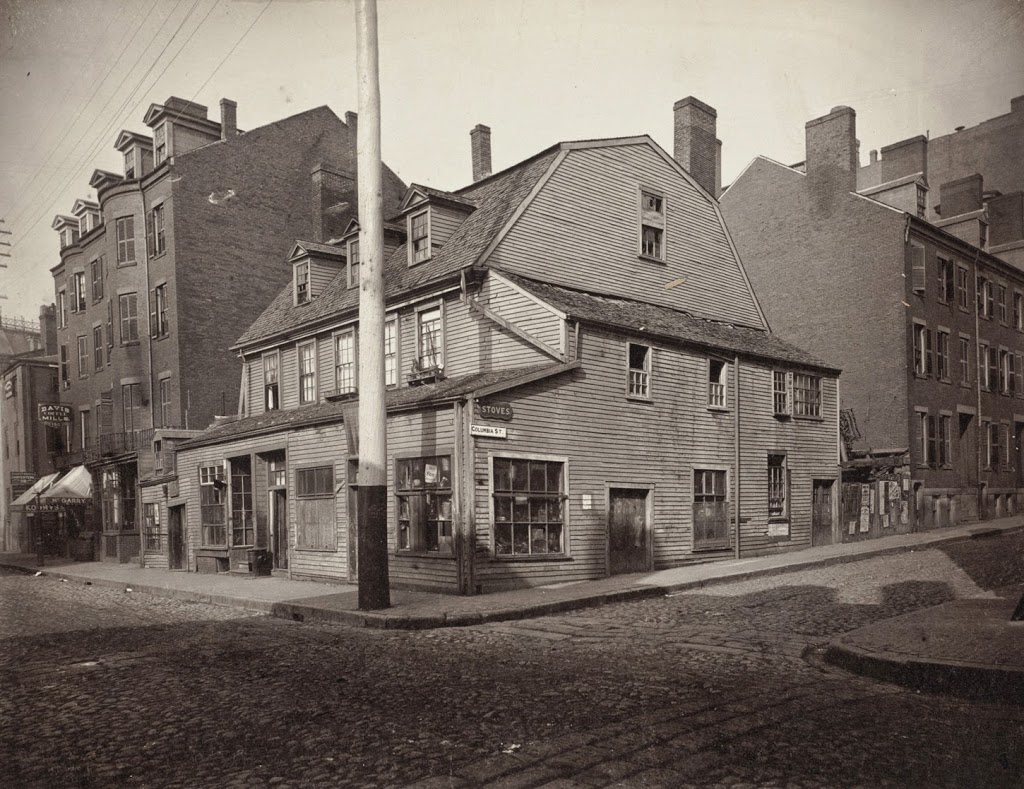
The Sheaffe House at the corner of Columbia and Essex in Boston, sometime in the 1800s. Photo courtesy of Boston Public Library.

324_1800s-2Bbpl

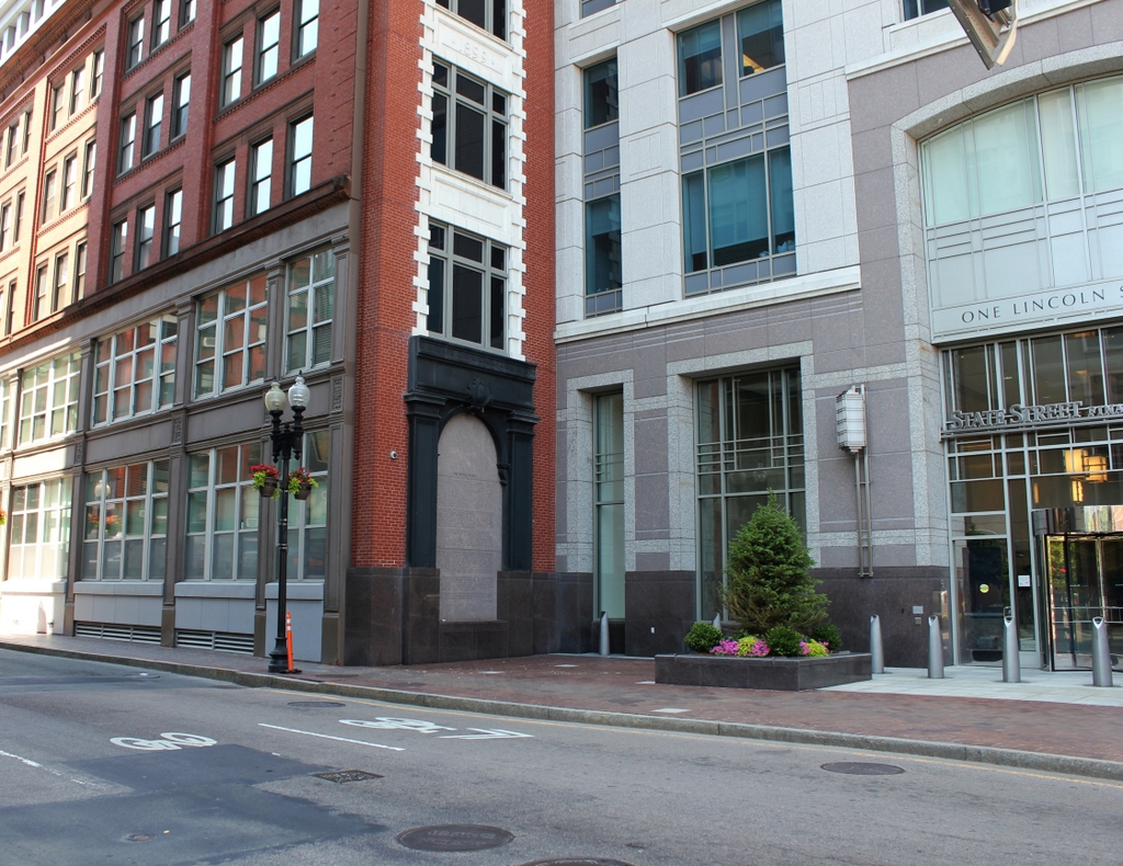
The scene in 2014:


Located in the southern part of downtown Boston, the Sheaffe House was built in 1734 by Thomas Child, who owned a distillery a few block away.  The house was later owned by his son-in-law, William Sheaffe, for whom the house is named.  Sheaffe died in 1771, and his wife opened the house as a boarding house to support the family.  One of the residents was Lord Percy, a British officer who fought at Lexington & Concord and the Battle of Long Island.  Thanks to Lord Percy, one of Sheaffe’s children, Roger Hale Sheaffe, attended military school in London and eventually reached the rank of general in the British army.

The house was demolished sometime before 1887, and the brick building on the left-hand side of the 2014 photo replaced it.  The building, 88 Kingston Street, has been substantially renovated – I’m not sure if anything survives but the facade.  To the right is the One Lincoln Street building, an office building that was built in 2003 and is one of the tallest buildings in the Financial District.

Niles Building, Boston

The Niles Building at the corner of School Street and City Hall Avenue in Boston, in 1880. Photo courtesy of Boston Public Library.

323_1880-2Bbpl

The same scene in 2014:

When the first photo was taken, School Street was home to Boston’s City Hall, which is barely visible on the far left-hand side.  The building, which opened in 1865, is still there, although it no longer functions as the City Hall.  The buildings in the foreground of the 1880 photo, however, are long gone – the building in the present-day photo was built in 1915, so the older buildings were obviously demolished before then.  At least one other building does exist today from the original photo – the Old Corner Bookstore is seen in the distance on the extreme right of the photo.