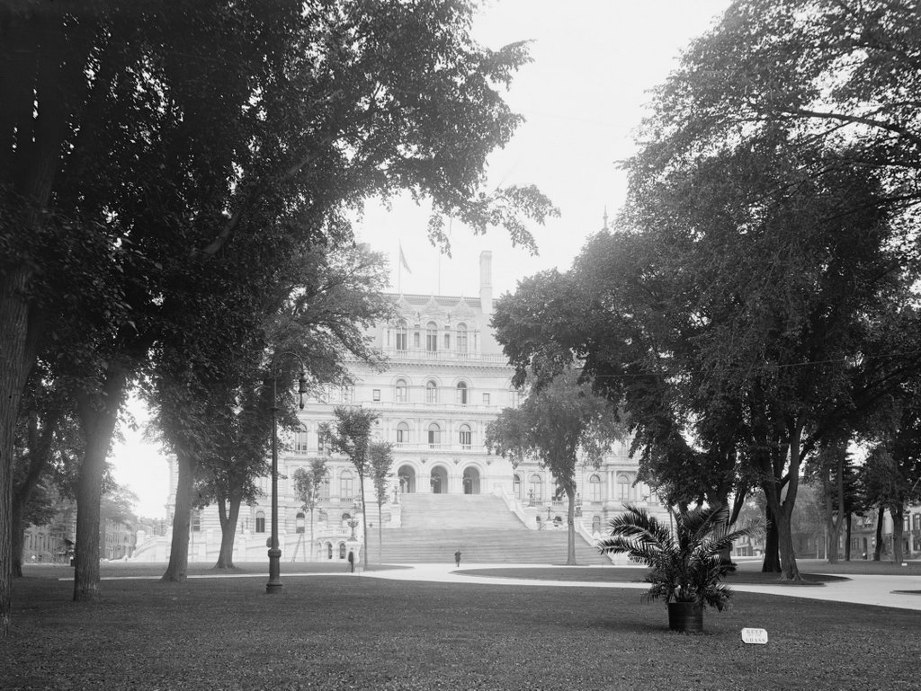
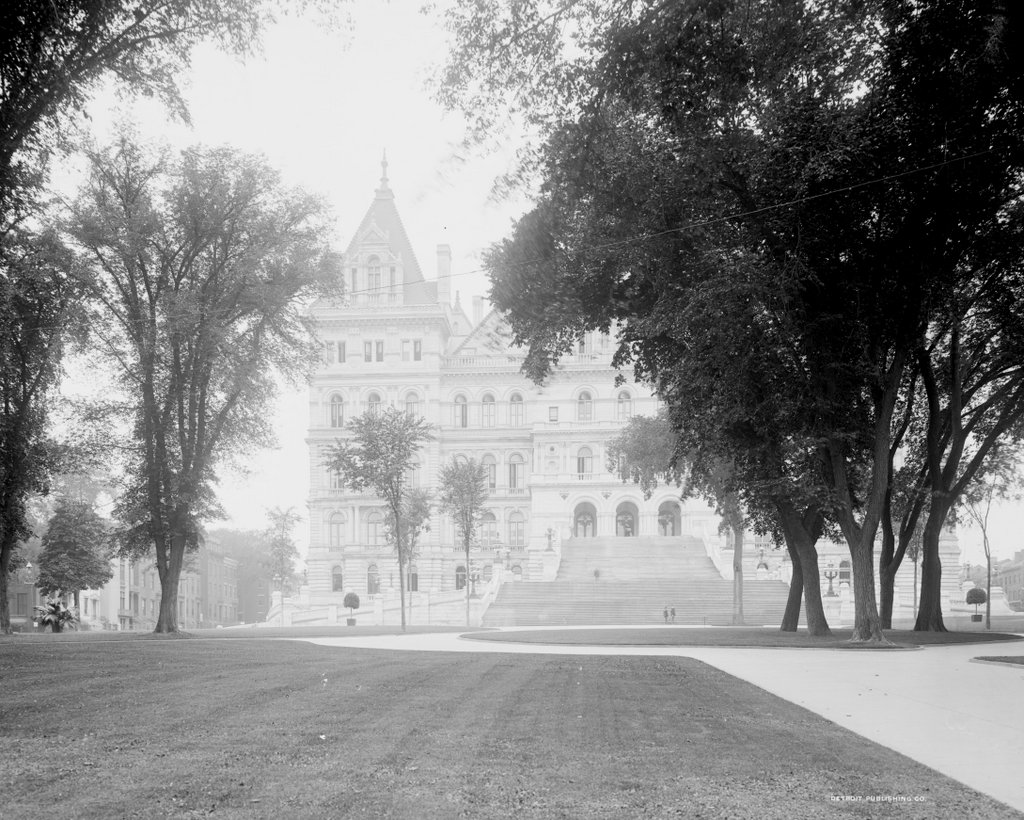
The New York State Capitol, seen from Eagle Street on the east side of the building, around 1900-1906. Image courtesy of the Library of Congress, Detroit Publishing Company Collection.
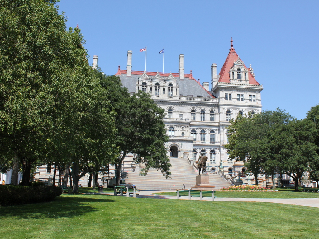
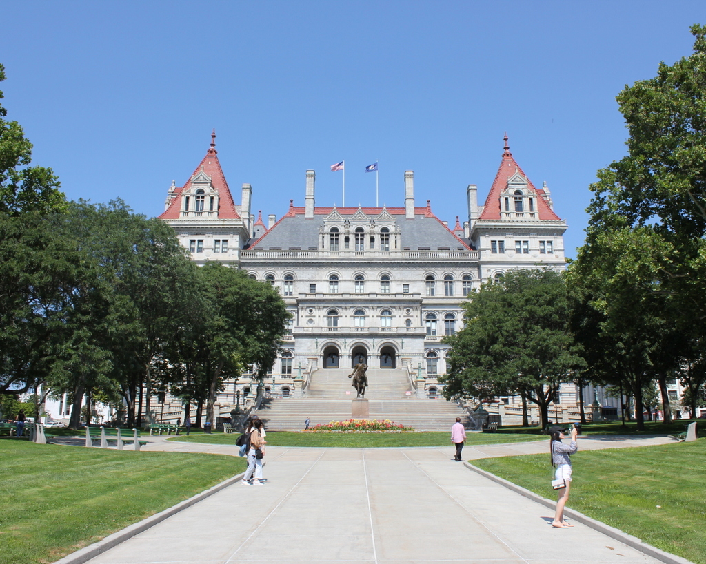
The capitol in 2019:
For a state capital, the city of Albany is relatively small, with a current population of just under 100,000. This modest size is even more apparent when contrasted with New York City, which is nearly a hundred times larger than Albany. However, while the city itself might be small, New York more than makes up for it with one of the most impressive state capitol buildings in the country, which stands here on a hill just to the west of downtown Albany.
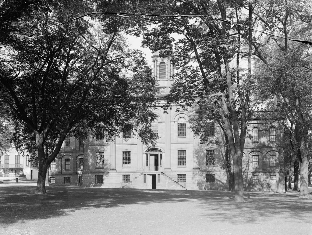
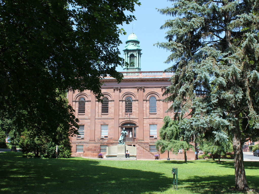
Albany became the capital of New York in 1797, and for much of the 19th century the state government was housed in a capitol building that stood on the far left side of this scene, directly in front of what is now the southeastern corner of the current capitol. This building was completed in 1809, and it remained in use even as its much larger replacement rose behind it in the late 1860s and 1870s. The state legislature finally moved into the yet-unfinished capitol in 1879, and the old one was demolished in 1883, although the new one would not be completed until 1899, after many years of construction delays and cost overruns.
Work on the new capitol had begun in 1867, and its initial design was the work of Thomas Fuller, a Canadian architect who had previously been involved in designing the buildings on Parliament Hill in Ottawa. His plans called for a Renaissance Revival exterior, although the construction work had only progressed as far as the ground floor by 1875, when he was dismissed from the project. The state then hired architects Leopold Eidlitz and Henry H. Richardson, who designed the next two floors before they too were dismissed in 1883 by then-Governor Grover Cleveland. Both Eidlitz and Richardson were pioneers of the Romanesque Revival style of architecture, and their involvement is visible in the exterior design of these two floors, which are significantly different from the ground floor.
Architect Isaac G. Perry then oversaw the final stage of construction, although Eidlitz and Richardson continued to be involved in the design process, and the upper floors have many of the same Romanesque features as the second and third ones. The capitol was also intended to have a Romanesque-style tower in the center, although this was ultimately never completed, in part because of concerns that the ground beneath the building would be unable to support its weight. However, financial issues likely played a role in this decision as well. By the time the building was declared completed in 1899, its original estimated construction costs had ballooned to a staggering $25 million, equivalent to over $750 million today. Finishing the tower would have meant spending even more money, not to mention prolonging a project that was already nearly a third of a century in the making.
The first photo was taken shortly after the capitol was completed, showing the large exterior staircase on the eastern facade of the building. It has a total of 77 steps and extends outward 166 feet from the front of the building. Built in the 1890s, it was one of the last major exterior features added to the capitol, and it was designed by Isaac Perry. He had also intended to build a large gable above the entrance, similar to the one on the west side of the building. However, structural concerns about the added weight forced him to abandon this plan, and he instead built a balcony over the entrance.
Unfortunately, the building’s troubles did not end with its completion. In the early morning hours of March 29, 1911, a fire started in the Assembly Library on the third floor. It soon spread to the nearby State Library, where hundreds of thousands of irreplaceable books and manuscripts provided more fuel for the blaze. By the time the fire was brought under control, the library was a total loss, and the fire caused extensive damage to the upper floors on the western side of the building, including the collapse of the tower at the southwestern corner. The fire also claimed the life of the State Library’s night watchman, 78-year-old Civil War veteran Samuel Abbott, whose charred body was found under the debris two days later.
The eastern side of the building, shown here in these photos, was unaffected by the fire. This included the governor’s Executive Chamber, located on the second floor in the southeast corner, on the left side of this scene. The flames did not reach the legislative chambers, which are located on either side of the building in the center of the east-west axis, but both rooms suffered water damage, and the legislators temporarily met across the street in City Hall while the capitol was repaired. In the end, the fire caused over $2 million in damage to the building, not to mention the priceless contents of the State Library, and none of these losses were insured by the state. The exact cause of the fire was never determined, but the most likely culprit was faulty electrical wiring, which had been installed in the early years of electric lighting.
Overall, though, despite the early troubles of the capitol building, it has stood here as a major landmark for well over a century. During this time, it has seen the rise of many notable politicians, particularly governors, who have gone on to achieve national prominence. Three of the governors who served here in this building subsequently became president: Grover Cleveland (1883-1885), Theodore Roosevelt (1899-1900), and Franklin D. Roosevelt (1929-1932). Of these, both Cleveland and Franklin Roosevelt were sitting governors when they were elected to the presidency, and Theodore Roosevelt was the governor when he was elected vice president in 1900.
Other prominent governors have included Charles Evans Hughes (1907-1910), who later became Secretary of State and Chief Justice of the United States; Al Smith (1919-1920, 1923-1928), the 1928 Democratic presidential candidate; and Thomas E. Dewey (1943-1954), who ran for president as the Republican candidate in both 1944 and 1948. The 1944 presidential election was particularly interesting in that it pitted the sitting New York governor against a former governor, Franklin Roosevelt. More recently, Nelson Rockefeller (1959-1973) served as vice president under Gerald Ford, after his 14-year tenure here as governor. Another vice president, Levi P. Morton, was also governor (1895-1896), although he was not elected to this office until after his term as vice president.
Today, more than a century after the first photo was taken, much has changed in the area surrounding the capitol, particularly to the south on the left side of the scene. During the Rockefeller administration, all of the buildings in the blocks to the south of the capitol were demolished as part of a large urban renewal project in order to create the Empire State Plaza, a sprawling complex of state office buildings. Although not visible in this particular view, the Modernist and Brutalist-style buildings of the plaza provide a sharp contrast to the elaborate 19th century architecture of the adjacent capitol building.
As for the capitol itself, it has undergone interior renovations over the years, but on the exterior it remains essentially the same as it did at the turn of the 20th century. It has been a source of controversy over the years, both for its expense and for its visual appearance as an odd hybrid of Renaissance and Romanesque architectural styles. However, it remains in use as the capitol of one of the largest states in the country, and it is probably the most recognizable historic landmark in the city of Albany.

