View from Bunker Hill Monument, Boston (3)

The view from the Bunker Hill Monument, sometime between the 1860s and 1880s. Photo courtesy of New York Public Library.

089_1860s-1880s-2Bnypl

The same view in 2024:

These two photos show three sections of Boston – Charlestown in the foreground, East Boston in the distance, and the North End of Boston barely visible to the right.  Other than the approach ramp to the Tobin Bridge, not much has changed in Charlestown – many of the houses in the foreground can easily be identified in both photos.  On the waterfront, many of the buildings at the former Boston Navy Yard are still there, and have been incorporated into the Boston National Historical Park. ln the distance, East Boston has been substantially expanded for Logan International Airport, which is barely visible on the far side of East Boston.


View from Bunker Hill Monument, Boston (2)

The view from the Bunker Hill Monument, sometime between the 1860s and 1880s. Photo courtesy of Boston Public Library.

088_1860-1880s-2Bbpl

The view in 2010:

088_2010

Looking west from the Bunker Hill Monument, the approaches to the Tobin Bridge dominate the landscape in the 2010 photo.  In the foreground, there is a stark contrast between the 19th century buildings to the right and the 1960s era redevelopment to the left.  Many of the buildings are easily recognizable in both photos, especially the ones along the street in the lower center of the 2010 photo.  In the background, beyond the approaches to the bridge. is the site of the former navy yard, which was still in active use in the first photo.

View from Bunker Hill Monument, Boston (1)

The view from the Bunker Hill Monument, sometime between the 1860s and 1880s. Photo courtesy of New York Public Library.

087_1860s-1880s-2Bnypl

The same view in 2010:

087_2010

The view from the top of the Bunker Hill Monument, looking east across the Mystic River.  The bridge in the first photo was the Chelsea Bridge, which was built in 1803.  It was replaced by the present-day Tobin Bridge, and much of the Charlestown neighborhood in the foreground was redeveloped in the 1960’s, giving it a far different appearance from the 19th century photo.

Summit of Mt. Washington

The summit of Mt. Washington, around 1860. Photo courtesy of New York Public Library.

Mt. Washington

The summit in 2013:

086_2013

I don’t know if the two photos were taken from the same angle – it’s impossible to tell without any landmarks – but they clearly show how popular the northeast’s tallest mountain has become.  On the day that we went, there was literally a line of people waiting to ascend the pile of rocks that form the summit.  Some climbed to the top, while others took the Cog Railway or, like us, drove to he top.  If the 1860 date is correct, however, neither of these options were available to the individual standing on the top – the carriage road was not completed for another year, and the railway not until 1868.

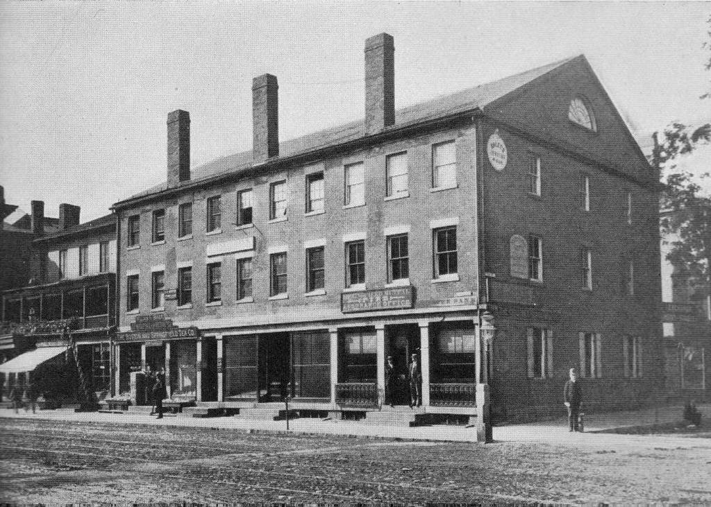
Court Square, Springfield (5)

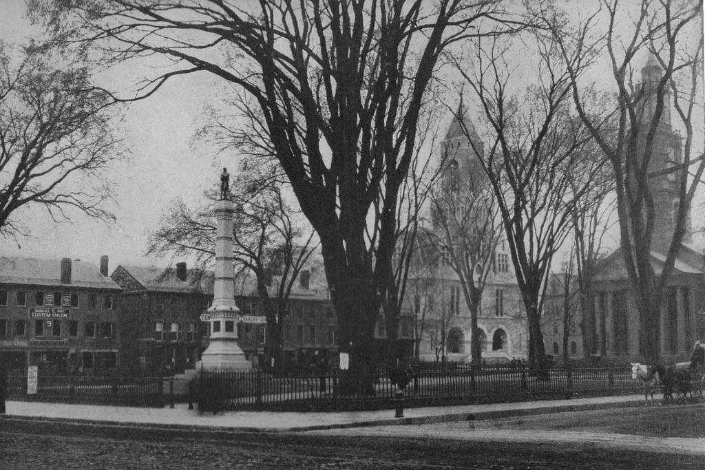
Court Square in Springfield, sometime in the 1860s or early 1870s. Photo courtesy of New York Public Library.

085_1860s-1870s-2Bnypl

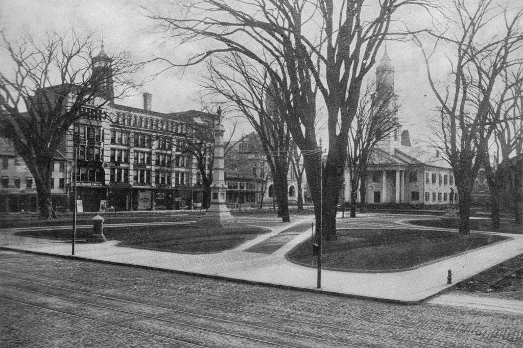
The same scene in 2013:

085_2013

Court Square has been the center of activity in Springfield since its founding.  The first meeting house was built just to the left in the foreground, and all of the subsequent churches have been built on Court Square.  The square was established as a park in 1821, two years after Old First Church was built.

The building on the right-hand side of the photo is the old Hampden County Courthouse, which was built in 1821 and used as a courthouse until the 1874 courthouse was built just to the left of Old First Church. The 1874 structure is still in use as the juvenile and housing court, but the preesent-day courthouse is visible beyond and to the right of the church in the 2013 photo.  The old 1821 courthouse was later used as an Odd Fellows hall, and was demolished at some point in the late 1800’s or early 1900’s. The small building in between was the church’s chapel, which was replaced by the present-day brick structure in 1874.

Washington Monument, Washington DC

The Washington Monument, around 1860. Image courtesy of the Library of Congress, Brady-Handy Collection.

084_1860c-2Bloc

The monument in 2012:

084_2012

Ever notice how the bottom third of the Washington Monument is a few shades lighter than the upper part?  The top photo shows why. Taken by noted Civil War photographer Mathew Brady, it shows the monument during the long stoppage in construction.  The construction started in 1848, and made it about 150 feet up by 1854, when work was halted, at first due to fundraising issues and later because of the Civil War.  Construction resumed in 1877, and was completed in 1884, at the height of 555 feet.  It was topped off with a 100-ounce aluminum apex.  At the time, aluminum was a precious metal, and it also served as a lightning rod.