Beacon Hill Reservoir, Boston

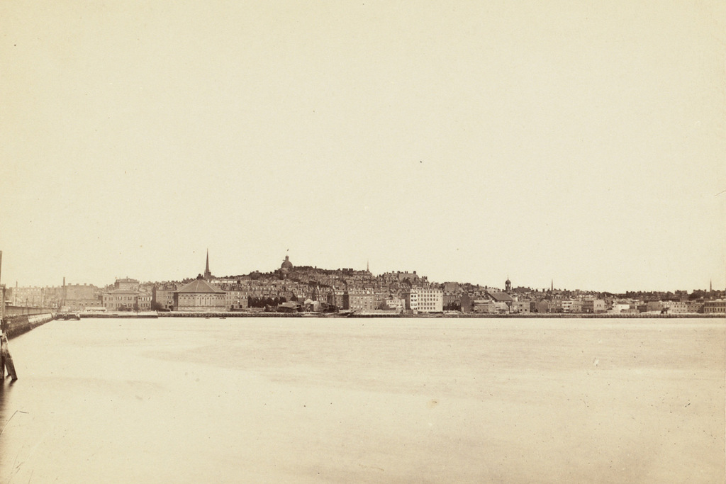
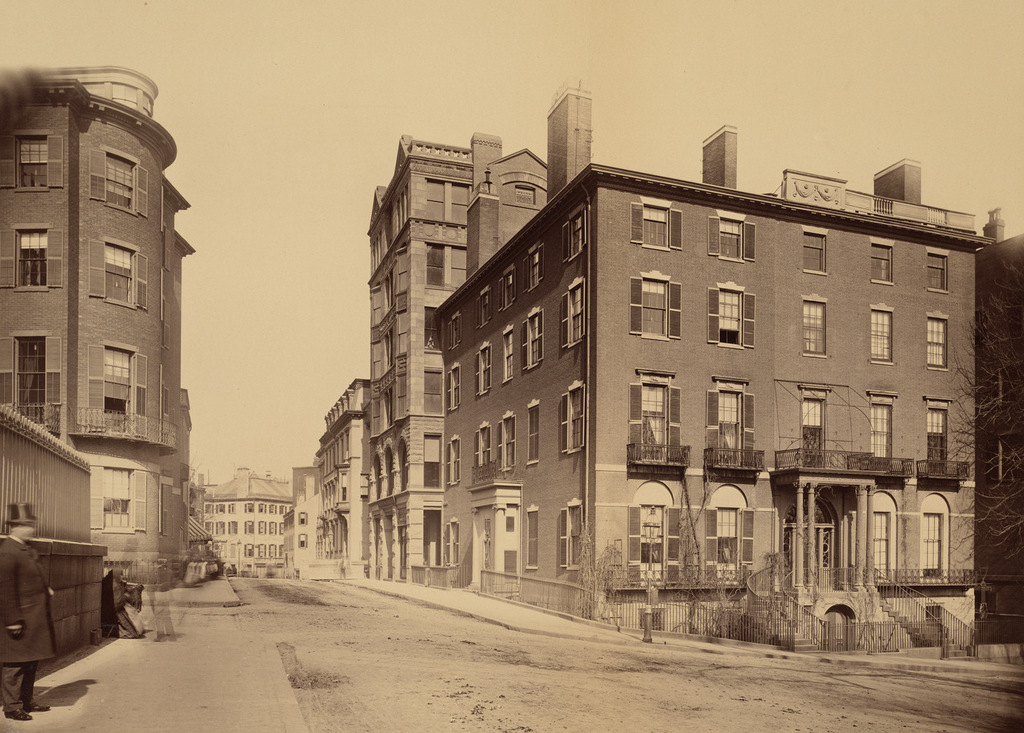
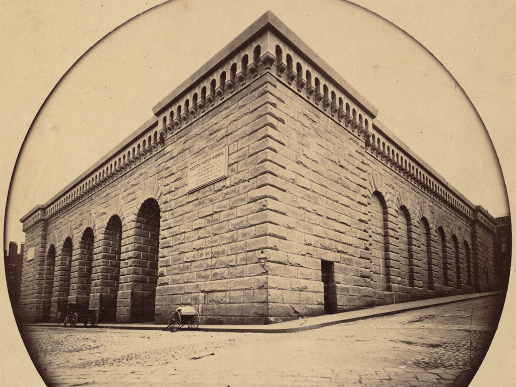
The reservoir atop Beacon Hill in Boston, around 1860. Image taken by Josiah Johnson Hawes, courtesy of the Boston Public Library.
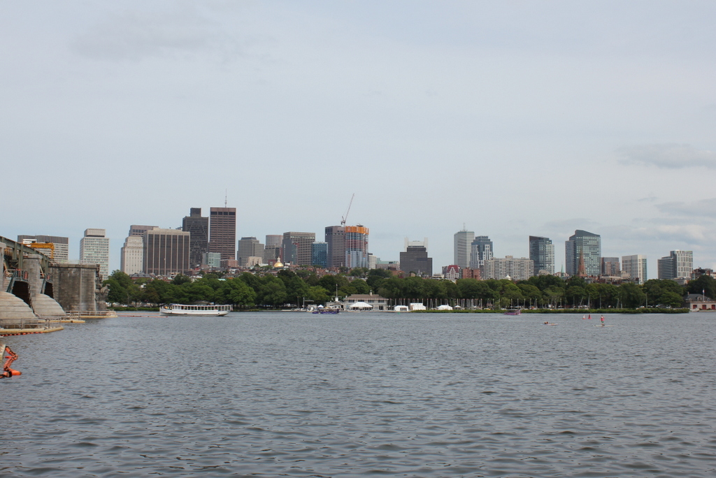
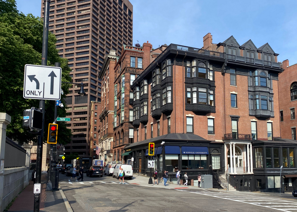
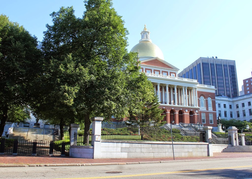
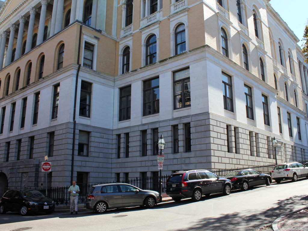
828_1860 bpl

The scene in 2015:

828_2015
Long before the Wachusett and Quabbin Reservoirs, Boston’s municipal water supply was Lake Cochituate, a reservoir in Natick, Framingham, and Wayland. The project began in 1845, and it included not only creating the artificial lake, but also building a 14-mile long aqueduct that fed this stone reservoir atop Beacon Hill, just behind the Massachusetts State House. From here, the water was distributed throughout the city, using the hill’s elevation to carry the water downhill through the pipes. It occupied the majority of the block between Hancock, Derne, Temple, and Mt. Vernon Streets, and it had a capacity of over 2.6 million gallons.

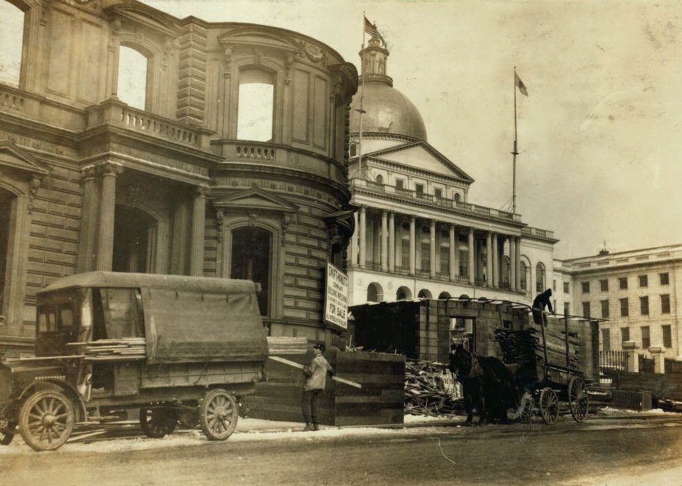
The structure’s cornerstone laying ceremony in 1847 included a time capsule, which contained several publications and two silver plates, perhaps in the hope that, like the great Roman aqueducts in Europe, this public water supply structure would last for thousands of years. However, as it turned out, it lasted for less than 40. It closed by about 1880, and around three years later it was demolished to build a large expansion of the Massachusetts State House, which now occupies the site where this reservoir once stood.

Charles Street Meeting House, Boston (2)

Looking north on Charles Street toward the Charles Street Meeting House in Boston, around 1889. Image courtesy of the Boston Public Library.

814_1889c bpl

The scene in 2015:

814_2015
As mentioned in the previous post, this historic church was built in 1807 as the Third Baptist Church. It played a major role in the abolitionist movement in Boston, and it was later the home to the Charles Street African Methodist Episcopal Church from 1876 until 1939. It was converted into offices in the early 1980s, but from the exterior it looks essentially the same as it did over 125 years ago. It is one of the 15 landmarks that comprises the Boston African American National Historic Site on Beacon Hill.  The buildings beyond it on Charles Street haven’t changed much, either. They date back to the second half of the 19th century, and like so many other buildings in the Beacon Hill neighborhood, they have been well-preserved over the years.

Charles Street Meeting House, Boston (1)

The Charles Street Meeting House, at the corner of Charles and Mt. Vernon Streets in Boston, around 1889. Image courtesy of the Boston Public Library.

813_1889c bpl

The church in 2015:

813_2015
This historic church in the Beacon Hill neighborhood was built in 1807 as the Third Baptist Church. It was designed by Asher Benjamin, a New England native who was one of the leading American architects of the Federal era, and at the time it was located right along the waterfront. The building hasn’t moved in the past two centuries, but the shoreline has; Charles Street once ran along the Charles River at the western edge of the city, but after widespread landfill projects in the 19th century the church is now a considerable distance from the water.

Prior to the Civil War, this church was prominent in Boston’s abolitionist movement, and it hosted speakers such as Frederick Douglass, Wendell Phillips, Charles Sumner, and Sojourner Truth. After the war, though, the congregation declined, and merged with the First Baptist Church by 1876. The building was sold to the First African Methodist Episcopal Church, and became the Charles Street A.M.E. Church.

When the first photo was taken around 1889, the A.M.E. Church still owned it, and they remained here until 1939. By then, Boston’s black population had shifted away from its historic roots in Beacon Hill, and the congregation relocated to Roxbury. The building was later used as an Albanian Orthodox church and later as a Unitarian Universalist church until the late 1970s. A few years later, it was converted into offices. The interior was completely renovated, but the exterior was preserved, and today it is a part of the National Park Service’s Boston African American National Historic Site.

Boston Skyline

The skyline of Boston as seen across the Charles River in Cambridge, sometime in the 1880s. Image courtesy of the Boston Public Library.

712_1880-1889c bpl

The same view in 2015:

712_2015
These two views certainly show how the city of Boston has changed over the past 125 years or so, but perhaps more remarkable is how much has remained the same.  This view shows an arc of the city from Cambridge Street and the Longfellow Bridge on the left to the foot of Mount Vernon Street on the far right, and the most obvious difference between the two photos is the skyscrapers of downtown Boston in the distance.

In the foreground, however, is the Beacon Hill neighborhood, which really hasn’t changed much since the 19th century.  Things are a little different along the waterfront – the trees of the Charles River Esplanade hide Storrow Drive, which cuts along the river now, but further up Beacon Hill this pocket of early 19th century Boston has survived as a low-rise residential neighborhood.  Although it is hard to identify individual buildings, many of the ones from the 1880s view are still standing today.  The most prominent building in the first photo is the dome of the Massachusetts State House, which stands at the top of the hill.  Although it now has a backdrop of skyscrapers instead of just sky, it is still easily visible from here despite being over a half mile from the river.

Beacon and Park Streets, Boston

Looking east on Beacon Street from in front of the State House, sometime around 1885. Image courtesy of the Boston Public Library.

692_1800sc bpl

The scene in 2022:


Despite all of the changes in downtown Boston during the past 130 years, there are several buildings from the first photo that survive today.  The building at the corner doesn’t bear much resemblance to its former self, but it is the same one that is seen in the first photo.  It was built in 1804 for merchant Thomas Amory Jr., and was one of several houses on Park Street that were designed by Charles Bulfinch.  The home occupies a prominent position next to the Boston Common and across the street from the Massachusetts State House, but the cost for the massive house ruined Amory’s finances, and he had to sell it in 1807.

After Amory sold it, the house was divided into four different units, which were rented to some of Boston’s most prominent citizens.  Senator and Cabinet member Samuel Dexter lived here, and Christopher Gore took advantage of the house’s proximity to the State House and lived here while serving as governor in 1809 and 1810.  In 1824, the Marquis de Lafayette stayed here during his tour of the United States, and Boston Public Library founder George Ticknor lived on the Park Street side of the house from 1830 until his death in 1871.  Around 1885, the house was extensively renovated on the exterior, with iron storefronts replacing the original first floor windows, oriel windows on the third and fourth floors, and three dormers on the right-hand side of the roof.  Today, several different businesses occupy the first floor storefronts, including Fox 25 News in the corner storefront.

The other historic building that has survived from the first photo is the Claflin Building, located just beyond the Amory-Ticknor House on Beacon Street.  It was completed in 1884, and is one of architect William Gibbons Preston’s several surviving buildings in Boston, along with the Armory of the First Corps of Cadets and the Museum of Natural History building.  The Claflin Building was built for the newly-founded Boston University, who used the upper floors for school offices and rented the first floor storefronts.  The school owned the building until the 1940s, when it moved to its present campus on Commonwealth Avenue, and today it has been renovated into condominiums.

Massachusetts State House, Boston

The Massachusetts State House, with a Beacon Street house being demolished in the foreground.  Photo taken January 27, 1917 by Lewis Wickes Hine of the National Child Labor Committee, courtesy of the Library of Congress.

310_1917-2Bloc

The scene in 2014:

310_2014

The Massachusetts State House was built in 1798, but has been expanded several times over the years.  An 1895 expansion was built behind the original building, and in 1917 the east and west wings were added (east wings visible on the right-hand side of both photos).  The west wing, however, required the demolition of a number of houses on Beacon Street, Joy Place, and Mount Vernon Place, and the elimination of Hancock Avenue altogether.

One of the demolished buildings can be seen here in the first photo.  In this particular scene, Lewis Wickes Hine captures workers, including young children, bringing wood home, presumably to use for firewood on what was probably a chilly late January day.