Harpers Ferry, West Virginia

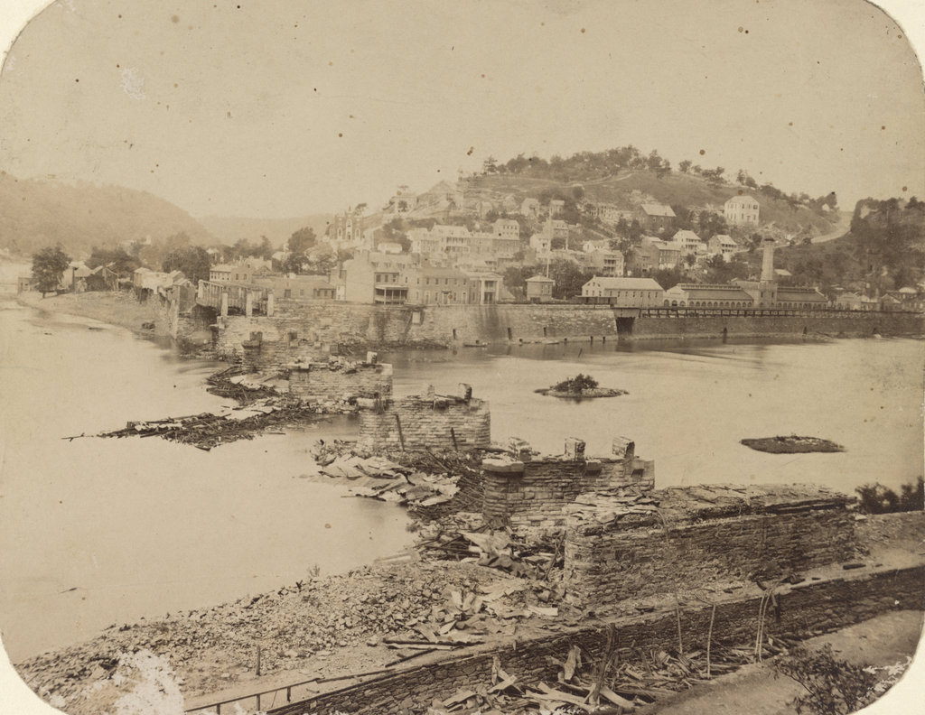
Looking across the Potomac River towards Harpers Ferry from the Maryland side of the river, around June 14, 1861. Image courtesy of the Library of Congress, Civil War Collection.

728_1861 loc

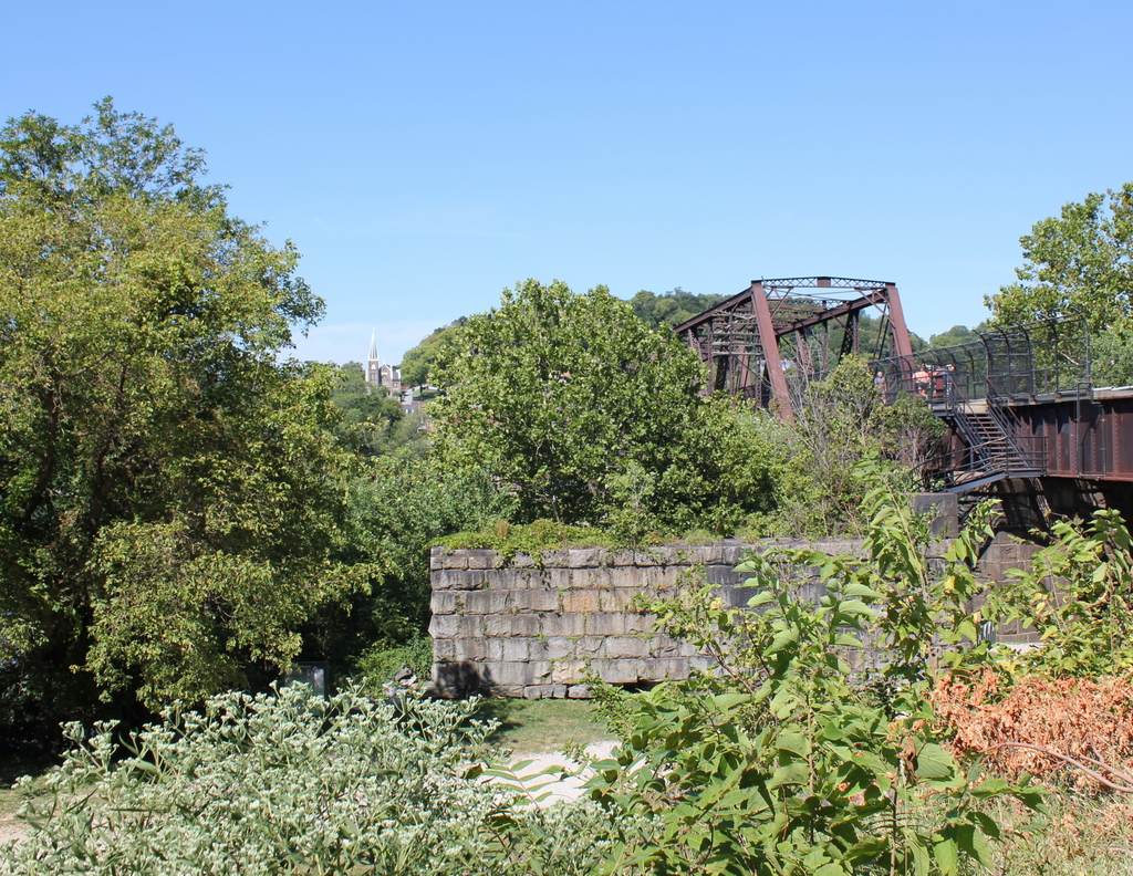
The same view in 2015:

728_2015 loc
The town of Harpers Ferry had only about 1,300 residents at the start of the Civil War, and its land area was just a half a square mile, but it became among the most contested places of the war.  It was literally located on the border of the Union and the Confederacy, changing hands eight times during the war and ending up in a different state by the time it was over.

As its name implies, this area was first settled as a ferry crossing.  Originally part of Virginia, it is located at the confluence of the Potomac and Shenandoah Rivers, and beginning in 1733 colonist Peter Stevens operated a ferry across the Potomac here, enabling settlers from Maryland and Pennsylvania to access the Shenandoah Valley of Virginia.  The town isn’t named Stevens Ferry, though, because around 1748 he sold his land and ferry to Robert Harper, who operated it until his death in 1782.

Because of its transportation connections and relatively defensible position, Harpers Ferry was one of two locations, along with Springfield, Massachusetts, selected by George Washington for federal armories.  Further transportation developments came in the 1830s: the Chesapeake & Ohio Canal (seen in the lower foreground of both photos) was completed as far as Harpers Ferry in 1833, several stagecoach lines were opened in 1834, and the Baltimore & Ohio Railroad reached the Maryland (foreground) side of the river later in 1834.  The first railroad bridge was completed in 1837, allowing a direct connection from the armory to the rapidly growing national rail network.

By 1850, this small town had grown to over 1,700 people thanks to the armory (visible along the waterfront to the right in the first photo), but before the end of the decade it would become the center of one of the major precursors to the Civil War.  In October 1859, abolitionist John Brown led a raiding party of 22 men in an attempt to capture the arsenal and start a slave rebellion.  The raid ultimately failed, and most of the raiders were either killed or were captured and executed, including John Brown, whose December 2 execution was seen as a martyrdom by many northern abolitionists.

The Civil War began just a year and a half after the raid, and Virginia’s state legislators voted to secede on April 17, 1861.  One of the state’s first objectives was to take the Harpers Ferry arsenal, which at the time was guarded by just 65 men.  Led by Lieutenant Roger Jones, they destroyed the arsenal and its 15,000 guns before evacuating the town ahead of the Confederates.  The Confederates didn’t occupy the town for long, though.  They left on June 14, and burned the Baltimore & Ohio bridge as they left.  The remains of the bridge can be seen in the foreground of the first photo, which according to the caption was “photographed immediately after its evacuation by the rebels.”

When the first photo was taken, the town was still relatively intact, but as the war progressed it became somewhat of a no man’s land.  Despite the loss of the armory, it was still a vital transportation corridor for armies on both sides, so between 1861 and 1863 it changed hands several more times.  West Virginia became a state on June 20, 1863, with Harpers Ferry citizens voting 196 to 1 to leave Virginia and join the union.  The town was briefly occupied by the Confederates in early July, but they soon evacuated for the last time and Union solders returned on July 13, finally bringing stability to Harpers Ferry for the rest of the war.

In terms of population, Harpers Ferry never fully recovered from the Civil War.  The armory never reopened, and the population has steadily fallen to less than 300 as of the 2015 census.  However, it has become a major tourist destination, with the Harpers Ferry National Historic Park now comprising much of the historic town.  Although the Chesapeake & Ohio Canal has not operated in nearly a century, there are still several railroad lines that pass through here.

One of the bridges, seen to the right in the 2015 photo, also carries the Appalachian Trail over the Potomac River on a pedestrian walkway on the left side of the bridge.  The bridge pier in the foreground is from an earlier railroad bridge that had been built on the spot of the one that was destroyed in 1861.  This bridge, in turn, was washed away in a 1936 flood, and it was never rebuilt.  Today, the modern railroad bridge, as well as trees along the river, help to hide the view of Harpers Ferry, with only a few buildings visible in the 2015 scene.

(Much of the information for this post came from “To Preserve the Evidences of a Noble Past”: An Administrative History of Harpers Ferry National Historical Park (2004).  For further reading, it and other resources are available online here at the National Park Service website.)

Soldiers’ Monument, Southington, Connecticut

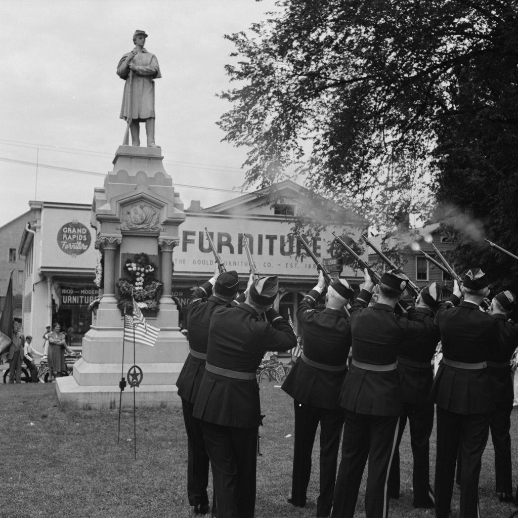
The Soldiers’ Monument in Southington during Memorial Day observances in May 1942. Image courtesy of the Library of Congress, FSA-OWI Collection.

639_1942-05 loc

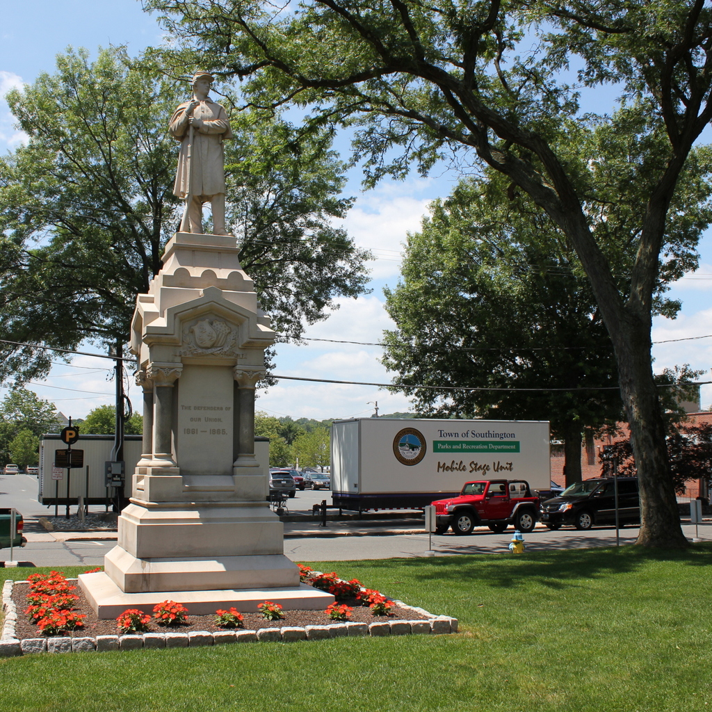
The monument in 2015:

639_2015
No New England town common is complete without a Civil War monument, and here in Southington the monument is a prominent subject in this photo, taken by the Office of War Information during World War II.  Taken during the town’s 1942 Memorial Day observances, it shows an American Legion honor guard firing a salute in front of the monument.  What makes this monument a little different, though, is that while many include lengthy inscriptions, this one simply reads “The Defenders of Our Union 1861-1865.”

Today, the monument is still there, and nearby on the town common are several others in honor of men and women from Southington who served in World War I, World War II, Korea, and Vietnam.  The surroundings, however, have changed.  The 1942 photo shows the Grand Rapids Furniture store in the background, and to the left of it is a house.  Both buildings are now gone, replaced by a parking lot today.

Veterans’ Association, Weirs Beach, NH (2)

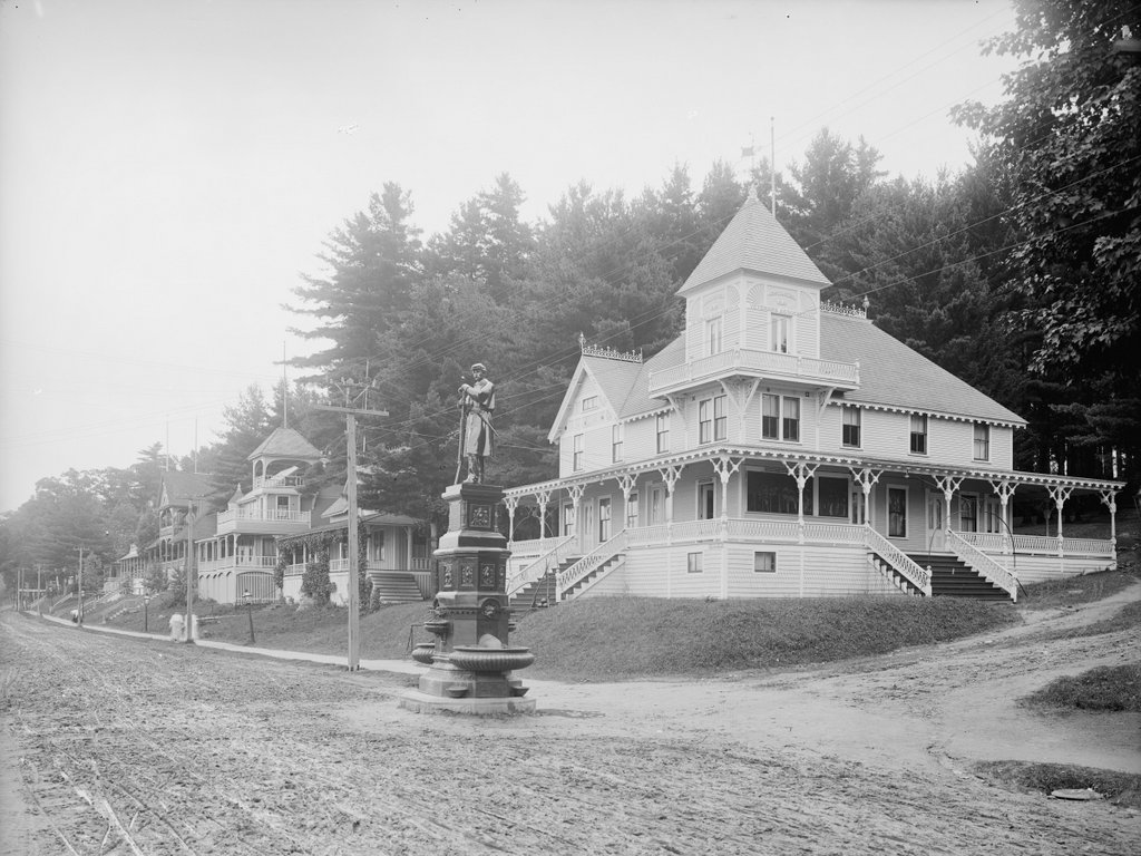
The Veterans’ Association buildings along Lakeside Avenue in Weirs Beach, around 1900-1906. Image courtesy of the Library of Congress, Detroit Publishing Company Collection.

584_1900-1906 loc

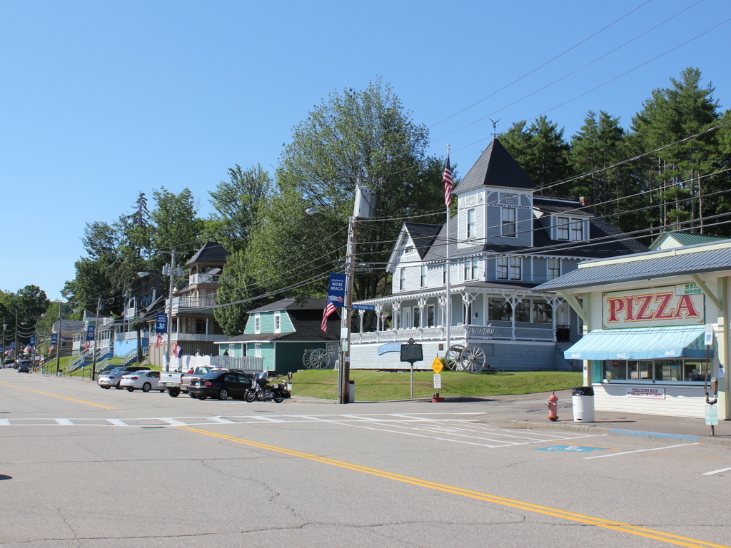
Lakeside Avenue in 2015:

584_2015
As mentioned in the previous post, Weirs Beach became the annual meeting place for New Hampshire’s Civil War veterans, who established the New Hampshire Veterans’ Association.  Beginning in the 1870s, the organization held its annual reunions here, and over time the different regiments built their own buildings for their members to stay in.  Many of these buildings fronted present-day Lakeside Avenue, as seen in the first photo.  Starting in the foreground is the Headquarters, located at the corner of New Hampshire Avenue, followed by the 3rd Regiment, 7th Regiment, 9th & 11th Regiments, and the Cavalry Headquarters.

All of these buildings were built between 1885 and 1888, and all survive except for the 3rd Regiment Building, which was lost in the same 1924 fire that destroyed the New Hotel Weirs.  The only other significant loss from the first photo is the statue, which was dedicated in 1894 and destroyed by lightning in 1931.  Today, the property is still owned by the New Hampshire Veterans’ Association, and although many other buildings on the site have since been destroyed or demolished, the view along Lakeside Avenue still looks a lot like how it did over a century ago.

Veterans’ Association, Weirs Beach, NH (1)

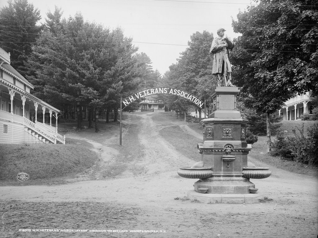
The Civil War Monument and the entrance to the New Hampshire Veterans’ Association grounds on Lakeside Avenue in Weirs Beach, around 1906. Image courtesy of the Library of Congress, Detroit Publishing Company Collection.

583_1906c loc

The scene in 2015:

583_2015
Located on the shores of Lake Winnipesaukee, the village of Weirs Beach in Laconia became a popular destination in the late 1800s.  Among the many people who traveled north in the summer were the Civil War veterans of the New Hampshire Veterans’ Association, whose reunions were held here.  Over the years, a number of buildings were added to the property, including the Lowell Building, seen in the center of both photos at the top of New Hampshire Avenue.  The sign over the road was added three years later, and in 1885 the Headquarters Building was built to the left, at the corner of Lakeside Avenue and New Hampshire Avenue.  The New Hotel Weirs can be seen on the far right, and the most recent addition to the 1906 scene was the statue, which was dedicated in 1894 in honor of Laommi Bean, a Weirs Beach farmer who was killed in the Civil War.  Today, the sign is long gone, and the statue was struck by lightning and destroyed in 1931. However, the property is still owned by the New Hampshire Veterans’ Association, and many of the historic buildings, including the Headquarters Building and the Lowell Building, have been restored.

Civil War Monument, South Hadley, Mass

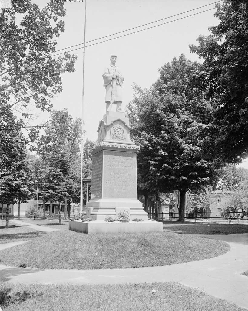
The Civil War monument on the town common in South Hadley, around 1900-1910. Image courtesy of the Library of Congress, Detroit Publishing Company Collection.

566_1900-1910 loc

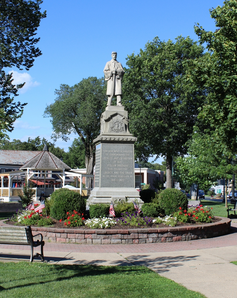
The monument in 2023:

There are several things that almost every New England town center has: some sort of a town common, and a Civil War monument on that common. South Hadley is no exception, with its granite statue honoring “the loyalty and patriotism of our citizen soldiers who fought for liberty and the Union in the great rebellion of 1861-1865,” as the inscription on the front reads.  South Hadley had 224 of its citizens fighting in the war, many of whom were probably still living here when the monument was dedicated in 1896.

First Church, Monson Mass

The First Church of Monson, around 1892. Image from Picturesque Hampden (1892).

557_1892c picturesquehampden

The church in 2015:

557_2015
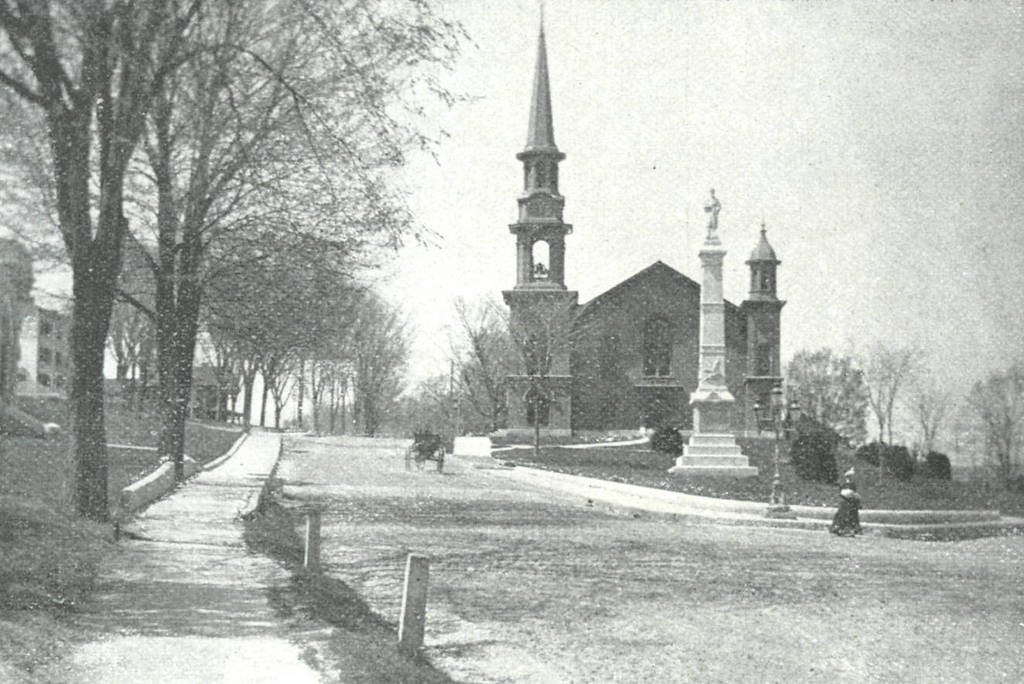
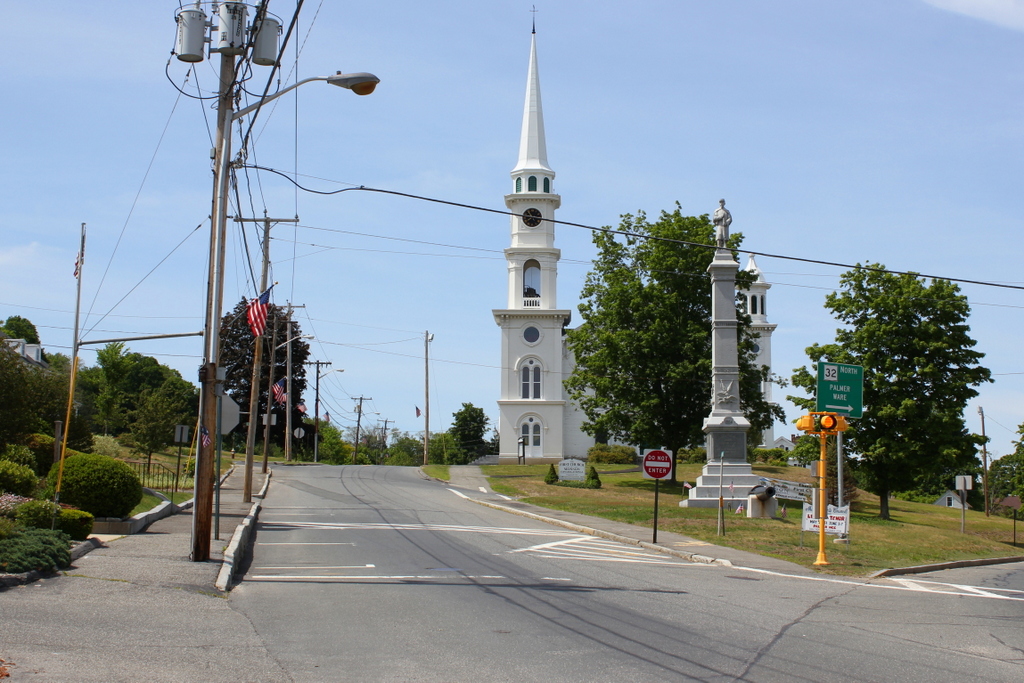
The First Church of Monson was established in 1762, two years after the town separated from Brimfield.  The first meeting house was built on this hill overlooking the center of town, and was used until a more substantial building was completed in 1803.  This building was used until 1871, when it was sold and moved down the hill and across Main Street.  Known as Green’s Hall, it was used for commercial space and social gatherings until it burned in 1895.  It can be seen in the c.1892 photo in this post.

The present-day church was built in 1873, and has withstood several major disasters over the years.  In August 1955, the town sustained heavy damage from flooding, including a massive rockslide from Ely Road, which covered this entire area in front of the church in boulders.  A photograph of the scene, taken from around this spot, was published in newspapers across the country.  Just a little over 50 years later, photographs of the church again made national news when the June 1, 2011 tornado destroyed the steeple.  The original steeple seen in the 1892 photo had been partially destroyed in the 1938 hurricane, and the sections above the belfry were replaced with a similar, but not identical steeple.  The entire thing, however, was destroyed in 2011, and a new one was built virtually identical to the 1939 reconstruction.

The other major feature in both photos is the Soldiers’ Monument, which was dedicated on July 4, 1884 in honor of those who served in the Civil War.  It was designed by R.F. Carter and was given to the town by industrialist Cyrus W. Holmes.  It is made of granite that was quarried in Monson by Flynt Granite Company, and is 46.5 feet tall; the soldier on the top alone is literally larger than life at 7.5 feet tall.