Market Street from Talcott Street, Hartford, Connecticut

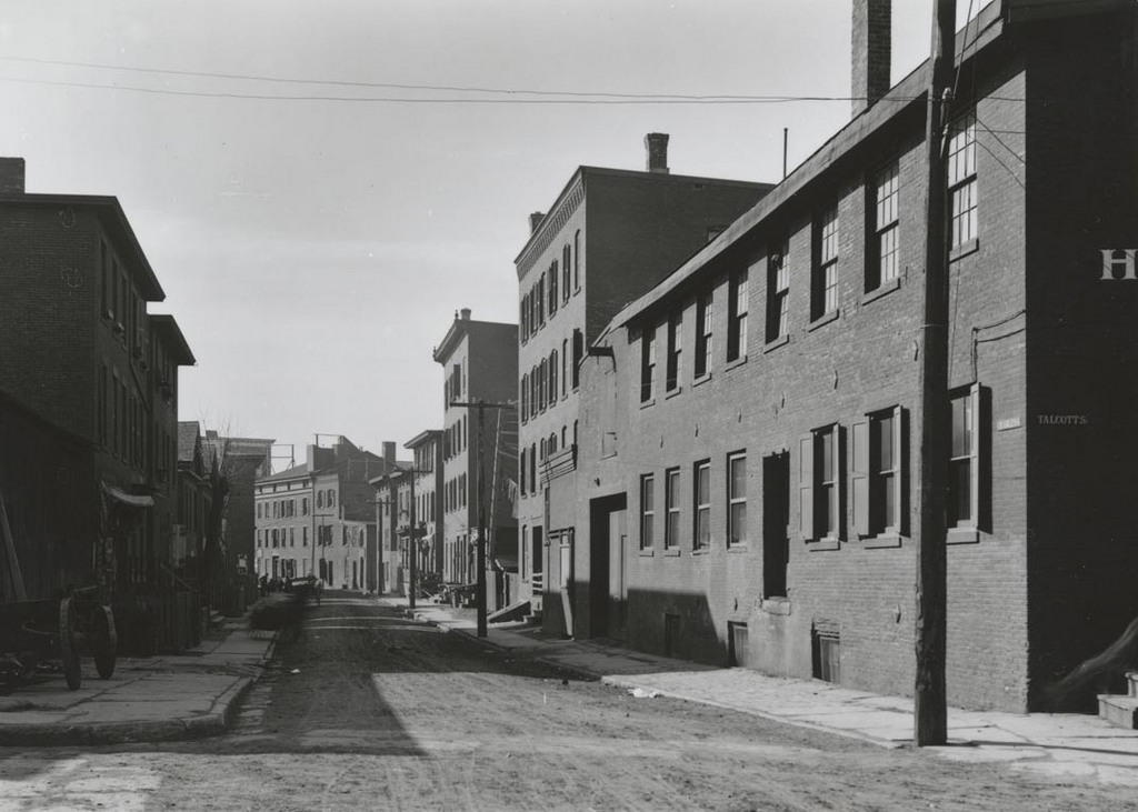
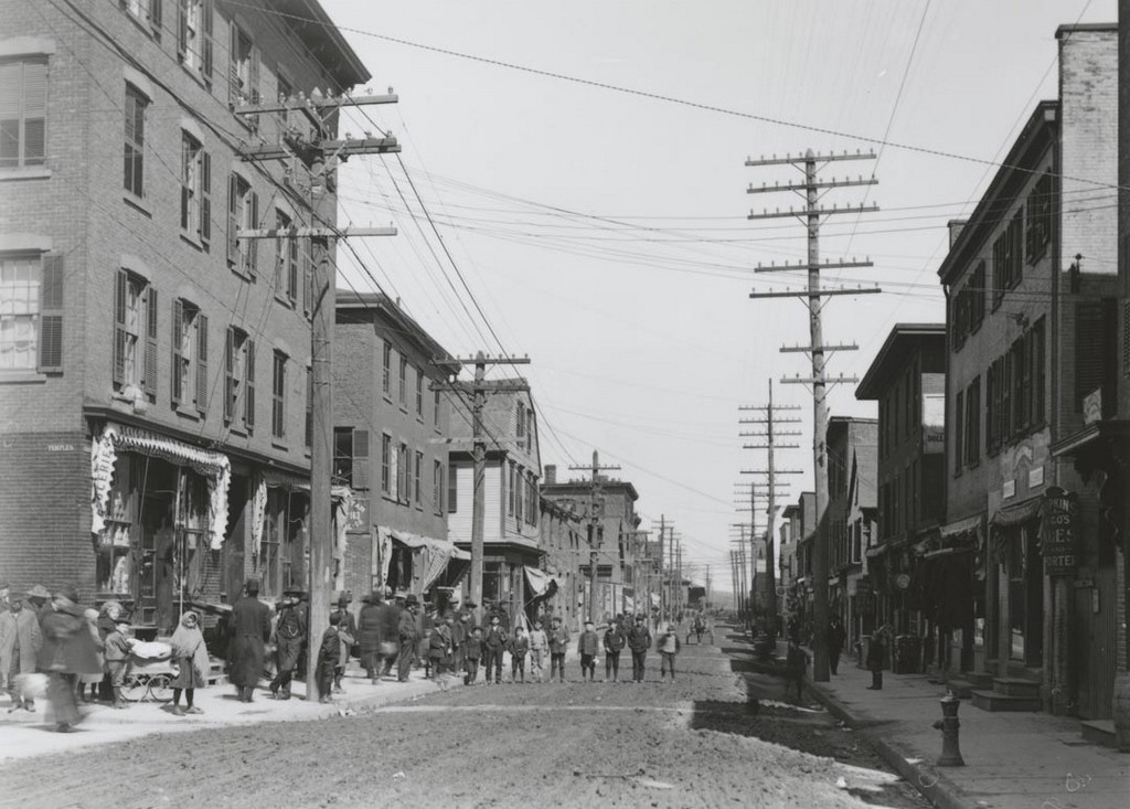
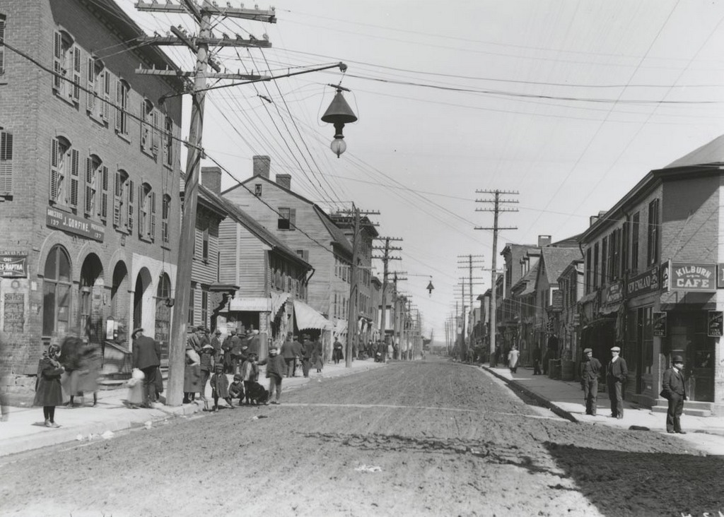
Looking south on Market Street from the corner of Talcott Street, on September 19, 1904. Image courtesy of the Connecticut State Library.

Market St. south of Talcott St.

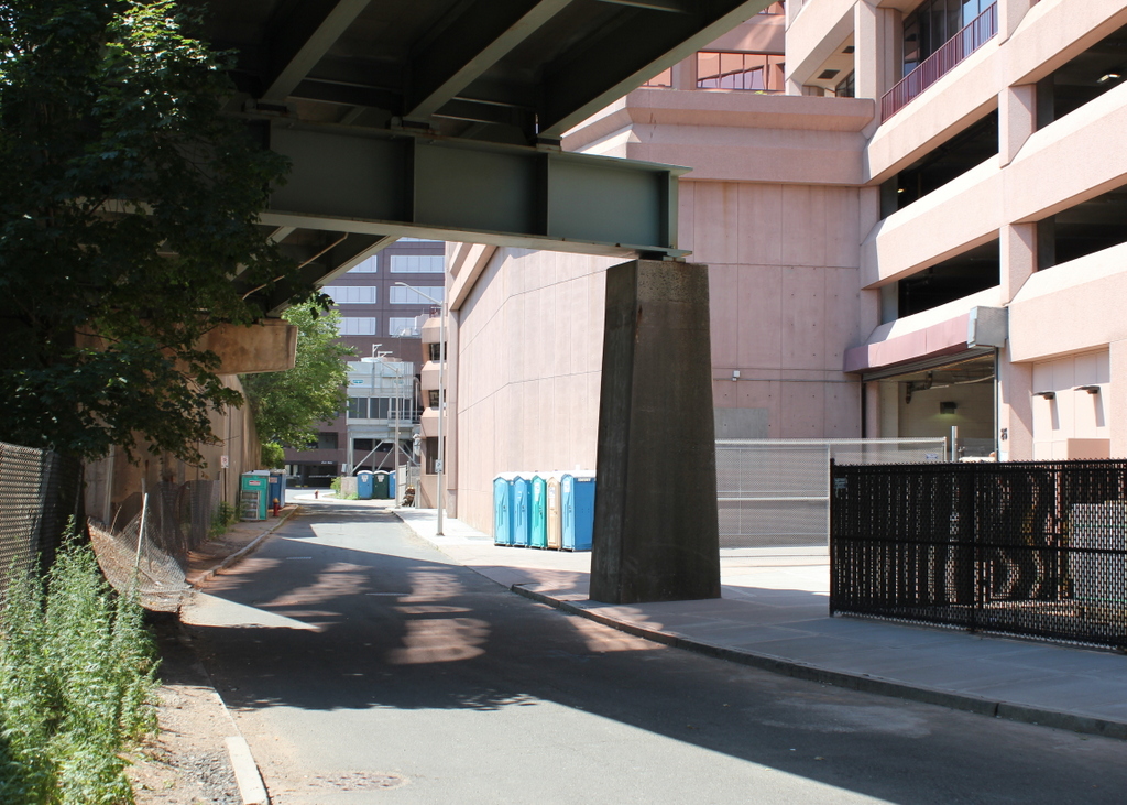
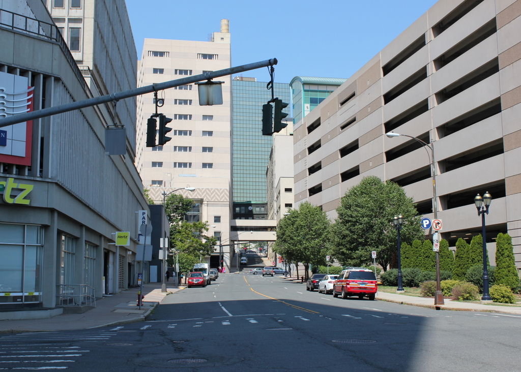
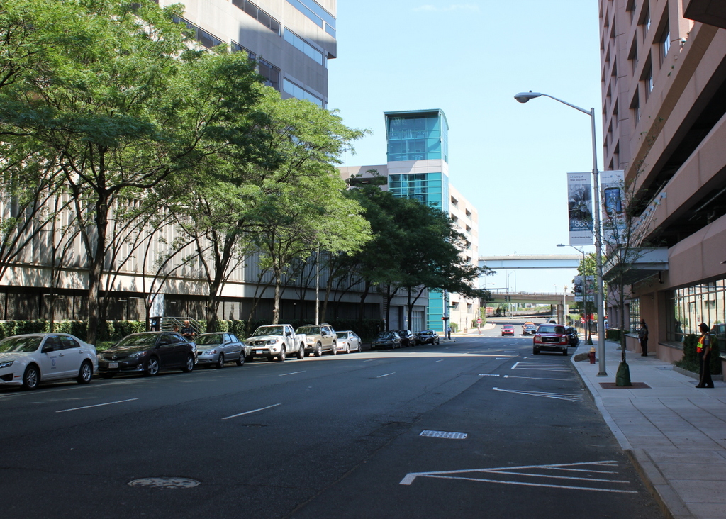
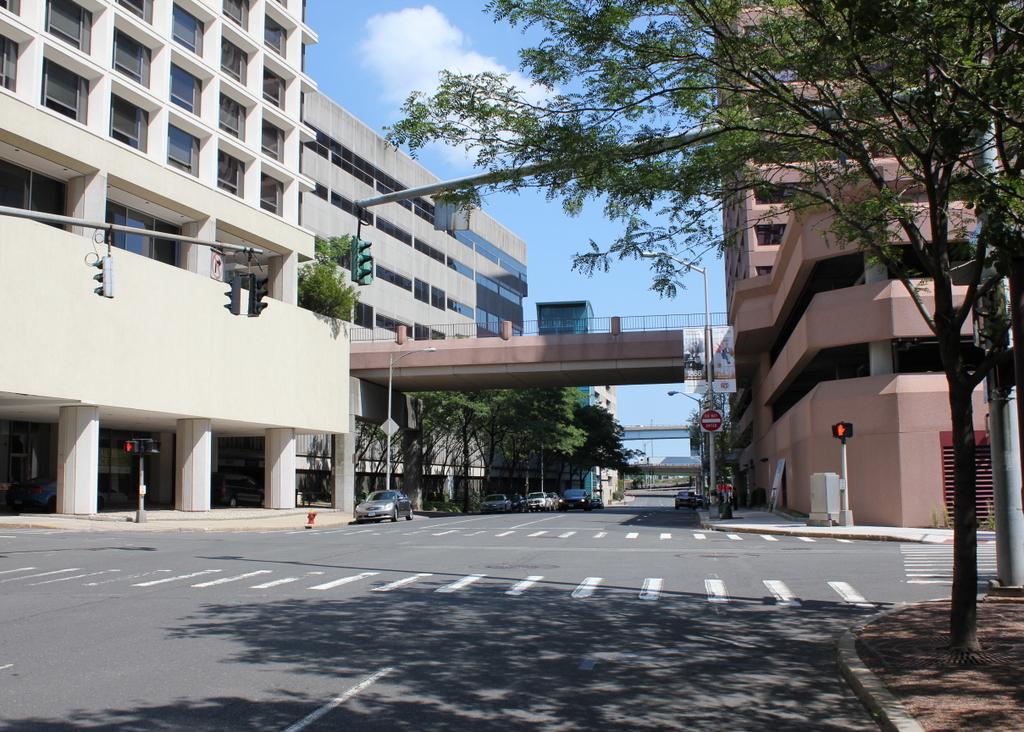
Market Street in 2016:

990_2016
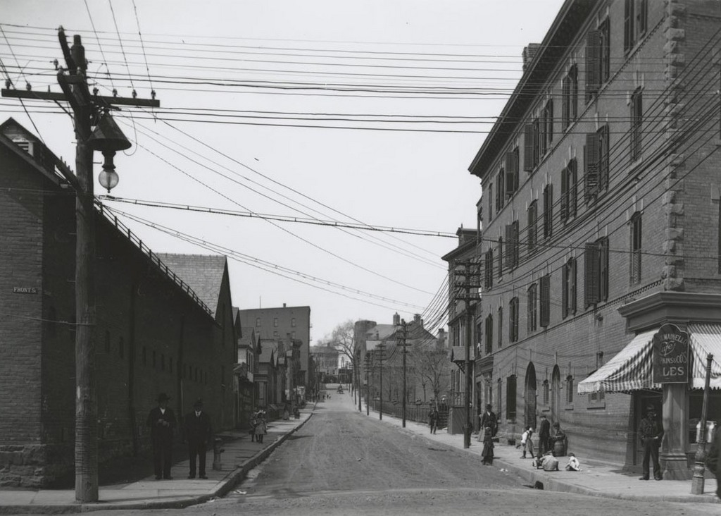
In these early 20th century views of the east side of Hartford, a common theme is that none of the historic buildings are still standing today. Anything that was left standing by the early 1960s was demolished to build Constitution Plaza, but in this scene there was one exception. St. Anthony’s Church, located on the right side of the street, is only partially visible in the first photo, but today it is the last surviving 19th century building in what had once been a large immigrant neighborhood.

Built in 1855, the church was originally St. Paul’s Episcopal Church, but by the time the first photo was taken it was St. Anthony’s, a Catholic church that served the area’s large Italian-American population. The building no longer serves as a church, but it still stands out amid modern office buildings as a reminder of the residential neighborhood that was once located here.

Charles Street, Hartford, Connecticut (2)

Looking south on Charles Street from Talcott Street in Hartford, on March 4, 1906. Image courtesy of the Connecticut State Library.

Charles St. south of Talcott

Charles Street in 2016:

986_2016
This view shows the same block as an earlier post, just from the opposite direction, facing south toward Kilbourn Street. As with the other photo, most of the 19th century buildings here appear to be either industrial buildings or tenement homes, which would have housed this neighborhood’s large population of Italian immigrants. Behind the camera, Charles Street once continued north to Morgan Street, but that section of the road has since been completely destroyed to build Interstate 91, leaving just this southern one-block stretch of Charles Street, sandwiched between the highway to the left, an office building to the right, and an exit ramp for Interstate 91 directly above it.

Talcott Street, Hartford, Connecticut

Looking west on Talcott Street from Front Street (now Columbus Boulevard) in Hartford, around 1903-1906. Image courtesy of the Connecticut State Library.

Street scene

Talcott Street in 2016:

985_2016
As mentioned in previous posts, this neighborhood along Front Street in the eastern part of Hartford was once home to a large Italian community. When the first photo was taken, the building on the right was owned by Felix Mainello, an Italian immigrant who operated a saloon at the corner. His wife Mary was also an immigrant, from Ireland, and they lived in the back part of the building along Talcott Street. They also rented out apartments in the building, with the 1910 census showing 9 other households with a total of 42 people, nearly all of whom were born in Italy. A good number of them only spoke Italian, and many had vague occupations like “Laborer” working “odd jobs.”

As with the rest of the neighborhood, this entire scene was demolished between 1958 and 1962 to build Constitution Plaza. Today, there is nothing left from the original photo in the two blocks between here and Main Street in the distance. The site of Mainello’s saloon is now a parking garage, and in the distance modern high-rise buildings line Main Street, with several pedestrian walkways over Talcott Street as well.

Columbus Boulevard, Hartford, Connecticut (2)

Looking north on Front Street (now Columbus Boulevard) from the corner of Temple Street, on April 1, 1906. Image courtesy of the Connecticut State Library.

Front St. north of Temple

Columbus Boulevard in 2016:

984_2016
Taken just a little further north from an earlier post, there is a lot going on in the first photo. The photo was taken on a Sunday, and the shadows indicate that it was sometime in the morning, so the street is busy, perhaps with people heading to or from church. This neighborhood had a large immigrant population, especially Italians, and many of the boys posing for the photographer in the distance were probably first generation Americans. The buildings in this scene are a mix of architectural styles, with most probably dating back to the mid-19th century, and there are a number of shops in the first floor storefronts, including a grocery store on the far left at the corner of Temple Street, and what appears to be a bar on the far right.

It was once Hartford’s “Little Italy,” but the largely poor neighborhood was hit hard by floods in 1936 and 1938, and over the next couple of decades it continued to decay. Because of its close proximity to downtown, it was eyed for redevelopment, so from 1958 to 1962 the entire neighborhood was demolished to build Constitution Plaza. The project added high-rise buildings to the area, but over the years it has also received widespread criticism for displacing its residents and isolating the plaza from the rest of the city, creating nearly empty streetscapes like the 2016 photo here.

Charles Street, Hartford, Connecticut

Looking north on Charles Street from Kilbourn Street, on March 4, 1906. Image courtesy of the Connecticut State Library.

Charles St. north of Kilbourn

Charles Street in 2016:

983_2016
The first photo here shows Charles Street as a narrow alley, with what appear to be tenement homes lining both sides of the street. A 1917 city atlas shows that nearly all of the buildings along this street had owners with Italian surnames, so this street was probably home to a number of immigrants. I don’t know if the people in the photo are posing for the camera or eyeing the photographer suspiciously, but they add an interesting human element to the photo, with the well-dressed men smoking pipes on the right side, and the assortment of men and boys on the left side. There are also a few people visible in the distance near the center of the photo, leaning over the railing of a second-floor porch to see the photographer.

The entire neighborhood, including all of Charles Street, was demolished by the early 1960s. To the left is an office building, which is part of Constitution Plaza, and to the right on the embankment just beyond the trees is Interstate 91. Charles Street is still a back alley, although instead of housing poor immigrants it is now a service road running behind the office building on the left.

Columbus Boulevard, Hartford, Connecticut

Looking north on Front Street (now Columbus Boulevard) from near Kilbourn Street, on April 1, 1906. Image courtesy of the Connecticut State Library.

Front St. north of Kilbourn

Columbus Boulevard in 2016:

982_2016
The first photo shows Front Street just a little further north from the one in this earlier post, which was taken a week later. The view here shows a neighborhood with a wide variety of architecture, from relatively modern four-story commercial blocks to wood-frame houses that probably dated back the the 1700s. The gambrel roofed building just to the left of center was probably one of the oldest, and was likely used as a tenement house by the time the 1906 photo was taken. Several businesses are also identifiable in the first photo, including a grocery store on the left and the Kilburn Cafe on the right, with “cafe” being a euphemism for a bar.

Many of these buildings were likely gone by the 1950s, but any that were left standing were demolished by the early 1960s to build Constitution Plaza, replacing the neighborhood with the hotels, office buildings, and parking garages in the 2016 photo. Part of the design was to build the plaza above street level, and connect the different buildings with pedestrian walkways like the one seen here. The result was a complex that was largely isolated from the city streets, and even though the second photo was taken in the middle of the day on a weekday, the street is completely devoid of any pedestrians, unlike the much more vibrant appearance of the first photo.