Province Court, Boston (2)

Facing Province Street from Province Court in Boston, in July 1901. Image courtesy of the Boston Public Library.

831_1901-07 bpl

The scene in 2015:

831_2015
These photos were taken facing the opposite direction from the ones in the previous post, and they give a glimpse into how Boston once looked along the old alleys and side streets of downtown Boston. Tucked away from the main commercial centers in the city, this area was home to less glamorous but nonetheless important businesses like plumbers, painters, roofers, carpenters, sign makers, chimney sweepers, tailors, and hat cleaners, as the signs here show.

None of these buildings are still standing today. The one on the right was demolished around 1922, when the present Province Building was built there. In the center, the wooden building along Province Street was demolished by 1908, and today most of the west side of the street is occupied by 45 Providence Street, a 30-story condominium building in the center of the 2015 photo.

Province Court, Boston (1)

Looking down Province Court from Province Street in Boston, in July 1901. Image courtesy of the Boston Public Library.

830_1901-07 bpl

Province Court in 2015:

830_2015
Province Court was once part of a maze of alleys in the block between Washington Street, School Street, Province Street, and Bromfield Street. Most of these are now gone, but Province Court is still here, functioning mainly as a service entrance for the surrounding buildings. When the first photo was taken, though, this area was much busier. In contrast to the busy shopping district on nearby Washington Street, Province Court was more of a blue collar area, with signs advertising a number of tradesmen, including plumbers, painters, carpenters, and tailors.

Both Province Court and Province Street were named for the Province House, a colonial mansion that was built here in 1679. For most of the 18th century, it served as the home of the colonial governors of Massachusetts, which is why early maps show Province Street as being named Governors Alley. The house burned in 1864 and was mostly demolished, although one of the walls was left standing and was incorporated into the buildings on the left side of the 1901 photo. Most of these buildings, including the remaining section of the Province House, were demolished in 1922 to build the Province Building,which is still standing today to the left and the center of the 2015 scene.

Mount Vernon Place, Boston

Mount Vernon Place, seen from Joy Street in Boston around 1860. Image taken by Josiah Johnson Hawes, courtesy of the Boston Public Library.

829_1860 bpl

Mount Vernon Place in 2105:

829_2015
Mount Vernon Place is a short street in Boston’s Beacon Hill neighborhood, located just west of the Massachusetts State House. It was once a full block long, and was developed in the 1830s on land that had once been owned by John Hancock and his family. As the 1860 photo shows, the street had a small park on the left side and eight townhouses on the right, and at the end of the street was the State House. The five houses closest to the State House were demolished in the 1910s when the building was expanded, and today only the three in the foreground survive. These three were built around 1833-1834, and have been largely unaltered on the exterior since then. They are among the many historic early 19th century townhouses that have become a defining feature of Beacon Hill, and they form a part of the Beacon Hill Historic District on the National Register of Historic Places.

Beacon Hill Reservoir, Boston

The reservoir atop Beacon Hill in Boston, around 1860. Image taken by Josiah Johnson Hawes, courtesy of the Boston Public Library.

828_1860 bpl

The scene in 2015:

828_2015
Long before the Wachusett and Quabbin Reservoirs, Boston’s municipal water supply was Lake Cochituate, a reservoir in Natick, Framingham, and Wayland. The project began in 1845, and it included not only creating the artificial lake, but also building a 14-mile long aqueduct that fed this stone reservoir atop Beacon Hill, just behind the Massachusetts State House. From here, the water was distributed throughout the city, using the hill’s elevation to carry the water downhill through the pipes. It occupied the majority of the block between Hancock, Derne, Temple, and Mt. Vernon Streets, and it had a capacity of over 2.6 million gallons.

The structure’s cornerstone laying ceremony in 1847 included a time capsule, which contained several publications and two silver plates, perhaps in the hope that, like the great Roman aqueducts in Europe, this public water supply structure would last for thousands of years. However, as it turned out, it lasted for less than 40. It closed by about 1880, and around three years later it was demolished to build a large expansion of the Massachusetts State House, which now occupies the site where this reservoir once stood.

First Harrison Gray Otis House, Boston

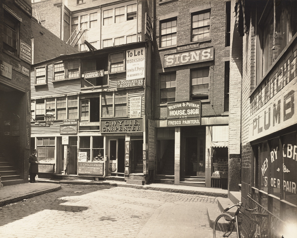
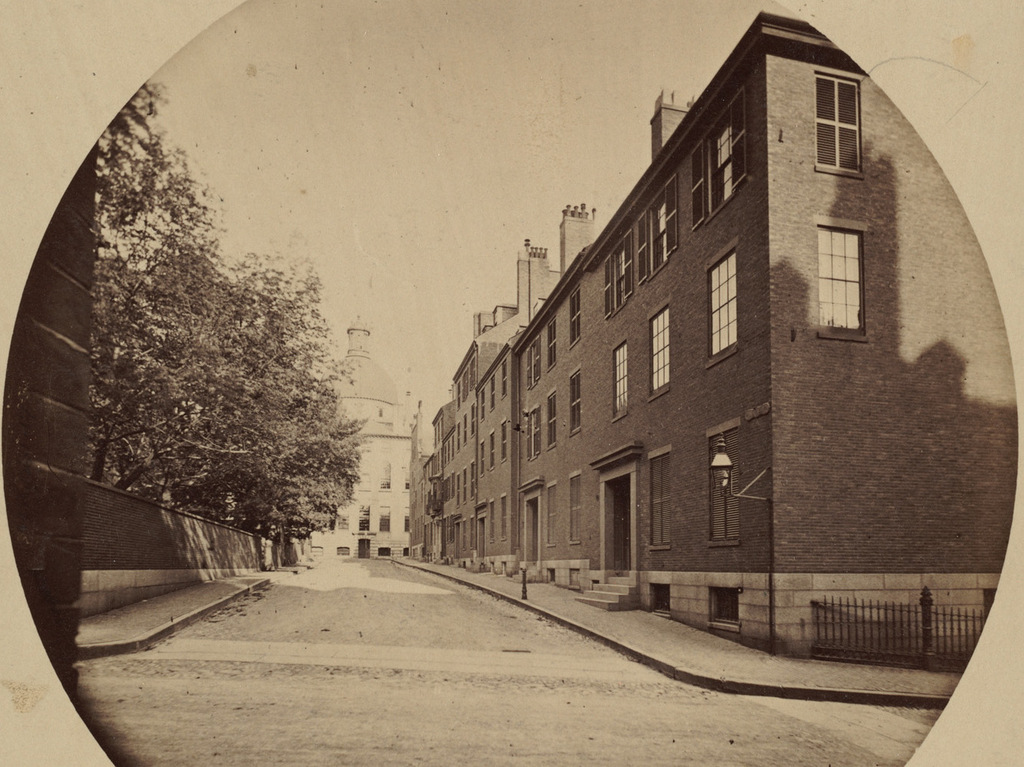
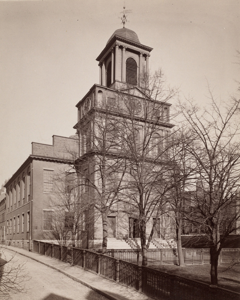
The First Harrison Gray Otis House, on Cambridge Street in Boston, on October 23, 1911. Image courtesy of the City of Boston Archives.
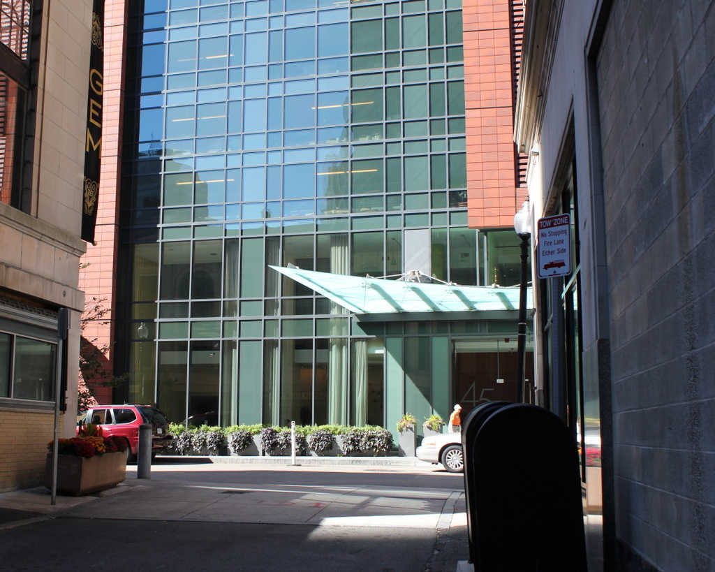
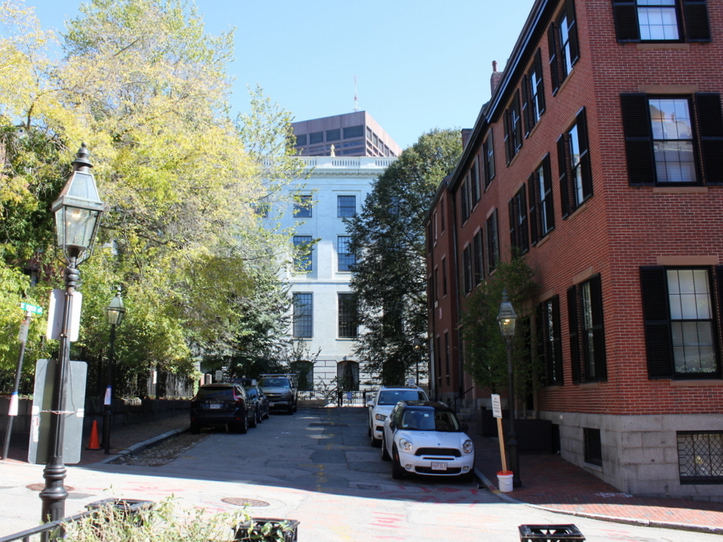
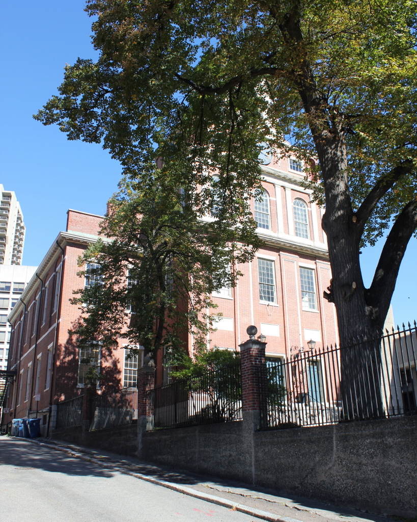
827_1911-10-23 coba

The house in 2015:

827_2015
At the end of the 1700s, Cambridge Street was lined with the homes of wealthy Bostonians, including lawyer and politician Harrison Gray Otis. His house was designed by Charles Bulfinch and completed in 1796 while Otis was serving as the U.S. Attorney for Massachusetts. Later that year, he was elected to Congress, where he served two terms in the House of Representatives.

The house is an excellent example of Federal architecture, designed by one of the most prominent American architects of the era, but Otis only lived here for less than five years. In 1800, Bulfinch designed a second home for him, on Mount Vernon Street on Beacon Hill, but again he only lived there for a few years before moving into his third and final Bulfinch-designed home in 1806, on Beacon Street across from Boston Common. Likewise, Otis changed jobs almost as frequently as he changed houses. After two terms in the House of Representatives, he served in the Massachusetts state legislature from 1802 to 1817, including as the state Senate President for several of those years. From 1817 to 1822, he served in the U.S. Senate, and then from 1829 to 1832 he finished his political career as the mayor of Boston.

All three of his houses are still standing today, but the first one here on Cambridge Street has seen a number of changes, as the two photographs show. During the 19th century it became a boarding house, and a one-story addition was built for storefronts. Other more minor alterations included the removal of the original Palladian window and the lunette window above it, and the addition of dormers on the roof, a storm porch at the front door, and a bay window on the second floor.

A few years after the first photo was taken, the house was purchased by the Society for the Preservation of New England Antiquities, which is now called Historic New England. They restored it and undid many of the 19th century alterations, and in 1924 the house was moved back 40 feet to its current location to allow for Cambridge Street to be widened. Since then, it has been restored further, and aside from serving as Historic New England’s headquarters, it is also open to the public as one of their many historic house museums. It is next to another historic landmark, the Old West Church, which was built just a few years after the house and can be seen on the right side of both photos.

Old West Church, Boston

The Old West Church on Cambridge Street in Boston, probably in the late 1800s or early 1900s. Image courtesy of the Boston Public Library.

826_1800sc bpl

The church in 2015:

826_2015
Old West Church was established in 1737, as one of Boston’s many Congregational churches. This particular building was built in 1806, and was designed by prominent early American architect Asher Benjamin. It is architecturally very similar to one of Benjamin’s earlier Boston churches, the Charles Street Meeting House, which is still standing on the opposite side of Beacon Hill from here. The church closed in 1892, but the historic building was saved from demolition and put to a new use as a branch library for the Boston Public Library. It was one of the few buildings to survive the urban renewal project of the 1950s that destroyed most of the West End, and after the library closed in 1960 it was purchased by the United Methodist Church. The interior was restored to its original appearance and reopened in 1964, and today it remains in use as a Methodist church.