Venezian Monumental Works, Springfield Mass

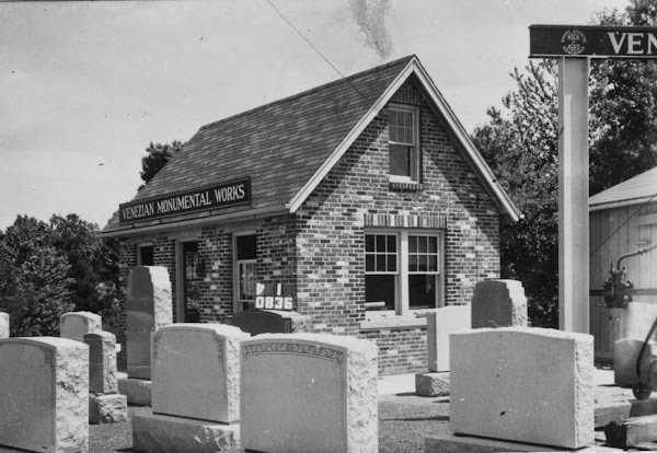
The Venezian Monumental Works building on State Street in Springfield, around 1938-1939. Photo courtesy of the Springfield Preservation Trust.

485_1938-1939 spt

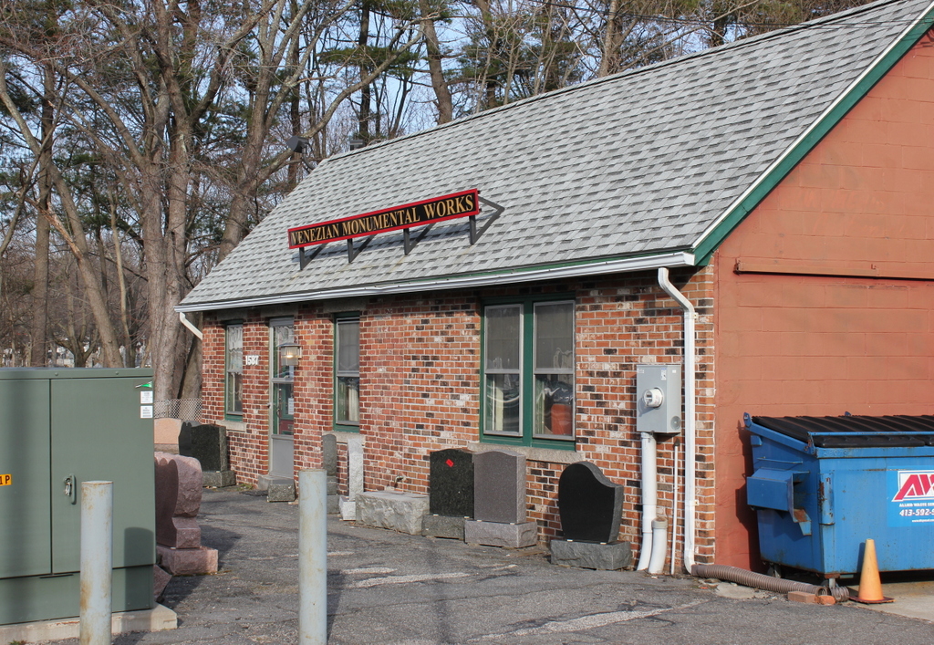
The building in 2015:

485_2015

This building is located right next to the architecturally similar building at 1579 State Street, which was probably photographed on the same day as this one.  However, while the former Frank’s Service building has long been shuttered, the Venezian Monumental Works is still in business.  The company is actually substantially older than even the first photo; it was established in 1882, when the Pine Point neighborhood was on the remote outskirts of the city.  Since then, the neighborhood has grown, which has presumably increased demand for headstones, and it also doesn’t hurt that they are located right next to St. Michael’s Cemetery.  Today, the building has doubled in size, but the original section is still visible on the left side.

Frank’s Service, Springfield Mass

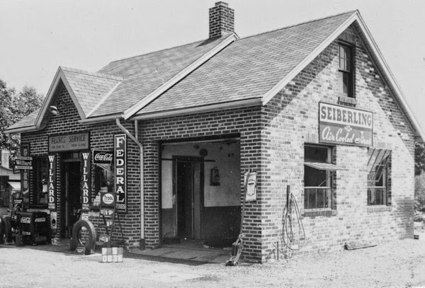
An automobile service station on State Street in Springfield, around 1938-1939. Photo courtesy of the Springfield Preservation Trust.

484_1938-1939 spt

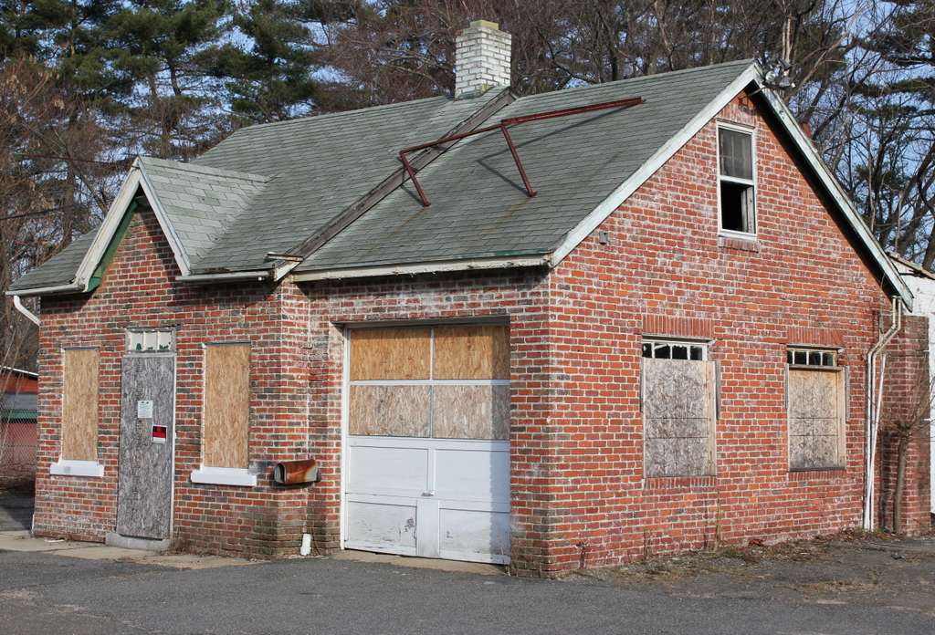
The building in 2015:

484_2015

This building is located in Springfield’s Pine Point neighborhood, a suburban section of the city that rapidly grew in population in the early 1900s.  At first, this growth was facilitated by the trolley line that ran through here, but later on it was automobiles that made this a practical place to live and commute from.  The establishment in the first photo, which appears to be called Frank’s Service, based on the sign above the door, would have been one of the many automobile-related businesses that opened to meet the demand.  I found this one particularly interesting, though, because my grandmother grew up in this neighborhood, and this place was about halfway between her house and where she worked in the late 1930s, at MassMutual.  She would’ve driven past here every day, and perhaps even stopped in to buy a Coca Cola.  According to the city assessor’s records, it was built in 1935, and although I don’t know what the building has been used for since the 1930s, it has clearly been vacant for a while.  The property has been owned by the City of Springfield since 2003, probably for nonpayment of taxes, so it had likely been abandoned long before that.

State & Myrtle Streets, Springfield, Mass

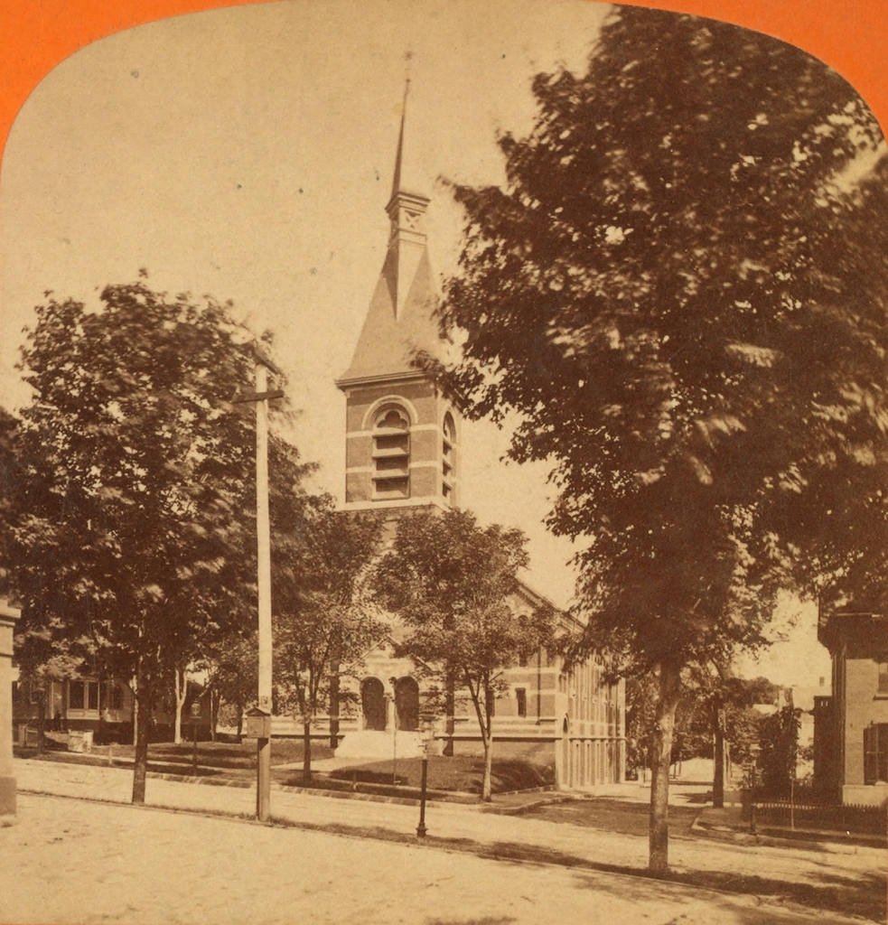
The State Street Methodist Episcopal Church at the corner of State and Myrtle Streets, around 1873-1885. Image courtesy of the New York Public Library.

483_1865-1885c nypl

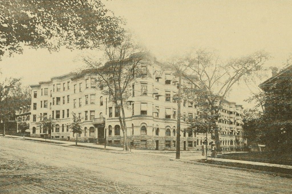
The same location, around 1905. Photo from Springfield Present and Prospective (1905).

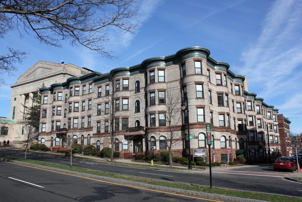
The scene in 2019:

The first photo shows the State Street Methodist Episcopal Church, which was situated opposite the main entrance to the Armory, and likely served many of the workers there.  The church wasn’t here for too long, however, because in 1899 they merged with another congregation, and this property was sold.  The apartment building seen in the last two photos, identified in Springfield Present and Prospective as the Oxford Apartment House, was built on the site and was completed in 1901.  Given its location, it was probably home to many Armory workers, and today the exterior hasn’t really changed at all.  The only major difference between the last two photos is the massive Masonic Temple, which was built in 1923 and can be seen behind the apartment building.


Springfield Armory Entrance, Springfield Mass

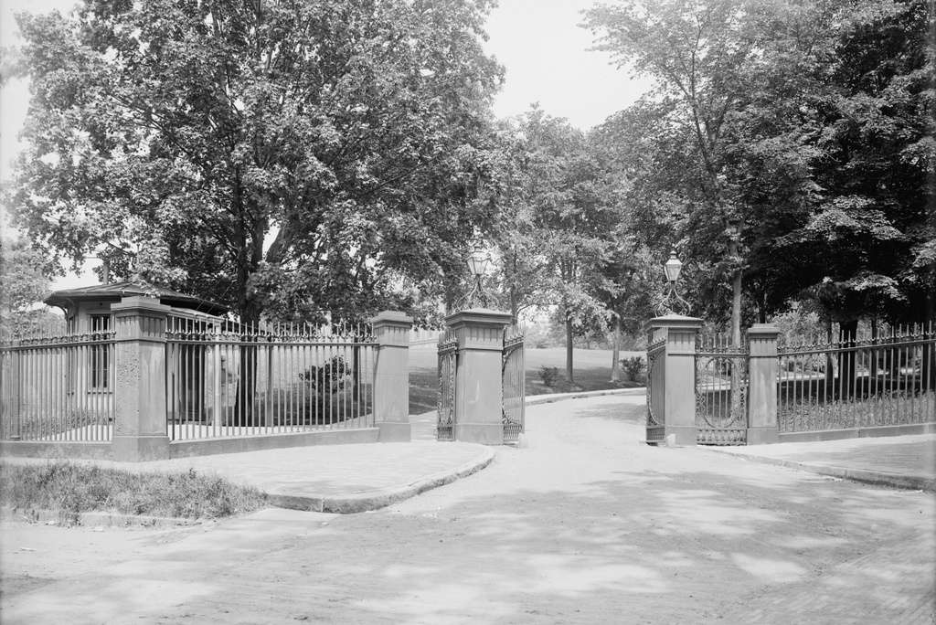
The entrance to the Springfield Armory at the corner of State Street and Byers Street, around 1907. Photo courtesy of the Library of Congress, Detroit Publishing Company Collection.

482_1907c loc.tif

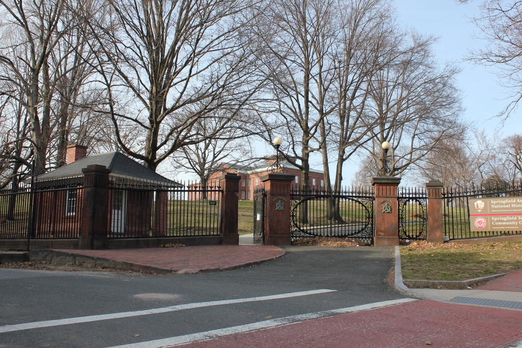
The entrance in 2015:

482_2015

This gate at the southwestern corner of the Armory grounds was opened in the 1870s, when the grade of State Street was lowered and the previous main entrance became unusable.  This became the main entrance for many years, but the advent of automobiles and trucks made the narrow gate and fairly steep grade impractical.  So, around 10 years after the first photo was taken, a new main entrance was opened on Federal Street; this continues to function as the main entrance for Springfield Technical Community College, which now uses the Armory grounds.  In the distance of both photos is the Arsenal, which was completed in 1851 and is discussed further in this post.

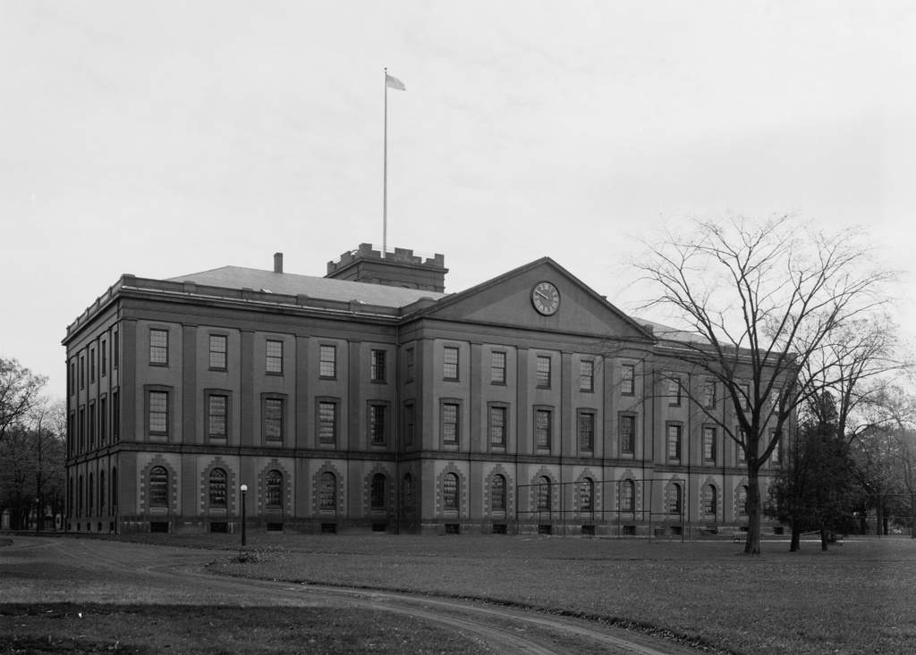
Main Arsenal, Springfield Mass

The Main Arsenal at the Springfield Armory, seen around 1910-1920. Photo courtesy of the Library of Congress, Detroit Publishing Company Collection.

481_1910-1920 loc

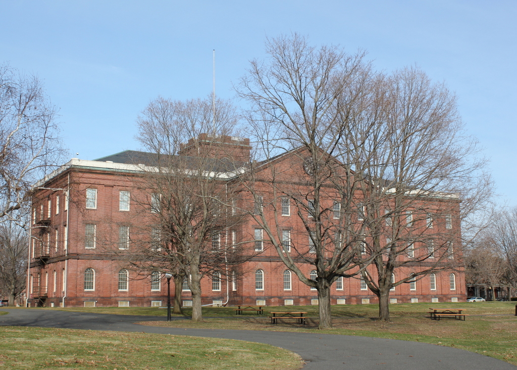
The Arsenal in 2015:

481_2015

Springfield had long been a center of production for US military firearms, beginning in 1777, during the American Revolution.  The need arose for a suitable location to manufacture and store arms and ammunition, and several sites in New England were considered, including Brookfield Mass. and Hartford.  However, in the end General Henry Knox recommended Springfield, and George Washington agreed.  Perhaps Knox had recalled passing through Springfield in early 1776 while bringing cannon from Ticonderoga to Boston, but either way he determined that it was the best location.

The location of Springfield was particularly valuable, as it was along several major roads, leading to Boston, Albany, Hartford, and other points south.  The Connecticut River and several major tributaries were also an advantage, although unlike at Hartford the river was not navigable by ocean-going vessels at this point.  This had been one of the strongest arguments in favor of Hartford, but it was also one of the main weaknesses of the Hartford plan – British ships could easily sail up the river and attack.  Springfield’s location, some 20 miles north of the head of navigation, meant that the town was secure from British naval attacks.  Another important feature in Springfield is the hill that the Armory is located on.  Situated on a broad plateau above the downtown area, the Armory is only three quarters of a mile from the river, but is about 150 feet higher in elevation.  In the unlikely event that Springfield was attacked, this would have been an easy position to defend.

However, while the Armory itself dates back to the 1700s, most of the buildings on the site date to the mid 1800s, including the main arsenal seen in these photos.  This building was built between 1847 and 1851, and it served as a storehouse for the weapons produced at the Armory.  It was built during the Mexican-American War, and it played a vital role in the Civil War just a decade later.  Springfield had been one of two federal arsenals prior to the war, with the other being at Harpers Ferry, Virginia.  Since this facility was lost early in the war, Springfield became the primary manufacturing center for Union firearms.  It continued in this role throughout World War I, World War II, and even into the Vietnam War before its closure in 1968.  Today, the Armory is National Historic Site, and is also home to Springfield Technical Community College.  The arsenal today hasn’t changed much since its completion in 1851, although today it serves as a museum run by the National Park Service.

Trolley Barn, Springfield Mass

The Springfield Street Railway trolley barn at the corner of Main and Carew Streets, around 1905. Photo from Springfield Present and Prospective (1905).
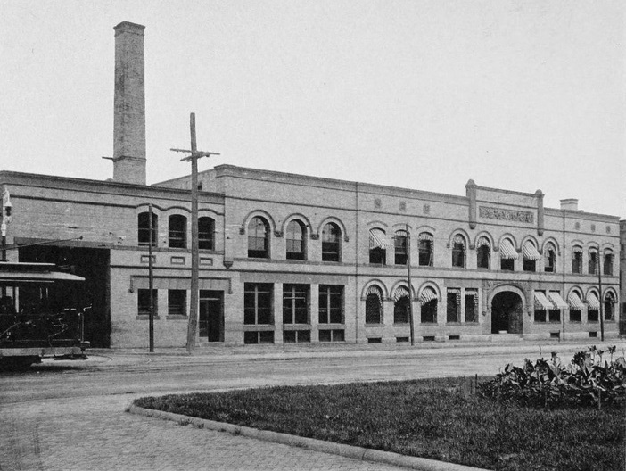
The building in 2023:
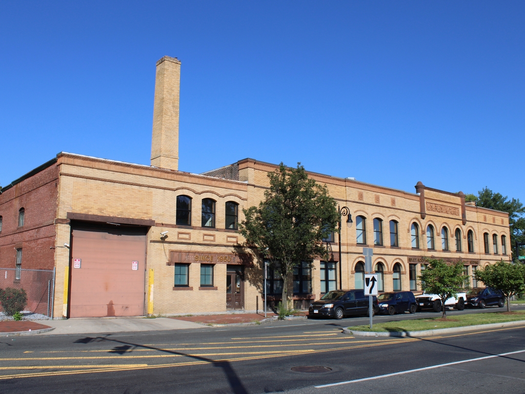
The late 19th century saw a dramatic growth in suburbs, and this was fueled in part by the development of inexpensive forms of mass transit such as street railways.  Although most commonly associated with electrified trolleys, these originally started as horse-drawn cars on rails.  This was the case in Springfield, where the Springfield Street Railway opened in 1870.  The original line was a single track that ran about 2.5 miles from Hooker Street in the North End, where the stables were located (not coincidentally, this is now the site of the PVTA headquarters), south along Main Street to State Street, and then along State Street to Oak Street, just past the Armory.  The line was served by four cars and 24 horses, and rides were eight cents each or 16 for a dollar.

It must have been popular, because within four years the network was expanded east on State Street to Winchester Square, and south on Main Street to the Mill River.  More lines were later opened, along Maple and Central Streets to the Watershops, and other lines to Indian Orchard, Brightwood, and along Worthington Street.  Meanwhile, fares continued to drop, first to six cents and then to five.  The biggest change, however, came in 1891, when all of the lines were electrified to run trolleys instead of horse-drawn cars.

By the end of the 19th century, the network was extended to Longmeadow, East Longmeadow, and Feeding Hills, and connections were made to street railway networks in Holyoke, Westfield, Northampton, Palmer, and Hartford.  As a result of the growth of the company, this building was built in 1897 as a new headquarters, at the corner of Main and Carew Streets in Springfield’s North End.  At the time that the first photo was taken, the company operated almost 94 miles of track, with 48 of those miles in Springfield, and operated 227 cars on the lines.

However, as was the case with trolley lines around the country, the Springfield Street Railway wouldn’t last.  Just as electrified trolleys replaced horse-drawn cars, automobiles and buses replaced the trolleys.  The trolley barn (the name itself is a holdover from when the horses were housed in literal barns) is still there, and still looks very much the same as it did over 100 years ago.