Newport Tower, Newport, Rhode Island

The Newport Tower at Touro Park, around 1899. Image courtesy of the Library of Congress, Detroit Publishing Company Collection.

The scene in 2017:

This stone tower is generally considered to be among the oldest existing structures in Newport, as well as one of the oldest in the entire state. However, the actual age of the tower has been the subject of much speculation over the years, leading to a number of alternate theories regarding its origins. Conventional historical evidence suggests that it was built in the 1670s as a windmill, but others argue that it is actually much older, with construction variously being ascribed to Vikings, the Knights Templar, medieval Portuguese explorers, and even the Chinese.

The most credible explanation is that the tower was once a windmill that had been built by Benedict Arnold (1615-1678), the colonial president and governor of Rhode Island whose great-grandson of the same name was the notorious traitor of the American Revolution. The tower appears to have been built on his property at some point in the early 1670s, and was mentioned in his 1677 will as “my stone built Wind Mill.” The overall design, with a stone exterior supported by arches on the ground floor, is also consistent with contemporary English windmills, such as the Chesterton Windmill in Warwickshire, which gives further credence to the fact that this tower was a 17th century windmill.

Despite this credible evidence, over the years many have suggested alternate explanations, with probably the most widespread theory claiming that it was built by Vikings during their pre-Columbian explorations of North America. Long considered to be myths, the Norse stories of trans-oceanic explorations were not given much serious attention until 1837, when Danish historian Carl Christian Rafn proposed that these ancient sagas were based on actual voyages to North America. He included the Newport Tower, as well as the nearby Dighton Rock in Massachusetts, as evidence of Norse settlement of the area, and the theory was further popularized by Henry Wadsworth Longfellow in his 1841 poem “The Skeleton in Armor,” where he writes:

There for my lady’s bower
Built I the lofty tower,
Which, to this very hour,
Stands looking seaward.

As it turned out, Rafn was correct about Norse settlement in North America, with archeological evidence verifying that Vikings briefly established a colony in Newfoundland. However, the southward extent of Viking exploration is unclear, and there have been no other definitive archeological finds beyond Newfoundland. There is no evidence that Vikings carved the mysterious Dighton Rock, and the connection to the Newport Tower seems equally spurious. Additionally, the tower bears little resemblance to anything in Norse architecture, while strongly resembling other 17th century English windmills.

Other alternate theories have included speculation that it was built by medieval Scottish Knights Templar, by 15th century Chinese explorers, or by early 16th century Portuguese explorer Miguel Corte-Real. However, all of these theories, including the Viking one, face a number of challenges. Newport was settled by Europeans in 1639, and the island had been thoroughly explored more than a century earlier by Giovanni da Verrazzano, yet there are no surviving accounts of this tower, which would have undoubtedly stood out to early settlers as being highly unusual if it had been there when they arrived. In colonial-era documents,s such as Arnold’s will, it is referred to only as a stone mill, and it would not be for another two centuries after Newport’s establishment that people such as Rafn began to question its origins.

Along with the historical evidence, scientific evidence has also cast serious doubt on the alternate theories and further bolstered the windmill theory. An 1848 study compared the mortar in the tower to that of other 17th century buildings in Newport, and found the samples to have essentially the same composition. Nearly 150 years later, radiocarbon dating futher verified this, finding that the mortar dates back to sometime between 1635 and 1698. Along with this, archaeological digs in the vicinity of the tower have found plenty of 17th century artifacts, but absolutely nothing from earlier centuries.

The tower, along with the surrounding property, was donated to the city in 1854 by Judah Touro, a wealthy New Orleans businessman and philanthropist whose father, Isaac Touro, had been the rabbi of Newport’s Touro Synagogue. This land, located between Mill Street, Pelham Street, and Bellevue Avenue, became Touro Park, with the tower serving as its centerpiece. By the time the first photo was taken at the turn of the 20th century, the tower’s alleged Viking connections were already well-established, and at least one contemporary guidebook, the 1916 A Guide to Newport, mentioned both the Viking and windmill theories, but more strongly argued in favor of the former. Certainly, the romantic appeal of the tower as a place where Viking warriors defended their settlement is far greater than that of a windmill where Benedict Arnold’s ancestors ground cornmeal, but the historical, archaeological, and scientific evidence seems to suggest otherwise.

Today, very little has changed in this scene, nearly 130 years after the first photo was taken. The park’s landscaping is essentially the same, and the tower is still surrounded by a short iron fence, with no changes to the tower itself. Although most likely not a Viking ruin, nor an artifact from some other previously-unknown visitors, the tower is undeniably an important historic landmark as a rare surviving 17th century windmill and one of the oldest structures in the state. Along with the rest of the neighborhood, it now forms part of the Newport Historic District, which was designated as a National Historic Landmark district in 1968.

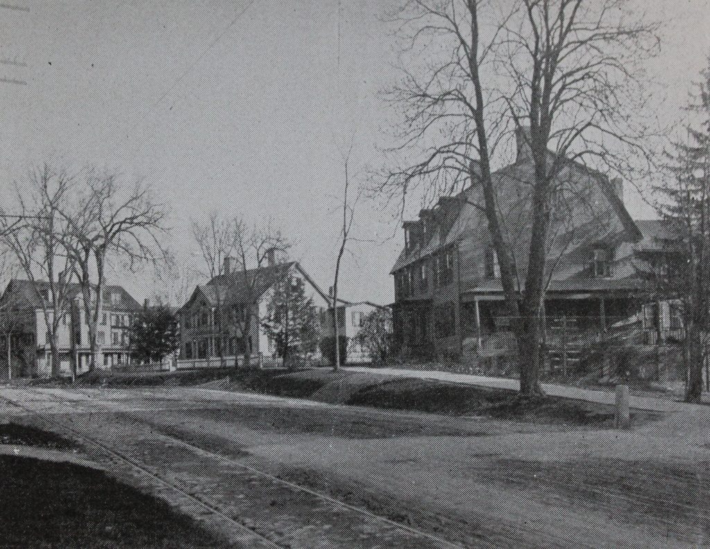
Marlborough Street, Newport, Rhode Island

Looking west on Marlborough Street from Farewell Street in Newport, around 1911. Image courtesy of the Providence Public Library.

The scene in 2017:

This scene on Marlborough Street includes several notable Newport landmarks, with the most significant being the White Horse Tavern on the far right. This building is perhaps the oldest in the city, dating back to before 1673. It was just a two-story, two-room house at the time, but it was later expanded, and by 1687 it was being operated as a tavern by William Mayes, Sr. His son, William Mayes, Jr., had a career as a pirate before returning to Newport, retiring from piracy, and taking over the operation of the tavern in 1703. Within a few years, though, his sister Mary and her husband, Robert Nichols, owned the property, and it would remain in the Nichols family for nearly two more centuries.

In the years before the Colony House was built in the 1730s, the colonial legislature often met here at the White Horse Tavern, which acquired its current name around this same time. Some 40 years later, it was used to house British soldiers during the American Revolution, and after the war the building was expanded to its current size, including the addition of the large gambrel roof. It would continue to be owned by the Nichols family until it was finally sold in 1895. The first photo was taken only about 16 years later, and at this point it had been converted into a rooming house.

The White Horse Tavern was already an old building in 1807 when the other prominent landmark in this scene, St. Paul’s Methodist Church, was completed. Long known for its religious tolerance, Rhode Island was among the first places where Methodism took root in America in the late 18th century. However, the Newport congregation caused a considerable stir in the Methodist community when they built this church. Although similar to other New England churches of the era, it was far more elaborate than the plain meeting houses that early Methodists worshipped in. It is considered to be the first Methodist church in America to have a steeple, bell, and pews, and early Methodist leader Bishop Francis Asbury is said to have “lifted his hands with holy horror when he first saw it and predicted that a church which began with a steeple would end with a choir and perhaps even an organ.”

Bishop Asbury was ultimately proven right in his prediction about the organ, with the congregation installing one in the church in the 1850s. However, an even more significant change had come about 15 years earlier in 1842, when the entire building was raised eight feet and a new, full-story foundation was built beneath it to make space for a parish hall. Otherwise, the exterior of the church has not significantly changed, although the building was heavily damaged by a fire in 1881. However, it was subsequently restored, and the first photo was taken about 20 years later.

In more than a century since the first photo was taken, most of the historic buildings on both sides of Marlborough Street have been demolished. Even the White Horse Tavern itself was threatened with demolition. Badly deteriorated and neglected more than 50 years after it became a rooming house, it was nearly demolished in the 1950s to build a gas station here on the corner. Instead, though, it was purchased by the Preservation Society of Newport County, who restored it and reopened it as a tavern in 1957. It remains in operation today, and is marketed as America’s oldest tavern. Further down the street, St. Paul’s Methodist Church is also still standing, and still houses the same congregation. The 2017 photo shows it in the midst of a restoration project, but otherwise it is largely unchanged from the first photo, and both it and the White Horse Tavern are now contributing properties in the Newport Historic District, which is a National Historic Landmark district.

Brick Market, Newport, Rhode Island

The Brick Market on Thames Street, opposite Washington Square in Newport, in 1890. Image courtesy of the Providence Public Library.

The scene in 2017:

Downtown Newport is renowned for its many colonial-era buildings, but one of the finest is the Brick Market, located along Thames Street at the western end of Washington Square. It is a prominent architectural landmark, and is one of only a handful of surviving buildings that are known to have been designed by Peter Harrison, one of the first formally-trained architects in America. Born in England in 1716, Harrison came to Rhode Island in 1740 but returned to England a few years later, where he studied architecture. Upon returning to the colonies, he designed several prominent buildings in New England, including King’s Chapel in Boston, Christ Church in Cambridge, and the Redwood Library and Touro Synagogue here in Newport.

The Brick Market was the last of his confirmed works, and is shows the influence that English architecture had on his designs. The building’s design was based on the Old Somerset House in London, with Harrison copying elements such as the arcade on the lower floor, the pilasters on the upper floors, and even the alternating arched and triangular window pediments. He designed the Brick Market in the early 1760s, and construction began in 1762. However, financial difficulties delayed the construction, and it was not completed until 1772.

Upon completion, the building consisted of an open-air market on the ground floor, similar to other contemporary New England marketplaces such as Faneuil Hall, while upper floors were used for offices and dry goods storage. However, over the years the building’s use changed several times, starting in the 1790s when the upper section was converted into a theater. Then, in 1842, the building was converted into Newport’s city hall, which included removing the third floor and replacing it with seating galleries. It was still in use as city hall when the first photo was taken in 1890, and it would remain so for another decade, until the current city hall was completed in 1900.

By the early 20th century the Brick Market was in poor condition, but it was restored in the 1920s by Norman Isham, an architectural historian and professor who specialized in preserving colonial-era buildings in Rhode Island. The building is now owned by the Newport Historical Society and operated as the Museum of Newport History, where it stands amid modern shopping plazas. All of the other historic buildings on the west side of Thames Street between Marlborough Street and Memorial Boulevard have since been demolished, and today the only other building still standing from the first photo is the one on the far left, at the corner of Thames and Touro Streets. Known as the Henry B. Young Building, it was built in 1861 but was heavily altered in the 20th century, including the removal of the top floor, and today it bears little resemblance to the building from the first photo.

Washington Square, Newport, Rhode Island

Facing west along the north side of Washington Square in Newport, around 1880. Image courtesy of the Providence Public Library.

The scene in 2017:

Washington Square has been the main focal point of Newport since its establishment in 1639, when the first settlers built their homes in this area. Over the years, it was variously known as the Mall and the Parade, and by the mid-18th century it was the civic and commercial center of Newport, with the Colony House and the Brick Market located on opposite ends of the square. In a sense, this arrangement was somewhat unusual for New England towns, which typically had a church, as opposed to secular buildings, situated in the most prominent location on the town common. However, here in Newport this reflected colonial Rhode Island’s focus on religious liberty, by not showing preference to one particular church over another.

Around the turn of the 19th century, the area came to be known as Washington Square, and over the next few decades the park was landscaped with trees, fences, walking paths, and a fountain. During this time, the square was the site of many fine mansions, including the one that is seen on the far left side of the photo. Built around 1750 for Peter Buliod, this house was purchased in 1818 by Oliver Hazard Perry, a Rhode Island native who achieved prominence as a naval hero in the War of 1812. He died a year later while serving in the Caribbean, but the house remained in his family until 1865, only about 15 years before the first photo was taken.

By the time the first photo was taken around 1880, modern commercial buildings had come to dominate the square, although some of the old mansions were still standing. Perry’s former house had become a commercial property, with a storefront on the first floor, and on the other side of the photo, further in the distance, was the Rathbun-Gardner-Rivera House, which had been built around 1722 and converted into a bank in 1803. In the center of the photo, the colonial-era Brick Market was still standing, although by this point it had become Newport’s city hall. Directly behind the photographer, the old Colony House was also still standing, and it was still in use as one of Rhode Island’s two state houses, with the state legislature alternating sessions between here and Providence.

Nearly 140 years after the first photo was taken, Washington Square has not undergone any significant changes. Some of the 19th century buildings have come and gone, but overall the area has retained the same scale, with mostly two and three-story commercial buildings surrounding the square. It is hard to tell because of the trees, but most of the buildings on the left side of the scene are still there today. On the far left, the Buliod-Perry House is still there, and was restored to its original appearance in the mid-1970s. Next to it is the Henry Bull Opera House, which was built in 1867 and still stands, although it no longer has its top floor. The Perry House Hotel to the right of it was demolished in the 20th century and replaced with a two-story commercial building, and at the corner of Thames Street the 1861 Henry B. Young Building still stands, although heavily altered and without its top floor.

The 1760s Brick Market is still standing at the western end of Washington Square, and it is now a National Historic Landmark that serves as the Museum of Newport History. Further to the right, the Rathbun-Gardner-Rivera House is still there, partially visible just to the left of the handicapped parking signpost. It is still a bank, having been used as such for over 200 years, but otherwise the right side of the scene is not as well-preserved as the left side. All of the other buildings here on the north side of Washington Square are from the first half of the 20th century, and the ones in this scene date back to around 1929-1931. However, directly behind the spot where this photo was taken, the Colony House is still standing as another one of Newport’s many National Historic Landmarks.

As for the park at the center of Washington Square, it is not much different from when the first photo was taken. The only significant change came in 1885, when a statue was dedicated to Oliver Hazard Perry to celebrate the 100th anniversary of his birth. Located directly opposite his house, it is mostly hidden by trees but still stands on the square. The park itself was renamed Eisenhower Park in 1960, joining Washington and Perry as another military hero whose name would be associated with the square. Eisenhower spent several summers here in Newport during his presidency, and he was present here at the park for the dedication ceremonies in the summer of 1960, during his last year in office. A few years later, in 1968, the park would join the rest of the neighborhood as a contributing property in the Newport Historic District, which is collectively another one of the city’s National Historic Landmarks.

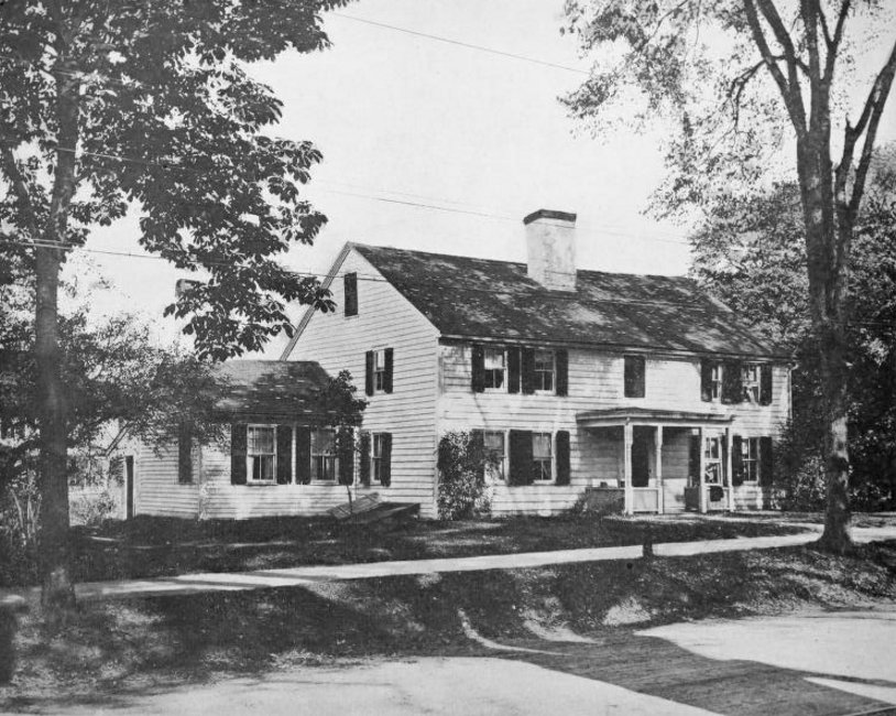
Jonathan Gibbs House, Newport, Rhode Island

The house at 181 Spring Street in Newport, around 1920. Image courtesy of the Providence Public Library.

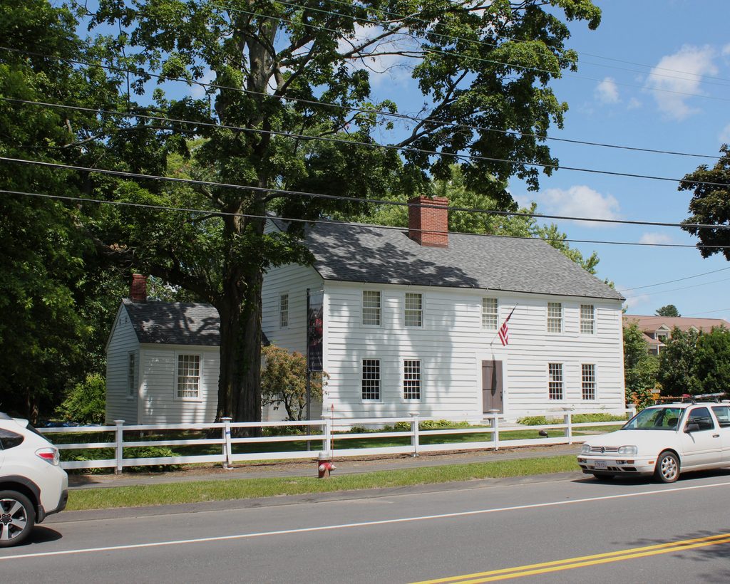
The house in 2017:

One of the remarkable features of modern-day Newport is the incredible number of colonial-era buildings that still stand in the city center. Some are grand 18th century mansions such as Hunter House and Vernon House, but the vast majority are plain, modestly-sized homes such as this one. Squeezed in sideways in a narrow lot about halfway between Mill and Pelham Streets, it was built around 1771 by Jonathan Gibbs, a housewright who owned it for about 20 years. Its design was fairly common for this period, and features a gambrel roof on the upper floor and two rooms on the first floor. According to the city’s property assessment, the house currently has just one bedroom, and a total of 776 square feet of living space.

Jonathan Gibbs does not appear to have personally lived here, and instead probably used it as a rental property. According to the Newport Restoration Foundation, in 1777 the house was the home of James Brattle, who lived here with four other people. Gibbs owned the house until 1782, and it was subsequently owned by John Bours in the early 19th century. By the time the first photo was taken there was a small addition to the back of the house, although otherwise its exterior appearance had not significantly changed since it was built.

By about 1925, shortly after the first photo was taken, this house was being rented by Bertha B. Chase, a widow who was in her mid-40s at the time. The 1930 census lists her as paying $19 per month in rent, and she lived in this house with her children Edward, Marion, and Lawrence, whose ages ranged from 17 to 22. A decade later, only Lawrence was still living here with Bertha, and they would remain here until the late 1940s, when they moved to Broadway.

About 20 years later, in 1969, the house was purchased by the Newport Restoration Foundation, an organization that had been founded the previous year by tobacco heiress Doris Duke in order to preserve Newport’s colonial architecture. The Foundation also purchased the neighboring Samuel Bours House on the right side of the photo, and both houses were restored in the early 1970s. Today, both of these properties are still owned by the Newport Restoration Foundation, and they form part of the Newport Historic District, which is designated as a National Historic Landmark.

Spring and Pelham Streets, Newport, Rhode Island

Looking west on Pelham Street from the corner of Spring Street in Newport, around 1883. Image courtesy of the Providence Public Library.

The scene in 2017:

Newport is well-known for its many Gilded Age mansions, but long before it was a summer playground for the rich and famous it was a prosperous seaport. Unlike the massive homes and spacious lawns of the Bellevue Avenue area, the center of Newport features narrow colonial-era streets, lined with historic 18th and 19th century houses. Spring Street, which runs from left to right through this scene, is one of the primary north-south streets in downtown Newport, and both it and its many cross streets have been remarkably well-preserved over the years, with few significant changes in the past two centuries.

When the first photo was taken, this scene was a mix of modest colonial-era buildings and larger, more elegant 19th century homes. The house at the corner was probably built sometime in the 1700s, as was the small gambrel -roofed house just beyond it on the right side, which predates the American Revolution. The exact date of this smaller house is unclear, but it was built sometime before 1771, and was the home of Lucina Langley. Just beyond the Langley house is a much more modern house at 41 Pelham Street. It was the home of Anthony Stewart, Jr., and it was built sometime around the 1860s or early 1870s.

More than 130 years after the first photo was taken, the only significant change in this scene is the house on the corner. The original colonial-era house was demolished shortly after the photo was taken, and its replacement is still standing today. Completed in 1883, this house was originally the home of William M. Austin, a house painter who had a prosperous business here in Newport. He was a lifelong resident of the city, and served on the city council, representing Ward 4 from 1884 to 1890. He and his wife Emily had three children: Percy, Susan, and Edward. Susan died young, long before the family moved into this house, but their two sons followed their father into the painter’s trade, eventually taking over the business after William’s death in 1897.

Since then, this scene has remained essentially unchanged. His house is still there, and now operates as the Austin House Inn. Further down Pelham Street, both the Langley and Stewart houses are still standing, as are the other historic 18th and 19th century homes on the street. Like much of downtown Newport, this area retains its colonial-era appearance, and the neighborhood now forms the Newport Historic District, which was designated as a National Historic Landmark in 1968.