Providence River, Providence, RI

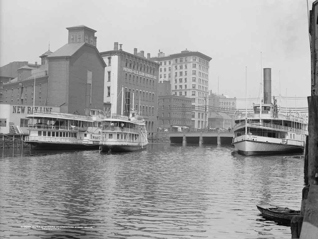
Looking upstream on the Providence River, with downtown Providence in the background, around 1906. Image courtesy of the Library of Congress, Detroit Publishing Company Collection.
1062_1906c-loc

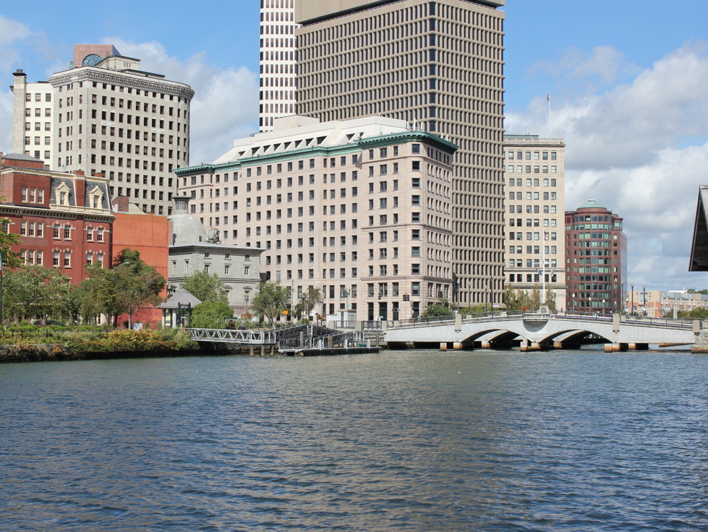
The river in 2016:

1062_2016
This view is just downstream of the one in the previous post, and shows some of the same features, including the 1896 Banigan Building and the Crawford Street Bridge. At the time, the bridge was the head of navigation for the Providence River, so the first photo shows several steamboats docked here. These boats were a common sight at the turn of the 20th century, providing excursion trips to vacation destinations such as Newport, Block Island, and other destinations in Narragansett Bay, Long Island, and beyond.

Two of the three steamers in the first photo are identifiable. The one on the right is the Warwick, which had been built in 1873 and was in service for nearly 50 years until 1920. En route to Newport in January, the old boat sprung a leak, and later sank at its dock in Newport. Likewise, the What Cheer on the far left of the first photo also fell victim to old age around the same time. Built in New Jersey in 1867, the What Cheer operated in Narragansett Bay for many years before being sold to a New York company. Two years later, the old sidewheel steamer sank at the pier at Glen Island, and was deemed to be beyond repair.

Today, very little is left from the first photo. The only readily identifiable building in both photos is the Banigan Building, although the Customshouse, seen just to the left of it in the 2016 scene, would have also been standing in the first photo. Otherwise, not much remains. The industrial buildings to the left are gone, including the one with the lettering that reads “Phenix and US Club Ginger Ale.” There are no longer any coastal steamers on the river, although, as mentioned in the previous post, the river itself has seen great improvement. In the first photo, most of it in the distance was hidden under the Crawford Street Bridge, which was probably just as well at the time, considering how polluted it was with sewage and industrial waste. Today, the nearly quarter-mile wide bridge is gone, the river is cleaner, and it is now an integral part of downtown Providence’s cityscape.

View from Citadel Hill, Halifax, Nova Scotia

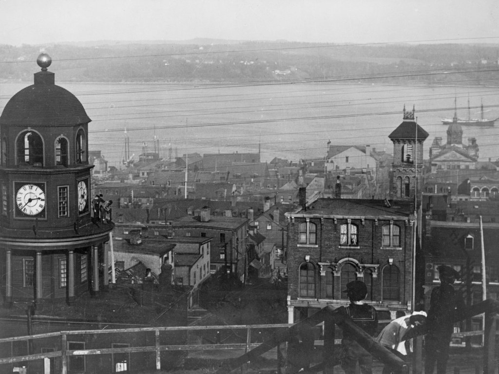
The view looking east toward downtown Halifax from Citadel Hill, around 1900-1917. Image courtesy of the Library of Congress.

1056_1900-1917c-loc

The view in 2016:

1056_2016
It isn’t in New England, or even in the United States, but Halifax has long had close ties with New England, especially Boston. It is the closest major North American port to Europe, and as such it is the last stop for outgoing ships from Boston, and the first for incoming ships. This scene here shows part of the city’s massive harbor, which has been of strategic importance over the years. After the British occupation of Boston ended in 1776, their fleet took refuge here in Halifax while preparing for an assault on New York City, and many years later the harbor was used as a gathering place for eastbound Atlantic convoys in both world wars.

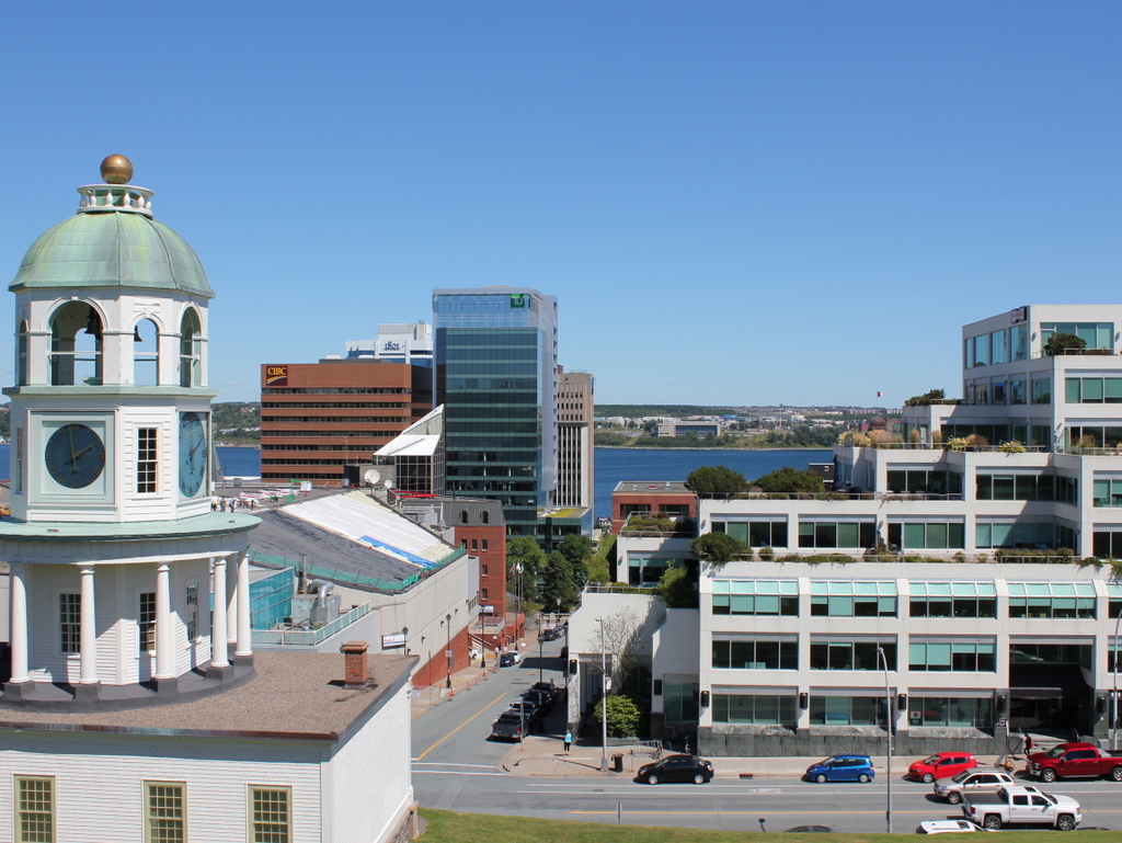
Through all of this, the strategically-valuable harbor has been protected by Fort George, a series of fortifications atop Citadel Hill. The hill stands just west of downtown Halifax, offering sweeping views of the city and harbor, and making it the ideal location for a fort to command the harbor and its approaches. The photos here were taken near the top of the hill, near the outer walls of the fort. On the left is one of Halifax’s oldest landmarks, the Town Clock, which was built at the foot of the hill. It faces down Carmichael Street, which leads to the Grand Parade three blocks down the hill, where City Hall and St. Paul’s Anglican Church are located.

The date of the first photo is somewhat unclear, but it was taken sometime soon before 1917, when Halifax experienced one of the deadliest disasters in history. Known as the Halifax Explosion, it occurred on December 6, 1917, when the harbor was filled with ships heading to and from Europe during World War I. Two such ships were the Norwegian SS Imo, which collided with French ammunition ship SS Mont-Blanc. The latter caught fire, and after about 20 minutes its cargo of high explosives detonated.

The Mont-Blanc was essentially vaporized, and the blast wave leveled much of the northern part of the city, to the left and out of view in the photos here. A few earlier posts, here and here, show scenes from the aftermath of the explosion, which killed nearly 2,000 people, injured around 9,000 others, and damaged or destroyed around 12,000 houses. The main commercial center of Halifax, seen in this view from Citadel Hill, escaped serious damage. Essentially every window in the city was shattered by the explosion, but most of the buildings in the first photo would have survived the disaster.

Despite being spared from serious damage, there is very little that is still recognizable from the first photo a century later. There are a number of 19th century buildings scattered throughout this section of the city, but the only one that is readily visible in both photos is the clock tower itself, which remains a prominent city landmark.

Today, Halifax remains an important port. It is the largest city in Canada’s Maritime provinces, and its downtown has been built up with skyscrapers, partially obscuring the view of the harbor from Citadel Hill. The shoreline across the harbor in Dartmouth has also changed dramatically in the past 100 years. In 1911, the community had a population of just over 5,000, but today it has over 67,000 people, and is a major suburb of Halifax as well as a commercial center in its own right.

Soldiers’ Monument, Worcester, Mass

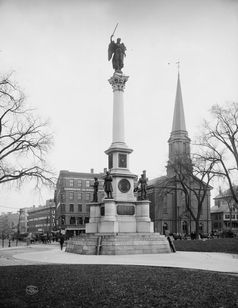
The Soldiers’ Monument on the Worcester Common, around 1906. Image courtesy of the Library of Congress, Detroit Publishing Company Collection.

1031_1906c-loc

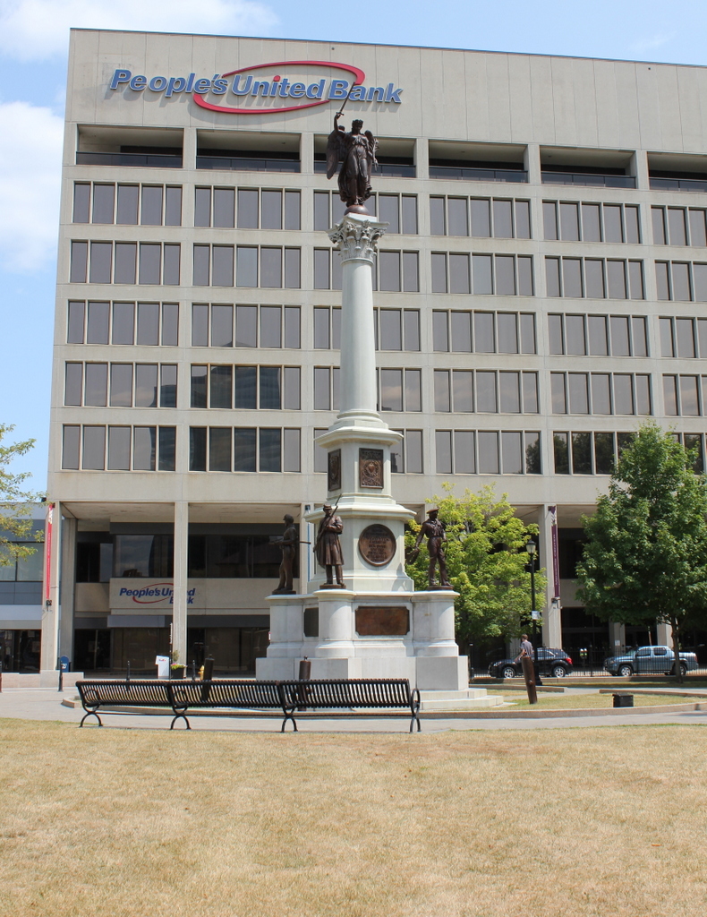
The scene in 2016:

1031_2016
This scene shows the Soldiers’ Monument from the opposite direction of the view in an earlier post. As mentioned in that post, the monument was designed by sculptor Randolph Rogers and dedicated in 1874, during a time when memorials to fallen Union soldiers were appearing on town commons across New England. It was placed at the northeast corner of the common, across from the Salem Street Congregational Church, which can be seen in the distance to the right. Although information on this church is scarce, the congregation appears to have been established in 1848, and based on the architecture of the building it was probably built around this same time. Also in this scene, on the left side, are several commercial buildings, with signs for carriage and sleigh harnesses, horse clothing, furniture, and even one for “Talking Machines.”

Today, the only landmark left from the first photo is the monument itself. All of the buildings in this scene have since been demolished, and in the early 1970s the Worcester Center urban renewal project was built here, in the area east of the common. It included the office building in the background of the 2016 photo, along with a shopping mall and parking garage. The mall closed in 2006, though, and parts of the complex have since been demolished. As of 2016, the area is now being redeveloped as CitySquare, another downtown Worcester revitalization project.

Worcester Common, Worcester, Mass (2)

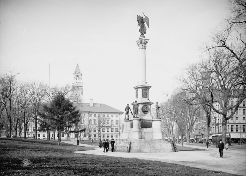
Another view of the Worcester Common, taken looking west from the corner of Church and Front Streets, around 1906. Image courtesy of the Library of Congress, Detroit Publishing Company Collection.

1024_1906c-loc

The Common in 2016:

1024_2016
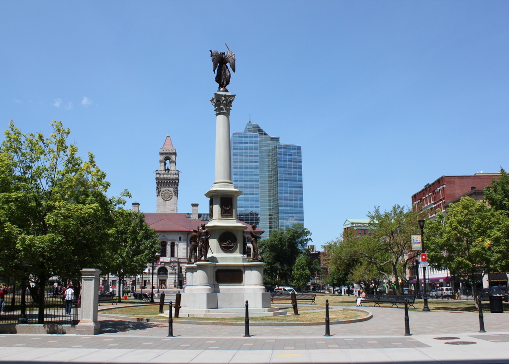
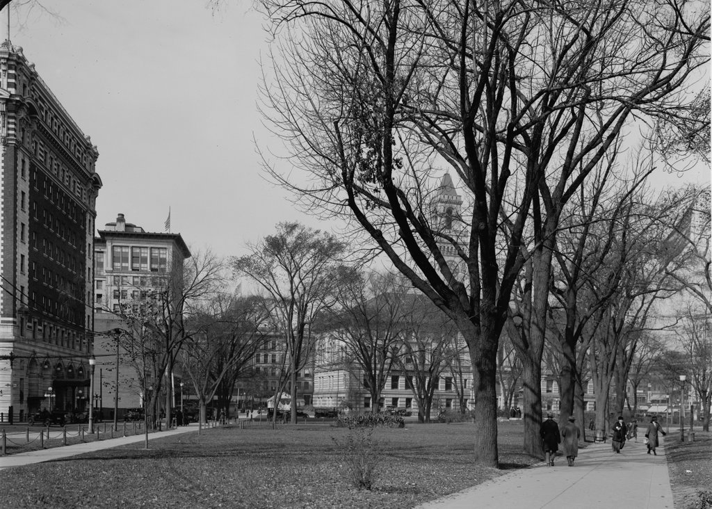
Taken from the northeast corner of the Common, on the other end of Church Street from an earlier post, this view shows the Soldiers’ Monument in the center, with City Hall to the left and Front Street to the right. The monument is the oldest feature in the first photo; it was dedicated in 1874 in honor of Worcester’s fallen soldiers and sailors of the Civil War, and was designed by prominent sculptor Randolph Rogers.

Along with the monument, several other buildings remain from the first photo, including the 1898 City Hall. On the far right, partially hidden by trees, are two 19th century commercial buildings. Both were designed by Fuller & Delano, a Worcester-based firm that was responsible for many other significant buildings in the city. The tall red brick building is the Chase Building, which was built in 1886 and, although the top floors were later altered, it is still standing. To the right of it, at the corner of Commercial Street, is the Ransom C. Taylor Block, built around 1897.

Today, the only particularly obvious change to this scene is the Worcester Plaza building in the distance. Originally built as the Worcester County National Bank Tower, it was completed in 1974, and is tied for the record of the tallest building in the city.

Worcester Common, Worcester, Mass

The Worcester Common, seen facing west from the corner of Franklin and Church Streets, around 1914-1920. Image courtesy of the Library of Congress, Detroit Publishing Company Collection.

1022_1910-1920-loc

The Common in 2016:

1022_2016
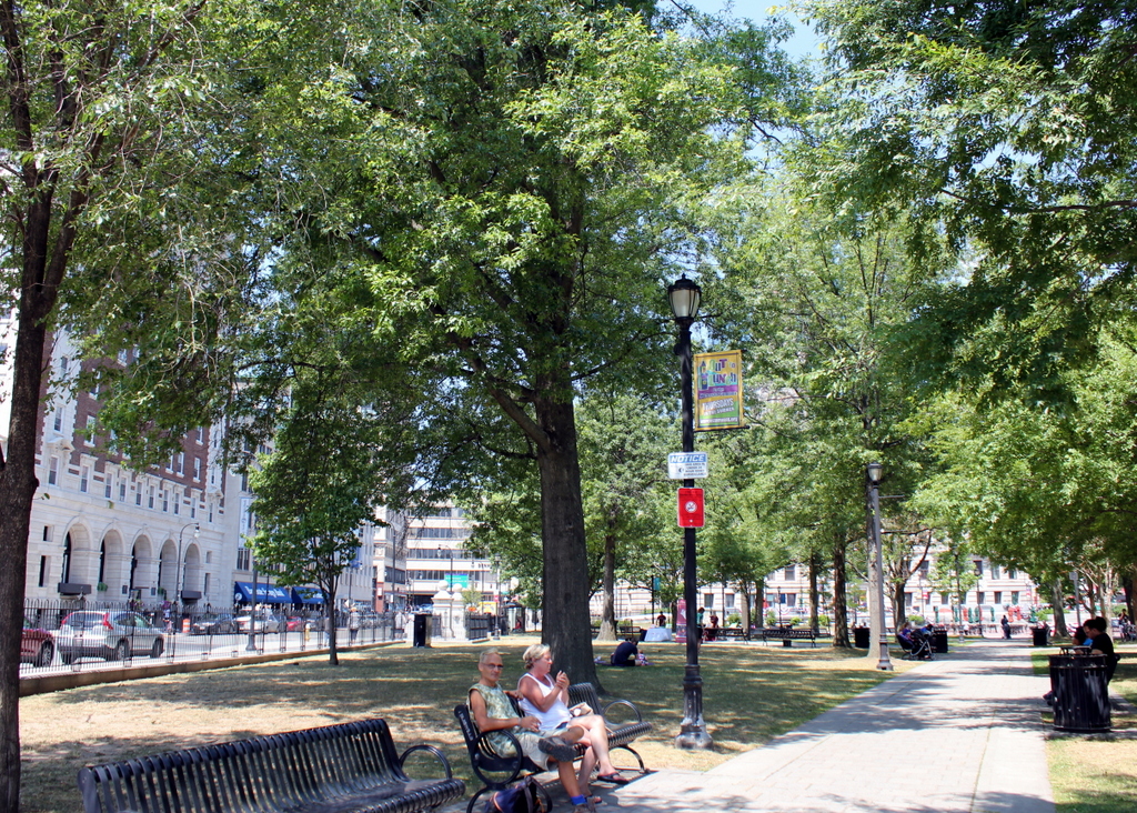
Today, Worcester is the second-largest city in New England, and the Common has been at the center of the city ever since it was a small colonial settlement in the 17th century. Set aside in 1669, more than 50 years before Worcester was formally incorporated as a town, the Common was originally used as a training ground for the militia, burial ground, and the site of the meetinghouse. It was once much larger, but as the city has grown up around it, this common land has steadily shrunk to its current dimensions, and at one point in the 19th century even had railroad tracks running across it.

The first photo was taken shortly after the completion of several prominent buildings along the Common, which are still standing today. These buildings, designed in the popular Classical Revival style of the turn of the 20th century, include the 1913 Bancroft Hotel on the left, the 1915 Park Building to the right of it, and the 1898 City Hall, which is mostly hidden by trees in the distance on the right. Along with the Common itself, all three of these buildings are now listed on the National Register of Historic Places.

Halfway House, Mt. Washington, NH

The Halfway House on the Mount Washington Carriage Road in New Hampshire, around the 1870s. Image courtesy of the Mount Washington Auto Road.

971_1870sc mwar

The scene in 2016:

971_2016
Mount Washington is the tallest peak in the northeastern United States, and it has been a popular tourist destination since the mid-19th century. By the end of the 1860s, the mountain had a hotel at the summit, along with both a cog railway and a carriage road to bring visitors to the top. The nearly eight-mile long carriage road opened in 1861, and this small building along the side of the road served an important purpose for early travelers. Known as the Halfway House, it was located about four miles up the road, hence the name, and it was used as a toll house. It was also a good resting place during the four-hour carriage ride up the mountain, and when necessary its location just below the treeline made it a refuge from the unpredictable and often dangerous weather in the alpine zone.

The building in the first photo was later replaced with a more substantial two-story structure. This one served the same purpose as the original, but over time it suffered from vandalism because of its isolated location, and it was finally destroyed by a fire in 1984. Today, the carriage road is now the Mount Washington Auto Road, and aside from cars replacing horses, not much has changed about the road, which still follows the same route that was laid out in the 1850s. The drive to the summit now takes about 30 minutes, and while the Halfway House no longer stands here, the site is still used as a stopping place. It is no longer necessary to rest horses here, but the climb is still taxing for cars, so the site here is used by drivers heading up the mountain to cool their radiators, and by those heading down to cool their brakes.