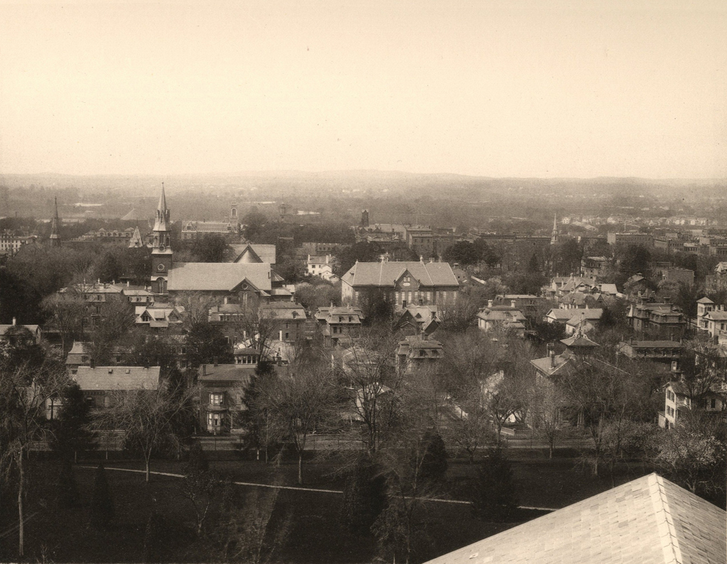
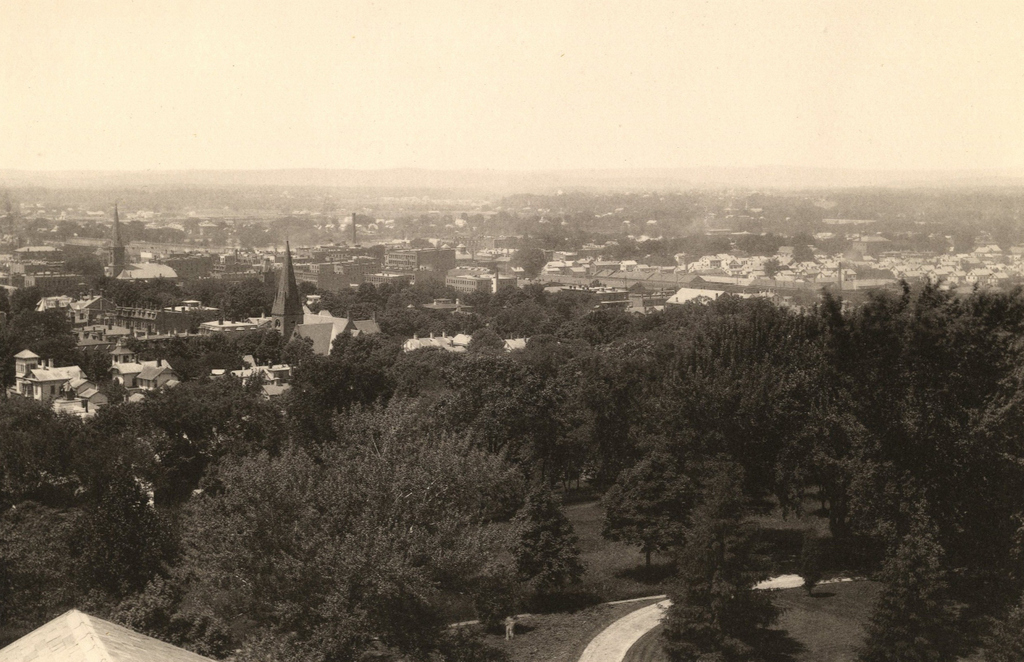
The view looking west from the top of the Arsenal tower at the Springfield Armory, around 1882. Image from Springfield Illustrated (1882)
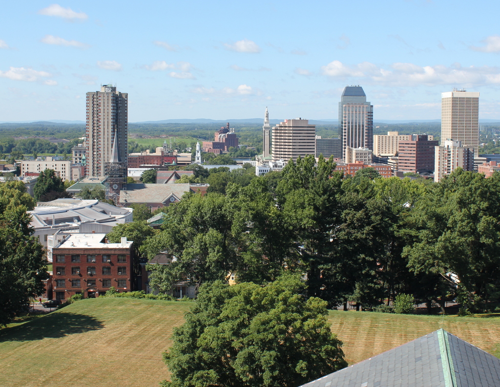
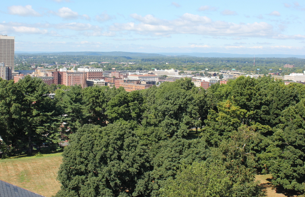
The view in 2015, photographed with permission from the Springfield Armory National Historic Site.
At first, this view looking toward the North End of Springfield does not appear to have seen many dramatic changes. In contrast to the downtown view in the previous post, the scale of this scene remains largely the same, with mostly low-rise commercial and industrial buildings. However, most of the buildings from the first photo have since been demolished. There is a group of surviving Victorian-era buildings on the far left in the Quadrangle-Mattoon Street Historic District, which includes the North Congregational Church and the nearby townhouses on Mattoon Street. The rest of the buildings in the scene, though, are mostly gone. Probably the most significant change happened in the 1960s, when most of the buildings on the right side of the photo were demolished as part of the North End urban renewal project. Much of this area now includes the interchange between Interstates 91 and 291.
Although little survives from the 19th century in this scene, this section of Springfield still includes a number of historic buildings. Just to the left of the center is the Apremont Triangle Historic District, which includes historic early 20th century buildings such as the 1910 Hotel Kimball building, which is visible just beyond the steeple of the North Congregational Church. To the left of it is the 1916 YMCA Building, and to the right is the 1924 Tarbell-Waters Building. Another historic building in this scene is the 1916 Willys-Overland Block, which is the boarded-up building just to the left of the center, and just beyond it on Dwight Street is the old 1932 post office.
For other then and now views from the Arsenal tower, see the other posts showing the view facing southwest, northwest, south, and north.