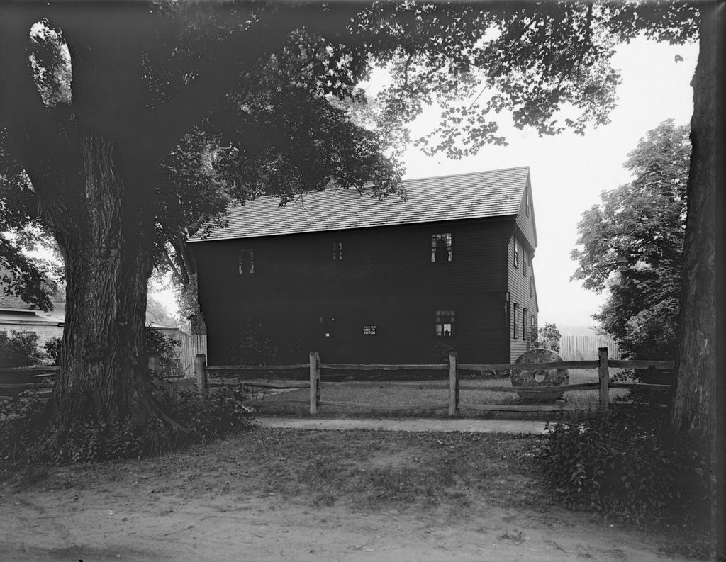
John Sheldon House, Deerfield, Massachusetts

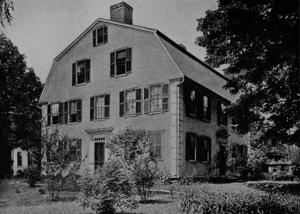
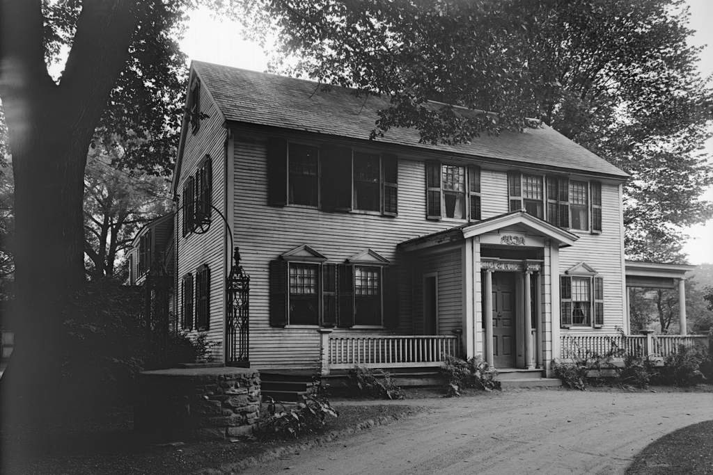
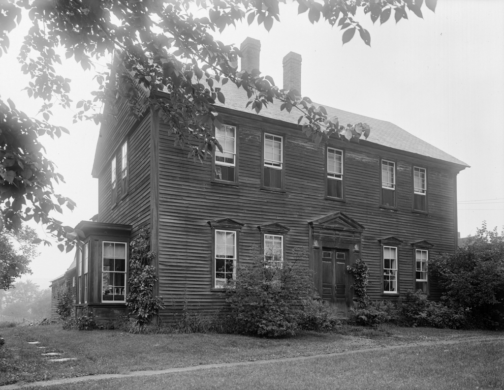
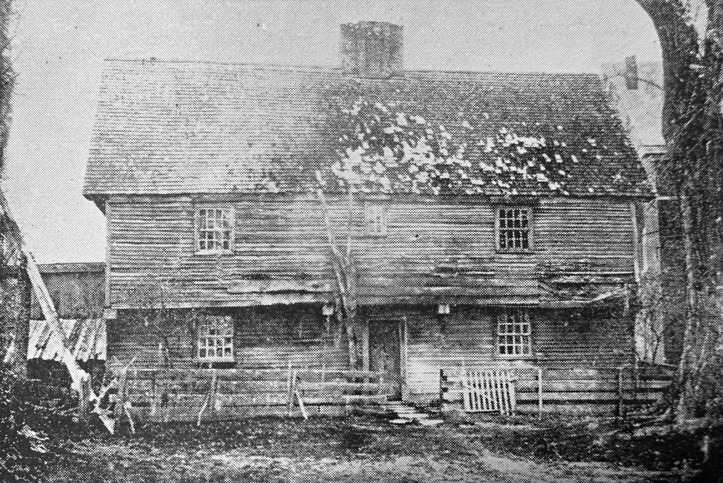
The John Sheldon House, also known as the “Old Indian House,” in Deerfield, Massachusetts, around 1848. Image from Picturesque Franklin (1891).
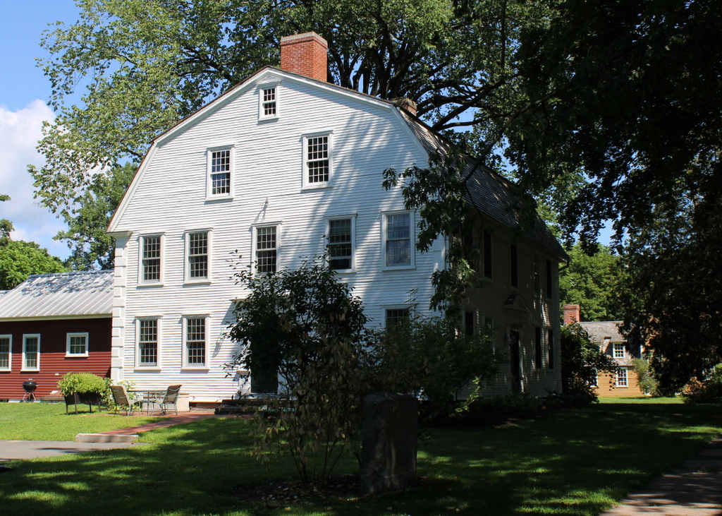
The scene in 2023:
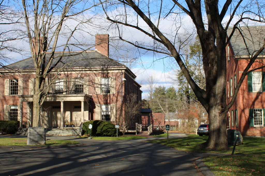
Deerfield features one of the best-preserved colonial town centers in New England, with a number of 18th century homes lining its historic Old Main Street. However, perhaps its single most famous landmark is a house that has been gone for the past 175 years. Known variously as the John Sheldon House or the Old Indian House, it was built around 1696 and stood here on the west side of Old Main Street until it was demolished in 1848. The top photo was taken shortly before its demolition, making it a very early example of an architectural photograph.

When it was built, the house was the largest in town. The original portion of the house measured 42 feet by 21 feet, and it consisted of two rooms on the first floor, two on the second floor, and a garret space in the attic. In the center of the house was a large chimney, which measured ten feet on each side on the first floor. Later in the 18th century, a kitchen lean-to was added to the back of the house, creating a saltbox-style appearance.

This was a common layout that was used in New England houses well into the mid-18th century, but it also had some architectural features that indicated its 17th century origins. It had a very steep roof, which was often seen on First Period homes, and it also appears to have had a fairly ornate chimney, in contrast to the more plain chimneys found on 18th century homes. Perhaps the most distinctive clues to its age were the overhanging second story on the front façade and the overhanging end gables on the sides of the house. These types of overhangs were common on 17th century homes, and were holdovers from post-medieval architecture in England.

Although the house was architecturally significant as a particularly elaborate First Period home in the Connecticut River Valley, it is best remembered for its role in the 1704 raid on Deerfield. The raid occurred during Queen Anne’s War, which was known in Europe as the War of Spanish Succession. The conflict began in Europe following the death of Charles II of Spain, the famously-inbred Hapsburg monarch who died without any heirs. Louis XIV of France claimed his grandson as the rightful heir to the Spanish throne, but this prompted England to go to war with France and Spain, in order to avoid shifting the balance of power in Europe. And, as was often the case in the 18th century, the conflict spilled over into the Americas, where French and English colonists fought for territorial control.

At the time, Deerfield was the northernmost major English settlement in the Connecticut River Valley, which left it vulnerable to French incursions. During the early morning hours of February 29, 1704, the town was attacked by a force of about 48 French soldiers and 240 Abenaki and other Native American warriors. The raiders went from house to house, killing or capturing as many of the inhabitants as possible, while also burning many of the homes.

Here at the Sheldon house, John Sheldon was evidently not home at the time, but the rest of his family was. The raiders had difficulty getting into the house due to the strength of the front door, but they used their axes to chop small holes in the door, which enabled them to shoot into the house. One of the bullets struck and killed John’s wife, Hannah.

The raiders were eventually able to gain access through the back door of the house. John’s son, who was also named John, was upstairs with his newlywed wife Hannah. They jumped out the window, intending to flee to Hatfield, but Hannah sprained her ankle in the fall. She was eventually captured, but she urged John to continue to Hatfield to get help for the town.

Aside from Hannah, several other members of the Sheldon family were captured, including 16-year-old Mary, 12-year-old Ebenezer, and 11-year-old Remembrance. The youngest Sheldon sibling, 2-year-old Mercy, was killed during the raid, supposedly from having her head beaten on the doorstep of the house.

In total, there were 291 Deerfield residents here in the village at the time of the raid. Of those, 56 were killed and 112 were captured. Nearly half of the houses in town were burned, but the Sheldon house survived. The house was temporarily used as a holding site for the captives before they were marched northward to Canada.

Some of the captives were killed during the march, and many of the young children were adopted into Native American families and chose not to return to the English colonies. However, All four of the Sheldon captives survived the march, and over the next few years John Sheldon made several trips to Canada to negotiate their release. All four were back here in Deerfield by 1706.

This house would remain in the Sheldon family for many years, with Ebenezer eventually acquiring it from his father. He lived here until 1744, when he sold the house to Jonathan Hoyt and relocated to Bernardston. There he built a fortified house that formed part of the northern defenses of the Massachusetts Bay colony during the next major war, King George’s War. As was the case 40 years earlier, English colonists fought against the French and their Native American allies, and one of Ebenezer Sheldon’s children was killed near their house in Bernardston during this war.

In the meantime, the old Sheldon house here in Deerfield remained in the Hoyt family for more than a hundred years. By the early 19th century it had become the town’s most famous landmark, but in 1847 the owner, one of the Hoyt descendants, announced that he would be demolishing it in order to build a new house on the site. The news prompted an outcry, and there were proposals to preserve it by moving the house to a new location. This was a very early example of historic preservation efforts in the United States, but it ultimately did not succeed in saving the house, which was demolished in 1848. However, several relics from the house were saved, most significantly the battle-scarred front door, and the exterior of the house was documented with a photograph, as shown in the image here at the top of this post.

Today, the site of the house is now part of the campus of Deerfield Academy. Its location is marked by a small monument, which is visible in the lower left side of the second photo. Aside from this, the only visible reminder of the scene from the top photo is the back part of the First Church, which can be seen on the right side of both photos. The door of the old house still exists, and it is on display at the Pocumtuck Valley Memorial Association (PVMA) museum here in Deerfield. The PVMA also owns a replica of the Sheldon House, which is known as the Indian House Children’s Museum. It was built in 1929, and it stands a little to the north of here, on the west side of Old Main Street.
Mount Toby from South Sugarloaf Mountain, Deerfield, Mass

A panoramic view looking east from South Sugarloaf Mountain in Deerfield, toward Mount Toby in Sunderland, around 1891. Image from Picturesque Franklin (1891).

The scene in 2021:

These two photos were not taken from the exact same spot, as shown by the different angles of the bridges in the lower right, but they show the same general view of the Connecticut River, the town of Sunderland, and Mount Toby in the distance. Both were taken from near the summit of South Sugarloaf Mountain, a relatively small hill that forms the southern end of the Pocumtuck Range, which is part of the larger Metacomet Ridge. Sugarloaf is best known for its dramatic views of the valley to the south, but this eastern view is also offers impressive scenery.

South Sugarloaf is often referred to simply as Sugarloaf Mountain, although it is the smaller of the two summits that comprise the mountain. However, the northern peak, while nearly 200 feet higher in elevation, has only limited views from the summit, and is rarely visited. By contrast, the southern peak has long been a popular tourist destination. Rising to an elevation of 610 feet, it is about 500 feet higher than the Connecticut River, which passes just a third of a mile from the summit.

The first photo was likely taken from the Summit House, which was built here in 1864. These types of mountaintop hotels were popular in the northeast during the second half of the 19th century, and several others were located on nearby summits on the Metacomet Ridge, including the Prospect House on Mount Holyoke and the Eyrie House on Mount Nonotuck. Even Mount Toby briefly had a tower and hotel at the summit, but the buildings burned in 1882. This was a common fate for summit houses, given their isolated locations far above water sources, and the summit house on Sugarloaf Mountain would eventually be destroyed by a fire in 1966.

Mount Toby, which towers in the distance beyond the town of Sunderland, is geologically related to Sugarloaf Mountain. It is the highest peak on the Metacomet Ridge, and at 1,269 feet it is more than twice the height of South Sugarloaf. However, as the photos show, the mountain is not a single peak. Its rugged landscape has many different summits, the highest of which is on the northern side, on the far left side of both photos.

The mountain is said to be named for Elnathan Toby, supposedly the first white settler to climb it. In the 19th century, though, the prominent geologist Edward Hitchcock criticized this rather bland name. Hitchcock, who would later serve as president of Amherst College, published a report on the state’s geology in 1841. In it, he included Mount Toby, along with Sugarloaf and a number of other peaks, as part of a list of “uncouth and vulgar names” for Massachusetts mountains. Hitchcock tended to prefer Native American names, and he succeeded in renaming several peaks, including Hilliard’s Knob, which was renamed Mount Norwottuck in a large mountaintop ceremony in 1846. He made a similar attempt on Mount Toby three years later, naming it Mettawompe in honor of the Native American chief who had sold the surrounding land to white settlers. However, unlike Norwottuck, this name didn’t stick, apparently because of local opposition among Sunderland residents, and the mountain has continued to be known as Mount Toby.

Aside from the ill-fated attempts to operate a summit house on Mount Toby during the 19th century, the mountain has remained largely undeveloped, and today it looks essentially the same as it did when the first photo was taken around 1891. The town of Sunderland has also retained much of its rural appearance, and many of the houses along Main Street are still standing, as is the 1836 First Congregational Church, which is visible on the right side of both photos. Another town landmark in this scene is the Buttonball Tree. Although not identifiable from this distance, it stands near the center of the scene in both photos, about a quarter mile north of the church. With a girth of over 25 feet, this sycamore tree is one of the widest trees in the region, and it is estimated to be over 350 years old. Overall, probably the only easily-noticeable difference in these photos is the bridge over the Connecticut River. The one in the first photo was built in 1877, and it spanned the river until 1936, when a bridge further upstream was washed away in a flood and crashed into this bridge.

In the meantime, here on South Sugarloaf, the mountain continues to offer some of the finest mountaintop views in the state. It is now part of the Mount Sugarloaf State Reservation, and there is an auto road to the summit, along with several short hiking trails. In place of the 19th century summit house, the mountain is now topped by an observation tower with several different levels of platforms.

Frary House, Deerfield, Mass

The Frary House on Old Main Street in Deerfield, around 1900-1904. Image courtesy of the Library of Congress, Detroit Publishing Company Collection.

1051_1900-1904c-loc

The building in 2016:

1051_2016
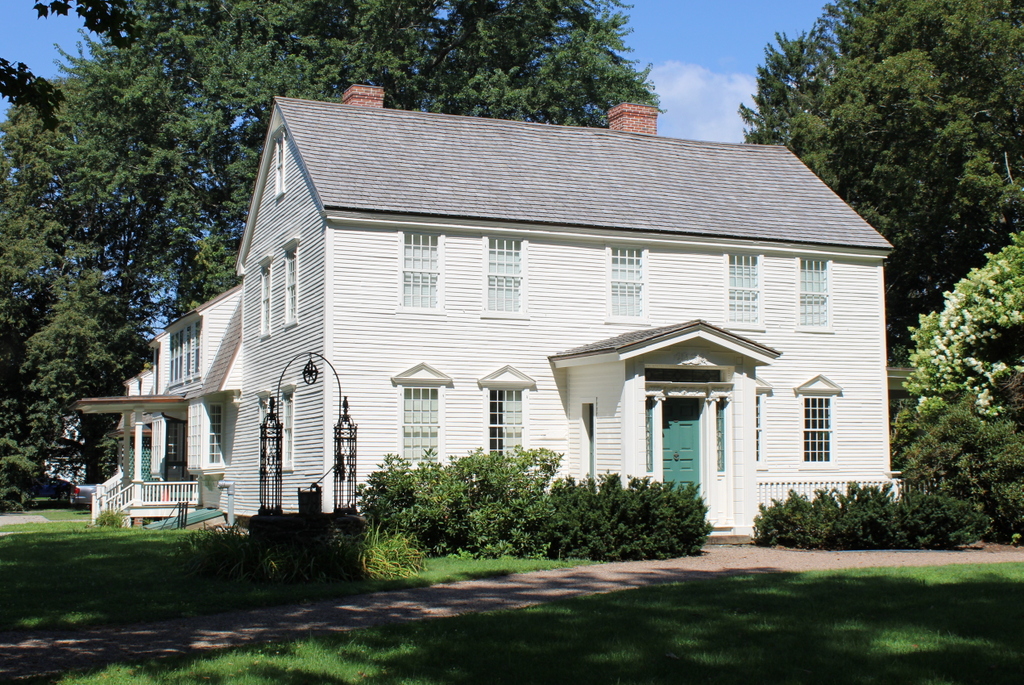
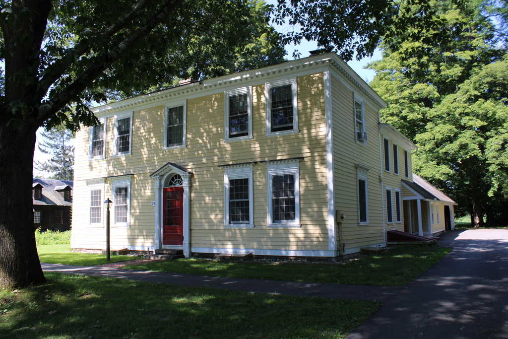
The Old Deerfield Historic District is a National Historic Landmark, which is the highest level of recognition on the National Register of Historic Places. The well-preserved New England village features 53 historic buildings, with over 30 that date back to the American Revolution or earlier. Among these is the Frary House, seen here in these photographs.

When the first photo was taken, the house was believed to have been built in 1698 by Samson Frary, one of the original settlers of Deerfield. However, dendrochronology has since shown that it was built around 1758, although it is possible that portions of the house may date back to 1698. If so, it would make it one of possibly two houses that predate the 1704 Indian attack on the village. Either way, though, the house is unquestionably old, and historically significant.

The left side of the building is the oldest, and dates back to about 1758, when it was owned by Salah Barnard. He operated a tavern out of the house, and in 1775 Benedict Arnold stopped here on his way north to capture Fort Ticonderoga. The American Revolution had started just weeks earlier, and Deerfield had a large number of loyalist residents, yet Arnold managed to acquire provisions for his men here at the tavern while at the same time maintaining the secrecy of his mission.

The most significant change to the building came around 1795, when Barnard added a larger tavern to the right side of the building. Like many other New England taverns of the era, it not only provided food, drink, and lodging for visitors; it also served as the social center of the town, and would have been used as a meeting place for a variety of local events. Salah Barnard died the same year that the addition was completed, and his son Erastus inherited the building and operated the tavern for the next ten years, until he moved away from Deerfield.

The property was eventually purchased in 1890 by Charlotte Alice Baker, a descendant of Samson Frary, the building’s purported original owner. She hired the Boston architectural firm of Shepley, Rutan & Coolidge to restore it to its original colonial appearance, and the work was complete by the time the first photo was taken. Today, the Frary House/Barnard Tavern is owned by Historic Deerfield, a museum that owns a number of historic properties in the village.

Along with the Frary House and Barnard Tavern, this scene shows one other historic home. Just to the right of the tavern is the Nims House, which predates the Frary House by over a decade The original house on this site was built around 1685 by Godfrey Nims, but was destroyed in the 1704 Indian raid. It was rebuilt in 1710, and portions of this house might still be standing, but most of the present-day home dates back to sometime between the 1720s and 1740s. It remained in the Nims family until the 1890s, and it is now owned by Deerfield Academy, who uses it for faculty housing.

First Church, Deerfield, Mass

The First Church of Deerfield on Old Main Street, around 1891. Image from Picturesque Franklin (1891).

1050_1891c-picturesquefranklin

The church in 2020:

Deerfield’s Old Main Street is a remarkably well-preserved New England village, with a number of historic homes and other buildings dating back to the 18th and early 19th centuries. The entire village is included in the Old Deerfield Historic District, which is listed as a National Historic Landmark on the National Register of Historic Places. One of the most prominent buildings in the district is the First Church of Deerfield, also known as the Brick Church. Although not as old as many of the nearby homes, the church has been at the center of the village for nearly 200 years.

It was built in 1824 and designed by architect Winthrop Clapp, although it was virtually a copy of the Second Congregational Church in Greenfield, which had been built in 1819 about three miles away. The Greenfield church had been designed by Isaac Damon, whose other works included churches in Springfield, Northampton, and Southwick. Although he did not actually design the Deerfield church, his influence is still evident, and it bears a strong resemblance his other churches.

Damon’s Greenfield church has long since been demolished and replaced with the present-day building, but the Deerfield church is still standing. Its interior was restored to its original appearance in 1916, and today the building still houses an active Unitarian-Universalist congregation. The brick exterior has remained essentially the same as it was when it was built, and its surroundings have also changed very little, with the village still retaining its appearance as a small, colonial-era community.