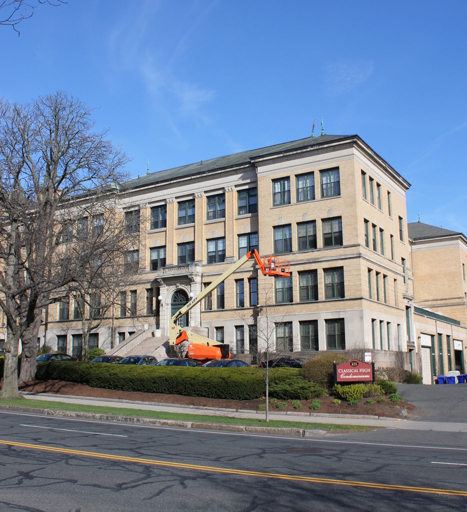
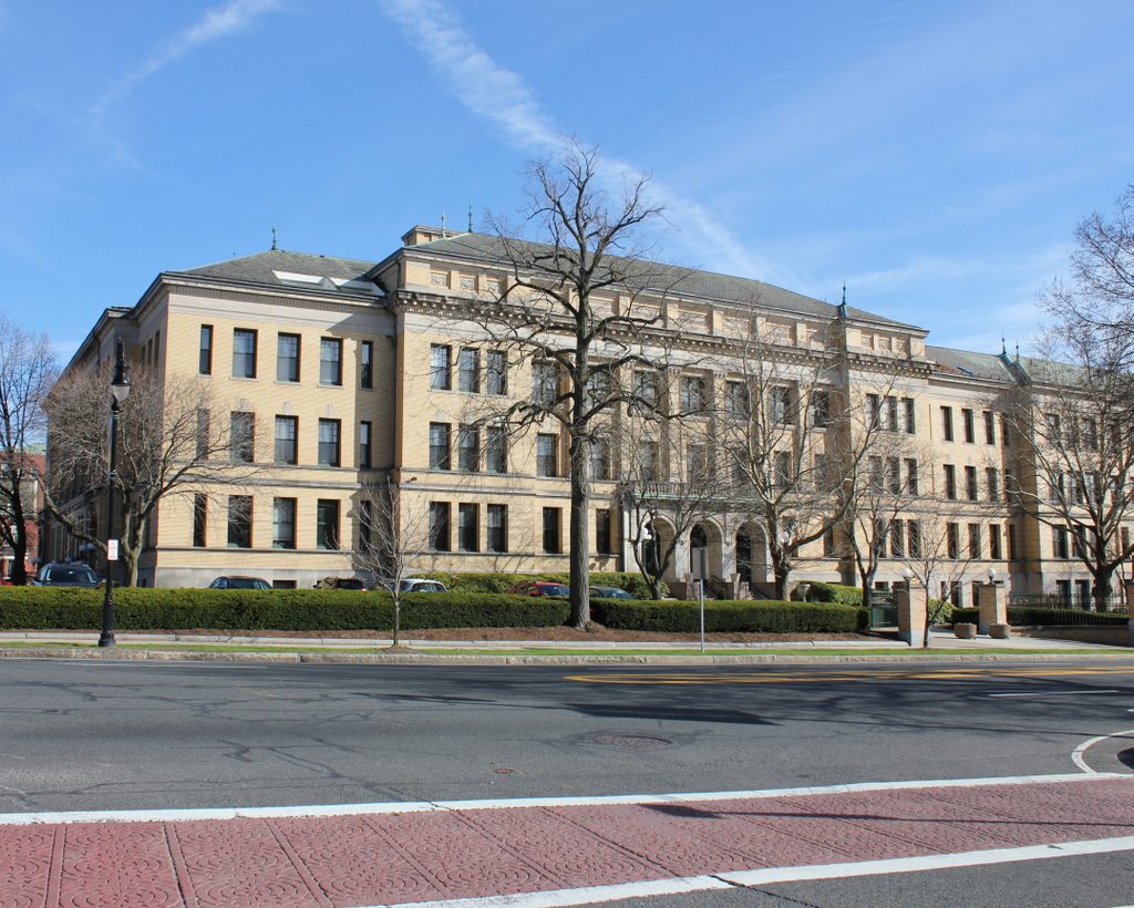
Classical High School, Springfield, Mass

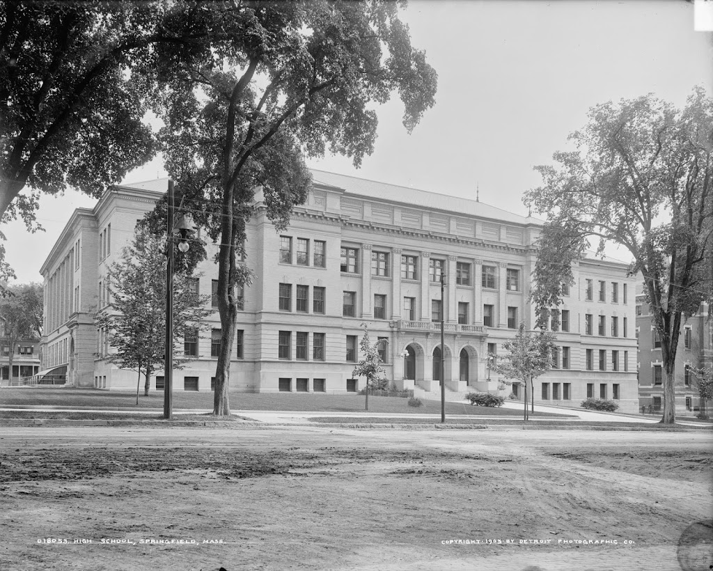
Classical High School in Springfield, around 1905. Image courtesy of the Library of Congress, Detroit Publishing Company Collection.
Schools

The building in 2019:

Originally built as Central High School in 1898, it became Classical High School in the 1930’s, and closed in 1986 when the present Central High School was built on Roosevelt Ave. It has since been converted into condominiums, and is remarkably well-preserved from its days as a school.  The building was built on the site of the former Hampden County Jail, which had been in this location from 1814 until 1887.

Visible on the far right of the 1905 photo is the old Springfield High School, which was built in 1874.  After the construction of this building, the old high school was used as State Street Grammar School until 1922, when Central/Classical High School was expanded to include a junior high school wing, which necessitated the demolition of the old structure.

Probably the school’s most famous alumnus was 1921 graduate Theodor Geisel, who was better known by his pen name, Dr. Seuss.  In addition, on a personal note, my grandfather was a 1937 graduate from the school, shortly after it became Classical High.

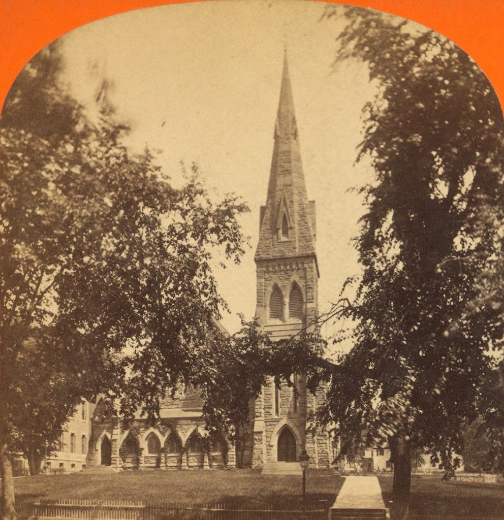
St. Michael’s Cathedral, Springfield

The view of St. Michael’s Cathedral, around 1908. Image courtesy of the Library of Congress, Detroit Publishing Company Collection.

060_1908c-2Bloc

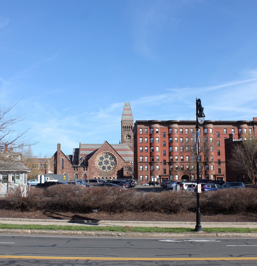
From the same spot in 2013:

060_2013

The tree is somewhat blocking it, but St. Michael’s Cathedral is still there today, looking as good as it did when it was built in the 1860’s.  It was the first Roman Catholic church in Springfield, and it is currently the cathedral for the Roman Catholic Diocese of Springfield in Massachusetts, which covers all four counties in Western Massachusetts.  The 1908 photo shows the church and the rectory, both of which still exist, but it also shows St. Luke’s Sanitarium, to the left of the church, which no longer exists.  Note, however, the break in the curb along the sidewalk that once led to the building.

On an arborist note, the short but wide tree on the far right of the 2013 photo appears to be the same one in the 1908 photo.  In addition, this may be pure conjecture, but the tree that now all but obscures the church from this angle appears to be visible in the 1908 photo.  There is a young sapling that is barely noticeable in the photo, and it appears to be in the same location as the present-day tree.  The current tree looks like it could be around 100 years old – could it be the same tree?

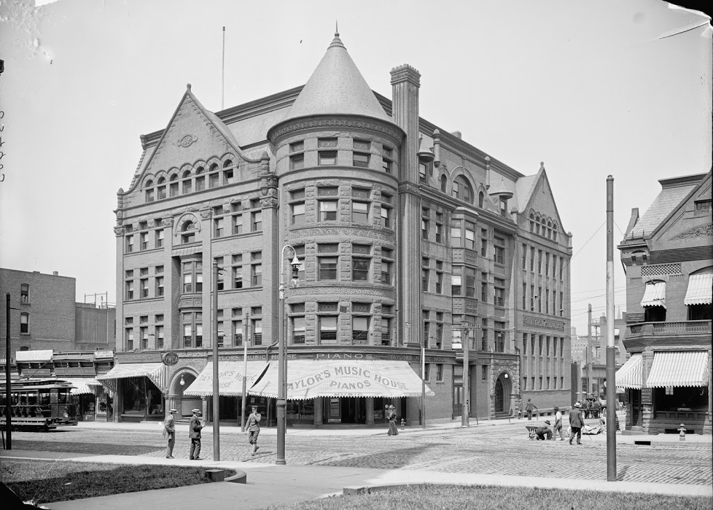
Corner of State & Maple, Springfield

The corner of State Street and Maple Street in Springfield, between 1900 and 1909. Image courtesy of the Library of Congress, Detroit Publishing Company Collection.

059_1900-1910-2Bloc

The same street corner in 2013:

059_2013

These photos were taken from the opposite side of State Street from the photos in this post, and show some of the changes that the Quadrangle area has undergone in the past 100+ years.  Some things remain – Christ Church Cathedral and the statue of Samuel Chapin are the two obvious ones.  Even minor details such as the short, bowling pin-looking granite posts on either side of the sidewalks are still there.  But, the big difference, aside from the traffic lights and complete lack of cobblestone in the 2013 photo, is the main Springfield Library building.

The library building in the early 20th century photo was built in the 1860’s as the first public library in Springfield.  Very shortly after this photo was taken, however, construction began on the new library (this happened in 1909, thus establishing the upper limit of the date range for the photo).  But, rather than demolishing the old structure, and to allow the library to function while the new building was being constructed, the old one was moved directly back, into the present-day Quadrangle.  The new library was dedicated in 1912, and the books were moved to the old one.  Whether the old building was demolished right after that, or whether it was used for something else in the intervening years, I don’t know at this time.

Springfield Skyline (3)

The view of Springfield from West Springfield, between 1900 and 1910. Image courtesy of the Library of Congress, Detroit Publishing Company Collection.

058_1900-1910-2Bloc

The view in 2014:

058_2014

The most obvious difference here is the lack of a covered bridge – this bridge was replaced by the current Memorial Bridge (just to the right of the scene in the 2013 photo) in 1922. The first bridge across the river in Springfield was an uncovered, six span bridge that was built in 1805. It collapsed in 1814, and was replaced by the covered bridge, which was completed in 1820. The designer was Isaac Damon, the same architect who designed Springfield’s Old First Church.  This bridge far outlasted its predecessor, and even the present Memorial Bridge hasn’t reached the 102 years that the covered bridge made it to.

The bridge was finally demolished – or, to be more accurate, dismantled piece by piece to reuse the wood – in 1922, upon completion of Memorial Bridge. Although there are no visible traces of the bridge itself, it’s still easy to pinpoint its location; there is a Bridge Street in Springfield, and another one directly across the river in West Springfield. Neither street currently leads to a bridge, but they were once the approaches to the old covered bridge.

Springfield Skyline (2)

The South End of Springfield, seen from West Springfield between 1900 and 1910. Image courtesy of the Library of Congress, Detroit Publishing Company Collection.

The same view in 2014:
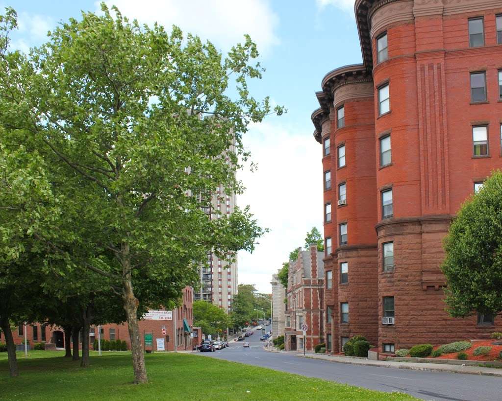
The scene in 2023:

Like the photos taken from the same spot but angled a little upstream, not much remains visible from the original photo.  Old First Church, the Hampden County Courthouse, and the Court Square Building are still there, but not much else is readily identifiable in both photographs.  The steeple that is visible toward the right-hand side of the first photo is St. Joseph’s Church, which was built in 1873 and demolished in 2008.  The building that has since taken its place is visible in the second photo – it is a gray-green rectangular building visible just above and to the left of the large brick structure that is on the waterfront on the right-hand side of the photo.

Several buildings that are visible in the 2013 photo did exist when the earlier one was taken, but they aren’t visible in it. Among those is the old castle-like National Guard Armory, which was built in 1895 and damaged in the 2011 tornado. At the time it was being used as the South End Community Center, but today it stands vacant, although part of MGM’s proposed casino includes preserving the distinctive facade of the building.

Along the waterfront, much has changed in the past 100 years.  Back in the early 20th century, the waterfront was dominated by boating clubs and factories.  According to a 1910 map, there were three boathouses along this stretch of riverfront, several of which can be seen in this photo. They were the Springfield Yacht Club, the Springfield Canoe Club, and the Springfield Boat Club. Presumably many of their members are among those who are sailing or rowing on the Connecticut River.  Sadly, this is not the case today – the construction of I-91 effectively blocked off downtown Springfield from the waterfront, and today a little-used bike path along the riverfront is the only significant recreational activity available on this part of the river.

2023 Update: The third photo shows the scene nearly a decade after the second photo. The most significant change here is the MGM Springfield Casino, which stands on the right side of the scene. This photo also shows much higher water levels than the other two photos, due to floodwaters caused by heavy rains upstream in Vermont in July 2023. 

Springfield Skyline (1)

Springfield, as it looked from across the river around 1900-1910. Image courtesy of the Library of Congress, Detroit Publishing Company Collection.

056_1900-1910-2Bloc

The same view in 2010:

056_2010

It’s a good thing that Old First Church and the Hampden County Courthouse still exist – otherwise it would’ve been very difficult to pin down exactly what part of Springfield is seen in the early 20th century photo.  In addition, the old Court Square Building is barely visible in between those two buildings in photos.  There are some parts of Springfield that still look similar to how they were 100 years ago, but downtown isn’t one of them.  Along with the skyscrapers and modern hotels that now sit directly across the river, there is also the Memorial Bridge, which wouldn’t exist for another 10+ years from the first photo.  Instead, travelers would cross the river slightly upstream of the current bridge, on a terrifyingly rickety-looking covered bridge that I will probably cover in a future post.  The other big change in the past century was the elevated I-91 viaduct along the Connecticut River, which replaced the railroad as both the prominent feature along the river and also the way that most people traveled from Springfield to points north and south.