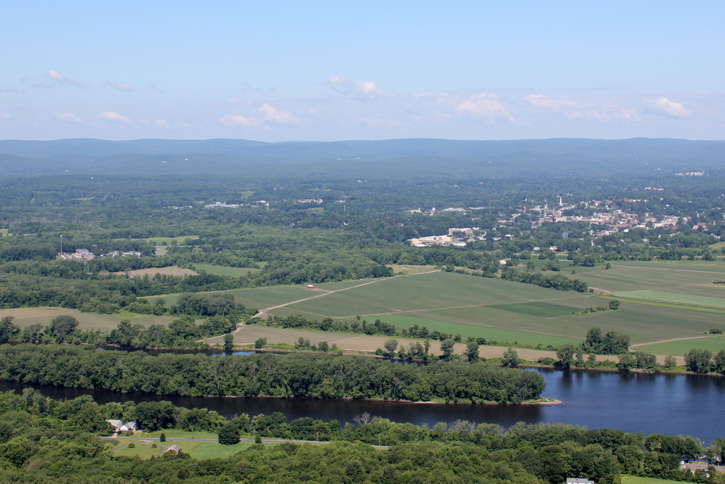
Northampton from Mount Holyoke, Hadley Mass

Looking west from the summit of Mount Holyoke toward Northampton, around 1900. Image courtesy of the Library of Congress, Detroit Publishing Company Collection.

564_1900c loc

The scene in 2015:

564_2015
Not a whole lot has changed in this scene in the past 115 years. From this distance, there aren’t too many noticeable changes in the city of Northampton, which has grown in population by more than 50% since 1900. The area near the river has hardly changed at all; this floodplain continues to be used as farmland.  Even Interstate 91, which passes through between the farms and the city, isn’t noticeable in the present-day scene.  In fact, the only really obvious difference here is something that is entirely natural – the island that has formed in the middle of the Connecticut River.

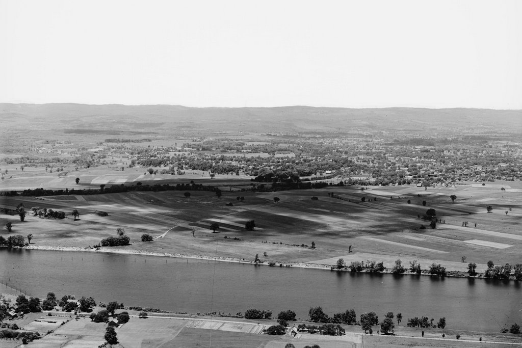
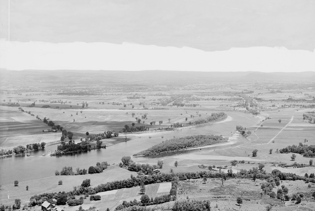
Connecticut River from Mount Holyoke, Hadley Mass

Looking north toward the Connecticut River from the summit of Mount Holyoke around 1900. Image courtesy of the Library of Congress, Detroit Publishing Company Collection.

565_1900c loc

The scene in 2015:

565_2015
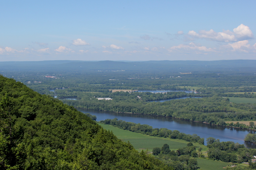
One of the things that amazes me about then and now landscapes of New England is the difference in trees.  It seems counterintutitive, but in most cases the present-day scenes are substantially more forested than they were in the past.  In part, this is because of agricultural changes over the past century.  This section of the Connecticut River Valley has some of the best farmland in New England, and there are still plenty of active farms today, but New England’s short growing season and limited land has prevented the area from being used for large-scale farming.  Today, some of the former farms have been developed into residential neighborhoods, but much of the land, especially in the floodplains along the river, has reverted to forest over the course of the past century.

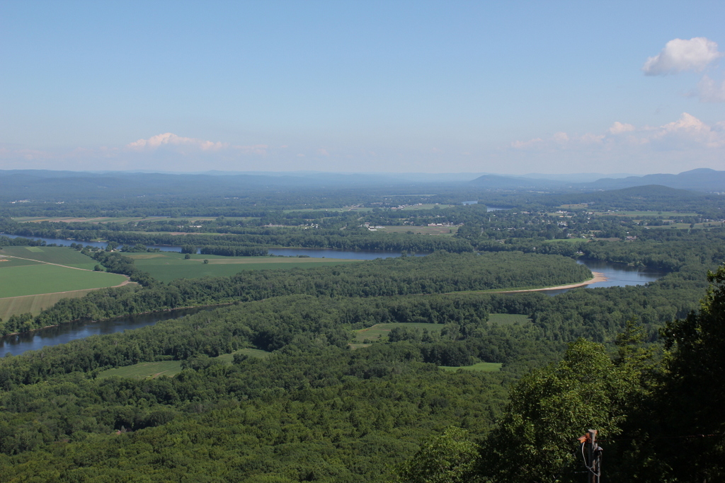
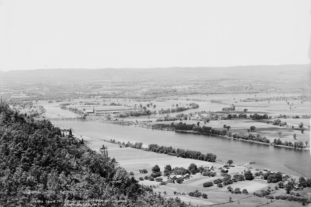
The Oxbow from Mount Holyoke, Hadley Mass

The view looking southwest from the Mount Holyoke Summit House around 1900. Image courtesy of the Library of Congress, Detroit Publishing Company Collection.

563_1900c loc

The scene in 2015:

563_2015
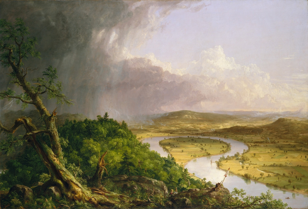
This scene from the summit of Mount Holyoke was made famous in 1836 when artist Thomas Cole painted “View from Mount Holyoke, Northampton, Massachusetts, after a Thunderstorm,” a work also known as “The Oxbow” because of the prominent meander in the river.  Cole’s depiction of the scene is below:

Cole_Thomas_The_Oxbow_(The_Connecticut_River_near_Northampton_1836)
The top of Mount Holyoke has long been a sightseeing destination, starting even before Cole’s 1830s visit.  In 1821, a small cabin was built at the summit, which was replaced in 1851 by a much larger hotel, which still stands today.  The 2015 photo, and presumably the 1900 photo, were both taken from the porch that surrounds the building, and they reveal some of the changes that have occurred in the landscape over the past 115 years.  However, probably the most obvious change here occurred long before the first photo was taken, and not long after Thomas Cole painted his famous work.  In 1840, a flood broke through the narrow neck, giving the Connecticut River a more direct route downstream and turning the former riverbed into a lake.  It also made travel easier; traffic no longer had to follow the meandering river, and the 1900 scene shows the railroad tracks that had been built across what was once the river.  Today, Route 5 parallels the railroad tracks, and Interstate 91 crosses the Oxbow just a little further to the west.

When the 1900 photo was taken, the Oxbow played an important role in river commerce as a holding place for logs that were floated downstream.  Each spring in the late 1800s and early 1900s, logs from upstream in Vermont and New Hampshire would be floated down the river to the paper mills in Holyoke.  Since it is just a short distance upstream of Holyoke, the Oxbow made for a convenient holding place away from the main channel of the river.  The last such log drive occurred in 1915, and since then it has been used primarily for pleasure boats, with the Oxbow Marina located on the inside of the curve.  There are no dams between Holyoke to the south and Turners Falls to the north, so this section is one of the busiest on the Connecticut River for recreational boating.

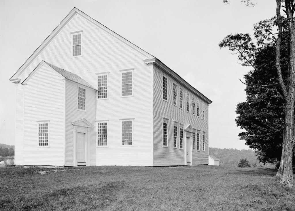
Rockingham Meeting House, Rockingham, Vermont

The Rockingham Meeting House around 1900-1910. Image courtesy of the Library of Congress, Detroit Publishing Company collection.
The meeting house in 2018:
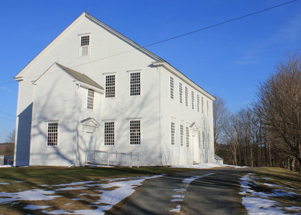
The Rockingham Meeting House is one of the two oldest existing church buildings in Vermont. It is so old, in fact, that it was not built in the United States – construction began in 1787, four years before Vermont became a state. At the time, Vermont was an independent republic, and although the citizens overwhelmingly favored joining the Union, there were issues over conflicting land claims between New York and New Hampshire. By the time the building was completed in 1801, however, Vermont had since joined as the 14th state.

Although it was built at the end of the 18th century, its architecture is fairly conservative, and it looks more like meeting houses from the first half of the century.  Probably the most conspicuous difference between it and most other churches built in the late 18th and early 19th century is its lack of a steeple.  Many early 18th century churches did not have steeples, although by the time the Rockingham Meeting House was built they were fairly commonplace.  Another difference is the interior layout; the main entrance, as seen in this view, is located in the middle of the long side of the building, and inside the pulpit is directly opposite it.  Again, this was common in the mid 18th century, but by the start of the 19th century most churches were being built with the central aisle running the length of the building.

Like many other meeting houses of the era, this building was used for both church services and town meetings, and at the time of its construction it was in the center of the main village in the town of Rockingham.  However, as time went on, and as industry replaced farming as the livelihood for many residents of the town, the village of Bellows Falls along the Connecticut River became Rockingham’s center of population.  Church services here ended in 1839, and town meetings continued until 1869.  After that, the building was mostly vacant until the early 20th century, when the historical significance of the building came to be appreciated.  The first photo was probably taken around the time of its restoration 1907.  Overall, the building is one of the best-preserved meeting houses in New England, in part because of its relatively brief use as a church and meeting house.  Today, the building is owned by the town of Rockingham, and is rented out for weddings and other functions.  However, because the building was never really updated or renovated since its completion, neither electricity nor heat was ever installed, so it is only usable in the summer months.
Baxter Memorial Library, Rutland Vermont

The H. H. Baxter Memorial Library at the corner of Grove and Library Streets in Rutland, around 1900-1906. Image courtesy of the Library of Congress, Detroit Publishing Company collection.

540_1900-1906c loc

The building in 2015:

540_2015
The Baxter Memorial Library was built in 1889 in honor of Horace Henry Baxter, a businessman who was involved in railroads as well as the Rutland marble business.  He served from 1859 to 1861 as the Adjutant General of the Vermont Militia, and later in the decade he moved to New York City, where he served as the president of the New York Central Railroad from 1867 to 1869, and was on the railroad’s board of directors from 1869 until his death in 1884.  Five years later, the library opened with funds donated by his family.  Today, the building is still there, and the only major difference is the retaining wall, which was removed in the 1950s, and the stones were used to make an addition on the other side of the building.  Otherwise, the only significant change is its use – today, it is the Rutland Jewish Center, and is on the National Register of Historic Places.

Merchants Row, Rutland Vermont

Looking north on Merchants Row from Center Street in Rutland, around 1904. Image courtesy of the Library of Congress, Detroit Publishing Company collection.

539_1904c loc

Merchants Row in 2015:

539_2015

Aside from a conspicuous lack of horse-drawn carriages in the 2015 scene, this view of Merchants Row hasn’t changed a whole lot in the past 111 years.  The only prominent building from 1904 that doesn’t survive today is the one on the far right, which was destroyed along with several other buildings in the 1906 fire.  Following the fire, the current building was built on the site.  Otherwise, all of the other buildings are still around today, although some have been altered.  The left side of the street is particularly well-preserved, with many of the buildings dating to the 1860s.  The oldest of these is probably the Ripley Bank Building, which was built before 1864.  Just beyond it is the ornate facade of the Rutland Opera House, which was built in 1881 after the original burned in 1875.  Today the entire area here is part of the Rutland Downtown Historic District on the National Register of Historic Places.