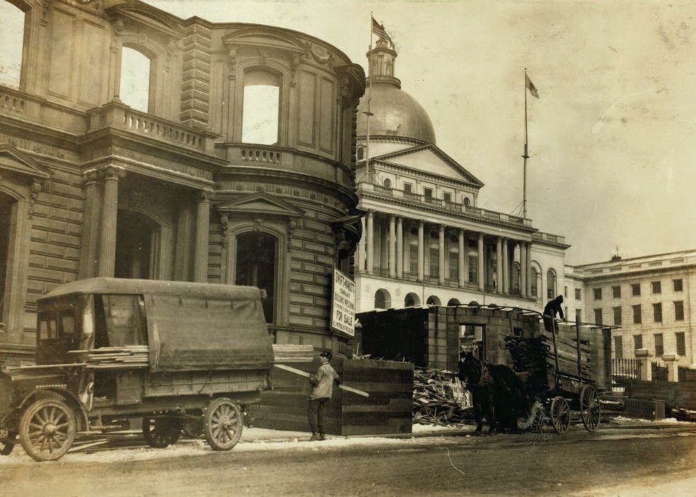
The Massachusetts State House, with a Beacon Street house being demolished in the foreground. Photo taken January 27, 1917 by Lewis Wickes Hine of the National Child Labor Committee, courtesy of the Library of Congress.
The scene in 2014:
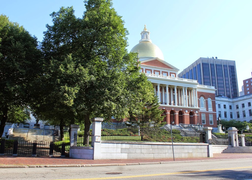
The Massachusetts State House was built in 1798, but has been expanded several times over the years. An 1895 expansion was built behind the original building, and in 1917 the east and west wings were added (east wings visible on the right-hand side of both photos). The west wing, however, required the demolition of a number of houses on Beacon Street, Joy Place, and Mount Vernon Place, and the elimination of Hancock Avenue altogether.
One of the demolished buildings can be seen here in the first photo. In this particular scene, Lewis Wickes Hine captures workers, including young children, bringing wood home, presumably to use for firewood on what was probably a chilly late January day.