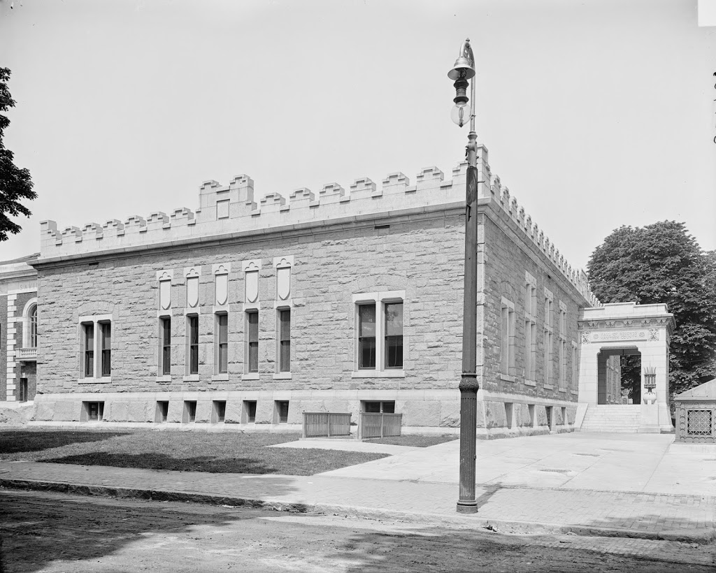
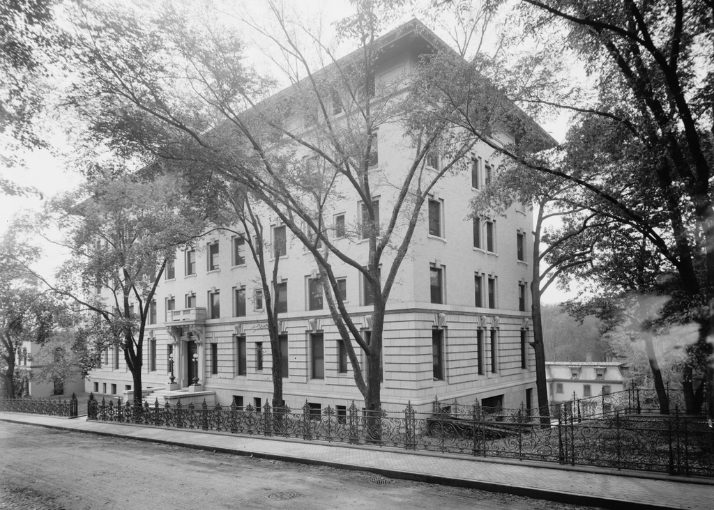
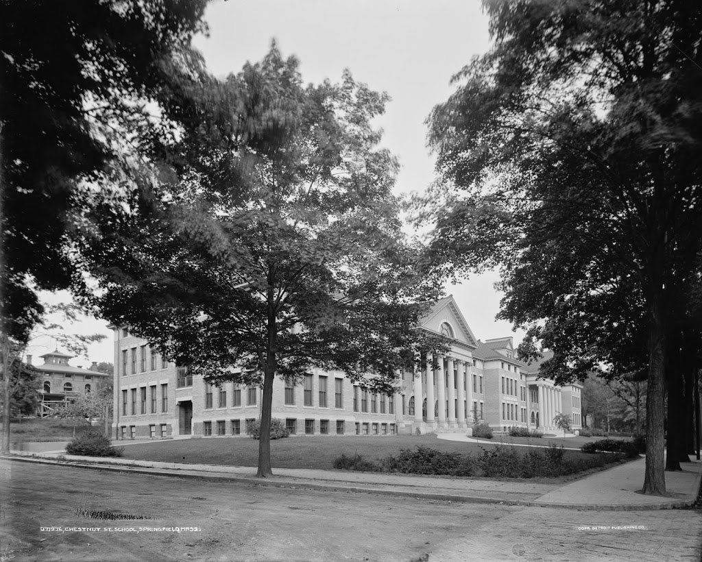
The Chestnut Junior High School in Springfield, around 1905-1915. Image courtesy of the Library of Congress, Detroit Publishing Company Collection.
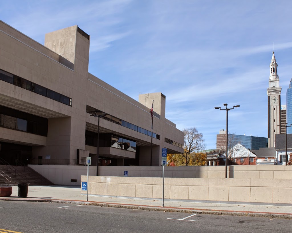
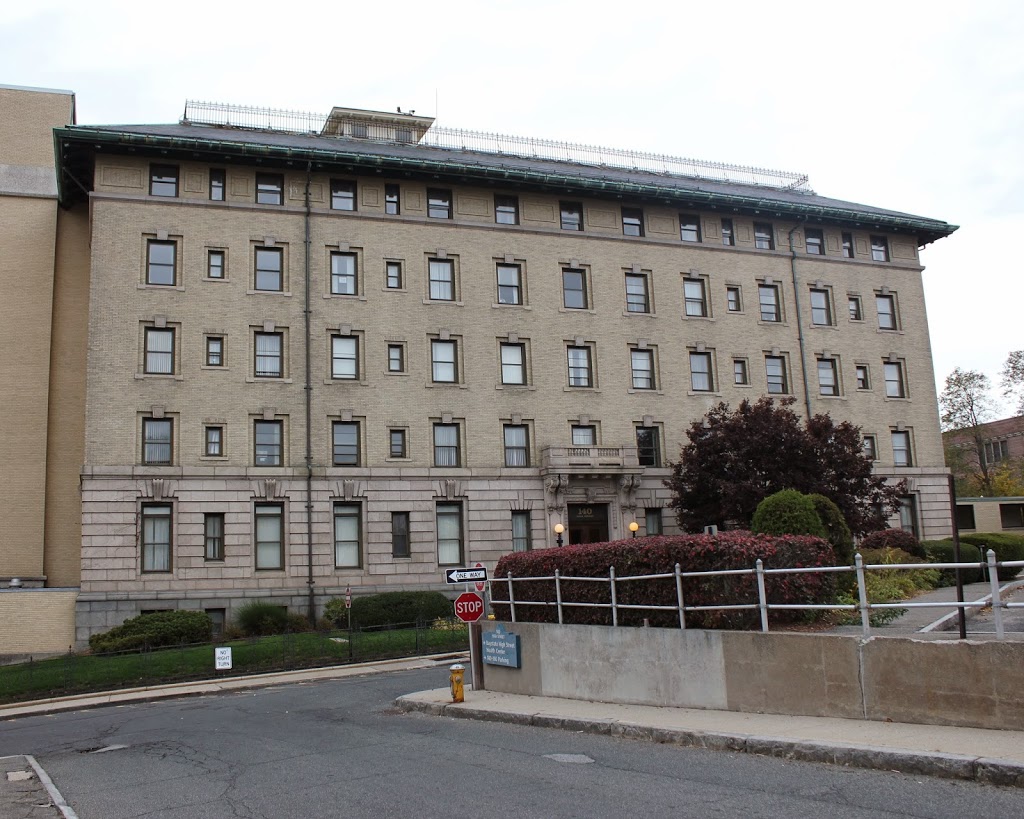
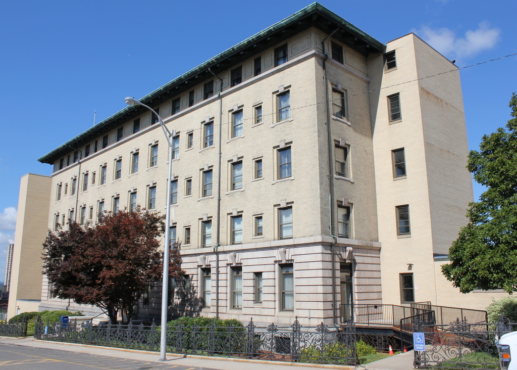
The scene in 2014:
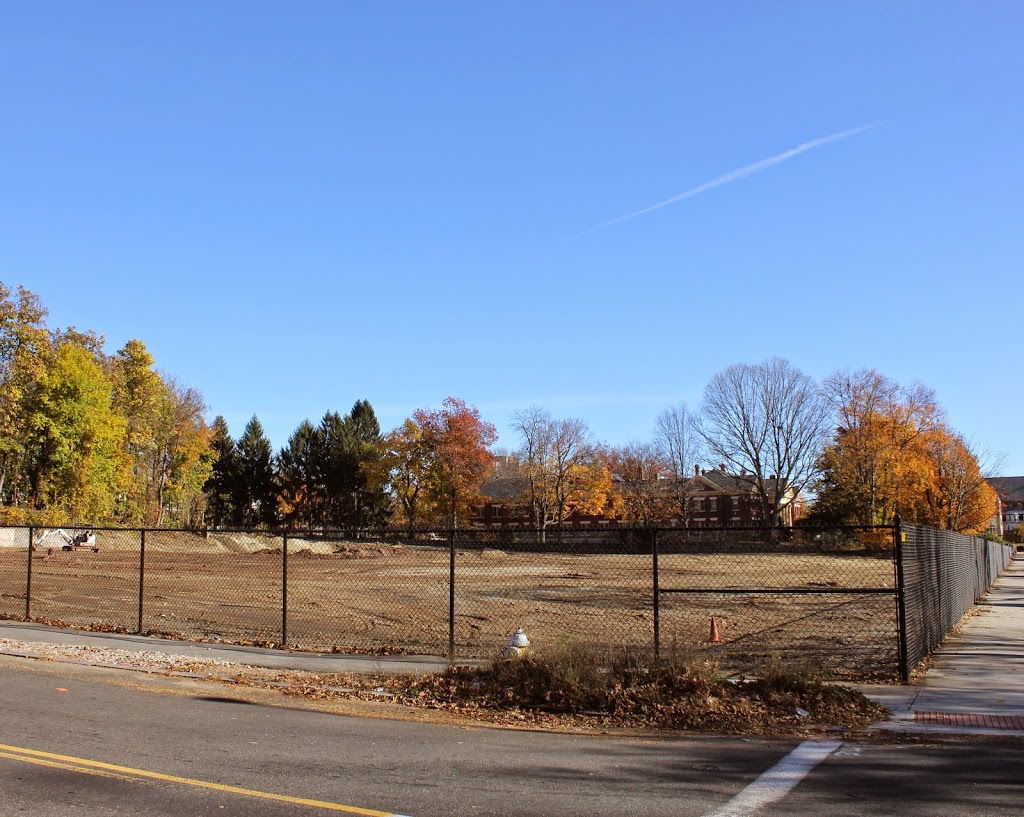
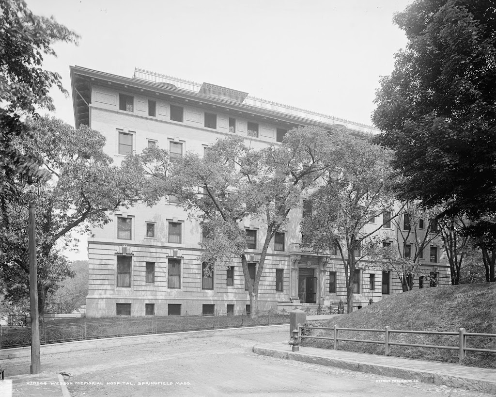
Chestnut Junior High School opened in 1903, at the corner of Chestnut and Prospect Streets in the North End of Springfield. The building was used as a school for 101 years, before closing in 2004. In the years after its closing, several redevelopment proposals were floated, including a seemingly promising plan to convert the school into condominiums, much like what was done with Classical High School on State Street in 1986. Built only a few years before Chestnut, the school was successfully converted into condos, but that would not be the case with this school in the North End. The building suffered from water damage and other deterioration, so the renovation costs, combined with a less than desirable neighborhood, meant that the proposal went nowhere. It was vacant until September 2013, when it was destroyed by a fire. The site has since been cleared, and nothing remains of the historic school building.