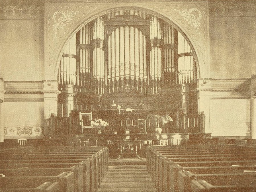
The interior of Old First Church in Springfield, around 1915. Photo from The First Church, Springfield, 1637-1915; Milestones Through Twenty-Seven Decades (1915).
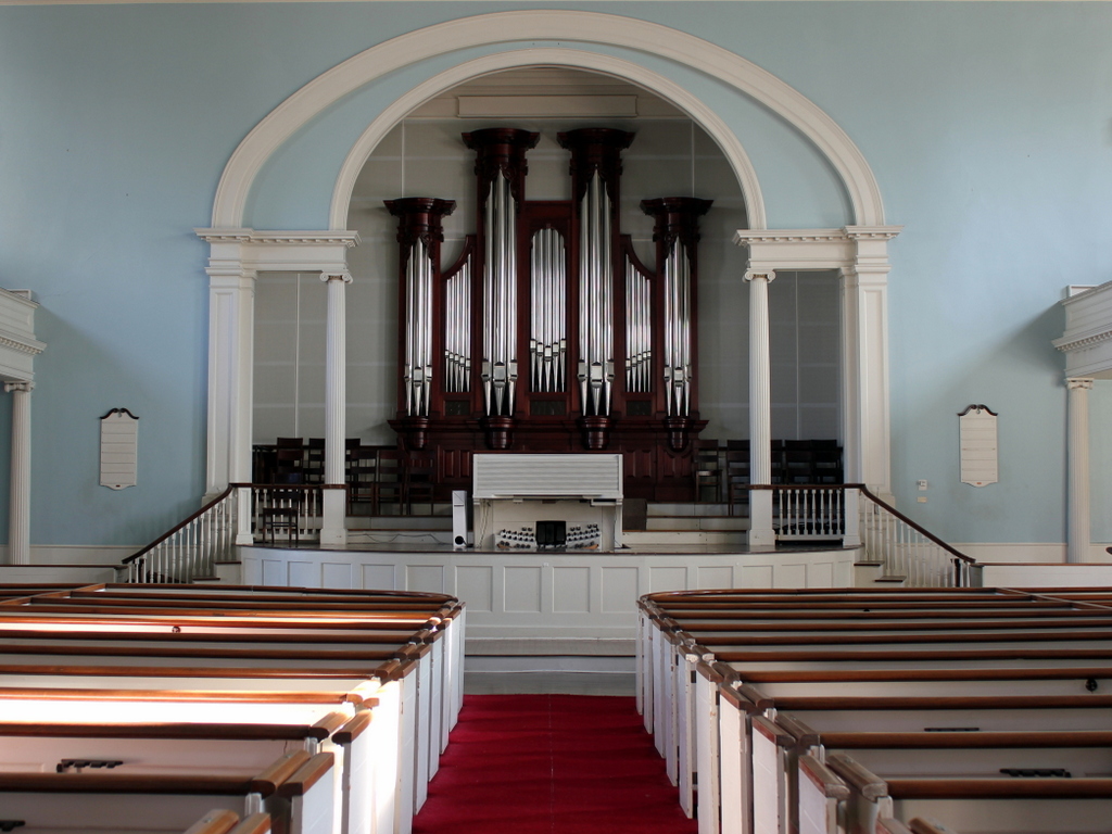
The church in 2015:
Old First Church was featured in the first post on this blog, and it is probably my favorite historic building in Springfield. It is also the oldest church building in the city, having been completed in 1819, and it is one of the oldest buildings of any type in Springfield. Although the exterior of the church hasn’t changed much in the past 195 years, the interior has gone through some changes, as the two photographs show.
As built, the church had different pews, which had tall backs and were not particularly comfortable. These were replaced with the current pews in 1864. Also at this time, the high pulpit was replaced with a platform, and the arch was constructed over it. The first organ was installed in 1849, but it was on the balcony in the back of the sanctuary; it wasn’t until 1881 that the organ was moved to the front, and the current organ has been there since 1958. Since the 1915 photo was taken, most of the major changes to the interior came in 1924, when it was renovated to early 19th century designs. This included modifying the arch over the organ and adding the two columns, changing the curve of the ceiling, and adding decorative scrollwork to the ceiling.
The church was dedicated in a special ceremony on August 19, 1819, with Reverend Samuel Osgood preaching on the occasion. Osgood had been the pastor of the church since 1809, and would continue in that capacity until 1854. During the ceremony, Colonel Solomon Warriner led the performance of four songs. Warriner was the director of music for the First Church from 1801 to 1838, and served as a colonel in the Massachusetts Militia during the War of 1812.
In the years that followed, the sanctuary at Old First Church has hosted a number of notable guests, including Secretary of State and Senator Daniel Webster, abolitionist John Brown, singer Jenny Lind, and evangelist D.L. Moody. I don’t know if any living presidents have ever visited the church, but in 1848, the body of John Quincy Adams lay in state in the center aisle when his body was being brought back from Washington, D.C. to Quincy. Far more recently, several other notable politicians have spoken at Old First Church, including former Massachusetts Governor Deval Patrick, Senator Elizabeth Warren, and former Mayor of Boston and Ambassador Ray Flynn.
The church congregation disbanded in 2007, after 370 years of existence, as a result of declining membership and the increasing costs of upkeep. The City of Springfield purchased the building and uses it for various functions. It is, however, still used as a church – WellSpring Church leases the building from the city for Sunday services and church offices.