Blandford Street Incline, Boston

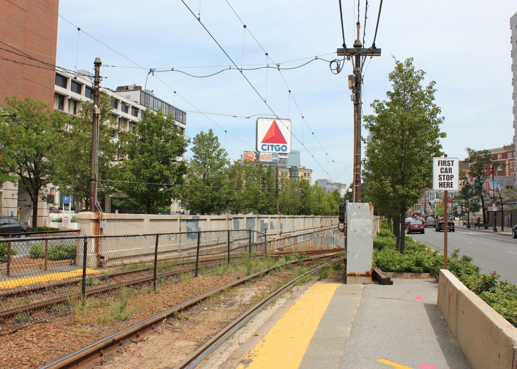
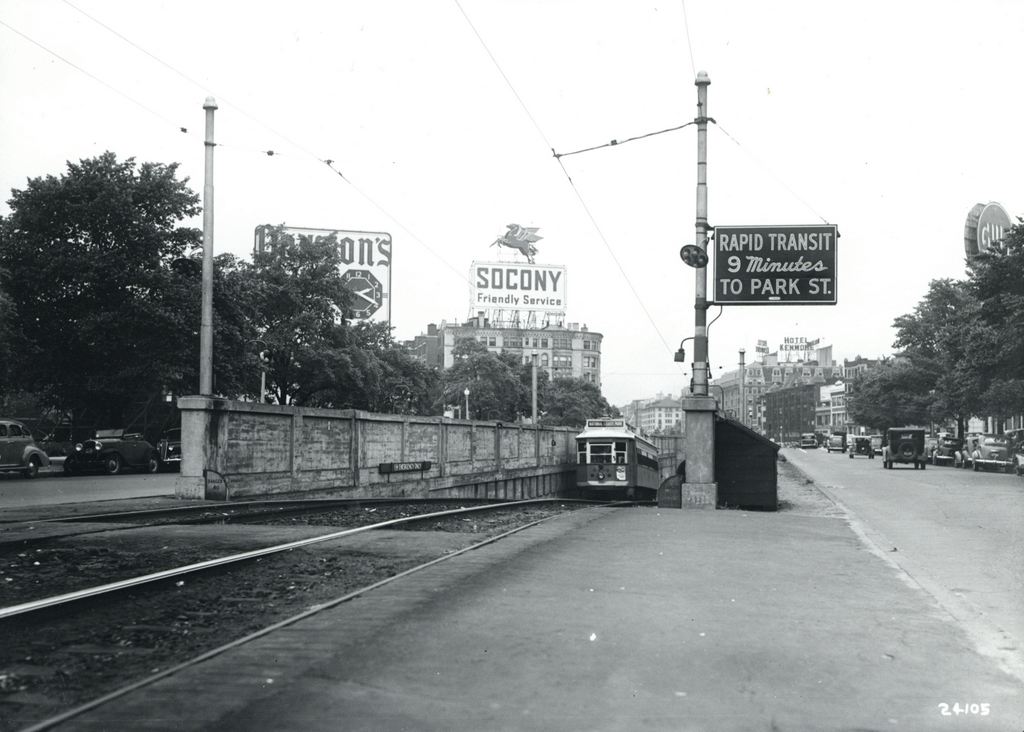
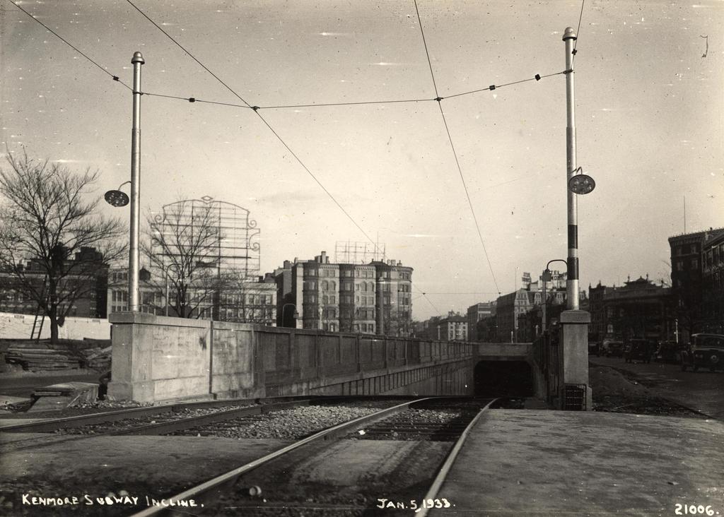
Facing east on Commonwealth Avenue toward Kenmore Square, with the Blandford Street Incline in the foreground, on January 3, 1933. Image courtesy of the City of Boston Archives.

710_1933-01-05 coba

The same location in 1943. Image courtesy of the City of Boston Archives.

710_1943 coba

The view in 2015:

710_2015
As mentioned in this post, trolley cars once entered and exited the subway from an incline in the median of Commonwealth Avenue just east of Kenmore Square.  However, in 1932 the tunnel was extended a little to the west, with one branch emerging here, at the present-day Boston University campus.  The first photo shows the incline shortly after it opened, and not much had changed ten years later when the second one was taken.

The most obvious change in the first two photos is the signs – by 1943 Kenmore Square had become home to many large advertisements, including ones for Dawson’s Pale Ale and Lager, Socony, the Hotel Kenmore, and Gulf.  Several of these signs were easily visible from Fenway Park, with the Gulf sign in particular being prominent in photographs of the park from that era.  Another sign in the foreground indicates that Park Street is a mere nine minutes away, which either suggests that the trolleys ran much faster than they do now, or that the Boston Elevated Railway was being a little generous in their estimates.

The second photo also reveals a largely forgotten piece of Boston history; the trolley coming up from the tunnel has “National League Park” as its destination.  Long before the Red Sox, the Boston Braves were the city’s original Major League Baseball team, and from 1915 to 1952, they played about a mile up Commonwealth Avenue from here.  After the team moved to Milwaukee for the 1953 season, the old stadium was purchased by Boston University and converted into Nickerson Field, with some of the original structure still standing today.

In the 2015 scene, the subway incline hasn’t changed much; even the poles supporting the overhead wires appear to be the same ones from the first two photos.  To the left, the Boston University campus has continued to expand, and today several of BU’s buildings are visible here.  In the distance, many of the buildings in Kenmore Square are still standing, and although none of the 1940s signs still exist, Kenmore Square is now home to arguably the city’s most famous sign, which appears to be located at the same spot as the old Socony sign.  This Citgo sign is visible over the Green Monster at Fenway Park, and has been identified with the Boston Red Sox ever since it was first constructed in 1965.

Kenmore Square, Boston

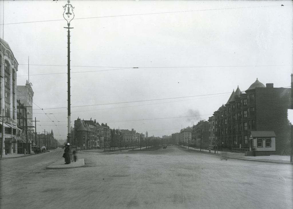
Facing east in Kenmore Square, with Beacon Street to the left and Commonwealth Avenue to the right, on November 14, 1911.  Image courtesy of the City of Boston Archives.

709_1911-11-14 coba

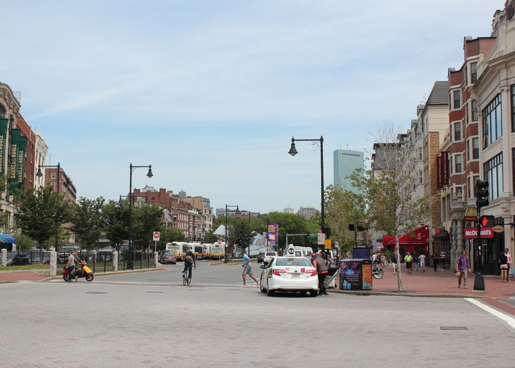
Kenmore Square in 2015:

709_2015
The area that makes up Kenmore Square today was originally Sewall’s Point, on the edge of a large tidal marsh along the Charles River.  These photos were taken right about where the shoreline once was when European settlers first arrived in 1630, and there was no dry land from here until Boston Common, around a mile and a half away. This “back bay” of Boston remained relatively unchanged for nearly 200 years, and the site of Kenmore Square, which technically wasn’t even part of Boston at the time, remained undeveloped.

Things started to change in 1821, when the Mill Dam was built across the Back Bay from here to Boston Common.  The idea was to use the tide to power factories in the area, and although that aspect of it was a failure, the dam was also used as a toll road.  Later in the 19th century, when the Back Bay was filled in, the road on the old dam became Beacon Street.  The original dam was never actually dismantled, so the wooden structure is still buried under the road today.

Once the landfill projects were completed around 1900, this area became the intersection of three major roads: Beacon Street, Commonwealth Avenue, and Brookline Avenue.  The houses along Commonwealth Avenue were primarily built in the 1890s, and within the next few decades larger commercial buildings opened here. The first was the 1897 Hotel Buckminster, which is located just behind where these photos were taken.

In the past century, Kenmore Square has not undergone drastic changes.  Many of the houses along Commonwealth Avenue are still standing, as are some of the commercial buildings to the left. Today, the square is probably best known for its association with the Boston Red Sox.  Fenway Park, which was under construction when the first photo was taken, is less than 300 yards to the right along Brookline Avenue, and the large Citgo sign that is prominently visible from the park is just out of view to the left, on top of Barnes & Noble building on the far left.

Kenmore Subway Incline, Boston

The subway incline at Kenmore Square on October 2, 1914. Image courtesy of the City of Boston Archives.

708_1914-10-02 coba

The scene in 2015:

708_2015
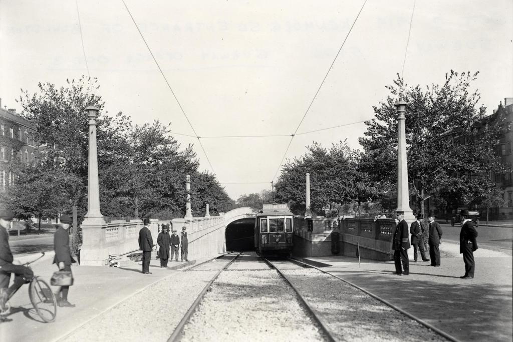
When Boston’s first subway tunnel opened in 1897, it extended as far west as the Boston Public Garden, where trolleys came to the surface and traveled west along Boylston Street.  However, because of the traffic congestion, the tunnel was extended a little over a mile to Kenmore Square, with cars surfacing just east of the square in the median of Commonwealth Avenue.  From here, the trolley lines split and either continued on Commonwealth Avenue (today’s B branch), or turned onto Beacon Street (today’s C branch).  The first photo was taken a day before the line officially opened in 1914, and the trolley car has a “Special Car” sign on top of it.  Less visible on the side of the car is a poster that reads “The Boylston Street Subway will open Saturday,” which was October 3.  The first photo was taken just to the left of the one in the previous post, probably only a few years later.

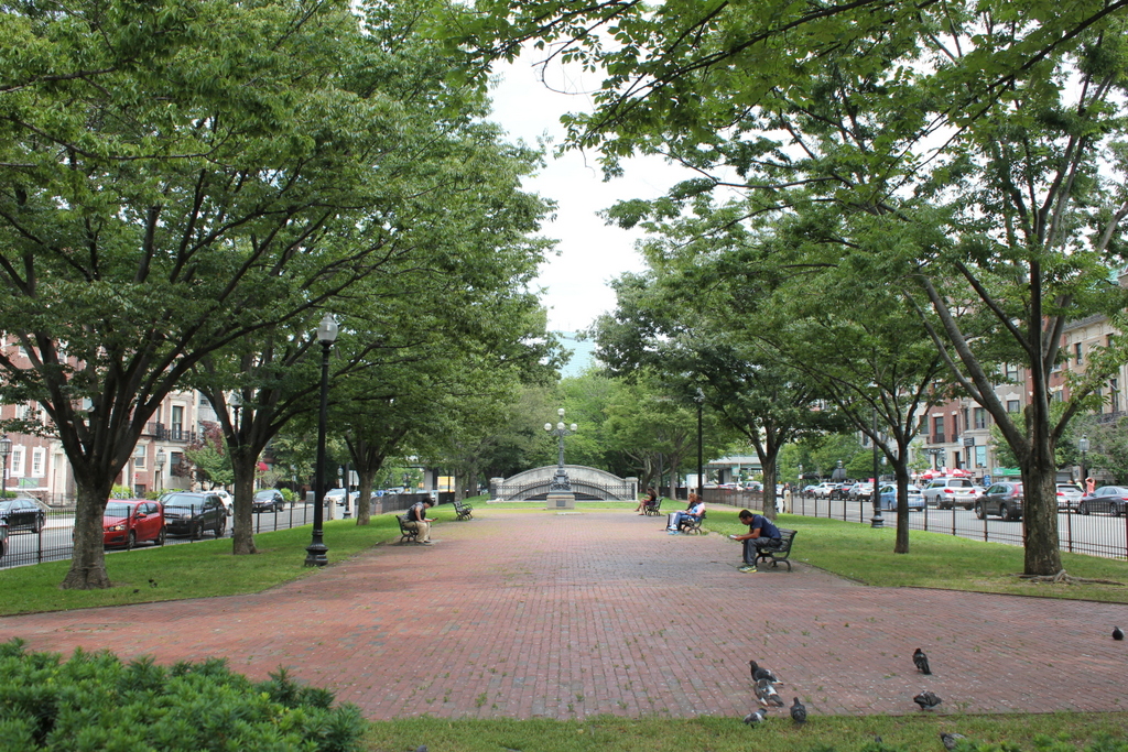
This subway incline ended up being used for just 18 years.  In 1932, the tunnel was extended under Kenmore Square, where it split into today’s B and C branches of the Green Line before surfacing just west of the square.  The original incline was closed off, and the Commonwealth Avenue Mall reverted back to its pre-1914 appearance.  Today, the only remaining trace of it is the arch in the distance, which once formed the top of the tunnel.

Commonwealth Avenue, Boston

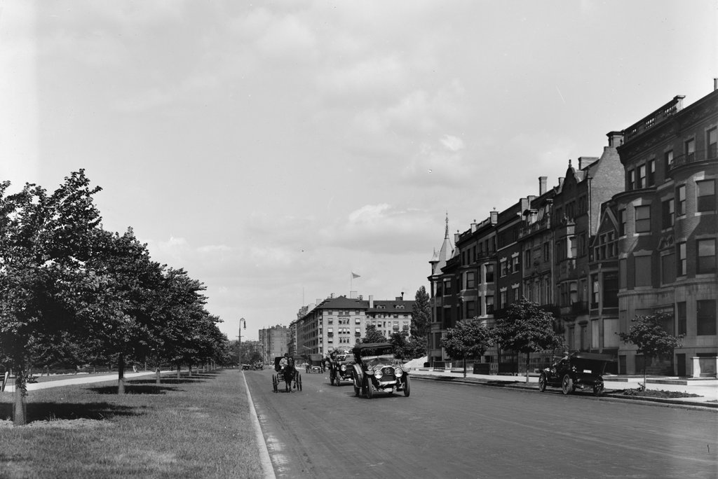
Looking east on Commonwealth Avenue from near Kenmore Square, around 1910-1914. Image courtesy of the Library of Congress, Detroit Publishing Company Collection.

707_1910-1920c loc

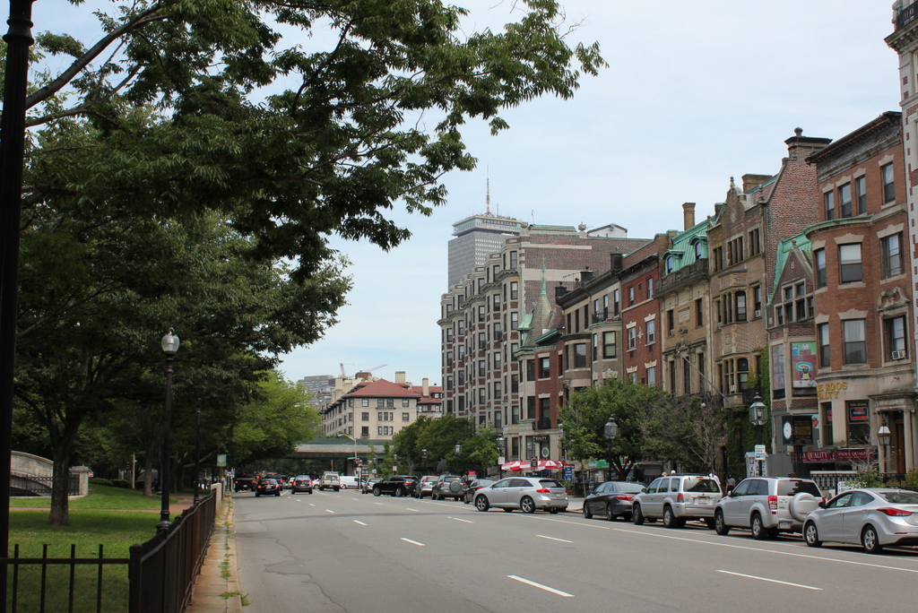
Commonwealth Avenue in 2015:

707_2015
When the first photo was taken, the Kenmore section of Boston was still being developed. The apartment building on the right, which is missing in the first photo, was built in 1916, and the other houses in the photo aren’t much older.  These late Victorian-era homes were built in the late 1890s, around the same time as the Hotel Somerset, which can be seen in the distance in the lower center of the photos.  To the left is the median of Commonwealth Avenue, which was part of the original design of the Back Bay to have a wide avenue with a large, landscaped central median.  Although today Commonwealth Avenue has one way traffic on each side of the median, this apparently wasn’t the case in the early 1900s; the first photo shows traffic traveling in both directions on what is now the eastbound side of the road.

Around 100 years later, most of the buildings from the first photo are still standing today.  The houses to the right now have stores on the ground floors, but despite this there haven’t been any drastic alterations.  As mentioned in the previous post, the Hotel Somerset is still standing on the other side of the elevated Charlesgate, but it was converted into condominiums in the 1980s.  To the left in the median, part of the old subway portal is visible in the 2015 photo.  This section of the subway opened in 1914, probably not long after the first photo was taken, with the trolleys coming to the surface at this spot in the median before crossing Kenmore Square.  This portal has since been closed off, but the arch at the top is still above ground.

Kenmore Square Bus, Boston

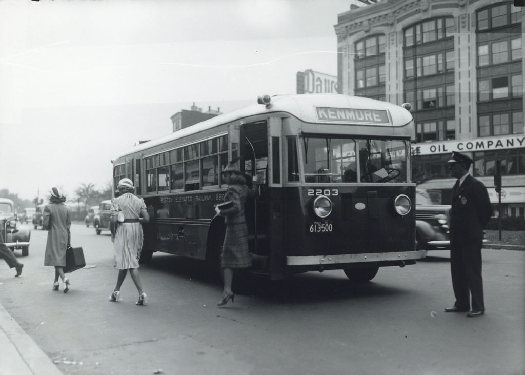
Passengers getting off of a bus at Kenmore Square, sometime in the 1940s and probably before 1947.  Image courtesy of the City of Boston Archives.

664_1940sc coba

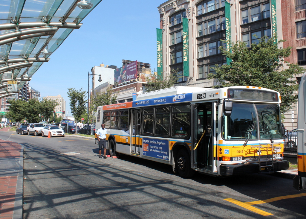
The same location in 2015:

664_2015
For all that has changed in the past 70 years, not much is different between these two photos.  Many of the buildings in Kenmore Square are still there today, including the Peerless Motor Company Building in the background on the right.  It was completed in 1911 as the New England headquarters of the Peerless Motor Company, an early luxury car brand that was in business until 1931.  The building was used for offices, showrooms, and garage space for the company, but by the time the first photo was taken, Peerless had been gone for over a decade.  Today, the exterior of the building is essentially the same as it was when it was built over a century ago, and it is used as Boston University’s bookstore.  It isn’t visible in the photo, but this is also the building that has the famous Citgo sign that can be seen beyond the Green Monster at Fenway Park.

The most obvious change from the 1940s photo is the bus.  Not only are bus styles different today, but so is the company that operates the city’s buses.  The side of the bus reads “Boston Elevated Railway,” which was the company that ran Boston’s subways, streetcars, and buses until 1947.  With increased competition from automobiles, the company was no longer profitable, so its operations were sold to the Metropolitan Transit Authority, which later became today’s MBTA.  As seen in the 2015 photo, Kenmore Square is still a major transportation hub, and the median of Commonwealth Avenue has a reserved lane for buses next to the bus shelter, which also offers access to the Green Line station directly underneath here.

Hotel Buckminster, Boston

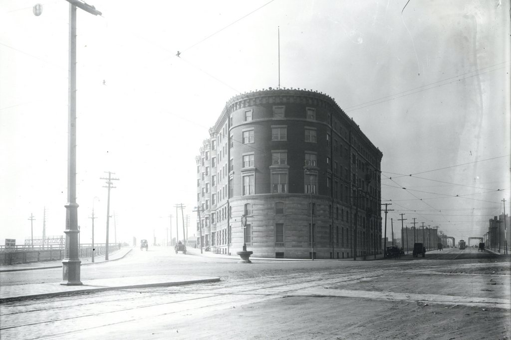
The Hotel Buckminster at Kenmore Square in Boston, around 1911. Image courtesy of the City of Boston Archives.

662_1911c coba

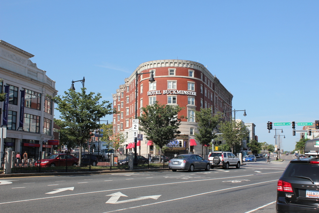
The hotel in 2015:

662_2015
The present-day Kenmore Square area was once just swampy land along the edge of the Charles River, separated from Boston the tidal flats of the Back Bay.  Boston began to fill in this land starting in the late 1850s at Arlington Street and steadily moving west.  The landfill project in the Fenway area was completed by the 1890s, and in 1897 the Hotel Buckminster opened as the first hotel at Kenmore Square, in between Brookline Avenue to the left and Beacon Street to the right.  Even by 1911, as seen in the first photo, the neighborhood was still sparsely developed.  Just a year after the photo was taken, the Red Sox would open Fenway Park on a vacant lot just two blocks south of here along Brookline Avenue.

Because of its proximity to Fenway Park, visiting teams would often stay at the hotel while they were in town.  Babe Ruth had a favorite room on the top floor along the Brookline Avenue side that overlooked Fenway Park, and it was also here that Boston bookmaker Joseph “Sport” Sullivan met with Chicago White Sox first baseman Chick Gandil and conspired to fix the 1919 World Series.  Later on, the radio station WNAC had its studio in the hotel, and in 1929 the world’s first network radio broadcast was sent from here.  From 191 to 1953, the Storyville nightclub was located in the building, and featured a number of notable jazz musicians, including Louis Armstrong, Billie Holiday, and Charlie Parker.

Over a century after the first photo was taken, the Hotel Buckminster is still around, although the neighborhood around it has grown significantly.  Although visiting teams probably don’t stay at this hotel anymore, the Kenmore Square is the primary subway station for fans going to and leaving Fenway Park, and there are a number of restaurants and other businesses that benefit from the sizable gameday crowds.  It is also a major intersection, with Beacon Street, Commonwealth Avenue, and Brookline Avenue all converging here above ground, and the “B”, “C”, and “D” branches of the Green Line meeting underground.  State Route 2 passes through here as well, and US Route 20, the longest road in the country, ends at Beacon Street, right in front of the hotel.