Lost New England Goes West: Palace Hotel, San Francisco (3)

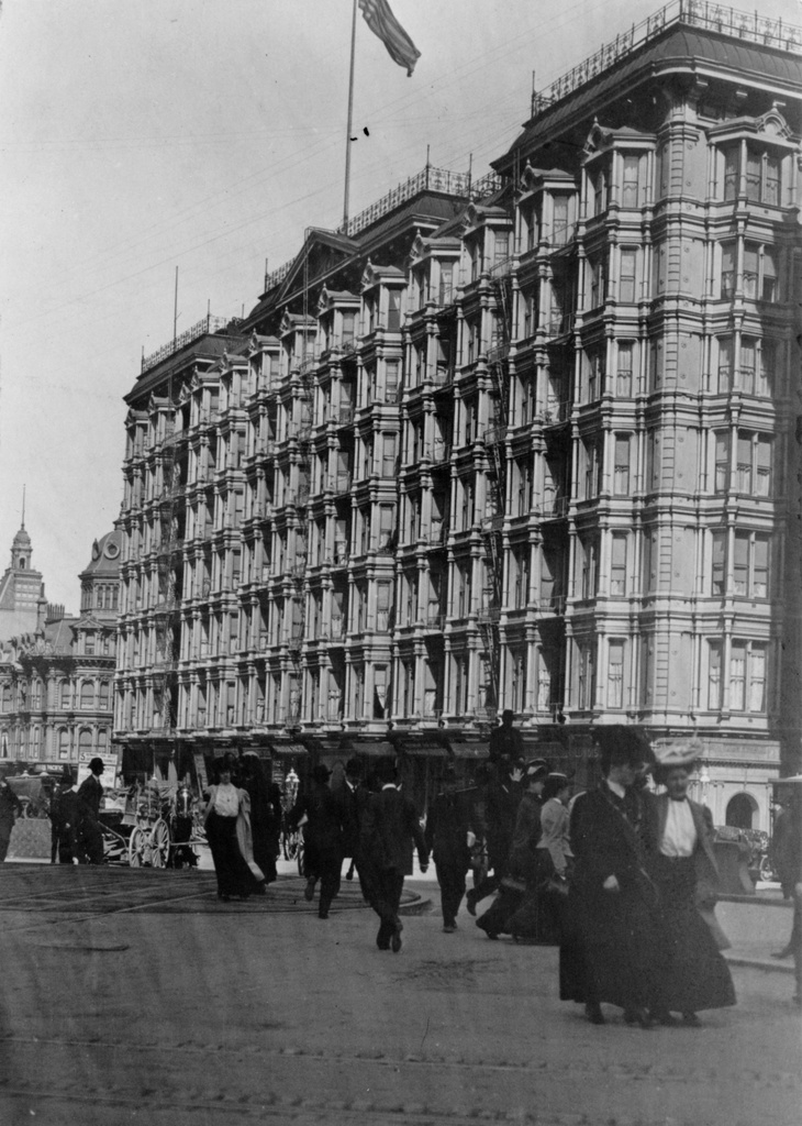
The Palace Hotel in San Francisco, seen from the corner of Market, Kearny, and Geary Streets in San Francisco, probably on April 15, 1906. Image courtesy of the Library of Congress.

896_1906c loc


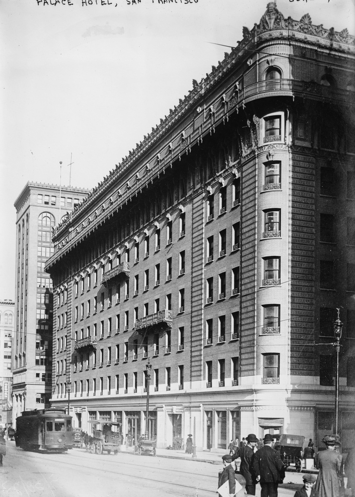
The new Palace Hotel, around 1910-1920. Image courtesy of the Library of Congress, Bain Collection.

896_1910-1920c loc

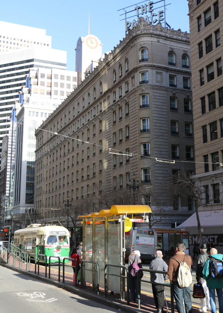
The hotel in 2015:

896_2015
The first photo here shows the original Palace Hotel as it appeared shortly before it was destroyed in the 1906 earthquake. The caption reads “The Palace April 15. Copyright 1906 Pillsbury Picture Co.”, so it appears to have been taken on April 15, 1906, just three days before the disaster. The hotel had been a San Francisco landmark since its completion in 1875, and as explained in an earlier post it had been specifically designed to withstand both earthquakes and fire. However, while its thick walls survived the earthquake itself, the building was gutted by the subsequent fires, as seen in the first photo of this earlier post, which was taken as the building burned. Yet another previous post, taken from almost the same spot as this April 15 scene, shows the burned-out remains of the hotel and other buildings along Market Street.

Three years later, the hotel was rebuilt on the same site, as seen in the second photo, and it retained its status as one of the city’s premier hotels. Several years after the second photo was taken, President Warren G. Harding died in an eighth-floor suite on this side of the building. He was visiting the city during a tour of the west coast, arriving on July 29, 1923. His health had been rapidly deteriorating amid a busy schedule, and he spent several days in the hotel before his sudden death from an apparent heart attack on August 2.

Today, not much has changed in the “new” Palace Hotel’s exterior appearance. It remains a prominent San Francisco hotel, and the buildings on either side of it are also still standing from the second photo. Market Street is as busy as it was in the early 1900s, and trolleys still run down the middle of the street as they did a century ago. Part of the “F” line of the Muni system, it runs historic streetcars, a few of which date back to the era the second photo was taken. The one in this particular 2015 scene is a PCC streetcar that was built in 1948, making it still far closer in age to the first two photos than to the present-day.

This post is part of a series of photos that I took in California this past winter. Click here to see the other posts in the “Lost New England Goes West” series.

Lost New England Goes West: Stockton Street, San Francisco (2)

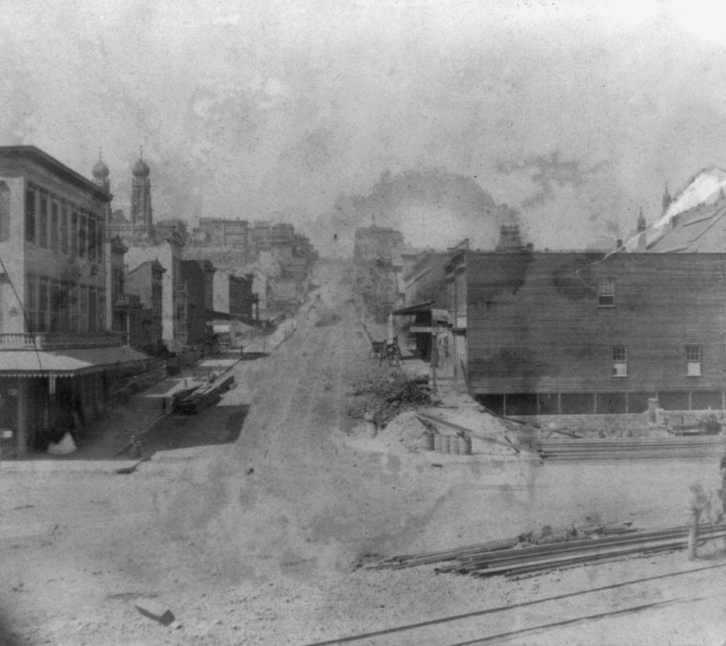
Looking north on Stockton Street from Market Street in San Francisco, in the early 1860s. Image courtesy of the Library of Congress, Lawrence & Houseworth Collection.

895_1866c loc

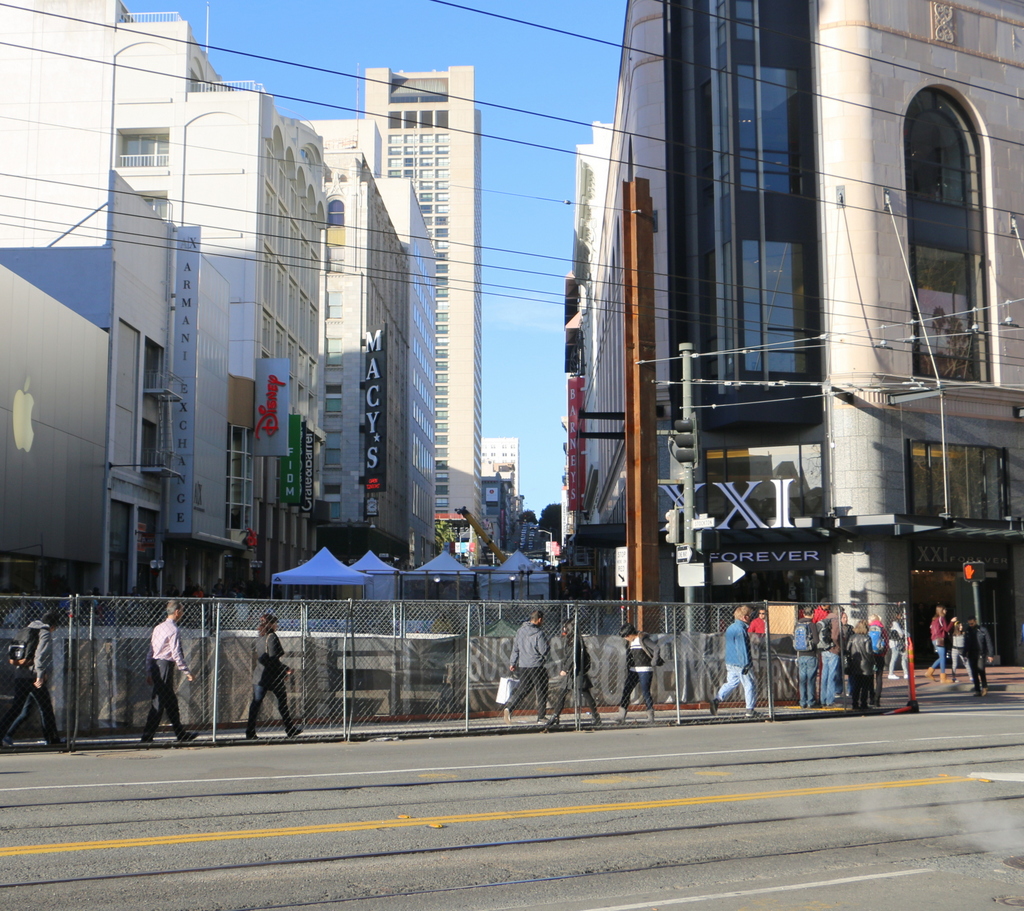
The scene in 2015:

895_2015
The southern end of Stockton Street is here at Market Street, which has been the commercial center of San Francisco since it was first laid out a few years before the first photo was taken. The photo was possibly taken in 1860, because the scene in the foreground appears to show the construction of the Market Street Railway, a horse-drawn trolley system that opened here in 1860. Today, the trolley system is still in place, although this line now operates historic electric streetcars rather than their horse-drawn predecessors.

Today, this section of San Francisco in the vicinity of Union Square is a major shopping district. Nothing is left from the original photo; most of the small two and three story buildings were probably gone before the turn of the 20th century, and anything that would have been left would have been destroyed in the 1906 earthquake. The two photos do have at least one thing in common, though – as in the 1860s view, the 2015 scene also shows a major public transit program in the works. As of 2016, San Francisco is building the Central Subway here, underneath Fourth Street and Stockton Street. The city does not have much in the way of true rapid transit lines, and this subway, which is scheduled to be completed in 2018, will provide much-needed service to the South of Market and Chinatown neighborhoods.

This post is part of a series of photos that I took in California this past winter. Click here to see the other posts in the “Lost New England Goes West” series.
Lost New England Goes West: California Street, San Francisco (2)

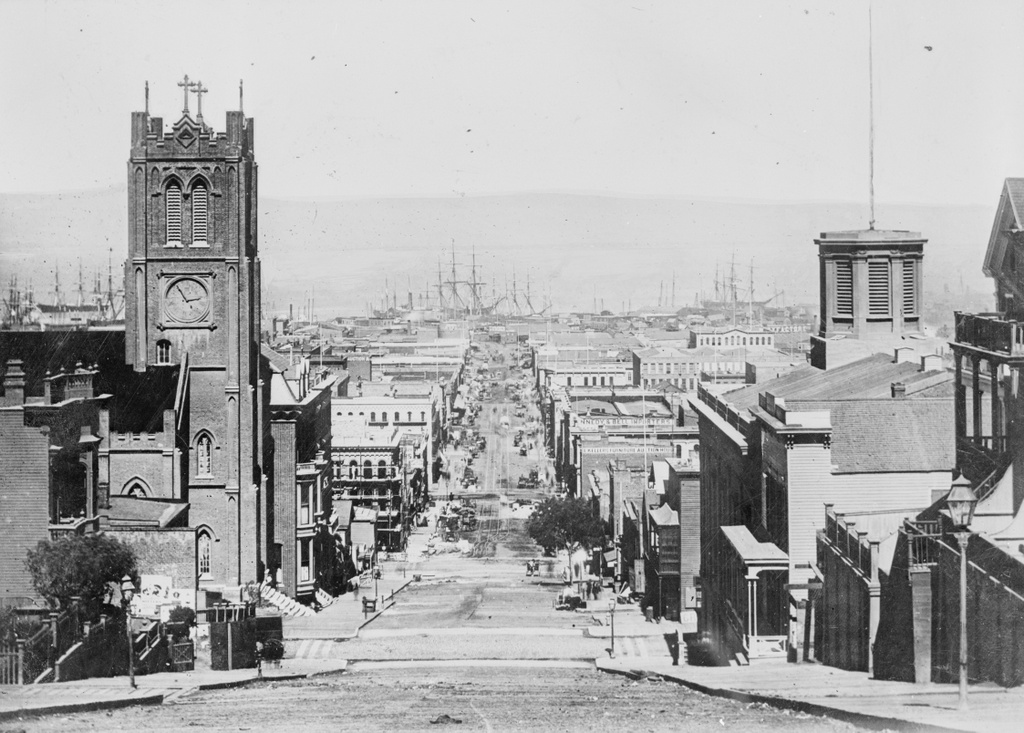
Looking east down California Street in between Grant and Stockton Streets in San Francisco, in 1863. Image courtesy of the Library of Congress, Historic American Buildings Survey Collection.

894_1863c loc

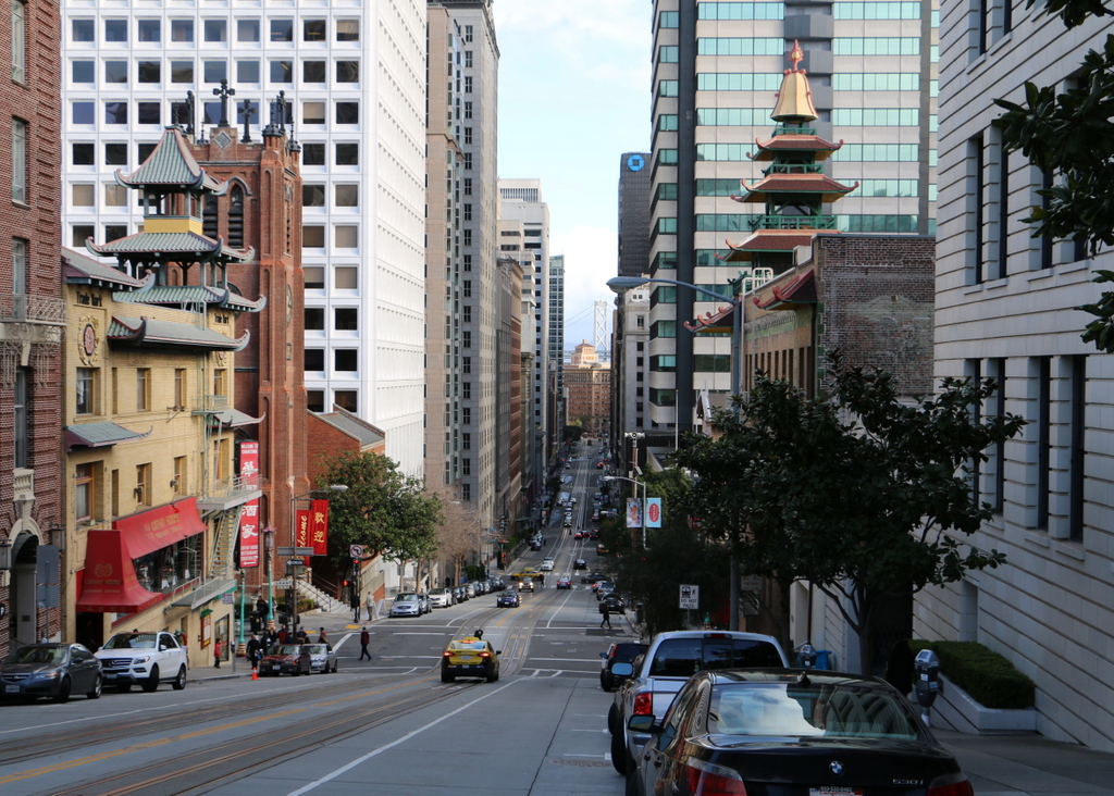
California Street in 2015:

894_2015
When the first photo was taken, the United States was in the midst of the Civil War, and although the bulk of the fighting was some 2,000 miles away, California nonetheless contributed to the Union war effort. Thanks to the Gold Rush about 15 years earlier, San Francisco was a prosperous, rapidly-growing city, and much of this gold was used to fund the Union army. Although southern California had a substantial number of Confederate sympathizers at the time, the northern part of the state, including San Francisco, was predominantly pro-Union, and provided a number of soldiers who went east to fight.

After the Civil War, San Francisco’s prosperity continued, and this section of California Street in the distance became the city’s Financial District. However, the entire area was destroyed in the 1906 earthquake and the resulting fires that spread across the city, and only a few buildings in this scene survived. The photo in this earlier post, taken from the base of the hill facing up California Street, shows some of the destruction.

The most notable survivor from the 1863 photo here is the Old Saint Mary’s Cathedral on the left, at the corner of Grant Avenue. Built in 1854, it withstood the earthquake itself, but was gutted by the fires that left only the brick walls standing. The interior was rebuilt in 1909, and the church is still standing today as a prominent landmark in the city’s Chinatown neighborhood.

This post is part of a series of photos that I took in California this past winter. Click here to see the other posts in the “Lost New England Goes West” series.
Lost New England Goes West: Stockton Street, San Francisco

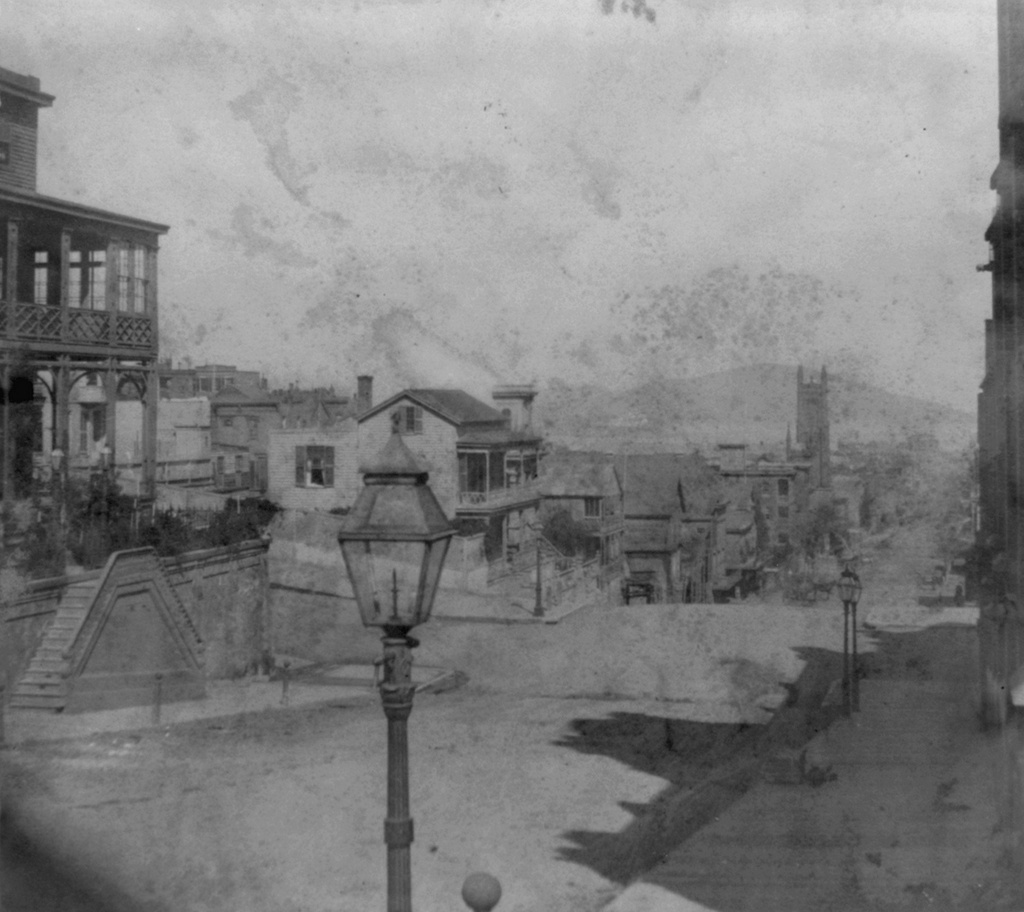
Looking north on Stockton Street from California Street in San Francisco, around 1866. Image courtesy of the Library of Congress, Lawrence & Houseworth Collection.

893_1866c loc

Stockton Street in 2015:

893_2015
When the first photo was taken, most of the buildings in the scene were still fairly new. San Francisco did not see dramatic population growth until the 1849 gold rush, and most of this area was probably developed in the mid to late 1850s. However, everything here was destroyed in the fires after the 1906 earthquake, and in 1914 the street itself underwent some major changes when the Stockton Street Tunnel was built. This tunnel starts here directly underneath the foreground, and it carries traffic two and a half blocks through the hill, while the original street still goes up and over the hill. Today, Stockton Street is one of the two main streets in Chinatown, along with Grant Avenue, and this section in the distance of the photo is the neighborhood’s primary commercial center.

This post is part of a series of photos that I took in California this past winter. Click here to see the other posts in the “Lost New England Goes West” series.
Lost New England Goes West: Portsmouth Square, San Francisco (2)

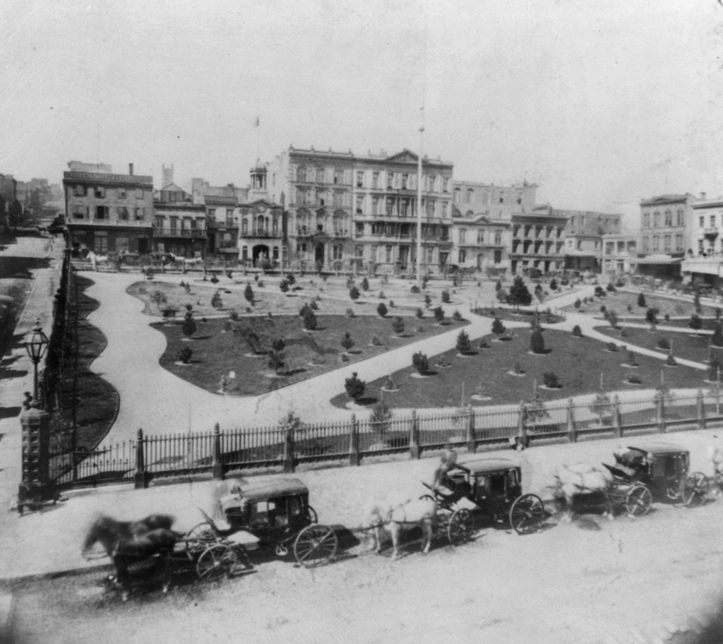
Facing west across Portsmouth Square from Kearny Street in San Francisco, around 1866. Image courtesy of the Library of Congress, Lawrence & Houseworth Collection.

892_1866c loc

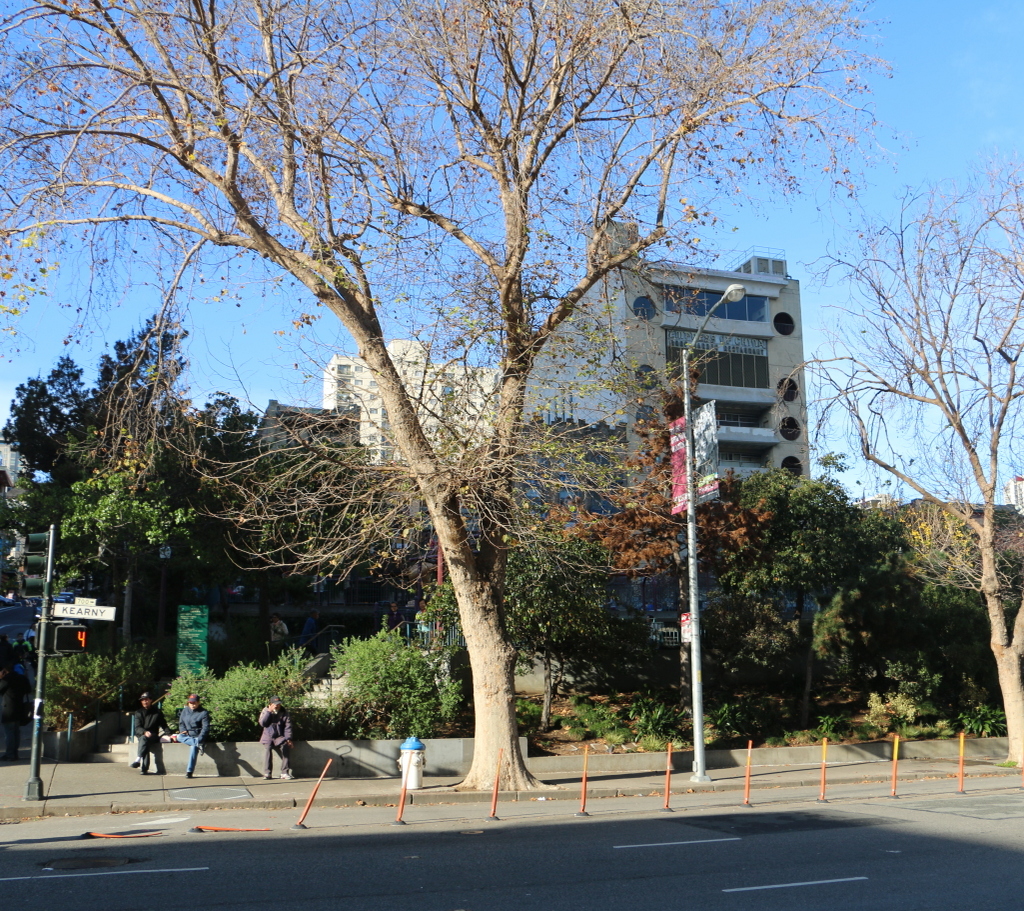
The scene in 2015:

892_2015
This earlier post shows Portsmouth Square in 1851, facing the north side of the square. Here, this first photo shows the west side of the square about 15 years later, after it had become a landscaped park. Anything from the first photo that was still standing 40 years later was destroyed in the 1906 earthquake; the photo in this earlier post shows the square, facing the opposite direction, in the aftermath of the disaster, when the square was covered in tents for displaced residents. Today, nothing is left from the original photo except for the square itself, which is still a public park and is located within the city’s Chinatown neighborhood.

This post is part of a series of photos that I took in California this past winter. Click here to see the other posts in the “Lost New England Goes West” series.
Lost New England Goes West: Russian Hill, San Francisco

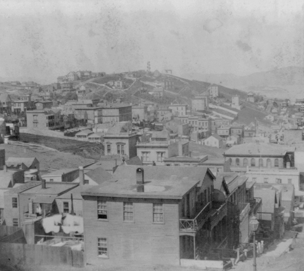
The view of Russian Hill from the corner of Mason and Sacramento Streets in San Francisco, around 1866. Image courtesy of the Library of Congress, Lawrence & Houseworth Collection.

891_1866c loc

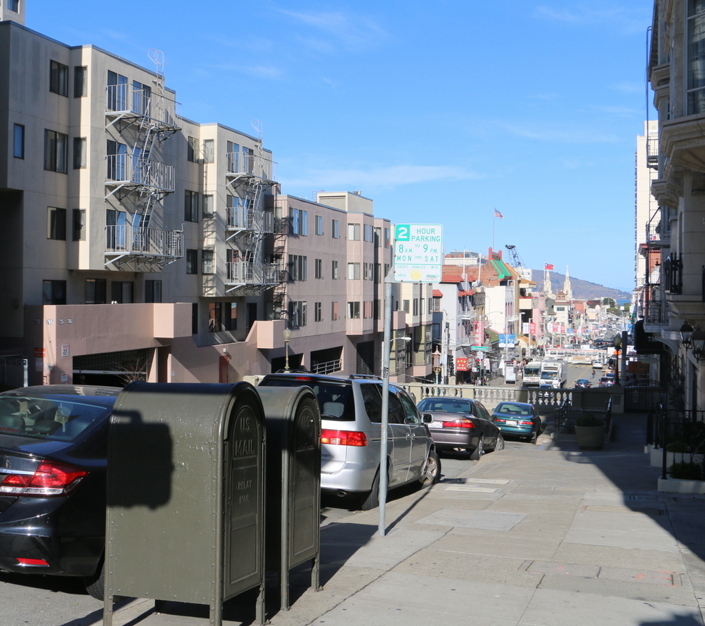
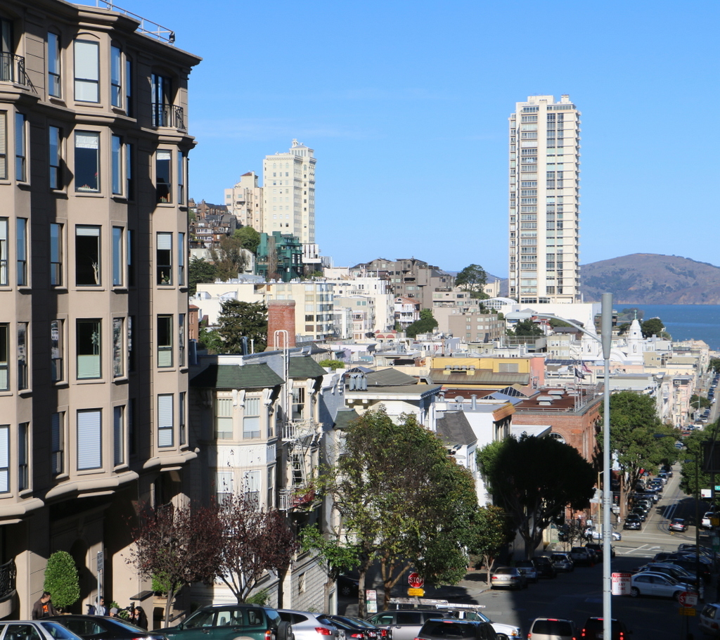
The view in 2015:

891_2015
Today, Russian Hill is probably best known for the zigzag section of Lombard Street between Hyde and Leavenworth Streets, and its excellent views of the city, as seen in this earlier post, also make it one of the San Francisco’s most expensive neighborhoods. However, when the first photo was taken 150 years ago, it was still sparsely populated, mostly with poorer residents who could not afford to live in a more convenient location. This began to change, though, soon after the photo was taken. Cable cars were introduced to San Francisco in 1873, allowing residents to easily move up and down the city’s many hills. As a result, wealthy residents who no longer had to worry about walking up the steep grades now found Russian Hill and nearby Nob Hill, where these photos were taken from, as appealing places to live.

As is the case with most of the other 19th century views of the city, most of this scene was completely destroyed by the fires caused by the 1906 earthquake. Much of Russian Hill now consists of modern condominium buildings, but there are a few surviving pre-earthquake homes near the top of the hill, especially along Green Street. At least one of these, the Feusier Octagonal House, was standing when the first photo was taken. It was built in the 1850s with an unusual octagonal design, and although the photo isn’t clear enough to identify the house, it would be located somewhere near the top of the hill on the left side.

This post is part of a series of photos that I took in California this past winter. Click here to see the other posts in the “Lost New England Goes West” series.