New Haven Green, New Haven, Connecticut

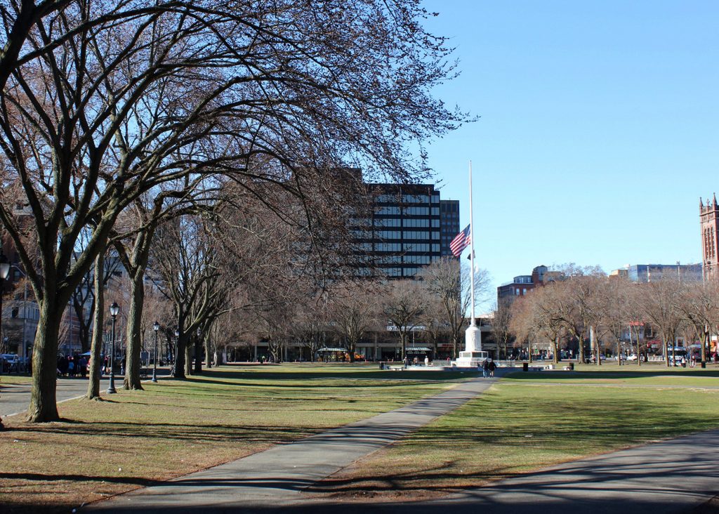
Looking south on the New Haven Green from near the corner of Elm and Church Streets, around 1900-1912. Image courtesy of the Library of Congress, Detroit Publishing Company Collection.

The scene in 2018:

The New Haven Green dates back to 1638, when it was established as one of the first town commons in the English colonies. Over the years, it would serve as the focal point of the community, and many of New Haven’s most important churches, businesses, educational institutions, government buildings, and houses have been located around – and in some cases on – the Green. These two photos show the view looking toward the southeast corner of the Green, with Church Street in the far left and Chapel Street running across the scene in the distance.

At the turn of the 20th century, this section of Chapel Street was the home of two of New Haven’s most important department stores. On the left side of the block was Gamble-Desmond, which occupied the ornate six-story, Second Empire-style building in the center of the first photo. Known as the Insurance Building, it was completed in 1871, and originally housed the offices of the American National Life and Trust Company. Other tenants included F. M. Brown & Co., a dry goods store that was purchased by David S. Gamble and John D. Desmond in 1898. Together they formed the Gamble-Desmond Company, and this department store became an important fixture in downtown New Haven throughout the first half of the 20th century.

On the right side of the block, the other major department store in this scene was the Edward Malley Company. It was founded in 1852, and during its early years it operated out of a two-story building at the corner of Chapel and Temple Streets. This building is partially visible in the distance of the first photo, a little to the right of the flagpole, but by the turn of the century the Malley Company had significantly expanded to include much of the block. The most recent addition in the first photo was the eight-story building just to the right of the Gamble-Desmond building, which was completed in 1899.

Along with Gamble-Desmond, Malley’s would also remain here at its Chapel Street location for many decades. However, as was the case in cities across the country, these once-thriving department stores began to suffer by the mid-20th century, as suburban shopping centers began to displace traditional downtown business districts. Gamble-Desmond closed in 1952, and the building was demolished several years later. Then, in 1962, Malley’s relocated to a new building two blocks to the south of here, and the old building was demolished to construct the Chapel Square Mall, which occupied the entire block along Chapel Street between Church and Temple Streets. The complex also included a hotel, along with an office tower, which is visible in the center of the present-day photo.

The mall was completed in 1967, and was successful for the first decade or two. However, the new Malley’s location, which served as one of its anchor stores, closed in 1982, and the mall began to decline. This was the case for many downtown indoor malls, which tend to combine the disadvantages of both downtown shopping and mall shopping, while offering few of the advantages of either. Both the office tower and the hotel are still here, but the mall ultimately closed in 2002, and its indoor space has since been converted into apartments.

Trinity Church on the Green, New Haven, Connecticut

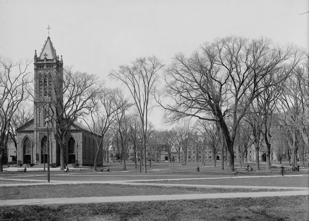
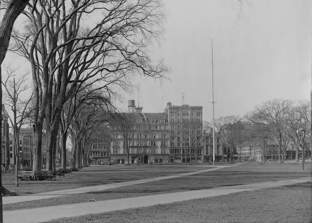
Looking west on the New Haven Green, toward Trinity Church on the Green, with the Old Campus of Yale University in the distance, around 1900-1915. Image courtesy of the Library of Congress, Detroit Publishing Company Collection.

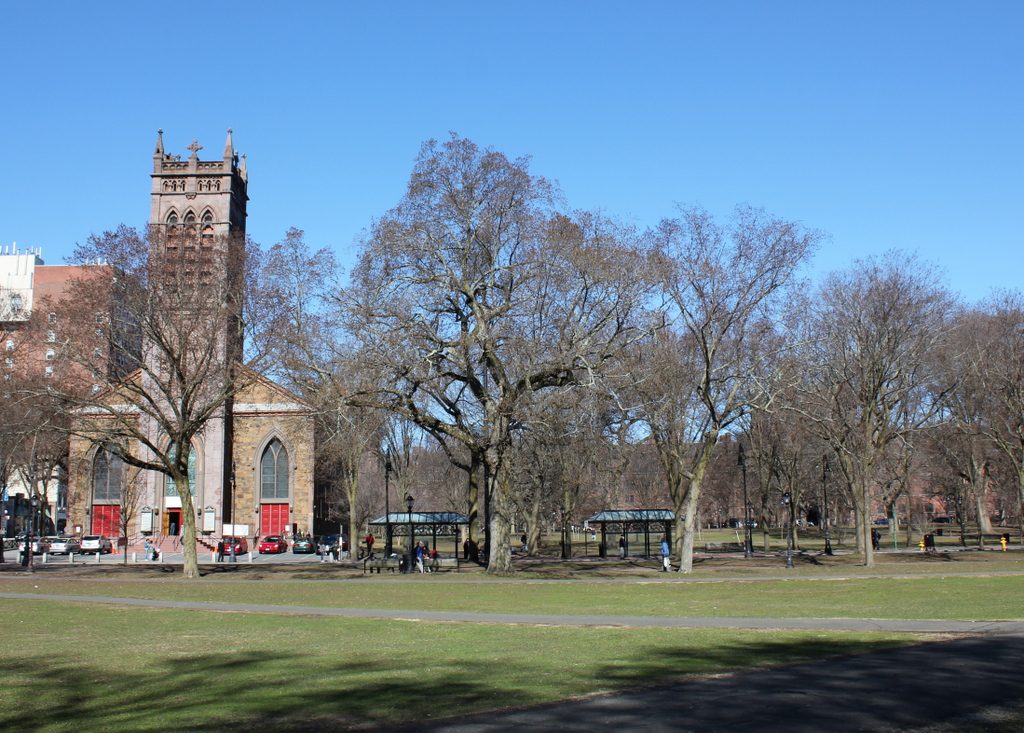
The scene in 2018:

The New Haven Green is home to three historic churches on the west side of Temple Street, all of which were constructed between 1812 and 1816. The two oldest, Center Church (1814) and United Church (1815) both feature Federal-style architecture that was common for churches of this period, and Center Church is particularly notable for having been designed by prominent architects Asher Benjamin and Ithiel Town. Town subsequently designed the last of these three churches, Trinity Church, which was completed in 1816 on the corner of Temple and Chapel Streets. However, its design was a vast departure from his work on Center Church, and it is generally regarded as one of the first – if not the first – Gothic-style church building in the country, as Gothic Revival architecture would not gain widespread popularity for several more decades.

Trinity Church was established in 1723, and was a rare Anglican parish in a colony that was otherwise predominantly Congregationalist. The first permanent church building was completed in 1753, and stood a block away from here on the southeast corner of Chapel and Church Streets. As time went on, though, this building proved too small for the growing parish, and in 1814 construction began on a new church here on the Green. The exterior was built of locally-quarried trap rock from East Rock, giving the church its distinctive multicolor appearance. This, along with the Gothic architecture, provided a significant contrast to the more conventional brick churches just to the north of here. The new church was consecrated in 1816, an event that coincided with the installation of a new rector, the noted journalist, author, and clergyman Harry Croswell.

By the time the first photo was taken in the early 20th century, Trinity Church was already nearly 100 years old, and had undergone some changes since its completion. The top of the tower was originally constructed of wood, but this portion was rebuilt of stone in 1871. The church had also been built with crenelated wood balustrades along the roofline, although these rotted and were eventually removed as part of the 1871 renovations. Other 19th century changes included the installation of stained glass windows, and the addition of a pyramidal spire atop the tower, which can be seen in the first photo.

In more than a century since the first photo was taken, the interior of the church has undergone some changes, but this view of the exterior has remained largely unaltered, with the only noticeable difference being the removal of the pyramid on the tower. Trinity Church is still an active Episcopalian parish, and the church building is now part of the New Haven Green Historic District, which includes the other two early 19th century churches nearby. Aside from the church itself, there have not been many other changes to the scene from the first photo. The New Haven Green still functions as a park in the center of the city, and the Old Campus of Yale University still stands in the distance, on the other side of College Street. The only significant difference in this view of the campus is the loss of Osborn Hall. Visible just to the right of the church, it was demolished in 1926 and replaced by Bingham Hall, which now stands on the site.

Harriet Beecher Stowe House, Hartford, Connecticut

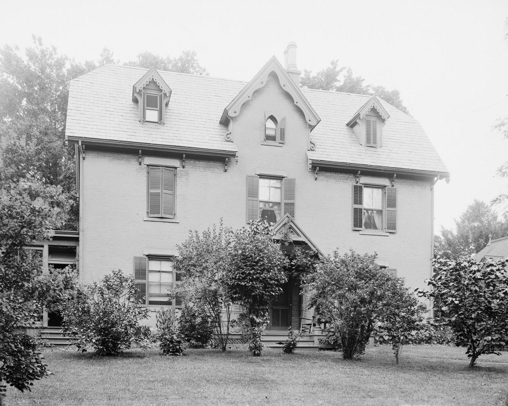
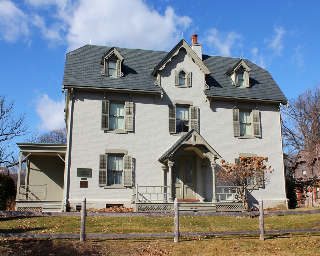
The Harriet Beecher Stowe House on Forest Street in Hartford, around 1905. Image courtesy pf the Library of Congress, Detroit Publishing Company Collection.

The scene in 2020:

Harriet Beecher Stowe, the author who was made famous by her 1852 anti-slavery novel Uncle Tom’s Cabin, was born in 1811 in Litchfield, Connecticut. She grew up in Connecticut and attended the Hartford Female Seminary, but she subsequently moved to Ohio, where she met her husband, Calvin Ellis Stowe, and then to Brunswick, Maine, where she wrote Uncle Tom’s Cabin. From there, they moved to Andover, Massachusetts, before finally returning to Connecticut in 1864.

Here in Hartford, the Stowes constructed a Gothic Revival mansion along the banks of the Park River. Known as Oakholm, the house was a dream home for Harriet, and she built it using much of the money that she had earned through the sale of her books. However, it proved too expensive to maintain, and the Stowes ultimately sold the house in 1870. The house was demolished in 1905, and the site of the house is now approximately where Interstate 84 crosses Capitol Avenue.

The Stowes’ final house, seen here in these two photos, was constructed in 1871 by Franklin Chamberlin, a lawyer who owned a large tract of land at the corner of Forest Street and Farmington Avenue. The Stowes purchased the house in 1873, and a year later they were joined by Mark Twain, who built a house just around the corner from here on Farmington Avenue. These two famous authors became the leading figures in Hartford’s flourishing literary scene, and they remained neighbors until 1891, when Mark Twain and his family moved to Europe.

In the meantime, Harriet Beecher Stowe continued to write while living in this house, although none of her subsequent works could top her first novel, which had sold more copies during the 19th century than any other book except for the Bible. She was also involved in civic organizations such as the Hartford Society for Decorative Art, which she helped to establish in 1877 along with several other notable Hartford women, including Mark Twain’s wife Olivia Clemens. The society was later renamed the Hartford Art School, and it is now part of the University of Hartford.

Calvin Stowe died in 1886, and Harriet’s health soon began to deteriorate. She evidently suffered from Alzheimer’s disease, and displayed erratic behavior such as wandering around the neighborhood, sometimes even entering her neighbors’ gardens and homes. She also took to rewriting Uncle Tom’s Cabin from memory, unaware that she had already written it. She outlived her husband by a decade, and lived here in this house until her death in 1896, at the age of 85.

Stowe’s children subsequently sold the house to Frances Z. Niles, a wealthy heiress whose father, Jonathan S. Niles, had been a prominent foundry owner. She was living in the house when the first photo was taken around 1905, and the 1910 census shows her here along with her niece, Caroline Hansell, and two servants. Neither Frances nor Caroline had ever married, and they lived here until Frances’s death in 1922. She left an estate that was valued at over $90,000, or nearly $1.4 million today. The house itself was valued at $17,000, but her single greatest asset was 33 shares of Aetna, valued at over $44,000.

In 1924, nearly 30 years after the Stowe family sold the house, it was purchased by Harriet’s niece, Katharine Seymour Day. She moved into the house, and became an outspoken advocate of historic preservation. Perhaps her single most important accomplishment in this field came in the late 1920s, when she spearheaded an effort to rescue the neighboring Mark Twain House from potential demolition. Through her leadership, the Mark Twain Memorial and Library Commission was established, which purchased the house in 1929 and subsequently restored it. Then, in 1940, she purchased the house directly to the right of hers, which had once been owned by Franklin Chamberlin.

Today, very little has changed in this scene. The house is still standing, and it is now the centerpiece of the Harriet Beecher Stowe Center, which offers guided tours of the home. The organization also owns the house on the right, which is now known as the Katharine Seymour Day House. It now houses administrative offices, along with a research library. Although not visible in this scene, the Mark Twain House is also still standing, and it is located directly behind the Stowe House. It is operated by a separate organization, but it is also open to the public for tours. Because of their connections to two of the most important American writers of the 19th century, both of these homes are now listed as National Historic Landmarks, the highest level of recognition on the National Register of Historic Places.

Katharine Seymour Day House, Hartford, Connecticut

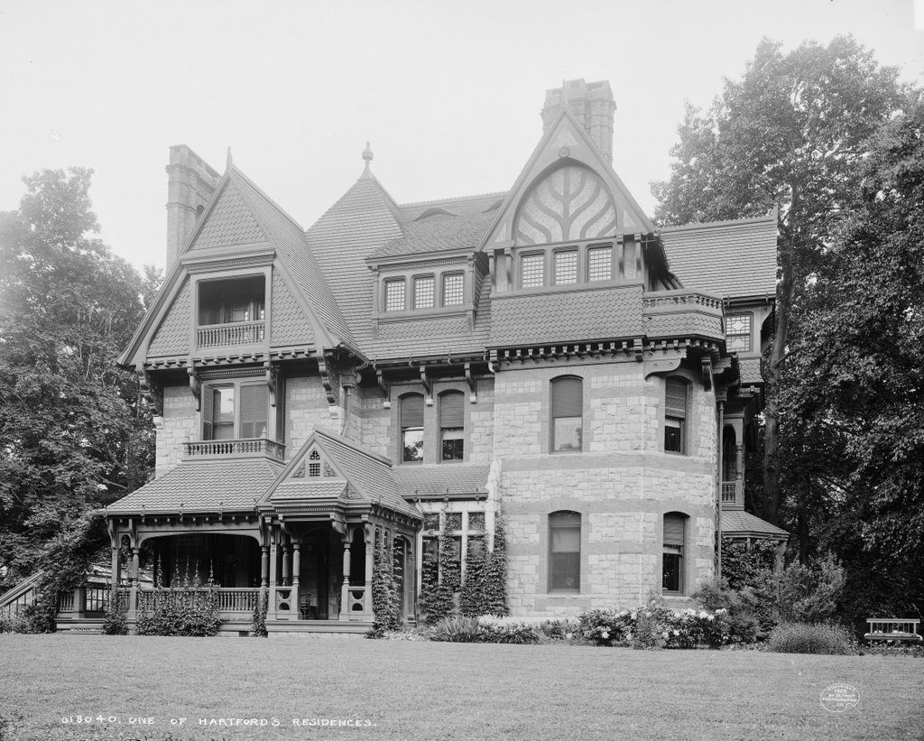
The house at the corner of Forest Street and Farmington Avenue in Hartford, around 1905. Image courtesy of the Library of Congress, Detroit Publishing Company Collection.

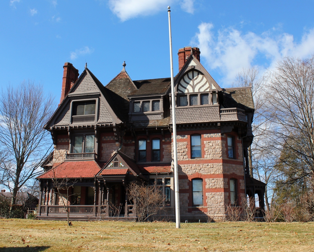
The house in 2020:

This house was built in 1884, and was designed by noted New York architect Francis H. Kimball. It features a variety of exterior colors and building materials, as was typical for Queen Ann-style homes of this period, including light-colored limestone and contrasting brownstone trim. Other common Queen Anne elements include an asymmetrical facade, along with a complex roof that is filled with an eclectic mix of gables and dormers. This style was particularly common in the United States during the 1880s and 1890s, with this house dating to the early part of that period.

The original owner of this house was Franklin Chamberlin, a lawyer who had once owned much of the land here at the corner of Forest Street and Farmington Avenue. In 1871, he had constructed a house just to the left of here, at 73 Forest Street, and in 1873 he sold it to Harriet Beecher Stowe. A year later, he sold another part of his land to Mark Twain, who constructed a house of his own on the property. However, Chamberlain retained the corner lot for himself, and subsequently built this house, which was flanked on either side by two of the country’s most celebrated authors.

Chamberlin died in 1896, but his widow Mary lived here in this house until her death in 1907. The next owner of the house was Willie Olcott Burr, the editor of the Hartford Times. His father, Alfred Edmund Burr, had been the editor of the newspaper for 60 years, and Willie began working for him as a teenager in 1861. The newspaper prospered under both father and son, and by the early 20th century it had the largest circulation of any paper in the state. Willie Burr moved into this house sometime in the early 1910s, and the 1920 census shows him living here with his wife Angie and two servants. He died only a year later, although Angie would continue to live here throughout the 1920s and 1930s.

In 1940, the house was purchased by Katharine Seymour Day, who was the grandniece of Harriet Beecher Stowe. She had previously purchased her great aunt’s former home next door, and in the late 1920s she led the effort to save the Mark Twain House, which was being threatened with demolition at the time. Her 1940 acquisition of this house helped to further preserve the neighborhood, and the house is still standing today, with few noticeable differences between the two photos. Along with the neighboring Stowe House, it is now part of the Harriet Beecher Stowe Center, and it serves as offices and as a research library for the organization.

Hadley Falls Dam, Holyoke, Mass

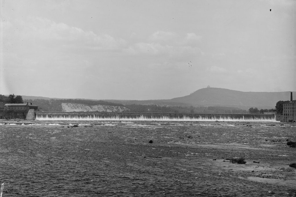
The Hadley Falls Dam on the Connecticut River, on the border of Holyoke and South Hadley, around 1900-1910. Image courtesy of the Library of Congress, Detroit Publishing Company Collection.

The scene in 2025:

As mentioned in the previous post, Holyoke is the site of the largest waterfall on the Connecticut River, with a drop of 58 feet. This made the location ideal for large-scale industrial development, and during the mid-19th century Holyoke was transformed into a prosperous manufacturing center. The first dam was built here in 1848, but it was poorly constructed, and it failed just hours after the gates were closed. However, a new dam was constructed the following year. It was built of wood, extending 1,017 feet across the river, and was 30 feet tall, with timbers that were firmly anchored four feet deep into the bedrock beneath the river.

This second dam proved far more durable than its short-lived predecessor, and it remained in use for the rest of the 19th century. However, by the early 1890s there was a need for a new dam, this time built of stone. Construction began in 1892, with the new dam being located 150 feet downstream of the old one. It took three years just to excavate the bottom of the river, and the work involved the removal of some 13,000 cubic yards of bedrock. Construction of the dam itself began around 1896, and it was comprised of a combination of rubble stone taken from the riverbed downstream of the dam, along with quarried granite blocks from Vinalhaven, Maine. The work was done in several different stages, as described in a 1900 article in the Journal of the Association of Engineering Societies:

The dam was constructed in four sections, the south end and a center section just north of the drain channel being built up for a considerable height first. Then a coffer dam was built on the first level of the north channel, thus turning the water through the center channel, while a section of dam 5 feet high was constructed behind it. The coffer was then transferred to the center channel, and a section 10 feet high built in that opening. In this way the alternate sections were built in until the structure was complete. The cost of the entire work is said to have been between $600,000 and $700,000.

Upon completion in 1900, the dam measured 1,020 feet across the river, and is said to have been the longest dam in the world at the time. The first photo was taken sometime soon after its completion, and shows water pouring over the top of the dam. On the far right is part of the Carew Manufacturing Company, a paper mill that was located on the South Hadley side of the dam, and in the distance on the right side is Mount Tom, with the Summit House prominently visible atop the 1,202-foot traprock mountain.

Today, more than a century after the first photo was taken, both the Carew factory and the Summit House are gone. However, the dam itself is still here, after having survived a number of major floods during the 20th century. Holyoke is no longer the major industrial city that it once was, but the dam and the canal system are still used to generate power. Both are now operated by the city-owned Holyoke Gas & Electric, with the hydroelectric generators here at the dam provide a significant portion of Holyoke’s electricity.

Post Office, Holyoke, Mass

The former post office on Main Street, between Dwight and Race Streets in Holyoke, around 1908. Image courtesy of the Library of Congress, Detroit Publishing Company Collection.

The scene in 2017:

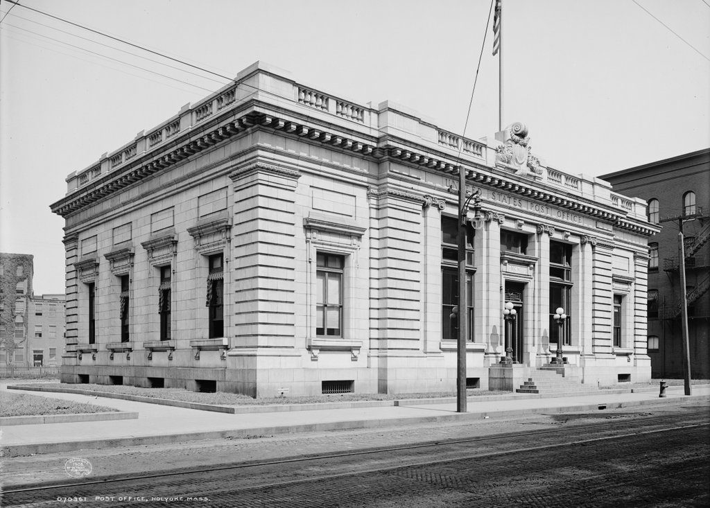
For many years, the Holyoke post office was located in the ground floor of the Holyoke House, a hotel at the corner of Main and Dwight Streets. However, in 1905 the post office moved into a space of its own, when this elegant Beaux-Art style building was completed. It was located directly behind the Holyoke House, which had by this point been renamed the Hotel Hamilton, and it sat in the middle of a triangular block bounded by Main, Race, and Dwight Streets. The first photo was taken only a few years after it was completed, and it shows the Main Street facade of the building.

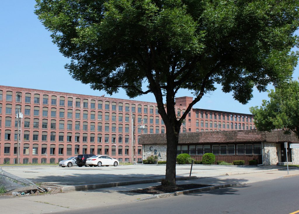
This building served as Holyoke’s post office for the first few decades of the 20th century, but it soon became too small for the volume of mail and packages that passed through here. As a result, construction began on a new post office in 1933. It was located further up the hill from here, on Dwight Street between Chestnut and Elm Streets, and was completed in 1935. The older building here on Main Street closed that same year, and it was subsequently demolished in the 1940s. Today, the site is a parking lot, and the present-day scene is dominated by the former Lyman Mills buildings, which stand in the distance on the other side of the Second Level Canal.