Custom House Tower, Boston

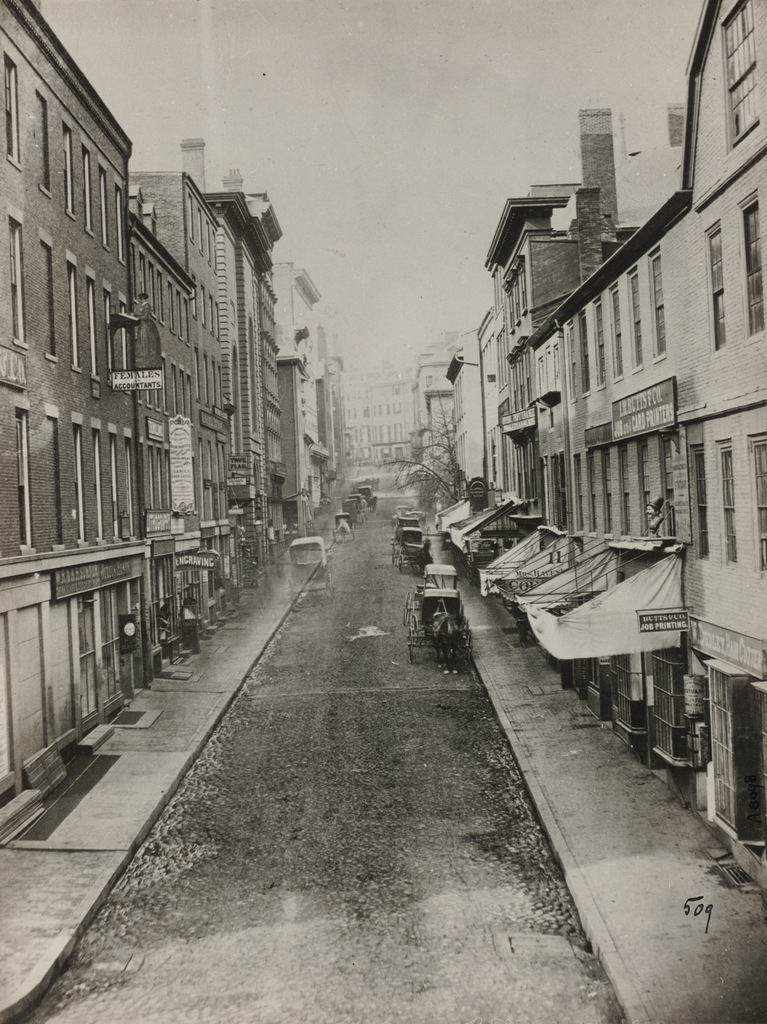
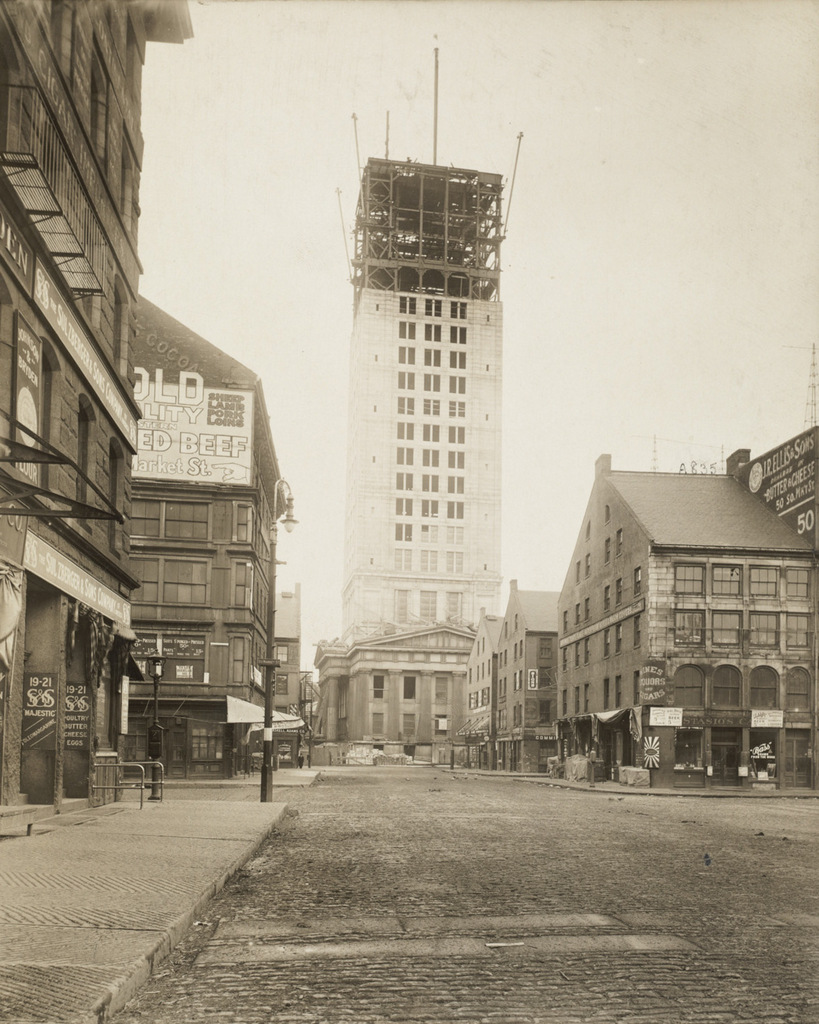
The Custom House Tower in Boston, as seen from Quincy Market during its construction, around 1913-1915. Image courtesy of the Boston Public Library.
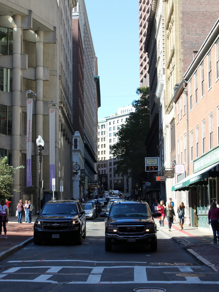
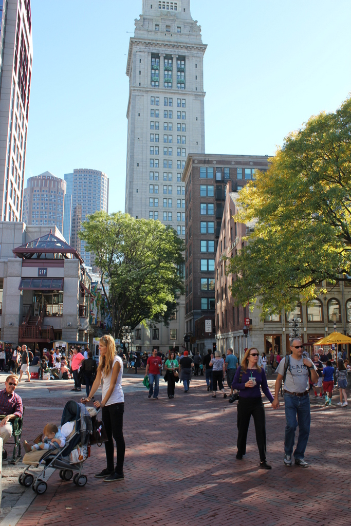
833_1913-1915c bpl

The scene in 2015:

833_2015
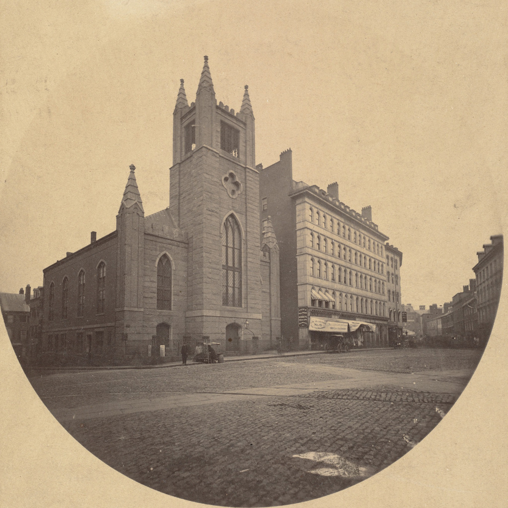
As explained in this earlier post, Boston’s Custom House was built in 1849, with a convenient location near Long Wharf that easily allowed officials to inspect incoming cargoes. Boston’s role as major seaport grew over the years, though, and by the early 1900s it was necessary to expand it. Rather than demolishing the old building, though, they simply added a 32-story skyscraper on top of it. At the time, Boston had a 125 foot limit on skyscrapers in the city, but as a federal building the Custom House Tower was exempt. At 496 feet tall, it was nearly four times the maximum height, and it dominated the Boston skyline for many years, as this early 1930s view of the city shows.

The c.1913-1915 photo above shows the building during its construction, with the original 1849 structure clearly visible at its base. It would remain the tallest building in the city until the completion of the Prudential Tower nearly 50 years later, and it would be used by US Customs until 1986 when they moved into the Thomas P. O’Neill, Jr. Federal Building. After a long period of vacancy, the historic tower is now a Marriott Hotel, and it is part of the Custom House District on the National Register of Historic Places.

School Street, Boston

Looking up School Street from Washington Street in Boston, around 1860. Image courtesy of the Boston Public Library.

832_1860c bpl

School Street in 2015:

832_2015
School Street is only a couple hundred yards long, yet this narrow downtown street has been home to a number of historic sites. The entire street is part of the Freedom Trail, and notable sites along here include King’s Chapel at the Tremont Street end and the Old Corner Bookstore on the right, here at the Washington Street end. In between, opposite Province Street, were two generations of Boston City Hall buildings, built on the former site of the Boston Latin School. The street is named for this school, which was here from 1704 to 1748, and during that time educated future Founding Fathers such as Benjamin Franklin, John Hancock, Samuel Adams, and Robert Treat Paine. Another School Street landmark, which has long since been demolished, was the original Parker House hotel, which was built in 1855 and is barely visible in the distance on the left side, on the site of the present Omni Parker House. A couple notable guests who visited the hotel not long after the first photo was taken included John Wilkes Booth, who stayed here eight days before assassinating Abraham Lincoln, and Charles Dickens, who lived here for five months in 1867-1868 during his tour of the United States.

The School Street that Charles Dickens would have seen was a narrow, busy street, and today not much has changed in that regard. In fact, the 1860 scene was probably busier than it appears. There are no pedestrians visible, which was probably due to the photographer using a long shutter speed, but in all likelihood there were plenty of people walking around at the time. None of the buildings are still standing from the first photo, though, except for the barely-visible King’s Chapel in the distance and the Old Corner Bookstore on the far right. The original part of the bookstore was built in 1712, and it was expanded up School Street in 1828 with the construction of the two three-story brick buildings on the right.

Province Court, Boston (2)

Facing Province Street from Province Court in Boston, in July 1901. Image courtesy of the Boston Public Library.

831_1901-07 bpl

The scene in 2015:

831_2015
These photos were taken facing the opposite direction from the ones in the previous post, and they give a glimpse into how Boston once looked along the old alleys and side streets of downtown Boston. Tucked away from the main commercial centers in the city, this area was home to less glamorous but nonetheless important businesses like plumbers, painters, roofers, carpenters, sign makers, chimney sweepers, tailors, and hat cleaners, as the signs here show.

None of these buildings are still standing today. The one on the right was demolished around 1922, when the present Province Building was built there. In the center, the wooden building along Province Street was demolished by 1908, and today most of the west side of the street is occupied by 45 Providence Street, a 30-story condominium building in the center of the 2015 photo.

Province Court, Boston (1)

Looking down Province Court from Province Street in Boston, in July 1901. Image courtesy of the Boston Public Library.

830_1901-07 bpl

Province Court in 2015:

830_2015
Province Court was once part of a maze of alleys in the block between Washington Street, School Street, Province Street, and Bromfield Street. Most of these are now gone, but Province Court is still here, functioning mainly as a service entrance for the surrounding buildings. When the first photo was taken, though, this area was much busier. In contrast to the busy shopping district on nearby Washington Street, Province Court was more of a blue collar area, with signs advertising a number of tradesmen, including plumbers, painters, carpenters, and tailors.

Both Province Court and Province Street were named for the Province House, a colonial mansion that was built here in 1679. For most of the 18th century, it served as the home of the colonial governors of Massachusetts, which is why early maps show Province Street as being named Governors Alley. The house burned in 1864 and was mostly demolished, although one of the walls was left standing and was incorporated into the buildings on the left side of the 1901 photo. Most of these buildings, including the remaining section of the Province House, were demolished in 1922 to build the Province Building,which is still standing today to the left and the center of the 2015 scene.

Mount Vernon Place, Boston

Mount Vernon Place, seen from Joy Street in Boston around 1860. Image taken by Josiah Johnson Hawes, courtesy of the Boston Public Library.

829_1860 bpl

Mount Vernon Place in 2105:

829_2015
Mount Vernon Place is a short street in Boston’s Beacon Hill neighborhood, located just west of the Massachusetts State House. It was once a full block long, and was developed in the 1830s on land that had once been owned by John Hancock and his family. As the 1860 photo shows, the street had a small park on the left side and eight townhouses on the right, and at the end of the street was the State House. The five houses closest to the State House were demolished in the 1910s when the building was expanded, and today only the three in the foreground survive. These three were built around 1833-1834, and have been largely unaltered on the exterior since then. They are among the many historic early 19th century townhouses that have become a defining feature of Beacon Hill, and they form a part of the Beacon Hill Historic District on the National Register of Historic Places.

Bowdoin Square Baptist Church, Boston

The Bowdoin Square Baptist Church in Boston, around 1860. Image taken by Josiah Johnson Hawes, courtesy of the Boston Public Library.

825_1860c bpl

Bowdoin Square in 2015:

825_2015
This scene shows Bowdoin Square facing the opposite direction from the one in the previous post, facing east on Cambridge Street toward Government Center. The most prominent building in the first photo is the Bowdoin Square Baptist Church, a Gothic Revival style church that was built in 1840. Its design is very similar to several other churches that were built in Boston around the same time, including the old Trinity Church on Summer Street and the nearby Bowdoin Street Congregational Church, which is still standing today as the Saint John the Evangelist Mission Church.

The church here at Bowdoin Square gained some notoriety in 1885, when the congregation split after the pastor, William W. Downs, was found in what was alleged to be a “compromising position” with a woman from his church. The scandal was well-publicized in newspapers across the country, and the church split into two factions, with one supporting his removal and the other believing his claims that he was the victim of a conspiracy. He was eventually dismissed from his position, and the church closed, but he maintained his innocence and several years later won a lawsuit against his accusers, with the jury awarding him $10,000 in damages.

Following the Downs scandal, the church became the Bowdoin Square Baptist Tabernacle, and it was extensively remodeled on the exterior and interior in 1898. However, the church sold the building in 1916 to the New England Telephone and Telegraph Company. Around 1930, they demolished the church and the neighboring Coolidge Building to the right, in order to build their new Boston headquarters, which is still standing in the 2015 photo. None of the other buildings remain from the 1860 photo, either; most of this section of Boston was demolished in the 1950s and 1960s as part of the West End and Government Center urban renewal projects.