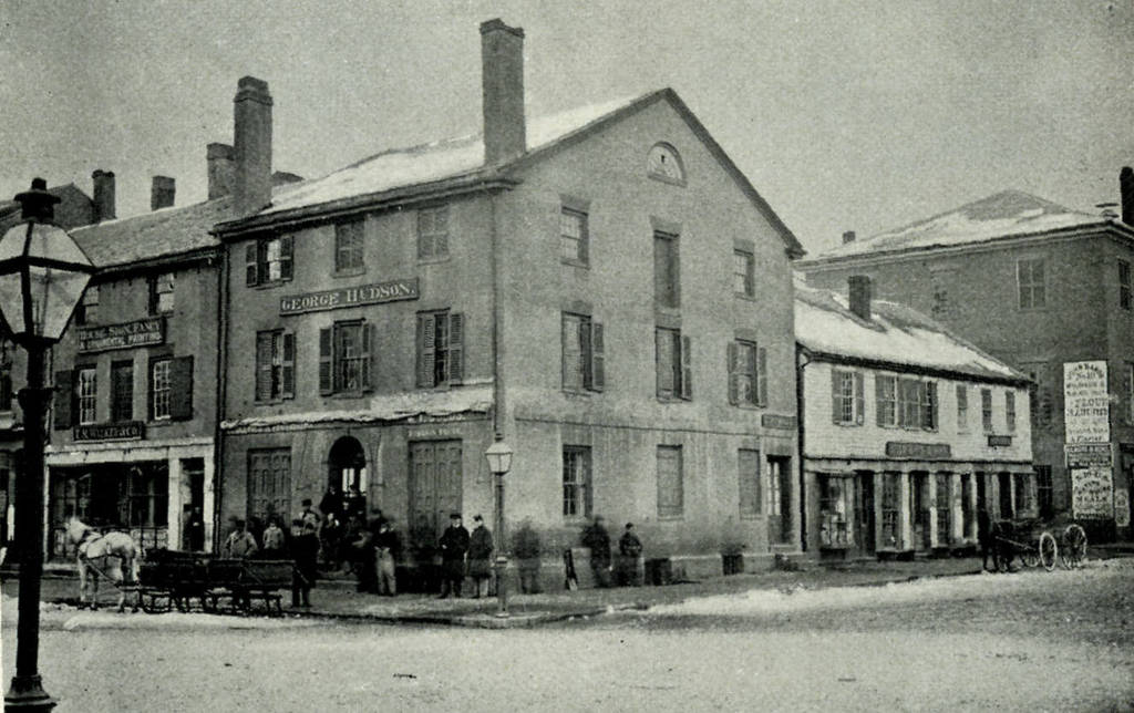
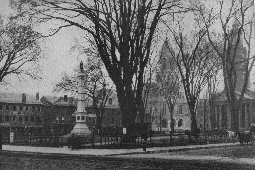
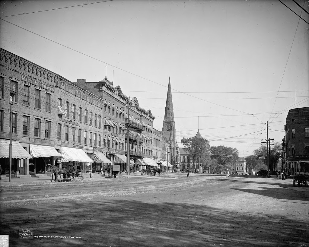
Park Street Church, Boston (2)

Park Street Church with Old Granary Burying Ground, sometime in the 1860s. Photo courtesy of Boston Public Library.

080_1860s-2Bbpl

The scene in 2011:

080_2011

As mentioned in this post, which shows the view of the church from the opposite side, Park Street Church was once the tallest building in the United States, from its construction in 1810 until 1846.  It remained the tallest building in Boston until around the time that the first photo was taken.  The tallest building in Boston is also visible in the 2011 photo – the John Hancock tower, which was built over 100 years after the first photo was taken.

The church itself hasn’t changed much, and neither has the Old Granary Burying Ground next to it.  The cemetery was opened in 1660, and many notable figures from the Revolutionary War period are buried there, including John Hancock, Samuel Adams, Paul Revere, Robert Treat Paine, and the victims of the Boston Massacre.

Old South Meeting House, Boston

The view looking north on Washington Street toward Old South Meeting House, sometime shortly before the Great Boston Fire of 1872. Photo courtesy of New York Public Library.

079_1870c-2Bnypl

The same view, in the immediate aftermath of the fire. Photo courtesy of New York Public Library.

079_1872-2Bnypl

Around 1875. Photo courtesy of Boston Public Library.

079_1875c-2Bbpl

Sometime in the late 1940s or early 1950s. Photo courtesy of Boston Public Library.

1940s

The same scene in 2011:

079_1940s-2011

The Great Boston Fire of 1872 was the most disastrous fire in Boston history.  It came just a year after the Great Chicago Fire, although Boston’s fire couldn’t hold a candle to Chicago’s (pun intended) when it came to the death toll and property losses.  Boston’s fire killed about 30, destroyed 776 buildings, and caused about $73.5 million in damages (about $1.4 billion in 2013 dollars).  Chicago, by comparison, killed 200-330, destroyed 17,500 buildings, and caused about $222 million in damage (around $4.2 billion today).

Still, Boston’s fire was extensive in its damage – it destroyed much of downtown Boston, including sections of Washington Street as seen in the first two photos.  However, the historic Old South Meeting House, built in 1729, survived thanks to volunteers using wet blankets to fend off the flames.

By the time the 1875 photo was taken, Boston was rebuilding, but so was Old South Church.  Because the fire destroyed so many homes, people began relocating to the newly filled in Back Bay, and the church followed them, constructing the oxymoronically-named New Old South Church at Copley Square.  No longer needed, the historic building was sold and was to be demolished.  However, given the building’s role in the events leading up the the Revolutionary War, Bostonians rallied to preserve it, making it one of the first such buildings to be preserved for its historical significance.

In the last two photos, most of the buildings in the foreground remain the same, although the skyline in the background has changed.  The building immediately to the right of the church is actually the same in the last three photos, and it looks similar to the burned-out building that occupied the spot before the fire.  I don’t know whether it is the same facade, or if it was just rebuilt with a similar style, but at the very least the existing building dates to the immediate aftermath of the fire.  As for the church, today it functions as a museum, although the congregation holds its annual Thanksgiving service at the building.

Union Station, Washington DC

Union Station in Washington, DC, between 1910 and 1920. Image courtesy of the Library of Congress, Detroit Publishing Company Collection.

071_1910-1920-2Bloc.tif

The same building in 2012:

071_2012

Union Station was built in 1907, by the Pennsylvania Railroad and the Baltimore & Ohio Railroad.  Since then, a lot has changed in the city, but the building has remained the same.  Neither the Pennsylvania nor the Baltimore & Ohio Railroads exist anymore, but the station is now a major Amtrak hub, and is the southern terminal of the Northeast Corridor, which stretches from DC to Boston, and is the busiest passenger rail line in the country.  The modes of transportation to the trains, however, has changed a lot in the past 100 years.  While the first photo shows trolleys unloading passengers at the station, they have been replaced by cars and buses in the 2012 photo.

Corner of Blackstone and Hanover Streets, Boston

The corner of Blackstone Street and Hanover Street, in 1956. Photo courtesy of Boston Public Library, Leslie Jones Collection.

1950s

The same corner in 2011:

067_2011

There’s something rather depressing about comparing these two photos – the bustling marketplace, contrasted with the shuttered storefronts and empty streets.  However, the appearance neighborhood as a whole has improved significantly since 1956 – the first photo was actually taken right in front of the Central Artery – the massive elevated highway that was eventually replaced by the much-maligned yet more aesthetically pleasing Big Dig.  Where I was standing to take the 2011 photo is right about where the highway ran through – if I had taken the photo 10 years earlier, the buildings in the foreground would’ve been barely visible.

I hadn’t seen the 1956 photo before taking this photo; what drew me to the building was the fading 19th century advertisements still visible on the bricks.  The two most prominent are for Bostonia Cigars (top and right-hand side), and W.P.B. Brooks & Co. Furniture Carpets &c.  I couldn’t find out much about either company, but it appears both from the appearance of the advertisements and also some quick online searches about the companies that they existed in the late 19th and early 20th centuries.

The building itself, which was constructed around 1835, is actually the same building that has the Boston Stone mounted on its wall, on the opposite side of where this photo was taken.  Behind it is the Blackstone Block, a rare group of buildings from the 18th and 19th century that still maintains the original 1600’s street network.  It is completely surrounded by much newer construction, but it is a small enclave of historic structures.  On the opposite side of this area is one of Boston’s oldest buildings, the home of the Union Oyster House.

This building itself actually used to have more floors, but at some point before the 1956 photo it was trimmed down to just three.  However, recent photos of this same building taken in the past year have shown that a couple more floors have actually been added on to the top of it, which would suggest that its future is brighter than the boarded up storefronts and deserted streets would seem to suggest.

Corner of State & Dwight, Springfield

The view looking northwest from the corner of State Street and Dwight Street, between 1900 and 1910. Image courtesy of the Library of Congress, Detroit Publishing Company Collection.

Buildings

The same street corner in 2015:

064_2015

There is absolutely nothing in the first photo that still exists today, so identification of its location eluded me for a while, until I zoomed in to a high-resolution scan of the photo and noticed the “Dwight Street” sign. The building in the first photo was, at the time, the YMCA building in Springfield. It was completed in 1895, and was the home of the YMCA for 20 years, until it moved into a new building on Chestnut Street. The older building then became the Victoria Hotel, and it stood here until 1969, when the hotel closed. It was demolished later in the year, in order to begin construction on the Civic Center. Now named the MassMutual Center, this arena still stands here at the corner of State and Dwight Streets.

Maple Street, Springfield

The view looking down Maple Street toward State Street, between 1905 and 1915. Image courtesy of the Library of Congress, Detroit Publishing Company Collection.

062_1905-1915-2Bloc

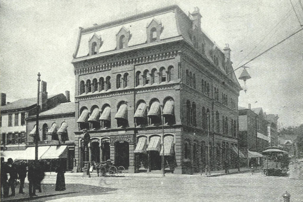
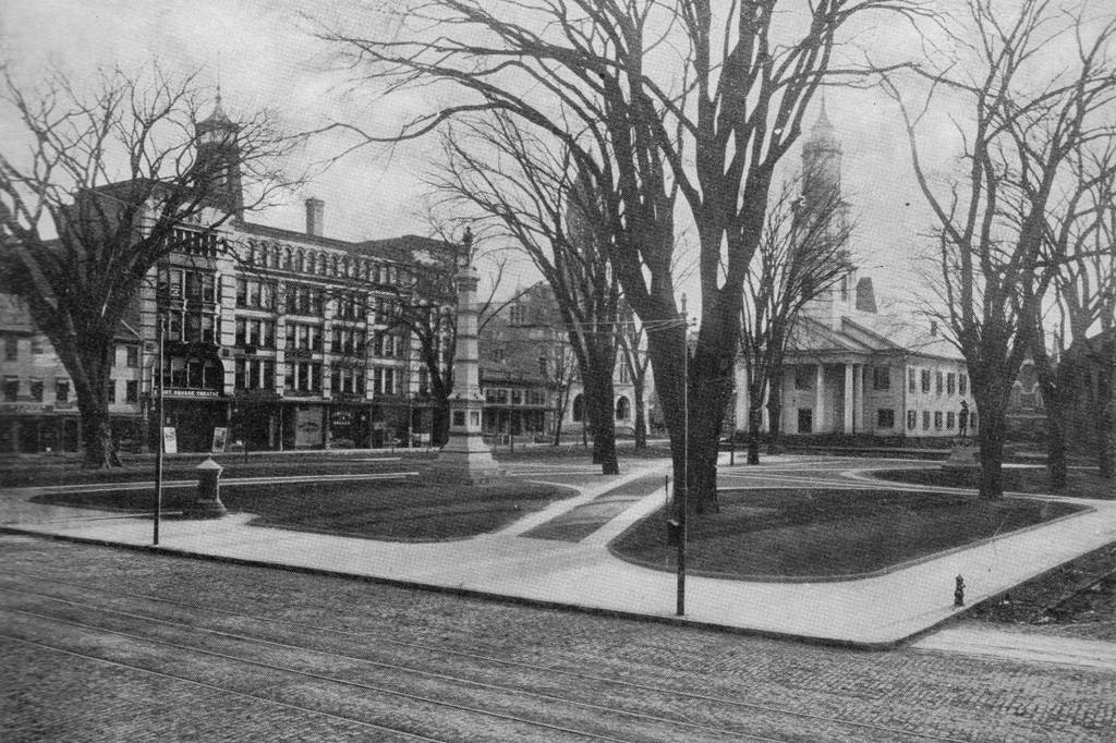
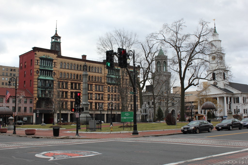
The same view in 2014:
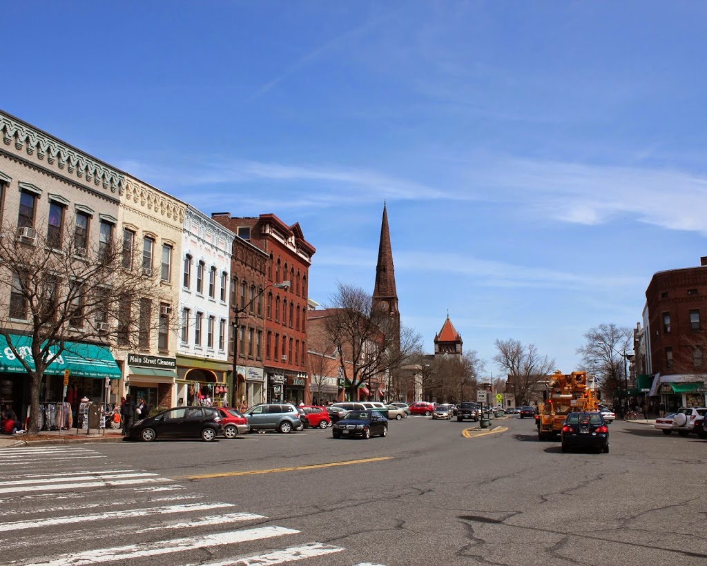
062_2014

If the street network seems a little different here, it’s because it is.  When the first photo was taken, Maple Street and Chestnut Street (which are essentially the same road – they just switch names after crossing State Street) were together a major two-way, north-south road running along the top of the hill overlooking downtown.  Dwight Street was,  likewise, a major north-south road that ran from the North End until terminating at State Street.  However, in 1972, Dwight Street was extended diagonally up the hill to meet Maple Street, and turned into a one-way street carrying southbound traffic.  Maple/Chestnut, north of this intersection, then became a parallel, northbound one-way street.  South of here (the opposite direction of this photo), Maple Street is still a two-way road.

In any case, this is part of the reason why the left-hand side of this photo looks so dramatically different from the 1905-15 photo; the houses and apartment buildings were later demolished to make room for the extended Dwight Street.  The right-hand side of the street, however, remains essentially the same; the apartment building in the foreground is the most obvious, but there is also another building behind it, and the Springfield Fire and Marine Insurance Building barely visible at the corner of State and Maple.

The other major change between the two photos is the massive 34-story Chestnut Park apartment building, which was built between Dwight and Chestnut Streets on State Street.  It is the third-tallest building in Springfield and the tallest residential building.