SS Nantasket and Custom House Tower, Boston

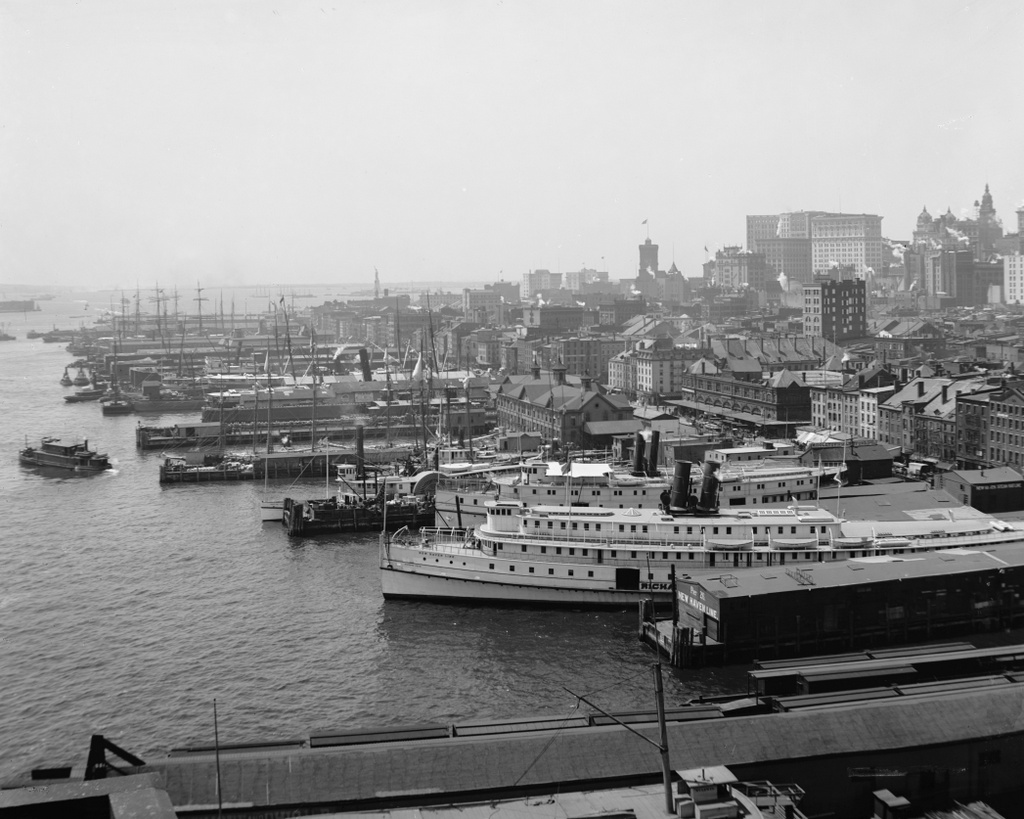
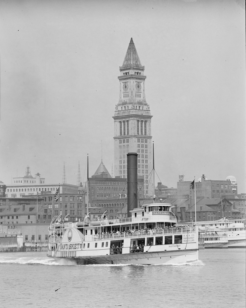
Boston’s Custom House Tower as seen from the waterfront, with the steamer Nantasket in the foreground, probably in the late 1920s. Photo courtesy of Boston Public Library, Leslie Jones Collection.
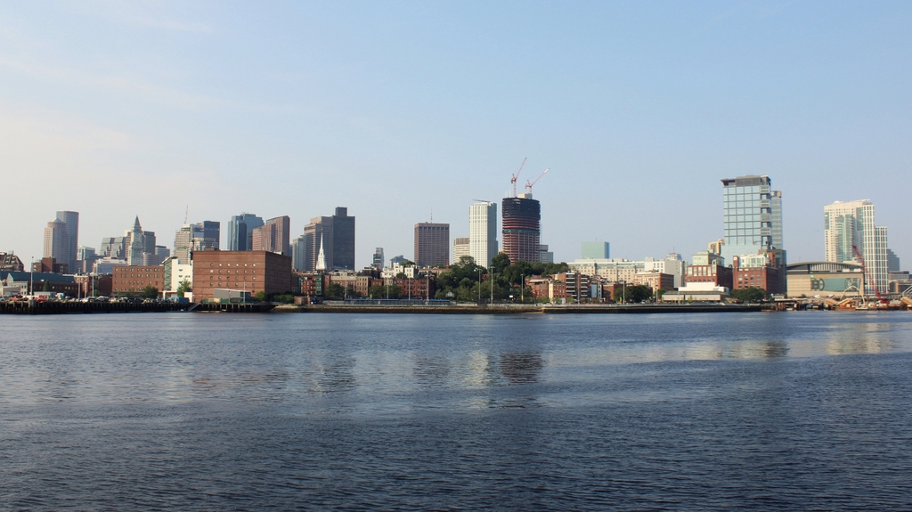
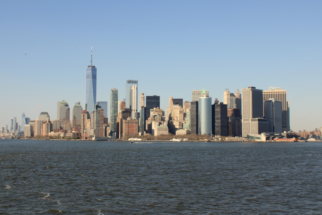
138_1920s bpl

The scene in 2013:

138_2013

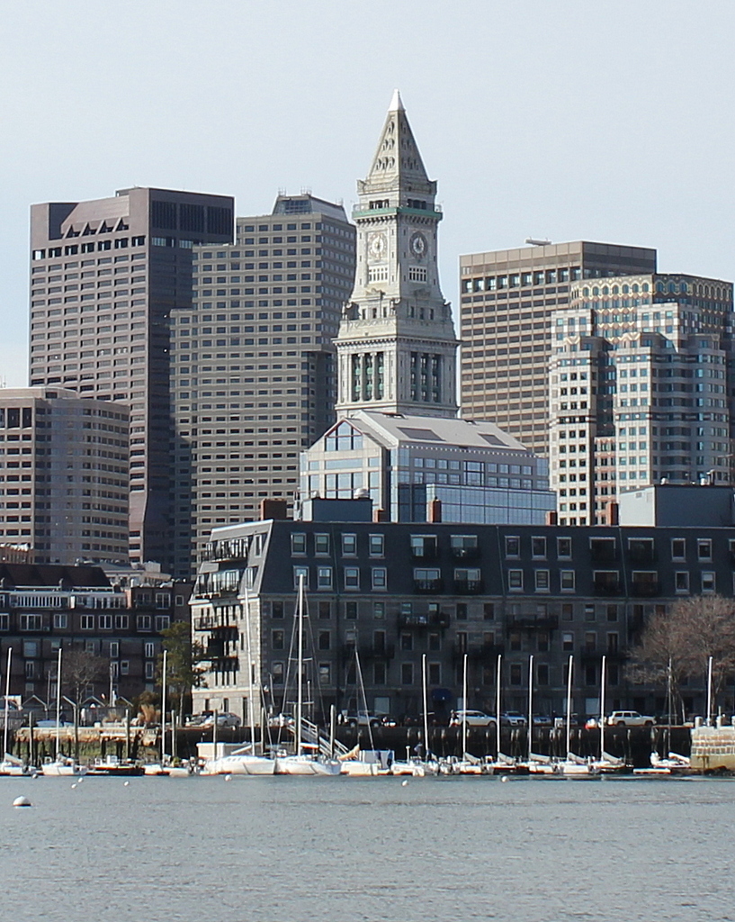
Boston’s skyline has changed substantially, but the Custom House Tower remains much the same as it appeared when it was completed in 1915.  It was the tallest building in Boston until the Prudential Tower was built in 1964, and to this day, remains the 17th tallest in the city.  Although no longer used as a custom house, it is now a Marriott hotel.

The Boston Public Library dates this photo to around 1934, but it had to have been earlier than that, because the Nantasket burned in a fire in November, 1929, along with almost the entire rest of the company’s fleet.

North End, Boston

The North End of Boston from the Charlestown Navy Yard, in 1870, with the USS Kearsarge in the foreground. Photo courtesy of Boston Public Library.

The scene in 2021:

Boston’s skyline has obviously changed significantly over the past 150 years, but at least one constant remains in both photos: Old North Church, which is barely visible behind some masts, just to the left of the Kearsarge, in the 1870 photo.  The Kearsarge was a famous ship by this point – during the Civil War, she defeated the infamous Confederate commerce raider CSS Alabama.  After she was decommissioned, a US battleship was named after her; she is the only non-state to have a US Navy battleship named after her.

Manhattan Waterfront from Brooklyn Bridge

The view of Lower Manhattan, looking south from the Brooklyn Bridge, around 1901. Image courtesy of the Library of Congress, Detroit Publishing Company Collection.

128_1901c loc

The view from the Brooklyn Bridge in 2013:

128_2013

Manhattan’s waterfront is quite different today from 100 years ago. Once a major transportation hub, today the FDR Drive along the waterfront is a major transportation corridor, instead of the East River that it runs parallel to. In the foreground of the first photo are the piers for the New Haven Line, a steamship company that operated ferries between Manhattan and New Haven, with railroad connections to points north. The closest steamship is the SS Robert Peck, which was built in 1892 as the flagship of the line. In 1943, it was transferred to the Navy, and served as floating barracks for part of World War II.

Manhattan and Brooklyn Bridge

The view of Manhattan and the Brooklyn Bridge from Brooklyn, around 1900. Image courtesy of the Library of Congress, Detroit Publishing Company Collection.

126_1900c loc

The view in 2013:

126_2013

The scene in 2023:

The difference is like night and day.  Cheesy puns aside though, there is quite a difference in the Manhattan skyline between the two photos, over 100 years apart.  The Brooklyn Bridge is still there, but otherwise, as far as I can tell, none of the buildings in the first photo are visible in the second.  At least one of them – the tall Park Row Building at the far left of the first photo – still exists today, but I don’t think it can be seen from here.

April 2023 Update: I have added an updated photo, showing the scene during the daytime.

Brooklyn Bridge Promenade

The view along the Brooklyn Bridge Promenade, looking toward Manhattan, between 1908 and 1920. Image courtesy of the Library of Congress, Detroit Publishing Company Collection.

125_1908-1920 loc

The same view in 2013:

125_2013

The angle here isn’t exact, since they were taken from different sides of the walkway, but both photos show the same view of the Brooklyn Bridge and of the Manhattan skyline.  The first photo is interesting, because although the subject of the photo is the bridge, the background shows three different buildings that were, at one point, the tallest in the world:

1. New York World Building: The tallest from 1890 to 1894, demolished in 1955 to expand the approaches for the Brooklyn Bridge.  The dome of the building is barely visible under the left-hand arch of the bridge tower.

2. Park Row Building:  Held the record from 1899 to 1901, and the building still exists, although it’s not visible in the 2013 photo.  It can be seen in the first photo, near the center, with the two towers on top.

3. Singer Building: Held the record from 1908 to 1909, and was demolished in 1968.  It is readily visible on the far left of the first photo, and its location today is marked by One Liberty Plaza, the large black rectangle at the base of the new World Trade Center building.

Lower Manhattan (3)

A view of Lower Manhattan from New York Harbor, taken between 1910 and 1917. Image courtesy of the Library of Congress, Detroit Publishing Company Collection.

124_1910-1917 loc

A similar angle in 2012:

124_2012

The scene in 2023:

Taken from about the same spot as the first photo of the previous post, the circa 1910s photo here may have been taken on the same day, although the battleship to the left is different from the two in the other post.  This battleship is either a Connecticut or Vermont class ship, built in the first decade of the 1900s and decommissioned shortly after the end of World War I.

Just like in the other post, the 2012 photo here is taken a little to the east of the first one. The only readily-identifiable landmark from both photos is the Whitehall Building. However, the Singer Building and its replacement, One Liberty Plaza, help to estimate the angle of each photo. In the first photo, the Singer Building is immediately behind and to the left of the Whitehall Building, while in the 2012 photo, One Liberty Plaza is to the right of the Whitehall Building.

April 2023 Update: I have added an updated photo of the scene, showing it after the completion of One World Trade Center and several other high-rise buildings here in Lower Manhattan.