Boston Skyline

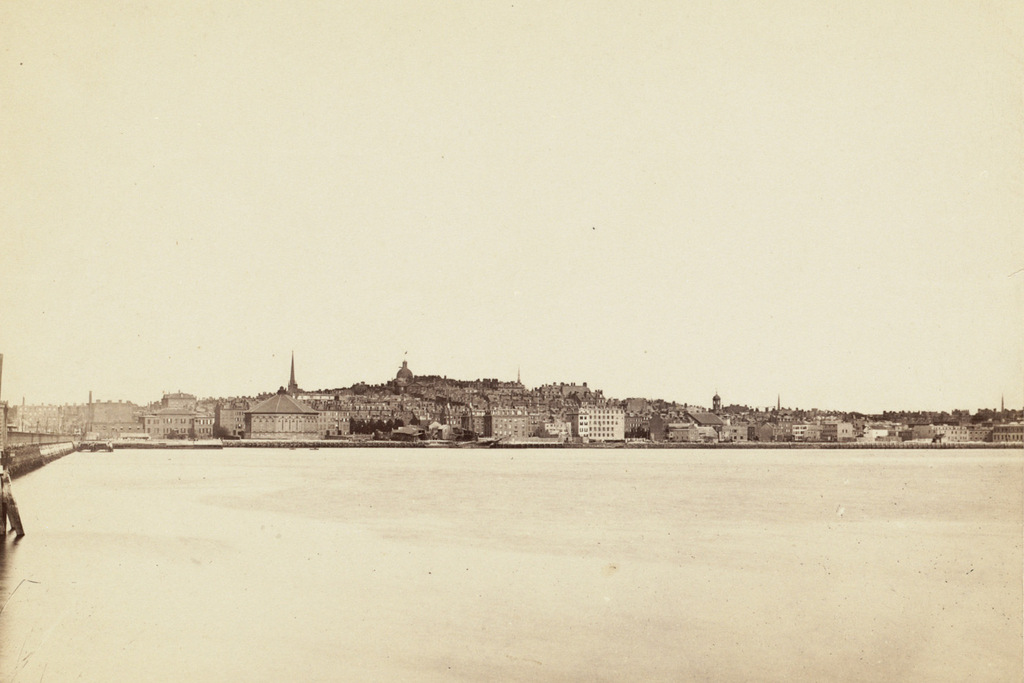
The skyline of Boston as seen across the Charles River in Cambridge, sometime in the 1880s. Image courtesy of the Boston Public Library.

712_1880-1889c bpl

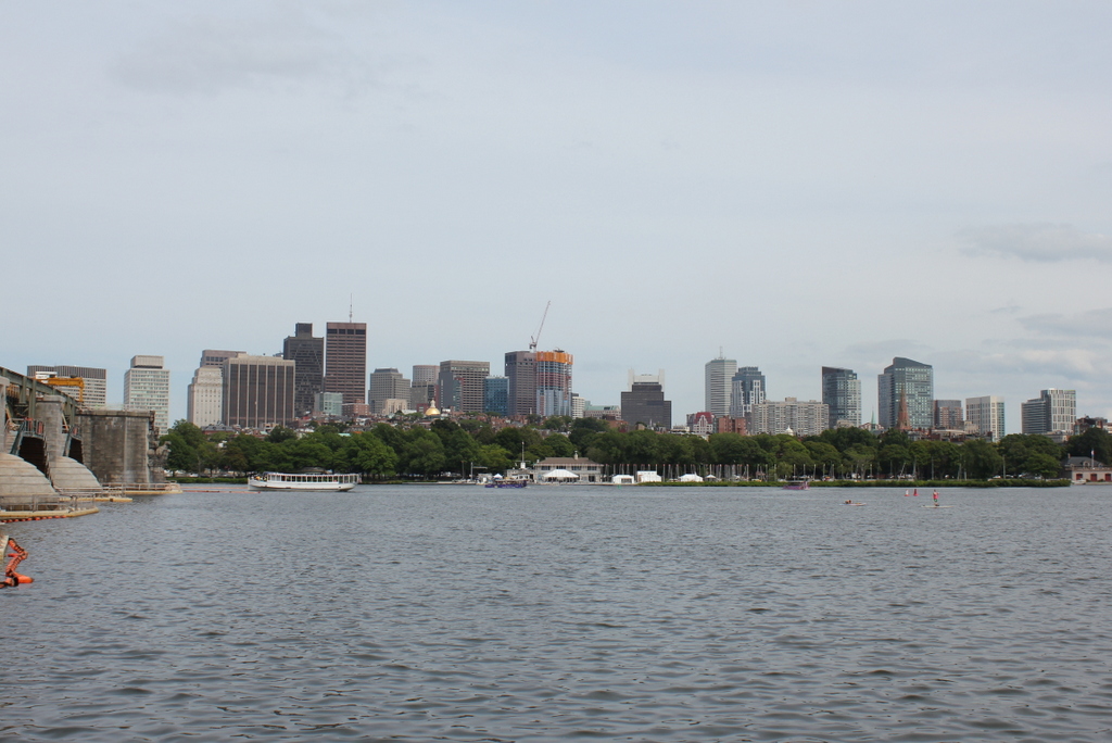
The same view in 2015:

712_2015
These two views certainly show how the city of Boston has changed over the past 125 years or so, but perhaps more remarkable is how much has remained the same.  This view shows an arc of the city from Cambridge Street and the Longfellow Bridge on the left to the foot of Mount Vernon Street on the far right, and the most obvious difference between the two photos is the skyscrapers of downtown Boston in the distance.

In the foreground, however, is the Beacon Hill neighborhood, which really hasn’t changed much since the 19th century.  Things are a little different along the waterfront – the trees of the Charles River Esplanade hide Storrow Drive, which cuts along the river now, but further up Beacon Hill this pocket of early 19th century Boston has survived as a low-rise residential neighborhood.  Although it is hard to identify individual buildings, many of the ones from the 1880s view are still standing today.  The most prominent building in the first photo is the dome of the Massachusetts State House, which stands at the top of the hill.  Although it now has a backdrop of skyscrapers instead of just sky, it is still easily visible from here despite being over a half mile from the river.

Beacon and Park Streets, Boston

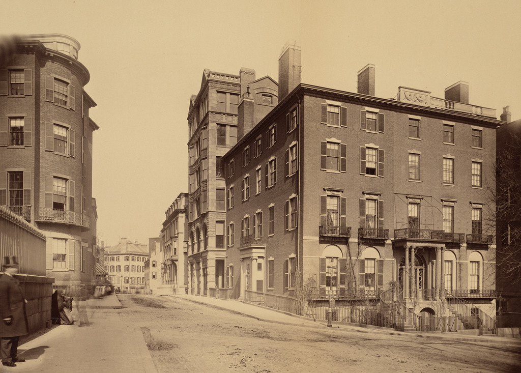
Looking east on Beacon Street from in front of the State House, sometime around 1885. Image courtesy of the Boston Public Library.

692_1800sc bpl

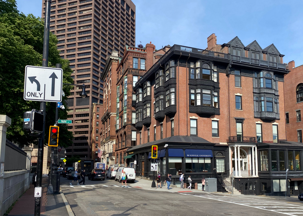
The scene in 2022:


Despite all of the changes in downtown Boston during the past 130 years, there are several buildings from the first photo that survive today.  The building at the corner doesn’t bear much resemblance to its former self, but it is the same one that is seen in the first photo.  It was built in 1804 for merchant Thomas Amory Jr., and was one of several houses on Park Street that were designed by Charles Bulfinch.  The home occupies a prominent position next to the Boston Common and across the street from the Massachusetts State House, but the cost for the massive house ruined Amory’s finances, and he had to sell it in 1807.

After Amory sold it, the house was divided into four different units, which were rented to some of Boston’s most prominent citizens.  Senator and Cabinet member Samuel Dexter lived here, and Christopher Gore took advantage of the house’s proximity to the State House and lived here while serving as governor in 1809 and 1810.  In 1824, the Marquis de Lafayette stayed here during his tour of the United States, and Boston Public Library founder George Ticknor lived on the Park Street side of the house from 1830 until his death in 1871.  Around 1885, the house was extensively renovated on the exterior, with iron storefronts replacing the original first floor windows, oriel windows on the third and fourth floors, and three dormers on the right-hand side of the roof.  Today, several different businesses occupy the first floor storefronts, including Fox 25 News in the corner storefront.

The other historic building that has survived from the first photo is the Claflin Building, located just beyond the Amory-Ticknor House on Beacon Street.  It was completed in 1884, and is one of architect William Gibbons Preston’s several surviving buildings in Boston, along with the Armory of the First Corps of Cadets and the Museum of Natural History building.  The Claflin Building was built for the newly-founded Boston University, who used the upper floors for school offices and rented the first floor storefronts.  The school owned the building until the 1940s, when it moved to its present campus on Commonwealth Avenue, and today it has been renovated into condominiums.

Main Street, Southington, Connecticut (2)

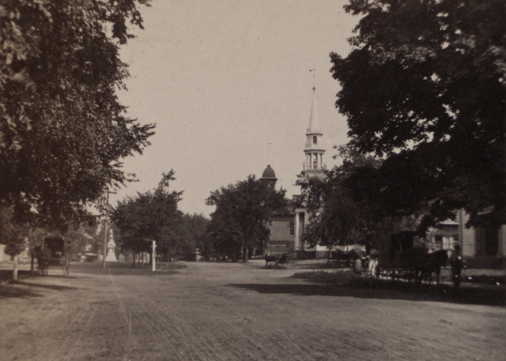
The view looking north on Main Street in Southington, from just south of Columbus Avenue, around 1885-1891. Image courtesy of the New York Public Library.

658_1885-1891 nypl

Main Street in 2015:

658_2015
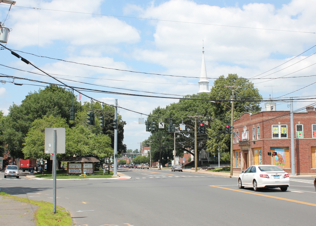
This view is very similar to the photos in this post, which were taken just a little further up the street beyond the intersection.  Unlike the other Southington photos that I have featured here, this one was not taken by the Office of War Information during World War II; instead, this image was from a 19th century stereocard.  In this scene, the Soldiers’ Monument on the green had just recently been dedicated, and most of the town’s Civil War veterans would have still been alive.  World War I was still a generation away at this point, and it would be more than 50 years before the OWI would capture photos of the town in the early years of World War II.

The only building from the first photo that is still standing today is the First Congregational Church. It is essentially unchanged from its appearance when it was built in 1830, and it is one of several nearly identical church buildings of the era that can still be seen in small towns throughout Connecticut.  Across Main Street is the town green, where the Soldiers’ Monument still stands today, although it is now accompanied by monuments to the veterans of the wars of the 20th century. The dirt roads around the town green in the first photo have several horse-drawn carriages, but within a decade or so automobiles would begin to appear, eventually leading to the paved roads and traffic lights of the present-day scene.

Sutton House, Center Harbor, NH

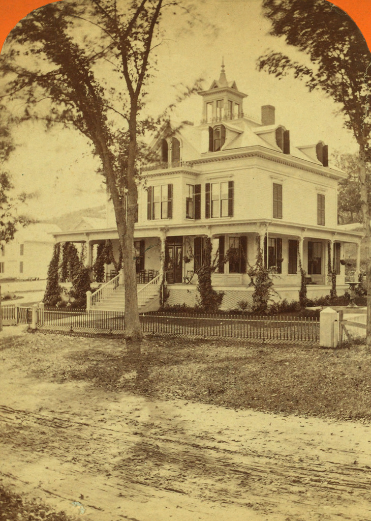
The home of Eliza Sutton in Center Harbor, around 1865-1885.  Image courtesy of the New York Public Library.

594_1863-1885c nypl charles bierstadt

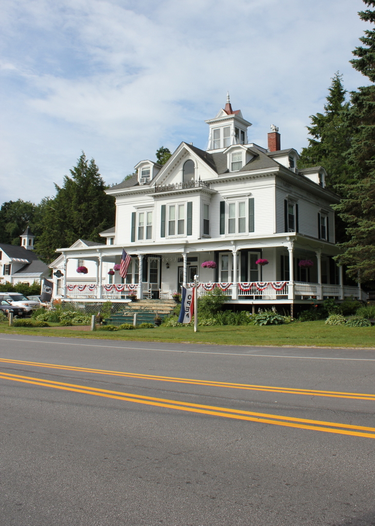
The house in 2015:

594_2015
This house on the present-day Whittier Highway was built in 1865 for Eben Sutton, a wool merchant in Peabody Mass., and his wife Eliza.  Eben died before the house was finished, but Eliza lived here for 24 years.  She ran a dairy farm here, using the fields across the street as pastureland.  The photo in this post, taken about 17 years after her death, shows the view from in front of her house looking across the street.  In addition to her agricultural pursuits, she was also a philanthropist, and in 1869 she donated funds to build the Eben Dale Sutton Reference Library at the Peabody Institute Library in her hometown.

The first photo was taken during the time when Eliza Sutton lived there, and the photographer was Charles Bierstadt, a 19th century photographer who specialized in stereoscopic views.  He is probably best known, though, as the older brother of landscape artist Albert Bierstadt. Most of the younger Bierstadt’s paintings were of the American west, but he did several of the White Mountains, not too far from where his brother Charles took this photograph.

The house was damaged by a fire in 1993, but it has since been restored to its original 19th century appearance and operates as the Sutton House bed and breakfast.

Allis House and First Church, Wilbraham Mass (2)

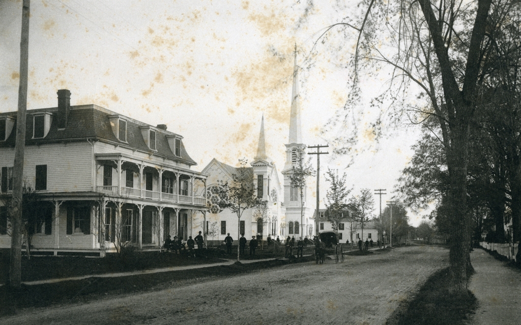
Another Main Street view of the Allis House and the First Church, sometime in the 1880s or 1890s. Image courtesy of the Wilbraham Public Library.

550_0dateunk wpl

Main Street in 2015:

550_2015
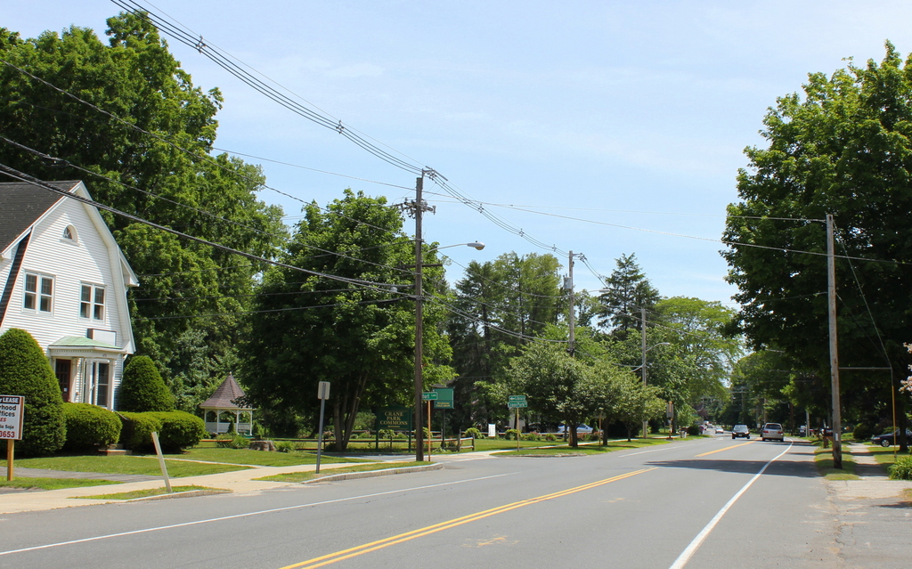
As mentioned in this post, both of these buildings in the first scene were destroyed in separate fires, not too long after the photo was taken.  The Allis House to the left was a hotel and tavern, offering accommodations for salesmen and other business travelers as well as providing food and entertainment for locals.  It burned in August 1896, but the 1964 History of Wilbraham book suggests that it may not have been accidental; business was apparently declining, and according to a local rumor the resident handyman ran out of the burning building yelling at Mrs. Allis for not telling him when she was planning on burning the place down.

Just under 15 years later the Congregational Church just to the right of the Allis House was also destroyed in a fire, although there was unquestionably no insurance fraud involved here; the steeple was struck by lightning and the church burned to the ground.  Today, Gazebo Park is located on the spot where the old church once stood, along with its two predecessors and its successor, before the present-day church was built in 1958 a short distance down Main Street.

Allis House and First Church, Wilbraham Mass (1)

The Allis House and the First Church on Main Street, seen from the intersection of Main and Springfield Streets, sometime around the 1880s or 1890s.  Image courtesy of the Wilbraham Public Library.

549_0dateunk wpl

The scene in 2015:

549_2015
This location on Main Street in the center of Wilbraham was the location of a series of fires between 1877 and 1911. In 1877, both the first and second meeting houses were destroyed in a fire, after which the Allis House hotel and the third meeting house were built, as seen in the first photo.  However, less than 20 years later the Allis House also burned, in a rather suspicious fire that conveniently occurred after business started declining in the 1890s.  The church survived the Allis House fire, but it burned in 1911 after being struck by lightning.  Today, the location of the church is part of Gazebo Park, at the corner of Main Street and Burt Lane.