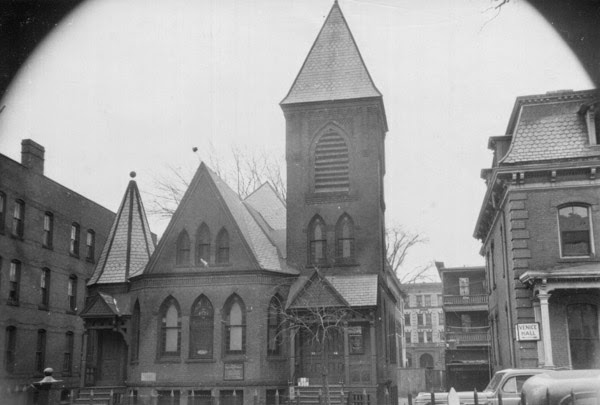
The former French Protestant Church on Bliss Street in Springfield, around 1938-1939. Image courtesy of the Springfield Preservation Trust.
The church in 2015:
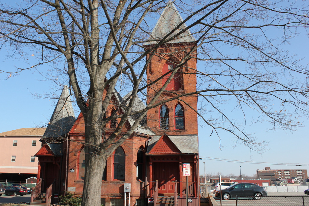
This church on Bliss Street was built in 1887 as the French Protestant Church, thanks in part to the efforts of Daniel B. Wesson, whose Smith & Wesson factory was just on the other side of Main Street from here. Many of his workers were French-Canadian Protestants, and he wanted them to have a French alternative to the Roman Catholic church. However, the congregation disbanded in 1909, and several other churches used the building until 1919, when it was purchased by the First Spiritualist Society, who remained at the Bliss Street location until 2013. The property was purchased by MGM Springfield, and while several historic buildings will be demolished to build the casino, the church will be moved to a new location on the MGM property and renovated as a restaurant.