Main Arsenal, Springfield Mass

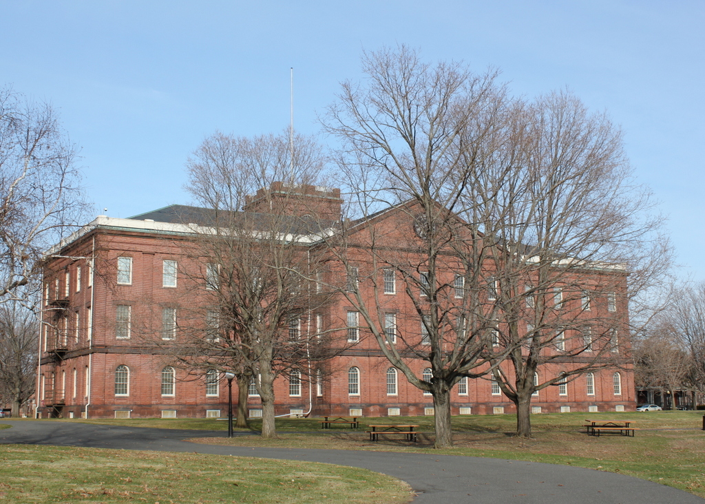
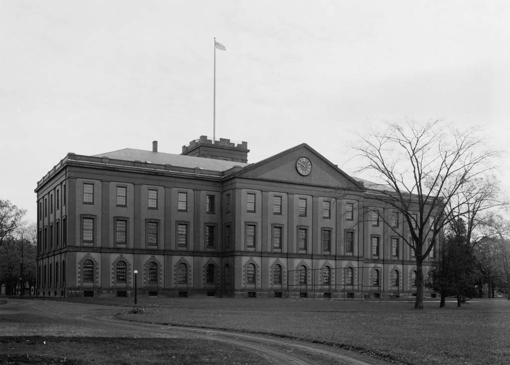
The Main Arsenal at the Springfield Armory, seen around 1910-1920. Photo courtesy of the Library of Congress, Detroit Publishing Company Collection.

481_1910-1920 loc

The Arsenal in 2015:

481_2015

Springfield had long been a center of production for US military firearms, beginning in 1777, during the American Revolution.  The need arose for a suitable location to manufacture and store arms and ammunition, and several sites in New England were considered, including Brookfield Mass. and Hartford.  However, in the end General Henry Knox recommended Springfield, and George Washington agreed.  Perhaps Knox had recalled passing through Springfield in early 1776 while bringing cannon from Ticonderoga to Boston, but either way he determined that it was the best location.

The location of Springfield was particularly valuable, as it was along several major roads, leading to Boston, Albany, Hartford, and other points south.  The Connecticut River and several major tributaries were also an advantage, although unlike at Hartford the river was not navigable by ocean-going vessels at this point.  This had been one of the strongest arguments in favor of Hartford, but it was also one of the main weaknesses of the Hartford plan – British ships could easily sail up the river and attack.  Springfield’s location, some 20 miles north of the head of navigation, meant that the town was secure from British naval attacks.  Another important feature in Springfield is the hill that the Armory is located on.  Situated on a broad plateau above the downtown area, the Armory is only three quarters of a mile from the river, but is about 150 feet higher in elevation.  In the unlikely event that Springfield was attacked, this would have been an easy position to defend.

However, while the Armory itself dates back to the 1700s, most of the buildings on the site date to the mid 1800s, including the main arsenal seen in these photos.  This building was built between 1847 and 1851, and it served as a storehouse for the weapons produced at the Armory.  It was built during the Mexican-American War, and it played a vital role in the Civil War just a decade later.  Springfield had been one of two federal arsenals prior to the war, with the other being at Harpers Ferry, Virginia.  Since this facility was lost early in the war, Springfield became the primary manufacturing center for Union firearms.  It continued in this role throughout World War I, World War II, and even into the Vietnam War before its closure in 1968.  Today, the Armory is National Historic Site, and is also home to Springfield Technical Community College.  The arsenal today hasn’t changed much since its completion in 1851, although today it serves as a museum run by the National Park Service.

Old Post Office Block, Ludlow Mass

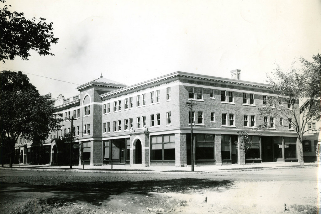
The Old Post Office Block at the corner of East and Sewall Streets in Ludlow in 1903. Photo courtesy of the Hubbard Memorial Library.

471_1903 hubbardmemlib

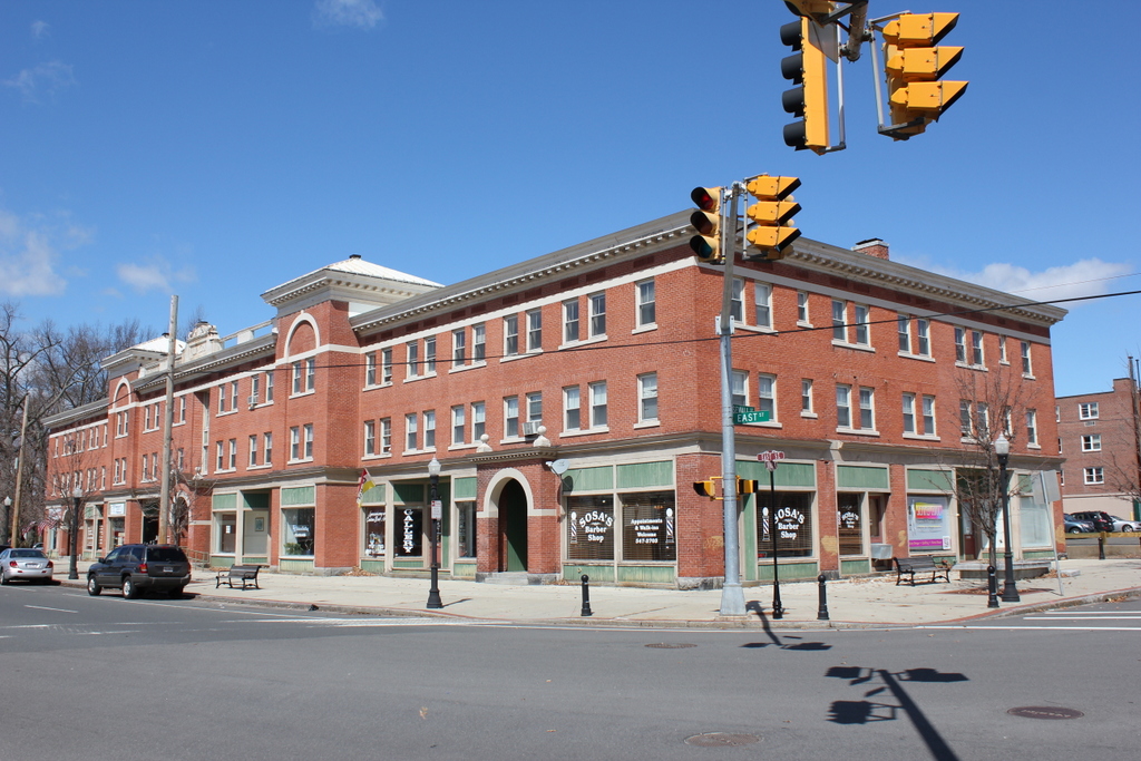
The building in 2015:

471_2015

These views were taken from about the same spot as the ones in this post, just turned a little further to the right.  The building here is the old Post Office Block, which was built in 1901, and not surprisingly housed the Ludlow Post Office for nearly 60 years.  Although Ludlow’s original town center is further away, this area along the Chicopee River grew in population in the late 1800s thanks to the factories that developed here in Ludlow and across the river in Indian Orchard.  Many of the postal customers of the early 1900s would have been workers across the street at the Ludlow Manufacturing Associates factory; some of the buildings from this facility still exist today, including the iconic clock tower directly behind where this photo was taken.

This building wasn’t just a post office though; it also had other commercial tenants, and it was one of the first large commercial buildings in the town.  The size of the building reflected the dramatic spike in population; between 1890 and 1900, Ludlow’s population nearly doubled, and would more than double again by 1920.  The post office hasn’t used the building in over 50 years, but it remains in a remarkable state of preservation 112 years later.

Court Street, Springfield, Mass

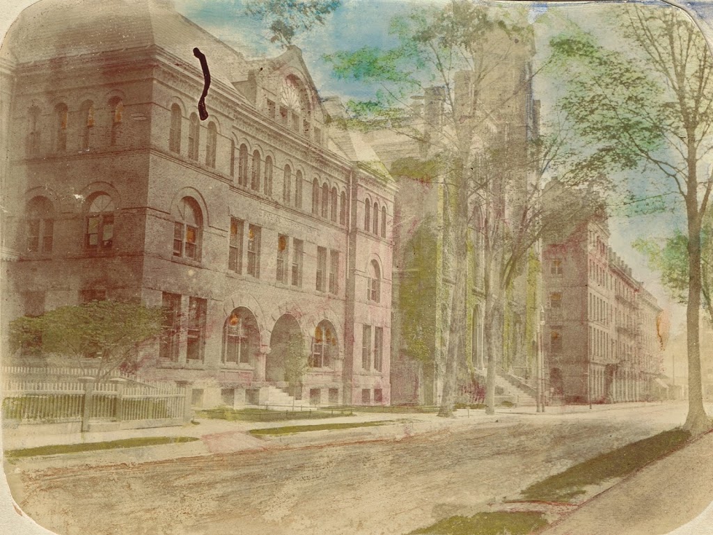
Court Street in Springfield, sometime before 1905. Photo from author’s collection.

444_1900c-2Bpersonalcollection

Court Street in 2014:

444_2014

I came across the first photo in a 3-for-$1 bin at an antique store, and despite the odd coloring it provides an interesting view along Court Street from around the turn of the last century.  It is an albumen print, mounted on thick paper, and evidently colorized after processing.  There are no identifying marks on the photo, and the only way I was able to figure out the location was because I recognized the old police station and City Hall as being in Springfield.  My guess is that it was probably taken sometime in the 1890s, but it could’ve been anytime before 1905, when the old City Hall burned down.

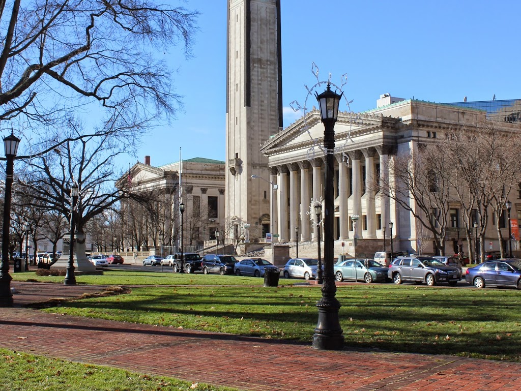
To the left of City Hall, in the foreground of the first photo, is the old police department headquarters, which was later demolished to make way for the Springfield Municipal Group.  The new City Hall, which was completed in 1913, is still there, on roughly the same spot that its predecessor stood in the first photo.  The site of the former police station is now the area between City Hall and Symphony Hall, where the campanile tower is.  In the background, One Financial Plaza building looms over City Hall, between City Hall Plaza and Main Street.  The only building in the present-day scene that would’ve even existed when the first photo was taken is the former Springfield Five Cents Savings Bank building at the corner of Main and Court Streets, although its Main Street facade has been altered beyond recognition.

Springfield Municipal Group, Springfield, Mass

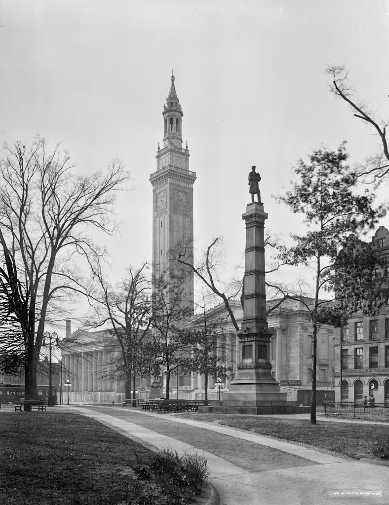
The Springfield Municipal Group from across Court Square, probably around 1913.  Image courtesy of the Library of Congress, Detroit Publishing Company Collection.

443_1910-1920-2Bloc.tif

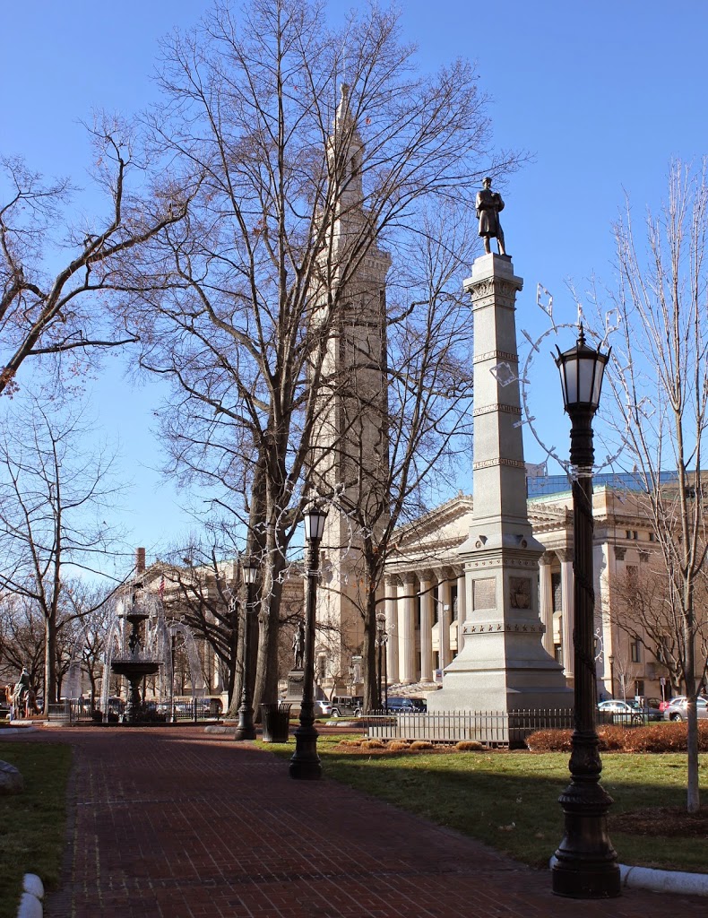
The Municipal Group in 2014:

443_2014

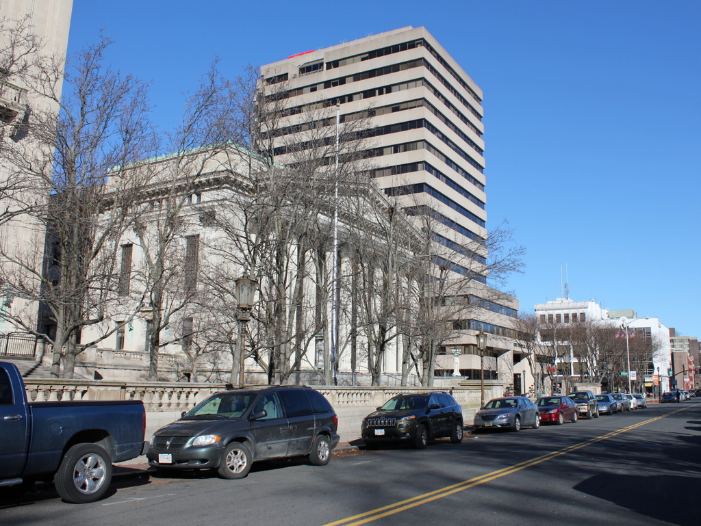
The first photo was taken shortly before the Springfield Municipal Group was completed, perhaps even on the same day as the first photo in this post.  In this photo, the buildings are still surrounded by a fence, and a sign for A.E. Stephens Co, the contractors, can be seen on a temporary shed on the right-hand side of the photo. In the ensuing 100 or so years in between the two photos, not much has changed in this scene.  City Hall, Symphony Hall, and Campanile tower are all still there, as is the Civil War monument and the Miles Morgan statue, which is barely visible in the distance in front of the bell tower.  One thing that has changed, though, is the way people get to City Hall.  In the first photo, a trolley can be seen on the far left, and no automobiles are visible anywhere in the scene.  Today, there are no trolleys to be found in Springfield, and instead Court Square is surrounded by cars, as seen in the 2014 photo.

Court Square, Springfield, Mass

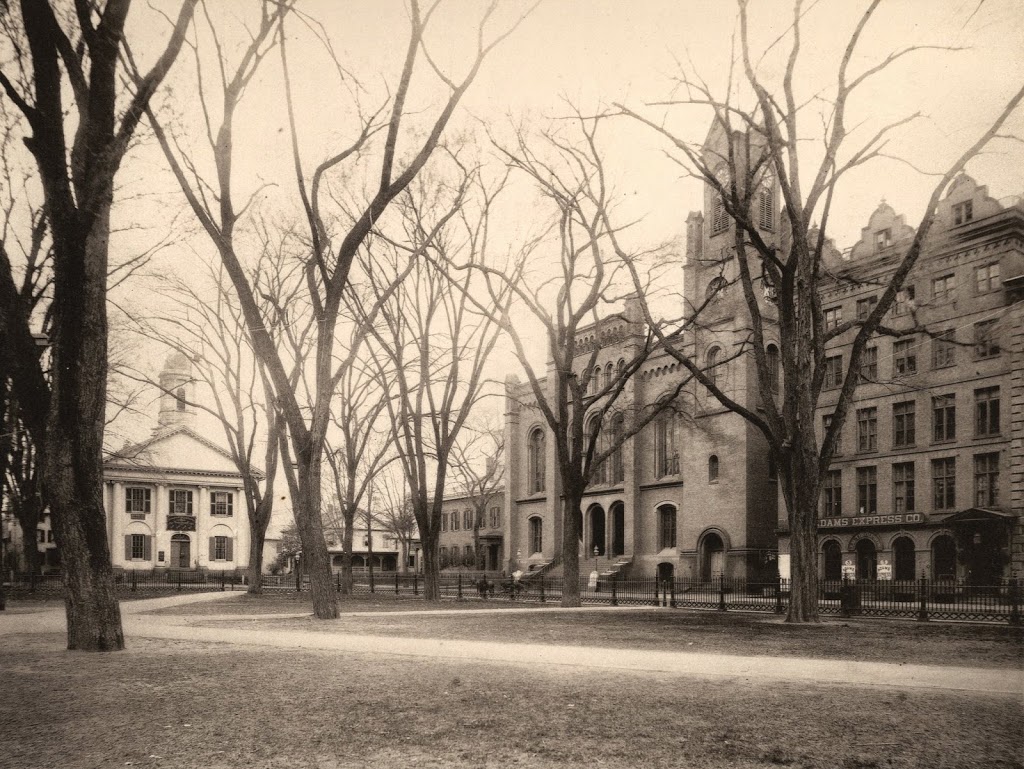
Court Square in Springfield, around 1882. Photo from Springfield Illustrated (1882).

438_1882c-2Bspringfieldillustrated

Court Square in 2014:

438_2014

The 1882 photo clearly shows Springfield’s old City Hall, which burned down in 1905 and was replaced in 1913 by the present City Hall, Symphony Hall, and Campanile tower.  On the far left of the old photo is the former Hampden County Courthouse, which by 1882 was being used by the Odd Fellows.  Today, the only constant between the two photos is Court Square itself; none of the buildings seen in the 1882 view are still there.  Even the Miles Morgan statue hadn’t yet been brought to Court Square, although it would within a year or so.

Post Office and Library, Bellows Falls, Vermont

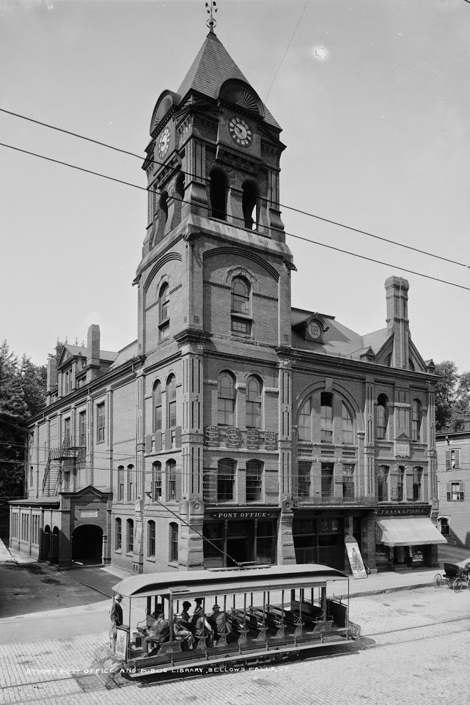
The post office and library in downtown Bellows Falls, Vermont, around 1900-1910. Image courtesy of the Library of Congress, Detroit Publishing Company Collection.

420_1900-1910c-2Bloc

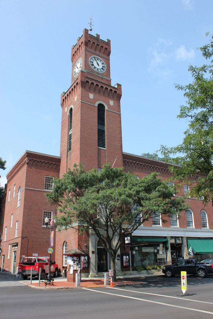
The scene in 2018, now the town hall for Rockingham, Vermont:

The building in the first photo served as the post office and library for the town of Rockingham from 1886 until it burned in 1925.  The first photo shows the entrance to the library on the far left of the building, with the post office located in the storefront at the base of the tower.  There are no automobiles in the first photo, but the open-air trolley in the foreground provided public transportation in the village of Bellows Falls.  After the fire, the replacement building opened in 1926, and it has served as the Rockingham Town Hall ever since.