State House, New Haven, Connecticut

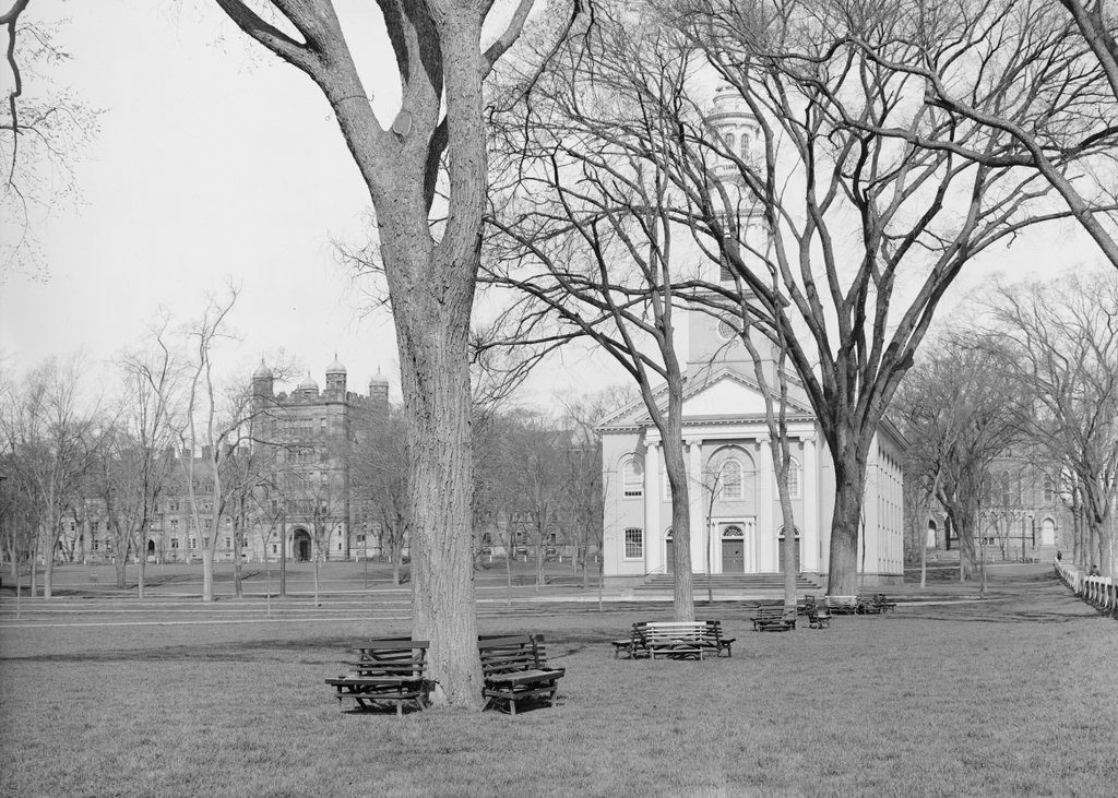
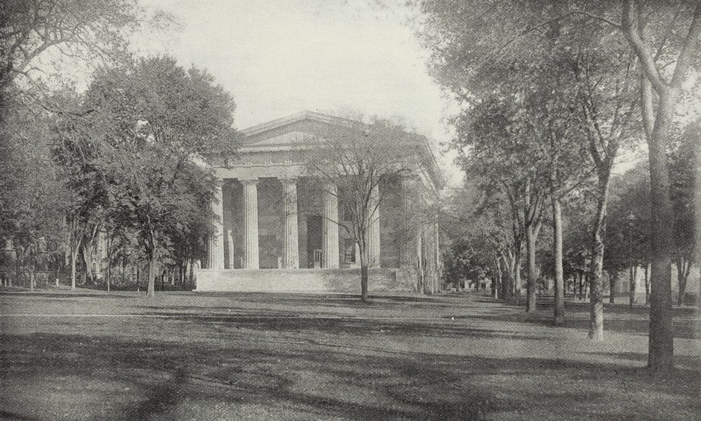
The Connecticut State House on the New Haven Green, seen from the south side of the building, sometime around the 1870s or 1880s. Image from The Connecticut Quarterly (1895).
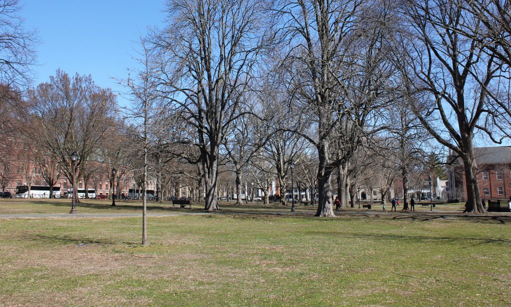
The scene in 2018:
During the early colonial period, the modern-day state of Connecticut actually contained two separate colonies. In the northern part of the state was Connecticut Colony, which was centered around Hartford on the Connecticut River. To the south, along the shores of Long Island Sound, was New Haven Colony, which was centered around its namesake town. These two colonies were ultimately merged in 1664, but the divide between Hartford and New Haven persisted for many years. In 1701, the two towns were designated as co-capitals of the Connecticut Colony, and legislative sessions altered between them, with the May session being held in Hartford each year, and the October session here in New Haven.

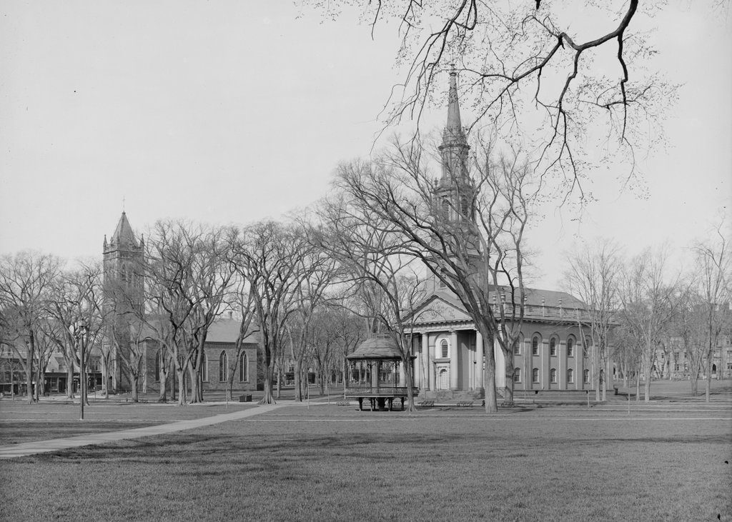
Two capital cities also meant two capitol buildings, and New Haven had a series of different state houses that were all located here on the New Haven Green. The last of these, which is seen in the first photo, was completed in 1831, replacing an earlier brick state house that had been in use since 1763. Its design was the work of Ithiel Town, a prominent Connecticut architect whose earlier New Haven works had included Trinity Church and Center Church, both of which are still standing nearby on the Green. Together, these three buildings demonstrated Town’s wide range of abilities, between the Federal-style Center Church, the Gothic-style Trinity Church, and the Greek Revival-style State House.

Town’s imposing design for the State House gave the building the exterior appearance of an Ancient Greek temple. It was built of stone, and had porticoes on both the north and south sides of the building, with classically-inspired columns, entablatures, and pediments. On the interior, the building included space for both the state and county governments. The basement and the first floor housed county offices, along with the county courtroom, a jury room, and various committee rooms. The upper floor had the two legislative chambers, with the House of Representatives at one end of the building and the Senate at the other, and there was also a room for the secretary and two rooms for the governor.

Following its completion in 1831, New Haven’s State House served, along with the older Hartford State House, as one of the state’s seats of government for more than 40 years. However, by the 1860s it was clear that maintaining two separate capitol buildings was both expensive and redundant. Railroads had significantly shortened the travel time between the two cities, which are a mere 35 miles apart, and the practice of having two capital cities apparently had more to do with each city’s sense of prestige than with any major convenience. Both cities lobbied hard to become the sole capital, and even Meriden threw its hat into the ring as a sort of compromise candidate. In the end, though, the question was settled by the voters of Connecticut, who chose Hartford as the capital, perhaps in part because of that city’s promise to contribute land and $500,000 toward the construction of a new State House.

The final legislative session at the New Haven State House was held here in 1874, and the following year Hartford took over as the state’s only capital. The new State House was completed in 1878, and still stands in Hartford’s Bushnell Park. In the meantime, the old 1797 State House was used as Hartford City Hall for many years, and it has since been preserved as a museum. However, here in New Haven the public sentiment was strongly divided over the fate of the city’s former State House. Having been vacated by both the state government and the county courts, the building was in need of a new use, and many argued in favor of preserving it and converting it into a public library. Perhaps with this proposal in mind, city voters approved an 1887 referendum to spend $30,000 on repairs to the building. However, the city council overruled this decision, and determined to demolish the iconic structure instead.

Even in the 1880s, long before the modern historic preservation movement gained widespread appeal, this was a highly controversial decision, with many praising the building’s architecture and its symbolic significance to the city of New Haven. Among the outside voices calling for its preservation was the Boston Advertiser, which published an editorial to that effect in 1889. In it, the newspaper argued:

That old State House is a priceless memento of a glorious past. It is a perpetual reminder that New Haven was originally an independent colony, and that, for nearly two centuries and a half it shared with Hartford the honor of being a state capital. Within those walls were uttered words whose echoes reached the continent and beyond the sea. Its style of architecture suggests the classic learning which, from the beginning, has been more faithfully taught in that locality than anywhere else in the world. . . . To tear down that building would be to obliterate one of the chief milestones on the path of time.

Not everyone in New Haven saw the State House in such a light, though. Apparently still embittered at losing the capital contest to Hartford some 15 years earlier, the New Haven Register responded to the Advertiser with an editorial of its own, arguing:

It will be news to most New Haveners to be told that the State House is a “priceless memento of the glorious past.” It is not, nor has it ever been priceless. It is a memento of New Haven’s folly in allowing Hartford to gobble up the capital. It is a perpetual reminder that New Haven in the past has shown a deplorable lack of public spirit in important crises. It is not a “chief milestone on the path of time.” Rather it is an encumbrance, a public nuisance, a bone of contention, an eyesore, a laughing stock, a hideous pile of brick and mortar, a blot on the fair surface of the Green. The Boston paper doesn’t know what it is talking about.

Both of these excerpts are quoted from The New Haven State House, a book that was published in 1889 shortly after the building was demolished. Interspersed within this history of the building were a number of advertisements, several of which attempted to use the demolition as a marketing strategy. One such ad declared “Two Great Mistakes! The greatest mistake ever made by New Haven people is shown by the destruction of the State House. The Second Mistake is in supposing that B. Booth has only second hand and auction goods at 388, 390 and 392 State St.” Another simply stated “The State House Gone. The City Market Remains,” and a third was for a photographic studio that promised “the Best Views of the Old State House that were made.”

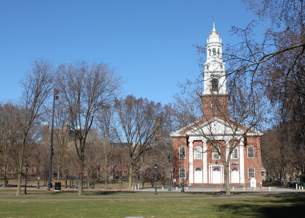
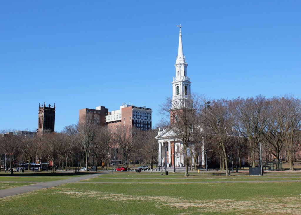
Following the demolition of the State House, the area was cleared and reverted to open park land, as part of the New Haven Green. However, this western portion of the Green, known as the Upper Green, was also the city’s colonial-era burial ground, where an estimated 4,000 to 5,000 people were buried. The headstones have long since been removed – aside from a small portion of the graveyard that is located in the basement of Center Church – but the remains themselves are still interred here under the Green. Today, though, there is little here to suggest the presence of a burial ground, or the former presence of a state capitol building. However, the New Haven Green is not without historic buildings, as three early 19th century churches still stand on the far right side of this scene, including the two designed by Ithiel Town.

United Church, New Haven, Connecticut

The United Church, at the southwest corner of Elm and Temple Streets, as seen from the New Haven Green around 1900-1912. Image courtesy of the Library of Congress, Detroit Publishing Company Collection.

The scene in 2018:

New Haven’s United Church, also know historically as North Church, has occupied this building on the Green since its completion in 1815. It was one of three church buildings to be built here during the mid-1810s, and it features a Federal-style design that was typical for churches of this period. The architect of United Church is somewhat unclear, but sources generally credit Ebenezer Johnson, Jr. with designing the building, and noted architect David Hoadley with overseeing the actual construction work. Either way, the design was likely influenced by the adjacent Center Church, which was completed a year earlier. Both churches have a brick exterior, a multi-stage steeple, and a pediment above the main entrance, although the United Church lacks a columned portico, and its steeple has a rounded top instead of a pointed spire.

The United Church was built a block east of the Old Campus of Yale University, which is visible in the distance on the left. The campus was developed in the 18th century, but most of these early buildings were demolished in the late 19th and early 20th centuries in order to construct the modern-day Gothic college buildings. The majority of this work was completed by the time the first photo was taken, and the most visible of these new buildings was Phelps Hall, with its distinctive tower that rises above Welch Hall to the left of it and Lawrance Hall to the right. Lawrance Hall is the oldest of the three, having been built in 1886, while Welch and Phelps were built in 1891 and 1896, respectively.

Today, more than a century after the first photo was taken, very little has changed in this scene. The elm trees on the Green are long gone, with most having presumably succumbed to Dutch Elm Disease in the mid-20th century, but otherwise the Green continues to function as a public park at the heart of New Haven. The United Church is still an active congregation, and its historic 1815 building has remained well-preserved, with no noticeable exterior changes from this angle. Along with the other two early 19th century churches on the Green, it is now part of the New Haven Green Historic District, which was designated as a National Historic Landmark in 1970. Further in the distance, this view of the Old Campus has also remained largely unchanged since the first photo was taken, and these buildings are used as freshman dormitories and as offices for several academic departments.

Trinity Church and Center Church, New Haven, Connecticut

Trinity Church on the Green (left) and Center Church (right), seen from across the New Haven Green, around 1900-1912. Image courtesy of the Library of Congress, Detroit Publishing Company Collection.

The scene in 2018:

These two churches were completed only two years apart, and were designed – at least in part – by the same architect, yet they represent two very different architectural styles. On the right is the Federal-style Center Church, which was completed in 1814. It was the work of notes architects Asher Benjamin and Ithiel Town, and it reflects the typical appearance of New England churches during this period. Common features include a columned portico with a triangular pediment above it, a tall, multi-stage steeple, and an exterior of red brick. The United Church, located just out of view to the right, was completed a year later, and in many ways its design was a close imitation of Center Church.

A third church, Trinity Church, was also built on the New Haven Green around the same time. It was completed in 1816, and can be seen in the distance on the left side of the scene. However, while the two earlier churches were Congregationalist, Trinity was an Episcopalian parish, and its members were interested in a design that would set it apart from the new neighboring churches. As discussed in more detail in an earlier post, the result was a stone, Gothic Revival church, perhaps the first church of this style to be built in the United States. Like the neighboring Center Church, it was designed by Ithiel Town, and his work predated the widespread popularity of Gothic Revival architecture by several decades.

The first photo was taken nearly a century later, and shows the view of the Green with both churches still standing. Aside from a partially-reconstructed steeple on Trinity Church, neither building had seen many exterior changes by this point. Today, the churches are more than twice as old as they were when the first photo was taken, yet they have still remained well-preserved. The only noticeable difference is the removal of the pyramidal spire atop Trinity Church, which was not original anyway. The Green itself has also remained largely unchanged, aside from the loss of the elm trees that once gave New Haven its nickname of Elm City. The only other major change to this scene since the early 20th century has been the construction of the Hotel Taft, which was completed in 1912 and can be seen in the distance between the two churches.

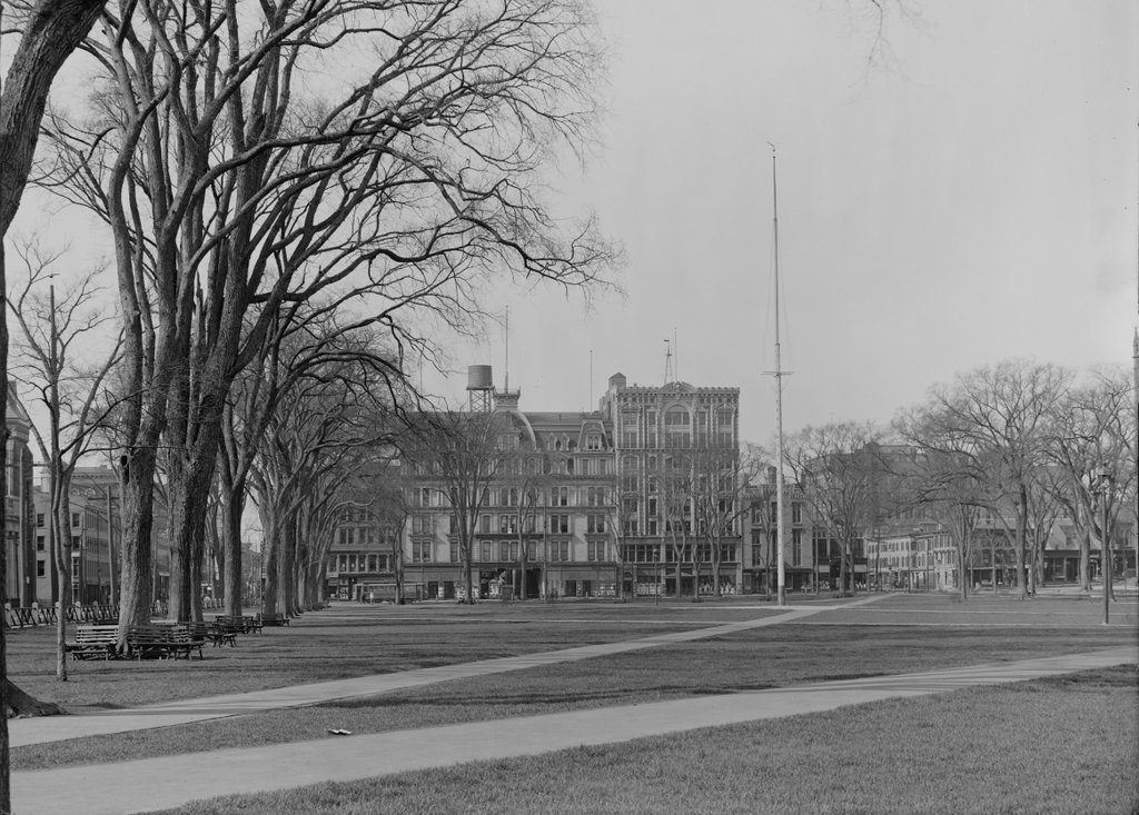
New Haven Green, New Haven, Connecticut

Looking south on the New Haven Green from near the corner of Elm and Church Streets, around 1900-1912. Image courtesy of the Library of Congress, Detroit Publishing Company Collection.

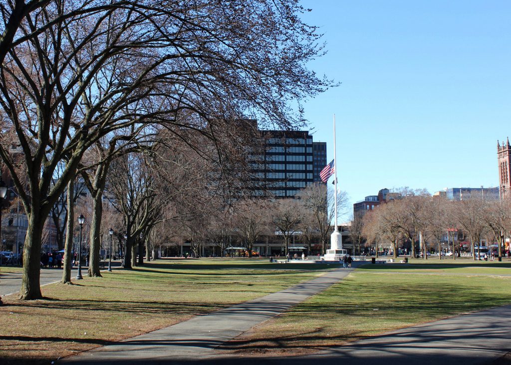
The scene in 2018:

The New Haven Green dates back to 1638, when it was established as one of the first town commons in the English colonies. Over the years, it would serve as the focal point of the community, and many of New Haven’s most important churches, businesses, educational institutions, government buildings, and houses have been located around – and in some cases on – the Green. These two photos show the view looking toward the southeast corner of the Green, with Church Street in the far left and Chapel Street running across the scene in the distance.

At the turn of the 20th century, this section of Chapel Street was the home of two of New Haven’s most important department stores. On the left side of the block was Gamble-Desmond, which occupied the ornate six-story, Second Empire-style building in the center of the first photo. Known as the Insurance Building, it was completed in 1871, and originally housed the offices of the American National Life and Trust Company. Other tenants included F. M. Brown & Co., a dry goods store that was purchased by David S. Gamble and John D. Desmond in 1898. Together they formed the Gamble-Desmond Company, and this department store became an important fixture in downtown New Haven throughout the first half of the 20th century.

On the right side of the block, the other major department store in this scene was the Edward Malley Company. It was founded in 1852, and during its early years it operated out of a two-story building at the corner of Chapel and Temple Streets. This building is partially visible in the distance of the first photo, a little to the right of the flagpole, but by the turn of the century the Malley Company had significantly expanded to include much of the block. The most recent addition in the first photo was the eight-story building just to the right of the Gamble-Desmond building, which was completed in 1899.

Along with Gamble-Desmond, Malley’s would also remain here at its Chapel Street location for many decades. However, as was the case in cities across the country, these once-thriving department stores began to suffer by the mid-20th century, as suburban shopping centers began to displace traditional downtown business districts. Gamble-Desmond closed in 1952, and the building was demolished several years later. Then, in 1962, Malley’s relocated to a new building two blocks to the south of here, and the old building was demolished to construct the Chapel Square Mall, which occupied the entire block along Chapel Street between Church and Temple Streets. The complex also included a hotel, along with an office tower, which is visible in the center of the present-day photo.

The mall was completed in 1967, and was successful for the first decade or two. However, the new Malley’s location, which served as one of its anchor stores, closed in 1982, and the mall began to decline. This was the case for many downtown indoor malls, which tend to combine the disadvantages of both downtown shopping and mall shopping, while offering few of the advantages of either. Both the office tower and the hotel are still here, but the mall ultimately closed in 2002, and its indoor space has since been converted into apartments.

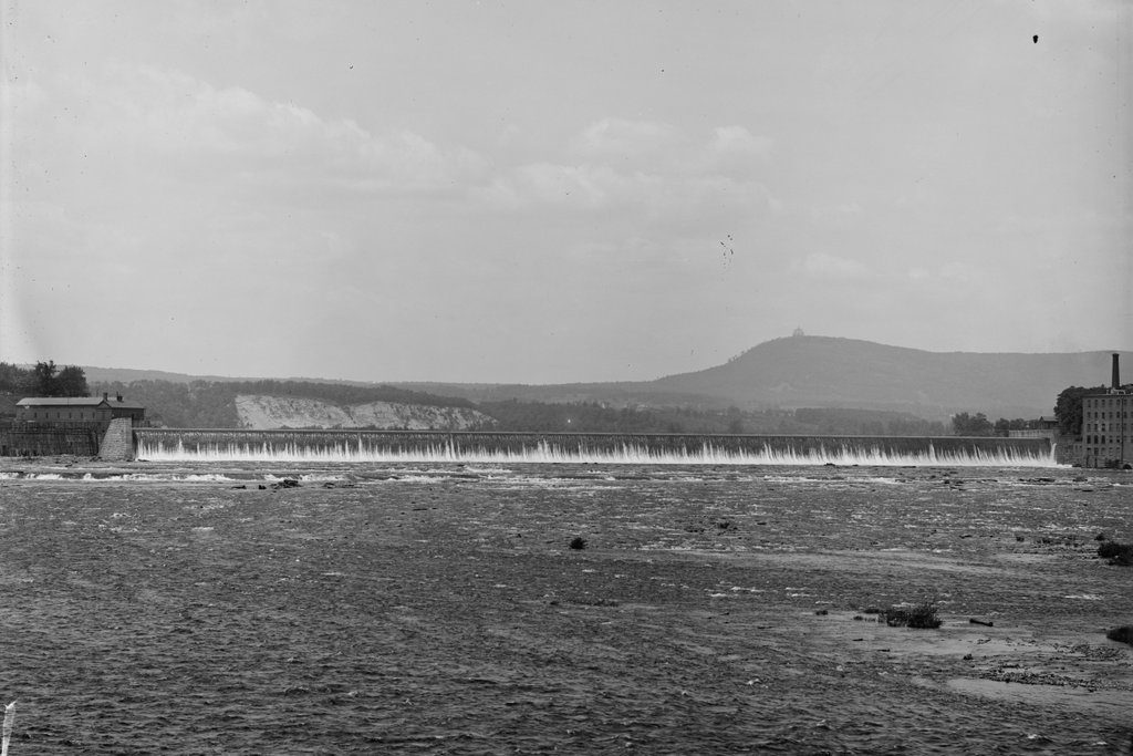
Hadley Falls Dam, Holyoke, Mass

The Hadley Falls Dam on the Connecticut River, on the border of Holyoke and South Hadley, around 1900-1910. Image courtesy of the Library of Congress, Detroit Publishing Company Collection.

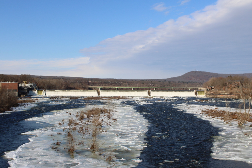
The scene in 2017:

As mentioned in the previous post, Holyoke is the site of the largest waterfall on the Connecticut River, with a drop of 58 feet. This made the location ideal for large-scale industrial development, and during the mid-19th century Holyoke was transformed into a prosperous manufacturing center. The first dam was built here in 1848, but it was poorly constructed, and it failed just hours after the gates were closed. However, a new dam was constructed the following year. It was built of wood, extending 1,017 feet across the river, and was 30 feet tall, with timbers that were firmly anchored four feet deep into the bedrock beneath the river.

This second dam proved far more durable than its short-lived predecessor, and it remained in use for the rest of the 19th century. However, by the early 1890s there was a need for a new dam, this time built of stone. Construction began in 1892, with the new dam being located 150 feet downstream of the old one. It took three years just to excavate the bottom of the river, and the work involved the removal of some 13,000 cubic yards of bedrock. Construction of the dam itself began around 1896, and it was comprised of a combination of rubble stone taken from the riverbed downstream of the dam, along with quarried granite blocks from Vinalhaven, Maine. The work was done in several different stages, as described in a 1900 article in the Journal of the Association of Engineering Societies:

The dam was constructed in four sections, the south end and a center section just north of the drain channel being built up for a considerable height first. Then a coffer dam was built on the first level of the north channel, thus turning the water through the center channel, while a section of dam 5 feet high was constructed behind it. The coffer was then transferred to the center channel, and a section 10 feet high built in that opening. In this way the alternate sections were built in until the structure was complete. The cost of the entire work is said to have been between $600,000 and $700,000.

Upon completion in 1900, the dam measured 1,020 feet across the river, and is said to have been the longest dam in the world at the time. The first photo was taken sometime soon after its completion, and shows water pouring over the top of the dam. On the far right is part of the Carew Manufacturing Company, a paper mill that was located on the South Hadley side of the dam, and in the distance on the right side is Mount Tom, with the Summit House prominently visible atop the 1,202-foot traprock mountain.

Today, more than a century after the first photo was taken, both the Carew factory and the Summit House are gone. However, the dam itself is still here, after having survived a number of major floods during the 20th century. Holyoke is no longer the major industrial city that it once was, but the dam and the canal system are still used to generate power. Both are now operated by the city-owned Holyoke Gas & Electric, with the hydroelectric generators here at the dam provide a significant portion of Holyoke’s electricity.

Carew Manufacturing Company, South Hadley, Mass

The Hadley Falls Dam and the Carew Manufacturing Company, as seen from the Route 116 bridge over the Connecticut River on the border of Holyoke and South Hadley, in 1936. Image taken by Lewis Hine, courtesy of the U. S. National Archives.

The scene in 2017:

At over 400 miles in length, the Connecticut River is, by far, the longest river in New England, and flows north to south through the region, from the border of Canada all the way to Long Island Sound. It passes over a number of rapids and waterfalls during its course, the largest of which is here on the border of Holyoke and South Hadley, Massachusetts, with a drop of 58 feet. This is also the last major waterfall on the river, and throughout the colonial era it was a major obstacle to river navigation, requiring a costly 2.5-mile portage around the falls.

This problem was partially solved in 1795, when a canal opened on the South Hadley side of the river. It was located on the other side of where the mill buildings stood in the first photo, and it was the first navigable canal in the country, predating longer and more famous ones like the Erie Canal by several decades. However, by the middle of the 19th century, railroads had replaced canals as the most important form of inland transportation, and the South Hadley Canal ultimately closed in 1862.

With the decline of river transportation, along with the rise of industry, this waterfall began to be seen as a major asset, rather than as an obstacle. Industrial development began in the early 19th century, with mills on the South Hadley side, but the most dramatic change to this area came in the the middle of the century. The west side of the river, once a part of West Springfield, was incorporated as Holyoke in 1850, and was developed into a major industrial center. This included the construction of a dam across the river, an extensive power canal system through Holyoke, and a number of large factory complexes.

As a result, Holyoke’s industrial development quickly outpaced that of its older neighbor on the other side of the river. However, South Hadley continued to operate several factories of its own, including two paper mills on the right side of the dam. The one closest to the dam was the Carew Manufacturing Company, and was established in 1848. Its original factory burned in 1873, but it was subsequently replaced by the brick building in the first photo, and produced writing paper for many years. Just to the right of the Carew factory was the Hampshire Paper Company, which was built in the early 1860s and produced the well-known Old Hampshire Bond writing paper.

The first photo was taken in 1936, by prominent photographer and social reformer Lewis Hine. It was in the midst of the Great Depression at the time, and Hine was traveling around the country documenting its effects. He made a visit to Holyoke, where he photographed many of the mills, and he wrote the following caption about this scene:

Mt. Holyoke, Massachusetts – Scenes. The dam: The Connecticut River: the old and famous Hampshire bond manufacturing plant, recently bought by its neighbor, Carew Manufacturing. Also an old and independent mill; founder paternalistic enough to build a church which still stands, enough local feeling to employ from South Hadley because on the Hadley side of the River – Carew Manufacturing Company, 1936

As Hine mentioned in his description, the Hampshire Paper Company closed in 1935, and the property was acquired by the Carew Manufacturing Company. However, the old Hampshire mill was later owned by Stevens Paper Mills, Inc., and it stood here until it was demolished around 1970. In the meantime, the Carew mill was purchased by Texon in 1948, and it produced a variety of goods until it closed in 1986. The property was later sold to Holyoke Gas & Electric, but the historic mill stood vacant for many years before finally being demolished around 2012.

Today, all of the mills from the first photo are gone, but otherwise the scene is still easily recognizable from the first photo. The dam, which was completed in 1900, is still there, and it still provides hydroelectric power for the city of Holyoke. Further in the distance, Mount Tom still forms the backdrop of this scene, although it now features a number of broadcast transmitters atop the 1,202-foot summit. These are hardly visible in the 2017 photo, though, and the only other addition to this scene is the Joseph E. Muller Bridge, which carries U. S. Route 202 across the river just upstream of the dam.