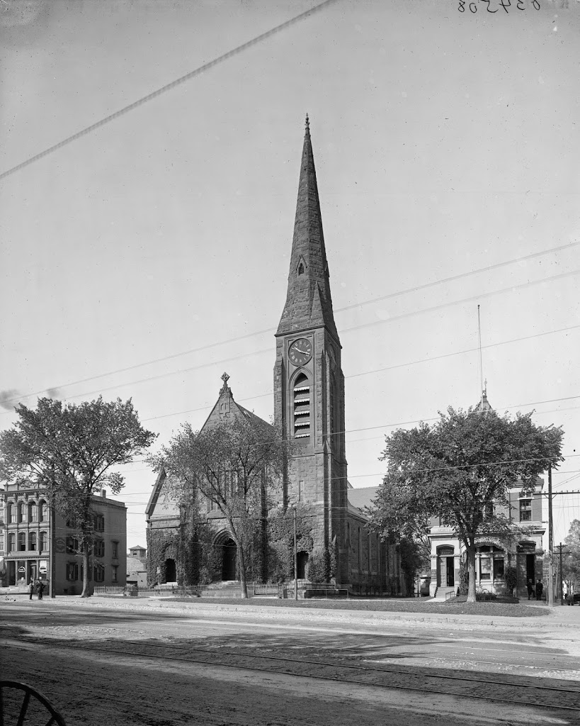
The First Church of Northampton, between 1900 and 1910. Image courtesy of the Library of Congress, Detroit Publishing Company Collection.
In 2014:
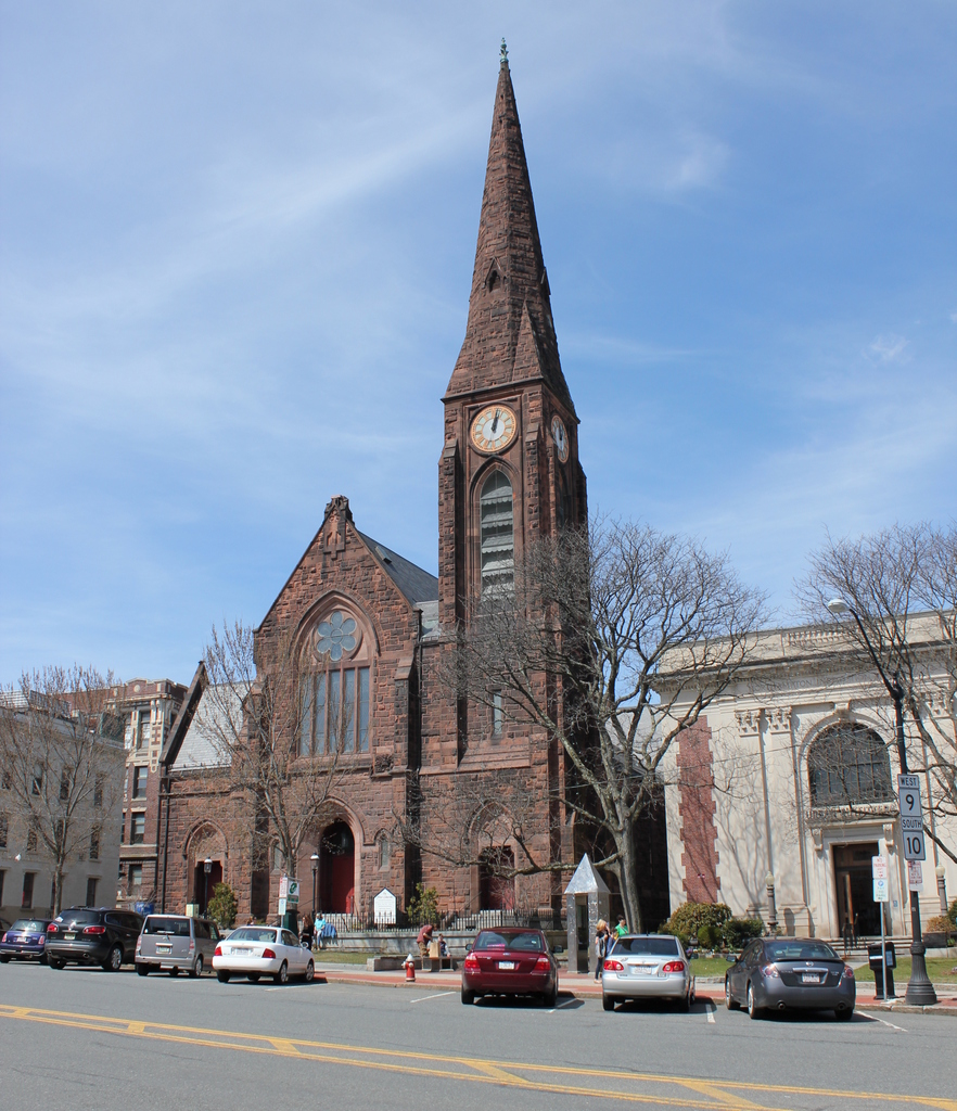
Built in 1877, Northampton’s First Church hasn’t changed much, although its surroundings are different than they were a century ago. Notice in particular the absence of trolley tracks or wires and the proliferation of cars. Nearly three centuries and three church buildings ago, this was the home to one of America’s most prominent theologians, Jonathan Edwards, who was pastor of the Northampton church from 1727 to 1751, and who led the Great Awakening from his pulpit here. The church building that he built in 1737 was replaced in 1812 by one designed by Isaac Damon, the same architect who designed Springfield’s Old First Church seven years later. That building burned in 1876, and was replaced by the present structure the following year.