Market Street, Springfield Mass

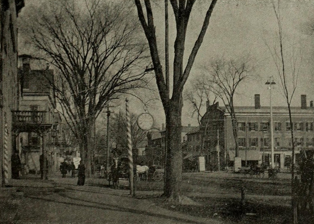
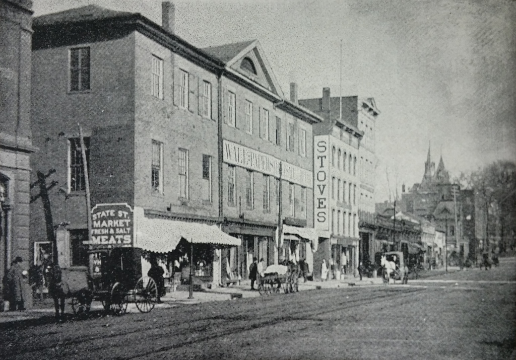
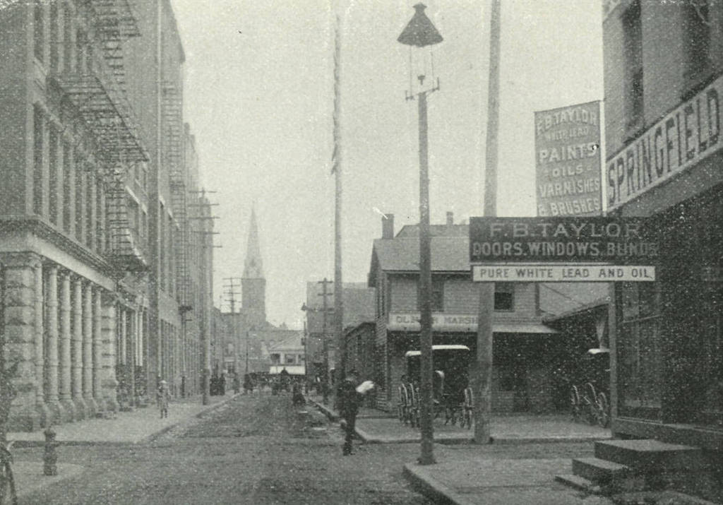
Looking north on Market Street from East Court Street in Springfield, c.1892.  Image from Picturesque Hampden (1892)
527_1892c picturesquehampden

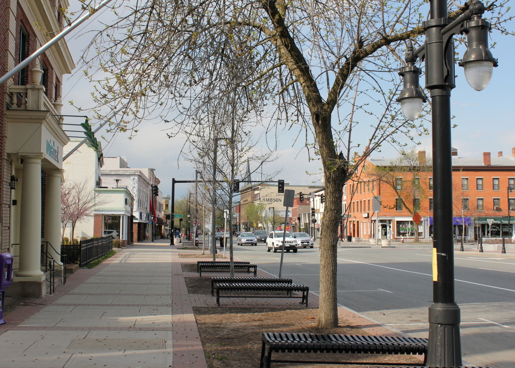
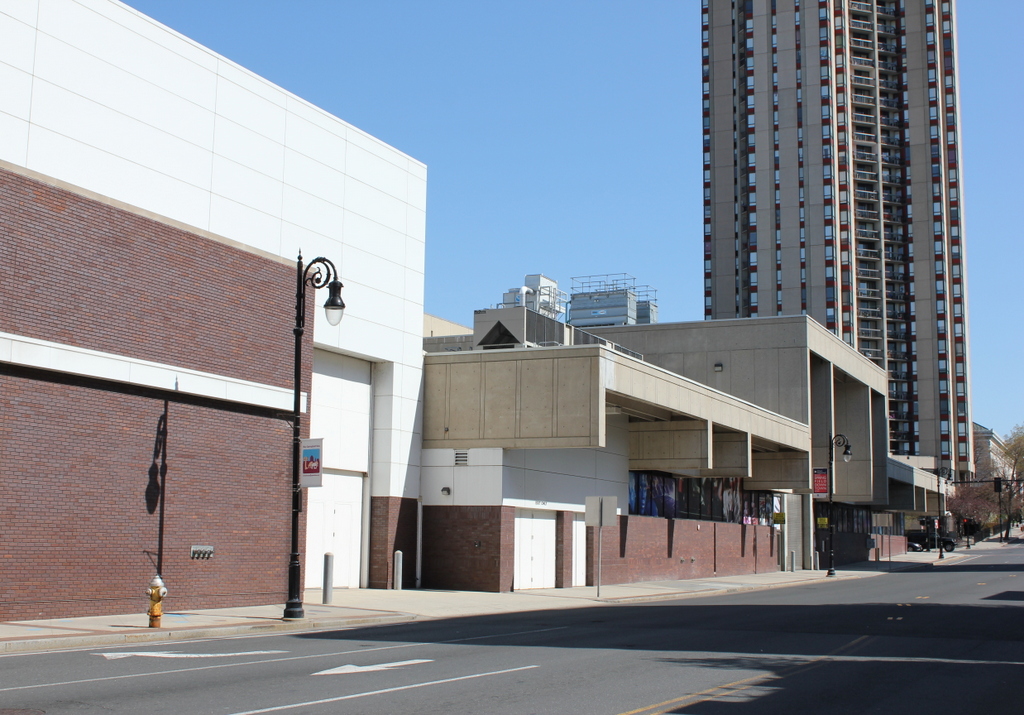
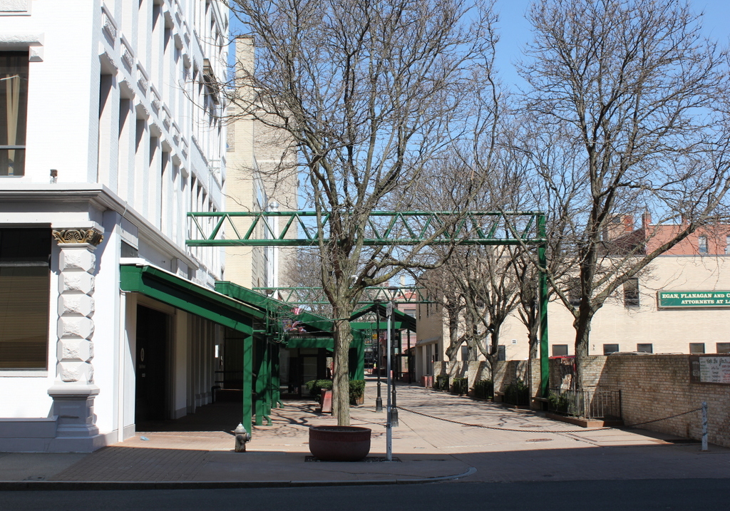
Market Street in 2015:

527_2015
Market Street once ran parallel to Main Street from State Street to Harrison Avenue, and these two photos show the northern section of the street toward Harrison Avenue.  This was never a major thoroughfare in the city – in fact, in the 1892 photo it looks more like an alley running behind the buildings on Main Street.  Today, the southern section of Market Street no longer exists at all; the section from State Street to East Court Street is now part of the MassMutual Center.  North of here, the street still exists, but it is a pedestrian-only walkway.

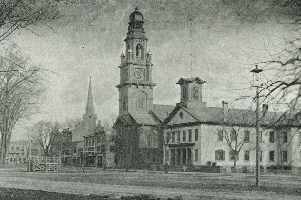
Most of the buildings from the first photo no longer exist.  On the right-hand side, F.B. Taylor once supplied builders with doors, windows, lumber, and paint; today this spot is occupied by the MassMutual Center.  In the distance is the steeple for Trinity Methodist Episcopal Church, which once stood on Bridge Street.  Today, the congregation still exists at the large stone church on Sumner Avenue.  The only building in the first photo that survives today is the Springfield Five Cents Savings Bank building, seen on the far left.  The Main Street facade of this building has since been substantially altered, but from the rear it is still recognizable as being the same one.

Main Street, Hartford Connecticut

Looking north on Main Street in Hartford from near the corner of Pearl Street, around 1905. Image courtesy of the Library of Congress, Detroit Publishing Company Collection.

517_1905c loc (02 City Hall and Main Street)

Main Street in 2015:

517_2015

Not much remains the same between these two views of Main Street in Hartford, although one of the few surviving buildings also happens to have been probably the oldest from the 1905 photo – the Old State House, on the right-hand side.  Built in 1796, it was substantially older than all of the other buildings in the foreground in 1905, but today it is double the age that it was back then, and all of its neighbors have long since been replaced by modern skyscrapers.  The only other survivors from 1905 are a couple buildings in the distance.  One of these is the tall building the left-center of the 1905 scene.  At the time, it towered over the other buildings on Main Street, but today it is literally in the shadows of its neighbors, and is barely noticeable in the 2015 scene.

Aside from the changes in buildings, the two scenes also show the differences in transportation.  The trolleys of 1905 have been replaced by buses, bicycles are not nearly as common on Main Street today as they were 110 years ago, and there are far fewer pedestrians walking along the street (although granted the 2015 photo was taken on a Saturday – a weekday scene would probably look busier).  Also in the first photo is a large billboard just to the left of the center, with the words “Wilson High Ball that’s all!”  Wilson was a blended whiskey brand, and in between the two photos alcohol went from being legal, to being illegal, and then back to being legal again.  The company apparently survived Prohibition, but like the building that once featured its billboard, it doesn’t appear to be around anymore.

Hartford Fire Insurance Company Building, Hartford Connecticut

The Hartford Fire Insurance Company Building, at the corner of Trumbull and Pearl Streets around 1900-1910. Image courtesy of the Library of Congress, Detroit Publishing Company Collection.

516_1900-1910c loc (05 Hartford Fire Insurance Co)

The scene in 2015:

516_2015

Hartford is often regarded as one of the world’s major insurance centers, and one of the first companies here was the Hartford Fire Insurance Company.  It was founded in 1810, and in 1869 the company built this building at the corner of Pearl and Trumbull.  The left-hand side of the building is clearly older; the addition to the right was probably put on in the late 1890s or early 1900s.  However, the company continued to grow, and in 1921 they moved to a new location in Hartford outside of downtown.  I don’t know when this building was demolished, but today a modern skyscraper sits on the site of the old insurance building.  The company is still located at the site they moved to in 1921, although they have changed names.  They are now The Hartford Financial Services Group, Inc., but they are better known as just The Hartford.

The street scene in front of the building is interesting; it captures the era in which automobiles and horse-drawn carriages shared the streets.  Here, a car takes a left turn from Trumbull onto Pearl Streets; the blurriness of the car and the woman in the white dress give the impression of a car taking a sharp turn at a decent speed while a pedestrian hurries across in front of it.  Behind the car is a carriage with “Besse’s Ice Cream” written on the side.  A 1904 ad from Printers’ Ink indicates that “Besse caters for Weddings, Parties, Banquets and gatherings of all kinds,” so perhaps the two men driving the carriage are heading to such an event.  The most unusual method of transportation in the photo, though, seems to be the thing that the two boys are riding in the right foreground – it looks like a wooden crate with four bicycle wheels attached to it.

Allyn House, Hartford Connecticut

The Allyn House at the corner of Asylum and Trumbull Streets in Hartford, around 1908. Image courtesy of the Library of Congress, Detroit Publishing Company Collection.

515_1908c loc (27 Allyn House)

The scene in 2015:

515_2015

The Allyn House was built in 1857 by Timothy Allyn, and in its heyday was one of the city’s premier hotels.  In his 1867 Illustrated Guide to the Connecticut Valley, Henry Martyn Burt describes it as “the largest and most elegant” of Hartford’s hotels, and that “no pains have been spared to make this a first class hotel in every respect.”  As built, it could accommodate almost 300 guests, many of whom were likely businessmen involved in Hartford’s insurance industry, as well as politicians working and visiting the state capital.  Around the time that the first photo was taken, it was the Hartford residence of many prominent state politicians; at various times the Governor, Lieutenant Governor, Secretary of State, Treasurer, Comptroller, Attorney General, and Speaker of the House lived here.

The ground floor of the building had several stores, including the Allyn House Drugstore, which as seen in the first photo offered “Ice Cream Soda,” and another sign advertises that “We Make A Specialty of Fancy Egg Drinks.”  There are two bicycles leaning against the building, and based on the frames one appears to be a men’s bike, and the other a woman’s bike.  Perhaps a young couple stopped at the drugstore to get some ice cream soda on a hot summer day?

The building was demolished in 1960, and today the location is at the southeast corner of the large block around the XL Center.  However, one of its contemporaries survives today; the building at 105-115 Asylum Street is located diagonally across the intersection, and it was built in 1855.  It was also owned by Timothy Allyn, and architecturally bears some resemblance to the former Allyn House.  A present-day photo of it can be seen on the Historic Buildings of Connecticut blog.

Soldiers and Sailors Memorial Arch, Hartford Connecticut

The Soldiers and Sailors Memorial Arch on Trinity Street in Hartford, around 1900-1910.  Image courtesy of the Library of Congress, Detroit Publishing Company Collection.

513_1900-1910 loc

The arch in 2015:

513_2015

Many cities and towns across the country have some sort of Civil War monument with a statue on top, but Hartford took it one step further and designed a pair of medieval-style towers connected by an arch.  The monument honors the approximately 4,000 Hartford citizens who served in the war, about 400 of whom never returned home.  It was dedicated in 1886, and spans Trinity Street not far from the State Capitol, which is off to the right, beyond the right-hand tower.  At the time that the first photo was taken, the section of road in front of the tower was a bridge over the Park River.  The bridge is still there, but the river has since been put underground and the grade was raised on the old riverbed.  Trinity Street has also changed – there are no longer any trolley tracks running down the middle, and because of how narrow the arch is, the street has been reduced to a single lane of one-way traffic.

Stockbridge Street, Springfield Mass

Looking east on Stockbridge Street toward Main Street in Springfield, around 1938-1939. Image courtesy of the Springfield Preservation Trust.

510_1938-1939 spt

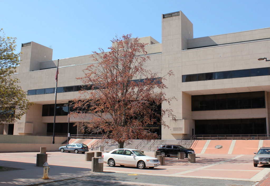
Stockbridge Street in 2023:

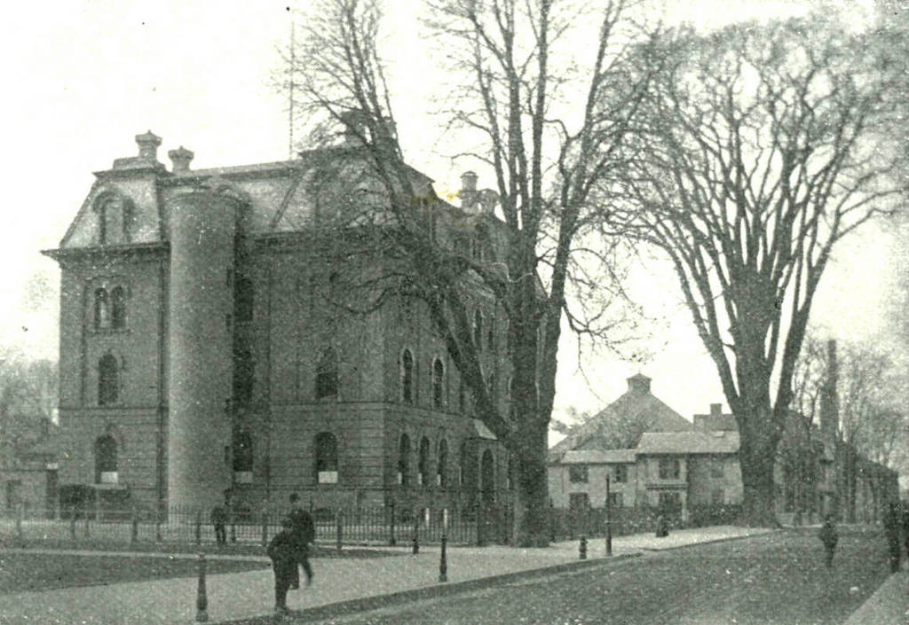
Like many other places in downtown Springfield, Stockbridge Street was once lined with three story brick commercial blocks, much like the ones seen in the 1930s view of the street.  This style appeared throughout the downtown area in the first half of the 19th century, when Springfield began growing into a major commercial and industrial center.  Early views of Court Square, Main Street, and other areas in downtown all feature plenty of examples of these buildings, but today only a few are left.  In the immediate downtown area, the last two are the Byers Block on Court Square, and the Guenther & Handel’s Block in this scene.

The Guenther & Handel’s Block was built in 1845, and as the 1930s photo shows, it was part of a row of similar buildings.  For many years, the ground floor was a grocery store and delicatessen, and in 1913 was sold to Emil Guenther and Richard Handel, who ran a grocery store under their names.  By the time the first photo was taken, both men had died, but the business was run by the family until 1972.  Today, all of the other mid-19th century buildings on the street are gone, and Guenther & Handel’s Block is wedged between an ornate early 20th century apartment building and a drab, nondescript late 20th century commercial building.