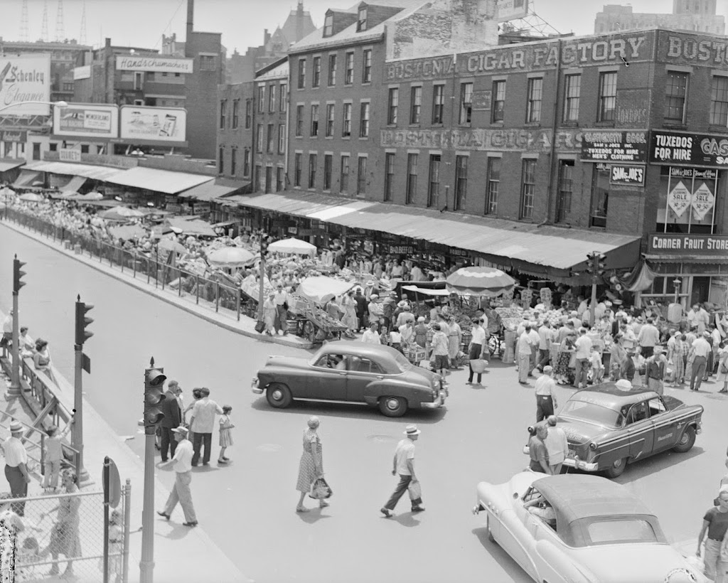
The corner of Blackstone Street and Hanover Street, in 1956. Photo courtesy of Boston Public Library, Leslie Jones Collection.
The same corner in 2011:
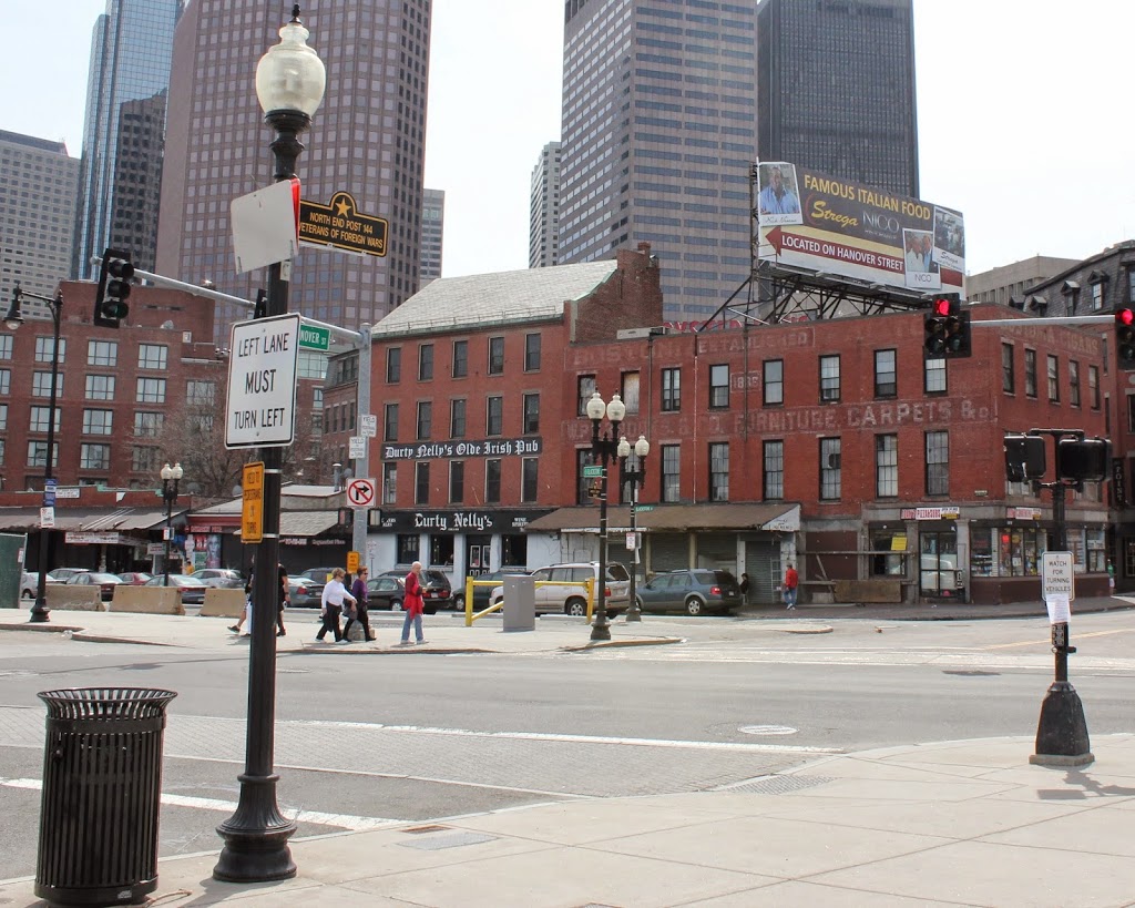
There’s something rather depressing about comparing these two photos – the bustling marketplace, contrasted with the shuttered storefronts and empty streets. However, the appearance neighborhood as a whole has improved significantly since 1956 – the first photo was actually taken right in front of the Central Artery – the massive elevated highway that was eventually replaced by the much-maligned yet more aesthetically pleasing Big Dig. Where I was standing to take the 2011 photo is right about where the highway ran through – if I had taken the photo 10 years earlier, the buildings in the foreground would’ve been barely visible.
I hadn’t seen the 1956 photo before taking this photo; what drew me to the building was the fading 19th century advertisements still visible on the bricks. The two most prominent are for Bostonia Cigars (top and right-hand side), and W.P.B. Brooks & Co. Furniture Carpets &c. I couldn’t find out much about either company, but it appears both from the appearance of the advertisements and also some quick online searches about the companies that they existed in the late 19th and early 20th centuries.
The building itself, which was constructed around 1835, is actually the same building that has the Boston Stone mounted on its wall, on the opposite side of where this photo was taken. Behind it is the Blackstone Block, a rare group of buildings from the 18th and 19th century that still maintains the original 1600’s street network. It is completely surrounded by much newer construction, but it is a small enclave of historic structures. On the opposite side of this area is one of Boston’s oldest buildings, the home of the Union Oyster House.
This building itself actually used to have more floors, but at some point before the 1956 photo it was trimmed down to just three. However, recent photos of this same building taken in the past year have shown that a couple more floors have actually been added on to the top of it, which would suggest that its future is brighter than the boarded up storefronts and deserted streets would seem to suggest.