Pennsylvania Station, New York City

Pennsylvania Station, seen from the corner of 7th Avenue and 31st Street in New York City, probably in 1912. Image courtesy of the Library of Congress, Detroit Publishing Company Collection.

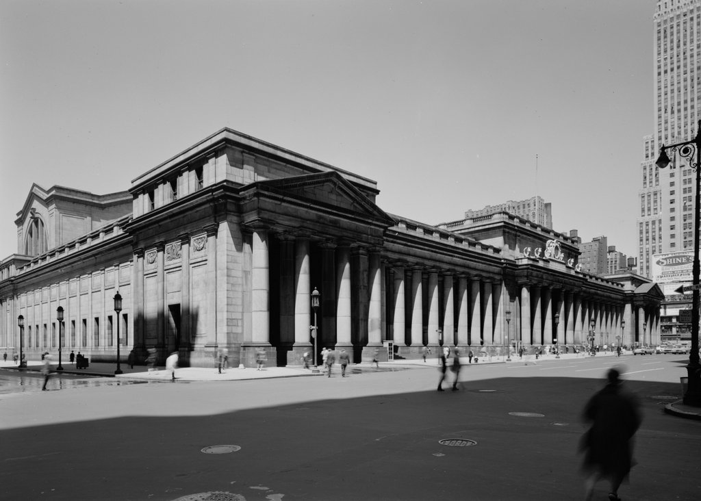
Pennsylvania Station on May 5, 1962. Image courtesy of the Library of Congress, Historic American Buildings Survey Collection.

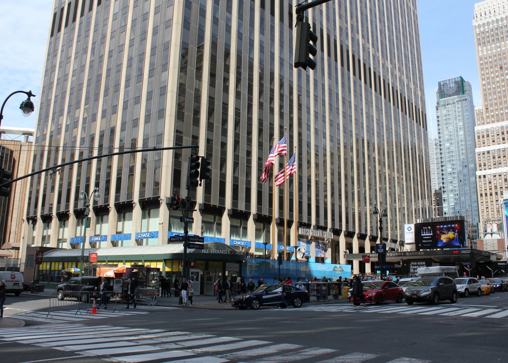
The scene in 2019:

During the heyday of rail travel in the late 19th and early 20th century, passenger stations in major cities were typically large, ornate buildings. As the first place that most travelers would see upon arriving in a new city, these stations sought to convey a strong first impression by demonstrating the importance and grandeur of both the city and the railroad company. Consequently, when the Pennsylvania Railroad—one of the largest corporations in the world at the time—constructed a rail line into the largest city in the country, it built what was arguably the grandest railroad station in American history.

Throughout the 19th century, the Hudson River was a major obstacle for railroad traffic heading to and from New York City. At the time, Manhattan’s only direct rail link was to the north, across the narrow Harlem River. This connected the city to upstate New York, New England, and other points north and east, but travel was much more difficult when heading south or west. In the absence of bridges or tunnels, the only way for these railroads to reach Manhattan was by ferry from the New Jersey side of the river.

As early as the 1880s there were proposals to bridge the Hudson, but these would have been prohibitively expensive, given the necessary height of the bridge and the amount of valuable Manhattan real estate that would have been required for the approaches. The only other option was to tunnel under the river, but this did not become a viable alternative until the development of electric locomotives, as there would have been no way to provide ventilation for steam locomotives in the tunnel. Even then, it would entail significant expense and engineering challenges along the way, not least of which was the difficulty of tunneling through the viscous mud on the riverbed.

The final plans consisted of two parallel tunnels under the Hudson River, which would bring Pennsylvania Railroad trains into the heart of Manhattan at a new station in midtown. This would be done in conjunction with the Long Island Rail Road, which was building similar tunnels under the East River. These tunnels would meet the Pennsylvania Railroad here at the new station, providing direct rail access to Manhattan for Long Island commuters.

Work on both the Hudson River and East River tunnels began in 1904, as did the excavation work for the new Pennsylvania Station. The station site occupied two full city blocks, and it was bounded by West 31st Street, West 33rd Street, 7th Avenue, and 8th Avenue, in the middle of the city’s Tenderloin neighborhood. This spot was four blocks west and nine blocks south of the city’s other major rail hub, Grand Central Terminal, which was operated by the Pennsylvania Railroad’s rival, the New York Central.

Pennsylvania Station included 11 tracks and 21 platforms, but its most notable feature was its above-ground portion, shown here in this view along 7th Avenue. The massive building was designed by the prominent architectural firm of McKim, Mead & White, and it is often regarded as their magnum opus. It featured ornate Beaux-Arts architecture, with an exterior of pink granite that was lined with columns and other classically-inspired elements. Here on the east side of the building, the main entrance was topped by a large clock, with allegorical representations of Day and Night on either side. The clock was also flanked by six eagles, with three on each side. All of these statues, along with the matching figures above the other three entrances to the station, were the work of noted sculptor Adolph Weinman, who is perhaps best known for designing the Mercury dime and the Walking Liberty half dollar.

On the interior, the main entrance opened to a 225-foot long, 45-foot wide arcade that was lined with shops. This led to the main waiting area in the center of the building, which spanned the width of the station from West 31st Street to West 33rd Street and featured a ceiling that rose 150 feet above the floor. It was said to have been the largest such waiting room in the world at the time, and it included ticket offices, baggage check windows, and telephone and telegraph offices, in addition to two smaller adjoining waiting rooms, with one for men and one for women. Beyond the waiting room, on the west side of the building, was the main concourse, with its distinctive iron and glass arched ceiling. The station also included two covered carriage drives, which led down to the lower level. These were located on the north and south sides of the station, and they were accessed here on the 7th Avenue side, beneath the pediments on the left and right side of this scene.

Pennsylvania Station was completed in the late summer of 1910, and part of it opened on September 8. The rest of the station opened on November 27, drawing an estimated 100,000 visitors throughout the day, in addition to the 25,000 passengers on the more than 80 trains that arrived and departed from here. Aside from a few short early morning delays the opening went smoothly, and the station was easily able to accommodate the large crowds. Reporting on the opening day, the New-York Daily Tribune described the station as a “fresh mechanical miracle,” and further noted:

And in thousands they flooded the acres of its floor space, gazed saucer eyed like awestruck pigmies at the vaulted ceilings far above them, inspected curiously the tiny details of the place, so beautifully finished, on their own level and pressed like caged creatures against the grill which looked down upon subterranean tracks, trains and platforms. W. W. Egan, the station master, was of the opinion that some of them had been there all night. There was no let up all day, at all events, and late last night the steel and stone palace still entertained its thousands of liliputian admirers swarming in and out and round about.

Aside from its colossal dimensions and great distances, the most noteworthy feature of this human achievement is its silence. It’s too big to be noisy, too dignified in its spaciousness for staccato sounds. The steady hum of its tense life spells only peace, like the drone of bees in a summer garden. The stealthy trains circulate in its underworld unnoticed. Even the announcers’ calls fade into faraway song, echoing in a canyon.

The hordes of sightseers caused no indigestion in the huge maw of this monster. Passengers came and went or waited without inconvenience or crowding, though they were outnumbered fifty to one. A delay here and there in providing car equipment, due to untried complications at the Harrison transfer station, only accentuated the general smoothness with which the eighty-four trains to and from the West were operated.

The first photo was taken within a year or two after the station opened, probably sometime in 1912. The presence of many horse-drawn vehicles suggests an early 1910s date, but the most helpful clues in dating the photo are the advertisements for Broadway shows, which are visible on the extreme right side of the photo. These productions, which include The Master of the House, The Little Millionaire, Hanky Panky, and Little Women, all premiered in either 1911 or 1912.

Penn Station, as it was commonly known, remained in use throughout the first half of the 20th century, with ridership here peaking during World War II. However, this quickly began to change after the end of the war, as commercial airlines and private automobiles began to eclipse railroads for long-distance travel. Railroads across the country began to struggle financially, including the once-mighty Pennsylvania Railroad, which had difficulty maintaining its iconic station here in New York.

This neighborhood, which had been a red light district prior to the construction of Penn Station, was valuable Midtown real estate by the mid-20th century. In addition, the cavernous station that had so impressed visitors in 1910 was both costly and underutilized, so in 1954 the railroad optioned the air rights to a developer. This agreement would allow for the demolition of the above-ground portion of the station, leaving only the tracks and platforms from the original structure.

Nothing came of this initial plan, but in 1962 the site became the subject of a new redevelopment proposal, which would involve demolishing the station, constructing a new, smaller station underground, and building a new Madison Square Garden and an office building atop it. The second photo was taken around this time, in May 1962, evidently as part of an effort to document the building’s architecture before its demolition. By this point, the interior had undergone some significant changes since the station opened, but the 7th Avenue facade was largely unchanged from this angle, aside from the accumulation of a half century of grime on the pink granite walls and columns.

These redevelopment plans caused significant controversy, as Penn Station was still a major New York landmark, despite the reduced importance of rail travel. However, demolition began in October 1963, just over a year after the second photo was taken, and the building was mostly gone by 1966. Madison Square Garden opened in 1968, and occupied the western two-thirds of the site. In the present-day scene, it is barely visible on the far left side of the photo. To the east of it is an office building, which stands in the foreground of the photo along 7th Avenue.

The reconstructed Penn Station was also completed in 1968, although almost none of it can be seen above ground aside from the entrances, one of which is visible in the lower right side of the photo. It remains in use as New York’s primary intercity rail station, and it is the busiest station in North America, with an annual ridership of over 100 million. However, it lacks all of the grandeur and architectural distinction of its predecessor, and its design is particularly unimpressive compared to the historic Grand Central Terminal, which still stands as the city’s other major railroad station.

In hindsight, though, the loss of the original Penn Station may not have been entirely in vain. The demolition helped to draw attention to the need for historic preservation, at a time when many important buildings were being lost to urban renewal projects in cities across the country. Here in New York, it led to the creation of the New York City Landmarks Preservation Commission, in order to protect significant buildings in the city. These included Grand Central Terminal, which was threatened by a similar redevelopment proposal that would have put a skyscraper atop the station building. This was successfully blocked by the Commission, and their ruling was upheld in a 1978 Supreme Court decision, thus preserving Grand Central in its historic appearance.

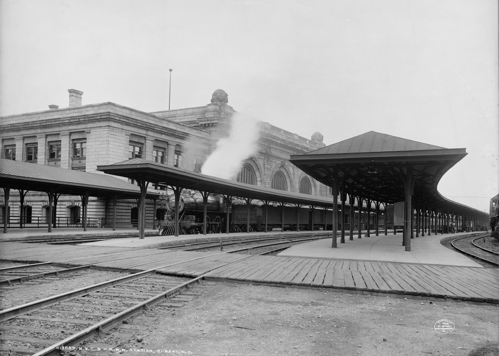
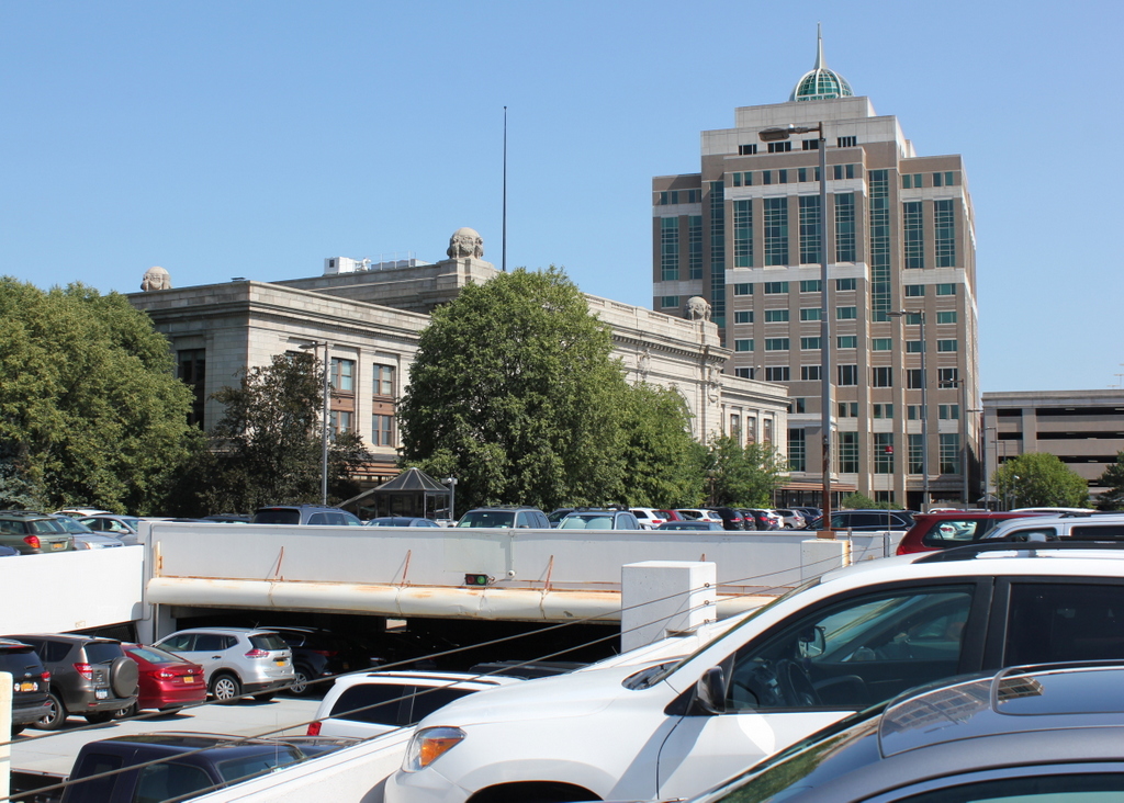
Union Station, White River Junction, Vermont

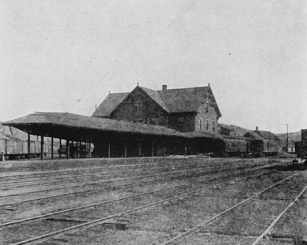
The railroad station at White River Junction, around 1900. Image from The Gateway of Vermont: Hartford and its Villages (1903).

The scene in 2018:

As discussed in an earlier post, the village of White River Junction is situated at the confluence of the White River and Connecticut River, on the border of Vermont and New Hampshire. Once sparsely-settled farmland within the town of Hartford, this area became an important railroad crossroads in the late 1840s, as new rail lines began spreading across northern New England.

By 1850, there were four different railroads that met here in White River Junction: the Vermont Central Railway from the northwest, the Connecticut River Railroad from the south, the Connecticut and Passumpsic Rivers Railroad from the north, and the Northern New Hampshire Railroad from the east. A fifth line, the Woodstock Railroad, was built in 1875, connecting White River Junction to the town of Woodstock, located 14 miles west of here.

The arrival of the railroads led to a small but thriving village, which was centered around the depot here, where the rail lines met. The first passenger station opened here on this spot in 1849. It was a union station, meaning that it was used by all of the railroads. This original depot burned in 1861, in a large fire that began in a nearby factory. The flames quickly spread, destroying a number of industrial buildings and warehouses, along with both the passenger and freight depots. It was one of many fires that hit White River Junction during the late 19th and early 20th centuries, and it was the first of three stations here that would be destroyed by fires.

The replacement station was completed here in 1862, but it burned within a couple decades, and around 1880 it was replaced by a third station, which is shown here in the first photo. It was from this station that, in the early morning hours of February 5, 1887, a northbound Central Vermont passenger train departed, heading for Montreal. However, just ten minutes later, at a bridge less than five miles northwest of here, the last four cars of the train derailed and fell onto the frozen White River. The cars caught fire with many passengers and crew trapped inside, and an estimated 37 people were killed, making it the deadliest rail accident in Vermont history.

The first photo was taken around the turn of the 20th century, showing the view of the station from the northwest. By this point, the various rail lines here at White River Junction had been consolidated into the Boston & Maine Railroad and the Central Vermont Railway. The Boston & Maine owned two-thirds of the station, with the Central Vermont owning the remaining third. These two companies controlled a significant portion of the rail traffic in northern New England, and White River Junction remained an important hub within their networks. In addition, the station housed a restaurant and the local telegraph office, which served as a major relay point for communications between Boston and Montreal.

Like its two predecessors, this station was also destroyed by a fire, which started on the morning of November 28, 1911. It evidently began as a result of faulty wiring in the telegraph office, and it soon consumed the entire building. The station was a total loss, but valuables such as the mail, baggage, and the contents of the ticket office were safely removed, and firefighters prevented the flames from spreading to neighboring buildings.

A day after the fire, the Barre Daily Times expressed optimism that the fire would lead to a new, improved station here, noting:

Now is the time for the Central Vermont and Boston & Maine railroads to get together and build a union station at White River Junction that will be just right. With the old station in ruins, they will have to start over again, and the new project ought to be accomplished with the added features, such as subways to the business streets of the village.

Evidently not everyone shared this hope for the future, though, because a few days later the Times quoted the Springfield Republican of Massachusetts, which had written “Travelers will find waiting at White River Junction, Vt., drearier than ever now that the railroad station has been burned.” To this, the Times added “Nevertheless, they ought to be able to find amusement in delving in the mysteries of antiquity, meaning the ruins of the old station.”

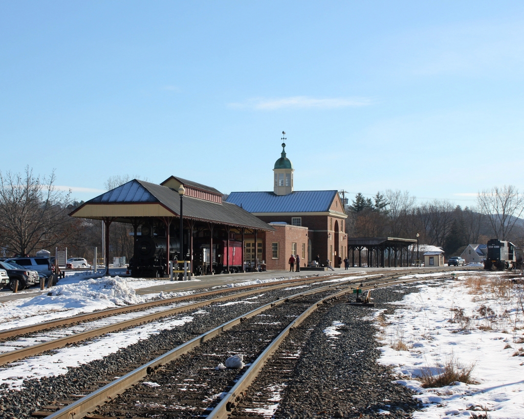
As it turned out, the Republican‘s assessment of the situation proved particularly accurate. For more than 25 years after the fire, passengers had to use a converted freight house as a temporary station, as the two railroads squabbled over the construction of its replacement. The new station, shown here in the present-day photo, was finally completed in 1937. It featured a Colonial Revival exterior that was designed by Jens Fredrick Larson, a noted architect and World War I flying ace who designed much of the campus at nearby Dartmouth College.

Today, more than 80 years after the station opened, the two railroad companies that built it are now long gone, and White River Junction is no longer the major passenger rail hub that it once was. The station is still here, and it remains in active use, although its passenger service is limited to just two daily trains on Amtrak’s Vermonter route, a significant drop from a village that, at its peak, saw up to 50 passenger trains stop here every day.

However, there are remnants of the past here in the present-day scene, including Boston & Maine engine #494, which is visible under the pavilion in front of the station. It was built in 1892 by the Manchester Locomotive Works in New Hampshire, and it remained in use until 1938. A year later it was an exhibit the 1939 World’s Fair, and in 1957 it was donated to the town of Hartford, which eventually restored it and put it on display here. In the 2018 photo, it contrasts with the modern diesel locomotive on the far right, which is operated by the New England Central Railroad, the successor to the Central Vermont.

Union Station, Springfield, Mass (2)

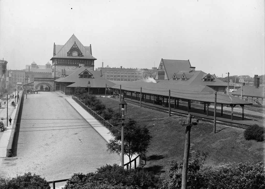
The old Union Station in Springfield, seen from near the corner of Lyman and Chestnut Streets around 1900-1910. Image courtesy of the Library of Congress, Detroit Publishing Company Collection.

The scene in 2018:

The first photo shows Union Station as it appeared about 10 to 20 years after its completion, as seen looking west from near Chestnut Street. The photo in a previous post shows the south side of the station from Lyman Street, but this view provides a more elevated look at the station, showing both the north and south sides, along with the platforms in between. Further in the distance, beyond the station on Main Street, are two of the city’s leading hotels: the Massasoit House on the far left at the end of Lyman Street, and Cooley’s Hotel, which can be seen in the center of the photo.

This area has been the site of Springfield’s primary railroad station since 1839, when the Western Railroad arrived, linking Springfield with Worcester and Boston. The original station, which was located on the west side of Main Street, burned in 1851, and the following year it was replaced by a brick and iron, shed-like station on the same spot. This station served for most of the second half of the 19th century, but it began to cause problems as the city grew in population and as rail traffic increased. Because the station was located at street level, trains had to cross directly over Main Street, leading to significant delays for traffic on the street. The station itself was also becoming insufficient for the number of trains that passed through here, and by the late 1860s there were already calls for a new station and elevated tracks through downtown Springfield.

In 1869, the state legislature authorized such a project, but it would take another 20 years before it was actually finished, thanks to an impasse between the city government and the Boston & Albany Railroad, which was the successor to the old Western Railroad. This dispute centered around which side was responsible for paying to raise the tracks and lower the grade of Main Street, and it ultimately did not get resolved until 1888, when the railroad agreed to spend around $200,000 to raise the tracks, while the city would spend about $84,000 to lower Main Street by four feet.

This compromise enabled the station project to move forward, and the old station was demolished in the spring of 1889. The new one was completed in July, and it was located on the east side of Main Street, which provided more room for the station. It featured a Romanesque Revival-style design, and the original plans had been the work of noted architect Henry H. Richardson, who designed many of the stations along the Boston & Albany Railroad. He died in 1886, though, and his successor firm of Shepley, Rutan & Coolidge subsequently modified the plans for the Springfield station.

One of these changes proved to be a serious design flaw. Richardson had intended for a single station building, located on the south side, with a large train shed over the tracks. However, the Connecticut River Railroad, which would share the union station with the Boston & Albany and the New York, New Haven & Hartford Railroads, objected to this plan, wanting a separate building on the north side. As a result, the finished station consisted of two buildings, each with its own ticket offices and waiting rooms, and four tracks in between them. The smaller northern building, on the right side of this scene, served northbound and westbound travelers, while the larger building on the south side was for those heading southbound and eastbound.

Within less than 20 years, this design was already causing problems as Springfield continued to grow. Having two different station buildings was an inefficient use of space, since it meant redundant facilities such as the waiting rooms. This was also a source of confusion for passengers, who would sometimes find themselves at the wrong ticket office or platform. In addition, the two buildings prevented the railroads from adding new tracks, since the space in between was already filled with four tracks and three platforms.

Aside from practical considerations, the architecture of the building was also obsolete by the early 20th century. Romanesque Revival had been widely popular during the last two decades of the 19th century, particularly for public buildings, and railroad stations were seen as important architectural showcases. They were usually the first thing that a traveler saw in a particular city, so any self-respecting city need a monumental station, in order to give a good first impression to visitors. This may have been the case for Union Station in the 1890s, but Romanesque Revival had fallen out of favor by the next decade, and the new generation of iconic railroad stations – such as Grand Central and Penn Station – began to feature classically-inspired Beaux-Arts designs.

As early as 1906, it was evident that the station was inadequate. That year, the Springfield Republican published an article on the city’s numerous railroad-related problems, observing that “[t]he most important problem as far as the safety and convenience of the public is concerned is the rebuilding of the union station.” In 1921, the newspaper was even more explicit, remarking on how “there seems to be, in fact, a nearly unanimous demand that the structure be cast to the scrapheap,” and four years later it declared that the station was “long execrated for its combination of discomfort, dinginess and danger.”

The station’s demise was hastened by a November 1922 fire that caused about $25,000 in damage to the north building. The fire was considered to be suspicious, but its origins were unclear, with the railroad superintendent simply telling the Republican, “your guess is as good as mine.” The city’s fire chief declared that he found no evidence of arson, although he did not actually inspect the cellar beneath the waiting room, where the fire had apparently started. There were no injuries, and most of the valuables, including mail, packages, and cash, were safely removed by railroad employees and by an off-duty police officer.

Within less than a month of the fire, the railroad had approved the plans for a new station. This replacement would be in approximately the same location, but the entire station would be located on the north side of the tracks. It would be connected to Lyman Street on the south side by way of a tunnel beneath the tracks, and this tunnel would also provide access to the platforms, avoiding the dangers of passengers crossing directly over the busy tracks. Perhaps most significantly, the number of tracks would be increased from four to 11, reducing congestion and delays on the railroad.

Demolition on the old station began in 1925, just 36 years after it was built, and the new Union Station opened the following year. It would remain in use for the next few decades, but passenger rail began to experience a significant decline throughout the country during the post-World War II era. With passenger trains becoming unprofitable for railroads to operate, Amtrak ultimately took control of the country’s passenger rail services in 1971. Two years later, most of Union Station was closed except for the Lyman Street entrance, and a small Amtrak station was built on the south side of the tracks.

Union Station sat empty for many years, and only one of the old station platforms was used for passenger service. However, the building underwent a major restoration in the 2010s, reopening in 2017. It now features a ticket office, waiting area, and retail space in the concourse, along with office space on the upper levels, including the offices of the Peter Pan Bus Lines. Union Station is also the terminus for most of the city’s PVTA bus lines, with 18 bus berths just to the west of the station. In addition to this, the rail traffic here at the station has also increased. Along with a number of daily Amtrak trains, Union Station is also served by the Hartford Line, which opened in 2018 with commuter trains running from Springfield south to New Haven.

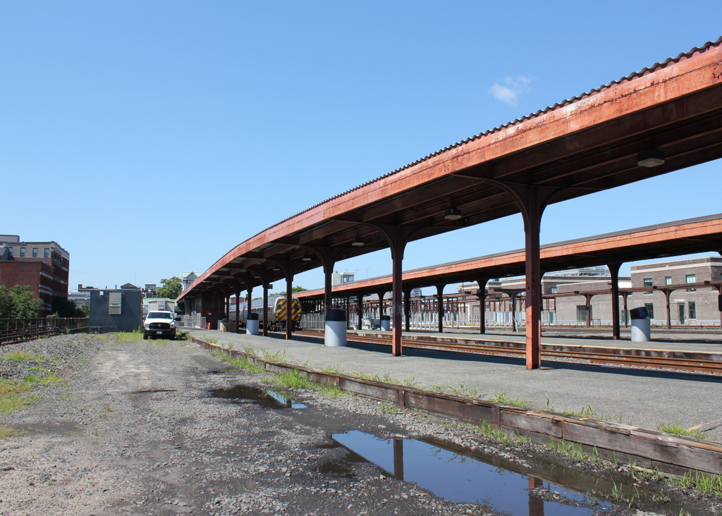
The 2018 photo shows this scene about a year after the station reopened. An Amtrak train is visible in the distant center of the photo, consisting of two passenger cars pulled by a P42DC diesel engine. This is the typical setup for most of the Springfield to New Haven Amtrak trains, and the rear car is a converted Metroliner cab car, which allows the train to be operated in either direction without turning the locomotive. Just to the right of the train is Platform C, which was the last part of the station’s renovation project. It was still unfinished when the first photo was taken, but this project – which upgraded the platform to modern accessibility requirements – was finished in January 2020, marking the end of Union Station’s restoration.

Canal Street, Holyoke, Mass

Looking southwest on Canal Street, toward the corner of Lyman Street in Holyoke, in 1936. Image taken by Lewis Hine, courtesy of the U. S. National Archives.

The scene in 2017:

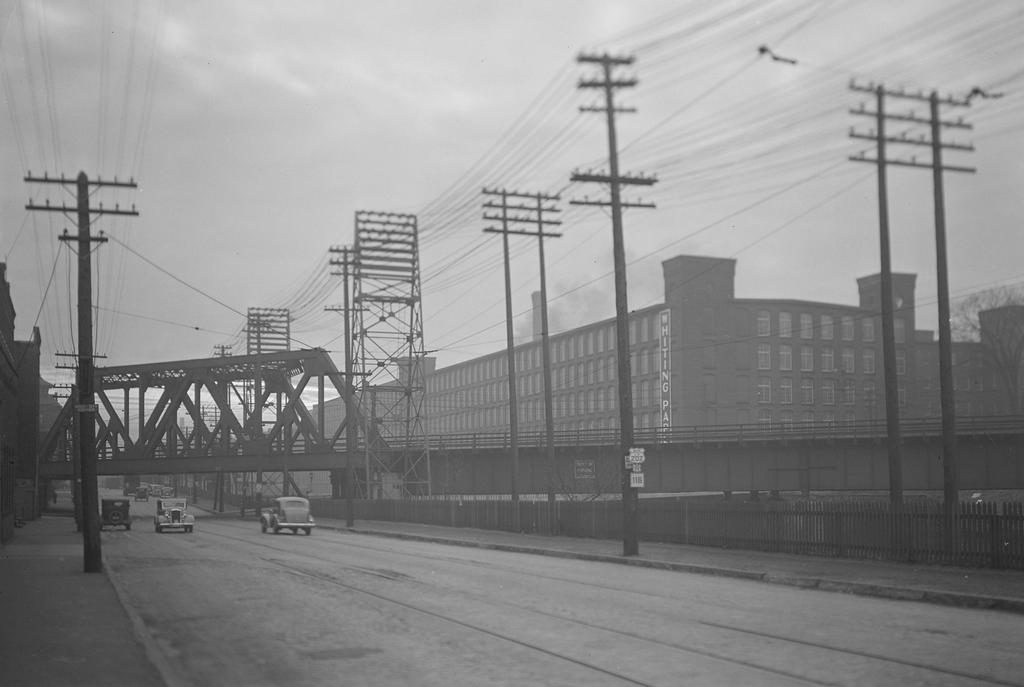
The first photo was taken by the prominent photographer and social reformer Lewis Hine, who is best known for his early 20th century work with the National Child Labor Committee. However, later in life he also documented life across the country during the Great Depression, including a visit to Holyoke in 1936. At the time, the city was a leading producer of paper and textiles, and most of his photos focus on Holyoke’s industry. This photo shows the scene along Canal Street, with the Second Level Canal on the right. The Boston and Maine Railroad crosses through the middle of the photo, and in the background is the Whiting Paper Company, which was located in a building that had previously been occupied by the Lyman Mills. Hine’s original caption provides a short description of the photo:

Mt. Holyoke [sic]Massachusetts – Scenes. An old mill of absentee ownership, liquidated and sold at a great bargain to a new owner, who would not sell or rent, uses only a small part; railway transportation; electric power transmission. Lyman Mills (Now Whiting Company), 1936

The Lyman Mills company was incorporated in 1854, in the early years of Holyoke’s industrial development. It was located in the area between the First and Second Level Canals, on the south side of Lyman Street, and over the years its facility grew to include a number of mill buildings. The earliest of these, not visible from this angle, were built in 1849-1850, and were originally used by the Hadley Falls Company before being acquired by Lyman Mills. Other buildings, including the large one in the distance on the right side of the scene, were added later in the 19th century, and the company became a major producer of textiles. It also employed a significant number Holyoke residents, including many of the city’s French Canadian immigrants, and by the turn of the century it had a workforce of over 1,300 people.

However, as Hine’s caption indicates, the Lyman Mills corporation was liquidated in 1927. Although still profitable despite increased competition from southern manufacturers, the shareholders were evidently more interested in selling the company’s assets instead of continuing to operate it as a textile mill. Over a thousand employees were put out of work on the eve of the Great Depression, and the property was sold to the Whiting Paper Company, whose original mill was located directly adjacent to the Lyman Mills complex.

Founded in 1865 by William Whiting, this company went on to become one of the largest paper manufacturers in the country, and Whiting enjoyed a successful political career as mayor of Holyoke and as a U. S. Congressman. After his death in 1911, his son, William F. Whiting, took over the company and oversaw the expansion into the former Lyman Mills buildings in the late 1920s. The younger Whiting was a longtime friend of Calvin Coolidge, and in August 1928 Coolidge appointed him as the U. S. Secretary of Commerce, replacing Herbert Hoover, who would be elected president a few months later. Whiting served in this role for the remainder of Coolidge’s presidency, until Hoover’s inauguration on March 4, 1929.

The conversion of the Lyman Mills into paper production, along with Whiting’s brief tenure as Secretary of Commerce, occurred just a short time before the stock market crash of October 1929. By the time the first photo was taken seven years later, the country was still in the midst of the Great Depression. Like the rest of the country, Holyoke was hit hard by the Depression, but the Whiting Paper Company managed to survive and remain in business for several more decades. However, Holyoke continued to see economic decline throughout the mid-20th century, with most of its major manufacturers closing or relocating, and the Whiting Paper Company finally closed in 1967, just over a century after it had been established.

Today, however, this scene has hardly changed in more than 80 years since Lewis Hine took the first photo. Although no longer used to produce textiles or paper, the Lyman/Whiting complex is still standing in the distance, and has been converted into a mixed-use property known as Open Square. Closer to the foreground, the same railroad bridges still carry the tracks over Canal Street and the Second Level Canal, and even the transmission towers are still standing, although they do not carry any electrical wires anymore.

Railroad Station, Salem, Mass

The railroad station at the corner of Washington and Norman Streets in Salem, around 1910. Image courtesy of the Library of Congress, Detroit Publishing Company Collection.

The scene in 2017:

Salem was a prosperous seaport throughout the 18th and early 19th centuries, with a fleet of sailing ships that brought goods to the city from around the world. Given its location on the north shore of Massachusetts, it was heavily dependent on the sea for its commerce, but in 1838 the first railroad line was opened to Salem, connecting the city to East Boston by way of the 13-mile-long Eastern Railroad. The line initially ended here in Salem, at an earlier station on this site, but in 1839 it was extended north to Ipswich, and then to the New Hampshire state line the following year.

The 1838 railroad station was built at the southern end of downtown Salem, meaning that the extension of the line would have to pass directly through the center of the city. In order to accomplish this, the railroad dug a 718-foot tunnel directly underneath Washington Street, allowing trains to pass through without disrupting downtown Salem. The incline for the tunnel began immediately north of the station, just out of view to the left of this scene, and it re-emerged just north of present-day Federal Street. The 1917 book The Essex Railroad, by Francis B. C. Bradlee, provides a description of the 1839 construction of the tunnel:

In order to build it the old Court House, together with stores and other buildings standing south of Essex street, were demolished. Washington street was laid open throughout its entire length and a wide ditch was dug, much trouble being experienced from the sandy nature of the soil. Residents on the side of the street boarded up their house fronts and moved away for some weeks. The sidewalks were piled with gravel. A stone arch was built in the open ditch, and when this was finished the gravel was back-filled as far as possible and the surface restored. Three air holes surrounded with iron railings came up from the tunnel through the street for ventilation, but when the locomotives began to burn coal they were done away with. All this work was done on the most elaborate plans and models, it being considered one of the largest pieces of granite work ever undertaken up to that time in New England.

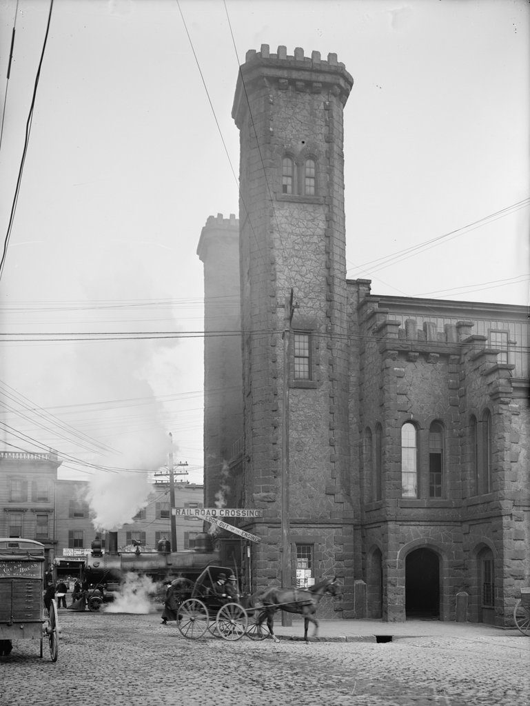
The original railroad station was used until 1847, when it was replaced by the one in the 1910 photo. It was designed by prominent architect Gridley J. F. Bryant, with a castle-like appearance that included two large crenellated towers on the north side of the building, as seen here. Trains passed directly through the building, and under a granite arch between the towers that resembled a medieval city gate. The interior originally included three tracks, and the upper level of the station housed the offices for the Eastern Railroad, including those of the president and the superintendent.

The station was badly damaged by an April 7, 1882 fire that started when a can of flares exploded in one of the baggage rooms. The wooded portions of the building were destroyed, but the granite exterior survived, and the rest of the station was soon rebuilt around it. Then, in 1884, the Eastern Railroad was acquired by its competitor, the Boston and Maine Railroad, and the station became part of a large railroad network that extended across northern New England. The first photo, taken around 1910, shows the a side view of the front of the building, with the original granite towers dominating the scene. In the lower left, a locomotive emerges from the station, while railroad flagmen – barely visible in front of the train – warn pedestrians and vehicles on the street.

In 1914, much of the area immediately to the south of the station was destroyed in a catastrophic fire that burned over a thousand buildings. The station itself survived, though, and remained in use for more than a century after its completion. However, it was demolished in 1954 in order to extend the tunnel south to its current entrance at Mill Street. By this point, intercity passenger rail was in a serious decline, due to competition from automobiles and commercial airlines, and the replacement station was a much smaller building on Margin Street, just south of the new tunnel entrance.

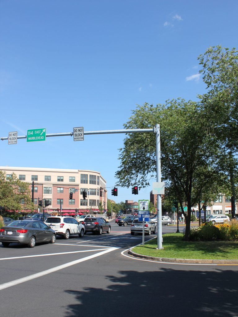
The 1950s station was used until 1987, when the present-day station was opened at the northern end of the tunnel, at the corner of Washington and Bridge Streets. Salem is no longer served by long-distance passenger trains, but it is now located on the MBTA Newburyport/Rockport commuter rail line, and trains still pass through the tunnel that runs underneath Washington Street. On the surface, though, there are no recognizable landmarks from the first photo, and today the scene is a busy intersection at the corner of Washington and Norman Streets. The former site of the historic station is now Riley Plaza, a small park that was dedicated in 1959 and named in honor of John P. Riley (1877-1950), a Salem resident who was awarded the Medal of Honor for his service in the Spanish-American War.

Lyman Street Bridge, Holyoke, Mass

Looking north toward the Lyman Street bridge over the Second Level Canal in Holyoke, around 1892. Image from Picturesque Hampden (1892).

The scene in 2017:

Holyoke was developed in the mid-19th century as one of the first planned industrial cities in the country, and was powered by a network of canals that were constructed starting in 1847. The Second Level Canal, seen here, runs parallel to the city’s street grid, and it is crossed by six of the major streets in downtown Holyoke. The northernmost of these is Lyman Street, which crosses the canal here, and the first photo shows a low, two-span bridge that was probably constructed of iron. The railroad bridge just beyond it was also iron, and carried the Connecticut River Railroad through Holyoke, passing diagonally across both the canal and the intersection of Lyman and Canal Streets on the right side of the photo. This lattice truss bridge was built in 1887, and later became part of the Boston and Maine Railroad after the company acquired the rail line in 1893, soon after the first photo was taken.

Today, this scene is still easily recognizable from the first photo, although both of the 19th century bridges are gone. The old railroad bridge was replaced in 1928 by a steel Warren truss bridge, which is still in use today, and the current Lyman Street bridge was built in 2011. Further in the distance, several of the 19th century mill buildings are still standing on Gatehouse Road. The long building on the left side of the photo, once the home of the Whiting Paper Company, is still there. It was heavily altered at some point after the first photo was taken, and the right side of the building collapsed during a severe thunderstorm in 2011. However, the left side is still standing, along with the small, two-story brick building on the far left side of both photos.