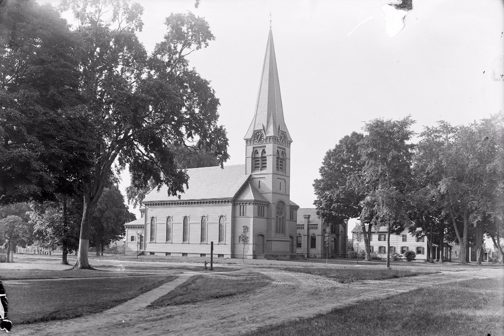
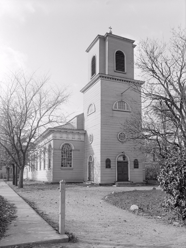
Christ Church on Garden Street in Cambridge, on October 25, 1929. Image courtesy of the Boston Public Library, Leon Abdalian Collection.
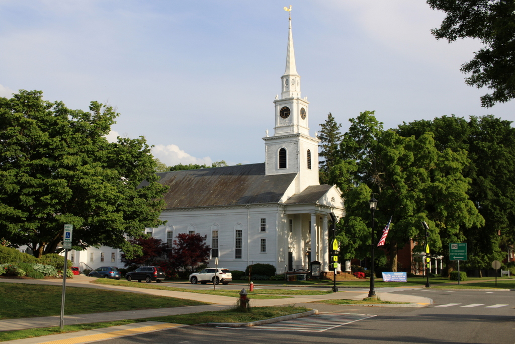
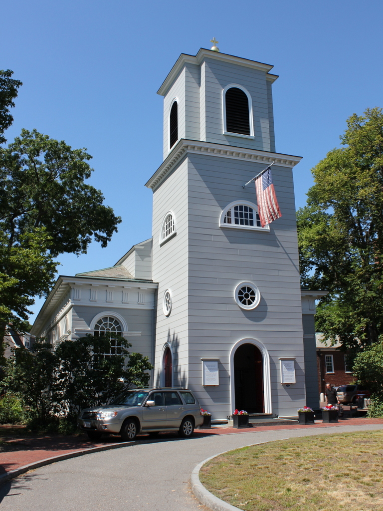
The church in 2016:
This church, which is also visible in the previous post, is the oldest existing church building in Cambridge. It was completed in 1761 and designed by Peter Harrison, who was the first formally trained architect to work in the future United States. It is one of only a few existing buildings that he definitely designed, along with King’s Chapel in Boston and several others in Newport, Rhode Island. Like King’s Chapel, and unlike most colonial New England churches, Christ Church was Anglican, and was intended to serve the town’s small but wealthy Anglican population along with students at nearby Harvard. Early in the American Revolution, Cambridge served as George Washington’s headquarters during the Siege of Boston. Many of the Anglicans here were Loyalists who fled the city, and the church closed for several years. However, George and Martha Washington, who were Anglicans themselves, did attend a service here in 1775.
The building reopened in 1790, and along with the Washingtons, the church has seen a number of other distinguished visitors. In 1879, Harvard student Theodore Roosevelt taught Sunday School here until a new pastor asked him to stop, because he was Dutch Reformed rather than Episcopalian. Nearly a century later, the church was more accommodating to Martin Luther King, Jr., who held a press conference here after Harvard refused to allow him to use one of their buildings.
Aside from an 1857 expansion to accommodate its growing congregation, the church has remained true to Harrison’s original design, and over 250 years later it is still in use as an Episcopalian church. Because of its historical and architectural significance, it has been designated as a National Historic Landmark, which is the highest level of recognition on the National Register of Historic Places.