Lost New England Goes West: Call Building, San Francisco

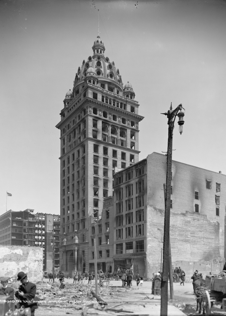
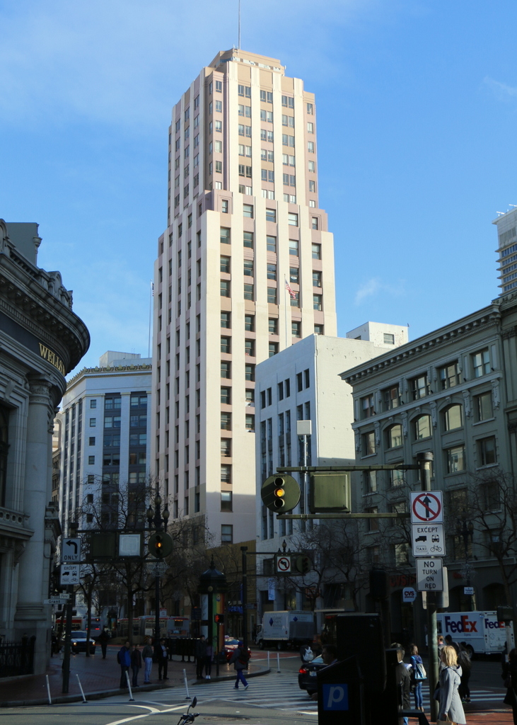
The San Francisco Call Building at the corner of Market and Third Streets, in the aftermath of the April 18, 1906 earthquake. Image courtesy of the Library of Congress, Detroit Publishing Company Collection.

876_1906c loc.tif

The building in 2015:

876_2015
This building has been mentioned in previous posts, such as this one, and it appears prominently in many post-earthquake images of the city. Also known as the Spreckels Building, this skyscraper was completed in 1898 by Claus and John Spreckels, the owners of the San Francisco Call newspaper. At the time, it was the tallest building west of the Mississippi River, although some were concerned that its height put it at risk for earthquakes in a very earthquake-prone city, and also a fire hazard because, in the event of a fire on the upper floors, it would be difficult for the fire department to fight.

To reduce the risk of earthquake damage, the building was anchored to a slab of concrete 25 feet below the surface, and to address fire concerns each floor was separated from the others by concrete, and the brick exterior walls were built nearly two feet thick. Ultimately, the earthquake-proofing worked, because it survived the 1906 earthquake with minimal damage, but no amount of fireproofing could have saved it from the massive fires that spread across the city in the aftermath. The building was completely gutted, as the first photograph shows, but structurally it remained intact, and was soon repaired.

The San Francisco Call later left the building, and in 1938 it was significantly altered to its present-day appearance. Its Beaux-Arts ornamentation was stripped off, the dome at the top was removed, and the exterior was modernized to give it an Art-Deco appearance. It is virtually unrecognizable in its current appearance, and there is probably little, if anything, left from its original 1898 construction, but it is still standing today as a major landmark along Market Street.

This post is part of a series of photos that I took in California this past winter. Click here to see the other posts in the “Lost New England Goes West” series.

Washington Street, Boston

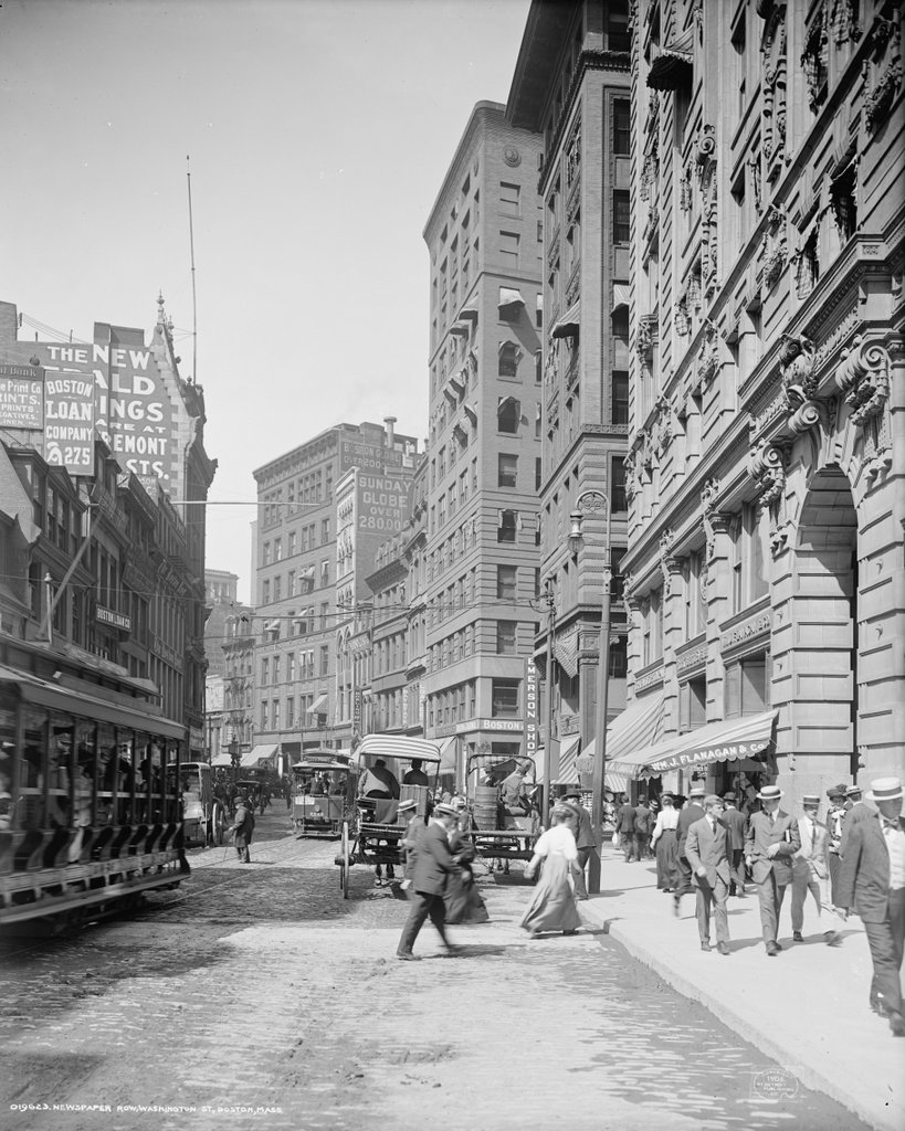
Looking north on Washington Street from School Street in Boston, around 1906. Image courtesy of the Library of Congress, Detroit Publishing Company Collection.
779_1906c loc

Washington Street in 2015:

779_2015
In the days before radio, television, and internet, the only major news source for most people was newspapers.  At the turn of the 20th century, large cities had many newspapers, which were often published twice daily.  However, for timelier updates, newspapers often posted breaking news, election results, and sports scores on bulletin boards outside of their offices.  In some cities, such as New York and here in Boston, many newspapers had offices in the same area, known as Newspaper Row.

Boston’s Newspaper Row was located along Washington Street, between Milk and State Streets, and at one point included up to 17 newspapers, including several in this scene.  On the far left of the first photo, partially blocked by the trolley car, is the Boston Post, and further down the street, the tall building to the left had been the home of the Boston Herald.  As the advertisement on the building indicates, the Herald had recently moved to a new location on Tremont Street.  Both the Post and the Herald buildings have since been demolished, and a parking garage now stands there.  The Post, which was established in 1831, was a major daily newspaper in New England until it closed in 1956.  The Herald, however, is still around today, 170 years after it was first published in 1846.

The large building in the distance in the left-center of the first photo was the home of the Boston Globe, the narrow building next to it was the Boston Advertiser, and the tall building in the center of the photo was the Boston Journal.  Of these three, the Globe was by far the newest of these newspapers, having been established in 1872.  The Advertiser, on the other hand, had been published since 1813 as the first daily newspaper in the city, and the Journal since 1833. However, the Globe ended up outliving both of them, as the Journal merged with the Herald in 1917, and the Advertiser was purchased by William Randolph Hearst the same year and was discontinued in 1929.  Both the Globe and the Advertiser buildings here have since been demolished, but the Journal building still stands as the only survivor of the five turn-of-the-century newspaper buildings in this scene.  The building opened in 1901, and was the home of the Journal until its merger with the Herald.  Since then, it has been used for other professional offices.

There are no longer any newspaper offices along this section of Washington Street; the Globe left in 1958, and it has been many years since Newspaper Row was the center of news information in the city.  It is also much less crowded; the first photo shows the narrow street filled with pedestrians, carriages, and trolleys, but within a few years the Washington Street Tunnel would be completed.  This subway tunnel eliminated some of the congestion by taking the trolleys off of the streets, and it formed the precursor to today’s Orange Line, which still runs under this section of Washington Street.

Despite the changes over the years, there have been several constants.  The Old Corner Bookstore, which is just out of view in the first photo but visible on the far left in the second one, is the oldest of them all.  It was built in 1712, and it is still standing as one of the oldest buildings in downtown Boston, and just beyond it is the Andrew Cunningham House, which was built a few years later around 1725.  Aside from these two colonial-era buildings, though, there are several other historic buildings in the scene.  On the far right is the Old South Building, a large office building that was completed shortly before the first photo was taken.  It wraps around the Old South Church between Washington and Milk Streets, and its Milk Street facade can be seen in this post.  The other prominent historic building here is the Winthrop Building, located just beyond the Old South Building at the corner of Washington and Water Streets.  A view of the long side of this building can be seen in the “now” photo of this post, which shows it from the Water Street side.  It was built in 1893 on a long, narrow, irregularly-shaped lot, and it was Boston’s first steel frame skyscraper.  It is still standing today, and is now on the National Register of Historic Places.
The Southington News, Southington, Connecticut

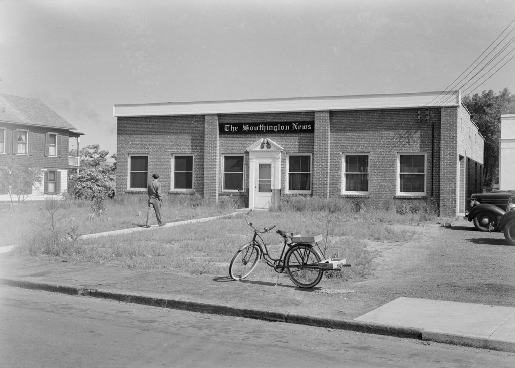
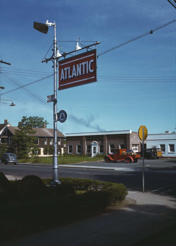
The Southington News Building on Eden Avenue in Southington, in May 1942. Image courtesy of the Library of Congress, FSA-OWI Collection.

637_1942-05 loc

The building in 2015

637_2015
This building can also be seen in color in the 1942 photo in this post, which was taken just a few yards away from here. It was the home of The Southington News, and was among the subjects photographed by the Office of War Information in an effort to document small town American life during the war.  Even in the 1942 photo, though, this scene isn’t particularly impressive.  The overgrown weeds, unmowed lawn, and large patches of dirt in front of the building give the impression that not much was going on at The Southington News.  Or, perhaps the idea was to show that with wartime labor shortages, maintaining the lawn wasn’t a priority?

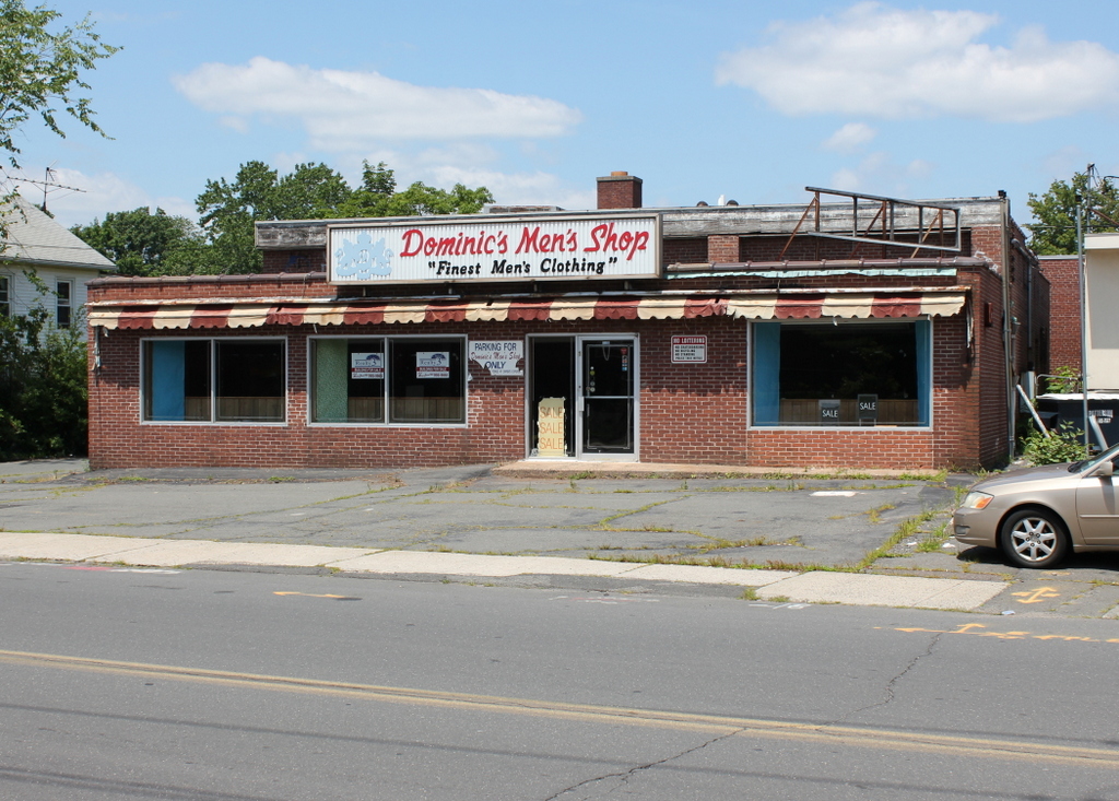
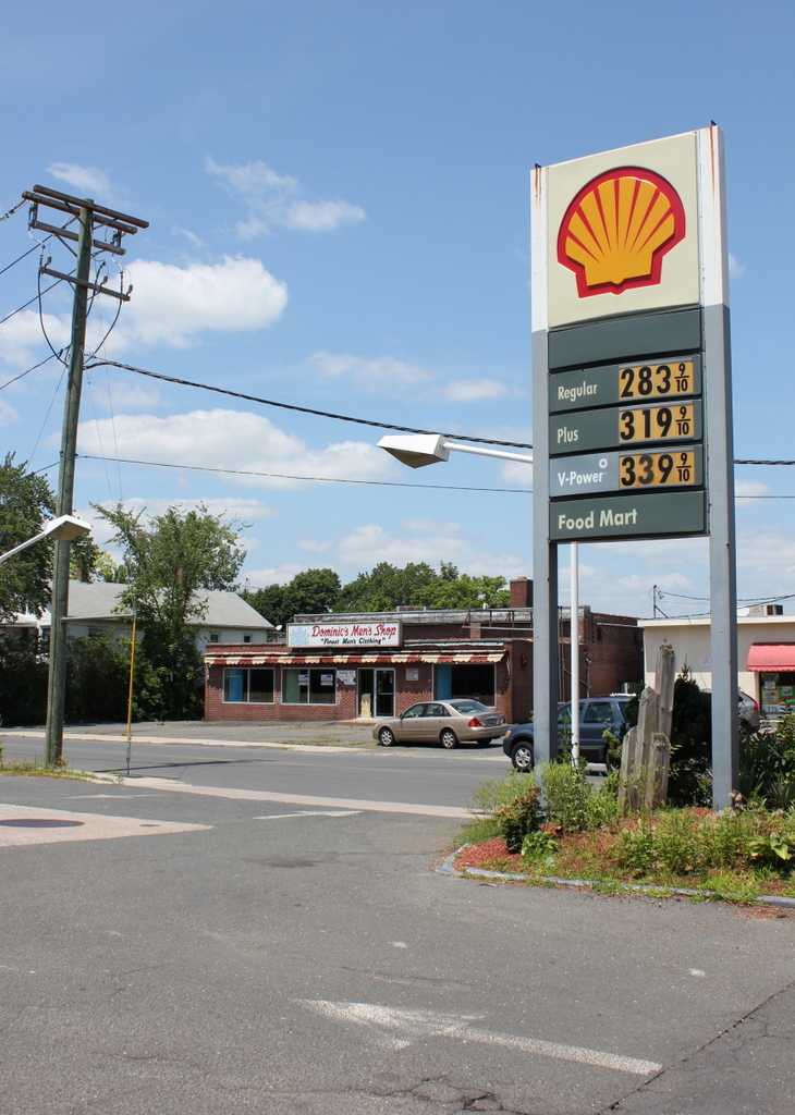
Today, The Southington News is long gone, but the building still stands, with an addition that covers most of the original facade.  The tops of the original brick pilasters can still be seen, and the edge of the roof is unchanged, although it looks like it hasn’t been painted since 1942.  As seen in the 2015 photo, it is vacant and for sale, having last been used as Dominic’s Men’s Shop.

Main Street and Eden Avenue, Southington, Connecticut

Looking northwest from the corner of Main and Eden in Southington, in May 1942. Image courtesy of the Library of Congress, FSA-OWI Collection.

636_1942-05 loc

The scene in 2015:

636_2015
This is the first color “then” photo that I have featured here, and it was taken by the Office of War Information, about six months after the US entered World War II.  The euphemistically-named OWI was essentially the propaganda department during the war, and one of their projects was to create a pamphlet that documented life in an American town.  Southington was chosen as the model, and several hundred photographs were taken in May 1942, including a few color ones.  The idea was to distribute the pamphlet overseas, with the goal of showing the freedom and equality that Americans enjoyed and hopefully gaining sympathy for the American war effort.

The 1942 photo was taken from the parking lot of an Atlantic gas station, with another gas station visible across Eden Avenue on the far right.  Both are still there, although the Atlantic one is now a Shell, and the gas prices are a little higher than they were in 1942, when the average price per gallon was 20 cents.  Across the street in the center of the photo was the home of The Southington News.  The building is still there today, although with an addition on the front.  Because the addition is not as tall as the rest of the building, the top of the original facade can still be seen from this angle.  It was most recently used as a men’s clothing store, but it is now vacant.

Springfield Republican Building, Springfield Mass

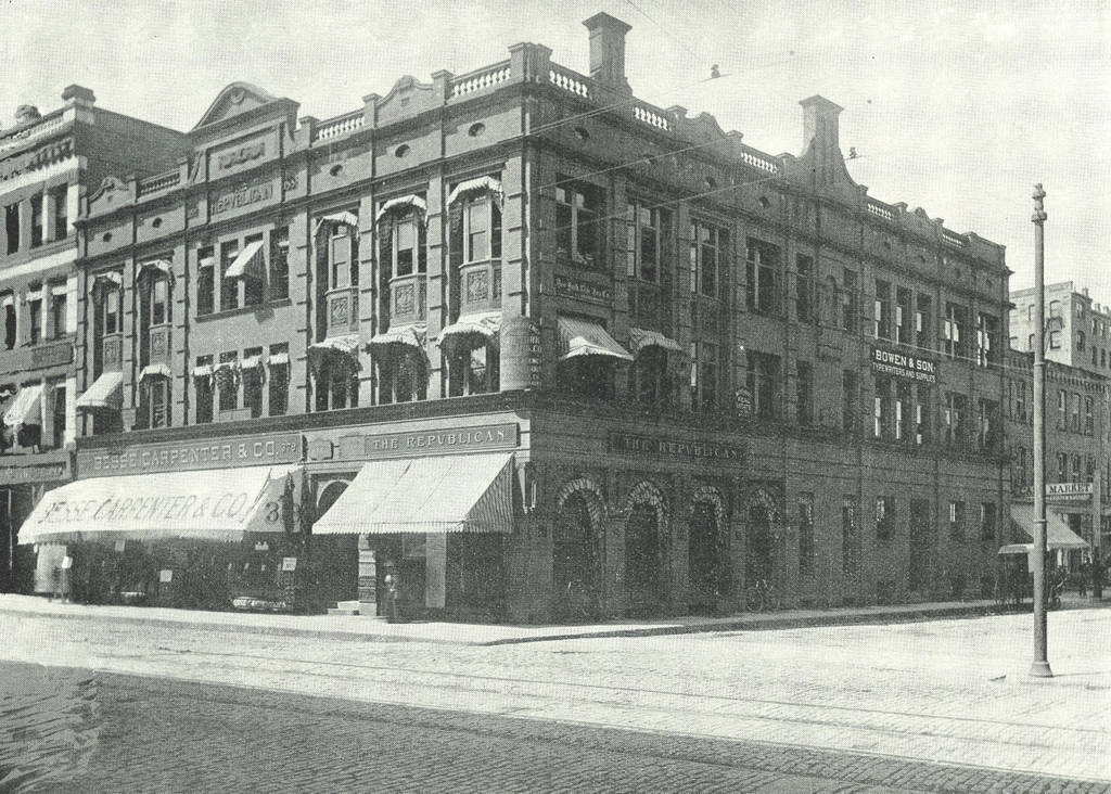
The Springfield Republican Building at the corner of Main Street and Harrison Avenue in Springfield, around 1892. Image from Picturesque Hampden (1892)

526_1892c picturesquehampden

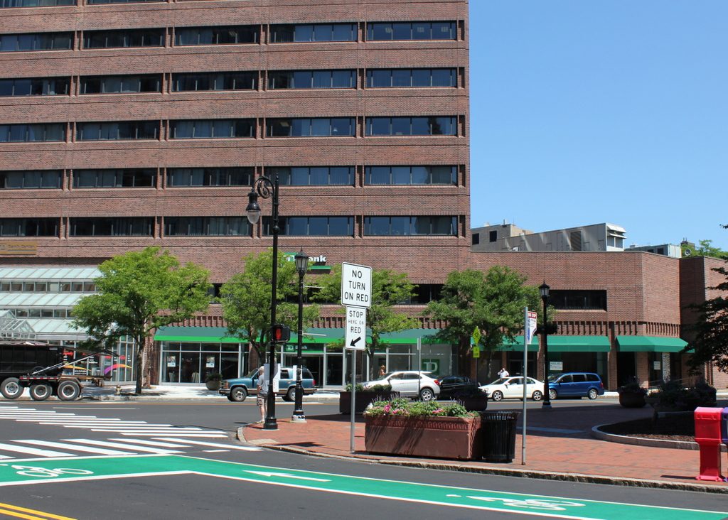
The scene in 2018:

The Republican in Springfield was established in 1824, and over the years it has been headquartered in a number of different buildings in downtown.  The building in the first photo was completed in 1888, and was located directly across Harrison Avenue from the Union Block, part of which had once been occupied by the newspaper’s offices.  At some point after the first photo was taken, the building was enlarged.  Two stories were added probably around the first decade of the 20th century, as seen in the historic photo in this post.  I don’t know how long the newspaper stayed here, but today both the building and the lot that it once occupied are gone.  The western end of Harrison Avenue was changed to cross Main Street at present-day Boland Way, so the street now passes diagonally through the lot of the old Republican building.

Homestead Building, Springfield Mass

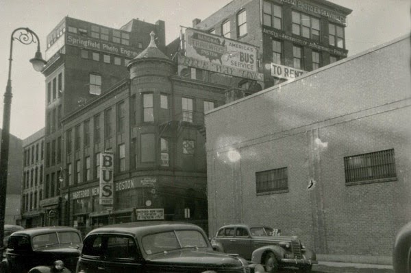
The Homestead Building, at 82-86 Worthington Street in Springfield, around 1938-1939. Photo courtesy of the Springfield Preservation Trust

447_1939 spt

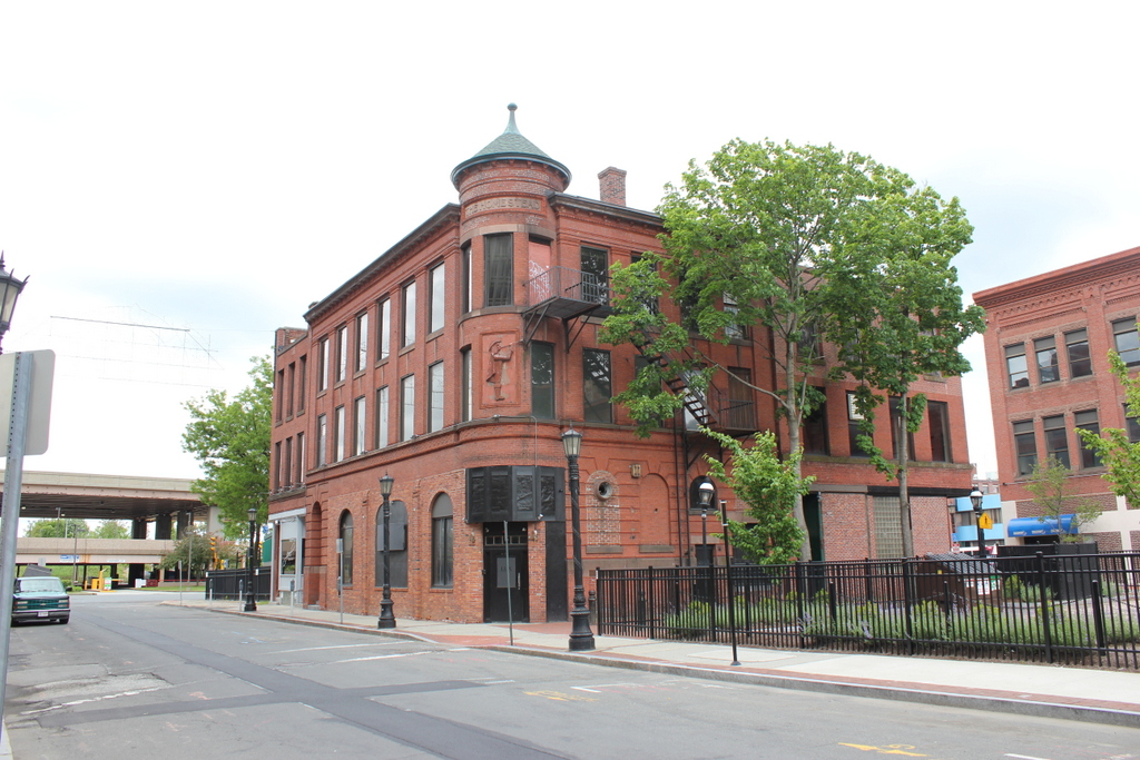
The building in 2014:

447_2014

According to the Massachusetts Cultural Resource Information System, this building on Worthington Street was built in 1903, although its architectural style makes it look more like something built in the 1880s, like a scaled-down version of the Chicopee Bank Building.  The building was the home of Phelps Publishing Company, which produced the Springfield Homestead newspaper as well as several other weekly publications.  In 1932, the building was sold to Blue Line Transportation Company, as seen in the first photo.  From here, passengers could take buses to cities around New England and beyond; the Worthington Street side lists Hartford, New York, and Boston as destinations.  Most recently, the building was used as a nightclub, which closed in 2014 following a shooting outside the building.

There’s another building that appears in both photos, although it isn’t as obvious.  The tall, “L” shaped building that seems to loom over the Homestead Building was built in 190, and in the first photo it was home to the Springfield Photo Engraving Company.  The building is still there today, although in 1949 it was trimmed down to three floors and now blends in with the Homestead Building.