Back Street, Boston

Looking east along Back Street in Boston from Massachusetts Avenue, on October 14, 1907. Image courtesy of the City of Boston Archives.

703_1907-10-14 coba

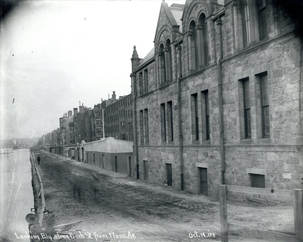
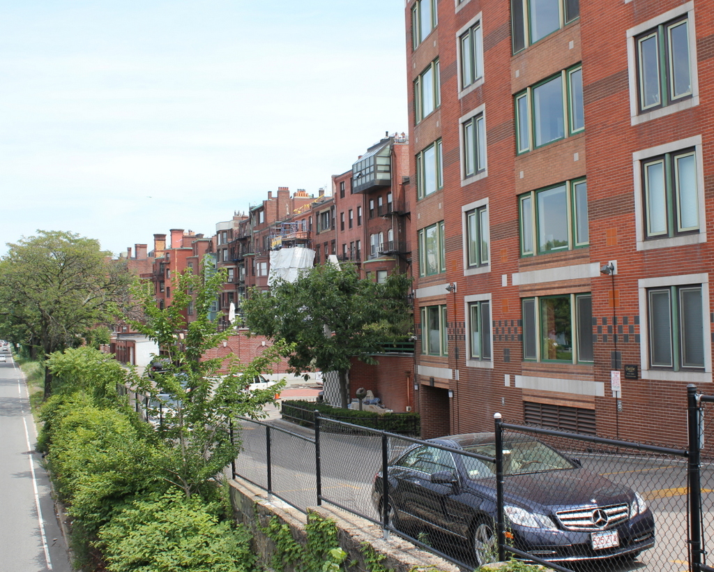
Back Street in 2015:

703_2015
When the Back Bay was filled and developed into a residential neighborhood in the late 1800s, the houses on the north side of Beacon Street were only a few feet away from the Charles River, separated only by the narrow Back Street, which serves as an alley to access the back of the houses.  Within a few years after the first photo was taken, though, this area began to change.  In 1910, the Charles River Esplanade was completed as a public park along the banks of the Charles River, and the first photo was probably taken as part of the city’s preliminary work on the project.

By the late 1940s, traffic congestion in Boston required some of the land to be used to build a parkway, so in 1951 Storrow Drive was completed as a six lane, automobile-only road with low clearances and no shoulders.  Most of the original parkland was lost, so more land was reclaimed from the Charles River on the other side of Storrow Drive.  As a result, this section of Back Street is now over 250 feet from the Charles River, which isn’t even visible from the ground level anymore.  Many of the 19th century rowhouses are still standing here, but the view from the north-facing windows has been drastically changed now that they have a highway in their backyards.

Park Street Subway Station, Boston (3)

The outbound platform at the Park Street station in Boston, on August 5, 1901. Image courtesy of the City of Boston Archives.

693_1901-08-05 coba

The same station platform in 2015:

693_2015
As mentioned in previous posts showing the interior of Park Street Station here and here, Park Street was one of the first two subway stations in the country, along with Boylston about a quarter mile to the south, when it opened in 1897.  The photos in those two posts show the station before it opened, but this 1901 photo here is interesting because it gives a glimpse into the day-to-day activity inside the station.  Because of the long exposure time, most of the figures are blurred, except for the woman seated on the bench in the foreground.  Another fairly clear figure is the man standing at the entrance in the distance.  In the years before turnstiles, passengers would purchase a ticket at one of the kiosks, and then give the ticket to the attendant at the gate, similar to the way movie theaters operate.  There were also separate entrances for entering and exiting passengers, hence the “This Is Not An Exit” sign above the gate.

Park Street station, along with the rest of the Tremont Street Subway, was originally designed for trolley cars rather than rapid transit subway cars, and this distinction can still be seen today in the trolleys that run on the Green Line, as opposed to the more conventional subway cars on the other three lines.  However, from 1901 to 1908, the tunnel was also used by the Boston Elevated Railway, so the station platforms had to be retrofitted to accommodate the higher subway cars, which is why the first photo shows wooden platforms along the track.  During this time, these cars used the two outer tracks in the station, while trolleys used the inner two tracks.  In 1908, the Boston Elevated Railway was rerouted through its own tunnel under Washington Street, which today forms the downtown section of the Orange Line.

A few years later, in 1912, the Boston Elevated Railway built another subway line through Park Street, forming what is now the Red Line.  Separate platforms were built underneath the existing station, with stairs now located around the spot where the passengers were waiting on the benches in the 1901 photo.  Other significant changes to the station over the years have included lengthening the Green Line platforms, as well as some of the more cosmetic changes that are seen in the 2015 photo, such as tiles on the floor and sheet metal covering the original columns.

Post Office, Boston

The old post office at Post Office Square in Boston, around 1906-1920. Image courtesy of the Library of Congress, Detroit Publishing Company Collection.

690_1900-1920c loc

The scene in 2015:

690_2015
The triangular intersection of Congress, Pearl, and Milk Streets has been known as Post Office Square since 1874, with the completion of the post office seen in the first photo. The square was actually the result of the Great Boston Fire of 1872, which destroyed most of the buildings around the post office, which was under construction at the time.  The small park is still there, although most of the buildings around it have changed.

The old post office was demolished to build the John W. McCormack Post Office and Courthouse, which was completed in 1933 and is still standing today.  It features Art Deco architecture, and at 22 stories and 600,000 square feet it is substantially larger than its predecessor.  It was added to the National Register of Historic Places, and it is still used as a federal courthouse, post office, and federal office building.  Just to the right of it is the former National Shawmut Bank Building, which was built in 1906 and can be seen in both photos.  At least one other building from the first photo, the 1893 International Trust Company Building, is still standing today; it is visible in the distance on the left, at the corner of Devonshire and Milk Streets.

Boston and Maine Station, Boston

The Boston and Maine Railroad station at Haymarket Square in Boston, around 1894. Image courtesy of the City of Boston Archives.

689_1894c coba

The Boston City Hospital Relief Station, on the site of the former railroad station in 1905. Image courtesy of the City of Boston Archives.

689_1905-11-05

The location in 2015:

689_2015
Of the eight major railroads that served Boston in the late 1800s, the Boston and Maine came the closest to the downtown area, with its depot at Haymarket Square. It was opened in 1845, and over the years Boston and Maine became the dominant railroad in northern New England, with many of its lines converging here.  However, because there were four different railroads that had their own stations within a few blocks of here, the companies built North Station in 1893, about 300 yards up Canal Street from here.

The old station had been built in the early years of railroad travel, and it stood until 1897, when it was demolished to make way for a new type of rail travel.  Boston’s Tremont Street Subway was the first subway tunnel in the country, and the northern entrance of the tunnel was built on the site of the station.  From here, the tracks ran along the surface between Canal and Haverhill Streets, where the station platforms used to be.  The only new building on the site was the Boston City Hospital Relief Station, as seen in the 1905 photo.  It was built in 1902 as a branch of the Boston City Hospital, in order to provide emergency services in the downtown area, and it stood until the early 1960s.

Today, there isn’t much left from either of the first two photos.  A few of the buildings on Canal Street are still standing, such as the one on the far left in both the 1891 and 1905 photos.  It is barely visible on the left of the 2015 photo, above the bus in the foreground.  Haymarket Square itself is completely changed, though, through a series of urban renewal projects in the 20th century.  To the left is a parking garage, with the Haymarket Square subway station underneath it.  On the right-hand side of the photo, the elevated Central Artery once passed through here.  Built in the 1950s, it cut a swath through downtown Boston until 2003, when the highway was rerouted through the Tip O’Neill Tunnel as part of the Big Dig.  The building under construction in the background is being built on land that the Central Artery once passed through.

Emancipation Memorial, Park Square, Boston

The Emancipation Memorial at Park Square, photographed around 1900-1906. Image courtesy of the Library of Congress, Detroit Publishing Company Collection.

686_1900-1906c loc

Park Square in 2015:

686_2015
This statue at Park Square is a copy of the original Emancipation Memorial at Lincoln Park in Washington, D.C., which was designed by Charlestown, Massachusetts native Thomas Ball and dedicated in 1876.  Designed to memorialize Abraham Lincoln and his role as the “Great Emancipator,” it shows Lincoln standing over a slave who is kneeling in front of him, with shackles on his wrist.  The original was paid for entirely by donations from freed slaves, but it has not been without controversy.  At the dedication ceremony, Frederick Douglass was reported to have criticized the slave’s position on his knees, and more recent historians have also objected to his seemingly inferior position in front of Lincoln.

Boston’s copy of the statue was donated to the city in 1879 by local politician Moses Kimball.  It has a different pedestal than the Washington one, which reads “A race set free and the country at peace Lincoln rests from his labors.”  The statue’s appearance has changed very little over the years, except for the planters at each corner.  However, the surrounding neighborhood has completely changed. The buildings behind the statue in the first photo show signs for a plumbing supply company, furniture upholsterers, and even Cuban cigars, over 50 years before they were outlawed.  On the extreme right is one of the buildings from the former Boston and Providence Railroad depot, which closed a few years earlier when the railroad was rerouted to South Station. Today, the Boston Park Plaza Hotel, which was built in 1927 and is just out of view in the 2015 photo, stands on the site of the former depot.

Armory of the First Corps of Cadets, Boston

The armory at the corner of Arlington Street and Columbus Avenue in Boston, around 1904. Image courtesy of the Library of Congress, Detroit Publishing Company Collection.

681_1904c loc

The building in 2015:

681_2015
Mixed in with modern high-rise buildings, this building looks more like it belongs in medieval Europe than in Boston, but it once served an important role in the city’s history.  It was one of many National Guard armories built across the state in the late 1800s, and it bears some resemblance to Springfield’s state armory, which was built around the same time.  The Armory of the First Corps of Cadets was built between 1891 and 1897, and like many other prominent civic buildings in late 19th century Boston it was designed by William Gibbons Preston, whose other works included Mechanics Hall and the Museum of Natural History.  Although the castle-like building seems somewhat whimsical in appearance, it actually served a very practical purpose; in the event of riots or other civil unrest, it would be able to withstand any attacks.  The tower could even be used to exchange signals with officials at the Massachusetts State House, which is located on the other side of Boston Common.

Over a hundred years after its construction, the armory is relatively unchanged on the exterior, although it has gone through several different uses over the years.  In the mid-20th century it was used for several different military-related museums, and in 1966 it was sold to a private owner.  It was listed on the National Register of Historic Places in 1973, and went through several different uses, including as a library and as an exhibition hall.  Today, it is owned by the Boston Park Plaza Hotel and is rented as a banquet and conference facility.