Scollay Square, Boston

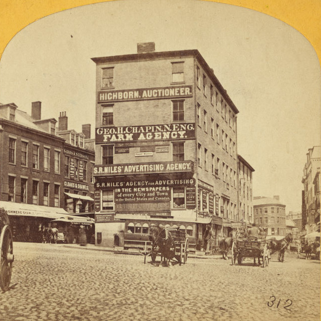
Scollay Square, looking north from the corner of Tremont and Court Streets, sometime in the 1860s. Image courtesy of the Boston Public Library.

823_1860-1869c bpl

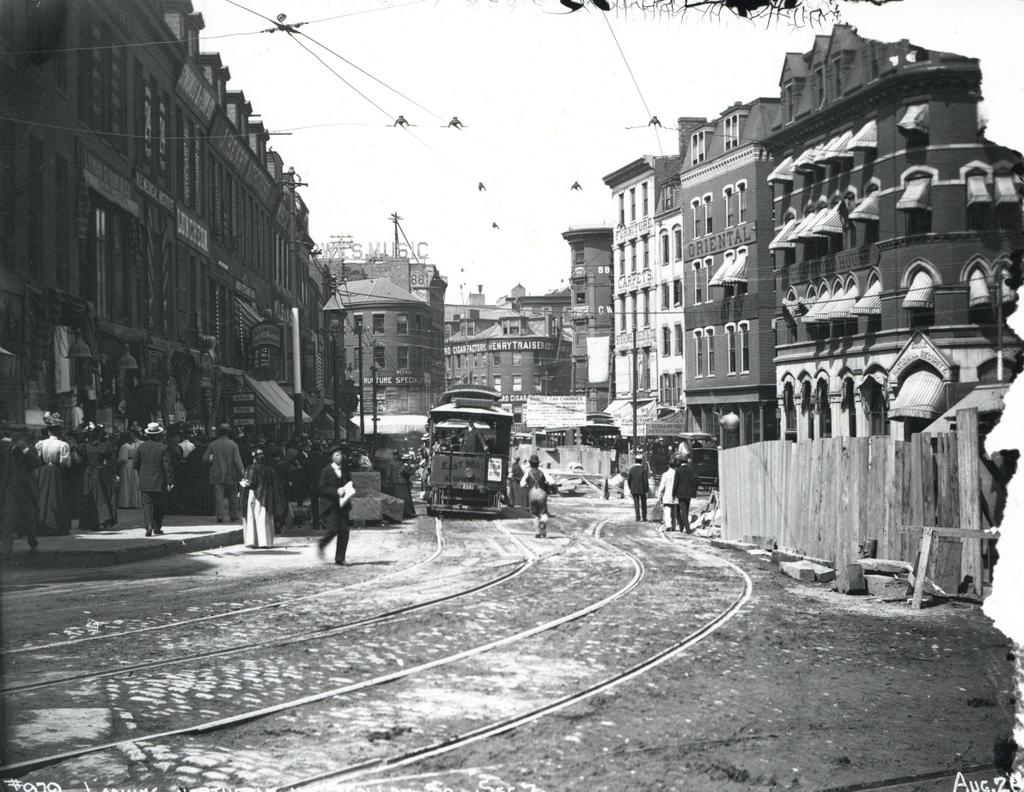
Scollay Square on August 26, 1897. Image courtesy of the City of Boston Archives.

823_1897_08_26 coba

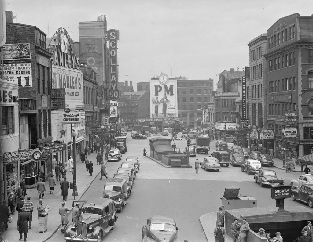
Scollay Square around 1942. Image courtesy of the Boston Public Library, Leslie Jones Collection.

823_1942c bpl

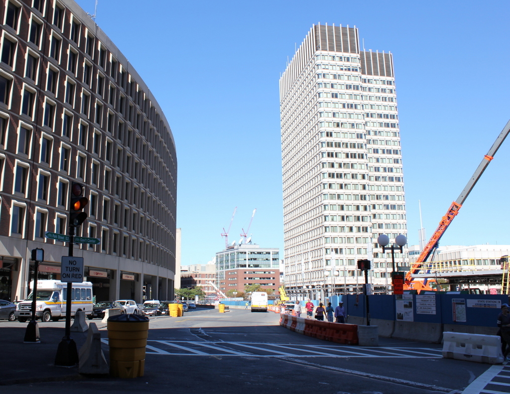
The scene in 2015:

823_2015
These four photos reveal the dramatic transformations that have occurred at Boston’s Scollay Square over the past 150 years. The square once included a long, narrow row of buildings in the middle, which appear on city maps as early as the 1720s. The construction date for the building in the first photo is unknown, but it was once at the southern end of this row, and in 1795 it was purchased by William Scollay, a real estate developer for whom the square would eventually be named. By the time the first photo was taken, all of the other buildings in the middle of the square had been demolished, and Scollay’s building was taken down soon after, around 1870.

The second photo shows a very different scene. Some of the buildings along the square are still standing, but the Scollay Building is gone, as are the horse-drawn trolleys from the first photo. Instead, they have been replaced by electric trolleys, like the one shown in the photo. However, these would not last long, at least not on the surface. The second photo was taken only about a week before the Tremont Street Subway opened, and the photo shows some of the construction activity as the workers prepared the Scollay Square station for its opening day on September 3. The station itself is not visible, but its ornate entrance can be seen in this post, which shows the scene from a slightly different angle.

Scollay Square had long been a major commercial center in the city, but by the time the third photo was taken in the 1940s, it had seen a dramatic decline. Many of the old buildings were still standing, but the businesses had become seedier. The 1942 photo shows a number of bars, liquor stores, cheap restaurants, and burlesque theaters, and the area was particularly popular among sailors on leave from the Boston Navy Yard and college students from the many nearby schools. One prominent hotel and theater in both the second and third photos was the Crawford House on the far right. It was built in 1865 and underwent several renovations, including one in 1926 that completely altered the front. The building burned in 1948, and all but the first two floors were demolished a few years later.

By the 1950s, the area was being targeted for urban renewal. Looking to replace the area with something more respectable, the Boston Redevelopment Authority demolished over a thousand buildings in the vicinity to build the Government Center complex, which includes the Center Plaza to the left, the John F. Kennedy Federal Building in the center, and the Boston City Hall, just out of view to the right. The old Scollay Square subway station was also extensively renovated and renamed Government Center. When the last photo was taken, the station was undergoing a another renovation, so if there is one thing that the second and fourth photos have in common, it is subway station construction.

Blandford Street Incline, Boston

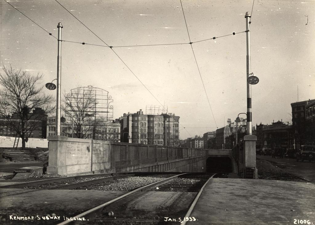
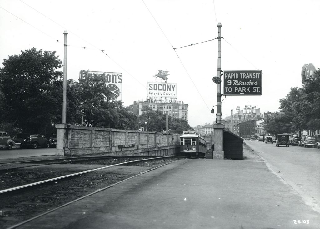
Facing east on Commonwealth Avenue toward Kenmore Square, with the Blandford Street Incline in the foreground, on January 3, 1933. Image courtesy of the City of Boston Archives.

710_1933-01-05 coba

The same location in 1943. Image courtesy of the City of Boston Archives.

710_1943 coba

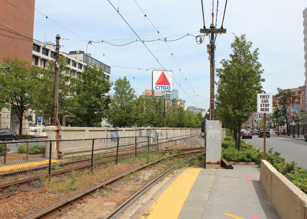
The view in 2015:

710_2015
As mentioned in this post, trolley cars once entered and exited the subway from an incline in the median of Commonwealth Avenue just east of Kenmore Square.  However, in 1932 the tunnel was extended a little to the west, with one branch emerging here, at the present-day Boston University campus.  The first photo shows the incline shortly after it opened, and not much had changed ten years later when the second one was taken.

The most obvious change in the first two photos is the signs – by 1943 Kenmore Square had become home to many large advertisements, including ones for Dawson’s Pale Ale and Lager, Socony, the Hotel Kenmore, and Gulf.  Several of these signs were easily visible from Fenway Park, with the Gulf sign in particular being prominent in photographs of the park from that era.  Another sign in the foreground indicates that Park Street is a mere nine minutes away, which either suggests that the trolleys ran much faster than they do now, or that the Boston Elevated Railway was being a little generous in their estimates.

The second photo also reveals a largely forgotten piece of Boston history; the trolley coming up from the tunnel has “National League Park” as its destination.  Long before the Red Sox, the Boston Braves were the city’s original Major League Baseball team, and from 1915 to 1952, they played about a mile up Commonwealth Avenue from here.  After the team moved to Milwaukee for the 1953 season, the old stadium was purchased by Boston University and converted into Nickerson Field, with some of the original structure still standing today.

In the 2015 scene, the subway incline hasn’t changed much; even the poles supporting the overhead wires appear to be the same ones from the first two photos.  To the left, the Boston University campus has continued to expand, and today several of BU’s buildings are visible here.  In the distance, many of the buildings in Kenmore Square are still standing, and although none of the 1940s signs still exist, Kenmore Square is now home to arguably the city’s most famous sign, which appears to be located at the same spot as the old Socony sign.  This Citgo sign is visible over the Green Monster at Fenway Park, and has been identified with the Boston Red Sox ever since it was first constructed in 1965.

Kenmore Subway Incline, Boston

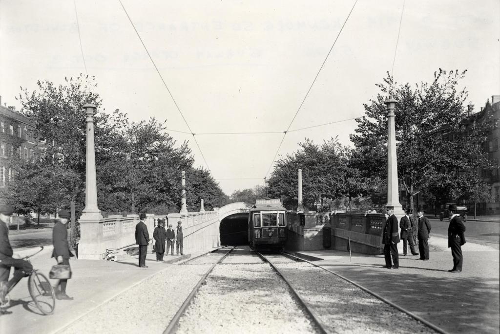
The subway incline at Kenmore Square on October 2, 1914. Image courtesy of the City of Boston Archives.

708_1914-10-02 coba

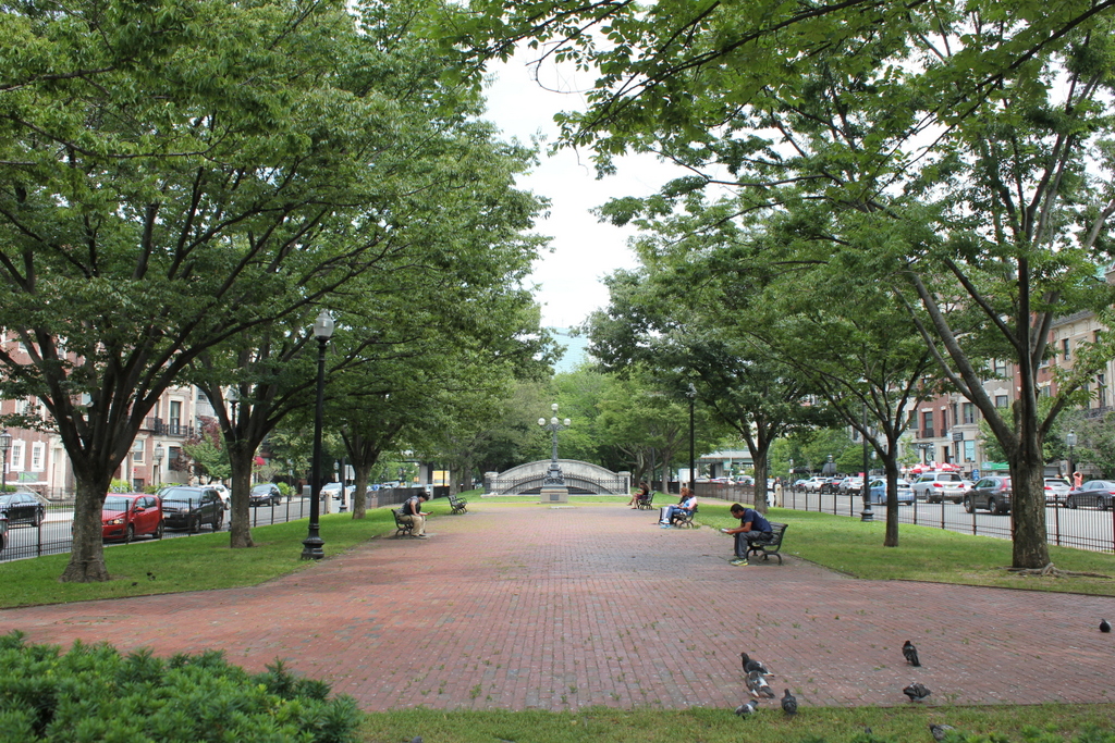
The scene in 2015:

708_2015
When Boston’s first subway tunnel opened in 1897, it extended as far west as the Boston Public Garden, where trolleys came to the surface and traveled west along Boylston Street.  However, because of the traffic congestion, the tunnel was extended a little over a mile to Kenmore Square, with cars surfacing just east of the square in the median of Commonwealth Avenue.  From here, the trolley lines split and either continued on Commonwealth Avenue (today’s B branch), or turned onto Beacon Street (today’s C branch).  The first photo was taken a day before the line officially opened in 1914, and the trolley car has a “Special Car” sign on top of it.  Less visible on the side of the car is a poster that reads “The Boylston Street Subway will open Saturday,” which was October 3.  The first photo was taken just to the left of the one in the previous post, probably only a few years later.

This subway incline ended up being used for just 18 years.  In 1932, the tunnel was extended under Kenmore Square, where it split into today’s B and C branches of the Green Line before surfacing just west of the square.  The original incline was closed off, and the Commonwealth Avenue Mall reverted back to its pre-1914 appearance.  Today, the only remaining trace of it is the arch in the distance, which once formed the top of the tunnel.

Park Street Subway Station, Boston (4)

Another view of the Park Street station on the Tremont Street Subway, taken on July 31, 1897. Image courtesy of the City of Boston Archives.

694_1897-07-31 coba

The station in 2015:

694_2015
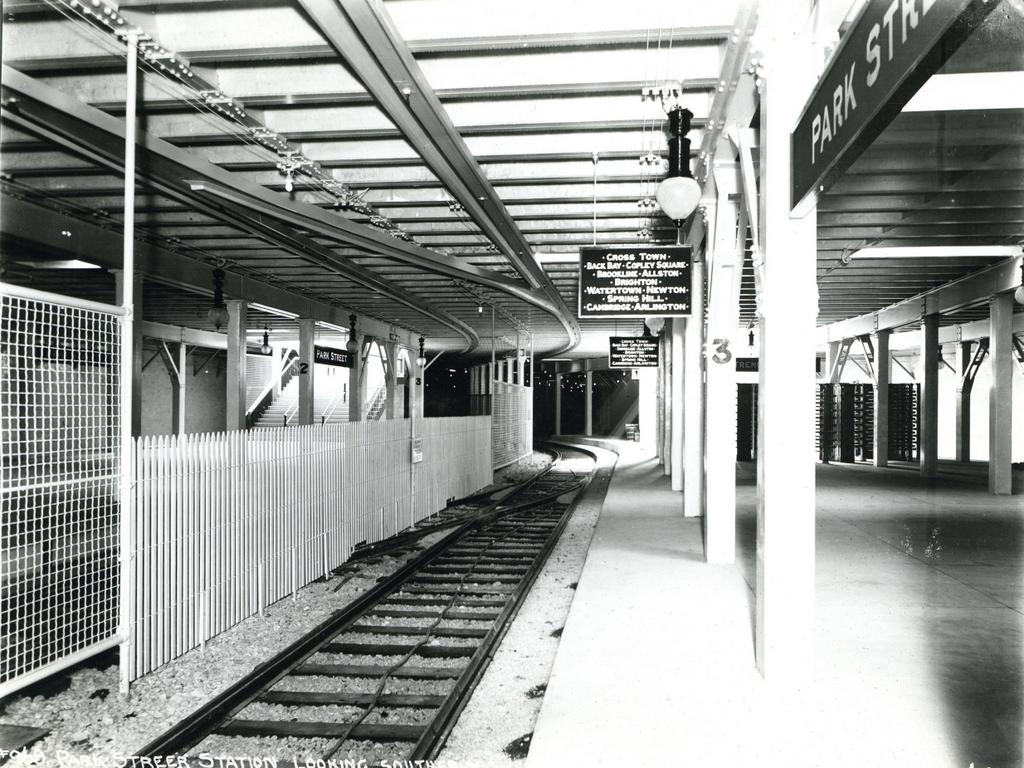
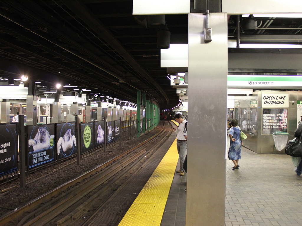
The first photo shows the interior of Park Street station as it appeared about a month before it opened as one of the first two subway stations in the United States.  It was taken from around the same location as the one in the previous post, just facing the opposite direction.  These two photos, taken nearly 120 years apart, show some of the changes that have taken place over the years inside this historic station.  The original 1897 trolley platforms soon became inadequate for the number of passengers that used the station, so from 1914 to 1915 they were extended to the south, which is why the station appears much larger in the 2015 photo.  Other changes have included removing the two stairwells that can be seen at the southern end of the platforms in the first photo; today, the station can only be accessed through the entrances closest to Park Street.

Not everything has changed, though.  One of the defining features of the Green Line is that it still runs trolleys rather than conventional rapid transit subway cars like those on the other three subway lines.  As a result, the station platforms are level with the tracks, and there is no third rail, with power instead being supplied by overhead wires.  Many of the destinations haven’t changed either.  Although Boston’s trolley network is significantly smaller than it was in 1897, many of the places on the sign in the first photo can still be accessed from here, including the Back Bay, Copley Square, Brookline, Allston, Brighton, and Newton.

Park Street Subway Station, Boston (3)

The outbound platform at the Park Street station in Boston, on August 5, 1901. Image courtesy of the City of Boston Archives.

693_1901-08-05 coba

The same station platform in 2015:

693_2015
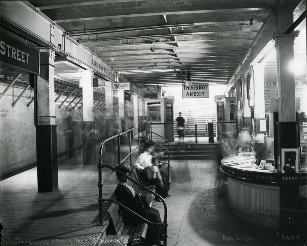
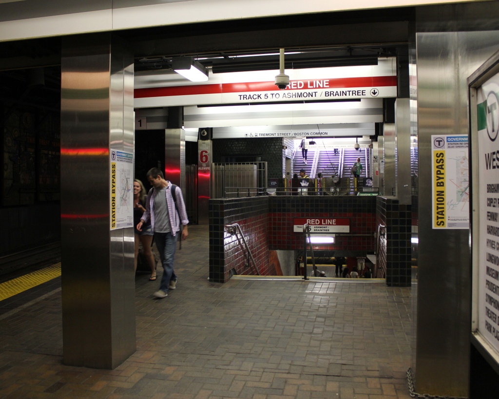
As mentioned in previous posts showing the interior of Park Street Station here and here, Park Street was one of the first two subway stations in the country, along with Boylston about a quarter mile to the south, when it opened in 1897.  The photos in those two posts show the station before it opened, but this 1901 photo here is interesting because it gives a glimpse into the day-to-day activity inside the station.  Because of the long exposure time, most of the figures are blurred, except for the woman seated on the bench in the foreground.  Another fairly clear figure is the man standing at the entrance in the distance.  In the years before turnstiles, passengers would purchase a ticket at one of the kiosks, and then give the ticket to the attendant at the gate, similar to the way movie theaters operate.  There were also separate entrances for entering and exiting passengers, hence the “This Is Not An Exit” sign above the gate.

Park Street station, along with the rest of the Tremont Street Subway, was originally designed for trolley cars rather than rapid transit subway cars, and this distinction can still be seen today in the trolleys that run on the Green Line, as opposed to the more conventional subway cars on the other three lines.  However, from 1901 to 1908, the tunnel was also used by the Boston Elevated Railway, so the station platforms had to be retrofitted to accommodate the higher subway cars, which is why the first photo shows wooden platforms along the track.  During this time, these cars used the two outer tracks in the station, while trolleys used the inner two tracks.  In 1908, the Boston Elevated Railway was rerouted through its own tunnel under Washington Street, which today forms the downtown section of the Orange Line.

A few years later, in 1912, the Boston Elevated Railway built another subway line through Park Street, forming what is now the Red Line.  Separate platforms were built underneath the existing station, with stairs now located around the spot where the passengers were waiting on the benches in the 1901 photo.  Other significant changes to the station over the years have included lengthening the Green Line platforms, as well as some of the more cosmetic changes that are seen in the 2015 photo, such as tiles on the floor and sheet metal covering the original columns.

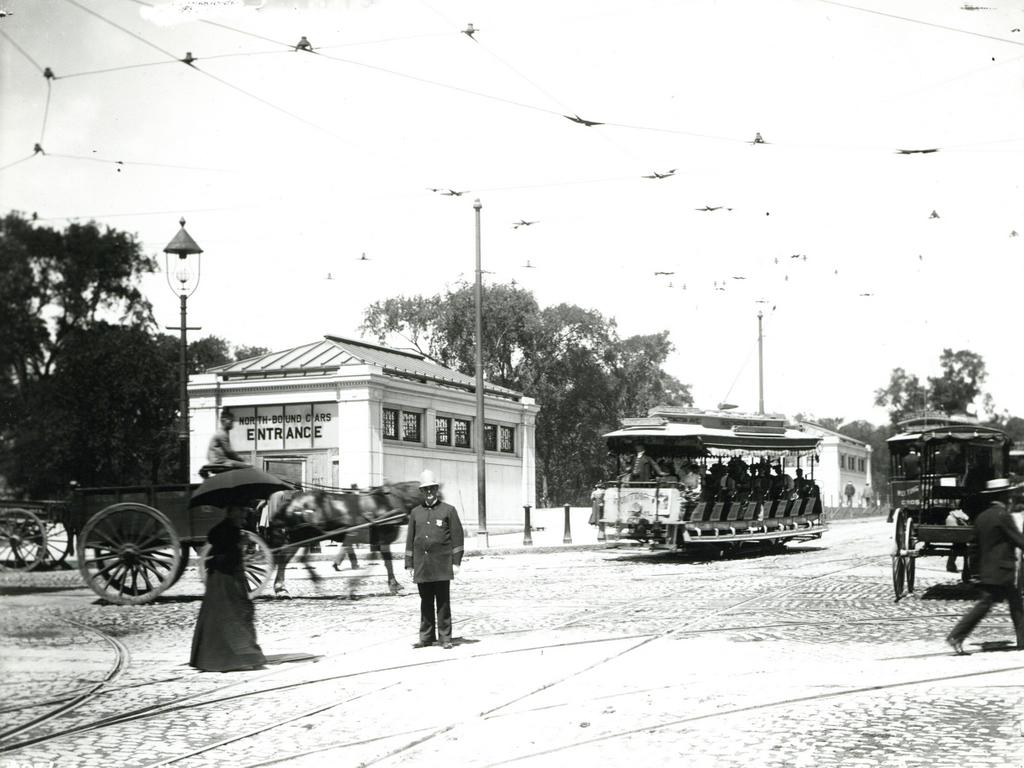
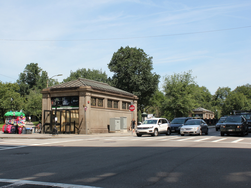
Boylston Station, Boston

The Boylston subway station, at the corner of Tremont and Boylston Streets in Boston, on August 12, 1897. Image courtesy of the City of Boston Archives.

687_1897-08-12 coba

The station in 2015:

687_2015
The first photo captures the ending of one era and the beginning of another.  Just a few weeks after the photo was taken, the trolleys that are seen here on congested Tremont Street would be moved underground, giving Boston the distinction of having the country’s first subway tunnel.  The first two stations were Park Street, just over a quarter mile to the north, and this one here at Boylston Street, in the southeast corner of Boston Common.  The project was a major civil engineering milestone, but it didn’t come without tragedy.  At this location earlier in the year, a leaking gas line in the work area under the intersection caused an explosion that killed six people.  The explosion is explained further in this post, which features photos that were taken diagonally across the street from here.

Today, the view really hasn’t changed too much.  The trolleys on the Green Line are still running under this intersection, the distinctive station entrances are still here, as is Boston Common in the background.  Even in the 19th century, this intersection of Boylston and Tremont streets was busy, necessitating the police officer in the left center of the 1897 photo.  The slow shutter speed of the camera has blurred most of the traffic around him, but he is standing perfectly still, posing for the photographer as trolleys, carriages, and pedestrians pass by.  It is still a major intersection today, albeit without the nostalgia of a 19th century officer directing traffic on a cobblestone street.