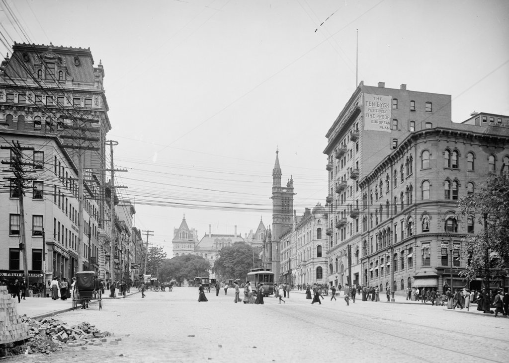
State Street from South Pearl Street, Albany, New York

Looking west on State Street from near the corner of State and South Pearl Streets in Albany, around 1904. Image courtesy of the Library of Congress, Detroit Publishing Company Collection.

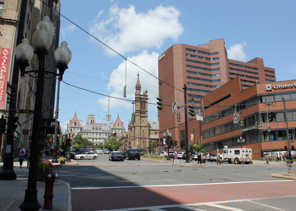
The scene in 2019:

State Street is the main east-west route through downtown Albany, originally starting at the Hudson River wharves and extending westward up the hill in a straight line toward the state capitol. It provided a direct link between the city’s water and rail transportation and its government institutions, and in the process it passed through the heart of Albany’s central business district, which is shown here in these two photos.

The first photo was taken around 1904, and it shows a busy street scene. Dozens of pedestrians are visible walking on the sidewalks and crossing the street, and there is also a mix of horse-drawn wagons, along with at least three trolleys traveling up and down the hill. Automobiles are conspicuously missing from the scene, but this would not last long. The New York state legislature, meeting in the state capitol at the top of the hill here, had passed the first motor vehicle registration laws in the country in 1901, and by 1904 the state had some 15,550 registered cars on its roads.

The buildings on either side of State Street in the first photo reflect the changes in architectural styles during the late 19th century, along with the city’s growth during this same time. Starting on the far left is the Globe Hotel, which is perhaps the oldest building in the photo. It appears to have been built around the mid-19th century, and by the time the first photo was taken it housed the hotel, along with a number of retail tenants. These included a fruit market at the corner of South Pearl Street, and the photographic supply shop of Finch & Hahn on the State Street side of the building.

Further in the distance, towering above the Globe Hotel, is the Albany City Savings Institution building, which was probably the newest building in the first photo. This large Beaux-Arts building was designed by noted local architect Marcus T. Reynolds, and it opened in 1902 as the city’s first skyscraper. Just beyond the bank is another new building, the Empire Theatre, a burlesque theater that opened here in 1898.

On the other side of State Street, starting in the foreground, is the Tweddle Building. It was built at the corner of North Pearl Street in the mid-1880s, replacing the earlier Tweddle Hall, which had been destroyed in a fire in 1883. Beyond it is the Ten Eyck Hotel, with a painted sign on the side of the building proclaiming it to be “positively fire proof.” The nine-story hotel opened in 1899, filling a void in Albany’s hotel business after the Delavan House burned in 1894. This disaster, which claimed the lives of 16 people, would have still been fresh in people’s minds when the Ten Eyck opened, and likely explains why the owners went to such lengths to advertise its fireproof construction.

Beyond the Ten Eyck, on the other side of Chapel Street, is the Albany Savings Bank. This ornate building was completed in 1875, and it was occupied by the bank until the late 1890s, when the bank moved to a new building on North Pearl Street. The county then purchased the building, and it was in use as county offices when the first photo was taken.

Further up the hill from the bank building are two other commercial blocks, followed by St. Peter’s Episcopal Church on the other side of Lodge Street. The main portion of the church was designed by architect Richard Upjohn, who was particularly well-known for his Gothic-style churches. It was consecrated in 1860, but in 1876 the parish added the 180-foot tower, which was designed by Upjohn’s son, Richard M. Upjohn.

At the top of the hill, in the distant center of the first photo, is the New York State Capitol. Construction on the capital had begun in 1867, but it was not completed until 1899, when Theodore Roosevelt was governor. By the time the first photo was taken, Roosevelt had become president, but less than a decade later another politician with the same last name would arrive at the capitol. Franklin Roosevelt served here as a senator from 1911 to 1913, and he later returned as governor, serving from 1929 until he was elected president in 1932.

Today, nearly 120 years after the first photo was taken, the capitol still dominates the background of this scene. It remains in use as the seat of the state government, although it has since been joined by a number of other government buildings, including the 34-story Alfred E. Smith State Office Building, which rises above the roof of the capitol in the present-day photo.

However, most of the other buildings in this scene at the turn of the century are gone now, including everything in the foreground. The Globe Hotel was altered beyond recognition in the early 20th century, and was known as the Arkay Building until the late 1920s, when it was demolished to build the National Savings Bank, which stands on the site today. Across the street, the Tweddle Building was demolished in the mid-1910s, and in its place the Ten Eyck Hotel built a new 17-story skyscraper. The hotel also continued to operate the older Ten Eyck, which became known as the Annex, and both buildings stood here until they were demolished in the early 1970s.

Further in the distance, only a few recognizable buildings from the first photo are still standing, aside from the capitol. On the left, the Albany City Savings Institution is still here, although it was altered in the 1920s with the addition of a large clock tower, and it is now mostly hidden from this angle by the National Savings Bank. Across the street, St. Peter’s Church is also still standing. Unlike the Savings Institution building, it has not been overshadowed by taller neighbors, and it continues to be a very prominent feature here on State Street. It remains an active Episcopalian parish, and in 1980 it was named a National Historic Landmark, becoming one of four Albany buildings, including the capitol, to receive this designation.

Dwight Street from Main Street, Holyoke, Mass

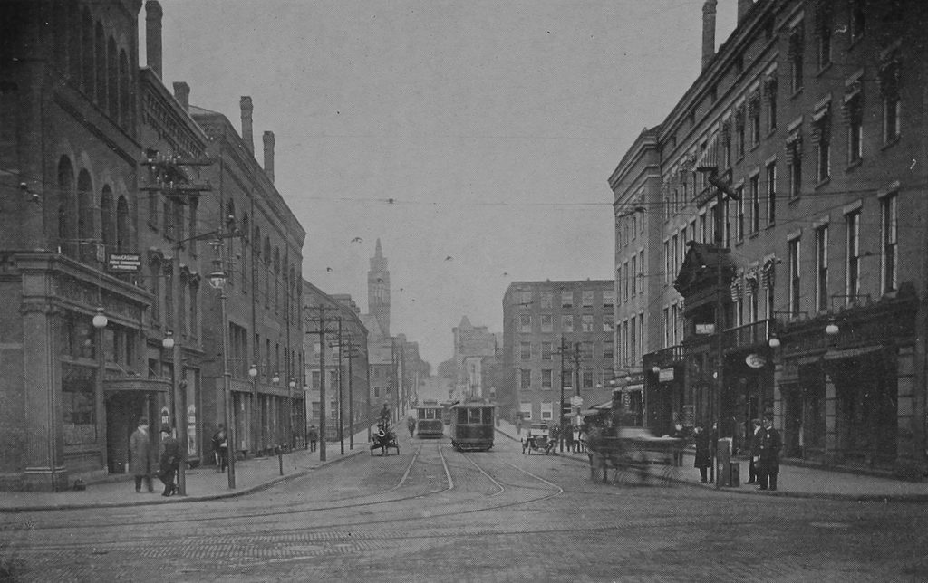
Looking west on Dwight Street from the corner of Main Street in Holyoke, around 1910-1915. Image from Illustrated & Descriptive Holyoke Massachusetts.

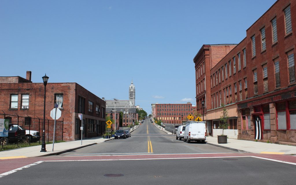
The scene in 2017:

This scene shows a view similar to the one in an earlier post, but these photos were taken a little further back, showing the entire block of Dwight Street between Main and Race Streets. The first photo here, taken around the early 1910s, shows a busy Dwight Street, with a mix of trolleys, automobiles, and what appears to be a blurry horse-drawn carriage. On the right side of the photo is the Hotel Hamilton, which was built in 1850 and expanded and renovated in 1889-1890. Among its ground-floor tenants at the time was the Mechanics Savings Bank, which occupied the storefront on the far right side, at the corner of Dwight and Main Streets. Another bank, the Hadley Falls National Bank, was located directly across the street, in the building on the far left side of the first photo.

Another important building in the first photo was Parsons Hall, the third building from the left side of the photo. Also known as the Chapin Block, it was apparently built around the early 1850s, about the same time as the hotel across the street. Its large third floor, which took up about half the building’s height, housed an auditorium that was used for a variety of events throughout the 19th century. Several local churches, including the Unitarian Church and the French Congregational Church, temporarily worshiped here before constructing buildings of their own, and high school graduations were also held here for many years. The actress Eva Tanguay, a French-Canadian immigrant to Holyoke, made her stage debut here as a young girl in the 1880s, before going on to have a successful career as one of the most famous vaudeville performers in the country.

Further up the street, the first photo shows several of Holyoke’s factory buildings. On the left, just beyond Parsons Hall on the other side of the Second Level Canal, was the mill of the Beebe & Holbrook Paper Company. It was built in the early 1870s as the Hampden Paper Company, but later became Beebe & Holbrook in 1878. Then, in 1899, it became a division of the American Writing Paper Company. This trust included many of Holyoke’s paper mills, and controlled a significant portion of the nation’s writing paper supply. However, other Holyoke mills remained independent, including the Whiting Paper Company, whose mill is visible on the other side of Dwight Street, just beyond the Hotel Hamilton. Further in the distance, hidden from view in the first photo, was the William Skinner & Sons silk mill, and at the top of the hill was Holyoke City Hall, with its tower rising above the factories.

Today, there are still some identifiable buildings from the first photo, but most have undergone significant changes. Some of the Beebe & Holbrook buildings are still standing, but the one that is most visible in the first photo is gone. Similarly, several of the former Whiting buildings are also still there, but not the one shown in the first photo. Closer to the foreground, the Hotel Hamilton building now stands vacant. It was dramatically altered after the hotel closed in the early 1940s, including the removal of most of the fourth floor. Most of the storefronts have also been altered, except for the former Mechanics Savings Bank on the far right side, which still retains its early 20th century appearance.

On the other side of the street, Parsons Hall similarly lost its upper floor during the mid-20th century, and much of its Dwight Street facade was also rebuilt. However, the rest of the building is still standing in its heavily-altered appearance. Its neighbors to the left are gone, though, including the former Hadley Falls National Bank building and the site is now an empty lot at the corner of Main Street. Overall, the only building that has survived from the first photo without any significant changes is city hall itself, which still stands in the distance at the corner of Dwight and High Streets, and remains in use as the seat of the municipal government.

City Hall, Salem, Mass

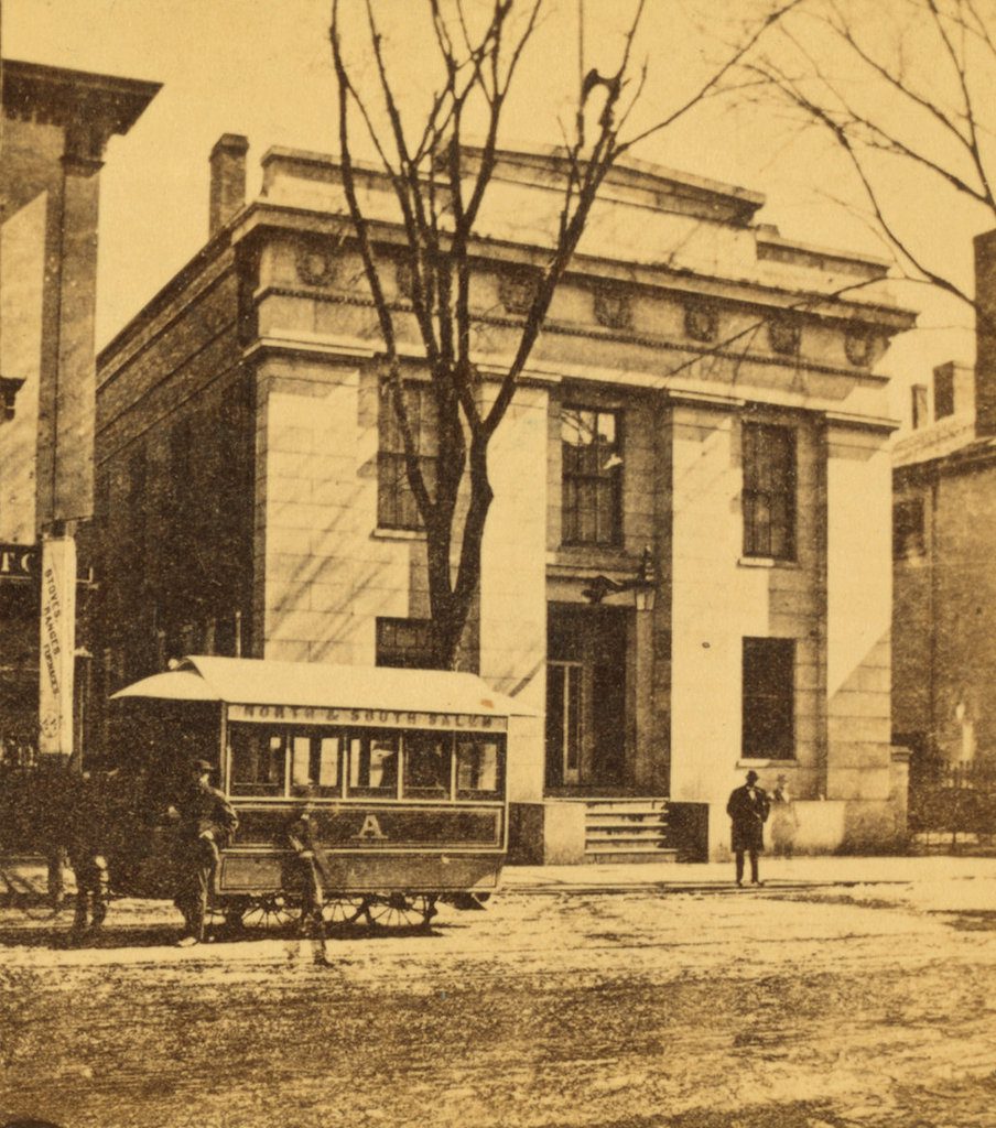
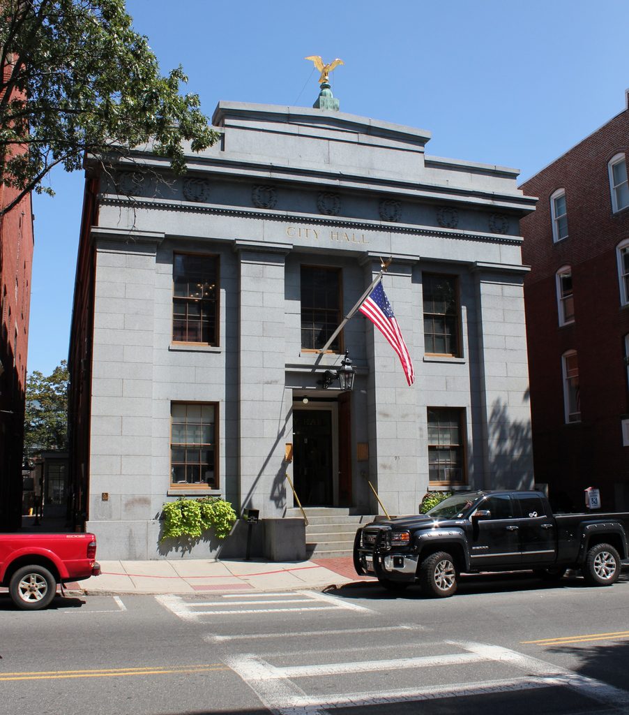
City Hall, at 93 Washington Street in Salem, around 1865-1885. Image courtesy of the New York Public Library.

City Hall in 2017:

During the early 19th century, Salem was among the largest cities or towns in the country, ranking among the top ten in the first four federal censuses. It was also the second-largest in New England during this time, behind only Boston, and in 1836 it was incorporated as the second city in the state, with a population of 15,886. At the time, the municipal government occupied the town hall at Derby Square, but construction soon began on a purpose-built city hall here on Washington Street, just north of the intersection of Essex Street.

The building, which was completed in 1838, was designed by noted architect Richard Bond, whose other Salem works included the 1854 Tabernacle Congregational Church (demolished in 1922), as well as the 1841 county courthouse on Federal Street. Bond’s design for City Hall had a Greek Revival exterior, with a granite facade on the Washington Street side and brick walls on the rest of the building. The main entrance is flanked by four Doric pilasters, supporting an entablature that features seven laurel wreaths, with a gilded eagle atop the building. On the interior, the building was constructed with city offices on the first floor, and the mayor’s office and city council chambers on the second floor.

The first mayor of Salem was Leverett Saltonstall I, a prominent politician who had previously served as president of the Massachusetts Senate and would later go on to serve in the U. S. House of Representatives from 1838 to 1843. He was also the great grandfather of Leverett A. Saltonstall, who would serve as governor of Massachusetts and as a U. S. Senator during the mid-20th century. Other notable early mayors included Stephen C. Phillips and Charles W. Upham, both of whom also served in Congress, and Stephen P. Webb, who served as mayor from 1842 to 1845 and 1860 to 1862, while in the interim serving as mayor of San Francisco from 1854 to 1855.

The first photo was taken at some point in the post-Civil War era, most likely in the late 1860s or early 1870s, and shows the front facade of City Hall, along with a horse-drawn trolley on Washington Street. The building was significantly expanded in 1876, with an addition that doubled its length, although its appearance from this angle remained unchanged. Another addition came a century later in the late 1970s, but likewise this did not affect the Washington Street side of the building.

Today, this building remains in use as the Salem City Hall, with a well-preserved exterior that shows hardly any changes from the first photo. Now over 180 years old, it is the oldest continuously-used city hall building in the state, and it survives as a good example of Greek Revival-style architecture. It was added to the National Register of Historic Places in 1973, and it is also a contributing property in the Downtown Salem Historic District.

Morgan Street, Hartford, Connecticut

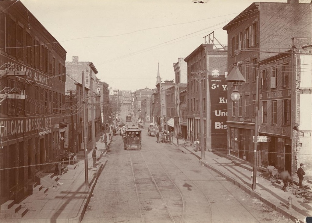
Looking west on Morgan Street from near the corner of Front Street (today’s Columbus Boulevard), on August 21, 1903. Image courtesy of the Connecticut State Library.

Morgan St. looking east

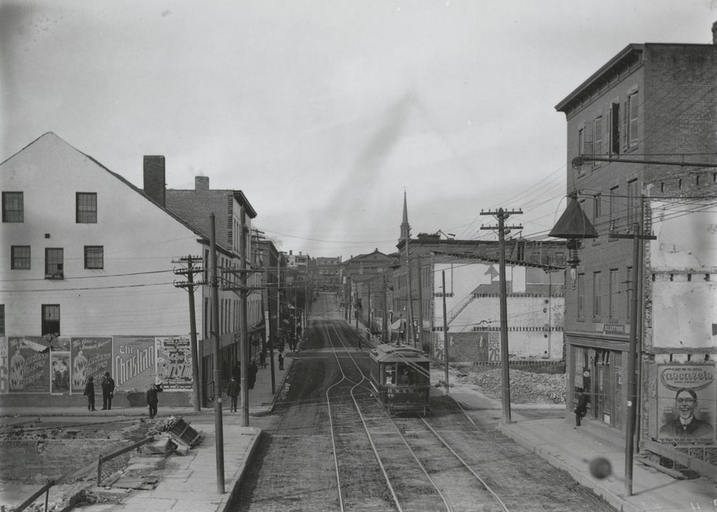
The view just two months later, on October 25, 1903. Image courtesy of the Connecticut State Library.

Morgan St., west of railroad bridge

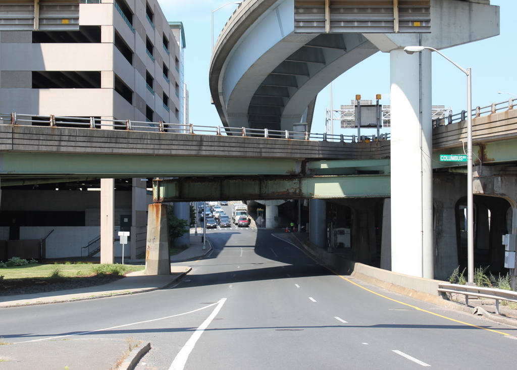
The scene in 2016:

987_2016
For many years, the only bridge across the Connecticut River at Hartford was here at the foot of Morgan Road, just behind the photographer. The original covered bridge that had been built here in 1818 burned down in 1895, and although a temporary replacement was soon built here, a more permanent bridge was in the works. The city ultimately chose a stone arch bridge, which was completed in 1908 and is still standing as the Bulkeley Bridge. As part of the project, they designed broad avenues on either side of the bridge, which required demolition along Morgan Street.

As seen in the first two photos, Morgan Street was fairly narrow, and passed through the working-class neighborhood on the east side of the city. Looking to improve this and provide a more impressive entryway into the city, they demolished the buildings on both sides of the street to widen it. Although taken only two months apart, the first two photos here show the demolition progress, with at least five of the buildings gone by the time the second photo was taken. The buildings that were still standing were covered in advertisements, including the one on the far left that has posters for plays entitled “The Christian” and “A Working Girl’s Wrongs.”

In later years, further transportation improvements would reshape Morgan Street again. With the coming of the Interstate Highway System, this spot just west of the Bulkeley Bridge became the intersection of I-91, Connecticut’s primary north-south route, and I-84, one of the main east-west routes in the state. Any of the early 20th century efforts to make Morgan Street a grand boulevard were completely undone by the 1970s, when I-84 was built directly above the street. Today, instead of being lined with the tenement houses and merchant storefronts that once stood here, the street is now surrounded by parking garages and elevated highways.

Cornhill from Washington Street, Boston

Looking up Cornhill from Washington Street, on April 14, 1897. Image courtesy of the City of Boston Archives.

964_1897-04-14 coba

The scene in 2016:

964_2016
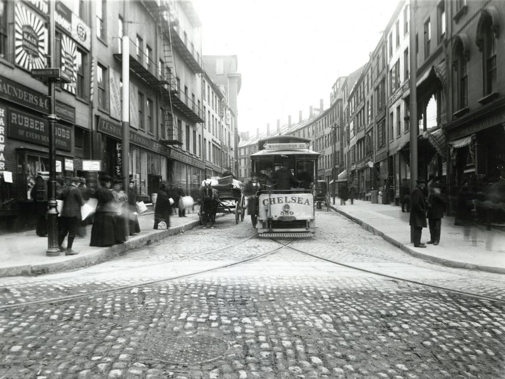
This narrow cobblestone street in downtown Boston connected Adams Square with nearby Scollay Square, and it was once a major literary center of the city, with many bookstores and publishers. When the first photo was taken, the early 19th century buildings here had a variety of businesses, with signs advertising for carpets, furniture, wallpaper, signs, trunks, and rubber goods. The first photo also shows a trolley coming down the street from Scollay Square, but this would soon change with the opening of the Tremont Street Subway in less than five months. Part of it was built under Cornhill, and it was the nation’s first subway, allowing trolleys to avoid the congested streets between Boston Common and North Station.

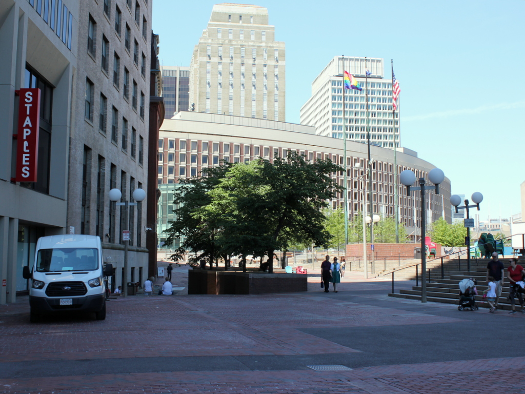
Nearly all of the buildings in the first photo were demolished in the early 1960s to build the Government Center complex. City Hall is just out of view on the right side of the 2016 photo, and the only building left standing in this scene is the Sears’ Crescent, partially visible in the distance on the left side of the street in both photos. Built in 1816 and renovated around 1860, this building still follows the original curve of Cornhill, serving as a reminder of what the neighborhood looked like before one of Boston’s most controversial urban renewal projects.

Harvard Square, Cambridge, Mass

Looking west toward Harvard Square on Massachusetts Avenue in Cambridge, around 1906. Image courtesy of the Library of Congress, Detroit Publishing Company Collection.

962_1906c loc

Harvard Square in 2016:

962_2016
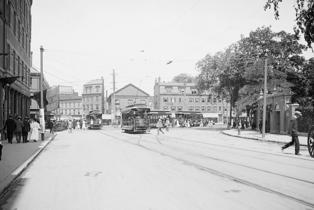
The first photo was taken only a few years before the Red Line opened. At the time, people traveling from Cambridge to Boston had to use the streetcars, as shown here. In the distance on the left side of the photo, passengers are boarding a trolley whose destination is “Subway Park Street,” and the trolley to the right of it is presumably heading outbound from Park Street, on the way to its destination at Mount Auburn. This route was replaced in 1912 by the much faster Red Line subway, which originally ran from Park Street to here at Harvard Square, and a station entrance was built in the middle of the square. The station also included a streetcar tunnel that allowed passengers to easily transfer between the subway and the trolleys; this tunnel was later modified for buses and is still in use as the Harvard Bus Tunnel.

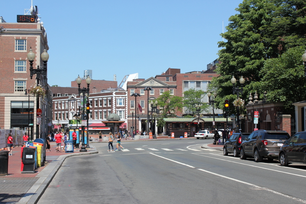
As for the buildings at Harvard Square, very little is left from the turn of the century. None of the buildings in the first photo have survived, with most being demolished in the early 20th century to build the current Colonial Revival buildings. Most of the businesses themselves are long gone, except for the Harvard Cooperative Society. Originally located in the Greek Revival-style building in the center of the photo, this bookstore was founded in 1882 as a cooperative for Harvard students. Now commonly known as The Coop, the bookstore is still in operation in a different building on the same spot, and serves students at both Harvard and MIT. Otherwise, the only landmark remaining from the first photo is the gate on the far right side, which connects the square to Harvard Yard.