Old City Hall, Boston

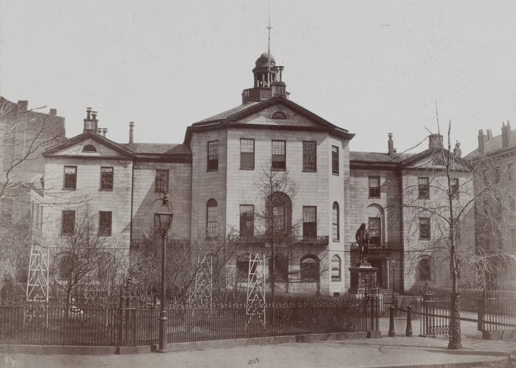
Johnson Hall, which served as a courthouse and later as City Hall, on School Street around 1855-1862. Image courtesy of the Boston Public Library.

691_1855-1862c bpl

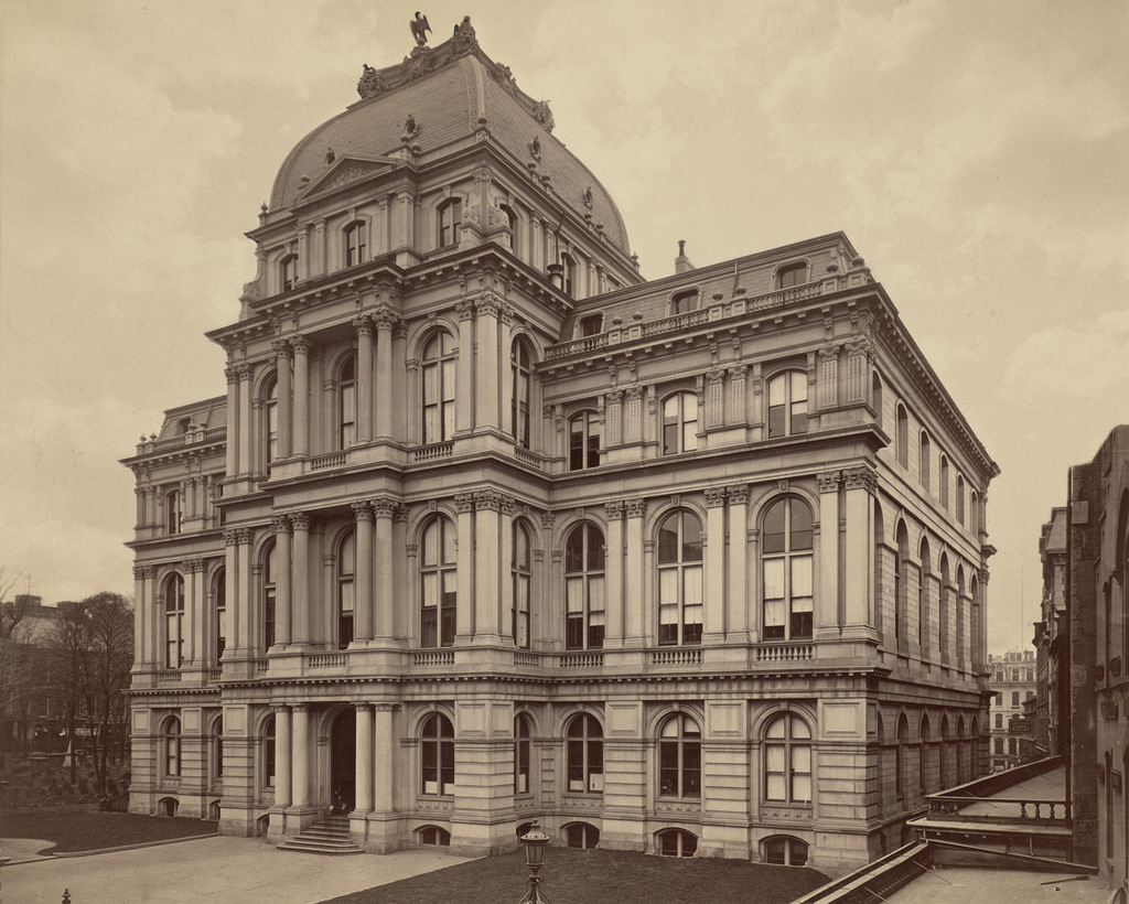
Boston’s old City Hall, which replaced Johnson Hall, as seen in 1865. Image courtesy of the Boston Public Library.

691_1865 bpl

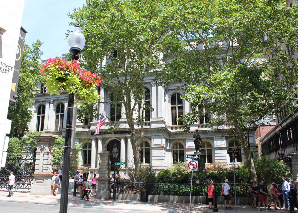
Old City Hall in 2015:

691_2015
This site on School Street has had two different City Hall buildings, as seen in the photos above, but the history here goes back even further.  From 1704 to 1748, Boston Latin School was located here, and during this time many of the Founding Fathers attended the school, including Benjamin Franklin, John Hancock, Samuel Adams, and Robert Treat Paine.  Years later, Charles Bulfinch designed a courthouse that was built here in 1810; this building, which is shown in the first photo, was used as both a county and federal courthouse in the early 19th century.  From 1841 until 1862, it was Boston’s City Hall, before being demolished and replaced with a newer, larger building.

The new City Hall was completed in 1865, and was one of the first examples of Second Empire architecture in the United States.  This French-inspired style would become very popular in the late 1860s and 1870s, especially in government buildings.  Boston’s old post office, which was built a decade later and just a few blocks away, shares many similar features.  On a much larger scale, the Old Executive Building next to the White House in Washington, DC also reflects the influence of Second Empire designs.

During its time as City Hall, this building saw the rapid growth in the city during the late 1800s and early 1900s.  When it was completed, the city had fewer than 200,000 people, but by the 1950s there were over 800,000, and the city government had long since outgrown this building.  The City Hall Annex, located behind this building on Court Street, was built in 1912 to accommodate more offices, but by the 1960s the city was looking to build a new City Hall.  The current building was completed in 1968, and since then the old building has been extensively renovated on the inside for commercial uses, but the exterior is essentially unchanged from 150 years ago.

Franklin Street, Boston (1)

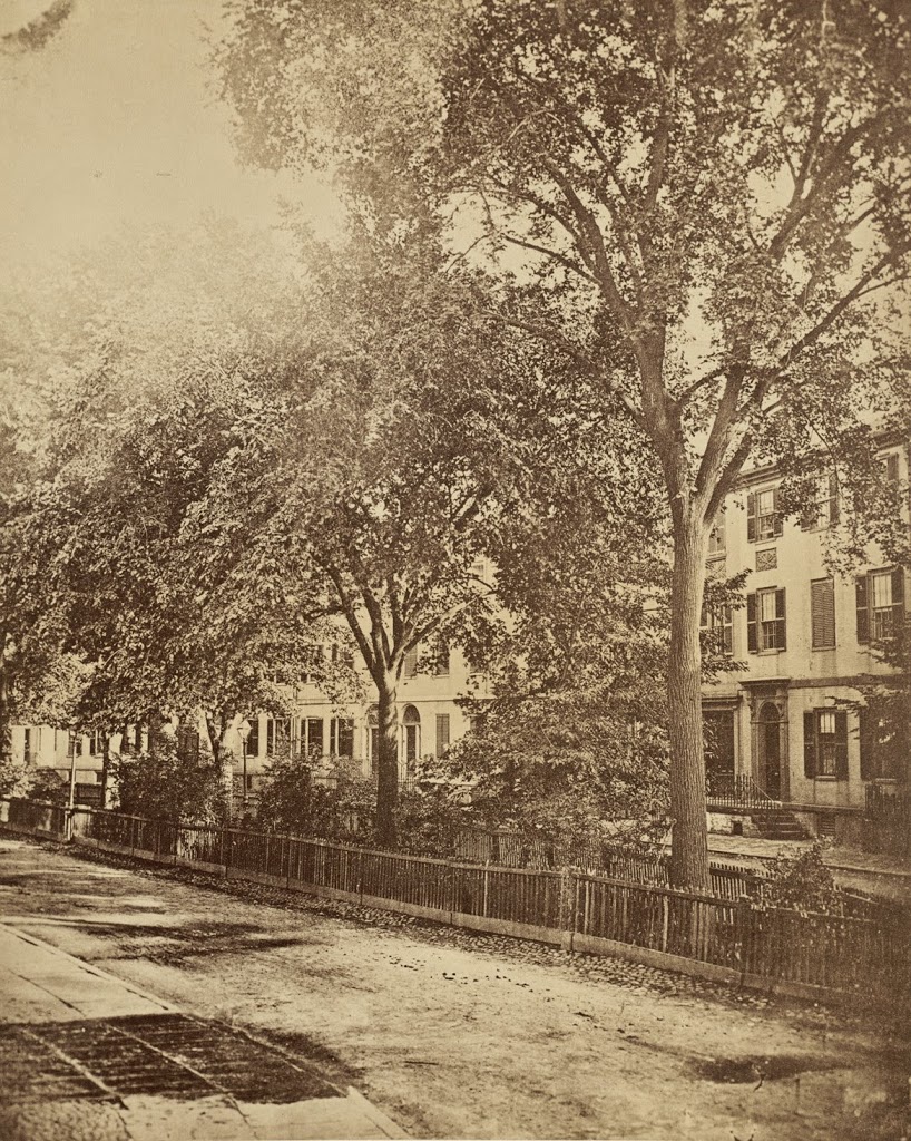
Looking down Franklin Street toward Arch Street from Hawley Street in Boston in 1858. Photo courtesy of Boston Public Library.

326_1858-2Bbpl

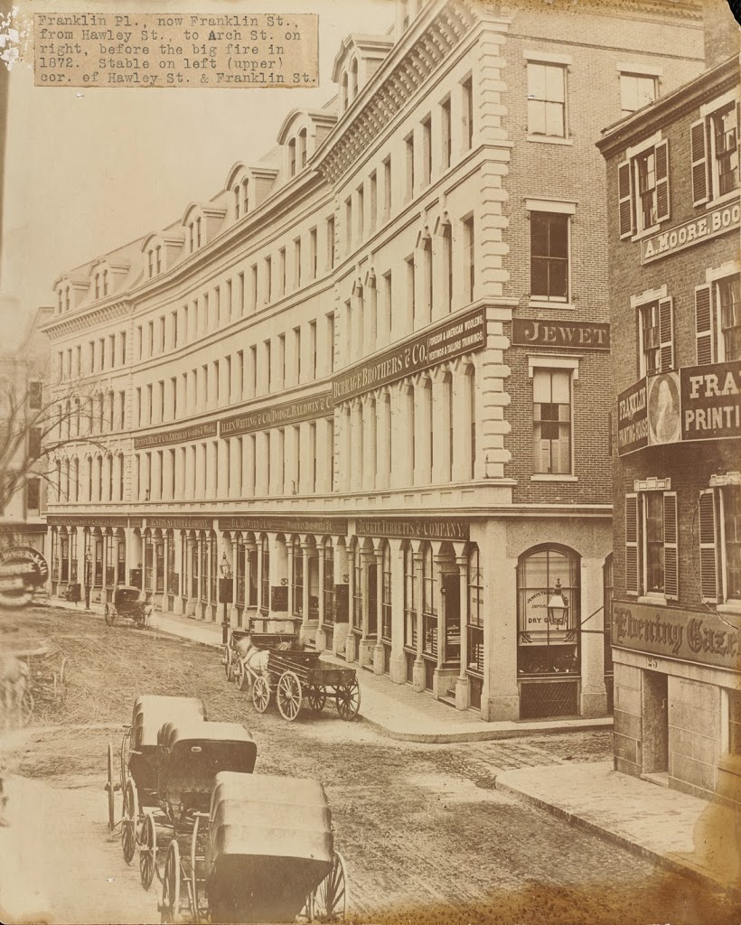
The same view down Franklin Street, between 1859 and 1872. Photo courtesy of Boston Public Library.

326_1850-1872c-2Bbpl

Franklin Street in 2014:

326_2014

Franklin Street in Boston was originally laid out in the 1790s by noted architect Charles Bulfinch, and included row-houses on both sides of a sweeping curve, as seen in the first photo. Known as the Tontine Crescent, this was an upscale neighborhood in the first half of the 19th century, but by the 1850s the city was expanding commercially. The row-houses were demolished, and replaced with the commercial buildings in the second photo. These didn’t last too long, though – they were destroyed in the Great Boston Fire of 1872. Today, it is still a major commercial center, part of the Downtown Crossing shopping district, but many of the buildings that are still standing along Franklin Street were the ones constructed in 1873 in the immediate aftermath of the fire. In addition, the street still retains its distinctive curve that was laid out over 200 years ago.

North Market, Boston

North Market in Boston, next to Quincy Market, around 1855. Photo courtesy of Boston Public Library.

297_1855c-2Bbpl

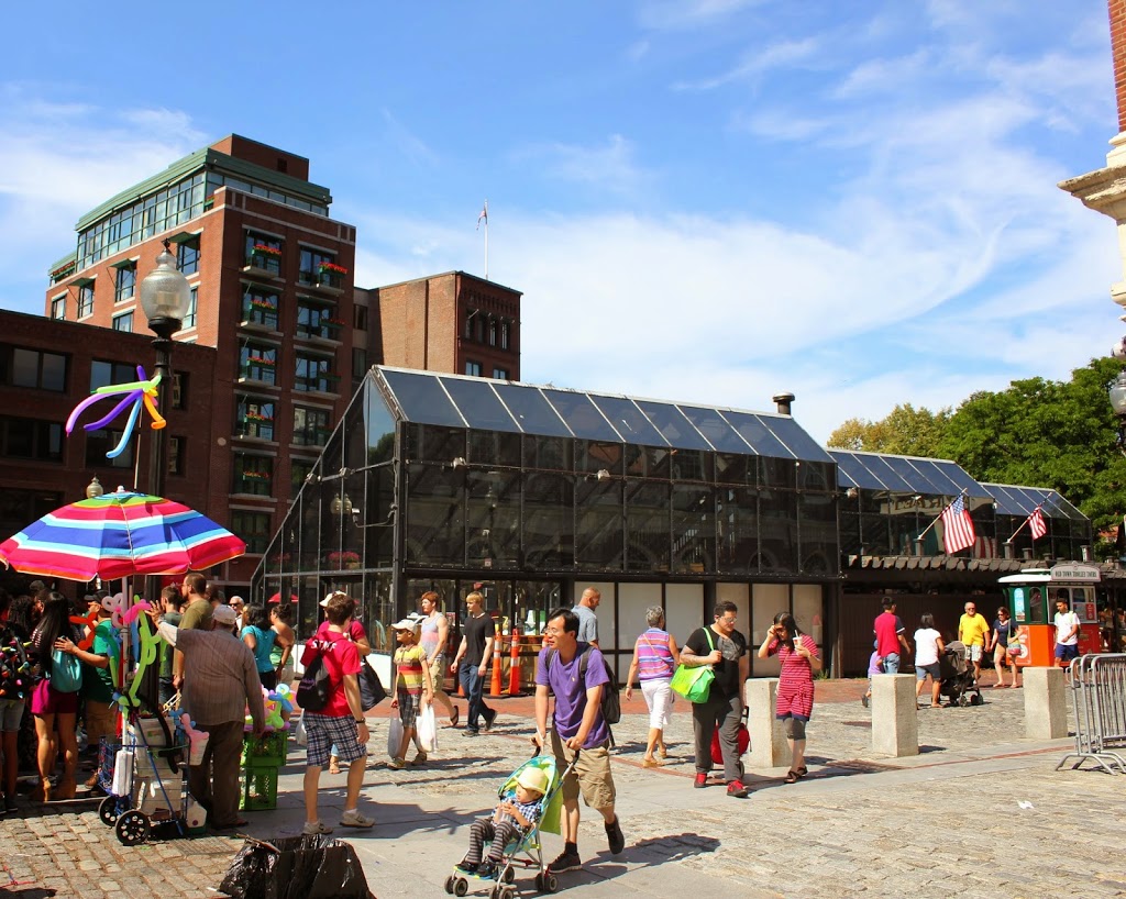
The scene in 2014:

297_2014

These photos show the same scene as the ones in this post, just from a different angle.  The building on the far left of the 1855 photo is the Old Feather Shop, the same one seen in the photo in the other post.  Built in 1680, it was demolished around 1860, soon after the first photo was taken.  Both pictures were taken from right in front of Faneuil Hall (which can be seen on the far right of the 2014 photo), and this area has been a major commercial center since the 1600s, when it was known as Dock Square.  Today, most of the commercial activity centers around tourism, and the location is adjacent to Quincy Market and along the Freedom Trail.  The red brick path of the Freedom Trail can be seen in the foreground of the 2014 photo.

Hotel Pelham, Boston

Facing the southwest corner of Boylston and Tremont in Boston around 1859, toward the newly-constructed Hotel Pelham.  Photo courtesy of Boston Public Library.

1850s

The same scene 2014:

Constructed in 1857, the Hotel Pelham was possibly the first apartment building of its type in the United States.  Although named a hotel, the term in the mid 19th century was commonly used to refer to what today we would call an apartment building – they catered more toward long-term residents than temporary visitors.

The date on the first photo is probably 1859, but some sources date it to 1869.  In either case, 1869 is the latest possible date for the photo, because in that year Tremont Street (the street that the photos are facing down) was widened.  Rather than demolishing and rebuilding, the owners moved the 5,000 ton building 14 feet to the west (right), a move that took three months to complete.  Following the move, the hotel remained in business for nearly 50 more years, before being demolished in 1916 and replaced with the present-day office building.


Old Feather Store, Boston

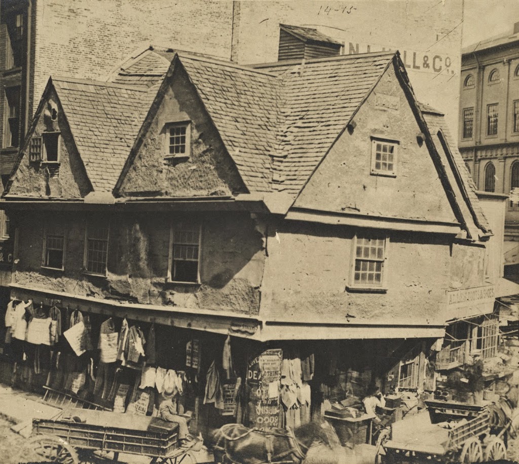
The Old Feather Store at Dock Square in Boston, around 1860. Image courtesy of Boston Public Library.

Colonial

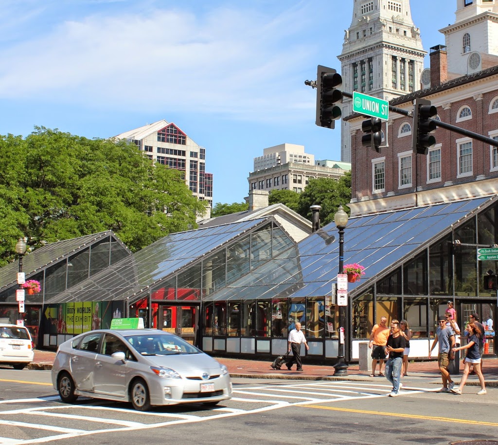
The location in 2014:

268_2014

The building in the 1860 photo looks like it belongs in Elizabethan England, not in 19th century Boston.  However, the building actually dates to the same century as Queen Elizabeth – it was built around 1680, and survived until around the time that this photo was taken.  Despite its age and unique architecture, historical preservation was not a major concern in the 1860s, and it was demolished.  At least one of its contemporaries survives to this day, though.  Just a few blocks up North Street (the road in the foreground of the 2014 photo) is the Paul Revere House, which was built around the same time, and is the only remaining 17th century building in downtown Boston.

As an example of the way Boston has expanded in the past few centuries, the Old Feather Store was built right on the waterfront, but by the time it was taken down, it was over a quarter mile from the harbor.  This area was originally known as Dock Square, because of its proximity to the Town Dock.  As a result, it has long been a center of commercial activity in the city.  Although the buildings that replaced the Old Feather Shop are also long gone, there is one commercial building that is in both photos; Faneuil Hall can be seen behind and to the right of the Old Feather Shop, and on the right-hand side in 2014.

American Falls, Niagara Falls, New York (1)

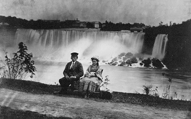
A young man and woman, seated in front of the American Falls at Niagara Falls, around 1858. Photo courtesy of Library and Archives Canada.

109_1858-2Blib-2Barch-2Bcanada

The scene in 2005:

109_2005

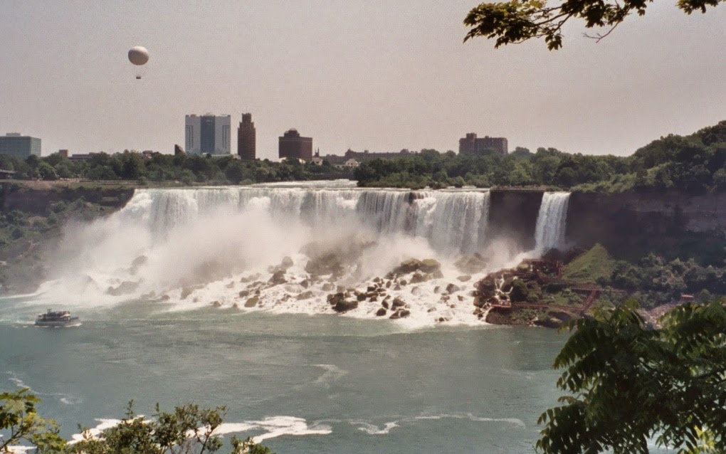
Niagara Falls has been a popular tourist destination since the 19th century, and was particularly popular as a honeymoon destination – perhaps that was the occasion for the young couple in the first photo.  Much has changed at the Falls since then, both the surrounding area and the waterfalls themselves.  In the distance, the high-rise buildings reflect the increasing popularity and tourist-oriented nature of Niagara Falls, and if the cameras were turned around, one would see even more striking changes on the Canadian side of the gorge.

One obvious change with the American Falls is the accumulation of rocks at its base.  The 2005 photo shows a much shorter distance from the top to the rocks at the bottom, which were deposited by rock slides and erosion caused by the waterfall’s steady retreat upstream.  By the 1960’s, there was great concern that the American Falls would erode to the point where they would become a series of rapids rather than a true waterfall, so the water was diverted from it and the American side of the Falls was temporarily shut off.  Geologists secured and stabilized some of the most erosion-prone areas, but they determined that it would be too costly to remove the rocks that had already fallen.