Cornhill from Washington Street, Boston

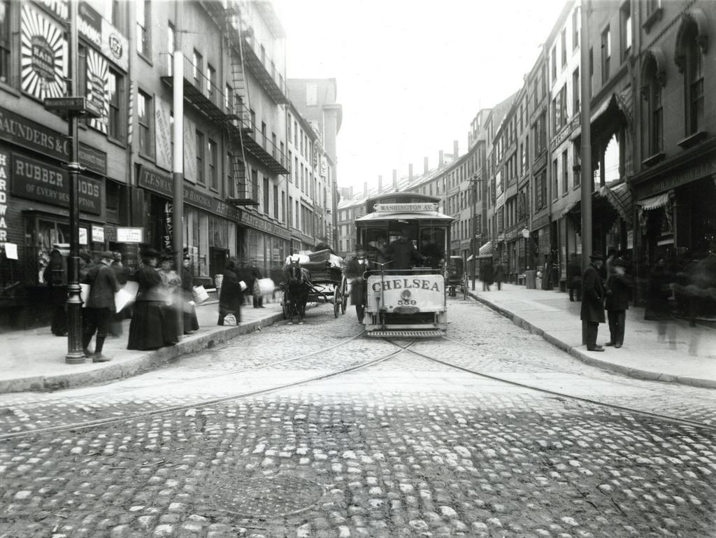
Looking up Cornhill from Washington Street, on April 14, 1897. Image courtesy of the City of Boston Archives.
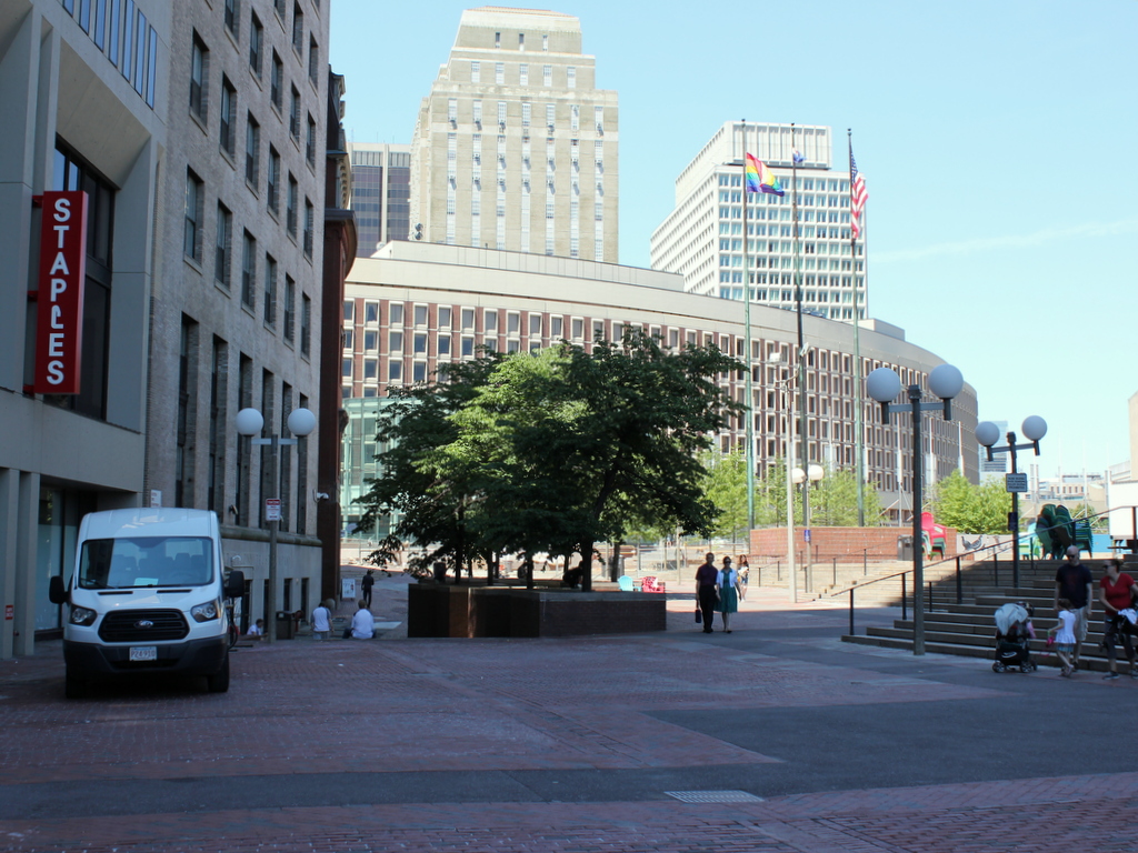
964_1897-04-14 coba

The scene in 2016:

964_2016
This narrow cobblestone street in downtown Boston connected Adams Square with nearby Scollay Square, and it was once a major literary center of the city, with many bookstores and publishers. When the first photo was taken, the early 19th century buildings here had a variety of businesses, with signs advertising for carpets, furniture, wallpaper, signs, trunks, and rubber goods. The first photo also shows a trolley coming down the street from Scollay Square, but this would soon change with the opening of the Tremont Street Subway in less than five months. Part of it was built under Cornhill, and it was the nation’s first subway, allowing trolleys to avoid the congested streets between Boston Common and North Station.

Nearly all of the buildings in the first photo were demolished in the early 1960s to build the Government Center complex. City Hall is just out of view on the right side of the 2016 photo, and the only building left standing in this scene is the Sears’ Crescent, partially visible in the distance on the left side of the street in both photos. Built in 1816 and renovated around 1860, this building still follows the original curve of Cornhill, serving as a reminder of what the neighborhood looked like before one of Boston’s most controversial urban renewal projects.

Old Burying Ground, Cambridge, Mass

The Old Burying Ground in Cambridge, across from Harvard Yard, around 1899. Image courtesy of the Library of Congress, Detroit Publishing Company Collection.

960_1899c loc

The cemetery in 2016:

960_2016
Cambridge was first settled in 1631, just a year after Boston, at a location a little further up the Charles River from Boston. Originally given the creative name of Newe Towne, the settlement centered around the Harvard Square area, and this was the town’s only cemetery for nearly 200 years. The first burials here date back  to around 1635, but headstones were not common at the time, so the oldest one still standing is dated 1653.

Most of the headstones here are from the late 17th and 18th centuries, with very few after the early 19th century. Because it was the town’s only cemetery, the burials here represent people from all classes and walks of life. Some of the prominent citizens have more elaborate monuments, such as the table stone in the foreground, which marks the grave of Colonel John Vassall, who died in 1747.

Today, the historic gravestone remains essentially unchanged since the first photo was taken some 117 years ago. In the background is Christ Church, one of two churches that borders the cemetery on either end. It was built in 1760, and although partially hidden by trees in the 2016 scene, it is still standing as one of the few surviving works of prominent colonial architect Peter Harrison.

Lost New England Goes West: Chinatown, San Francisco (1)

The corner of Jackson Street and Grant Avenue in San Francisco, around 1896-1906. Image courtesy of the Library of Congress, Arnold Genthe Collection.

885_1896-1906c loc

The scene in 2015:

885_2015
San Francisco’s Chinatown is the largest Chinese community in the world outside of Asia, and it was also America’s original Chinatown. Immigrants from China arrived here around the same time that almost everyone else did, during the Gold Rush of the late 1840s and early 1850s. Later on, many other Chinese people came to find work on projects such as the Transcontinental Railroad, and this neighborhood became an ethnic enclave within the city.

Photographer Arnold Genthe was primarily known for his portrait work, and his clients included many notable politicians, writers, and entertainers. In addition, he photographed the immediate aftermath of the 1906 earthquake, including the one in the previous post, but his works also included hundreds of photos of Chinatown that were taken beginning in the 1890s. His collection, which includes the first photo here, provides the only real glimpse into everyday life in Chinatown before the earthquake.

This scene, along with the rest of Chinatown, was completely destroyed in the earthquake, and some politicians sought to use the disaster to rebuild Chinatown further from the center of the city. However, the plans ultimately failed, and Chinatown was rebuilt here, where it continues to be a vibrant community as well as a popular tourist destination in the city.

This post is part of a series of photos that I took in California this past winter. Click here to see the other posts in the “Lost New England Goes West” series.

Tapley School, Springfield, Mass

The Tapley School, at the corner of Bay and Sherman Streets in Springfield, around 1892. Image from Picturesque Hampden (1892).

860_1892c picturesquehampden

The building in 2015:

860_2015
This historic building is located within the McKnight neighborhood of Springfield, which covers the area to the east of the Armory and north of State Street. As the city’s population grew in the 1870s, this area was developed by brothers John and William McKnight, who built around 300 houses here, most of which are still standing today.

To serve the growing population here, this school opened in 1887 at the corner of Bay and Sherman Streets, right at the heart of the neighborhood. It was expanded around 1910 with a large wing to the south, which is not visible in the present view, and it remained in use as a school well into the 1970s. After it closed, it was vacant for over a decade, but it was sold converted into apartments in 1993. Aside from the 1910 addition, the exterior is largely the same as it was when the first photo was taken, and today it is one of the oldest school buildings still standing in the city.

David Ames, Jr. House, Springfield, Mass

The David Ames, Jr. House, on Maple Street in Springfield, around 1893. Image from Sketches of the old inhabitants and other citizens of old Springfield (1893).

858_1893c sketchesinhabitants

The house in 2015:

858_2015

The house in 2023:

This historic house was built in 1826-1827, for David Ames. Jr., a local paper manufacturer. It was one of the first of many 19th century mansions to be built along this section of Maple Street, on a hill overlooking downtown Springfield and the Connecticut River. The house bears a strong resemblance to the smaller, older Alexander House, and it was designed by Chauncey Shepard, a young local architect who later built homes for many other notable residents, including Horace Smith and Daniel B. Wesson, whose pistol factory he also designed.

David Ames, Jr. came from a prominent industrial family. His father, David Ames, Sr., was the son of an iron mill owner, and David, Sr. began manufacturing shovels and guns during the American Revolution. In 1794, he was appointed by George Washington to serve as the first superintendent of the Springfield Armory, and after leaving his position in 1802 he began manufacturing paper. David, Jr. and his brother John followed in their father’s footsteps in the paper industry, and their company eventually operated mills in Springfield, Chicopee Falls, South Hadley Falls, Northampton, and Suffield.

In 1867, David, Jr. sold the house to his son-in-law, Solomon J. Gordon. Over 40 years after he first built it, Chauncey Shepard was then hired to extensively renovate the house, and the first photo here shows its appearance sometime after these significant alterations. David, Jr. continued to live here until his death in 1883 at the age of 91, and Solomon died just eight years later. The house remained in his family for some time after that, but it later became part of the MacDuffie School. In 2011, the school moved to a new location in Granby, but just before the move happened at the end of the school year, the Springfield campus was heavily damaged by the June 1 tornado. The tornado caused significant damage to the Ames House, including the loss of the front portico and much of the roof.

Nearly five years after the tornado, the house has still not been restored, and the above photos show the contrast between what it looked like before and after 2011. It is one of the most historically significant homes still standing in Springfield, though, and this year the Springfield Preservation Trust included the house on their annual Most Endangered Historic Resources list.

2023 update: As shown in the third photo, the house remains unrestored, although the windows have been boarded up since the 2015 photo was taken.

Red Men’s Wigwam, Springfield, Mass

The Improved Order of Red Men building at the corner of Main and Stockbridge Streets in Springfield, around 1892. Image from Picturesque Hampden (1892)

857_1892c picturesquehampden

The scene in 2015:

857_2015
The caption from Picturesque Hampden does not provide any additional details beyond “Red Men’s Wigwam,” but this was evidently a lodge for the Improved Order of Red Men, a nationwide fraternal organization that was particularly popular in the late 1800s and early 1900s. The group had a structure and rituals similar to Freemasons and other similar societies, but used a number of pseudo-Native American rituals and terminology, including calling their local chapters “tribes,” which met in “wigwams” such as this one here in Springfield. However, at the time, the Improved Order of Red Men was only open to white men, an irony that was probably lost on most of its membership.

The organization still exists today, although in much smaller numbers than a century ago, but the building that once stood here is long gone. It was demolished by about 1902, when the present-day Colonial Block was built here. In 1905, the building was expanded to the right, where the old colonial-era George Bliss, Sr. house once stood. When the first photo was taken, the house was owned by McGregory & Casman Marble Works, which explains the many gravestones in front of it.